
Ascent Log
- Region – Alps, Switzerland, Zermatt.
- Peak – Matterhorn 4478 m. Via the left part of the north face.
- Assessed grade – 6B, variation of the Polish Route (ED2/3)
- Nature of the route – combined
5. Route Characteristics:
Total elevation gain – 1280 m. Main section elevation gain – 810 m. Route length – 2000 m. Length of 6B sections – 370 m, 5B – 705 m. Average steepness of the main section 62°.
-
Gear left on the route: total 2 pitons, including bolted – 0. Stationary bolted pitons used – 0. Removable bolted pitons – 0. Total amount of artificial climbing gear (ITOs) used – 104 + (around 300 on "fifas").
-
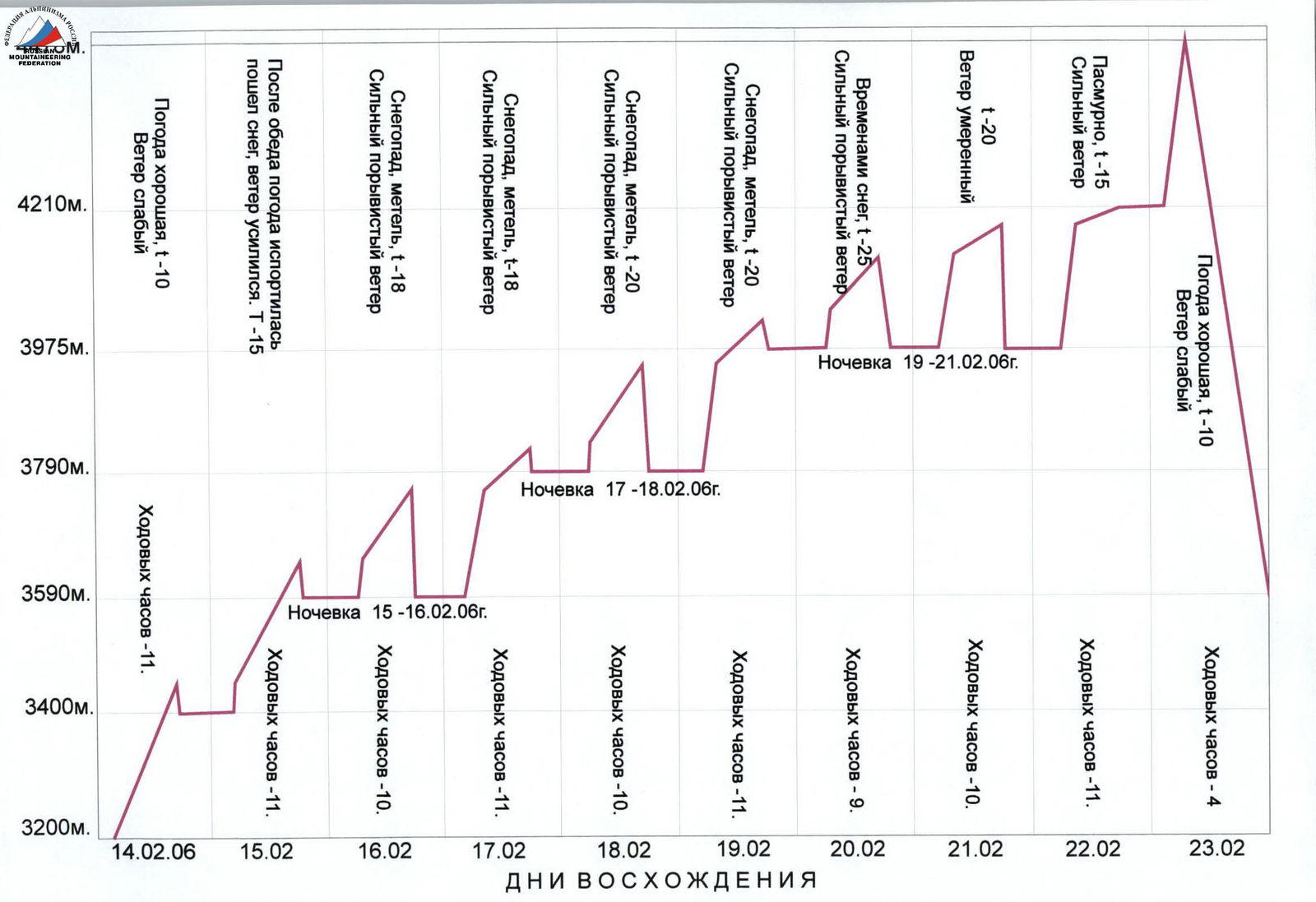
Total climbing hours – 97, days – 10.
-
Team leader: Sergey Cherezov, Master of Sports of International Class. Team members: Yuri Glazyrin, Master of Sports; Boris Rodikov, Candidate for Master of Sports.
-
Team coaches: Valery Balezin, Master of Sports of International Class. Nikolai Zakharov, Master of Sports of International Class, Honored Coach.
-
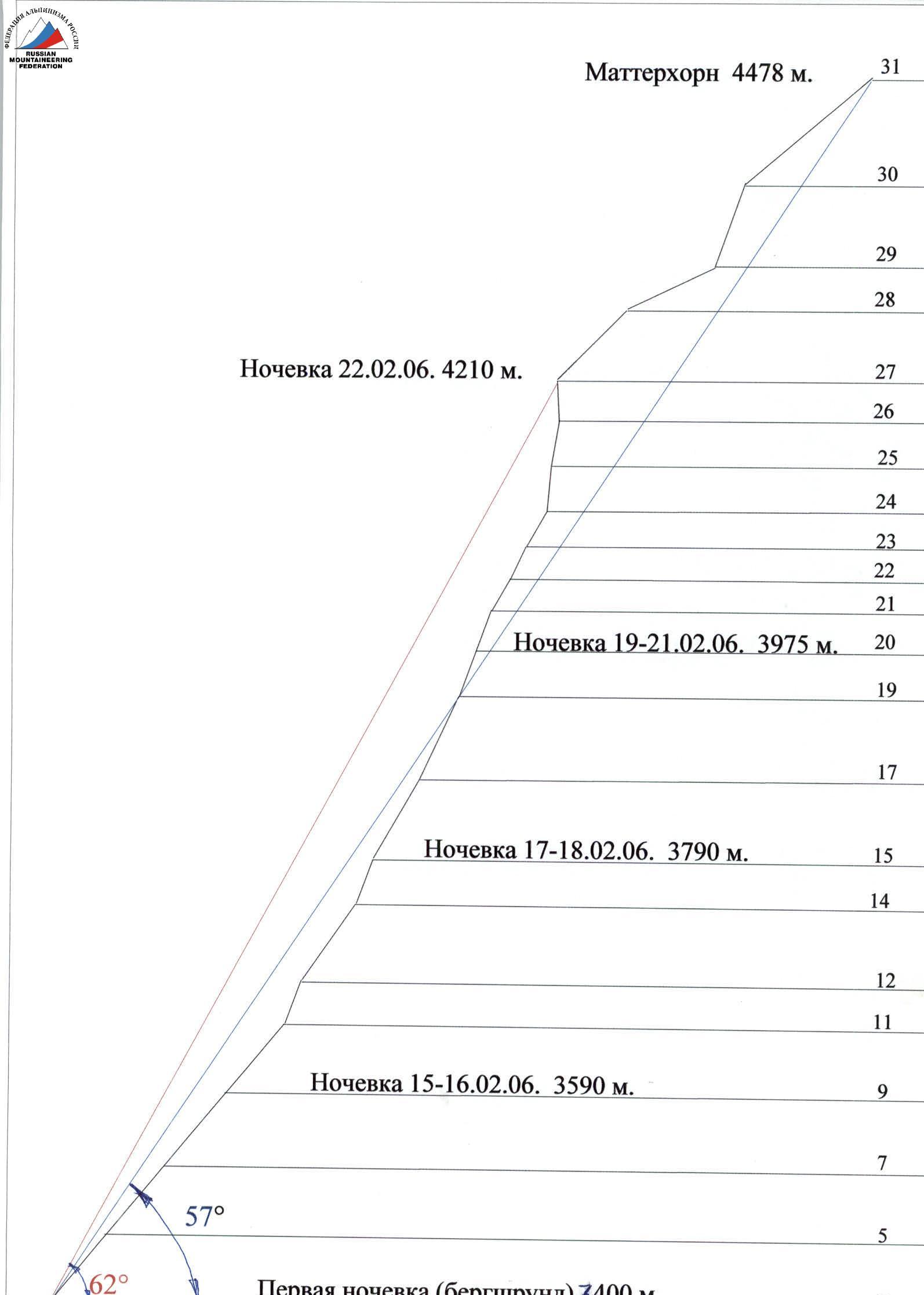
Departure dates: To the route – at 6:00 on February 14, 2006. To the summit – at 9:00 on February 23, 2006. Return – at 9:00 on February 24, 2006.
-
Ascent organized by – Krasnoyarsk Regional Sports Committee.
2006
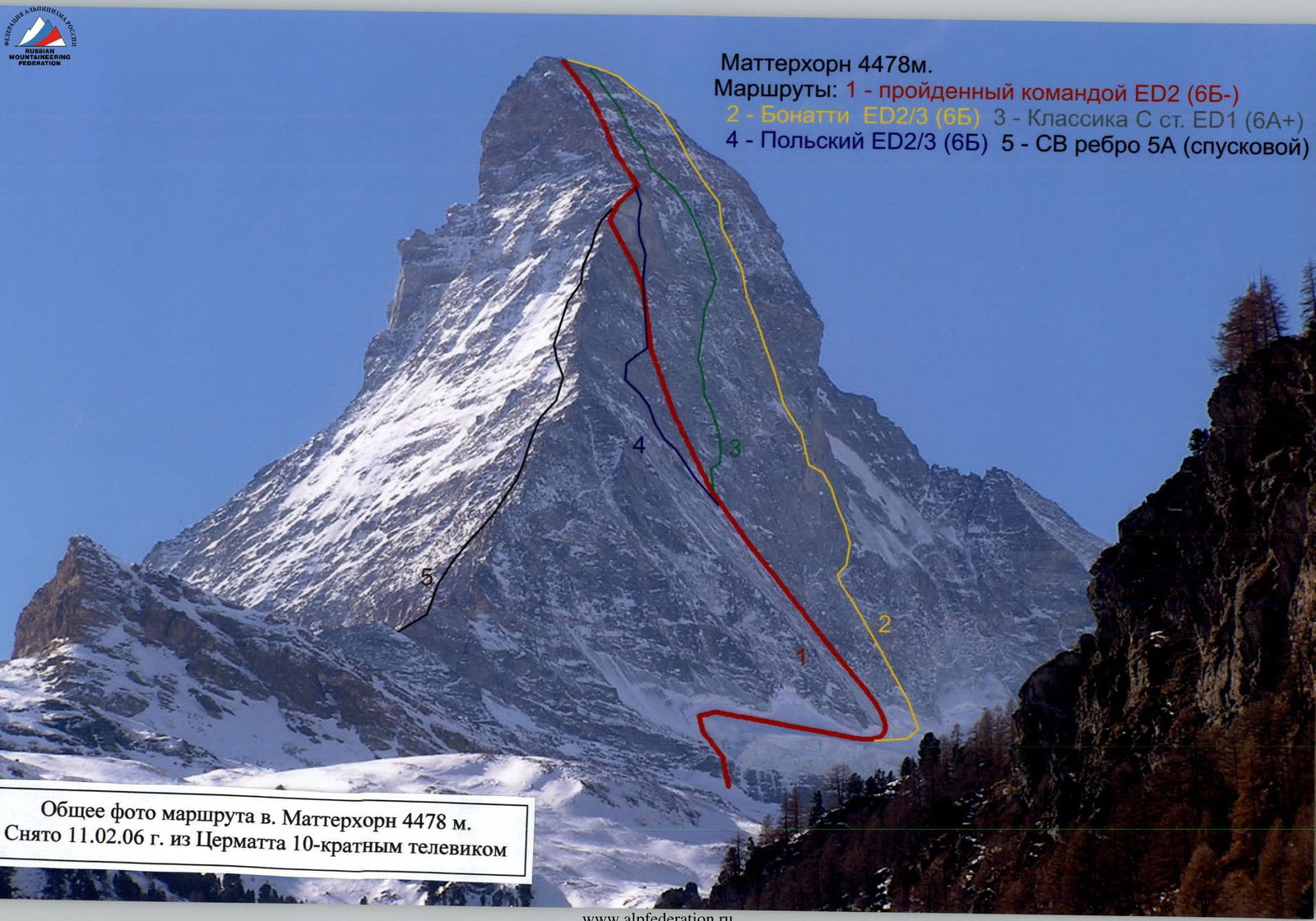
Matterhorn 4478 m.
Routes: 1 – route taken by the team ED2 (6B–) 2 – Bonatti ED2/3 (6B) 3 – Classic North Face ED1 (6A+) 4 – Polish ED2/3 (6B) 5 – NE ridge 5A (descent route)
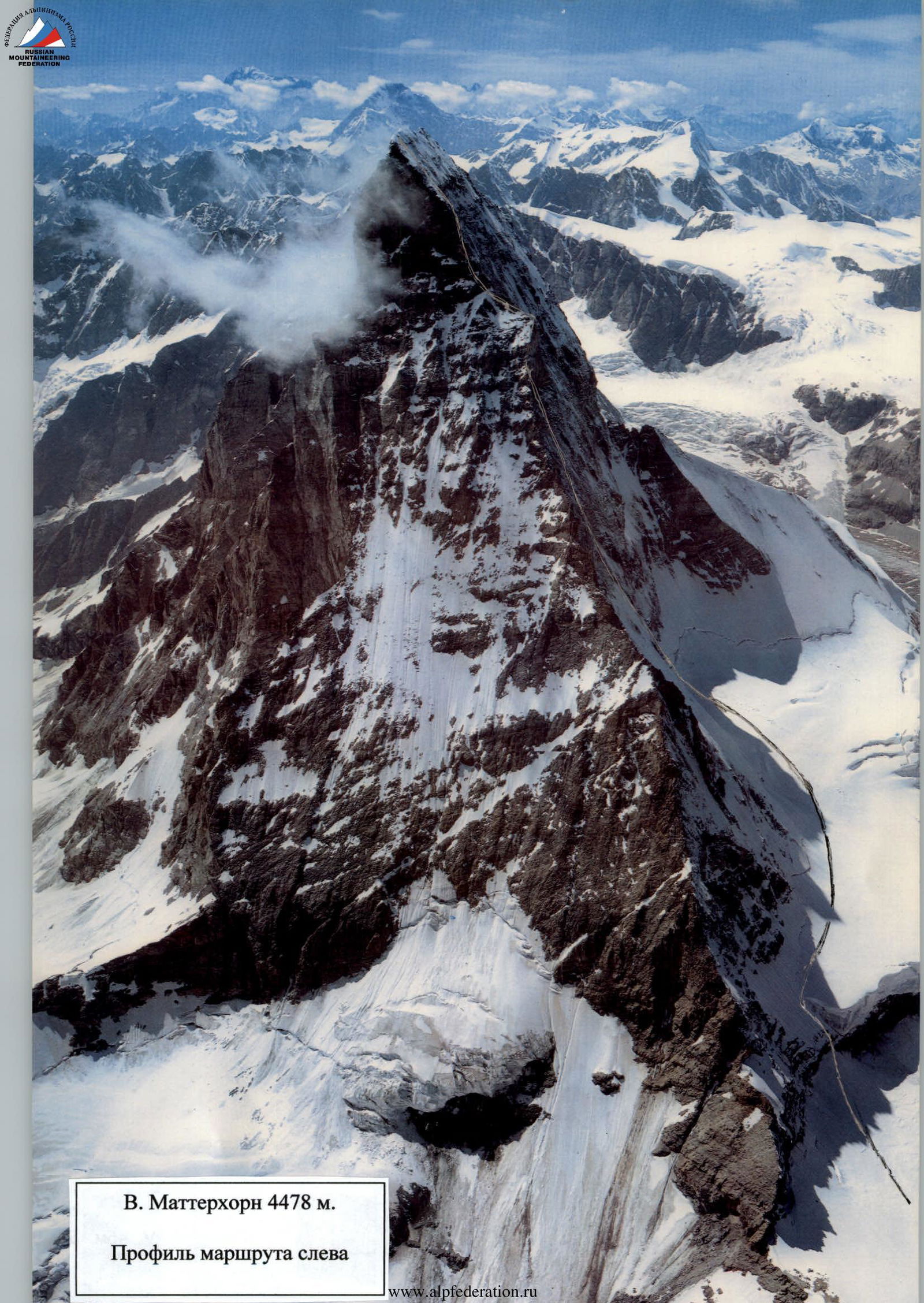
Matterhorn 4478 m.
Route profile on the left
| R-marker | Pitons | Ice screws | Anchor placements | Category, length, steepness | Additional info |
|---|---|---|---|---|---|
| Start | 1 | 4/1 | V 30 m 65° | ||
| R1 | 6 | IV 100 m 45° | |||
| R2 | 1 | I 400 m | |||
| R3 | 3 | Bergschrund, IV 40 m 50° | |||
| R4 | 3 | IV 45 m 50° | |||
| R5 | 1 | 6 | V 45 m 50° | ||
| R6 | 1 | 4 | V 45 m 50° | ||
| R7 | 1 | 5 | 1 | V 45 m 50° | |
| R8 | 2 | 5 | V 45 m 50° | ||
| R9 | 2 | 4 | 1 | V 45 m 50° | |
| R10 | 1 | 4 | 1 | V 45 m 50° | |
| R11 | 4 | 6 | 2 | V, A2 45 m 70° | |
| R12 | 1 | 5 | 1 | V, A1 45 m 55° | |
| R13 | 2 | 5 | V 45 m 55° | ||
| R14 | 2 | 6 | 3 | V, A1 45 m 70° | |
| R15 | 6/3 | V 45 m 60° | |||
| R16 | 5 | 3 | 3 | V 45 m 60° | |
| R17 | 4 | 8 | 6 | VI, A2 25 m 70° | |
| R18 | 3 | 9 | 8 | VI, A2 45 m 65° | |
| R19 | 5 | 14 | 8 | VI, A3 45 m 70° | |
| R20 | 3 | 10 | 8 | VI, A2 40 m 70° | |
| R21 | 2 | 6 | 2 | VI, A1 35 m 60° | |
| R22 | 2 | 8 | 6 | VI, A1 35 m 65° | |
| R23 | 3 | 6 | 2 | V 25 m 55° | |
| R24 | 8 | 10 | 8 | VI, A3 45 m 90° | |
| R25 | 8 | 9 | 6 | VI, A2 45 m 80° | |
| R26 | 6 | 14 | 8 | VI, A4 40 m 95° | |
| R27 | III 90 m 45° | Used stationary anchor pitons | |||
| R28 | II 90 m 30° | ||||
| R29 | V 90 m 70° | Used stationary anchor pitons | |||
| R30 | III 150 m 40° | ||||
| R31 | |||||
| Total | 65 | 155 | 22 | ||
| Total | 34 | 70 |
Matterhorn 4478 m. February 23, 2006.

Matterhorn 4478 m. Taken on February 11, 2006. Technical photo of the route.
Section 5–6. Ice ended, rock started. Taken from point 5.
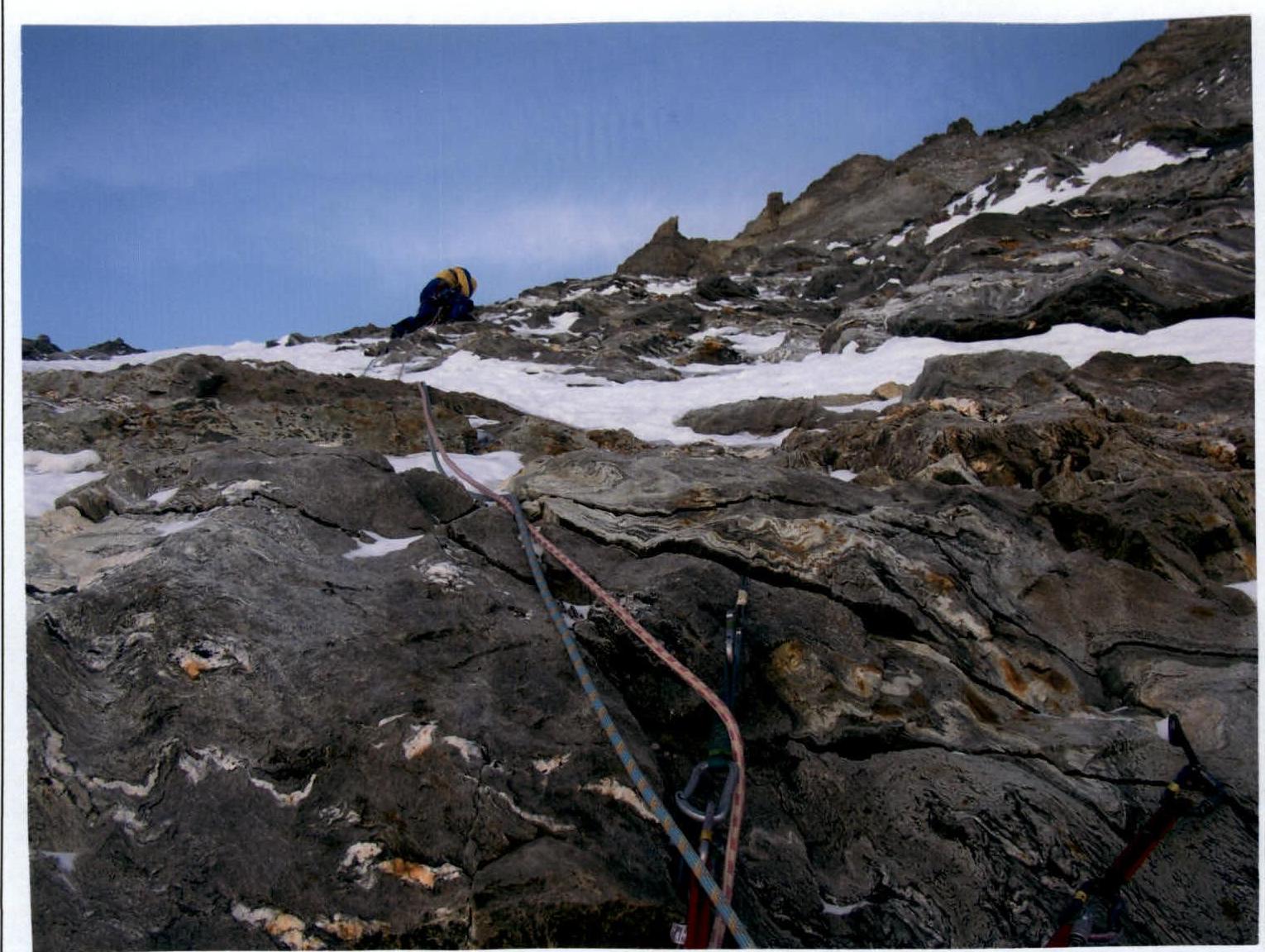
Section 6–7. Taken from point 6.

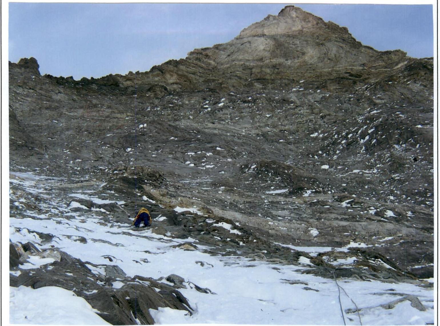
Section 8–9. Rodikov leads. Taken from point 8.
Section 10–11. Rodikov leads. Taken from point 10.
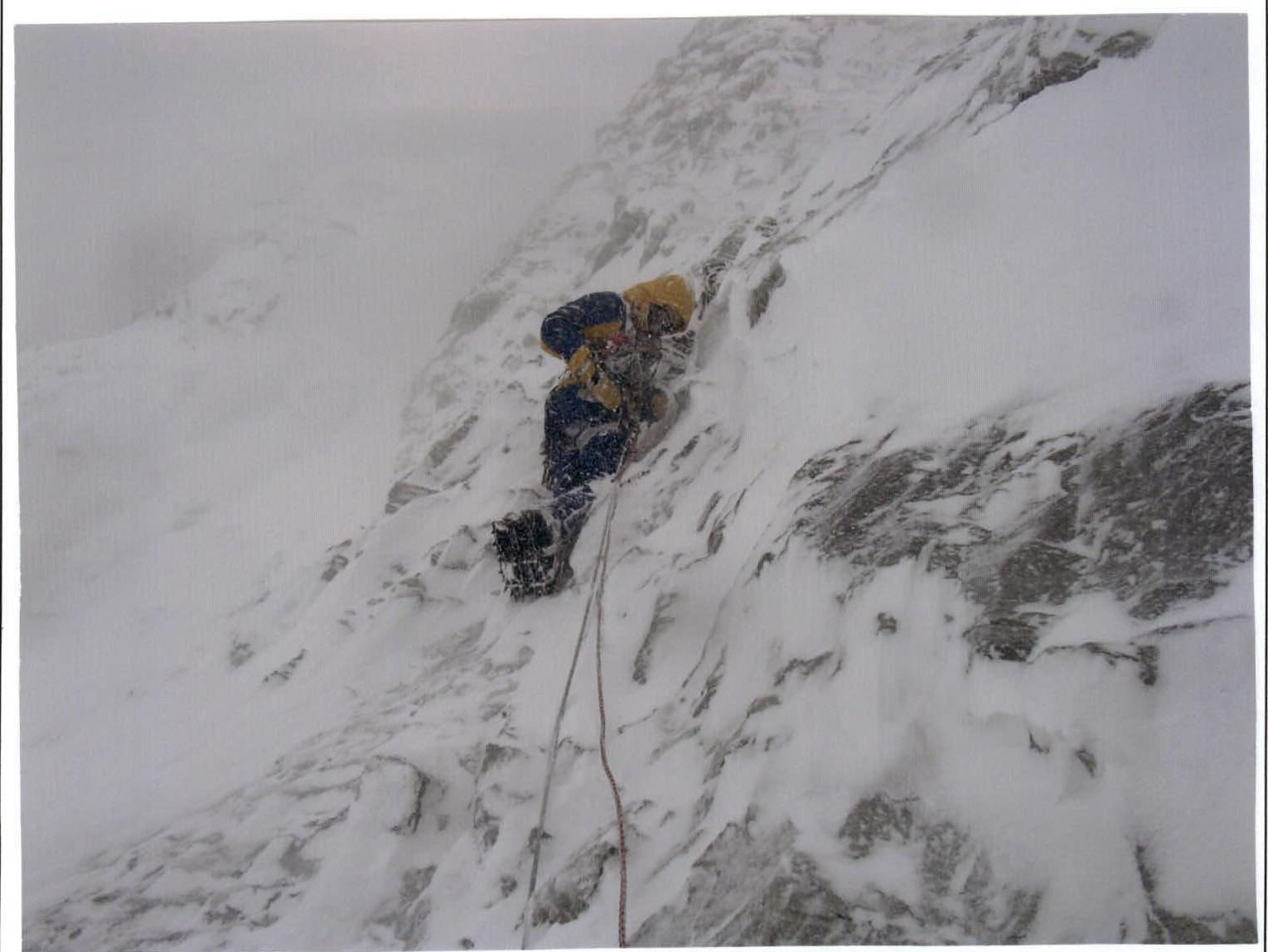
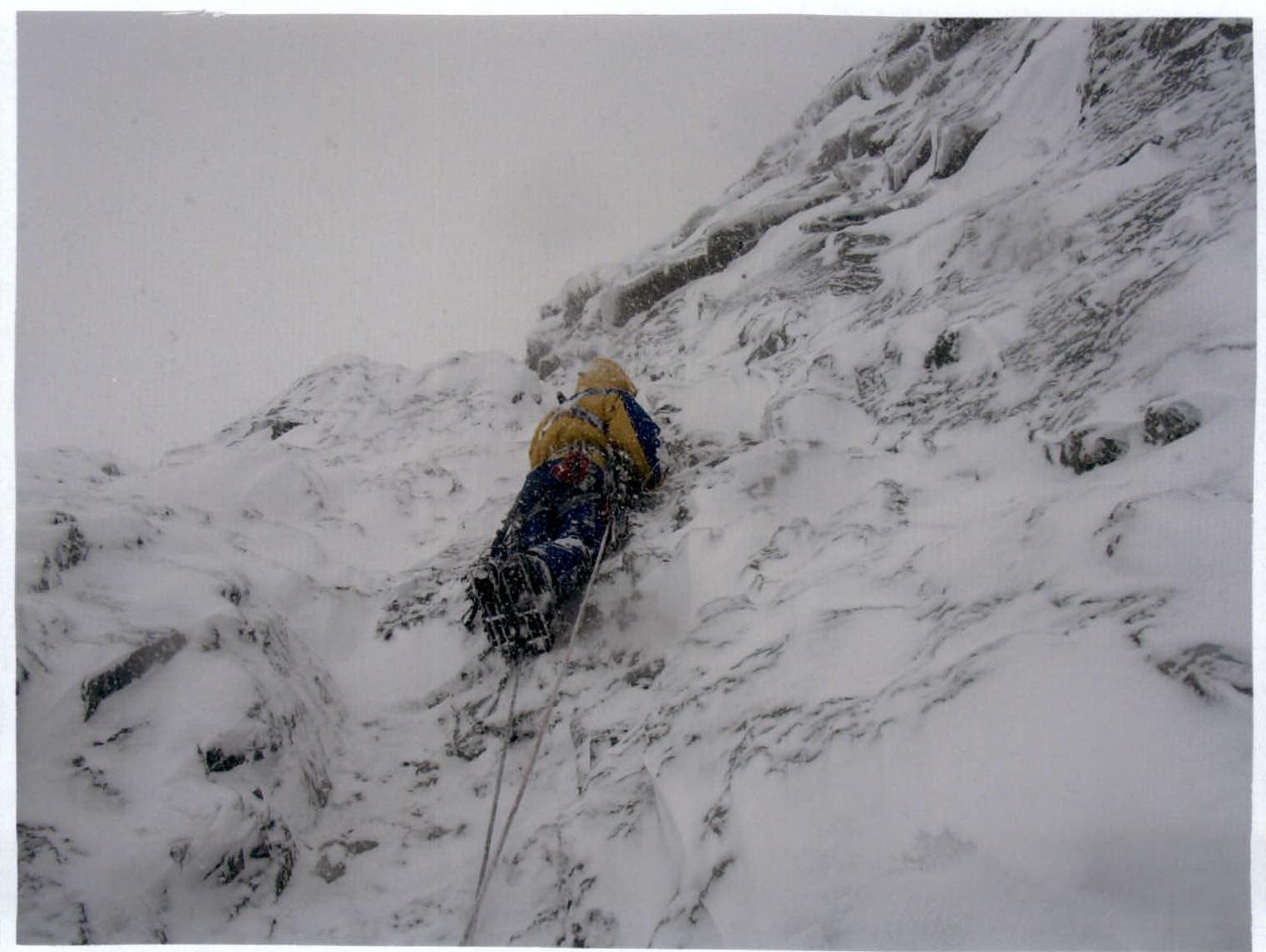
Section 15–16. Bad weather continues. Everything is covered in snow, but we are still moving forward.
Rodikov is leading. Taken from point 14.
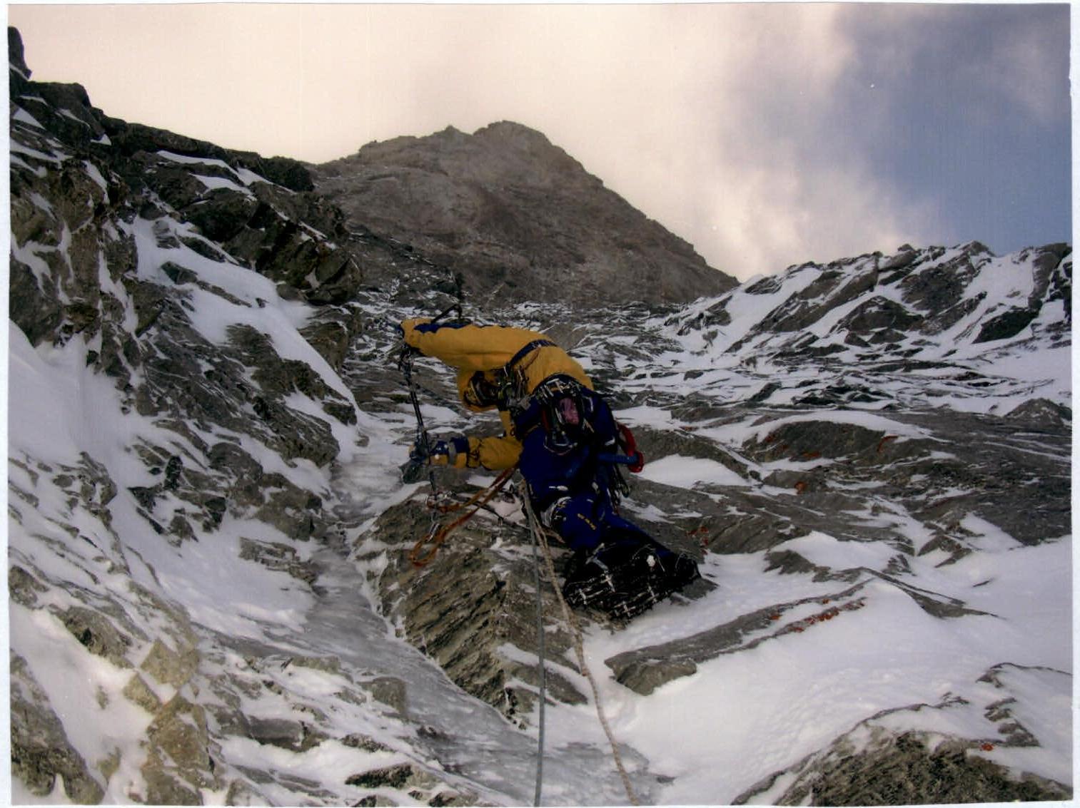
Section 20–21. Taken from point 20.
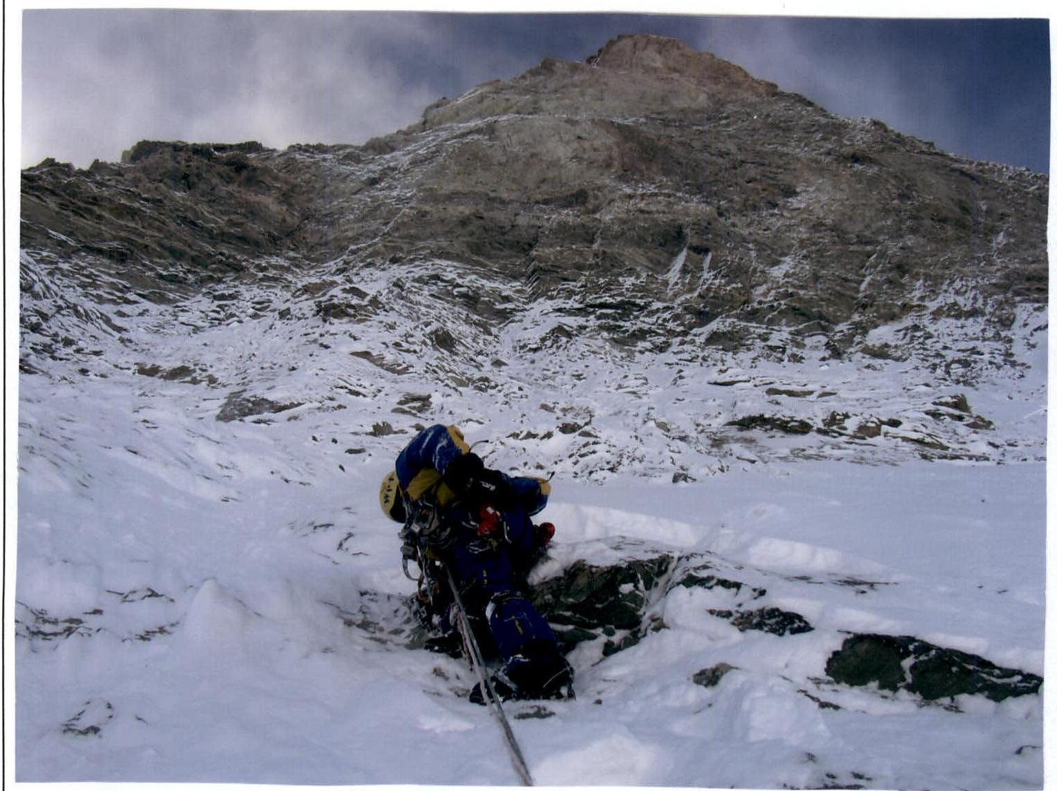
Section 22–23. So much snow fell that we had to literally dig our way through.
Taken from point 22.
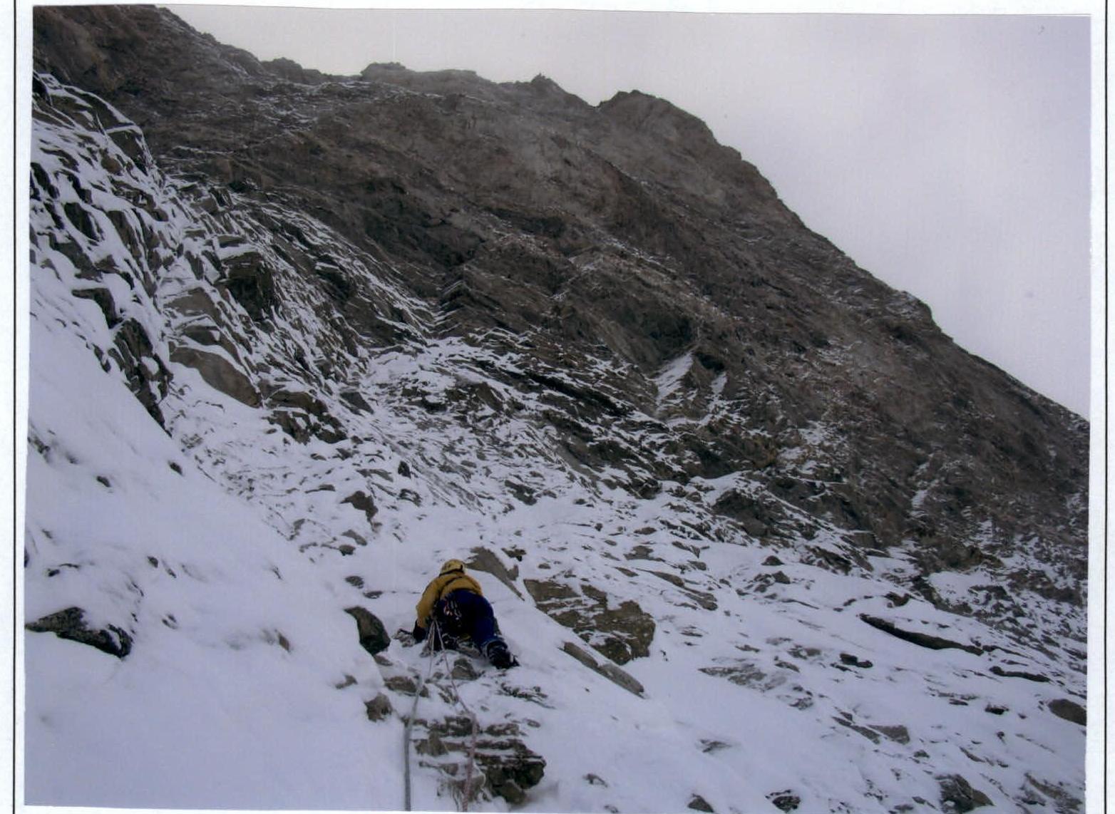
Section 23–24. Taken from point 23.
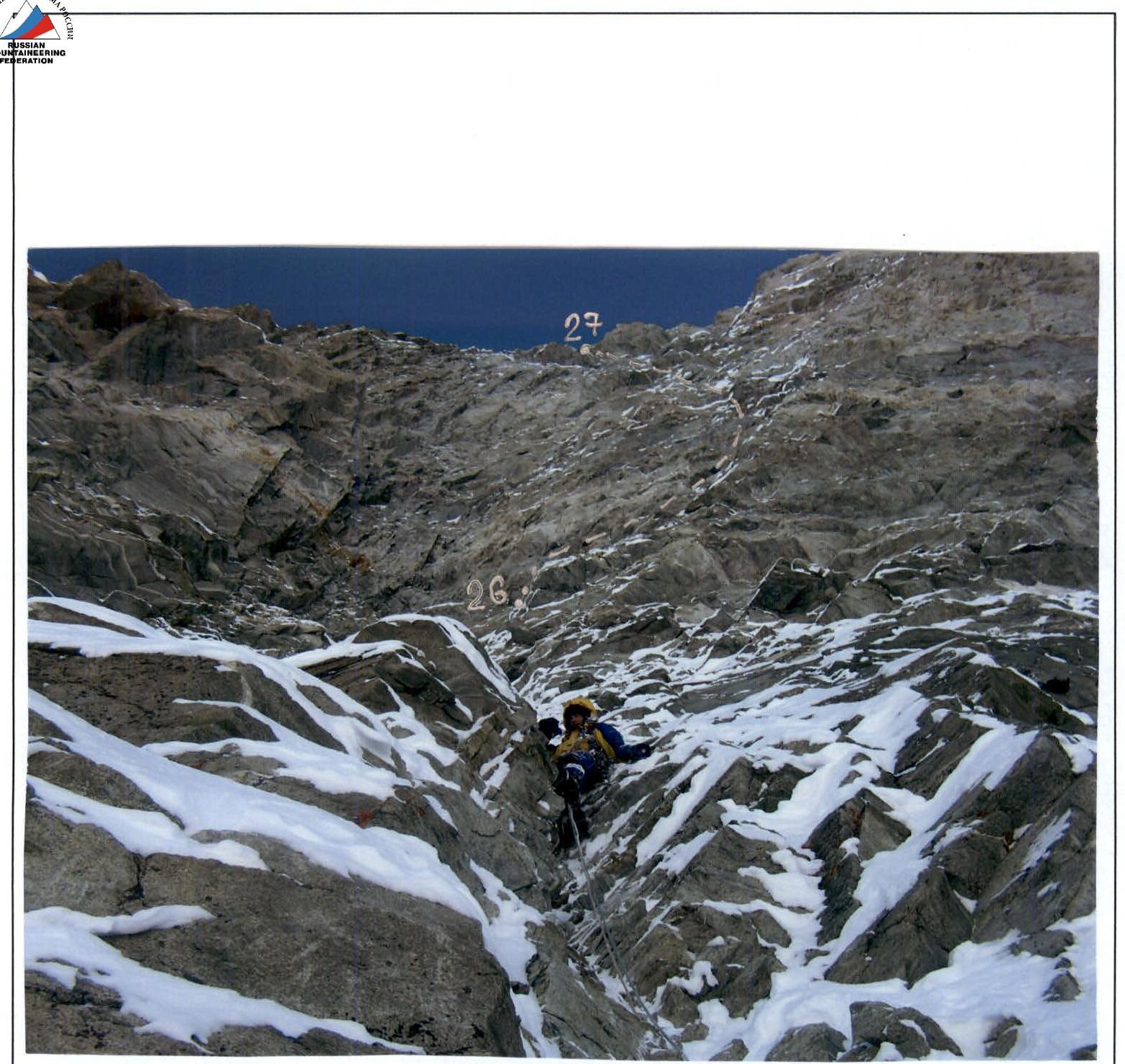
Section 25–26. Taken from point 25.