ASCENT DOCUMENT
- Technical category.
- Pamir-Alay, Turkestan Ridge, Karavshin river basin.
- Peak 4300 – via North-East ridge.
- 5A category of difficulty, presumably, first ascent.
- Height difference: 300 m. Length: 430 m. Average steepness: 59°. Length of sections of 5th category of difficulty: 130 m.
- Pitons driven:
| Rock | Nuts | Bolt | Ice |
|---|---|---|---|
| 6 | 65 | 0 | 1 |
| 0 | 0 | 0 | 0 |
- Moving hours: 7 + (3 hours descent) days: 1.
- Overnight stay on descent, convenient, in a tent.
- Leader: Kotelnikov A.I. — Master of Sports
Team members:
- An P.V. — Master of Sports
- Bukreev V.V. — Master of Sports
- Zaikin A.A. — Candidate for Master of Sports
- Kolabushkin V.A. — Candidate for Master of Sports
- Selyaev V.V. — Master of Sports Coaches: Shabanov A.V., Kudakaev T.Z.
- Approach to the route July 17, 1992, summit July 17, 1992, descent July 17, 1992.
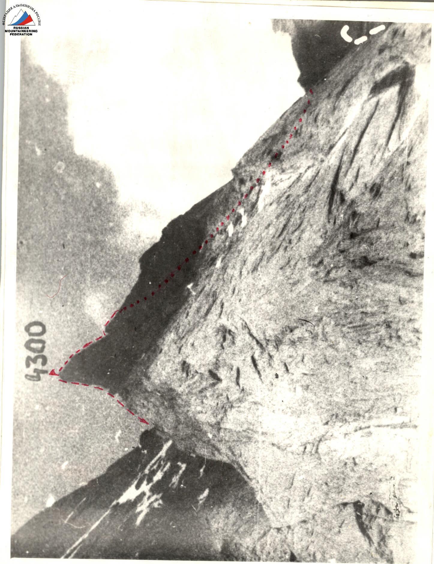
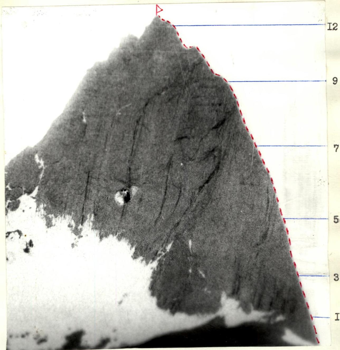
General photograph of the summit
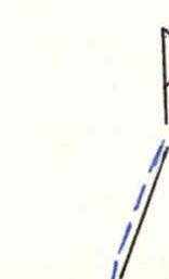
Conventions:
- Group's route.
Taken on July 9, 1989 at 16:00. Camera "Zenit". Distance — 5 km.
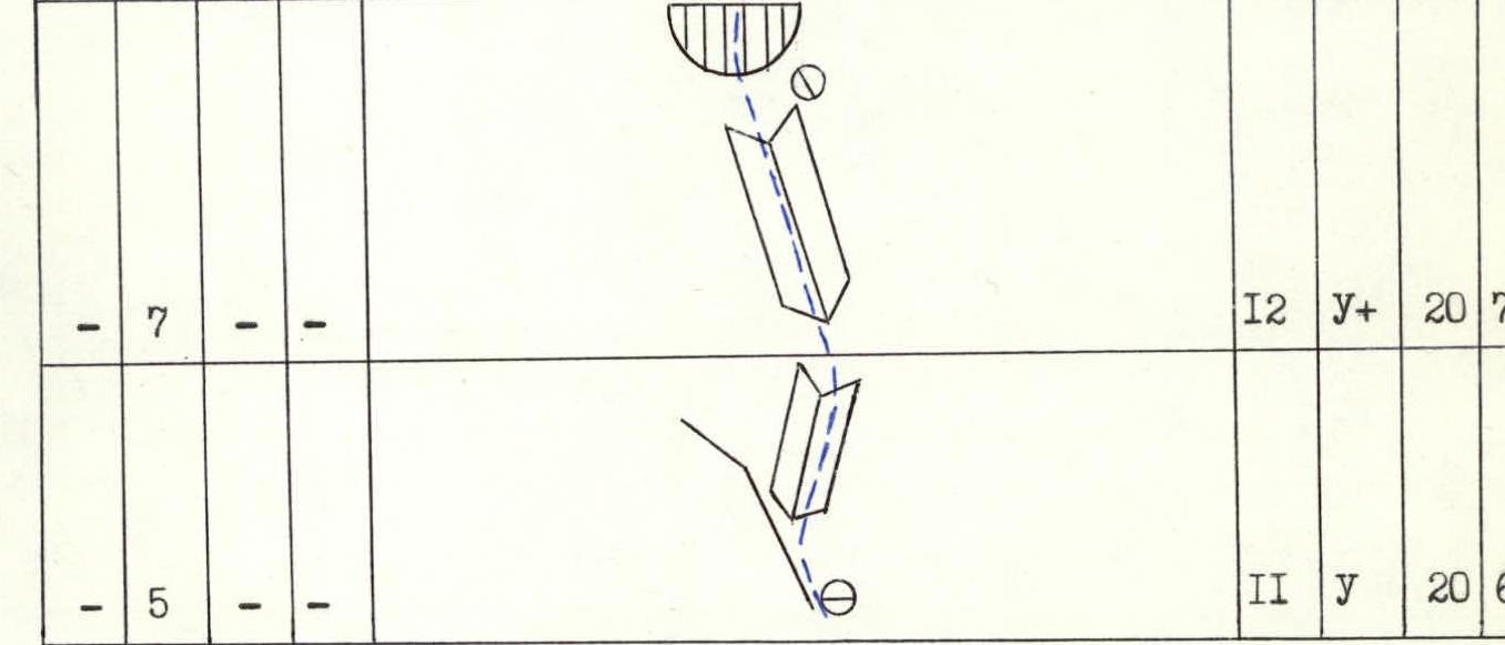
Route diagram in symbols
| Section | Category of difficulty | Length | Steepness | Belay points: P (rock) | Z (nuts) | Sh (bolts) | L (ice) |
|---|---|---|---|---|---|---|---|
| R0–R1 | 5 | 20 m | 60° | ||||
| R1–R2 | 4 | 20 m | 70° | ||||
| R2–R3 | 5+ | 10 m | 90° | ||||
| R3–R4 | 3 | 15 m | 50° | 3 | |||
| R4–R5 | 4 | 40 m | 60° | ||||
| R5–R6 | 5 | 40 m | 70° | 5 | |||
| R6–R7 | 4 | 40 m | 60° | 6 | |||
| R7–R8 | 4 | 40 m | 60° | 7 | |||
| R8–R9 | 4 | 40 m | 50° | 3 | 6 | ||
| R9–R10 | 4 | 50 m | 60° | 5 | |||
| R10–R11 | 5 | 40 m | 65° | 3 | |||
| R11–R12 | 5 | 20 m | 65° | 5 | |||
| R12–R13 | 5+ | 20 m | 70° | 7 | |||
| R13–R14 | 4 | 35 m | 50° | 4 |
Route description by sections
R0–R1. Smooth slab with brittle holds. Move left-upwards 20 m, 60°, 5th category of difficulty.
R1–R2. Steep wall with sufficient number of solid holds, though quite steep, climbing is straightforward, 20 m, 70°, 4th category of difficulty.
R2–R3. Sheer wall, in the upper part with a slight overhang, 10 m, 90°, 5+ category of difficulty.
R3–R4. Via slabs to a cornice, which is bypassed on the left, 15 m, 50°, 3rd category of difficulty.
R4–R5. Slab-like wall with shallow vertical hollows, 40 m, 60°, 4th category of difficulty.
R5–R6. Via wall towards a cornice, which is traversed in the left part, 40 m, 70°, 5th category of difficulty.
R6–R7. Rock ridge, in some places quite sharp, 40 m, 60°, 4th category of difficulty.
R7–R8. System of slabs and ledges, rocks are crumbling, 40 m, 60°, 4th category of difficulty.
R8–R9. Rock ridge leads to a monolithic slab with smooth holds, 40 m, 50°, 4th category of difficulty.
R9–R10. Steep snow ridge. Cornice on the right! 50 m, 60°, 4th category of difficulty.
R10–R11. Crumbling rocks, leading to the ridge, 40 m, 65°, 5th category of difficulty.
R11–R12. Along the ridge to an internal corner. Traverse on the right part, 20 m, 65°, 5th category of difficulty.
R12–R13. Internal corner, leading to a small cornice, which is traversed in the center, 20 m, 70°, 5+ category of difficulty.
R13–R14. Sharp rock ridge, leading to the summit, 35 m, 4th category of difficulty.
Technical photograph of the route
Taken on March 14, 1992. Camera "Lomo-Compact". Distance — 4 km.