
Climbing Passport
- Region — Tian-Shan, Kyrgyz Ala-Too, Ak-Sai valley
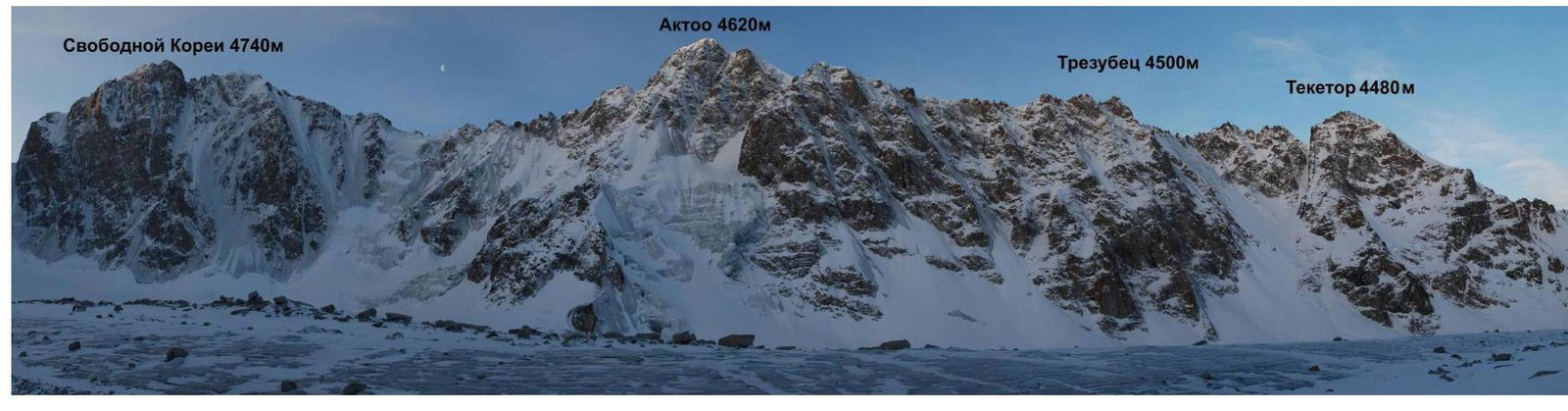
- Peak — Trezubets 4500 m, right couloir, N side, 5A cat.
- Proposed — 5A cat., first ascent
- Route type — combined
- Route description:
elevation gain — 560 m, route length — 820 m, length of 5th cat. sections — 470 m, average slope — 55°, main part 65°
- Equipment left on the route: total 2 rappel rings.
Used stationary pitons — 0, removable pitons — 0. Total IT used — 0
- Total climbing time — 14:30, days — 1
- Team leader: Prokofyev Denis Evgenyevich MS
Team members: Popova Marina Evgenyevna 1st cat.
9. Team coaches:
Balezin Valeriy Viktorovich MSMK, Zakharov Nikolay Nikolayevich MSMK, ZTR
On the route — at 6:30 on March 4, 2013, on the summit — at 17:30 on March 4, 2013, returned to Base Camp — at 23:00 on March 4, 2013.
- Climbing organized by — Ministry of Sports, Tourism and Youth Policy of Krasnoyarsk Krai.
2013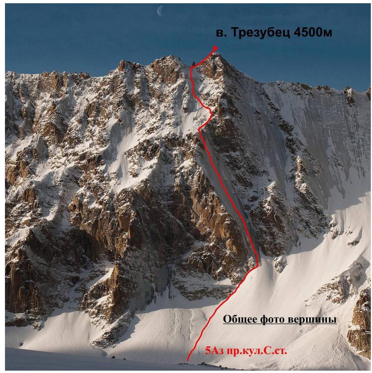 Trezubets 4500
m
Trezubets 4500
m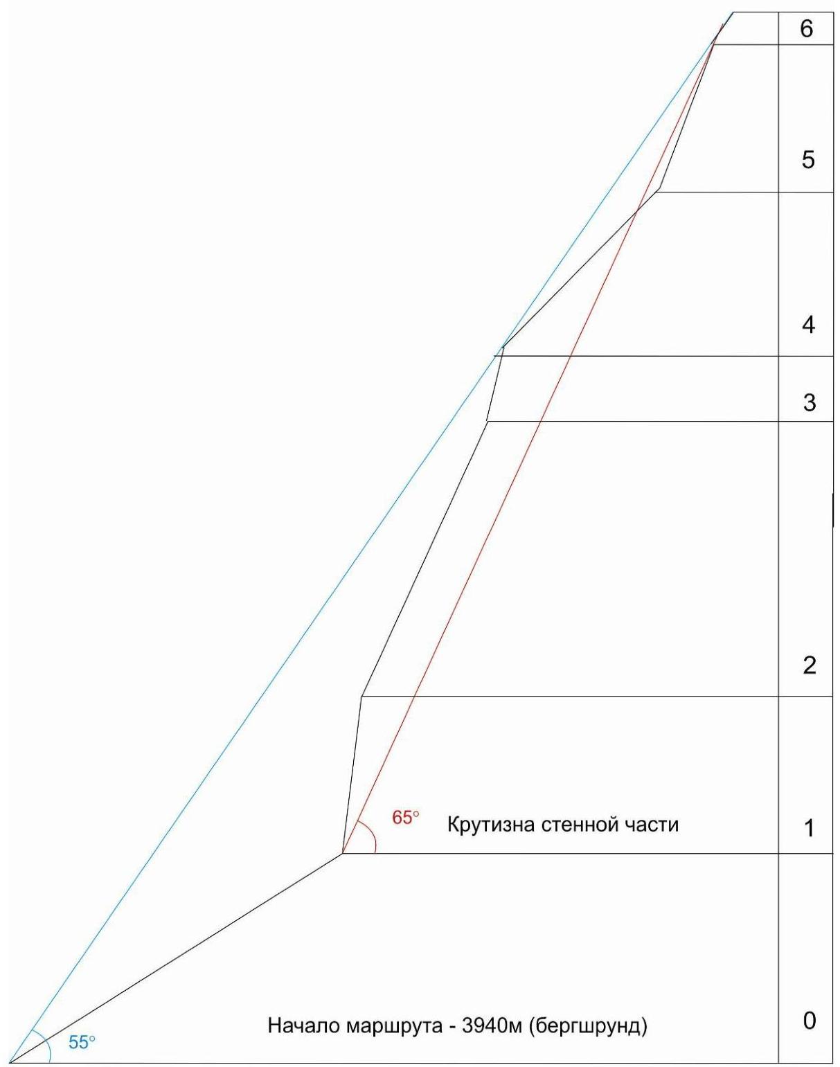
Panorama of the area
Brief overview and tactical actions of the team
The summit Trezubets is located between the peaks Aktoo and Teketor, and there is a relatively easy approach to it via the Ak-Sai glacier from the Koronskie bivouac. A logical first ascent was planned — via the icy couloir on the northern wall to the right peak.
The team Prokofyev D., Popova M. left Koronskaya hut at 6:30 am, and by 9:00 am they reached the foot of the icy part of the route. By 2:00 pm they reached the rocky section, and due to the large amount of snow, they completed it by 4:00 pm, then again encountered an icy section. By 5:00 pm they were on the col between the peaks. At 5:30 pm they reached the summit.
As the situation was avalanche-prone and there was limited daylight left, the decision was made to:
- descend via the ascent route,
- use 60 m ropes.
By 9:00 pm the team descended to the foot of the icy part. At 10:00 pm they descended through the snow to the Ak-Sai glacier. At 11:00 pm the team returned to Koronskaya hut.
| № | total | ||
|---|---|---|---|
| 15 | 40 | ||
| 6-7 |  | 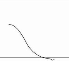 |  |
| 4 | III + 30 м — 60° | ||
| 5-6 | 12 | 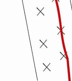 | |
| 4-5 | 7 |  | |
| 6 | 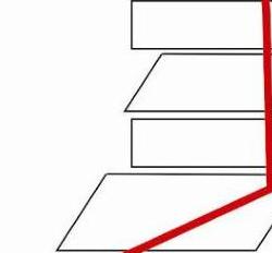 | ||
| 3-4 | 6 | 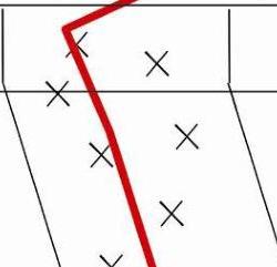 | |
| 2-3 | 11 | 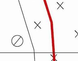 | |
| 1-2 | 6 |  | |
| 0-1 | 4 | 5 | 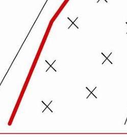 |
UIAA grading scheme of the route
Route description by sections
Approach from Koronskaya hut — approximately 1–1.5 hours across the Ak-Sai glacier. It is necessary to move in a tied rope team, as the glacier is partially covered. Then the ascent begins towards the bergschrund, movement is also in a tied rope team, and there is a risk of avalanches.
Section R0–R1 — approximately 200 m long. Start of the route. We approach the bergschrund, then move along the snow towards the rocks. Movement is along the rocks to the right and upwards, towards the icy couloir. Belaying is done using rock protection (medium-sized chocks), and at the end — using ice screws. The ice is fragile in some places. It is necessary to move carefully — risk of avalanches.
Section R1–R2 — approximately 80 m long. Movement is on ice, the ice is not very firm, and at the beginning of the pitch, it requires preliminary cleaning of "bubbly ice". After about 30 meters, the ice becomes firmer. The slope of the ice is approximately 75°. This section is complex.
Section R2–R3 — movement on ice, about 170 m. The ice slope eases to 60°.
Section R3–R4 — the ice becomes steeper, the couloir leads to a steep "face", approximately 75°. This section is the most complex and is the key section of the route.
Section R4–R5 — ascent on ice towards the rocks, approximately 120 m. The rocks are not steep, about 40°, the orientation is a continuation of the icy couloir. It is necessary to move carefully (with a large amount of snow — risk of avalanches), belaying is done along the rocks using stoppers and medium-sized chocks. The stance is on a large ledge. Then again, an ascent onto the ice.
Section R5–R6 — 180 m long, movement on ice. The ice is also steep, 65°–70°, near the top, the ice starts to break off in lenses. Ascent to the col between the peaks.
Section R6–R7 — 30 m long. We move from the col to the right, ascending a 60° wall, the climbing is not complex. A control cairn is built, and a note is left.
Descent: descending via the ascent route is the most logical. First, 3 rappels to the rocky section. Then 2 rappels along the rocks (a rappel ring is left), and then along the icy couloir for about 500 m. In total, there were 11 rappels, and by 9:00 pm the team was already at the start of section R0–R1.
Addendum to the route:
The equipment used on the route was predominantly ice screws; from rock climbing equipment, it is necessary to bring a set of stoppers and a friend.
At the beginning of the route and on the rocky section R4–R5, it is necessary to be cautious due to the possible risk of avalanches.
