CIS Climbing Championship 2009 Class of High-Altitude Technical Ascent
Report
on the ascent of Peak Korzhenevskoi, 7105 m via the Southwest Ridge, Category 5B (V. Markelov's route) by the team of Sumy Regional Federation of Alpine Sports from July 24 to July 28, 2009
Team Captain: Sergey A. Pugachev Team Coaches:
- Fedor P. Mityukhin
- Mikhail V. Zagirnyak
Sumy – 2009
Contacts
Coaches:
- Fedor Petrovich Mityukhin
- 40004, Sumy, Metallurgov St., 14/67
- home phone: 8 (0542) 24–56–06
- work phone: 61–99–64
- Mikhail Vasilyevich Zagirnyak
- Lenina St., 3A, apt. 7, Kremenchuk, Poltava region, 39600
Team Leader:
- Sergey Alexandrovich Pugachev
- 84646, Gorlovka, Donetsk region, Pobedy Ave., 110, apt. 18
- Phone: 8–050–204–44–64
Ascent Details
- Ascent class — high-altitude technical
- Ascent area — Pamir, Academy of Sciences Range
- Peak Korzhenevskoi, 7105 m, via SW ridge (V. Markelov's route, 1984)
- Route category — 5B
- Height difference — 2500 m
Route length — 5000 m
Length of exposed sections:
- category 5 — 150 m Average slope — 30° Average slope of the main section — 60°
- Pitons used:
- Rock pitons — 18/0
- Bolt pitons — 10/0
- Ice screws — 10/0
- Protection gear — 10/0
- Team's climbing hours — 28 hours; 4 days
- Camps:
- 1st camp — 4750 m
- 2nd camp — 5750 m
- 3rd and 4th camps — 6400 m
- Team Leader: Sergey A. Pugachev — Master of Sports
Team Members:
- Sergey Yu. Bublik — Master of Sports
- Vladimir I. Roshko — Candidate for Master of Sports
- Dmitry A. Venslavovsky — Candidate for Master of Sports
- Yuri V. Kilichenko — Candidate for Master of Sports
- Dmitry B. Romanenko — 1st sports category
- Team Coaches:
- Fedor P. Mityukhin — Master of Sports
- Mikhail V. Zagirnyak — Master of Sports
- Departure on the route: July 24, 2009 Summit: July 27, 2009 Return to Base Camp: July 28, 2009
Equipment List
| № | Item | Quantity |
|---|---|---|
| 1. | Main rope: D=10 mm — 50 m | 3 |
| 2. | Auxiliary rope: D=8 mm — 50 m | 1 |
| 3. | Titanium rock pitons | 10 |
| 4. | Steel rock pitons | 5 |
| 5. | "Sail" type protection | 10 |
| 6. | Friends, camalots | 5 |
| 7. | Rock hammers | 2 |
| 8. | Ice axes | 1 |
| 9. | Ice axes (general) | 5 |
| 10. | Ice screws | 10 |
| 11. | Quickdraws | 20 |
| 12. | Belay loops | 5 |
| 13. | Crampons for cramponing | 1 pair |
| 14. | Crampons | 5 pairs |
| 15. | Extractor | 1 |
| 16. | First aid kit | 1 set |
| 17. | Route documentation | 1 copy |
| 18. | Radio station | 1 |
| 19. | Camera | 2 |
Overview of the Area
Peak Korzhenevskoi (7105 m) is a mountain in the northern part of the Academy of Sciences Range, 13 km from Peak Ismoili Somoni (formerly Peak Communism). It is one of the five seven-thousanders of the former USSR. The peak was first discovered on August 23, 1910, by the Russian geographer N. L. Korzhenevsky and named after his wife, Evgenia Korzhenevskaya. The first attempt to climb the peak was made in 1936 by climbers A. Dzaparidze and N. Gusak. The first ascent was achieved on August 22, 1953, by a group led by A. Ugarov via the northern ridge from the Korzhenevsky Glacier. There are 17 routes to the summit: 14 of category 5B and 3 of category 6B. The most challenging is considered to be Ugarov's route along the Northern Ridge. Many complex routes are also located on the western slope. The classic route is Tsetlin's route, which goes along the Southern Ridge. The base camp is located at an altitude of 4200 m above sea level, at the confluence of the Walter and Moskvin glaciers (eastern tributaries of the Fortambek Glacier), and is the most convenient and safe starting point for climbing Peaks Communism and Korzhenevskoi due to the shortest approaches.
Tactical Actions of the Team
July 24, 2009. Departure from Base Camp, located on Moskvin clearing (4200 m). Establishment of CAMP 1 at an altitude of 4750 m. July 25, 2009. Early departure at 6:00 to the SW ridge. Passage of the key bastions of the route. Night camp on the ridge — CAMP 2 — 5750 m. July 26, 2009. Departure on Tsetlin's route ("classic"). Night camp on the ridge — CAMP 3 — 6400 m. July 27, 2009. Assault departure at 4:00. 10:00 — summit — 7105 m 13:30 — descent to assault camp CAMP 3 — 6400 m July 28, 2009. Descent to Base Camp.
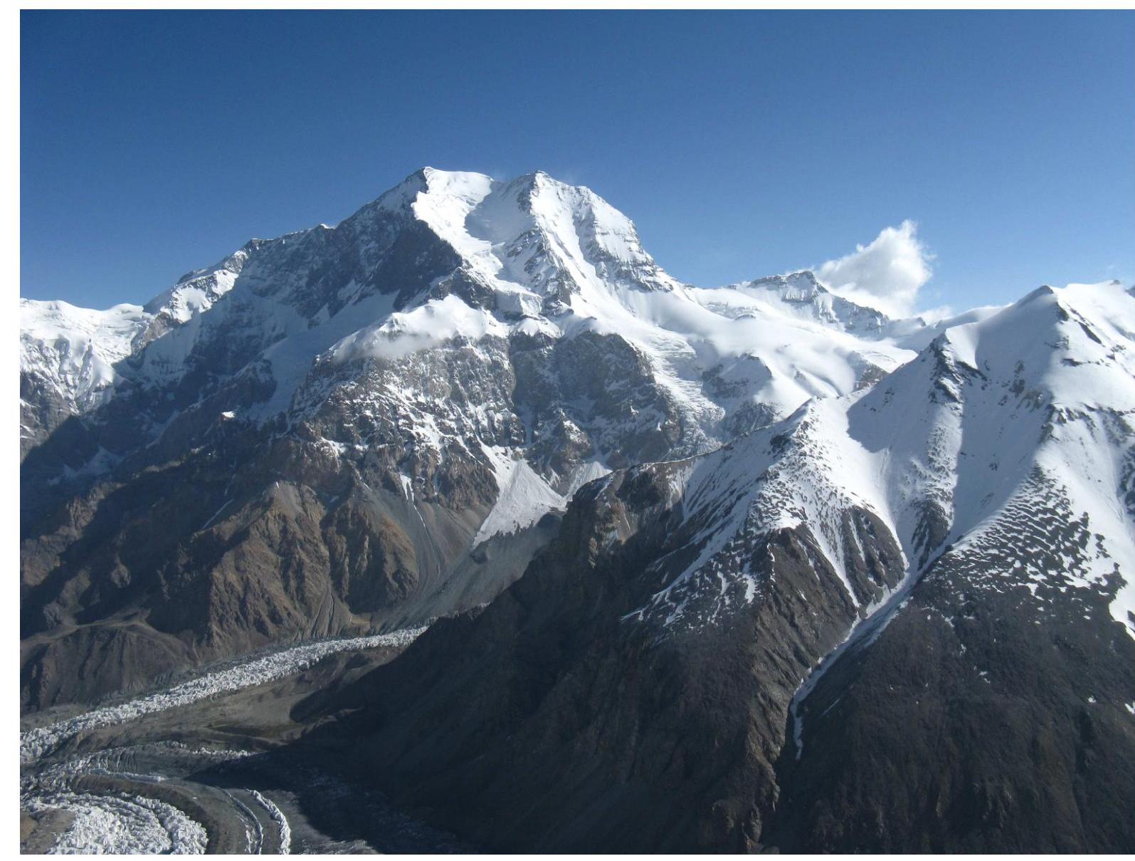
General view of the summit
 The route was completed without deviations. The ascent was carried out in accordance with the tactical plan. Communication sessions were held regularly, without omissions. There were no injuries or illnesses among the participants on the route.
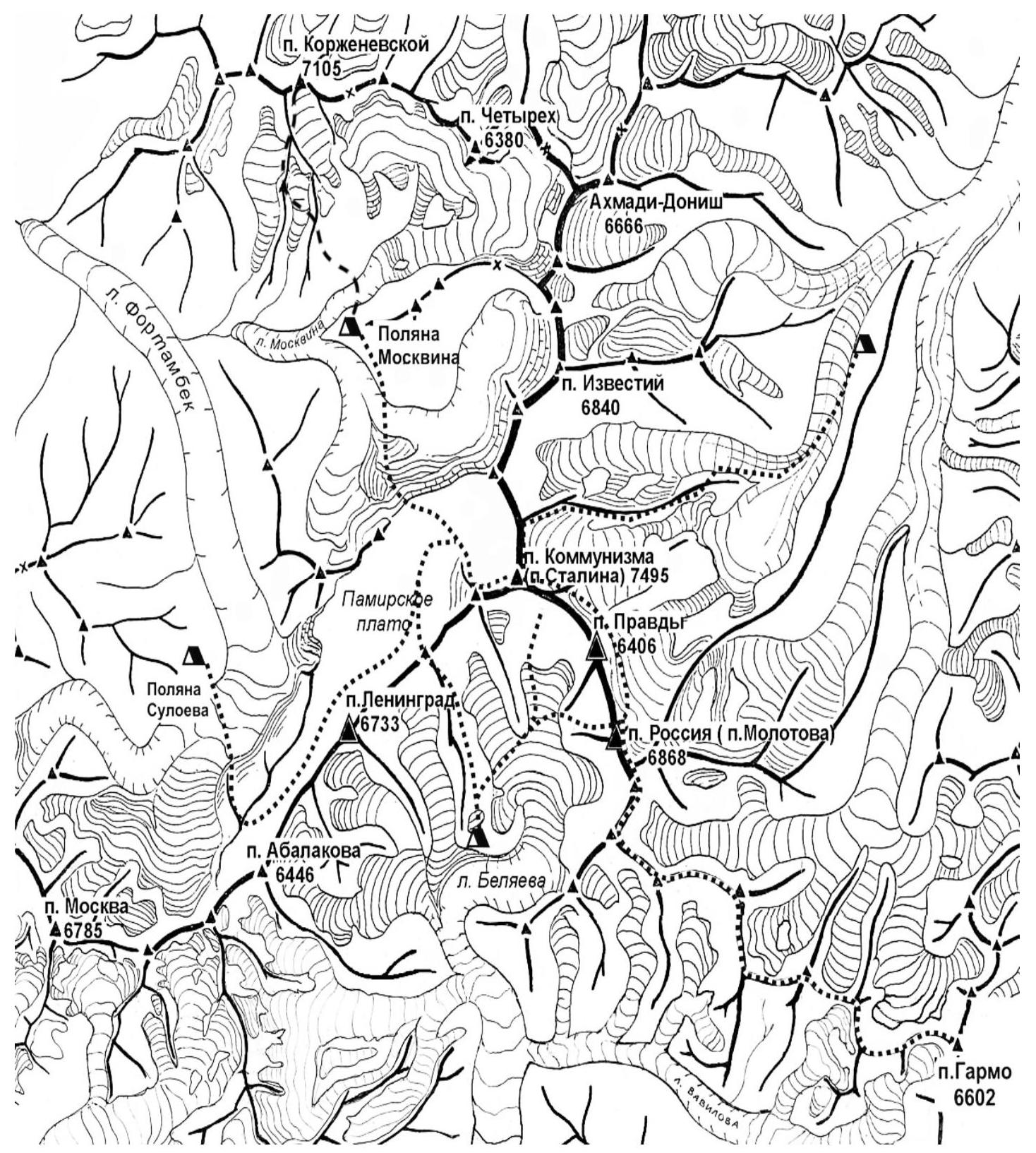
Map of the area
The route was completed without deviations. The ascent was carried out in accordance with the tactical plan. Communication sessions were held regularly, without omissions. There were no injuries or illnesses among the participants on the route.
Map of the area
 Technical photograph of the route
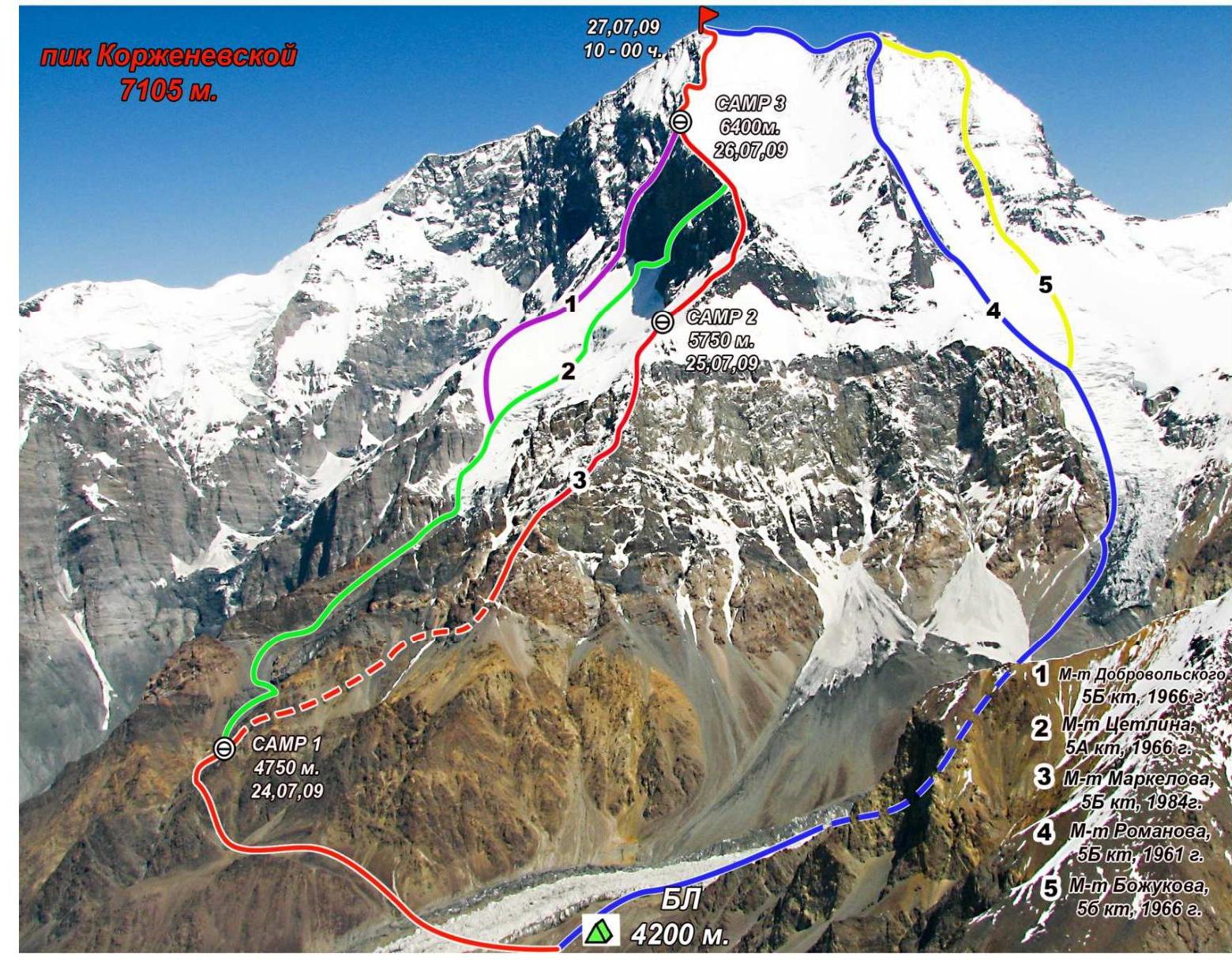 Profile of the key bastion
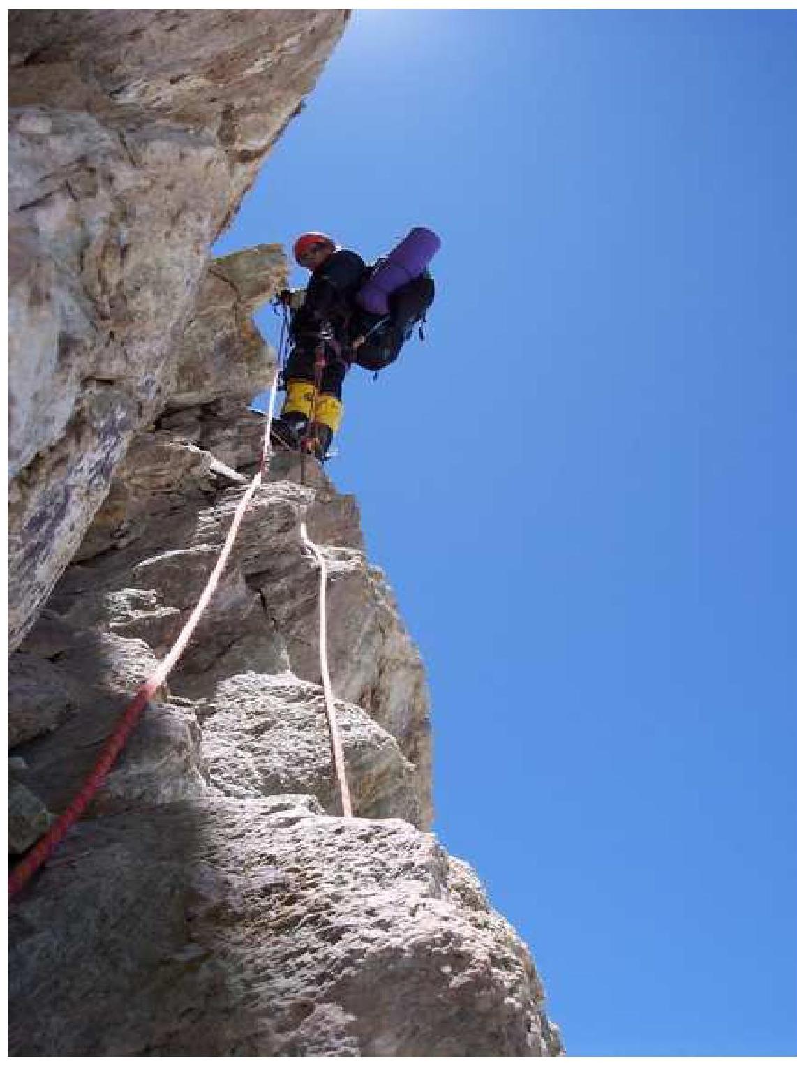
 Passage of the key section
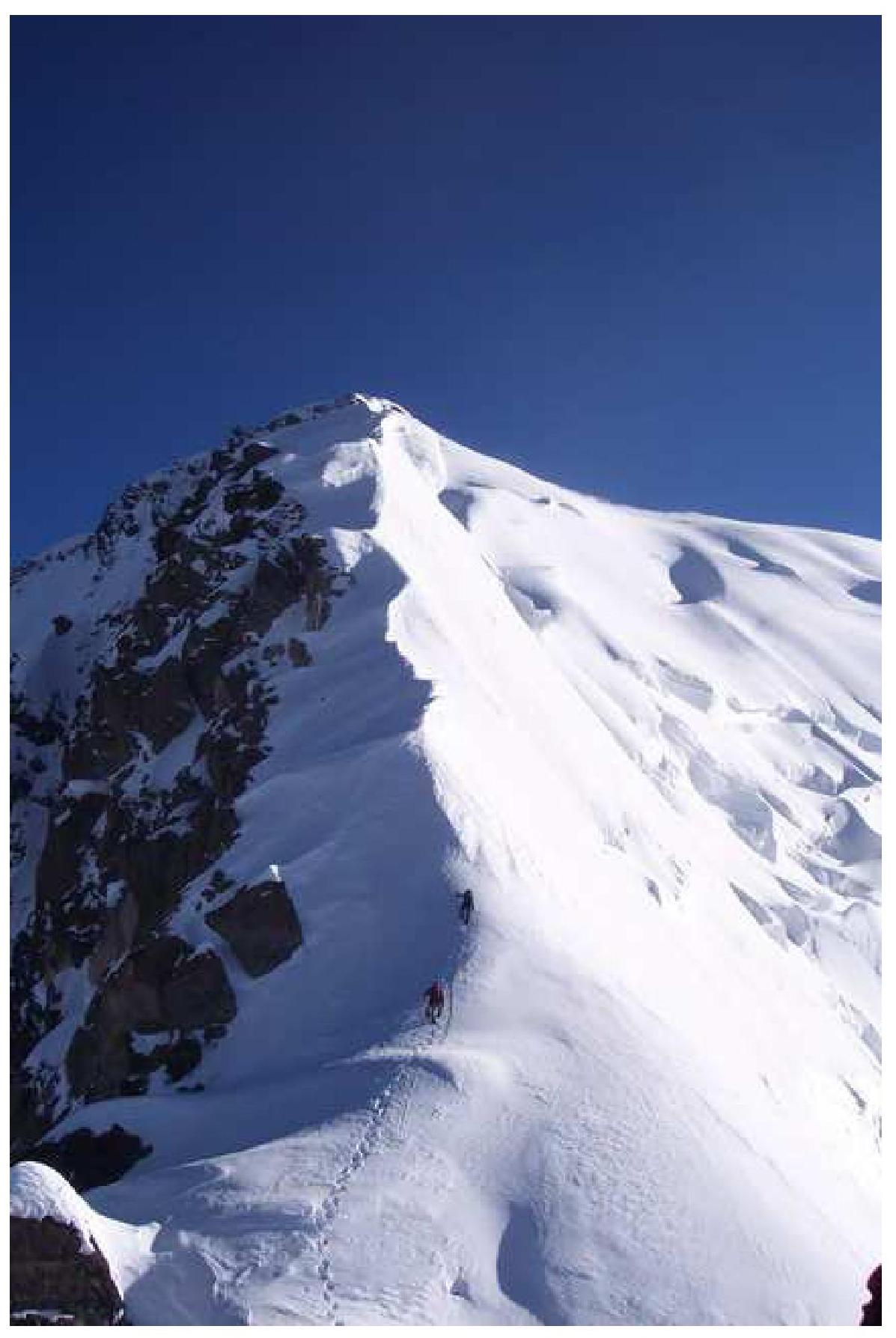
 Pre-summit ridge
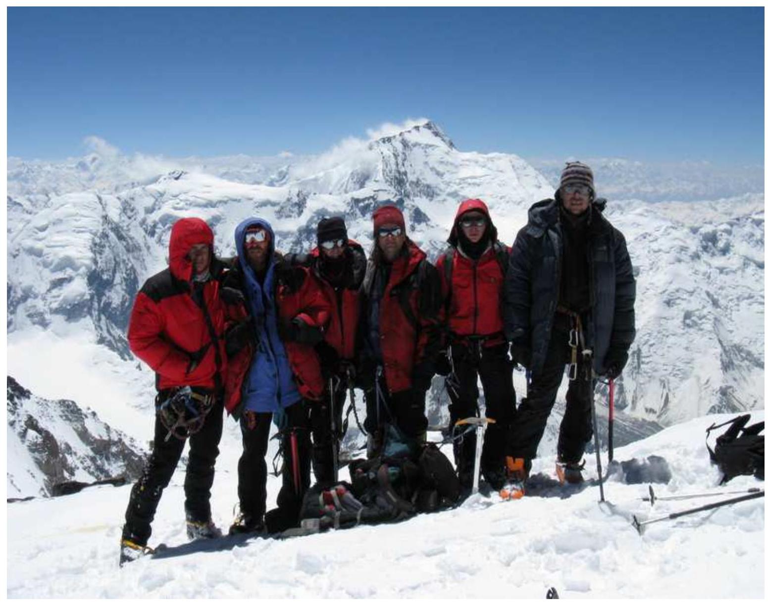
 Team at the summit, 7105 m.