East. Shakhdag, via South Couloir by Asadov Ya. A. East Caucasus 2.11.2018
Passport
- Route type — combined
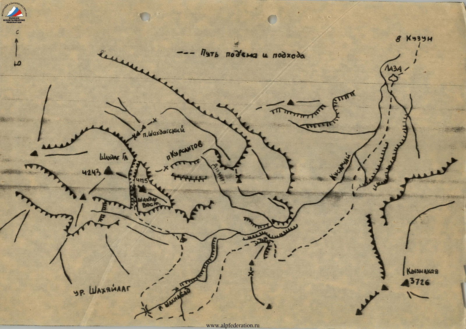
- East Caucasus, Shahnabad and Kusarчай river gorges
- Shakhdag East via South Couloir
- Assumed 2A cat. diff. — first ascent
- Elevation gain — 1125 m, distance — 2260 m
Length of cat. diff. 2 sections — 600–700 m. Average steepness of the main part of the route — 35°
-
Moving time — 6 hours
-
Leader — Asadov Yakub Aliaga ogly
Participants — Mamedov Elchin Soltan ogly
- Gamidov Niyaz Sabirovich
- Ragimov Elman Mubariz ogly
- Baranov Sergey Nikolaevich
-
Coach — Jafarov Rasim Pashaevich
-
Departure — summit — return — August 24, 1993
-
Organization — Azerbaijan Republican Mountaineering Club
 V. Shakhdag East (4125 m) via South Couloir, 2A cat. diff. Brief description.
From Kuzun village along a dirt road to Laza village (about 5 km). From Laza village along a good trail on the left side of the Kusarчай River, then along the Shahnabad River to reach Shakyaylag tract. Cross the Shahnabad River via a bridge. From Kuzun village to the bridge — 9–12 hours. From the bridge, move towards the Shakhdag wall, 30 minutes from the bridge — good camping spots.
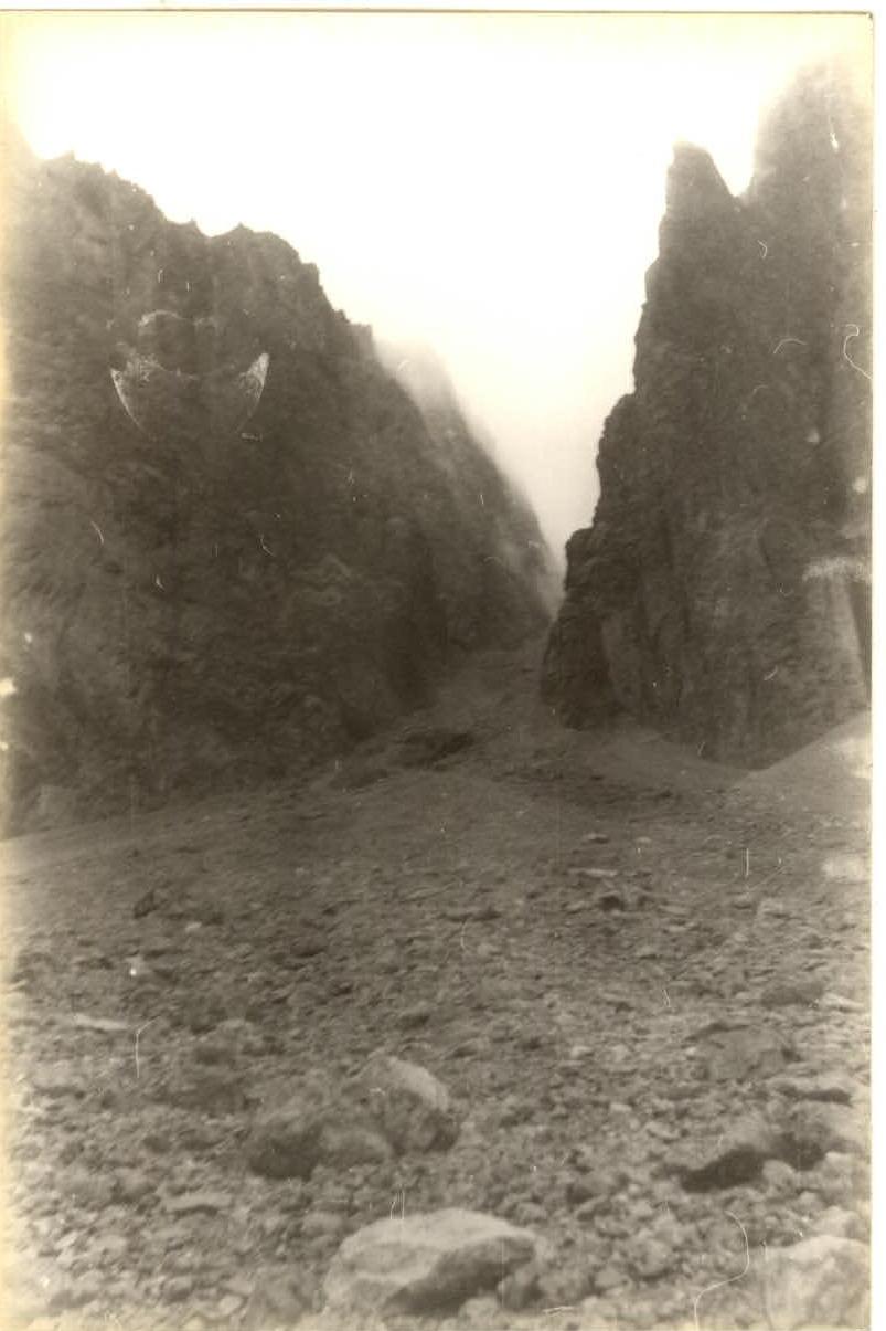
From the camping spots near the bridge, move towards the couloir with a waterfall on the Shakhdag wall (Smirnov's Couloir). Approach takes 1 hour 30 minutes (end of grassy slopes).
Then, via scree, enter the right scree couloir (the couloir is not visible from the approach). To the start of the couloir — 1 hour.
Start of the route.
Via steep scree 25–35° cat. diff. 1, in places cat. diff. 2, straight up towards the snow patch, in the middle and upper parts stick to the left side of the couloir. From the start of the route to the snow patch — 2 hours. Then, via the snow patch (steepness 40° cat. diff. 2) to the fork in the couloir, from the start of the snow patch — 1 hour. Ice is present under the snow in places. From the fork, move to the right along the snow patch for about 100 m, cat. diff. 2, steepness 40°. Then, via ice covered with stones, reach the dome of East Shakhdag, steepness 35° cat. diff. 1, about 100 m. From the exit to the dome to the summit — 10 minutes.
Descent is via the ascent route. Note: the entire couloir is prone to rockfall. Pass through the couloir when its slopes are not exposed to the sun.