ASCENT DOCUMENT
-
Ascent classification combined
-
Ascent region Eastern Caucasus
-
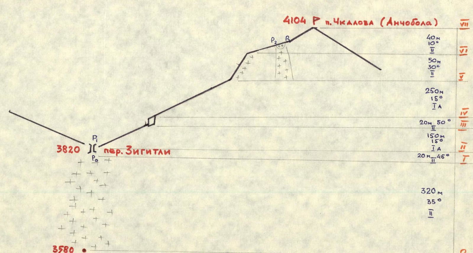
Peak, its height, and ascent route (Peak Chkalova (Anchobola)), 4111 m, from the south and along the western ridge
-
Estimated difficulty category 1B
-
Route characteristics elevation gain — 520 m average steepness — 30° length of sections: I — 320 m, II–VIII — 530 m
-
Pitons hammered in: — rock: 0 — ice: 0 — bolted: 1 (for belay, for creating anchor points)
-
Number of nights and their characteristics no nights
-
Number of climbing hours 7
-
Surname, name, patronymic of the leader and participants, their sports qualification
- Akhmedkhanov K.E. — 2nd sports category
- Pashuk E.G. — 2nd sports category
- Kozorezov E.F. — 2nd sports category
- Leonov P.G. — 2nd sports category
- Svinarev G.I. — 3rd sports category
-
Team coach Master of Sports of the USSR Timoshin M.E.
-
Date of departure on the route and return June 25, 1981


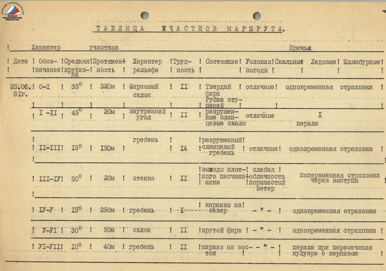
Route Sections Table
| Date | Designation | Average steepness | Length | Terrain characteristics | Difficulty | Condition | Weather conditions | Pitons: Rock | Ice | Bolted |
|---|---|---|---|---|---|---|---|---|---|---|
| June 25, 1981 | R0–R1 | 35° | 320 m | Firn slope | 2 | Firm firn, step cutting | Excellent | simultaneous belay | ||
| R1–R2 | 45° | 20 m | Inner corner | 2 | Destroyed shale rocks | Excellent | 1 | handrail | ||
| R2–R3 | 15° | 150 m | Ridge | 1 | Destroyed shale ridge | Excellent | simultaneous belay | |||
| R3–R4 | 50° | 20 m | Wall | 2 | Dense sandstone outcrops | Light cloudiness, gusty wind | alternate belay through ledges | |||
| R4–R5 | 15° | 250 m | Ridge | 1 | Cornices to the north | simultaneous belay | ||||
| R5–R6 | 30° | 50 m | Slope | 2 | Steep firn | simultaneous belay | ||||
| R6–R7 | 10° | 40 m | Ridge | 2 | Cornice to the east | handrail when crossing couloir with cornice |
Route Diagram according to UIAA
Height 4104 m, Peak Chkalova (Anchobola) Height 3820 m (Zigitli pass) Height 3580 m