Report
on the first traverse of Tbau Glavnaya – Tbau Severo-Zapadnaya, winter category 1B difficulty level, by the FATUM CAT team on February 14, 2024.
I. Climbing Passport
| № | 1. General Information | |
|---|---|---|
| 1.1 | Full name, sports rank of the leader | Egorin S.V. — Master of Sports |
| 1.2 | Full name, sports rank of participants | Tolistikova E.Yu. — 2nd sports rank |
| 1.3 | Full name of coach | Egorin S.V. |
| 1.4 | Organization | FATUM CAT |
| 2. Characteristics of the Climbing Object | ||
| 2.1 | Region | Caucasus, Skalisty Range |
| 2.2 | Valley | Dargavs depression |
| 2.3 | Section number according to the 2020 classification table | 2.8 |
| 2.4 | Name and height of the peak | Tbau Glavnaya (3007 m) – Tbau Severo-Zapadnaya (2980 m) |
| 3. Route Characteristics | ||
| 3.1 | Route name | Traverse, from the South |
| 3.2 | Proposed difficulty category | 1B winter |
| 3.3 | Route exploration level | First ascent |
| 3.4 | Route terrain character | Rocky |
| 3.5 | Route elevation gain | 600 m from R0 point |
| 3.6 | Route length | about 1.5 km from R0 point |
| 3.7 | Technical elements of the route | I difficulty level ice/rock/combination – 500 m. II difficulty level ice/rock/combination – 300 m. III difficulty level ice/rock/combination – 80 m. IV difficulty level ice/rock/combination – 2 m. Movement on closed glacier – none. |
| 3.8 | Descent from the summit | From Tbau SZ, via the North-East slope, or via the ascent route. |
| 3.9 | Additional route information | There is mobile coverage on the summits. No water on the route. |
| 4. Team Actions Characteristics | ||
| 4.1 | Time in motion | 6 hours |
| 4.2 | Overnights | None |
| 4.3 | Start of the route | 8:00, February 14, 2024 |
| 4.4 | Reaching the second summit | 14:00, February 14, 2024 |
| 4.5 | Descent to the road | 18:00, February 14, 2024 |
| 5. Report Responsible | ||
| 5.1 | Full name, e-mail | Egorin S.V., e.s.128@mail.ru |
II. Climbing Description.
1. Climbing Object Characteristics.
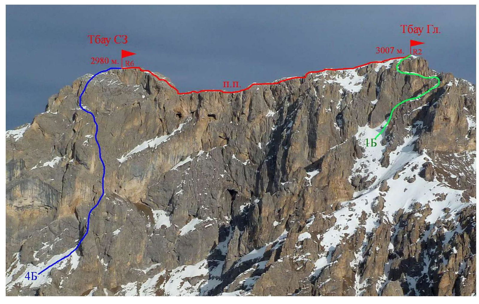
Photo 1. View from the South-West, from the Uacilakhoh summit. December. The first ascent route is marked in red.
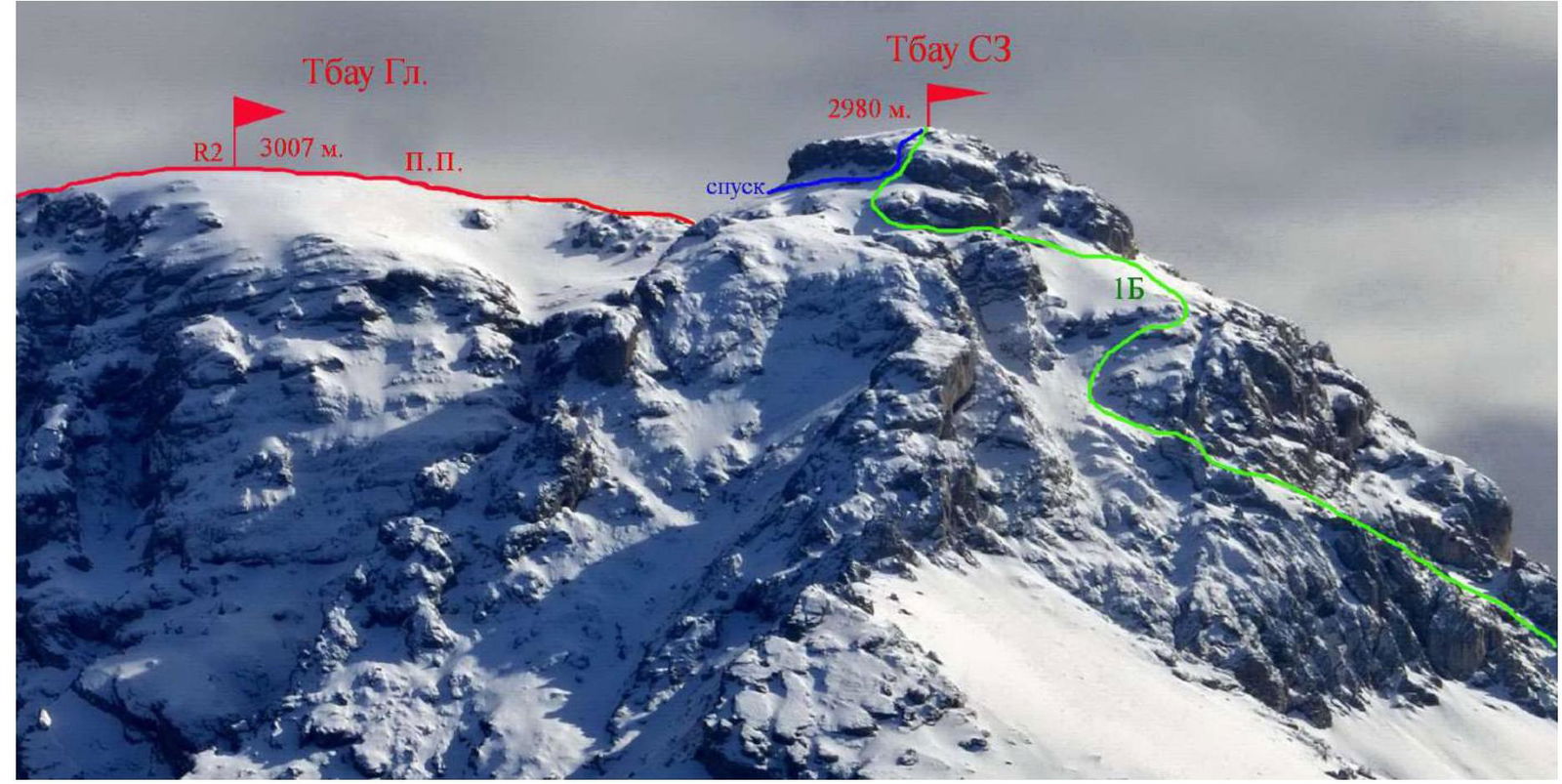
Photo 2. View from the North-East. March. The first ascent route is marked in red. The descent from Tbau SZ is marked in blue, its visible part.
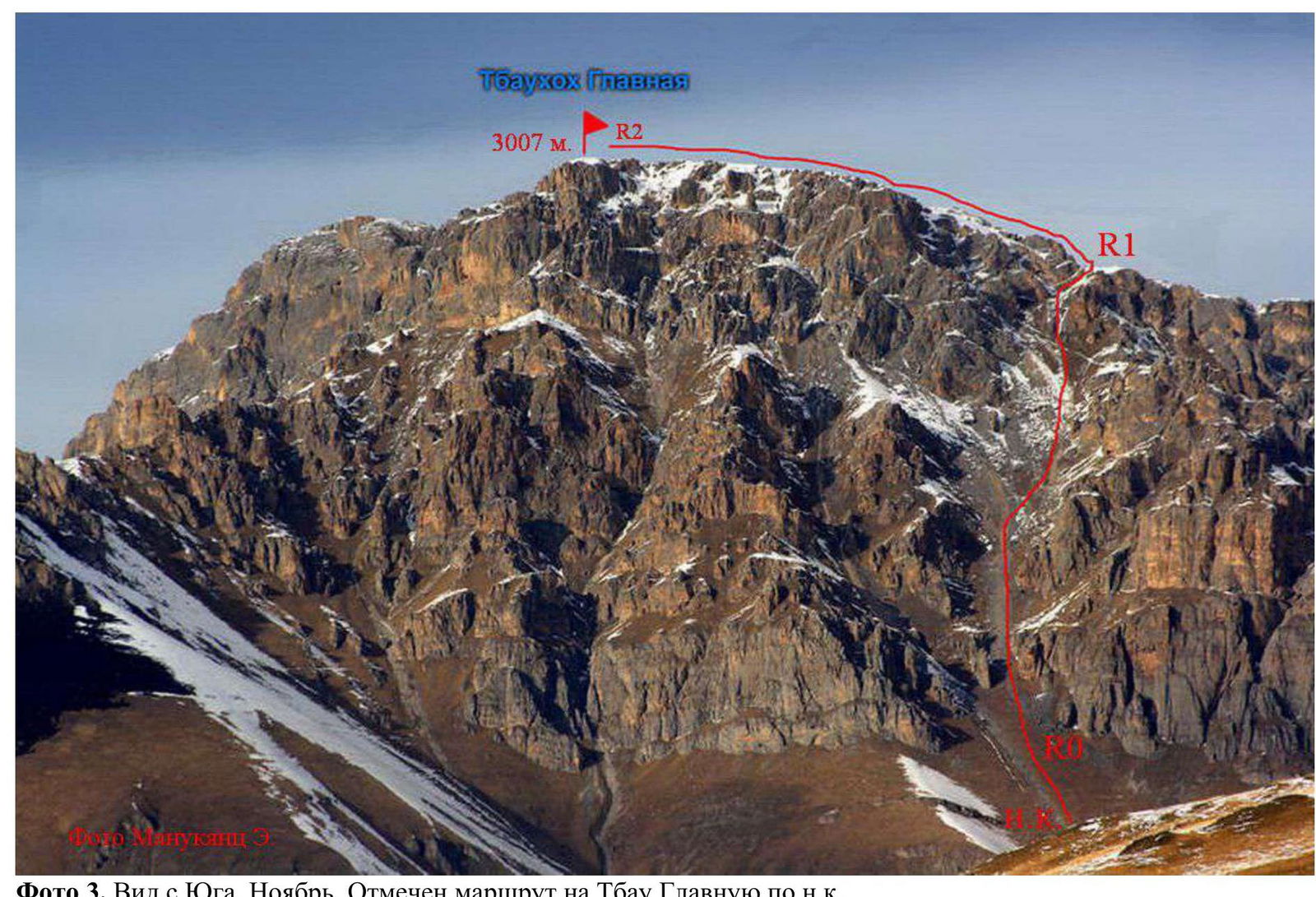
Photo 3. View from the South. November. The route to Tbau Glavnaya via the normal route is marked.
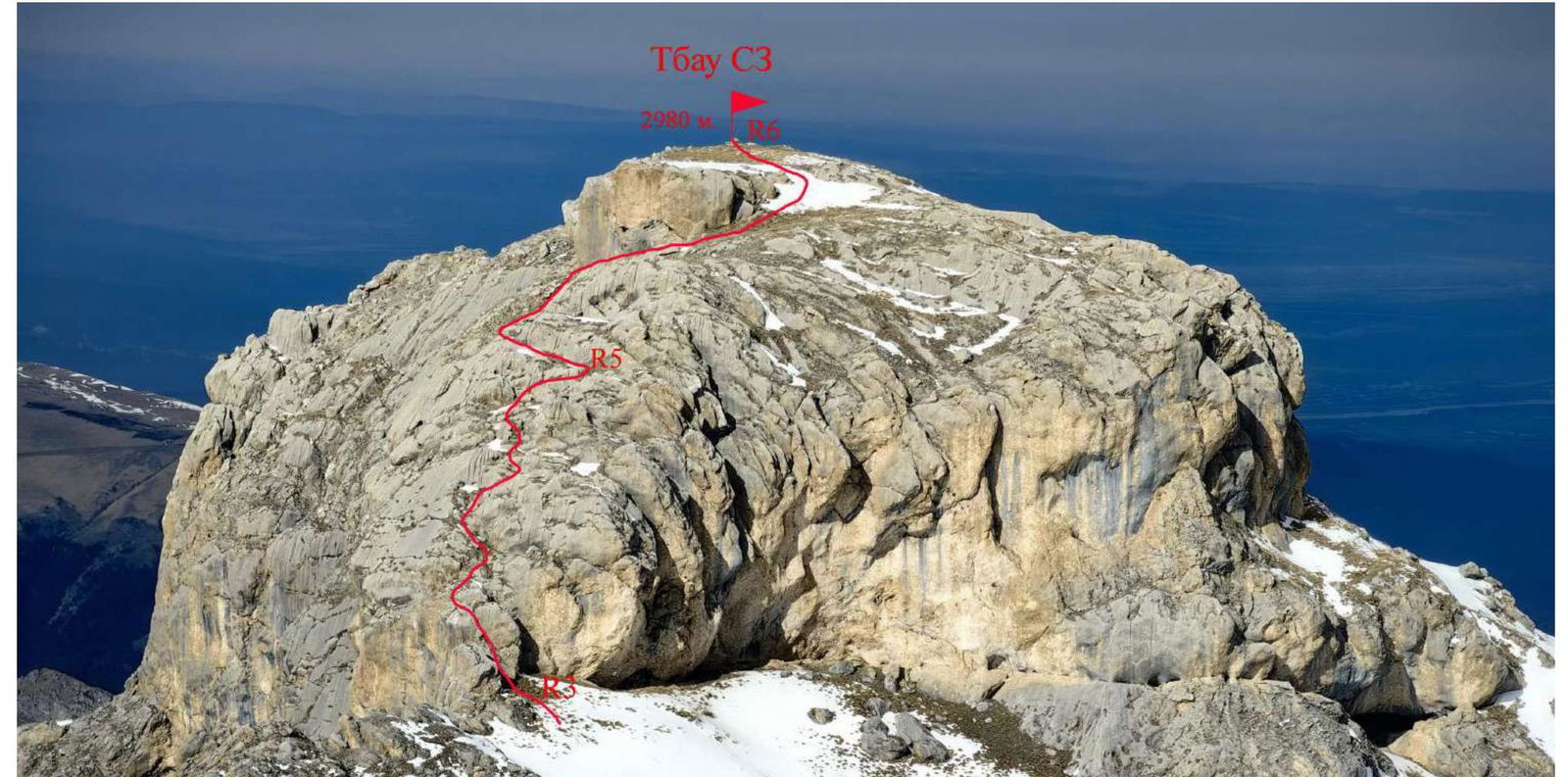
Photo 4. View of the Tbau SZ tower, from the South. February. The first ascent route is marked.
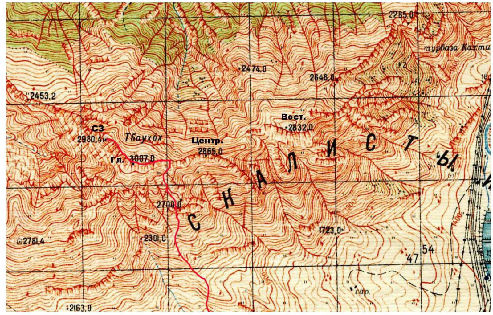
Photo 5. Climbing area map. The first ascent route is marked in red.
2. Technical Characteristics of Route Sections:
| Section | Terrain Character | Difficulty Level | Length, m | Type and Number of Hooks |
|---|---|---|---|---|
| R0–R1 | Grassy-scree couloir, with individual rock outcrops. | n.c. – 1 | 700 m | - |
| R1–R2 | Grassy-scree slope, with individual rock outcrops. | n.c. – 1 | 350 m | - |
| R2–R3 | Rocky-scree ridge. | 1–3 | 350 m | Belay via ledges. |
| R3–R4 | Wall with a crack. | 3–4 | 5 m | 2 stoppers (friends) |
| R4–R5 | Rocks like "sheep's foreheads". | 2–3 | 45 m | 2 stoppers (friends). 3 anchors. For station organization — anchors. |
| R5–R6 | Rocks like "sheep's foreheads", scree slope. | 1–2 | 50 m | 1–2 stoppers (friends). 2 anchors. |
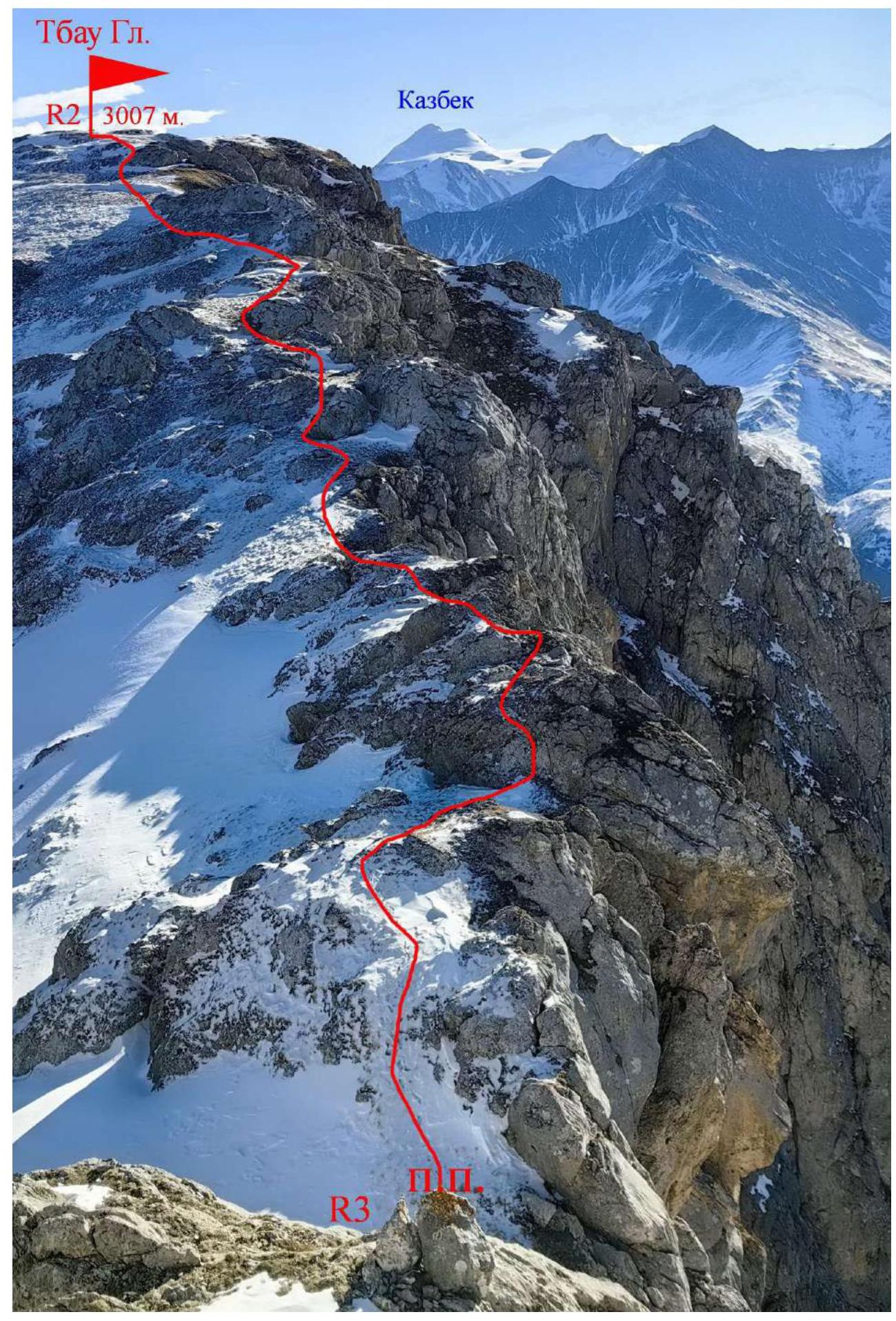
Photo 6. The path along the ridge on the R2–R3 section is marked. Photo from R5.
3. Team Actions Characteristics.
3.1 Approach to the Route Description:
From Vladikavkaz to Lamardon village takes 1.5 hours. Along the western outskirts of the village, you can drive on a dirt road to a height of 1650 m. Then, move along cattle trails towards the beginning of the southern couloir of the Tbau massif.
Approaching the couloir, we take an scree path leading to the eastern ridge of the massif, and then to the Main summit — via the normal route. Coordinates of the lower part of the couloir: Latitude: 42.860853°, Longitude: 44.398971°
3.2 Brief Description of the Route Passage.
| Section | Description | Photo № |
|---|---|---|
| R0–R1 | Move along the scree couloir, on a clearly visible path, bypassing rock outcrops. At the top of the couloir, at the fork before the grotto, turn right and exit to the main ridge of the Tbau massif. | 3 |
| R1–R2 | After exiting to the ridge, turn West and move up the slope towards the Tbau Glavnaya summit. The Tbau SZ tower is visible to the North from the summit. | 4 |
| R2–R3 | Descend from the Main summit to the North-West. It's better to move directly along the ridge line, there's less snow and it's safer. Individual rock outcrops — bypass or descend with belay. Attention! There are drops on the left, up to 400 m. | 6–9 |
| R3–R4 | Approach the southern side of the Tbau SZ tower. Bypass the first rock and climb to the saddle behind it, under the wall with a sloping crack. In the crack, it's easy to place stoppers of large sizes. | 10, 11 |
| R4–R5 | Move straight up, on smoothed rocks like "sheep's foreheads". Short walls and slabs alternate with scree ledges. Organizing a station without anchors is difficult. | 12, 13 |
| R5–R6 | Move left along the ledge, to the end. There are drops on the South-West wall below! Then, move right and up, on the rocks, towards the summit. Station on a ledge. At the end of the section — scree slope. | 14 |
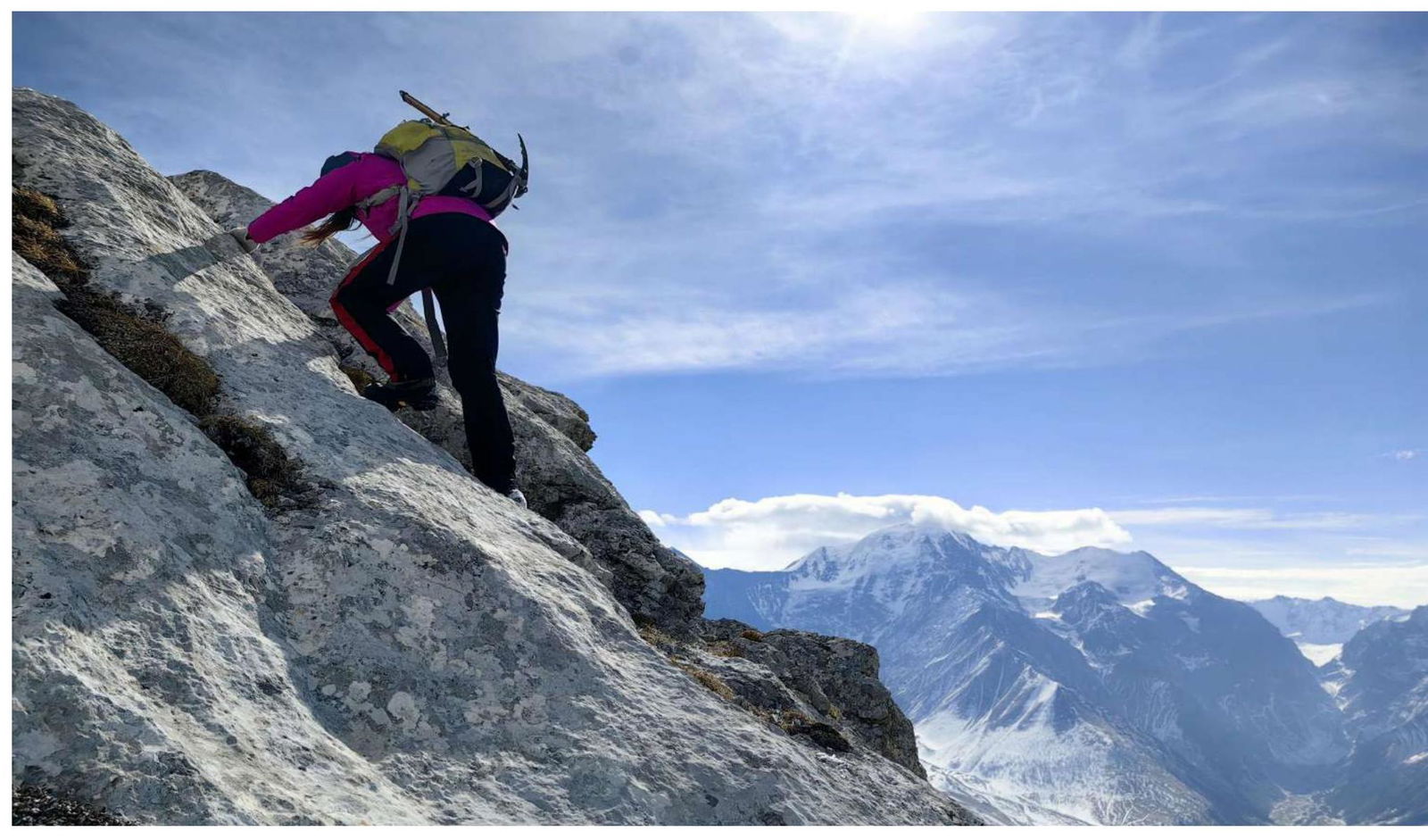
Photo 7. Movement through short rock walls on the R2–R3 section. Gymnastic belay.
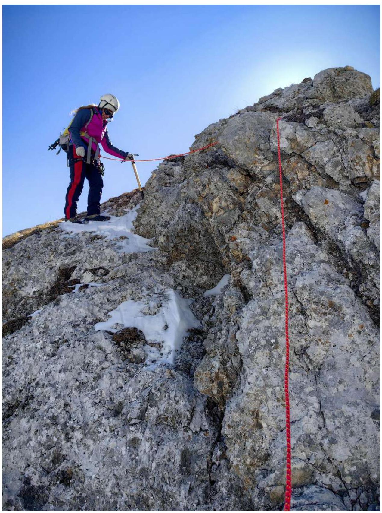
Photo 8. Movement through short rock walls on the R2–R3 section. Belay via a ledge.
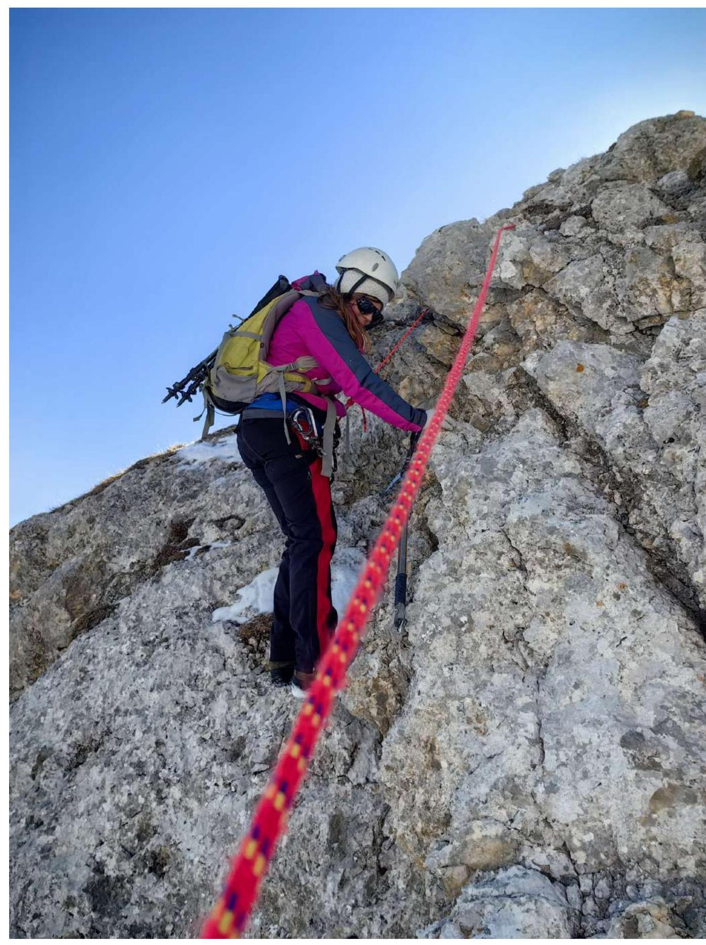
Photo 9. Movement through short rock walls on the R2–R3 section. Belay via a ledge.
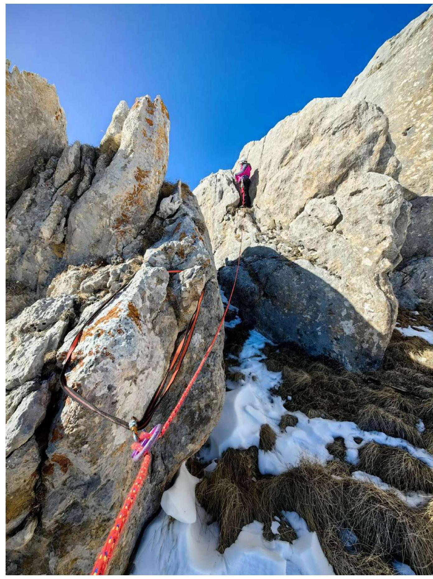
Photo 10. Passage of the R3–R4 section. Organization of an intermediate point.
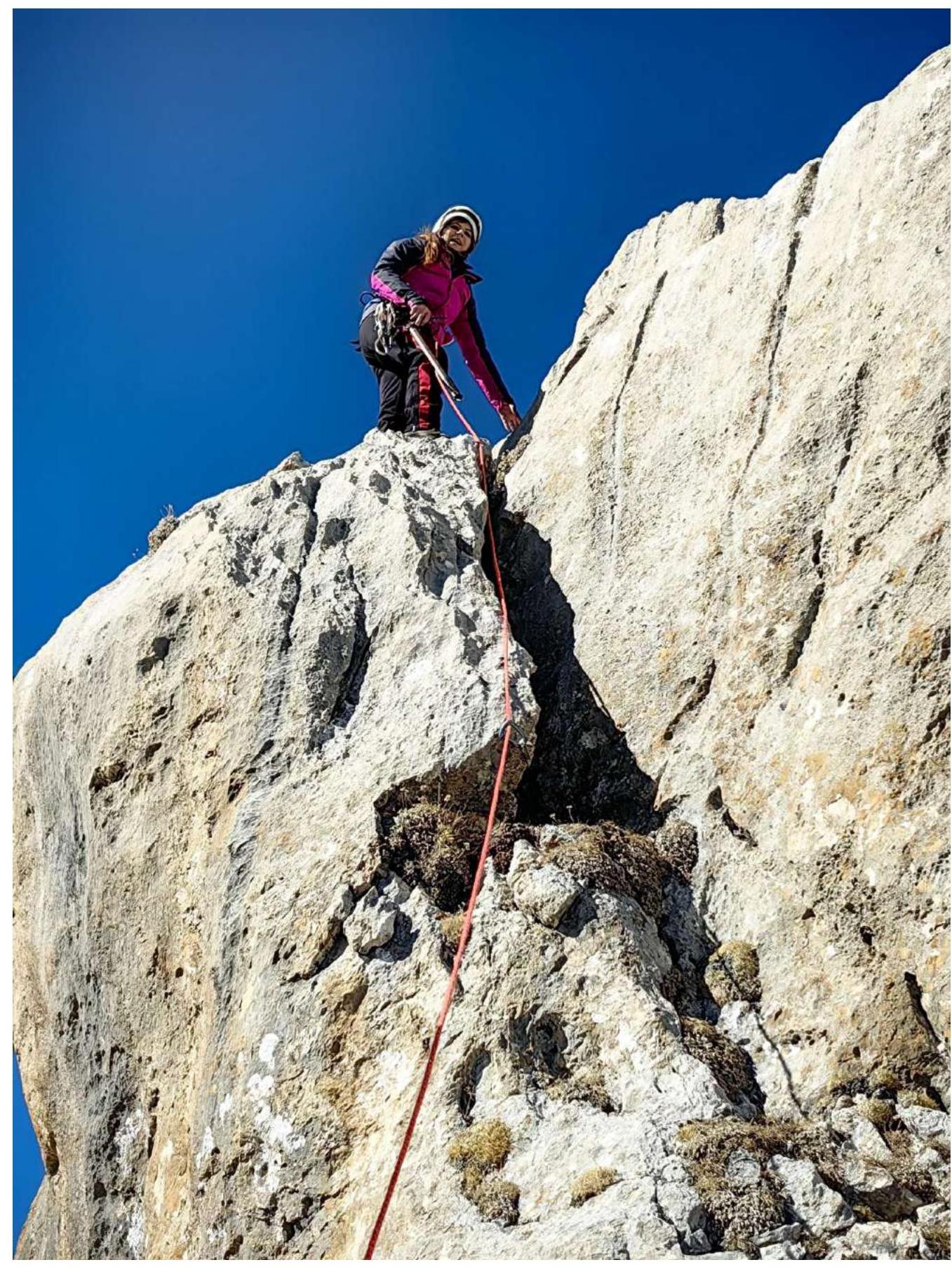
Photo 11. Exit via the crack on the R3–R4 section.
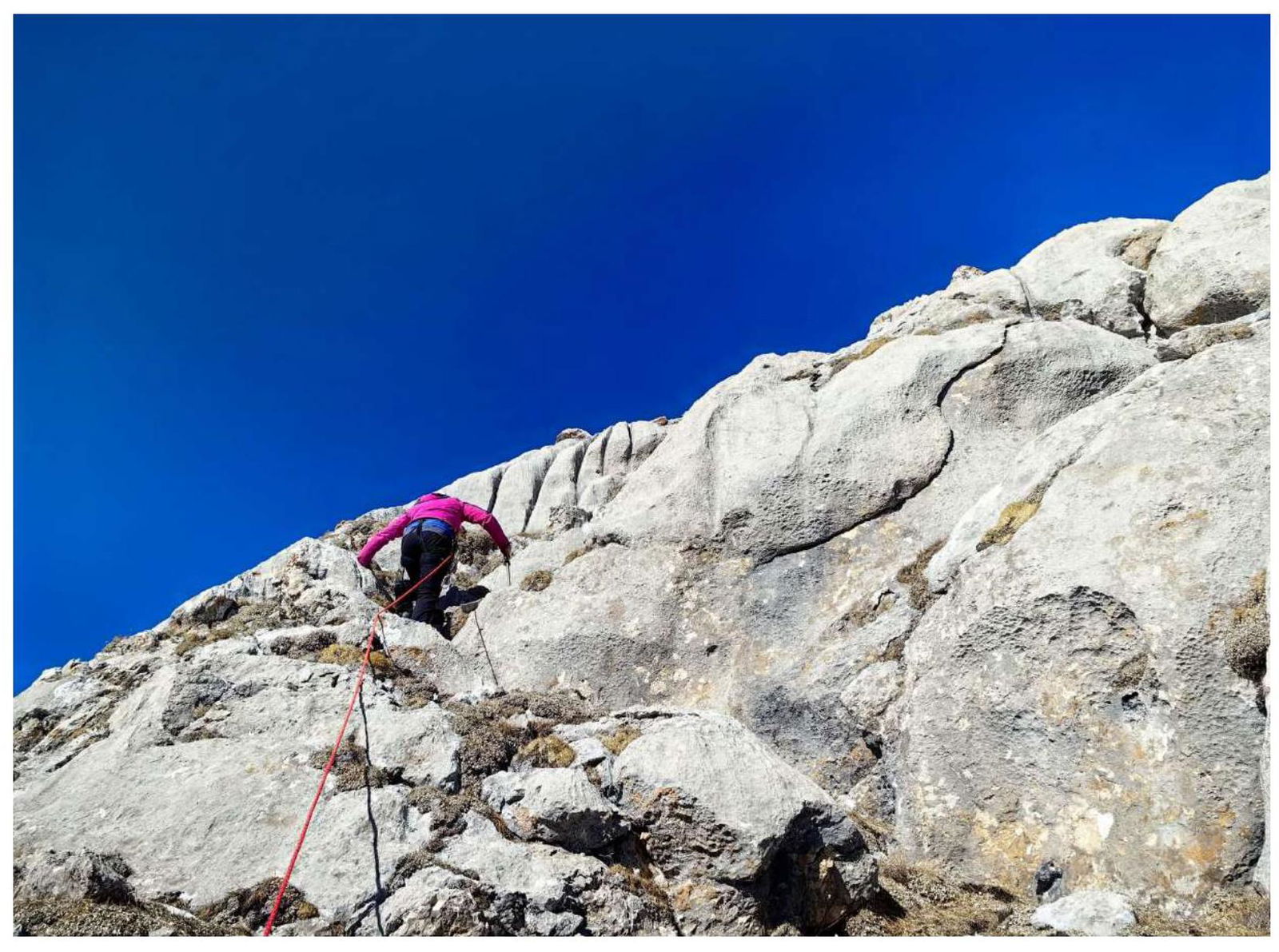
Photo 12. Movement on the R4–R5 section.
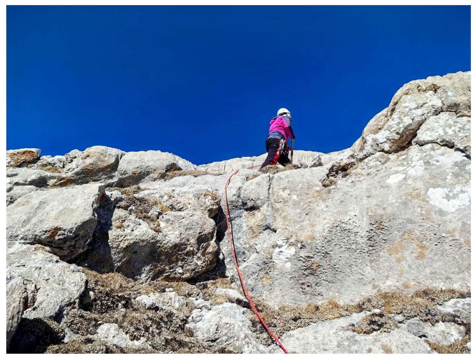
Photo 13. Movement on the R4–R5 section.
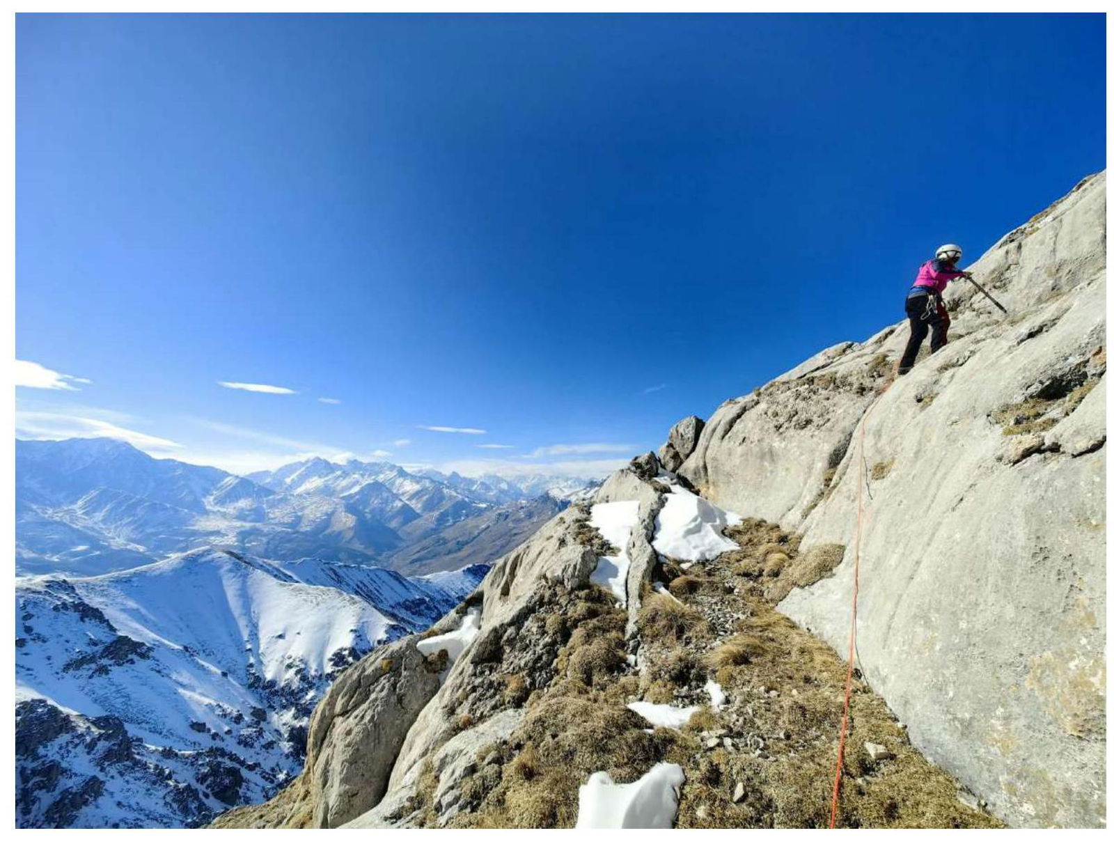
Photo 14. Movement at the beginning of the R5–R6 section.
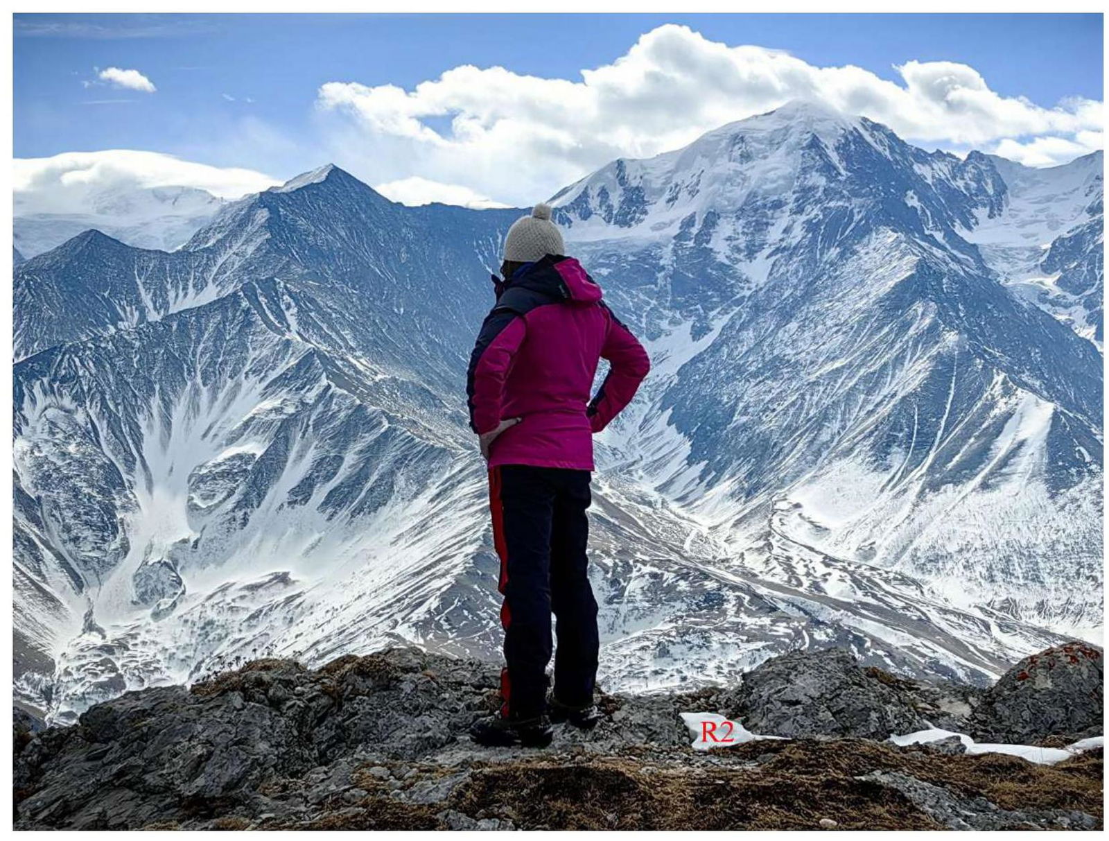
Photo 15. On the Tbau Glavnaya summit.
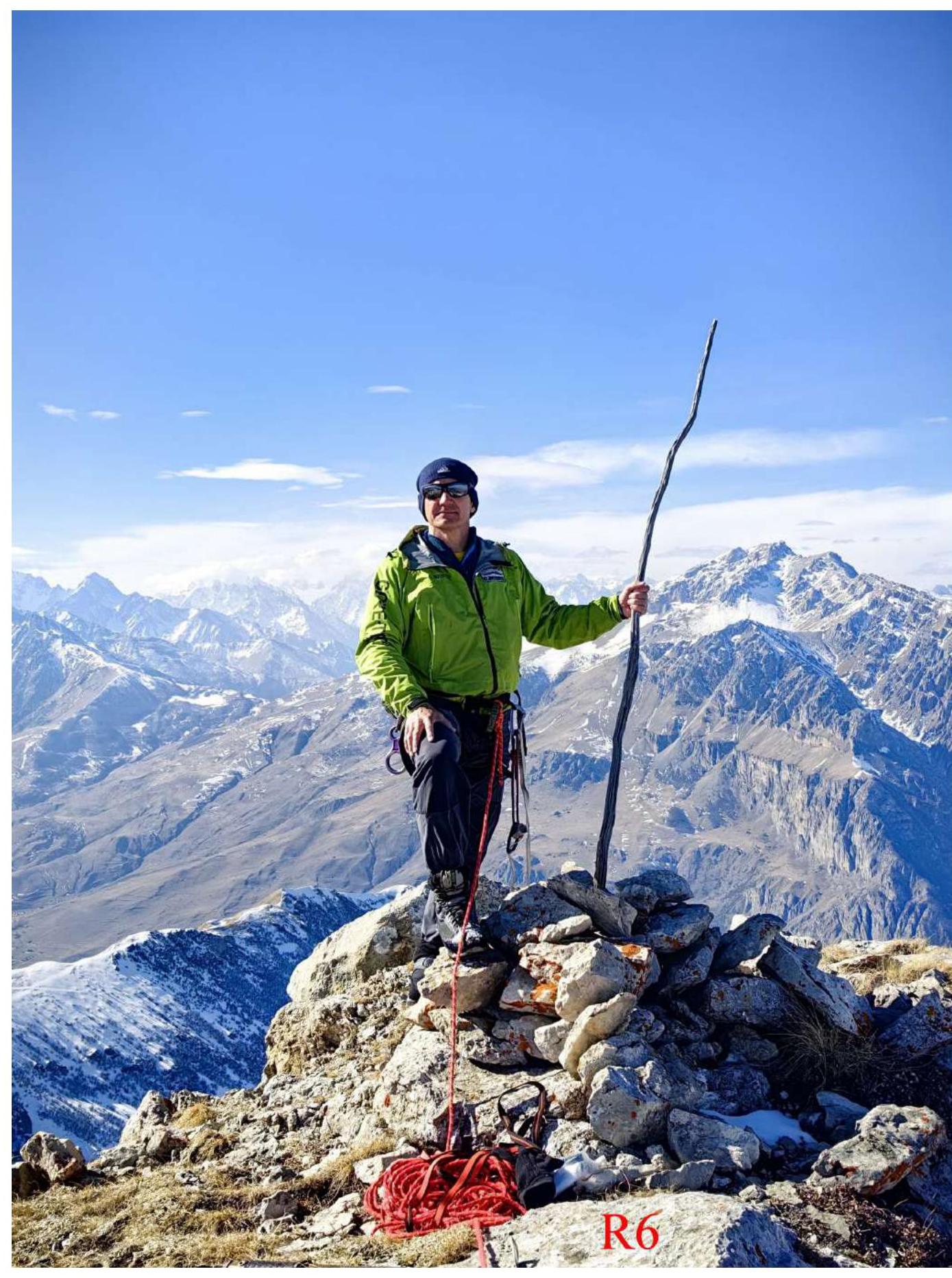
Photo 16. On the Tbau SZ summit.
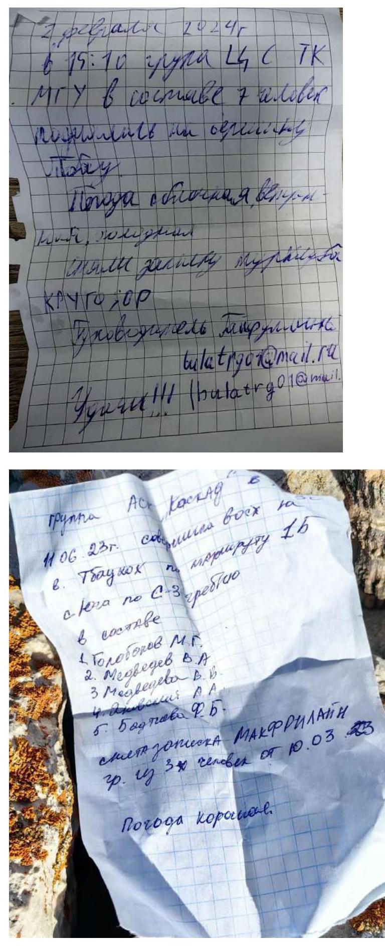
Photo 17. Notes on the summits.
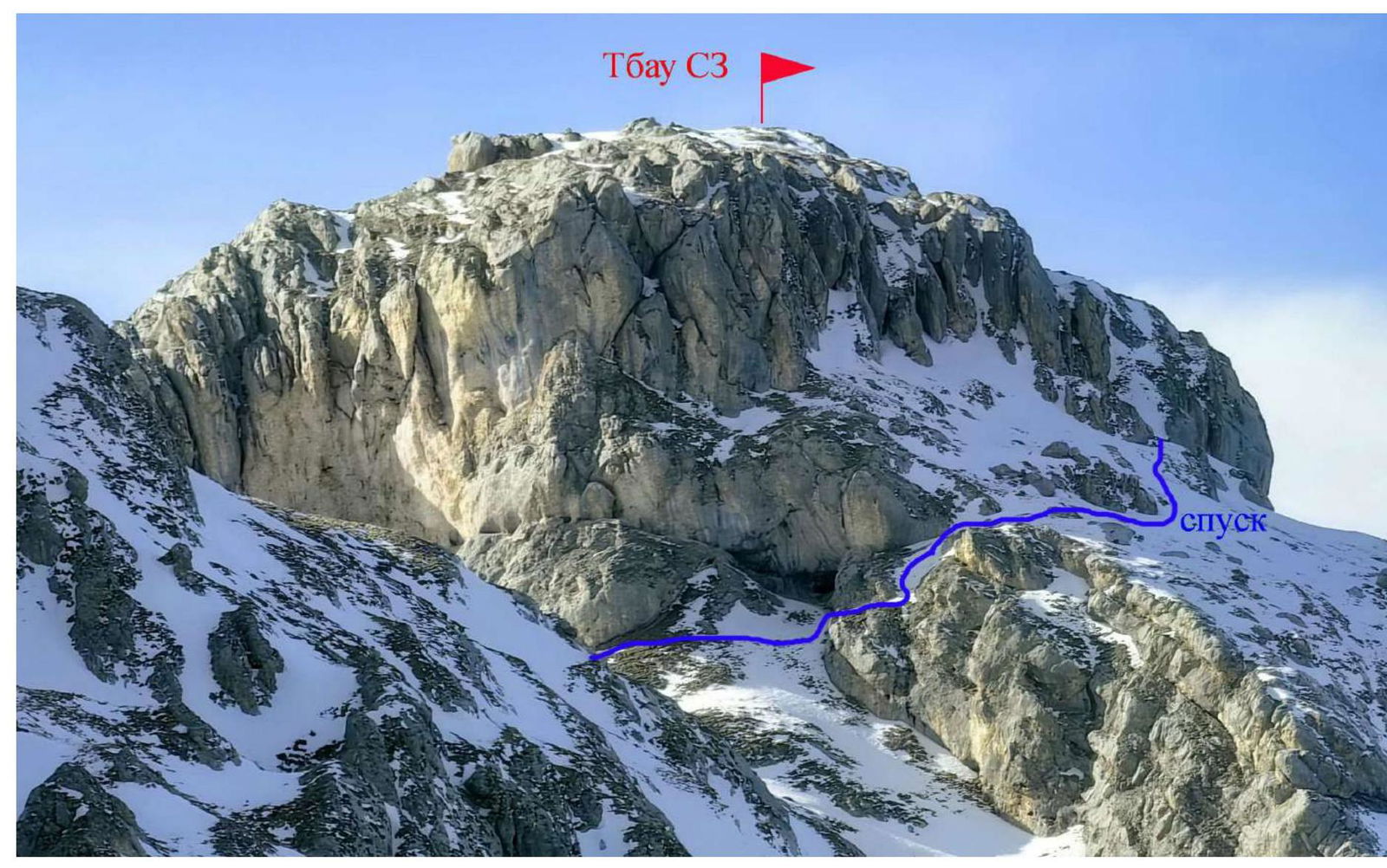
Photo 18. The descent path from Tbau SZ is marked — its visible part. View from the East, from the Tbau Tsentr summit. February.
3.3 Recommendations and Conclusions on the Route.
The descent from Tbau SZ goes along the usual (classical) ascent route to the tower, i.e., along the North-East slope. In the lower part of the slope — a snowy inner corner of 1–2 difficulty level.
The traversed traverse route of the two Tbau summits is logical and safe as a path, mainly along the ridge of the massif. The route corresponds to the 1B difficulty category. It was climbed by the ascent leader back in the last century and is now suitable for photographing key sections.
The route is better classified for winter conditions due to the low heights of the summits.
The technically complex part of the route — rocks of southern exposure, i.e., quickly clears of snow after bad weather.
On the R2–R3 section and when descending from the North-West summit:
- With a large amount of snow, it's necessary to move only with belay.
- Snowboards can form from the North.