Report
ON ASCENT TO PIK Vil'sa VIA NORTH-WEST EDGE, 5A CAT. DIFF.
TEAM OF MGS DSO "ZENIT" LEADER V. Tyninkin
Moscow 1972
Brief Characteristics of the Ascent Area
Tsey region is one of the main alpine centers in the Caucasus. It is distinguished by an exceptional variety and beauty of gorges. The height of the peaks in the region is over 4000 m. The highest point of the region, Mt. Uilpata, has a height of 4648 m. The height of Pik Vil'sa is 4100 m. Most routes are combined, significant glaciation of the region (Tsey and Skavish glaciers) determines the presence of complex snow and ice sections on the routes. The weather is comparatively unstable. This to a certain extent complicates ascents.
Technical Characteristics of the Route
Ascent to Pik Vil'sa via NW edge is very interesting for highly qualified mountaineers. The first ascent via this route was made in 1966 by a group of experienced mountaineers led by A. Fomesna. Since then, this route, along with 5th category routes to the peaks of Chancha and Uipinagu, has been frequently visited by the most prepared mountaineering groups. The ascent route to Pik Vil'sa via NW edge is generally combined. However, the main part of the path is a purely rock route of wall type with great steepness.
The average steepness is ~70°. The route is characterized by a very limited number of holds and belay points. The route passes mainly along the right edge of the rib, and to overcome the last wall, it is necessary to move to the left edge. The route consists of three sections:
- The first wall: average steepness 80°, length 4–5 ropes. The central section of this wall has a steepness of up to 90°, length about 12 ropes.
- The second wall: The structure of the wall is slab-like, average steepness 70°. The wall is characterized by a small number of holds and almost complete absence of protrusions.
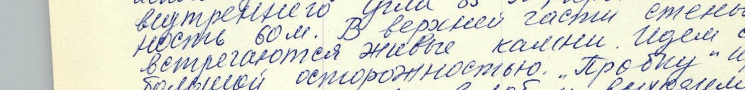
- The third wall: Average steepness 85°. Length 60 m. It represents an internal angle and has a very limited number of holds. The last section of the wall with an overhanging rock is particularly difficult. Climbing is extremely difficult. The third wall can be considered as the key section of the route.
The total length of the route is 800–900 m. The height difference from the beginning of the first wall to the summit is 650–700 m.
Conditions and Tactical Ascent Plan
A characteristic feature of this route is the presence of relatively "long" complex walls.
A characteristic feature of the Tsey region is an almost regular change of weather during the day. Even if good and sunny weather sets in the morning, by 12–14 hours, as a rule, clouds gather, and it starts raining or snowing. In the period preceding the ascent, bad weather persisted in the Tsey region for several days. During these days, snow naturally did not stay on the steep walls, but it thoroughly covered the existing holds and cracks, which are already in short supply. This somewhat reduced the speed of passage on the route. In addition, snow made the walls slippery. This made it impossible to use "galoshes" type boots, although the terrain of the route made their use undesirable. After analyzing the state of the route and consultations, it was decided to allocate two days for the passage of the route proper. The ascent showed that this option was optimal under the given conditions.
Organization of the Ascent
The ascent was made by the team of MTS DSO "Zenit" during the qualification days for instructor-participants of the alp. Torpedo. The team had a set of necessary standard and non-standard equipment made accordingly. Communication with the camp was provided by the "Vitalka" radio station and flares. The group was provided with high-calorie and high-quality food and a "PHOEBUS" type primus stove. The entire route was passed in climbing boots, as the condition of the walls did not allow the use of "vibram" type boots, although the relief of the rocks made their use undesirable. About 60 pitons were hammered on the route.
Group Composition
- Tyninkin V. D. 1st sports category MTS "Zenit" Moscow (leader)
- Akhmatov G. V. CMS MTS "Zenit" Moscow
- Ilyinsky I. S. MS MTS "Zenit" Moscow
- Odintsov L. G. 1st sports category MTS "Zenit" Moscow
Description of the Route Passage
Day 1 (July 11, 1972)
We left a/l "Torpedo" at 11:00. The path initially goes along the trail along the right bank of the river Skaz-don. We move in the direction


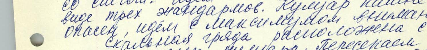
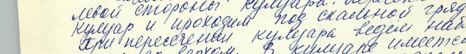


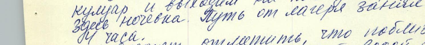
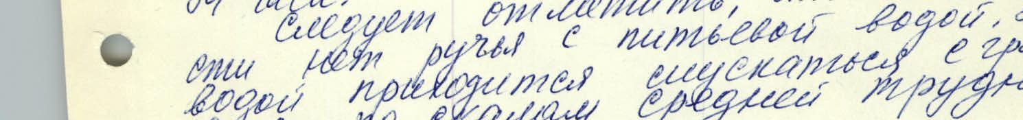
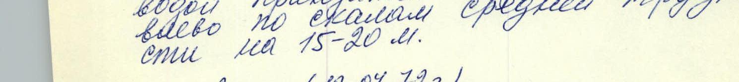


of a well-known landmark - the green hill. We reach the stream flowing from the couloir coming from the slopes of Pik Vil'sa. The upper part of Pik Vil'sa with its characteristic regular trapezoid shape serves as an orientation. Along the left bank (here and further - in the direction of movement) of this stream, we go up to the couloir. Further, the path goes along the right side of the couloir, through the snow. We move towards the rock ridge with three gendarmes. The couloir is stone-dangerous, so we move with maximum caution. The rock ridge is located on the left side of the couloir. We cross the couloir and pass under the rock ridge. When crossing the couloir, we keep an eye on the top. There is a fairly deep snow-filled pit in the couloir. We cross it with alternate belay, then cross the second snow couloir and reach the foot of the ridge. Here we set up a bivouac. The journey from the camp took 14 hours. It should be noted that there is no drinking water stream nearby. To get water, we have to descend into the gully to the left along the rocks of medium difficulty for 15–20 m.
Day 2 (July 12, 1972)
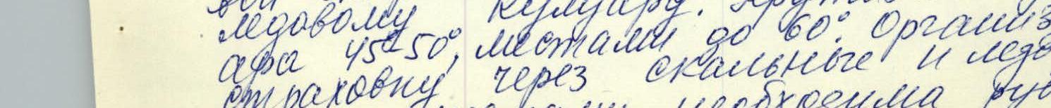
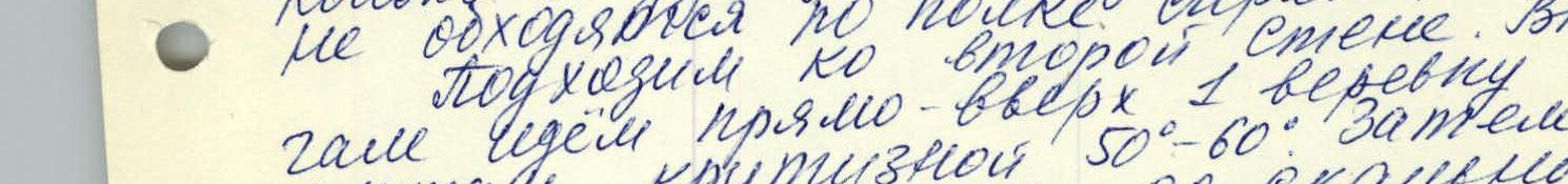
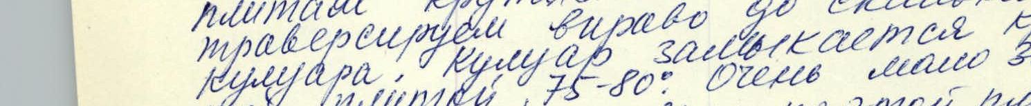
Early rise. We move towards the rock ridge. We bypass the rock ridge from the right side along a narrow snow-ice couloir. The steepness of the couloir is 45°, in some places up to 60°. We organize belay through rock and ice pitons, and in some places, step-cutting is necessary. Along this couloir, we approach the end of the rock ridge. At the end of the rock ridge, there is a 1st category difficulty tur. Then we traverse the snow-ice slope towards the internal angle in the rib of Pik Vil'sa. The steepness of the slope is ~50°, we move with step-cutting, using ice pitons. Along the internal angle with thin ice, we move 2 ropes and reach a rock shelf. The rocks are of medium difficulty. From the shelf, we move right-up along the cracks of the left face of the internal angle. The steepness of the rocks is ~80°. The rocks are difficult, holds are small. Belay is piton. After 25 ropes, we reach relatively easy rocks with a steepness of 70°. Further, with great caution, we move along destroyed rocks to a gendarme in the ridge. We bypass the gendarme from the right and reach a platform. Several next gendarmes on the ridge are bypassed along the left side. Initially, we move straight up 1 rope along slabs with a steepness of 50–60°. Then we traverse to the right to a rock couloir. The couloir ends with a steep slab 75–80°, with very few holds. We move straight up along this slab to a narrow shelf. From here - to the right, into the rock couloir. The couloir ends with somewhat overhanging destroyed rocks of the upper slabs. Steepness 75–80°, length 1 rope. Many loose stones are stuck in nests, live rocks are present.
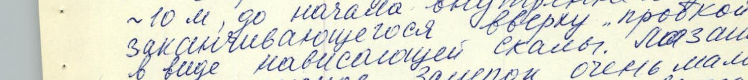
Day 3 (July 13, 1972)
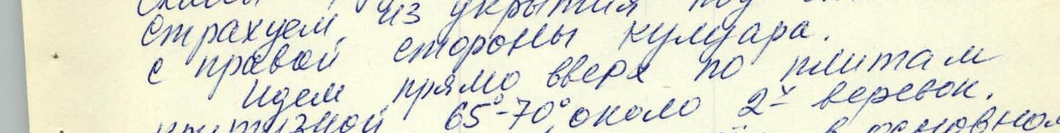
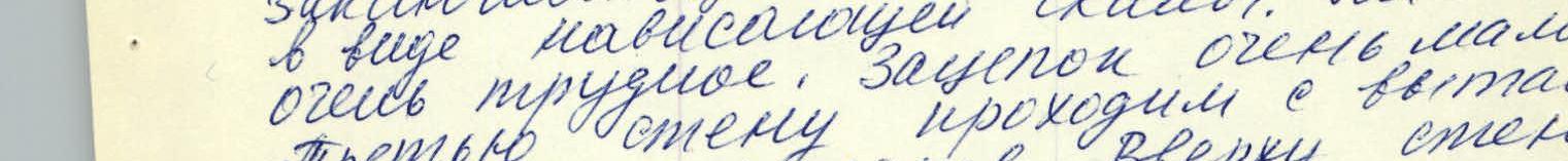
We climb straight up to the end of the couloir and reach the upper slabs. The rocks are difficult. Belay is piton. We belay from a shelter under the wall on the right side of the couloir. Further, we move straight up along the slabs with a steepness of 65–70° for about 2 ropes. There are very few holds, we move mainly on friction. Belay is through petal pitons. We approach the beginning of the third wall with an overhanging rock at the top. Climbing is very difficult. It should be noted that at the base of the third wall, there is a narrow shelf. Here it is possible to organize a sitting bivouac (overnight stay) for the entire group. From the ridge, we move left along the shelf ~10 m, to the beginning of the internal rock ending with a "cork" at the top. Climbing in the form of hanging is very difficult. There are very few holds. We pass the third wall with masking of backpacks. At the top of the wall, there are two hanging ladders. The steepness of the internal angle is 85–90°, length 60 m. In the upper part of the wall, there are live rocks. We move with great caution. The "cork" or "rib" is overcome straight up along an inclined slab. Climbing along the internal part is extremely difficult. It should be noted that the third wall requires extremely attentive and careful passage, as in case of falling live rocks, it is practically impossible to hide from them.
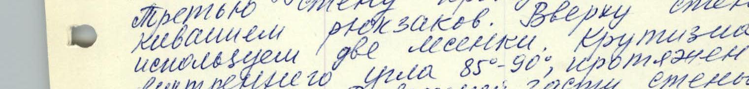
After overcoming the "cork", we move left along a loose couloir with a steepness of 50° for ~20 m. Then ~20 m to the right, along rocks of medium difficulty, we reach a small platform on the ridge. Here is a control tur. We level and somewhat tidy up the platform. Here we set up a bivouac. The size of the platform allows it. The group passed the tur above the third wall in 14 hours, working intensively and cohesively.
From the bivouac, we move along slab-like rocks of medium difficulty, to the right of the rib. We reach the eternal ridge of the massif and move along it. We pass a snow-ice saddle, and along the pre-summit snow slope, we reach the summit. The journey from the bivouac to the summit takes about 2 hours. We descend from the summit via the route of 2A category difficulty and move in the direction of Pass Kayner. The dense fog that has descended greatly complicates orientation and delays the group's progress! From Pass Kayner, we descend a bit, traverse to the right under the rocks of Pik Shamova, and reach Pass Ossetia. From Pass Ossetia, we move down first along a snow slope, then along scree, and reach the trail leading to a/l camp. Having gotten lost in the fog while finding Pass Kayner, we fail to return to a/l before dark. We decide to spend the night.
Day 4 (July 14, 1972)
In the morning, the weather is excellent. We get up, dry our equipment a bit, and by 10 o'clock return to the alpine camp.
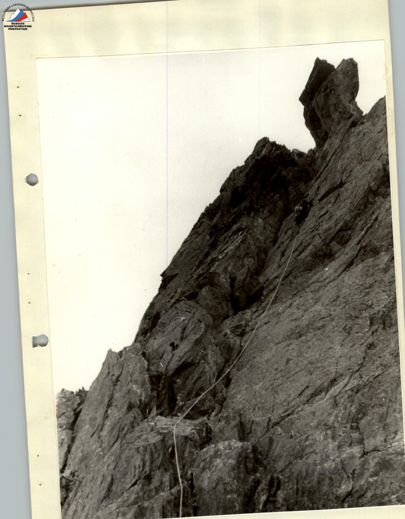
UPPER SECTION OF THE THIRD WALL