Vils
The Vils peak (3861 m) is located in the northeastern part of the Kalper ridge, between Shulgina peak and Passionaria summit. Above the Skazdona valley, Vils rises with steep rocky slopes and walls.
In the Hissar gorge, a simple South ridge descends from the peak, separating the Vils glacier to the east from Passionaria to the west. Under the southwestern slopes of Vils lies a small hanging glacier, Western Passionaria.
The following ridges have no routes to the peak yet:
- North ridge
- Southwest ridge
- Vils via the East ridge, category 2A (A. Dolinsky, M. Batischeva, Yu. Kochetov, L. Kuranova, V. Korzhenyants, V. Naumenko, A. Pestov, E. Sachkov et al., August 22, 1947).
The path from the CSP of the Tsey region (group 4–20 people) to the initial bivouac on the saddle of the Kalper pass is described in route 211.
From the Kalper pass, descend along a snowy scree couloir to the Vils glacier and cross it to the right in the direction of a snowy scree couloir descending from the East ridge of Vils peak. Along the screes of a wide, possibly snowy, couloir, bypassing a large rock on the left, approach the snowy scree couloir to the "Gates" formed by rocky walls protruding into the couloir. From the "Gates," ascend along an icy-snowy slope, then a couloir (possible rockfall) to the East ridge of Vils peak (rockfall and avalanches are possible in the couloirs).
Here, turn right and ascend along the heavily damaged simple, partially snowy rocks of the East ridge or its right side to Vils peak. From the Kalper pass, 4–5 hours.
Descent follows the ascent path.
Naumov A. F. Karaugom, Digoria, Tsey (Central Caucasus), M., "Fizkultura i sport", 1976.
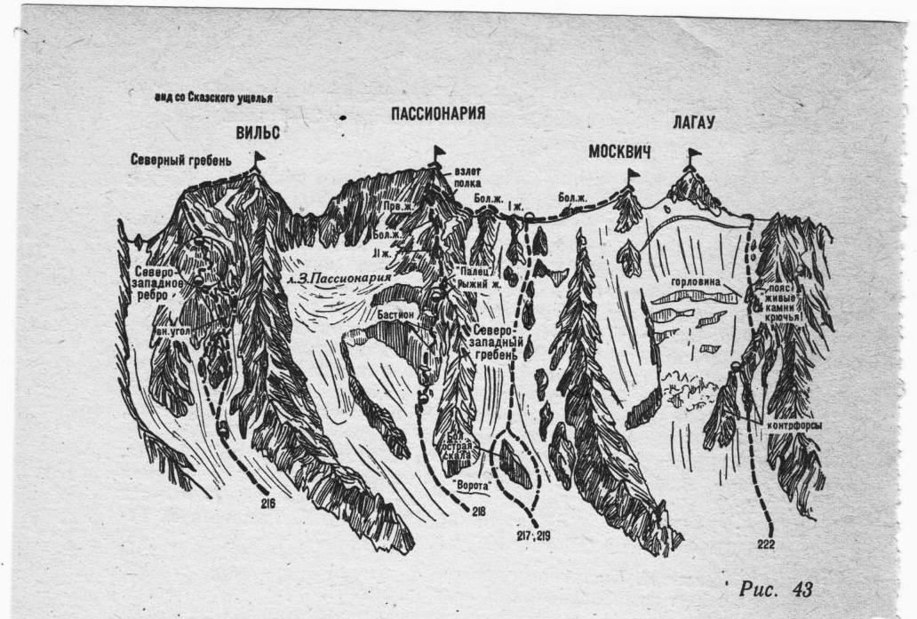
Fig. 43
