South Sugan
South Sugan (3900 m) is a small peak in the ridge connecting the Sugan ridge with the Main ridge, between the peaks of Shtulu to the south and False Sugan to the north.
The slopes of the peak are home to:
- Western glaciers - snowfields that feed the Akhsu river
- Eastern glaciers - snowfields that feed the Orsdon river
Technically simple, heavily destroyed South Sugan is rarely visited by climbers (mainly during traverse with False Sugan).
The only route was climbed on August 4, 1929, by L. Gasparotto, U. Vallepiano, K. Geron, G. Zinger.
- South Sugan via the South ridge (combined route, 1B category of difficulty, Fig. 12).
The path from the "Nakhashbita" clearing (group of 4-20 people) to the tongue of the Doppakh glacier is described in route 46.
From here, ascend the moraine to the tongue of the Doppakh glacier and cross it to the left in the direction of a small snow slope under the saddle of the South ridge of the South Sugan peak. After crossing the glacier, cross a small stream flowing from under the small hanging Soldier glacier, which is located under the saddle of the ridge connecting the peaks of South Sugan to the left and False Sugan to the right. Then traverse left - up the scree slopes of the southeastern slopes of the South Sugan peak, in the direction of a large snowfield under the saddle of the South ridge of the peak. Up the snowfield, straight up, then up the gentle ("live") rocks (insurance) - ascent of 50-60 m to the saddle of the South ridge of the South Sugan peak.
On the saddle, turn right and ascend the simple, gentle, местами strongly destroyed rocks with small simple walls and snow-covered sections of the South ridge to the summit of South Sugan.
From the "Nakhashbita" clearing, 5-6 hours.
Descent via the ascent route.
Duration of the route is 1 day.
Naumov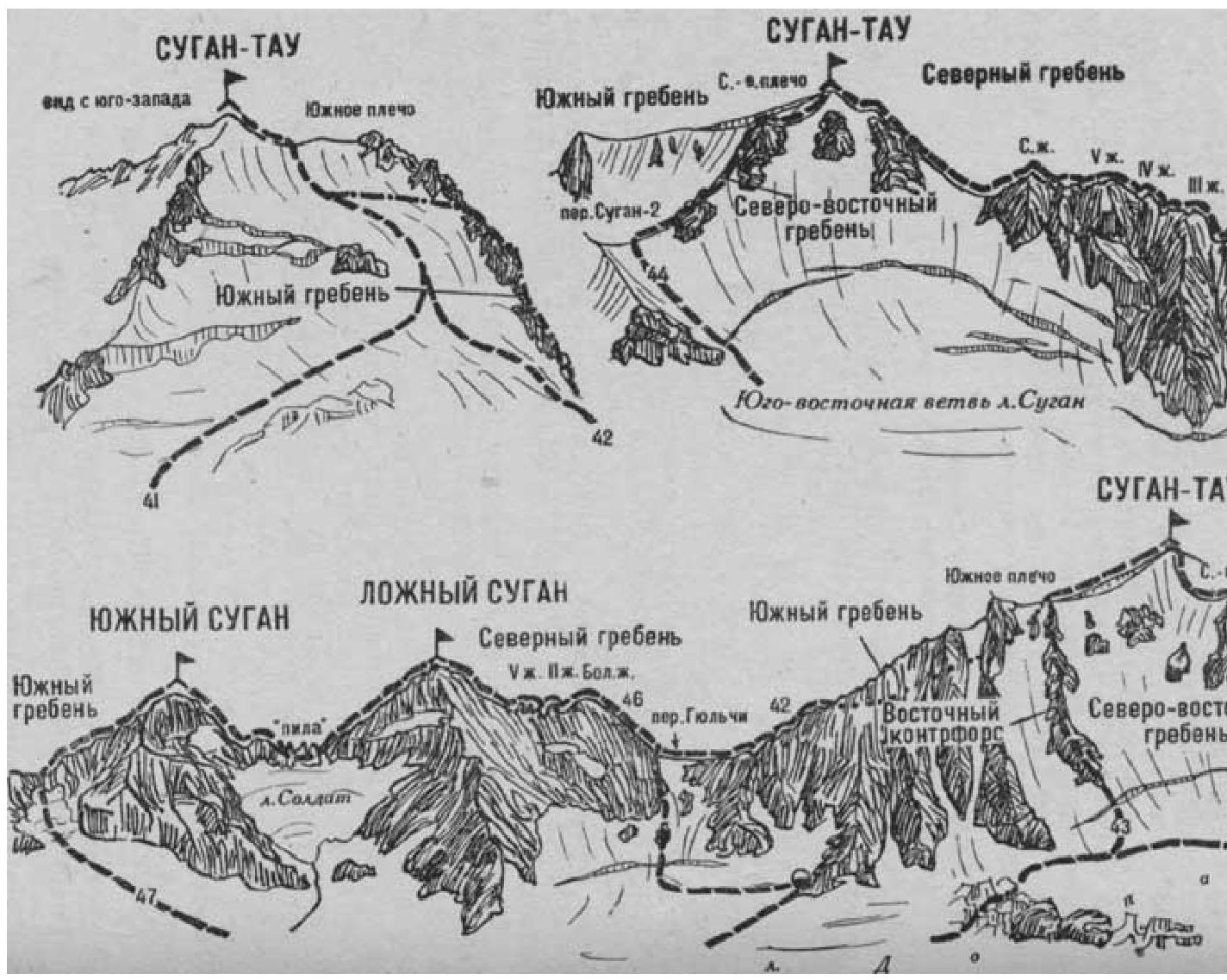 A. F. Kara-ugom, Digoria, Tsey (Central Caucasus), M., "Fizkultura i sport", 1976.