- Climbing class: technical
- Region: Central Caucasus
- Summit: p. Semenovskogo 4050 m, from the northeast
- Difficulty category: 3B
- Route characteristics: ice
elevation gain — 700 m, average route steepness — 45 °
- Pitons driven:
for belay, for creating artificial holds
| rock | ice | |
|---|---|---|
| rock | 0 | 0 |
| ice | 46 | 0 |
| bolt | 0 | 0 |
- Number of climbing hours: 13 h
- Number of overnight stays: none
- Leader: Andrienko V.B., CMS, instructor category I. Participants:
- Amineva N.L., 1st sp. rank
- Goryun A.N., 1st sp. rank
- Gransky S.K., 1st sp. rank
- Kotelnikov A.I., 1st sp. rank
- Selivanov A.F., 1st sp. rank
- Coach: Honored Coach of the RSFSR Zhirnov V.V.
- Date of departure on the route: August 25, 1980
- Date of return: August 25, 1980
Description of the route to peak Semenovskogo, 4050 m via the north wall, 3B cat. diff. (approximate)
Approach
From the Bezengi alpine camp along the trail to the Missekosh hut. Down to the Bezengi glacier. Bypass ice falls from the right and along the glacier to the second stream flowing from the cirque between the peaks Misses-Tau and Dykhtau. Then left towards the western ridge of Dykhtau peak onto the lateral moraine of the Bezengi glacier. Up to the right, bypassing the western ridge from the right, under the grassy and talus rise of the moraine. From the Bezengi alpine camp 2.5–3 h.
Left of the stream flowing from the I–III cirque of Dykhtau peak, ascent onto the moraine. Then along the moraine ridge, initially grassy and then talus, exit into the I–III cirque of Dykhtau peak under the northern slope of peak Semenovskogo. Overnight stay on the talus under the ice slopes of peak Semenovskogo. From the Bezengi glacier 1.5–2 h.
Section R0–R1
Exit onto the snow-ice slope (30–35 °) and along it to the bergschrund, width of which is 2–3 m, length — 100 m. Simultaneous movement.
Section R1–R2
Bergschrund is overcome via a snow-ice bridge with alternate belay through an ice axe. Then up 100 m. Steepness of the section is 45 °. Belay is via pitons.
Section R2–R3
Upwards goes a characteristic steep, rounded ice slope. Along its right part up 40 m. On front points. Steepness 45–50 °. Belay is via pitons.
Section R3–R4
Then up along a large rock outcrop 80 m. On front points with the help of an ice hammer and ice axe. Steepness of the section is 50–55 °. Belay is via pitons.
Section R4–R5
Up along the line of falling water, leaving rocks to the right and below 120 m. Steepness 50 °. Belay is via pitons.
Section R5–R6
Upwards in the direction of rocks onto the northeast ridge of peak Semenovskogo 100 m. Exit onto the ridge to the right of rocks. Steepness of the section is 45 °. Belay is via pitons.
Section R6–R7
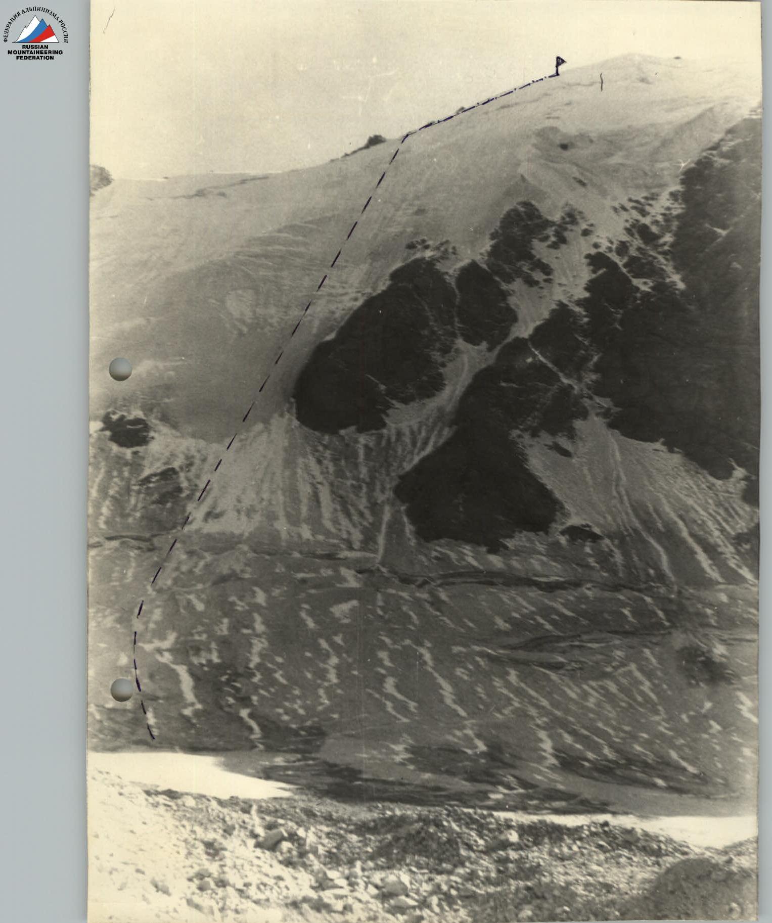
Then along the snow-ice ridge, bypassing rock outcrops to the right, to the summit, 150–200 m. Steepness 35 °. From the start of the route 7.5–8 h.
Descent
Descent via the 1B cat. diff. route to the eastern branch of the Bezengi glacier. Along the ridge of the left-bank moraine to the lake. Descent onto the Bezengi glacier. Then along the median moraine to the turn towards the I–III cirque of Dykhtau peak, 2.5–3 h.
Table of main characteristics of the ascent route to peak Semenovskogo from the northeast, 3B cat. diff.

| Sections traversed | Average steepness | Length of section | Characteristics of passage conditions by relief character | Method of overcoming | Pitons driven (ice) |
|---|---|---|---|---|---|
| R0–R1 | 30–35° | 100 | ice, snow | simultaneously | - |
| R1–R2 | 45° | 100 | ice, snow | alternately, pitons | 6 |
| R2–R3 | 45–50° | 40 | ice | alternately, pitons | 4 |
| R3–R4 | 50–55° | 80 | ice | alternately, pitons | 9 |
| R4–R5 | 50° | 120 | ice | alternately, pitons | 15 |
| R5–R6 | 45–50° | 100 | ice, snow | alternately, pitons | 12 |
| R6–R7 | 30–35° | 150–200 | ice, snow, rocks | simultaneously, ledges | - |