
Ascent Passport
- Ascent class — technical.
- Ascent area — Central Caucasus, Bezengi gorge.
- Semenovsky Peak (4050 m) from the west via hanging glacier.
- Route type — combined, sections determining the complexity category — ice.
- Proposed complexity category — 2B category.
- Route characteristics. Elevation gain — 1170 m, length 2325 m, length of sections 3–4 category — 875 m, average steepness of main difficulty sections 33° (2880–3680).
- Pitons hammered: rock — 1, ice — 16.
- Number of climbing hours — 10.
- There were no overnight stays on the route.
- Team composition: Makarov V.K. CMS — leader. Kolchin A.A. MSICM Kuchumova R.E. 2nd sports category Rapoport I.B. 2nd sports category Trofimov A.G. 2nd sports category Zaryansky G.K. 2nd sports category Konkin Yu.V. 2nd sports category
- Team coach — Honored Coach of the RSFSR Kudinov I.B.
- Ascent date — July 1, 1986.
- Organization — Bezengi Alpine Training and Sports Base.
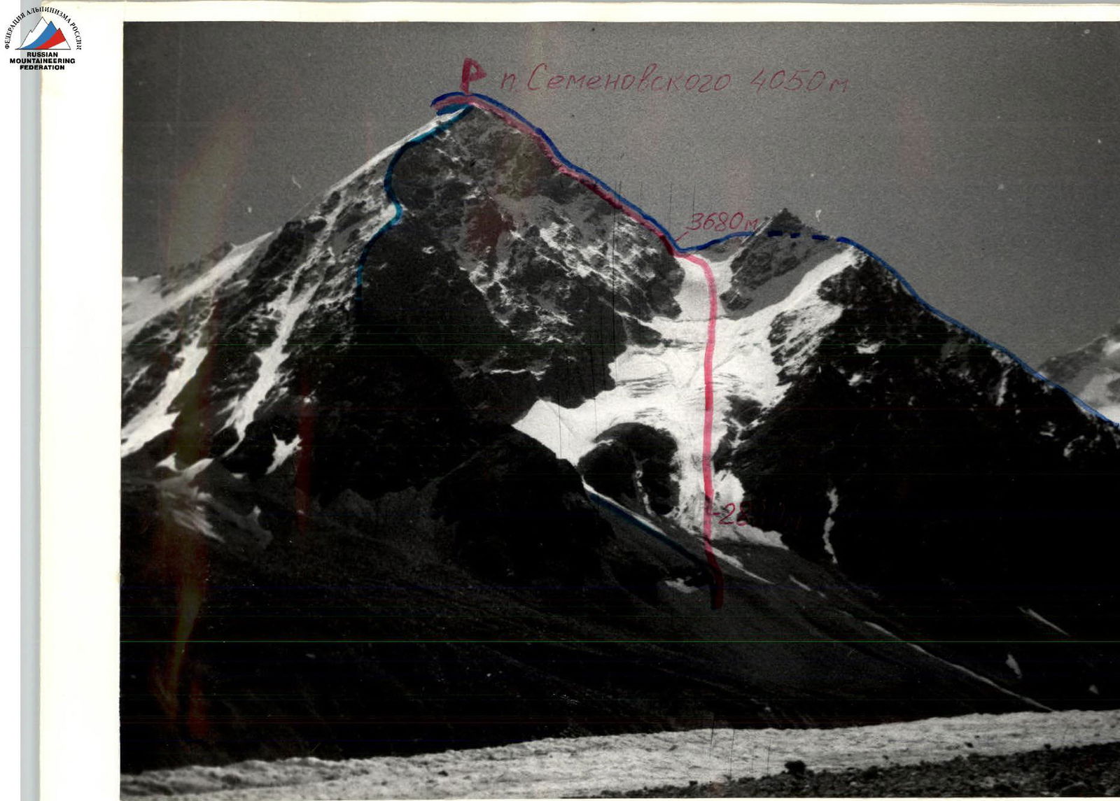
Photo 1. General photo of the summit, August 28, 1986 12:00. Lens "Helios-29", F=30 mm. Distance — 1500 m. Shooting point — 1. Shooting point height — 2600 m. Routes taken on July 1, 1986:
- Route via 3rd grade 1B category s/v
- Route via NW buttress, 3A category.
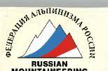
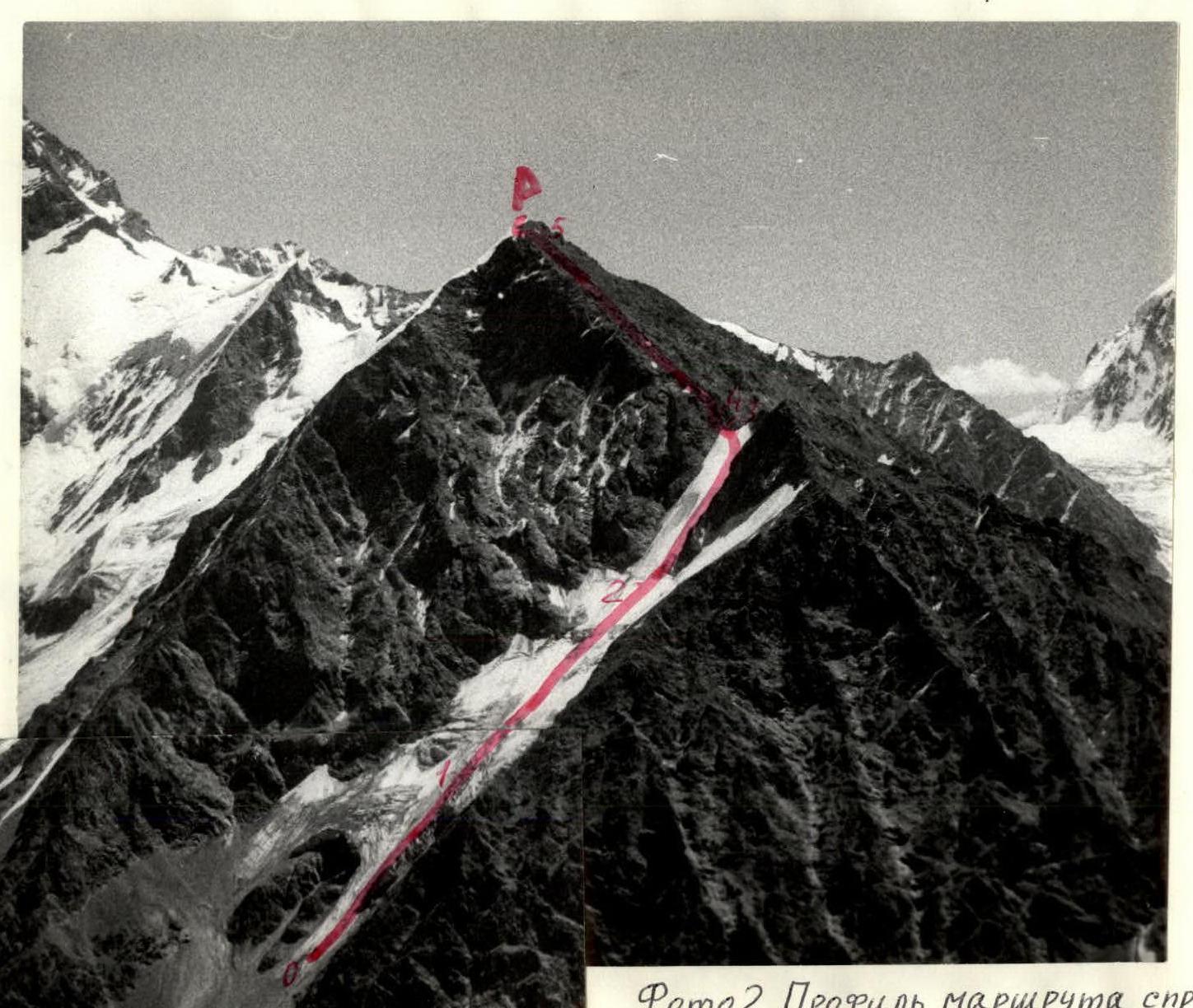
Photo 2. Route profile from the right. August 3, 1985 12:00. Lens "I-61". F=52.4 mm. Distance — 2500 m. Shooting point — 2. Shooting point height — 3000 m.
Photo 3. Route profile from the left (section R0–R1). July 2, 1986. Lens "Helios-89". F=30 mm. Distance — 400 m. Shooting point — 3. Shooting point height — 2800 m.
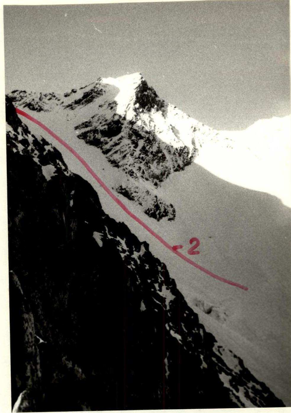
Photo 4. Route profile from the left (section R2–R3). July 2, 1986 08:00. Lens "Helios-89". F=30 mm. Distance — 500 m. Shooting point — 4. Shooting point height — 3300 m.
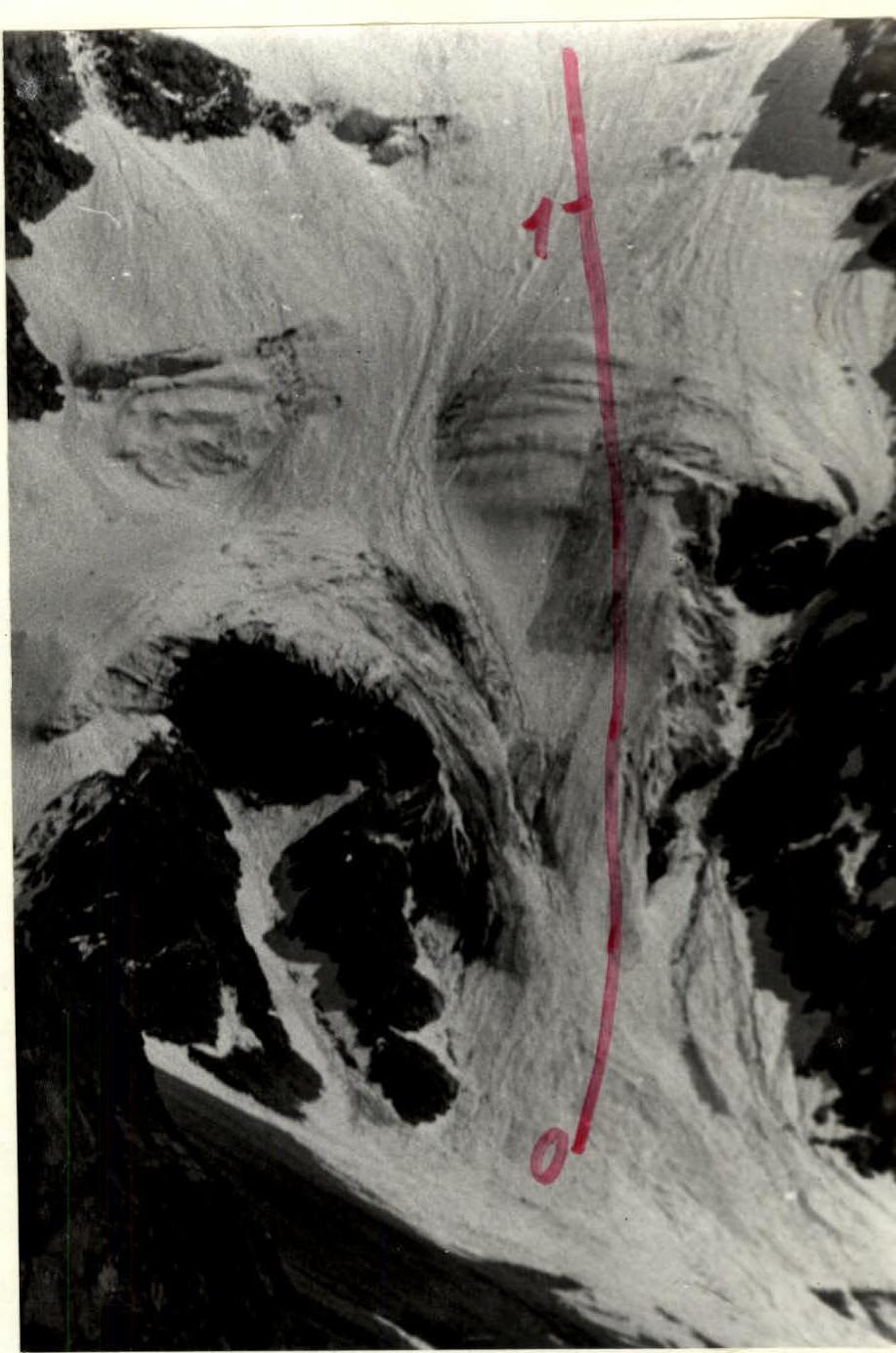
Photo 6. Condition of section R0–R1 at the beginning of the season. June 24, 1986 13:00. Lens "Yupiter-37A". F=135 mm. Distance — 1500 m. Shooting point — 1. Shooting point height — 2600 m.
| Section | Pitons (rock) | Pitons (ice) | Category | Length, m | Steepness, ° |
|---|---|---|---|---|---|
| R5 | 1 | 200 | 10 | ||
| R4 | 1 | 570 | 35 | ||
| R3 | 1 | 3 | 25 | 40 | |
| R2 | 8 | 4 | 400 | 45 | |
| R1 | 1 | 680 | 25 | ||
| R0 | 8 | 3 | 450 | 30 |
Description of the route to Semenovsky Peak from the west via hanging glacier
Approach: from overnight stays under the West ridge of Dykh-Tau, one needs to ascend to a convenient crossing over the canyon, where the main stream from the West circus of Dykh-Tau flows, and then, traversing the slope, approach the tongue of the glacier.
There is a convenient ascent directly from the Bezengi glacier to the start of the route, starting approximately 100 m to the right of the canyon.
The route begins directly along the tongue of the glacier. The right-hand canyon is exposed to rocks falling from the right buttress. Approaching the main walls of Semenovsky Peak from the left is even more dangerous — rockfalls from them start very early.
Along the tongue of the glacier (section R0–R1, 30°, 450 m, 3rd category). Then the slope becomes gentler (section R1–R2, 25°, 680 m, 1st category). In the middle of this section — the most gentle place on the glacier (height 3340 m). Then a steep ice section starts again (section R2–R3, 45°, 400 m, 4th category). For the first ascenders (June 1), this section had deep, loose, fluffy snow on smooth, dense ice. For insurance, it was necessary to dig deep pits. Solovyov B.'s group, which repeated the ascent the next day and used the ready-made steps and pits, rated this section 2B–3A category.
In case of open ice, this section should be passed to the left, along an implicit ice buttress, to avoid possible rockfalls from the right ridge.
After the saddle, the route follows the West ridge, coinciding with the route of 1B category. However, the first rope of the rocky ridge (section R3–R4, 40°, 25 m, 3rd category) is quite difficult — the rocks are covered with ice.
Further, along a simple rocky ridge (section R4–R5, 35°, 570 m, 1st category), leading to a wide snowy ridge (section R5–R6, 10°, 200 m, 1st category). The snowy ridge leads to the summit.
Descent from the summit is possible both along the West and South ridges.