St. Petersburg Alpine Championship
High-Altitude Technical Class
Report
on the ascent of Kara-Kaya peak (3646 m)
Route via the Central counterfort of the southwest wall, 6A category of difficulty, (E. Poltavets, 2010)
St. Petersburg 2017
Ascent Passport
- Central Caucasus, Bezengi gorge, section No. 2.5 of the route classifier for mountain peaks, item 2.5.226 (Minutes of the Classification Commission meeting No. 6 dated December 28, 2010)
- Name of the peak: Kara-Kaya (3646 m), route name: via the central counterfort of the southwest wall (E. Poltavets, 2010)
- Category of difficulty: 6A
- Route type: rock
- Route elevation gain: 700 m (by altimeter) Route length: 1151 m. Length of sections: V category of difficulty – 245 m, VI category of difficulty – 491 m Average steepness: first bastion: 76°, second bastion: 81°, third bastion: 87°, entire route: 68°.
- Pitons used (denominator for artificial climbing aids): rock pitons: 127/71 protection elements: 144/57 bolts: 10, including 1 for artificial climbing aids (all left by the first ascenders) Total artificial climbing aids (artificial climbing aids) used – 128. Pitons left on the route: 0
- Climbing hours for a pair: 40 hours, 4 days
| Role | Name | Rank |
|---|---|---|
| 1. leader | Lonchinsky A.S. | Master of Sports |
| 2. participant | Krotov A.A. | 1st sports rank |
- Coach: Shamalo V.P., Master of Sports of International Class, 1st category instructor
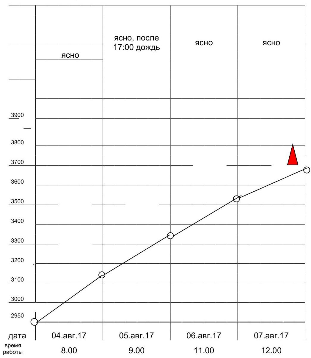
- Route start: 12:00 on August 4, 2017 Reached the summit: 19:00 on August 7, 2017 Returned to Base Camp: 11:00 on August 8, 2017
- Report responsible: Krotov A.A. (tylov1@mail.ru)
General photo of the summit
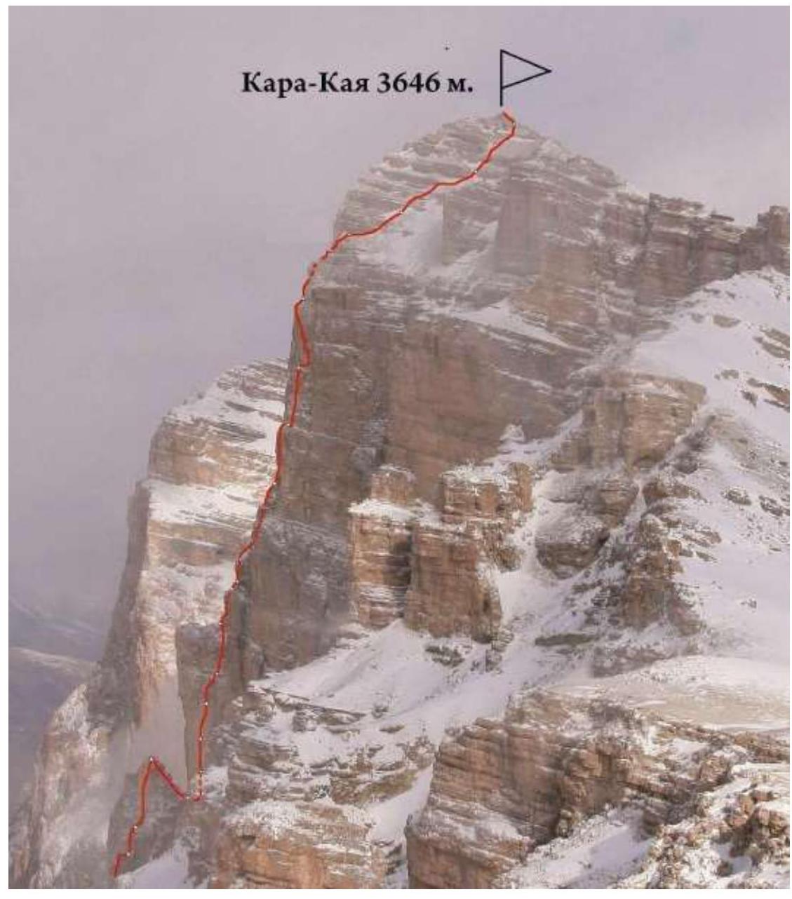
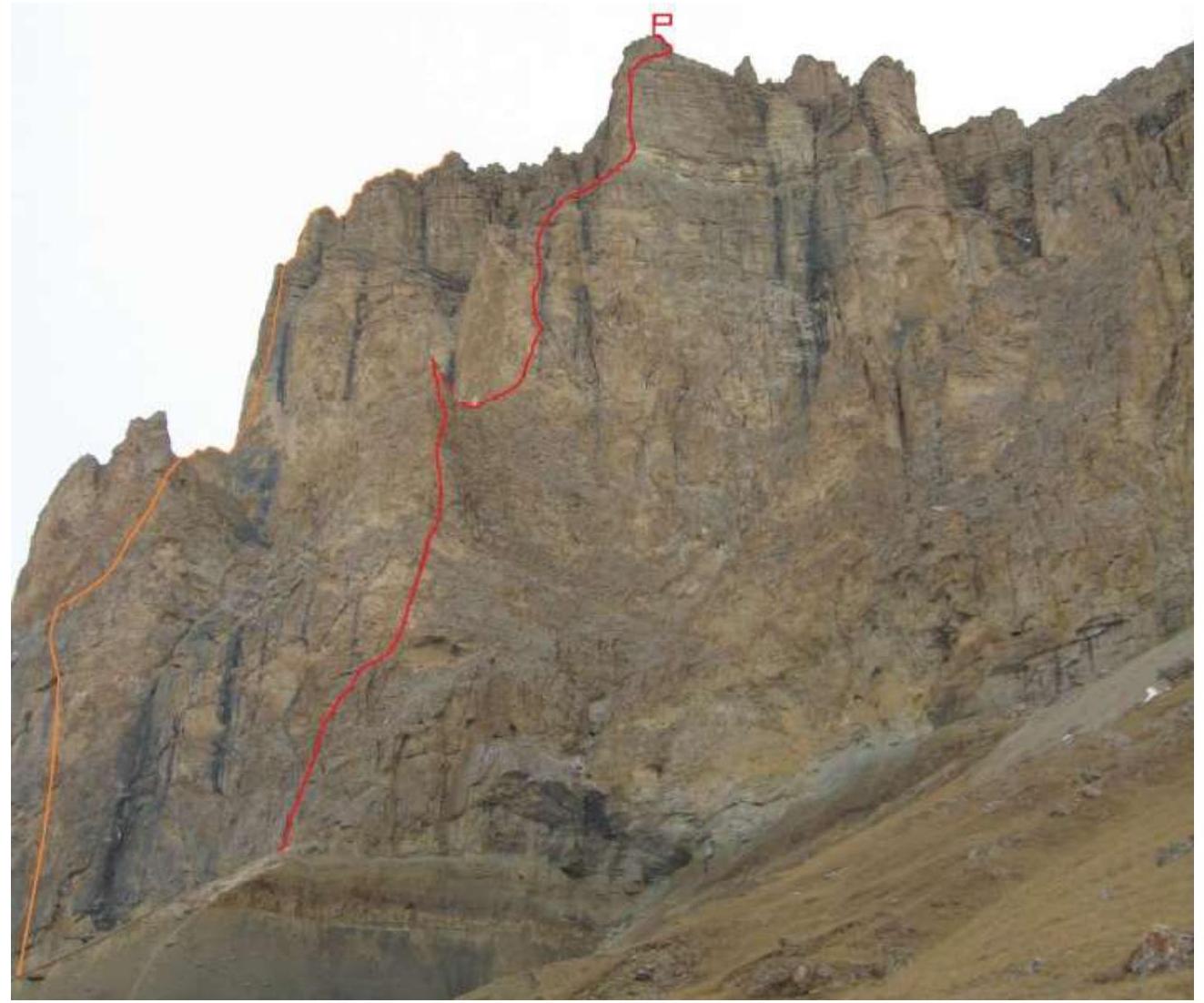 Kara-Kaya from the south
Taken from the slopes of Dumala pass at an altitude of about 2600, February 2011. The yellow line indicates the route in the center of the southwest bastion («Страна туманов»), E. Poltavets, 2009, 5B (6A for a group)
The red line indicates the route via the central counterfort of the southwest wall, 6A (E. Poltavets, 2010), followed by the team
Kara-Kaya from the south
Taken from the slopes of Dumala pass at an altitude of about 2600, February 2011. The yellow line indicates the route in the center of the southwest bastion («Страна туманов»), E. Poltavets, 2009, 5B (6A for a group)
The red line indicates the route via the central counterfort of the southwest wall, 6A (E. Poltavets, 2010), followed by the team
Photo of the route profile from the left
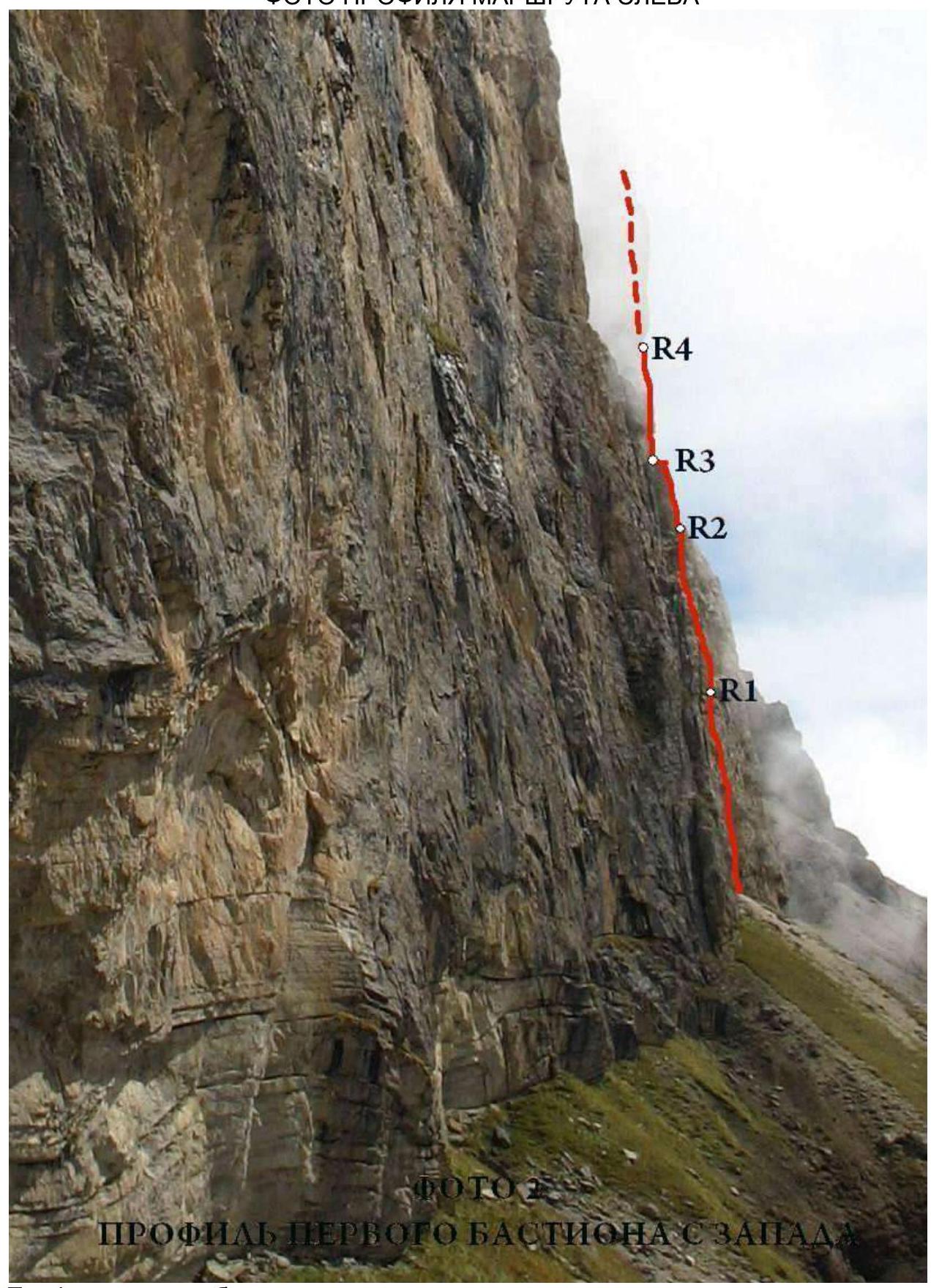 Profile of the first bastion from the west. Taken in summer 2010 by E. Poltavets
Photo of the route profile from the right
 Kara-Kaya 3646 m.
Route profile from the east from the slopes of Ak-Kaya peak.
The upper part of the first bastion, second and third bastions are visible.
February 2010 (photo by A. Lavrenenko)
Kara-Kaya 3646 m.
Route profile from the east from the slopes of Ak-Kaya peak.
The upper part of the first bastion, second and third bastions are visible.
February 2010 (photo by A. Lavrenenko)
Hand-drawn profile of the route
Hand-drawn profile of the route Kara-Kaya 3646 m. Route profile Scale 1:2500 R28, R29 R27 R26 R25 R24 R23 R22 87° 3480 m. R21 R20 R19 R18 R17 R16 R15 R14 R13 R12 81° 3250 m. R10 R9 R8 R7 R6 R5 R4 R3 R2 R1 76° 68° 2950–2960 m. R0
UIAA route diagram
| Section No. | Pitons | Protection elements | Bolts for belay/artificial climbing aids | Kara-Kaya 3646 m via Central counterfort of SW wall, 6A (E. Poltavets, 2010) | Length, m. | Steepness, ° | Difficulty |
|---|---|---|---|---|---|---|---|
| R28–R29 | - | 3 | - | 130 | 50 | II | |
| R27–R28 | 1 | 6/2 | - | 8 | 90 | VI A1 | |
| 15 | 50 | II | |||||
| 20 | 50 | III | |||||
| R26–R27 | 1/1 | 3/2 | - | 8 | 90 | VI A1 | |
| 15 | 50 | II | |||||
| R25–R26 | 7/6 | 12/10 | - | 40 | 90 | VI A2 | |
| 10 | 45 | II | |||||
| R24–R25 | 5/3 | 7/3 | 1/0 | 35 | 90 | VI A1 | |
| R23–R24 | 9/7 | 10/10 | 1/0 | 20 | 85 | VI A1 | |
| 25 | 95 | VI A2 | |||||
| R22–R23 | 1 | 5 | - | 25 | 90 | III | |
| R21–R22 | - | 3 | - | 30 | 50 | I | |
| R20–R21 | 6/4 | 5/3 | - | 15 | 95 | VI A1 | |
| 35 | 50 | II | |||||
| R19–R20 | 4/2 | 5/2 | - | 10 | 90 | VI A1 | |
| 10 | 60 | III | |||||
| R18–R19 | 4/2 | 9/3 | - | 25 | 85 | VI A1 | |
| 15 | 60 | IV | |||||
| R17–R18 | 4/3 | 8/6 | 1/0 | 20 | 90 | VI A2 | |
| 10 | 80 | V+ | |||||
| R16–R17 | 13/12 | 3/2 | 1/1 | 30 | 95 | VI A3+ | |
| R15–R16 | 10/10 | 6/5 | 1/1 | 15 | 100 | VI A3+ | |
| 15 | 80 | VI | |||||
| R14–R15 | 8/8 | 5/4 | 1/0 | 35 | 85 | VI+ A2 | |
| R13–R14 | 7 | 5 | 1/0 | 25 | 90 | VI | |
| 20 | 60 | V | |||||
| R12–R13 | 3 | 4 | - | 15 | 60 | IV | |
| 20 | 30 | II | |||||
| R11–R12 | - | - | 1/0 | 35 | 60 | III | |
| R10–R11 | 4 | 4 | 1/0 | 35 | 80 | V+ | |
| R9–R10 | 7/5 | 8/5 | - | 10 | 70 | IV | |
| 40 | 90 | VI A2 | |||||
| R8–R9 | 6 | 5 | - | 40 | 75 | V+ | |
| R7–R8 | 5 | 5 | 1/0 | 30 | 80 | VI | |
| R6–R7 | 4 | 6 | - | 25 | 75 | V | |
| 15 | 65 | III | |||||
| R5–R6 | 6/5 | 9/4 | - | 40 | 90 | VI A2 | |
| 10 | 80 | V | |||||
| R4–R5 | 4/3 | 6/1 | 1/0 | 30 | 85 | VI A1 | |
| R3–R4 | 4/2 | 5/1 | - | 25 | 85 | VI A1 | |
| R2–R3 | 3 | 4 | 1/0 | 30 | 75 | V | |
| R1–R2 | 3 | 6 | - | 15 | 80 | V | |
| 15 | 60 | III | |||||
| 15 | 90 | V | |||||
| R0–R1 | 4/3 | 9 | - | 45 | 80 | V+ A1 |
Description of the route passage
First day
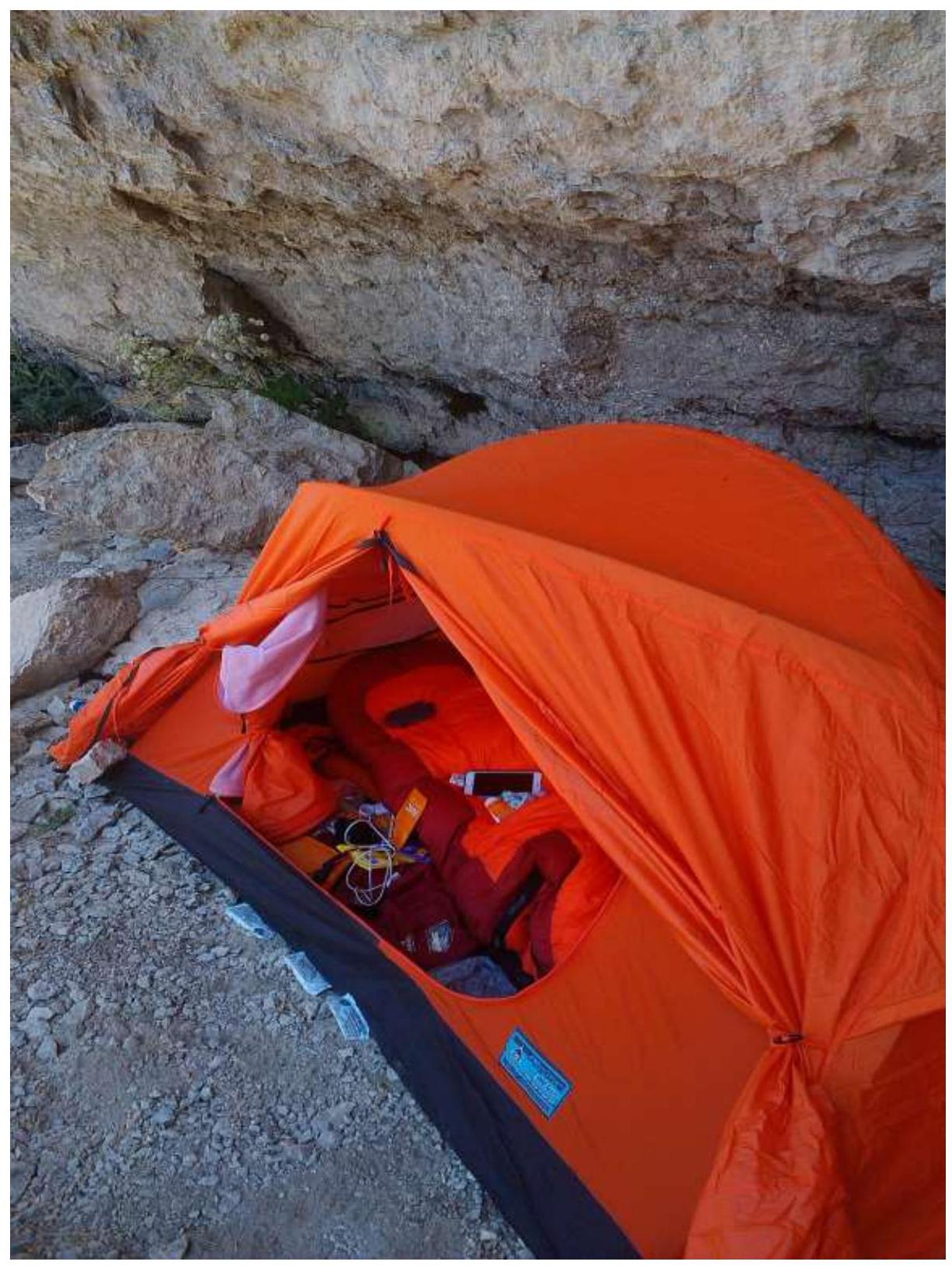
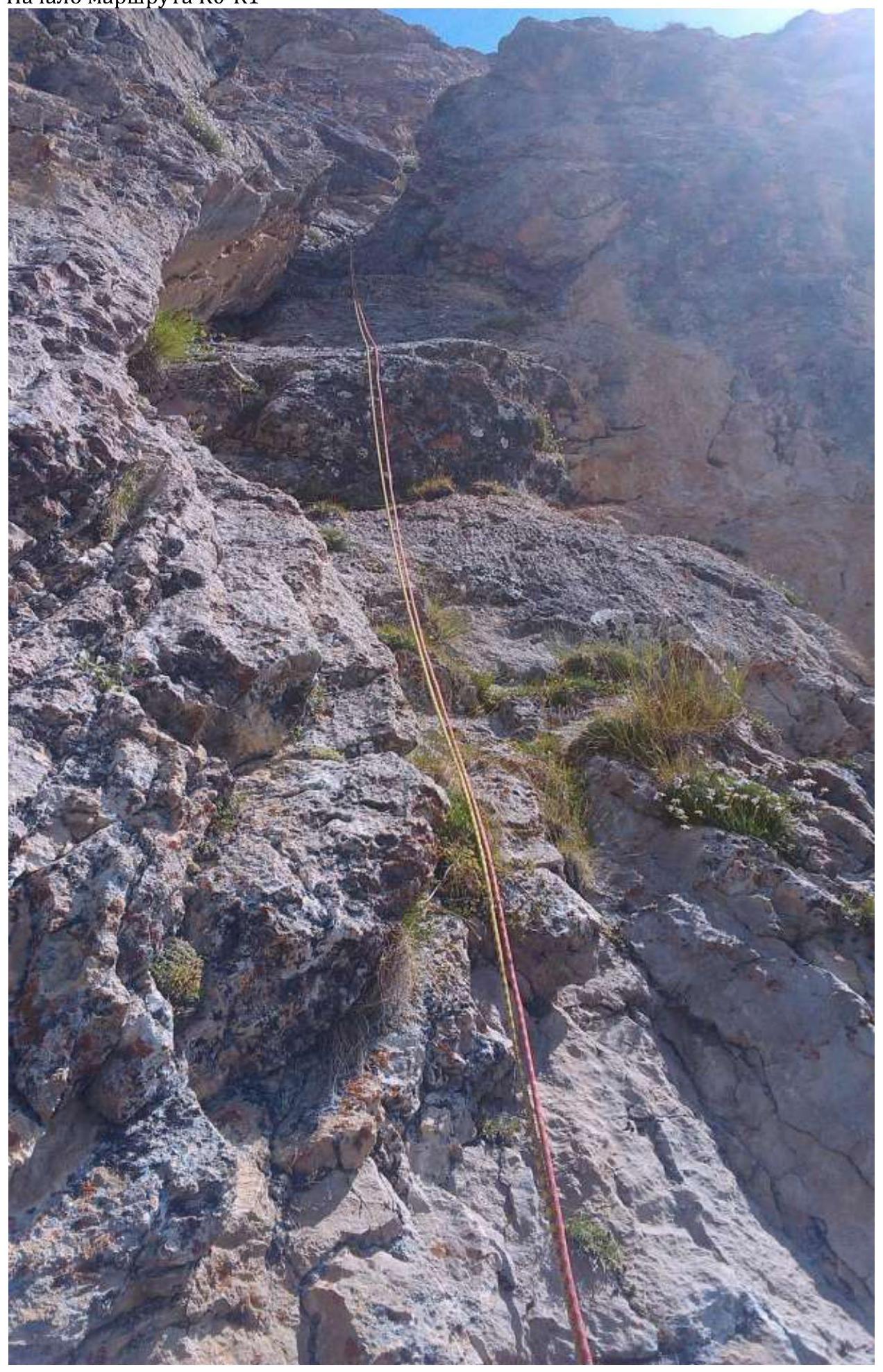
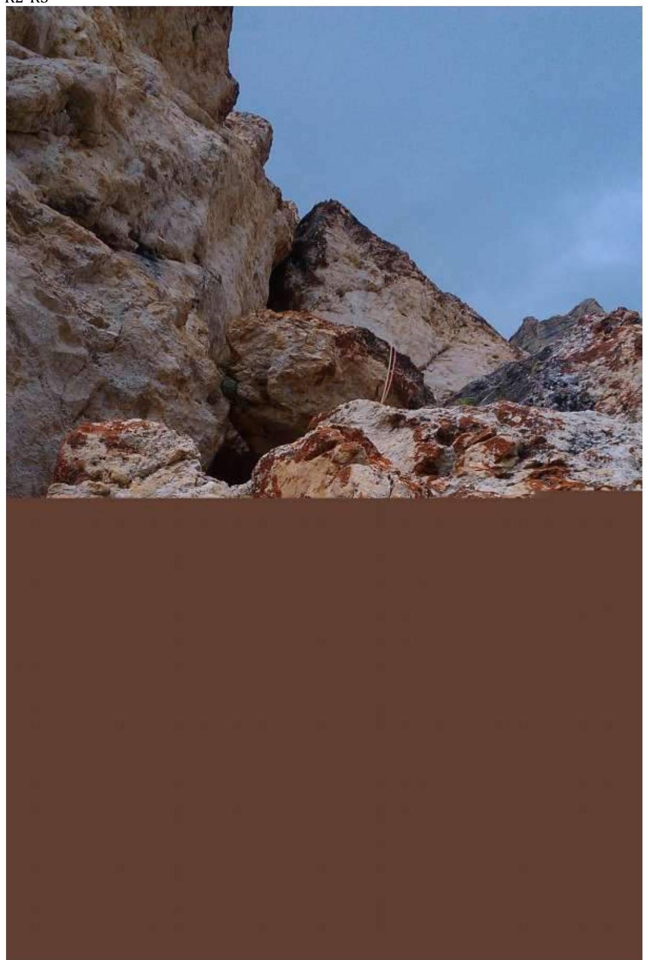
R0–R1. At 6:00 we started climbing from the pass to the observation camp under the cornices, where we set up an observer's camp. Then, having collected 17 liters of water from a stream below, we started moving along the route at 12:00. The beginning of the route is a characteristic internal corner ten meters to the left of the edge of the scree couloir. Up the internal corner. 45 m V+ A1. R1–R2. Up the crack to the right for 15 meters, then 15 meters along simple rocks to a vertical wall. Up the wall to a ledge under a cornice. 15 m V; 15 m III; 15 m V. R2–R3. Up the corner to a large ledge. Station under a cornice. Bolt. 30 m V. R3–R4. Up a destroyed, partially overhanging crack to the right. "Live rocks!" 25 m VI A1. R4–R5. Up a destroyed, partially overhanging crack to the right. Enter a chimney. At the base of the chimney is a bolt. 30 m VI A1. R5–R6. We bypass the plug, exit the chimney. Along a steep overhanging wall to the right-up to a ledge. 10 m V, 40 m VI+ A2. We pass the next rope and descend to a ledge below. Overnight stay on a ledge to the right of the main direction, under an overhang in a safe place. Preparing the site for a one-person tent took 1.5 hours.
Second day
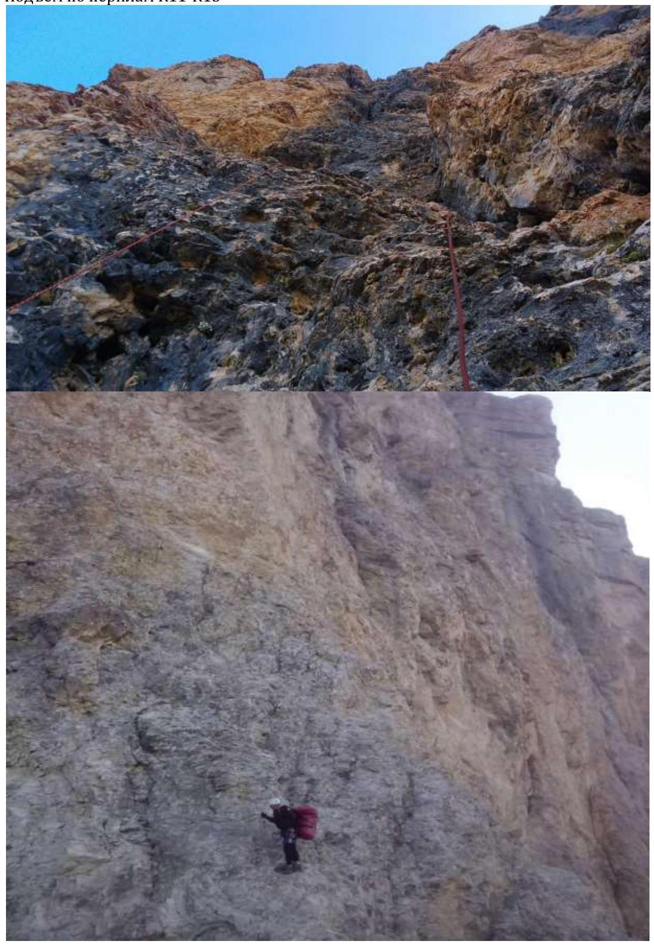
R6–R7. Along the ledge, we traverse to the left to the "Finger" outcrop. Up the left edge of the outcrop along the wall. 15 m III, 25 m V. R7–R8. Up the wall for 30 m. Station on an oblique ledge with a bolt. 30 m VI. R8–R9. Up to a comfortable ledge. 40 m V+. R9–R10. To the right to a bolt, then along a steep, destroyed wall to the right-up to an internal corner. Up the corner to a ledge. 20 m VI, 30 m V. R10–R11. Exit to the ridge. Along the ridge, we approach under the second bastion, "Iron". 20 m III, 15 m I. R11–R12. Along the slabs, we approach under the overhanging wall, then a difficult traverse along an oblique ledge to the right to a bolt (behind the bend, not immediately visible). 20 m V; 25 m VI. R12–R13. Traverse to the right to an overhanging crack, up it, then along the wall to the right-up to a bolt (loose rock, points may be unreliable!!!). 35 m VI+ A2–A3. Descent to a comfortable overnight stay on the top of the first bastion.
Third day
R13–R14. Traverse to the right-up to an overhanging internal corner. Up the corner (there is a bolt), overcome the cornice, then difficult climbing up to a ledge with a bolt. 15 m VI A3+; 15 m VI. R14–R15. Up the corner for 10 m, then along a slab to an overhanging corner (there is a bolt). Up the corner for 15 m. Station is inconvenient. 30 m VI A3+. R15–R16. Up, under a cornice. Overcome the cornice and exit to a ledge with a bolt. 20 m VI A2; 10 m V+. R16–R17. To the right to an internal corner, up the corner with difficult climbing to a ledge. Along the ledge, we move to the left to the counterfort. 25 m VI A1; 15 m IV. R17–R18. Overcome a wall and along gentle rocks to the left to a ledge. 10 m VI A1; 10 m III. R18–R19. Through an overhanging internal corner, we pass a wall, exit to gentle, destroyed rocks. Further to a comfortable ledge in the middle part of the scree coming from the base of the third bastion. On the ledge - a comfortable overnight stay. 15 m VI A1; 35 m II.
Fourth day
R19–R20. From the overnight stay spot up under the base of the third bastion. 30 m I. R20–R21. Along a narrow ledge, we traverse to the right to an overhanging internal corner. Station is inconvenient. 25 m III. R21–R22. Up through an internal corner, we approach under a cornice, overcome it, and then move to the right-up to the right of the counterfort to a ledge with a bolt. 20 m VI A1; 25 m VI A2. R22–R23. Up the wall to an outcrop. In the lower part of the outcrop, we traverse to the right to a break. Bolt. 35 m VI A1. R23–R24. 5 m to the right to a corner. Up the corner under a cornice. Overcome the cornice and move up, bearing to the left under a large cornice (live blocks, very hazardous!). We pass this cornice in the left part. Further up 8 m through a vertical wall to a scree ledge. 40 m VI A2; 10 m II. R24–R25. Overcome a short difficult wall and along the scree, we approach under the next ascent of the counterfort. 8 m VI A1; 15 m II. R25–R26. To the right around the corner. Along the ledge, we approach to an internal corner. Up the corner, then along strongly destroyed rocks to a monolithic wall. 15 m II, 8 m VI A1; 20 m III. R26–R29. We move up along simple, strongly destroyed rocks. Sometimes there are short, steep walls. We exit to the summit ridge. 130 m II. Along the ridge, we climb to the summit of Kara-Kaya 3646 m. At 19:00 we reach the top. Overnight stay next to the summit on a slightly sloping but flat ledge.
Descent from the summit to the west along the north side of the slope
100 meters west of the saddle (further along the route) between Kara-Kaya Main and Kara-Kaya West (there is a cairn), a careful descent of 50 meters along a steep slope to a large stone with many loops. From it - a series of rappels into a couloir leading to gentle scree slopes at the base of the wall.
Ascent schedule
 3900
3800
3700
3600
3500
3400
3300
3200
3100
3000
2950
clear, after
17:00 rain
clear
Clear
Clear
date
August 4, 2017
August 5, 2017
time
work
8:00
9:00
August 6, 2017
11:00
August 7, 2017
12:00
3900
3800
3700
3600
3500
3400
3300
3200
3100
3000
2950
clear, after
17:00 rain
clear
Clear
Clear
date
August 4, 2017
August 5, 2017
time
work
8:00
9:00
August 6, 2017
11:00
August 7, 2017
12:00
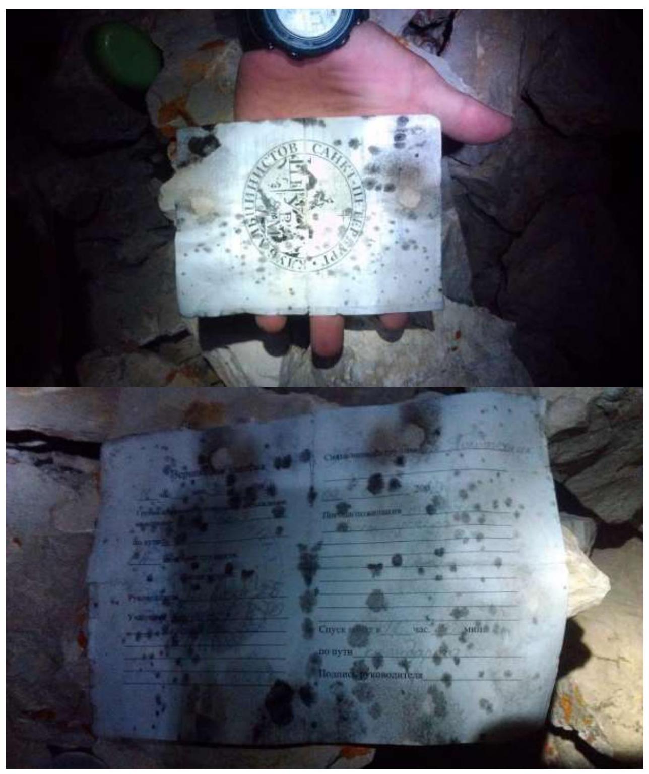
Note from the summit
There are no control tours on the route. A cairn is equipped on the summit.
Report photo illustration
Overnight stay under our observer Putinseva Kristina's route, with whom we had radio contact 3 times a day, and the final information at the end of the day was transmitted to AUSB «Bezengi» via a cellular operator.
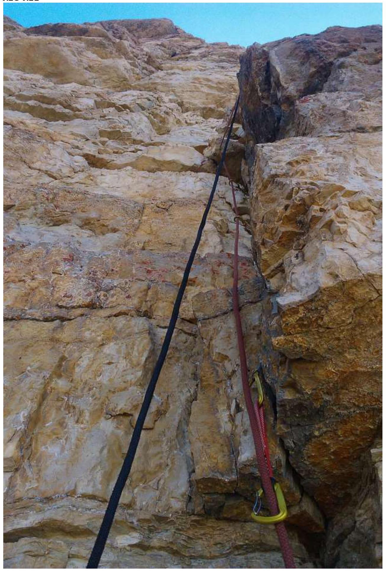
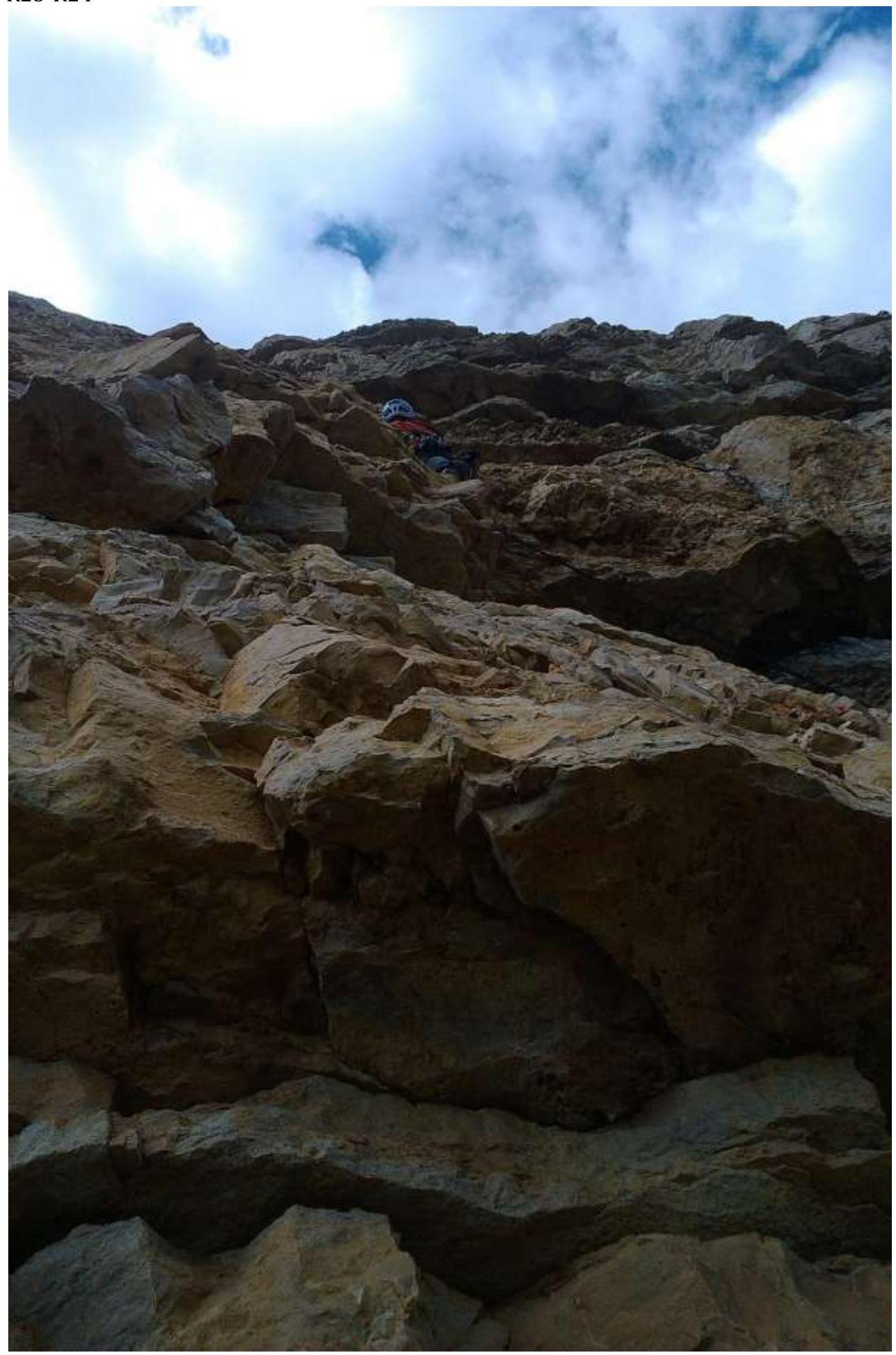
Start of the route R0–R1
 R1–R2
R1–R2
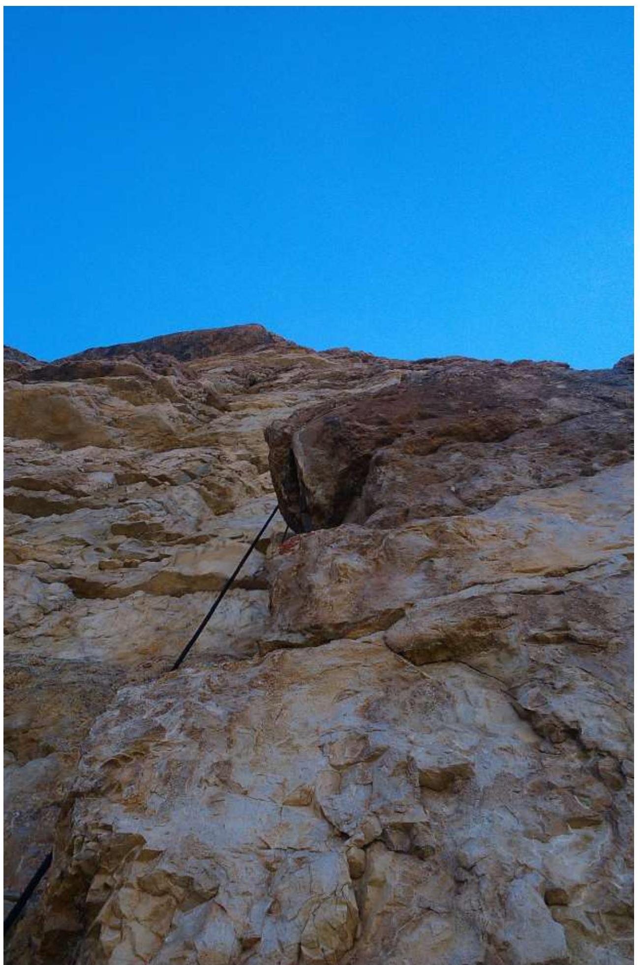
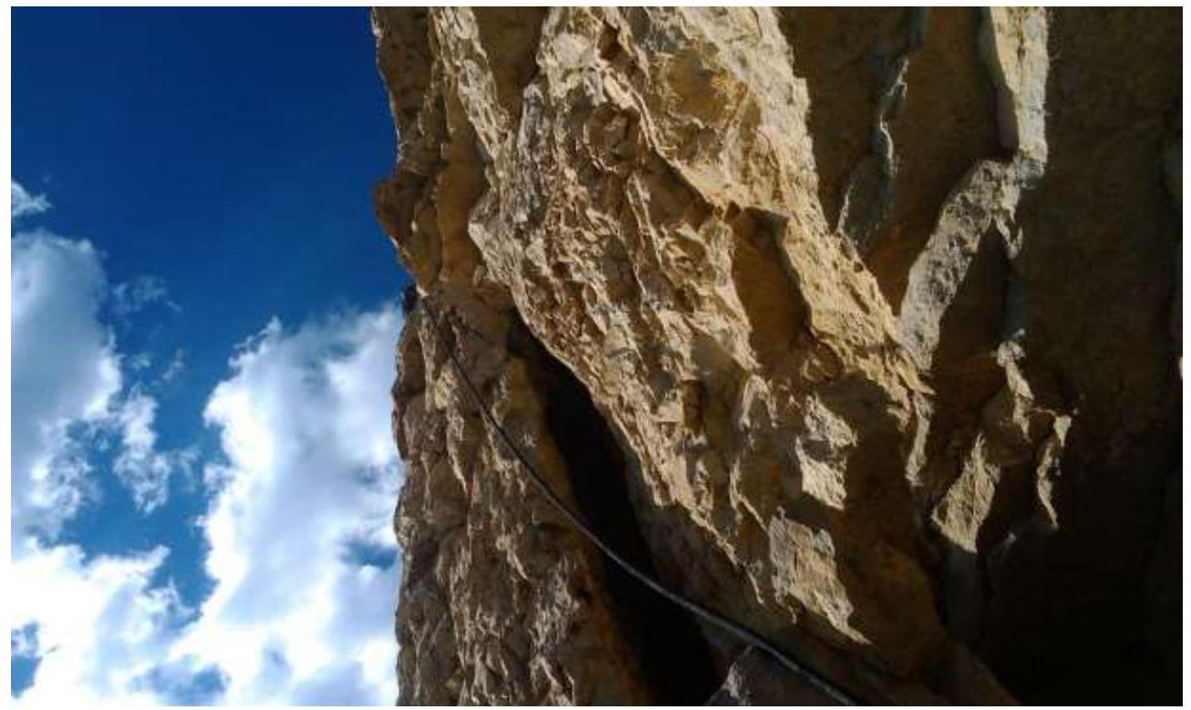
 R2–R3
R2–R3
 R5–R6
R5–R6
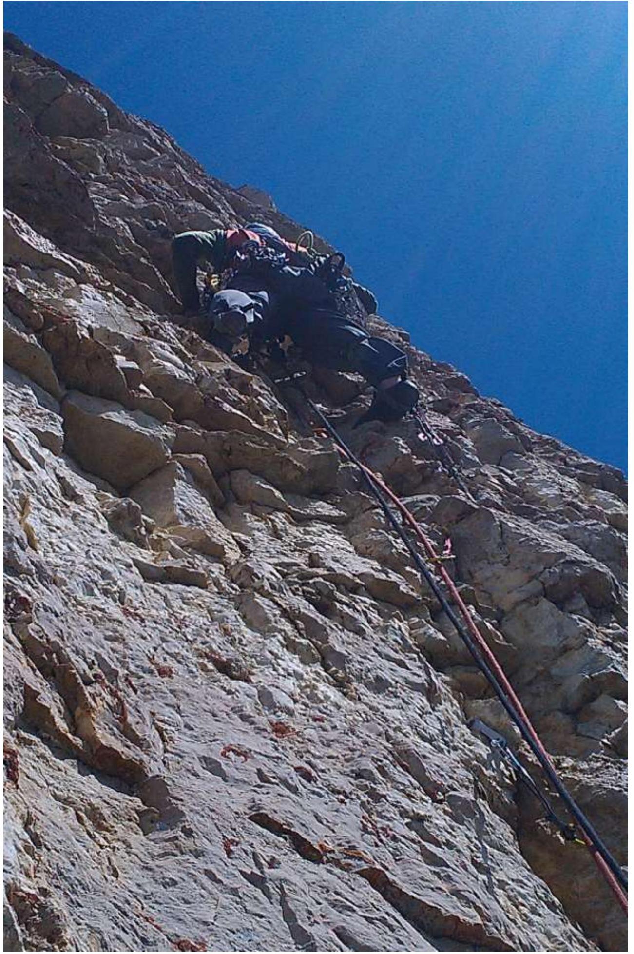
 Climbing on the rope R11–R13
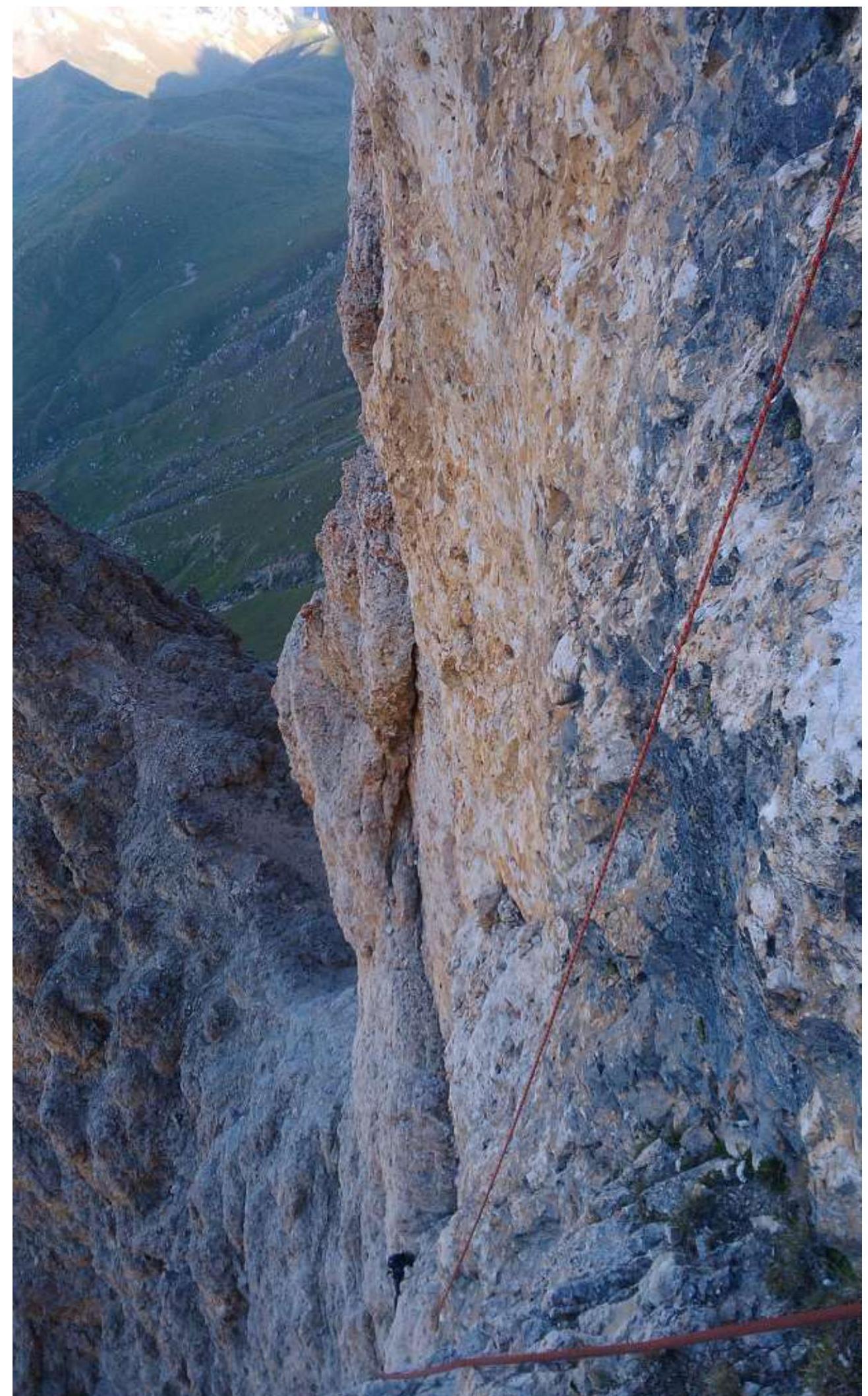 R13–R14
 R14–R15
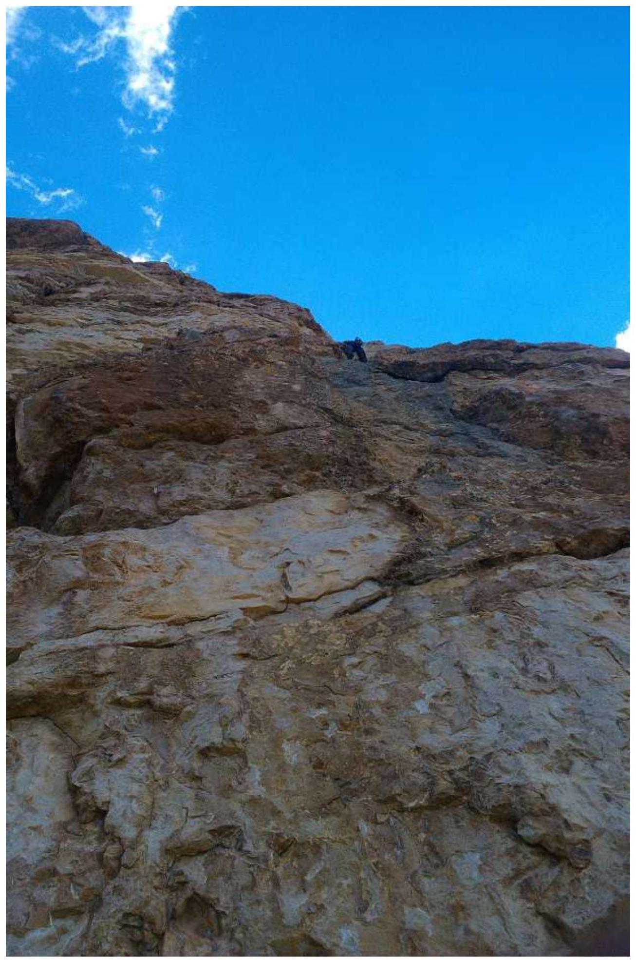
 R21–R22
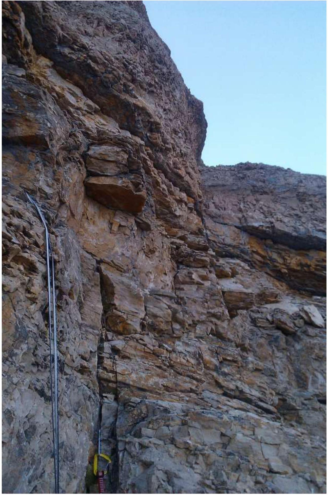
R22–R23
 R23–R24
R26–R27
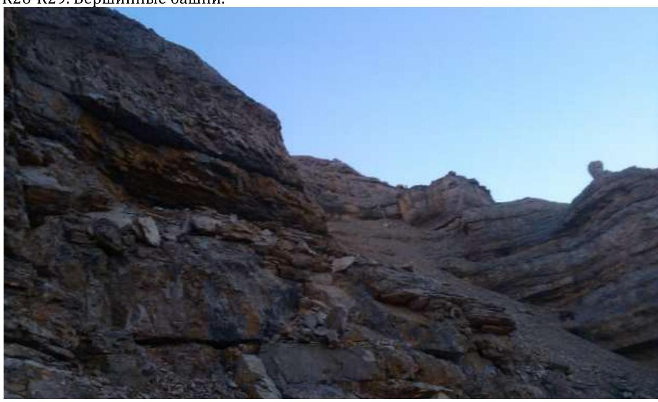
 R26–R29. Summit towers.
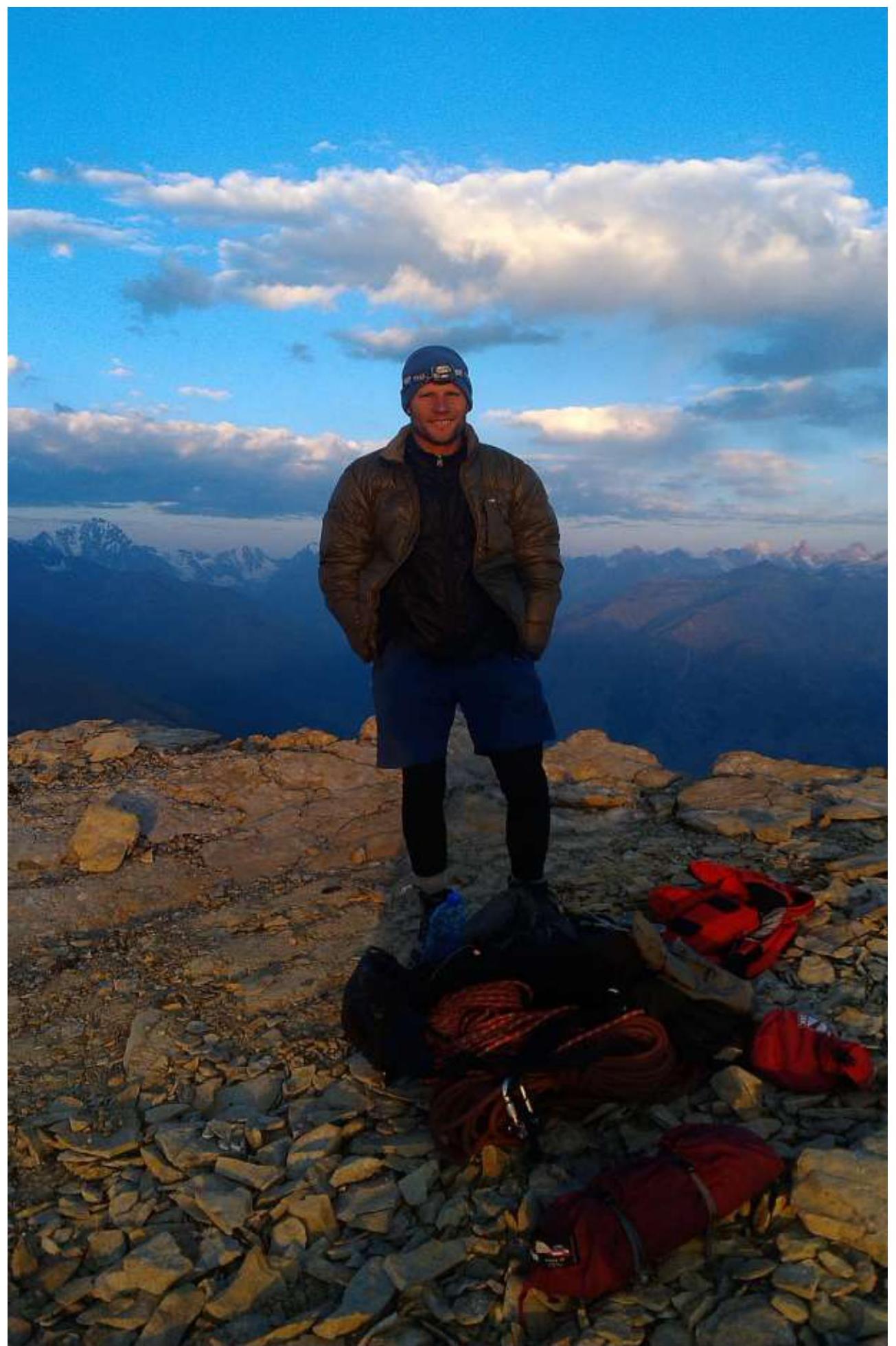
Summit
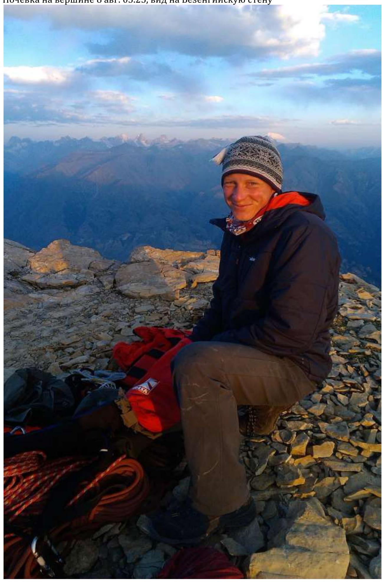
 Overnight stay on the summit on August 8, 2017 at 5:25, view of the Bezengi wall