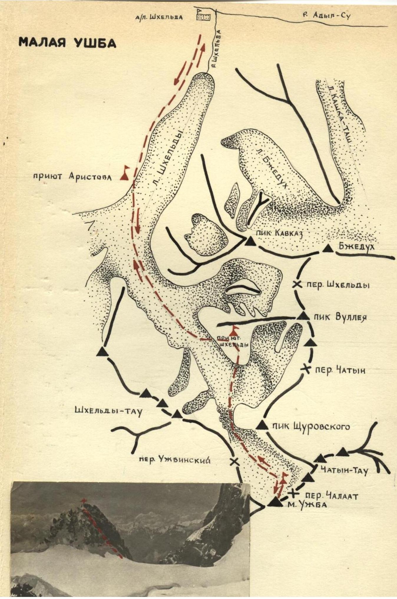
The summit of MALAА ЈŽBA is located in the main Caucasian ridge on the Јžbinskoye plateau. To the northeast of M. Јžba is the summit of Chatyn-Tau, to the southwest — Severnyaya and Yuzhnaya Јžba, to the north — Shchurovsky peak.
The summit of M. Јžba rises above the Јžbinskoye plateau by 150 meters. The only ridge descending from the summit goes in the direction of the Chalaat pass; in the three other directions, the slopes of the summit break off with steep walls.
The first Soviet ascent was made in 1936 by a group consisting of Sidorenko and Slobodskaya via the right couloir.
The ascent to the summit is made from the Јžbinskoye plateau. The ascent from the plateau to the summit and descent back to the plateau takes 3–4.5 hours.
The ascent from the plateau passes through a couloir facing Severnyaya Јžba:
- The beginning of the ascent passes 50–60 meters through a snowy couloir.
- Higher, the ascent path goes through the couloir along rocks of medium difficulty.
You need to be very cautious as the rocks are heavily deteriorated and bulging. The rocky couloir leads to a rocky ridge, along which the path goes all the way to the summit. The descent is made via the ascent route. The ascent and descent should be made with belay.
The path from the Spartak camp to the Јžbinskoye plateau — see the description of the
ascent to
Shchurovsky peak.
Malaya Ushba