Ascent Passport
- Ascent class — technical.
- Ascent area — Central Caucasus.
- Peak — Bashkara (4241 m) via the N wall of the 3rd shoulder.
- Difficulty category — 6A.
- Route characteristics:
- total length — 935 m.
- wall section length — 400 m.
- height difference — 741 m.
- average steepness 53°.
- average steepness of the wall section 63°.
- length of sections with V difficulty category — 230 m.
- length of sections with VI difficulty category — 75 m.
- Pitons driven:
- rock — 54/8
- chocks — 42/4
- friends — 9/0
- ice — 61/0
- bolt — 0/1
- Number of climbing hours — 43 hours; days — 4 (including descent)
- Overnights: 3; 1st in a cave under the wall, 2nd on an open ledge, 3rd on the pre-summit ridge.
- Surnames, I. O. of the leader, participants, and their qualification:
| captain: | Volodin V.G. | MS |
|---|---|---|
| participants: | Savelyev D.S. | 1st sports category |
| Kochetkov G.S. | 1st sports category | |
| Nilov S.A. | 1st sports category |
- Team coaches: Volodin V.G.
Baykovsky Yu.V.

- Dates of departure to the route and return to the base camp:
- departure to the route on February 4, 2005.
- reaching the summit on February 7, 2005 at 10:30.
- return to the base camp on February 7, 2005.
- Organizing body — CSKA named after A.S. Demchenko and RGUFK.
General photograph of the summit
Bashkara 4241 m
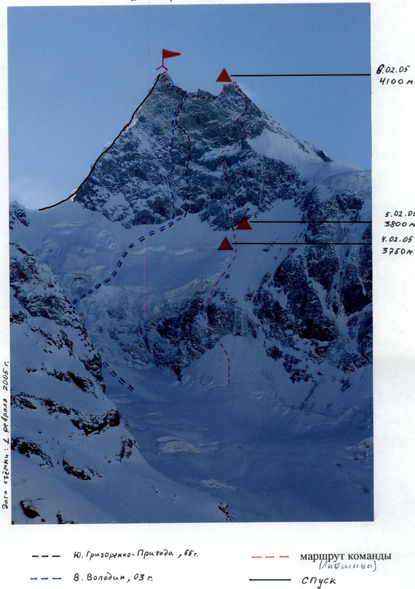 Photopanorama of the area
 Route scheme in UIAA symbols
| № | Rock | Bolt | Ice | Chock | Friend | UIAA scheme | L, m | Steepness, ° | Difficulty category |
|---|---|---|---|---|---|---|---|---|---|
| R11 | - | - | 4 | - | - | ∼3950 m. February 4, 2005 | 50 | 45 | 3 |
| R10 | - | - | 2 | - | - | +1+ | 50 | 45 | 3 |
| R3 | - | - | 2 | - | - | +1 | 50 | 45 | 3 |
| R8 | - | - | 2 | - | - | +1+ | 50 | 45 | 3 |
| R7 | - | - | 2 | - | - | +1+ | 50 | 50 | 3 |
| R5 | 2 | - | 1 | 1 | - | λᵣ₊₁ ∣ 1 | 45 | 65 | 5 |
| R5 | 1 | - | 2 | - | - | ++1 | 50 | 60 | 4 |
| R9 | 1 | - | 4 | - | - | +1 | 50 | 60 | 4 |
| R5 | - | - | 3 | - | - | λᵣ₊₁ ∣ | 45 | 50 | 4 |
| R2 | - | - | 3 | - | - | +1+ | 50 | 45 | 3 |
| R1 | - | - | 3 | - | - | +1+ | 50 | 45 | 3 |
| R0 | - | - | 4 | - | - | +1 | 50 | 45 | 3 |
Route scheme in UIAA symbols
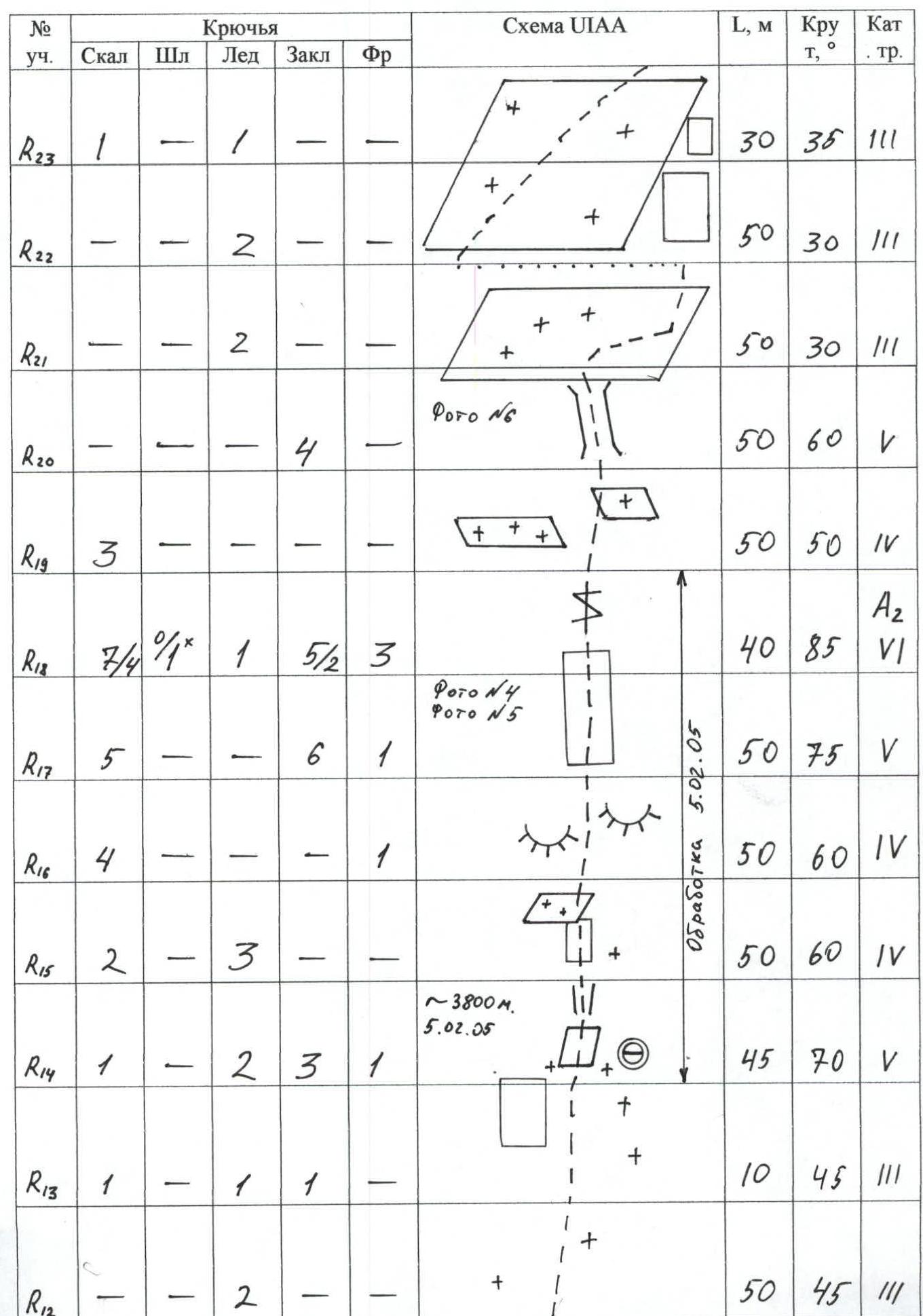 Route scheme in UIAA symbols
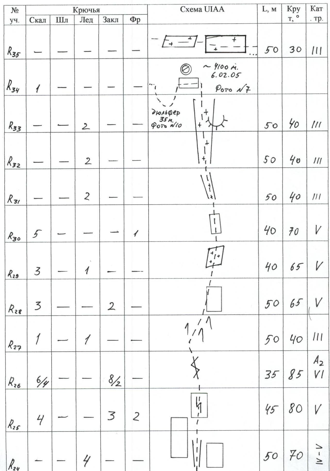 Route scheme in UIAA symbols
| Section № | Rock | Bolt | Ice | Chock | Friend | UIAA scheme | L, m | Steepness, ° | Difficulty category |
|---|---|---|---|---|---|---|---|---|---|
| R12 | - | - | 2 | - | - | 50 | 45 | 3 | |
| R13 | 1 | - | 1 | - | 1 | 10 | 45 | 3 | |
| R14 | 1 | - | 2 | 3 | 1 | ~3800 m. February 5, 2005 | 45 | 70 | 5 |
| R15 | 2 | - | 3 | - | - | 50 | 60 | 4 | |
| R16 | 4 | - | - | - | 1 | Preparation on February 5, 2005 | 50 | 60 | 4 |
| R17 | 5 | - | - | 6 | 1 | 50 | 75 | 5 | |
| R18 | 7/4 | 0/1 | 1 | 5/2 | 3 | Photo №4 Photo №5 | 40 | 85 | 6 |
| R19 | 3 | - | - | - | - | 50 | 50 | 4 | |
| R20 | - | - | - | 4 | - | Photo №6 | 50 | 60 | 5 |
| R21 | - | - | 2 | - | - | 50 | 30 | 3 | |
| R22 | - | - | 2 | - | - | 50 | 30 | 3 | |
| R23 | 1 | - | 1 | - | - | 30 | 35 | 3 | |
| R24 | - | - | 4 | - | - | 50 | 70 | 5 | |
| R25 | 4 | - | - | 3 | 2 | 45 | 80 | 5 | |
| R26 | 6/4 | - | 8/2 | - | - | 35 | 85 | 6 | |
| R27 | 1 | - | 1 | - | 1 | 50 | 40 | 3 | |
| R28 | 3 | - | 2 | - | - | 50 | 65 | 5 | |
| R29 | 3 | - | 1 | - | 1 | 40 | 65 | 5 | |
| R30 | 5 | - | 1 | - | 1 | 40 | 70 | 5 | |
| R31 | - | - | 2 | - | - | 50 | 40 | 3 | |
| R32 | - | - | 2 | - | - | 50 | 40 | 3 | |
| R33 | - | - | 2 | - | - | 50 | 40 | 3 | |
| R34 | 1 | - | - | - | - | ~4100 m. February 6, 2005 Photo №7 rappel 35 m. Photo №10 | - | - | - |
| R35 | - | - | - | - | - | 50 | 30 | 3 | |
| R36 | 1 | - | - | - | - | 50 | 30 | 3 | |
| R37 | - | - | - | - | 2 | 50 | 55 | 4 | |
| R38 | - | - | 1 | - | - | 50 | 40 | 4 | |
| R39 | 2 | - | - | - | - | 50 | 40 | 4 | |
| R40 | - | - | - | - | - | Total: Rock 54/8 Bolt 0/1 Ice 61 Chock 43/4 Friend 9 Photo №8 Photo №9 Bashkara 4241 m. February 7, 2005 10:30 | - | - | - |
Technical photograph of the route
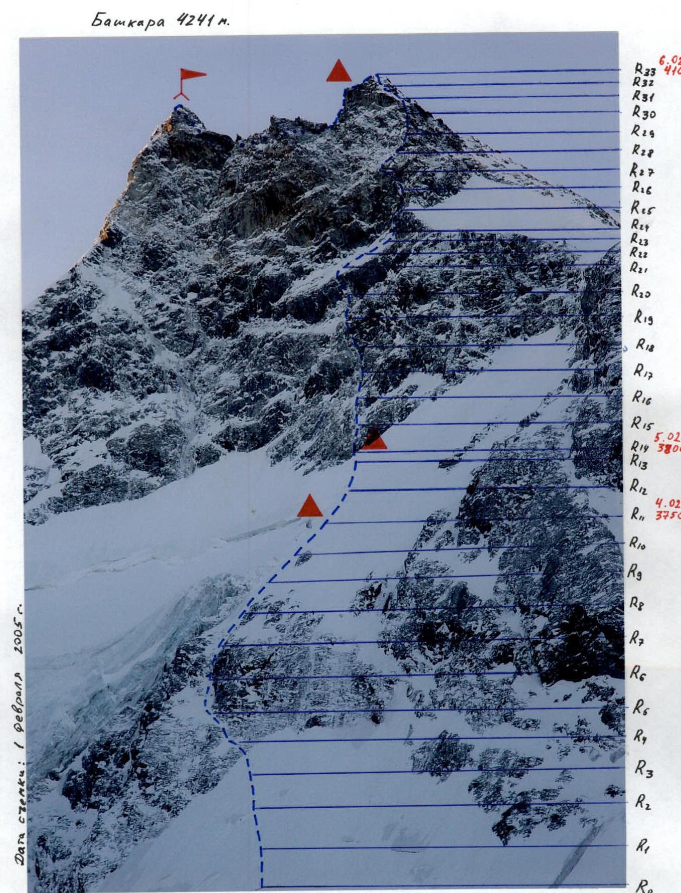 Photo illustration of the report
Photo №4. Kochetkov G. working on section R17–R18
Photo illustration of the report
Photo №4. Kochetkov G. working on section R17–R18
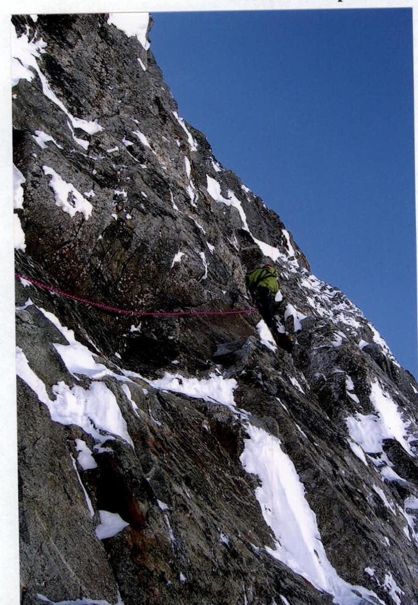 Photo №5
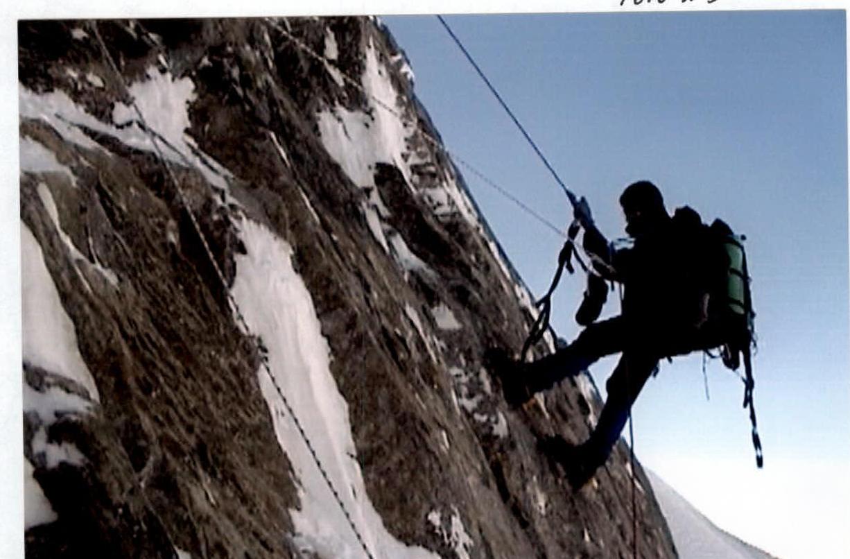 Photo illustration of the report
Photo №6. Passing the belay on section R20
Photo illustration of the report
Photo №6. Passing the belay on section R20
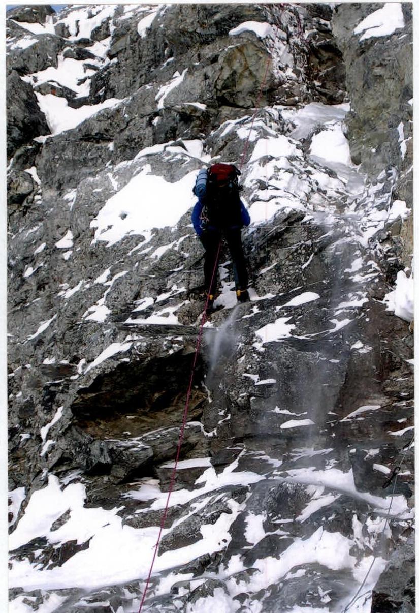 Photo №7. Overnight on the pre-summit ridge
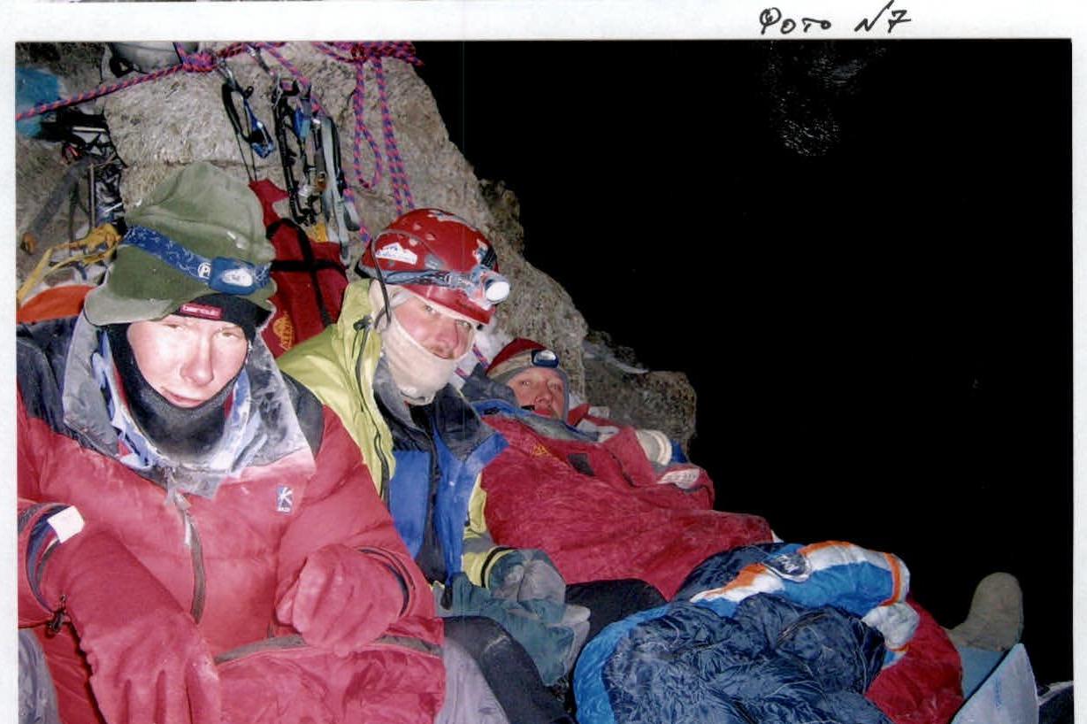 Photo illustration of the report
Photo №8. On the summit
Photo illustration of the report
Photo №8. On the summit
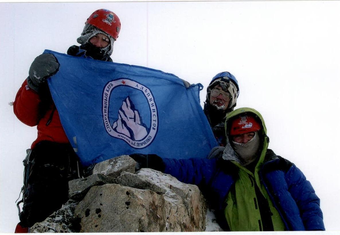 Photo №9. Altimeter reading on the summit
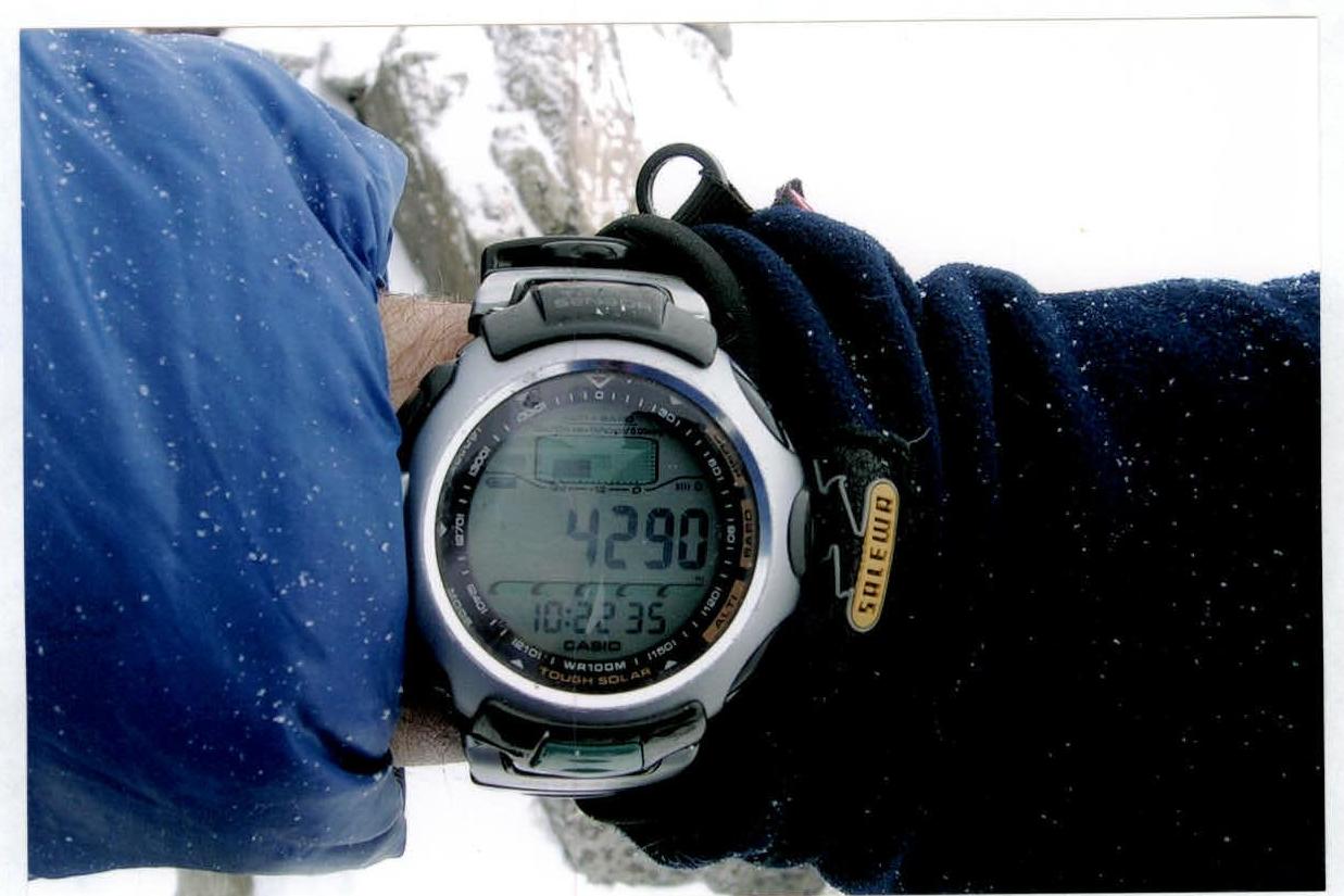 Photo illustration of the report
Photo №10. Rappelling into the pass. Section R34
Photo illustration of the report
Photo №10. Rappelling into the pass. Section R34
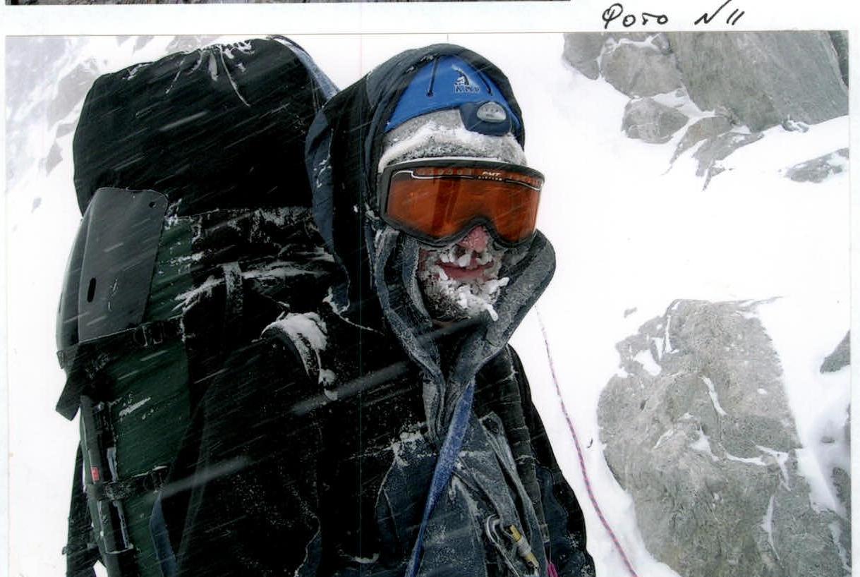
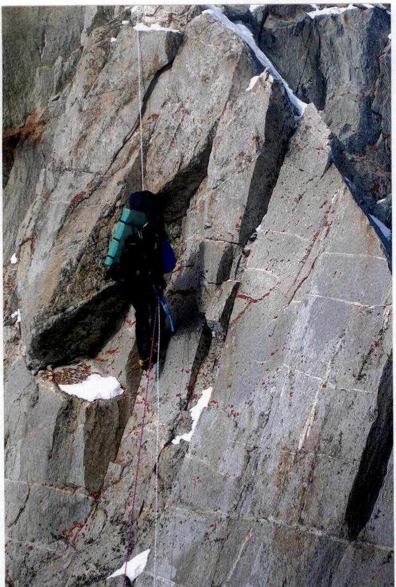 Photo illustration of the report
Photo №11. Bad weather on descent
Photo illustration of the report
Photo №11. Bad weather on descent