
Moscow Alpinism Championship
High-Altitude Technical Class
Ascent Report
To the peak Dzhailyk, 4424 m, via 1st South buttress, 3rd rib by Frantsuzov's route
Team KAiS MPEI
Moscow, 2017
Ascent Passport
- Central Caucasus, northern spur of the Main Caucasian Range, branching off from Mestia-tau peak, Dzhailyk node between Donkin and Kilar passes, section number according to the classification table 2.4.1.
- Dzhailyk peak 4424 m via 1st South buttress, 3rd rib (Frantsuzov's route 1970).
- Difficulty category: 5B.
- Route type: rock.
- Route elevation gain: 670 m. Route length: 905 m. Length of sections with 5–6 difficulty category: 210 m. Average steepness: — wall part of the route — 79° — entire route — 58°
- Pitons left on the route: Repschnur loops on the ridge for rappelling. Used on the route: chocks: 102/3. pitons: 10/2. bolts: 2/6. ice screws: 3.
- Team's climbing hours: on the route 16 h, on descent 5 h. Overnight bivouac after the wall part, lying down.
- Team leader: Zadvornый Andrey Vladimirovich (1st sports category). Team members: Leonkin Sergey (1st sports category), Mosina Ksenia (1st sports category).
- Coach: Kutkin Sergey Anatolyevich (Candidate Master of Sports).
- Reconnaissance: July 19, 2017 up to R3. Departure: 9:30, July 19, 2017. Summit: 13:40, July 21, 2017. Return to the alpine camp: 8:00, July 22, 2017.
- Organization: KAiS MPEI, Moscow.
- Report responsible: Zadvornый Andrey Vladimirovich: chepushilo@gmail.com, phone: 8(926)562-778
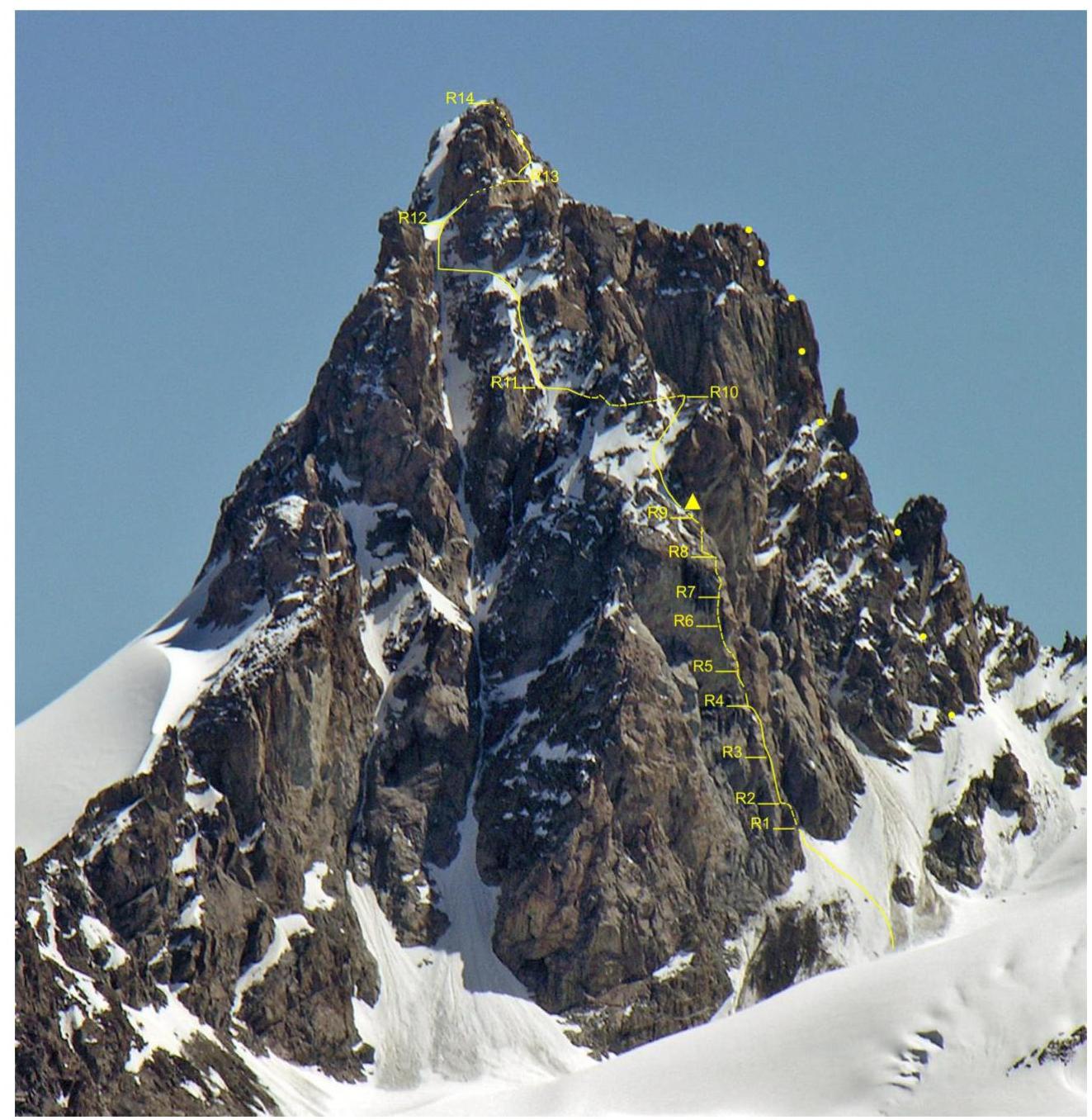
General photo of the summit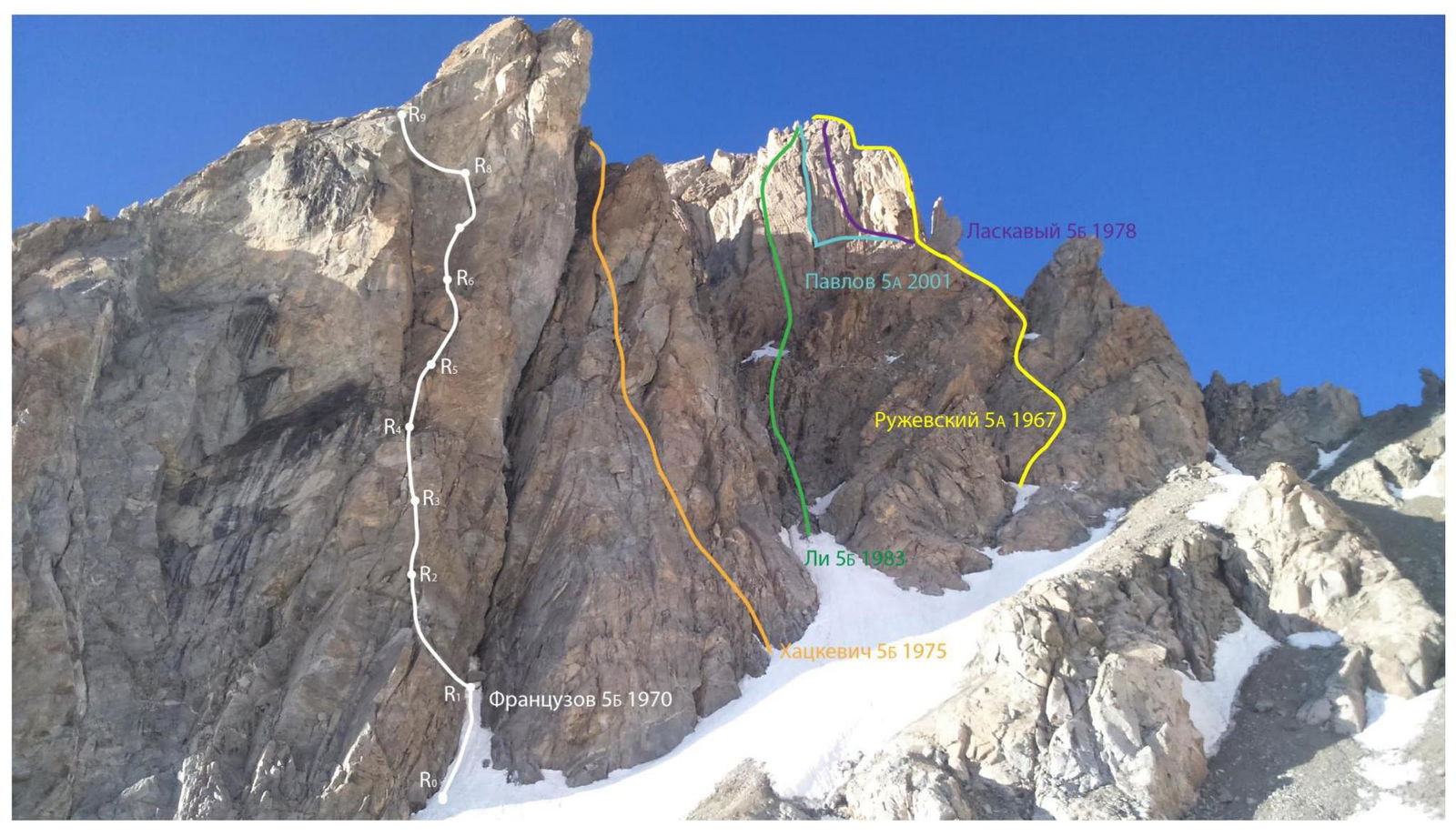
Threads of neighboring routes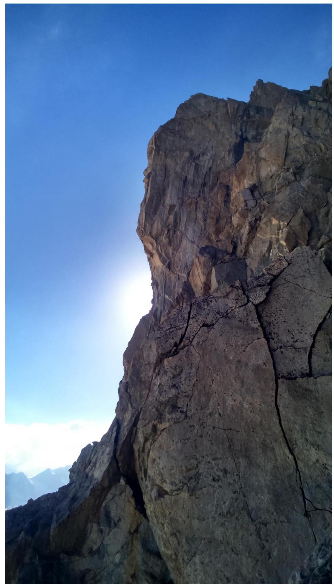
Profile of the wall on the right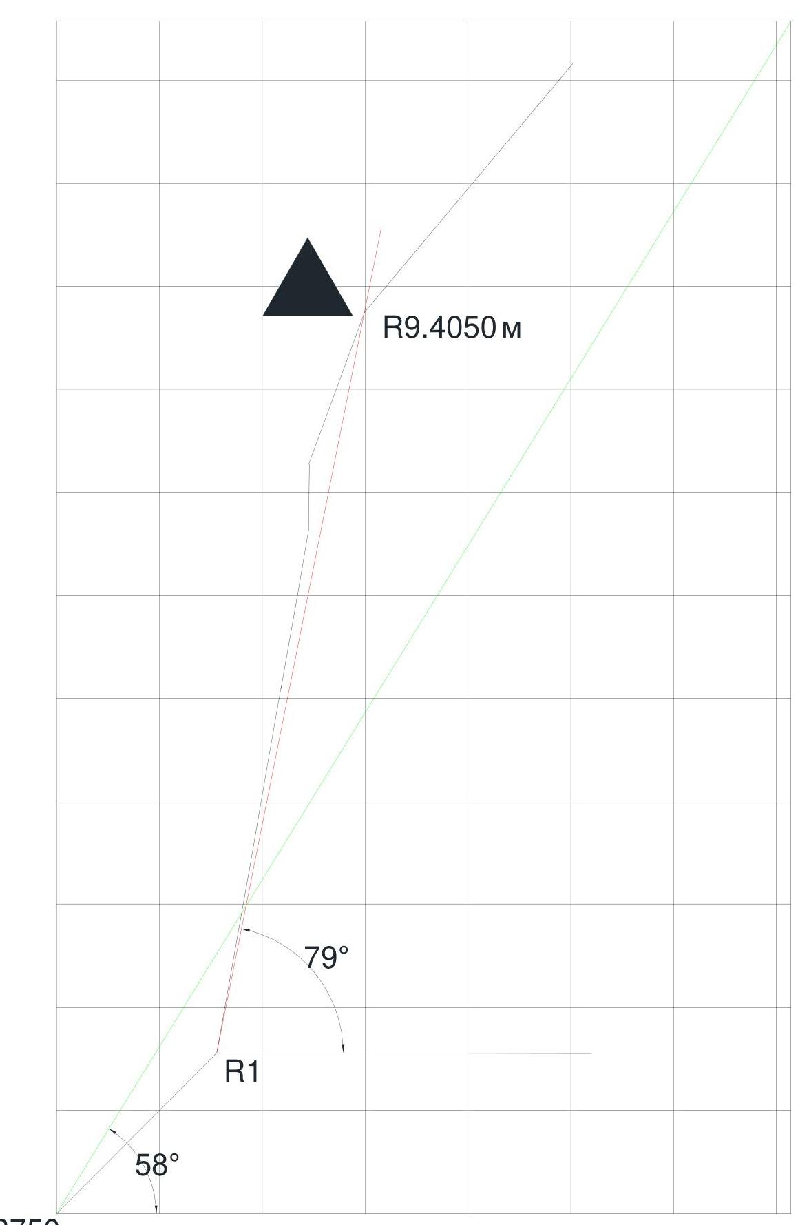
Drawn profile of the wall part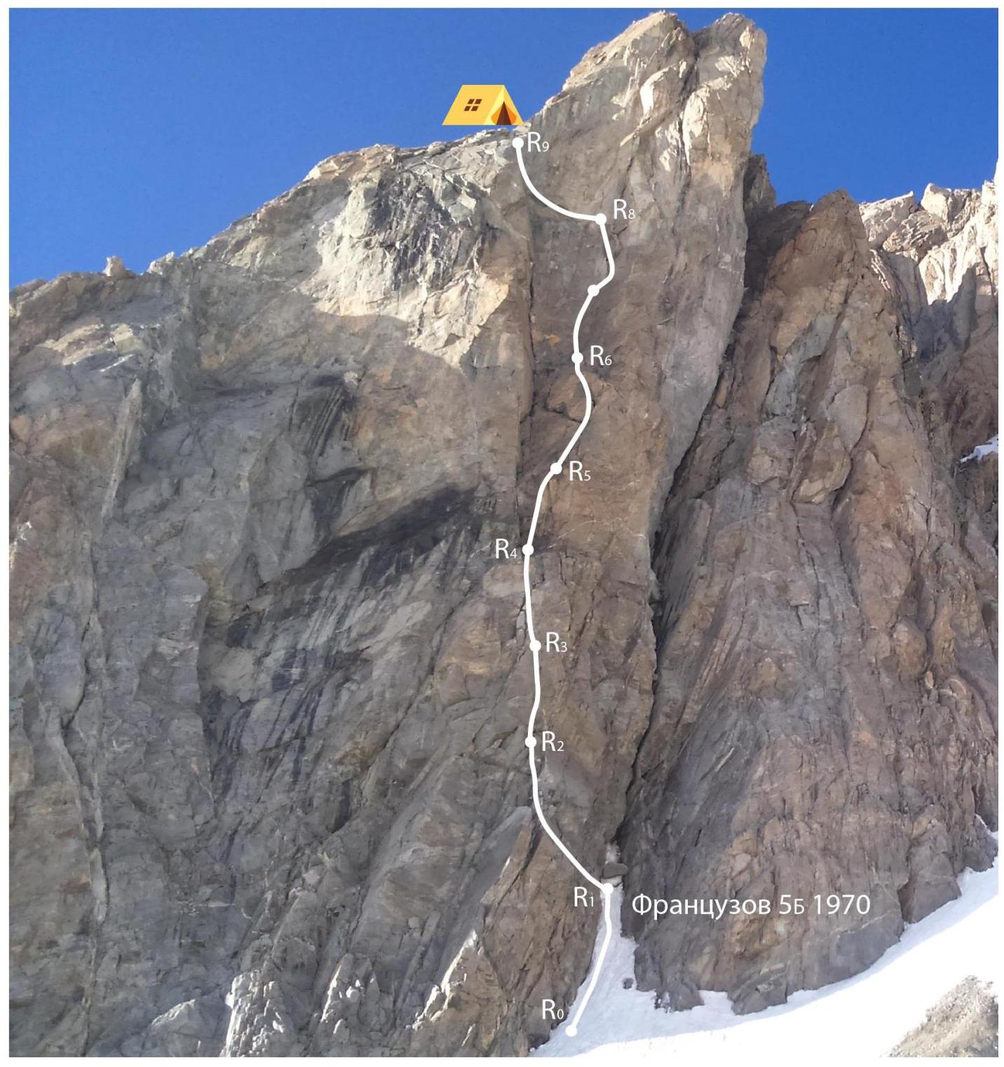

Wall part by sections
| Section | Chocks | Pitons | Bolts/Ice screws | Length, m | Steepness, deg. | Difficulty category |
|---|---|---|---|---|---|---|
| R0 | - | - | - | 70 | 45 | 2–3 |
| R1 | 10 | 1 | - | 30 | 80 | 5 |
| R2 | 8/3 | 1 | 1/1 | 30 | 70–90 | 4–5 |
| R3 | 10 | 1 | - | 30 | 80 | 5 |
| R4 | 8 | - | - | 25 | 80 | 4 |
| R5 | 11 | - | - | 30 | 80 | 5–6 |
| R6 | 6 | 2 | - | 20 | 80 | 5–6 |
| R7 | 7 | 3/2 | 1/5 | 20 | 90–100 | 5–6 |
| R8 | 12 | - | - | 50 | 70 | 4–5 |
| R9 | 12 | - | - | 150 | 50 | 3–4 |
| R10 | 6 | - | - | 50 | 40 | 3–4 |
| R11 | 8 | 2 | - | 200 | 50 | 3 |
| R12 | - | - | 3 | 50 | 40 | 3 |
| R13 | 4 | - | - | 250 | 40 | 2–3 |
| Total | 102/3 | 10/2 | 2/6 (b.) + 3 (i.s.) | 905 | - | - |
Route Description by Sections
R0–R1: Snow-ice couloir with a large stone plug at the top. R1–R2: Traverse up-left by climbing a difficult wall. R2–R3: Short wall. There is a bolt. The overhang is passed using TCO via a crack. Then an internal corner leads to a ledge. R3–R4: Descend left for 2 m and via an internal corner and wall, exit to a wide ledge. Overnight bivouac possible. R4–R5: Via a 4 m crack, exit to a steep slab under the wall. Then exit to the right side of a large internal corner. R5–R6: 20 m right-up via a cleft by climbing. After a small overhang, exit left to a comfortable ledge. R6–R7: 20 m up a steep wall of the internal corner. Intermediate station to collect gear. R7–R8: 15 m up a steep wall under an overhanging 2 m cornice into a crack. The cornice is passed using TCO. There are old bolts. Exit to an inclined ledge. R8–R9: 10 m left along the inclined ledge. Then 10 m up a wet internal corner to a narrow chimney (with ice inside). 10 m climbing up the chimney, then 10 m up a wall, moderate difficulty climbing. Exit to simple rocks and a wide area. Overnight bivouac here, there is snow and water. R9–R10: Exit to slabs via an ice couloir, then to a scree couloir right of a guarder. R10–R11: Traverse around the guarder on the right via ledges and broken rocks, exit to a ridge col. R11–R12: From the col, traverse 200 m up-left via steep rocks, ridges, and ice-snow sections on the left side of the South ridge, exit to the upper part of a large couloir. R12–R13: Then up a steep ice-snow ridge to a col on the South ridge under the summit tower. R13–R14: Up-right 70 m to exit to a system of rock ledges with handholds, encircling the summit tower left to right like a serpentine. Via ledges, then inclined slabs, exit to the summit.
Team's Tactical Actions
July 19, 2017
8:00 Team consisting of Zadvornый A., Mosina K., Leonkin S. departed from Shogentsukov's shoulder. Via Khvost Drakona pass, approached the start of the route and set up a base camp on a flat part of the Zap. Yunun glacier, 400 m from the start of the route. At 13:00 the weather deteriorated: — wet snow, — rain, — wind gusts.
16:00. After lunch, we decided to start processing the lower part of the route. Visibility was almost zero, the buttress was shrouded in dense clouds. Fortunately, the start of the route has an obvious landmark — a wedged stone at the top of the snow couloir. By 18:30, we fixed 2 ropes on sections R1–R2 and R2–R3 via wet rocks. Mosina K. worked first. Photo №1, 2 (weather).
19:30. Returned to the bivouac. During processing, the wind tore off the tent, scattering our gear.
July 20, 2017
9:30 Variable cloudiness. Due to unstable weather, we decided to dismantle the tent and start the route with a bivouac.
10:00 Having passed the fixed ropes, we began working on section R3–R4. Zadvornый A. worked first. The weather worsened, slowing our movement. At the "key" Zadvornый used TCO in several places. Photo №5 ("Key").
16:30 Arrived at station R9 on a ledge with a good, flat area for a tent. End of the buttress and technically complex part of the route. Considering that Dzhailyk peak is prone to lightning during thunderstorms, we decided to set up a tent and spend the night. Photo №6 "Bivouac".
July 21, 2017
6:30 Weather improved, variable cloudiness, no precipitation. Managed to dry our gear somewhat, and by 8:30 we departed towards the summit.
13:30 Dzhailyk summit. Clear, resting, warming up in the sun, and at 13:40 began descending via Ruzhevsky's 5A route "through Monakh". Photo №10 ("Summit").
17:30 Descended to Zap. Yunun glacier.
On the wall part (up to R9), the first climber led on a double rope, in a harness, without a backpack, while the second and third climbers Jumared with top-rope. We didn't bring Fifi or Skyhooks. There were no falls or injuries.
The route is interesting, with diverse terrain, the rock buttress is not too destroyed, and practically nothing was falling on the wall part of the route. In good weather, it's possible to climb free. Requires attention when organizing protection on key sections, as the bolts are old and unreliable. We consider the route's 5B difficulty category to be adequate, as Frantsuzov's line is more complex and longer than the neighboring Laskavyy line, which team members had climbed previously.
Route Progress Chart. Weather Conditions
| Section | Time | Time taken, h | Weather conditions | Comments |
|---|---|---|---|---|
| July 19 | ||||
| Approach from camps on Shogentsukov's shoulder | 7:30 to 13:00 | 5.5 | Variable cloudiness. Dry. | |
| R1–R2 | 16:00 to 17:00 | 1 | Overcast, occasional rain. Wind. | Processing |
| R2–R3 | 17:00 to 18:30 | 1 | Processing | |
| Descent to the tent | 18:30 to 19:30 | 1 | Rain. Wind. | Processing |
| July 20 | ||||
| Bivouac–R3 | 9:00 to 10:00 | 1 | Variable cloudiness. | Movement on fixed ropes |
| R3–R5 | 10:00 to 11:30 | 1.5 | ||
| R5–R7 | 11:30 to 13:30 | 2 | Overcast. Occasional rain. Wind. | |
| R7–R8 | 13:30 to 14:30 | 1 | ||
| R8–R9 | 14:30 to 16:30 | 2 | Variable cloudiness, thunderstorm risk. Wind. | Exit to overnight bivouac |
| July 21 | ||||
| R9–R10 | 8:30 to 10:00 | 1.5 | Variable cloudiness | |
| R10–R11 | 10:00 to 11:00 | 1 | ||
| R11–R12 | 11:00 to 12:20 | 1.3 | ||
| R12–R13 | 12:20 to 13:00 | 0.7 | ||
| R13–R14 | 13:00 to 13:30 | 0.5 | Clear | Summit |
| Descent | 13:40 to 18:00 | 4 | Descent to original bivouac |
Photo 1. Section R1–R2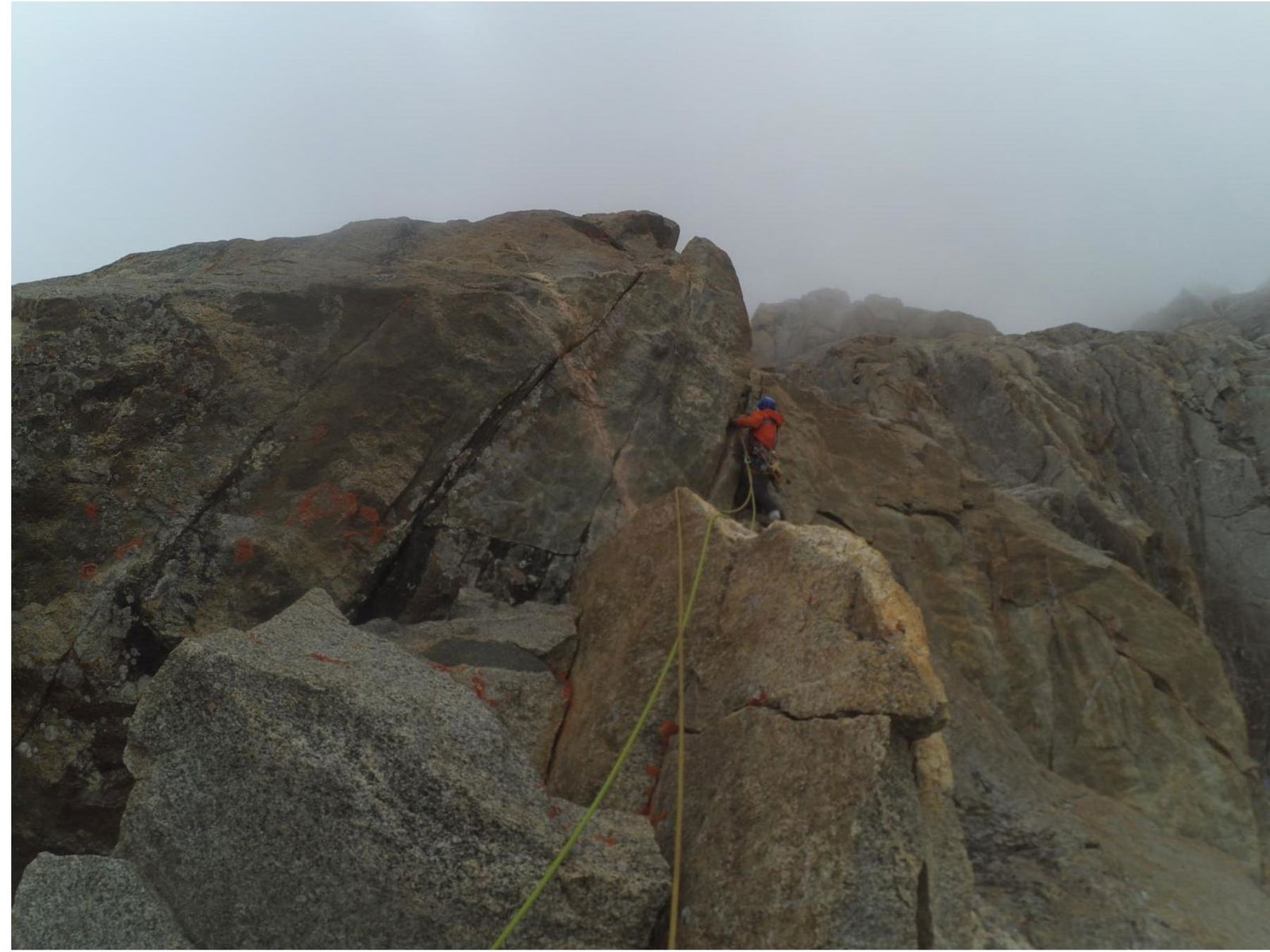
Photo 2. First climber on section R2–R3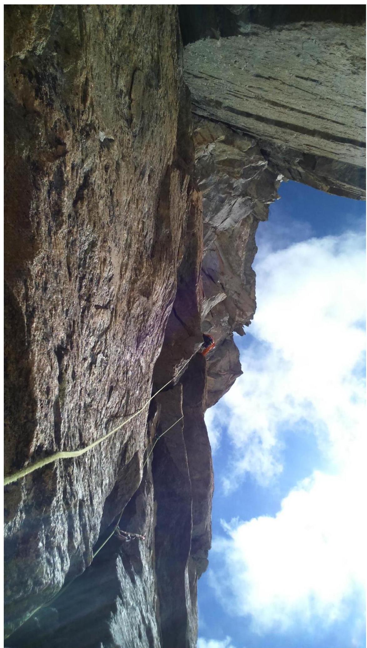
Photo 3. First climber on section R5–R6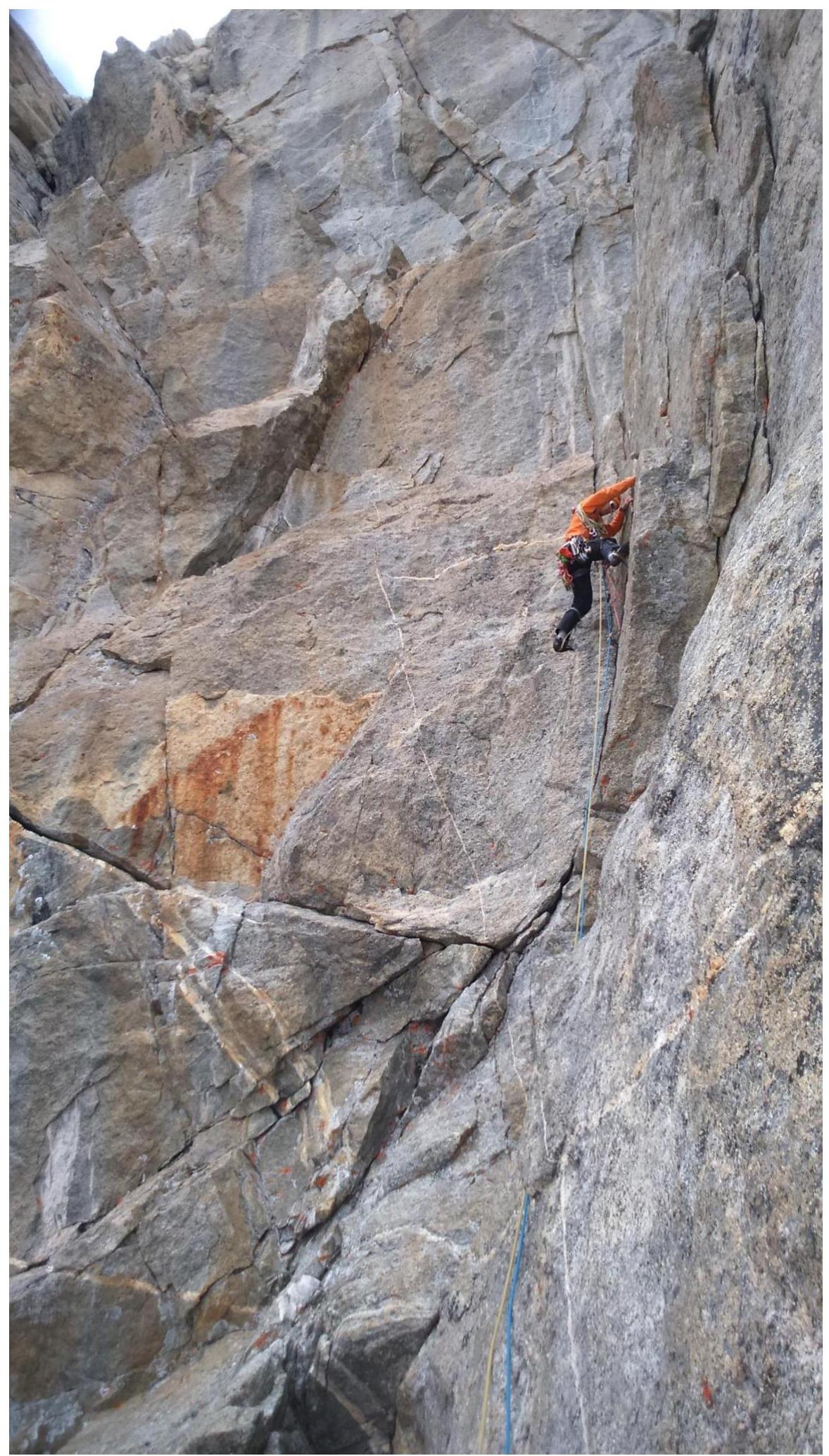
Photo 4. First climber on section R6–R7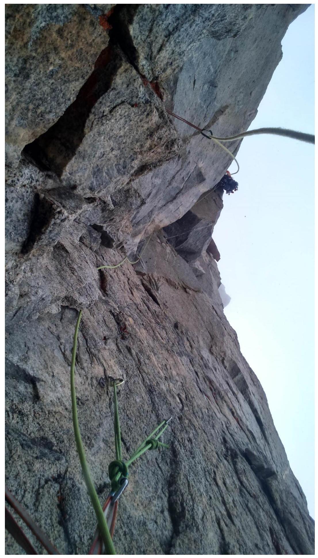
Photo 5. First climber on the "key" section R7–R8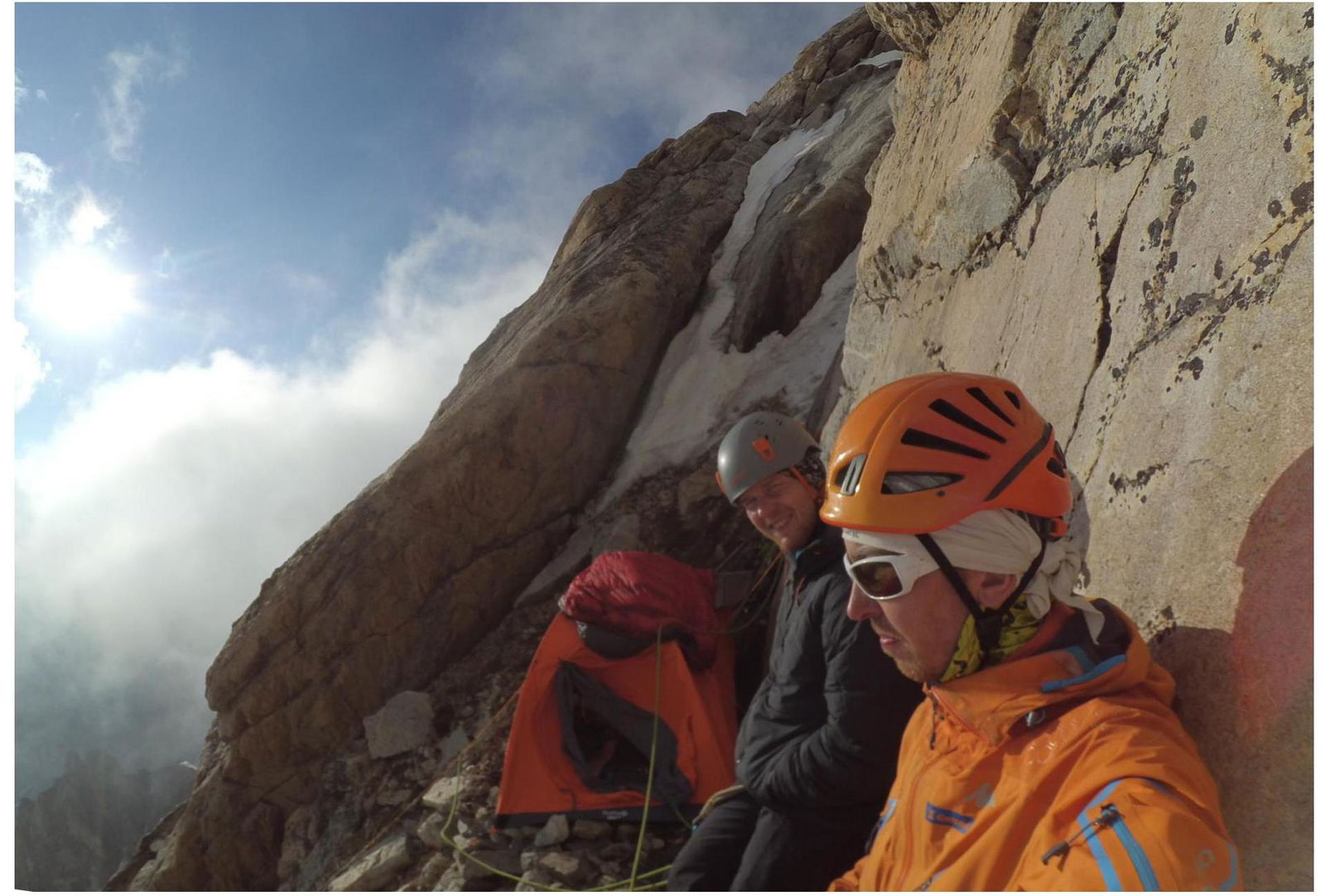
Photo 6. R9. Overnight bivouac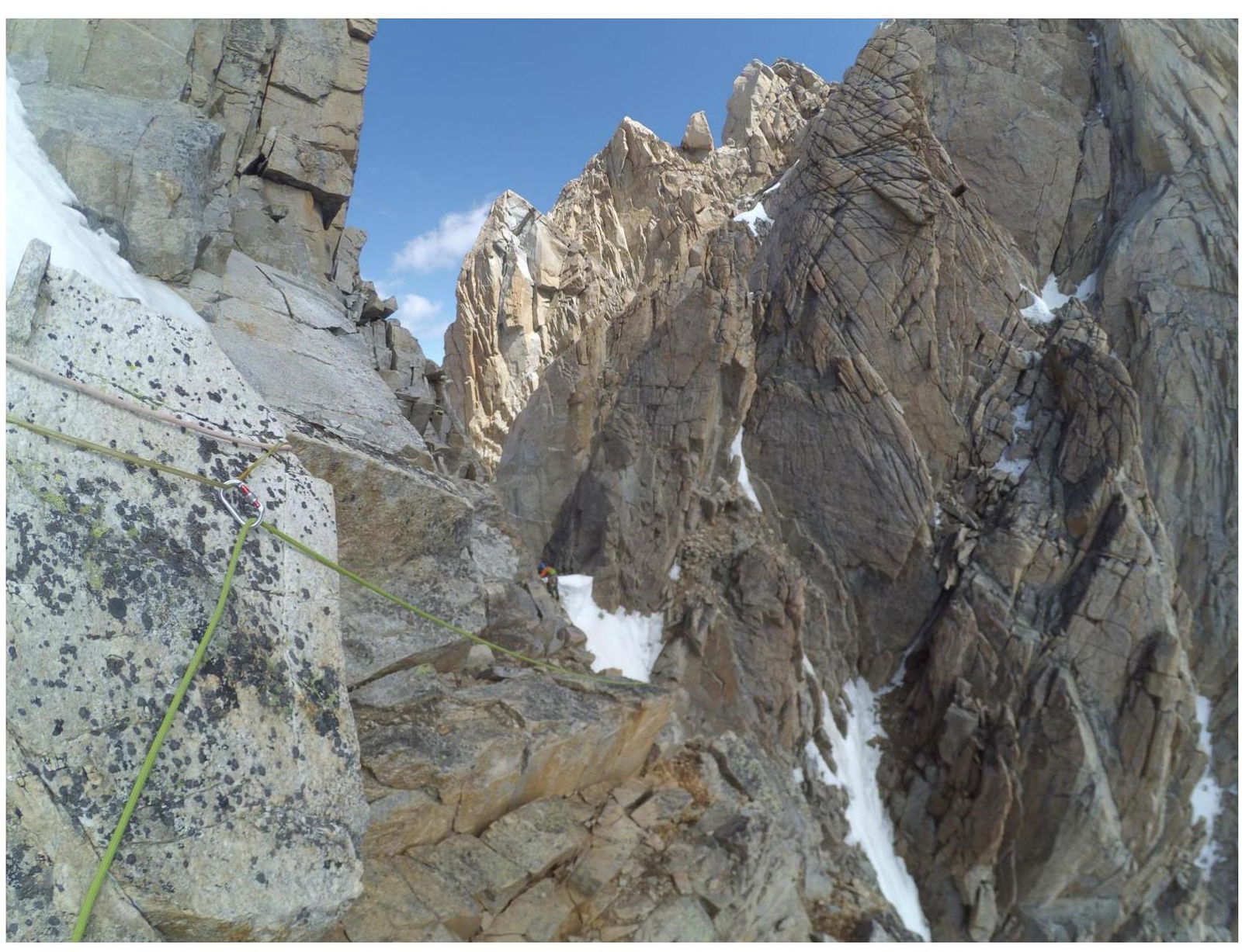
Photo 7. Section R10–R11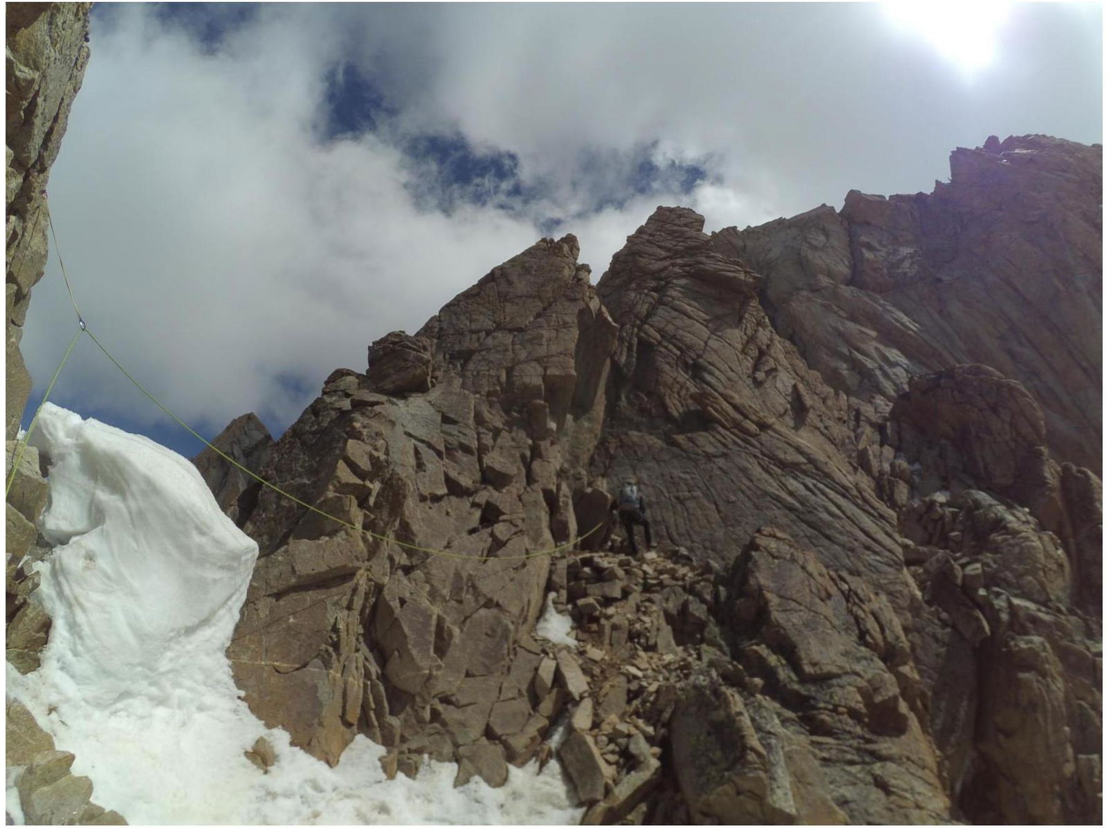
Photo 8. Section R10–R11. This guarder is better to bypass on the left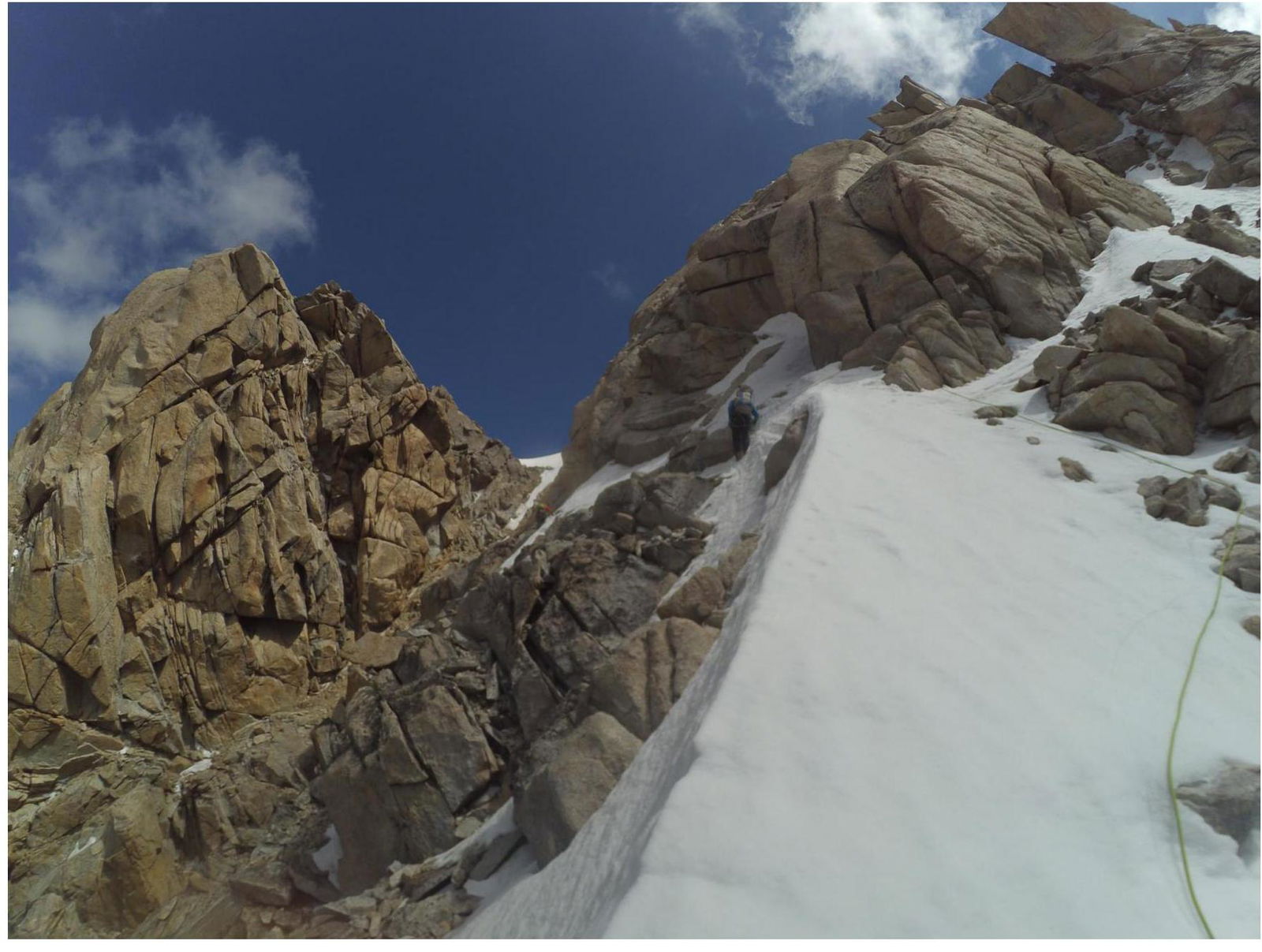
Photo 9. Section R11–R12
Photo 10. Summit