
Report
Teams from St. Petersburg
On the ascent of Mt. Angvundaschorr, 1120 m
Route on the left edge of the S wall, 2B category of difficulty, first ascent
21.06.2012
St. Petersburg
2012
Ascent Passport
- Area: Lovozerskie Tundry mountains, Sengis-yok river valley, nearest section 8.6 ECTM 2011
- Mt. Angvundaschorr 1120.6 m, via the left edge of the S wall
- Proposed category of difficulty: 2B, first ascent
- Route type: rock climbing
- Height difference: 400 m, with 270 m being the wall section
Route length: 1100 m. Average steepness: main part of the route — 55°; total route — 30°
- Number of "live rocks" left on the route: none
- Team's total climbing time: 2 h 20 min
- Team leader: Ivanova-Efimova E.N., 3rd sports category
Team members: Shamalо V.P., Master of Sports of International Class
- Coach: Timoshenko T.I., Master of Sports
- Departure from Base Camp (BC) to the route: June 21, 2012, 12:00
Route started: June 21, 2012, 13:40. Reached the summit: June 21, 2012, 16:00. Returned to BC: June 21, 2012, 18:00. Descent from the summit: via the W ridge of Angvundaschorr, on scree and snowfields, n/k
-
Organization: FASiL St. Petersburg
-
Person responsible for the report: Ivanova-Efimova E.N. Email and phone: lswm@ya.ru, 8964-325-73-92
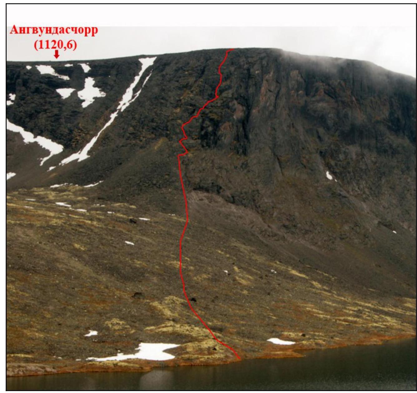
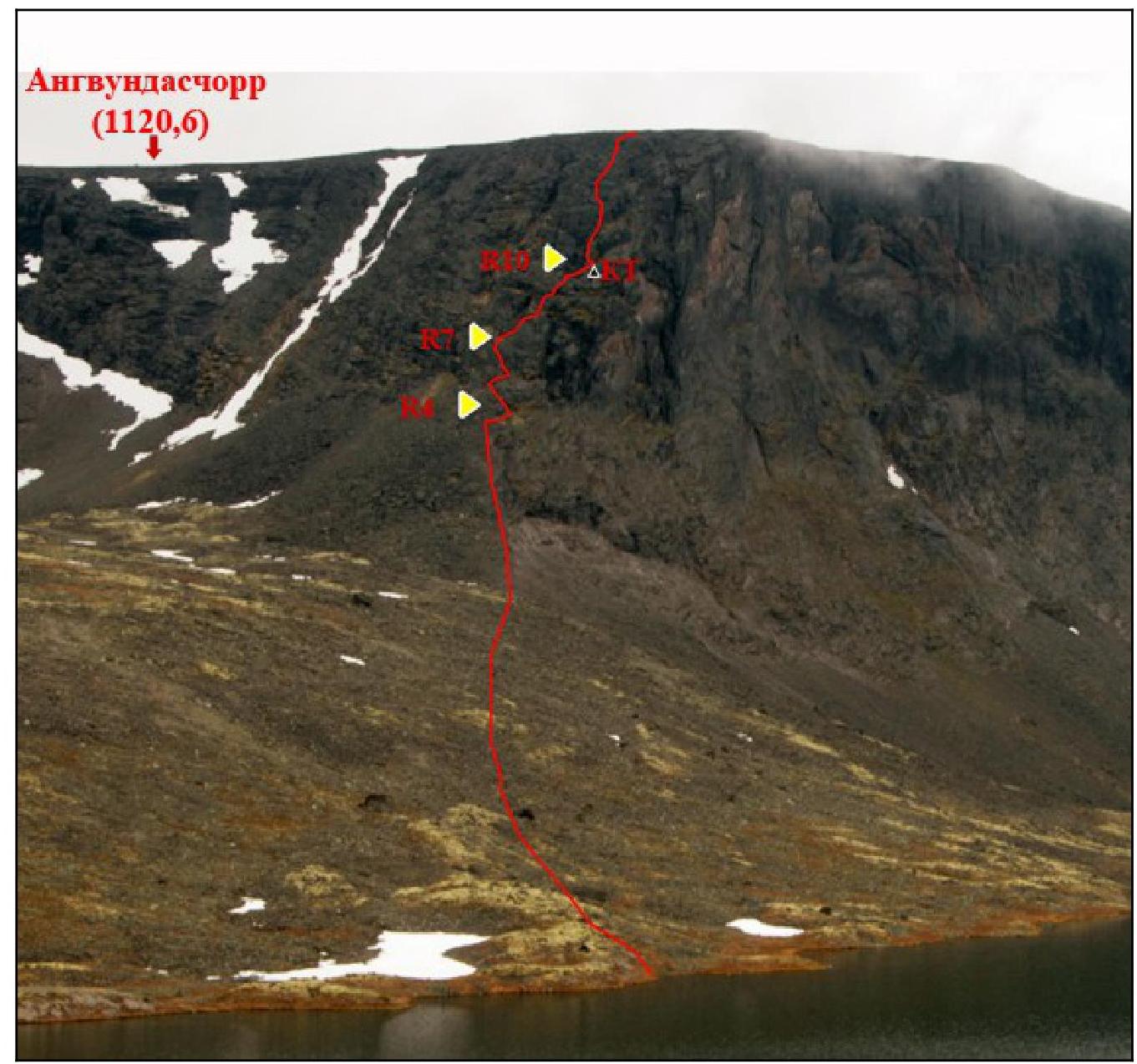
General photo of Mt. Angvundaschorr summit
Route on the left edge of the S wall
- 21.06.12
- Photo taken from the shore of Lake Sengis-yavr
- Absolute height 724 m

Standard route on the left edge of the S wall
21.06.12,
Photo taken from the shore of Lake Sengis-yavr, absolute height
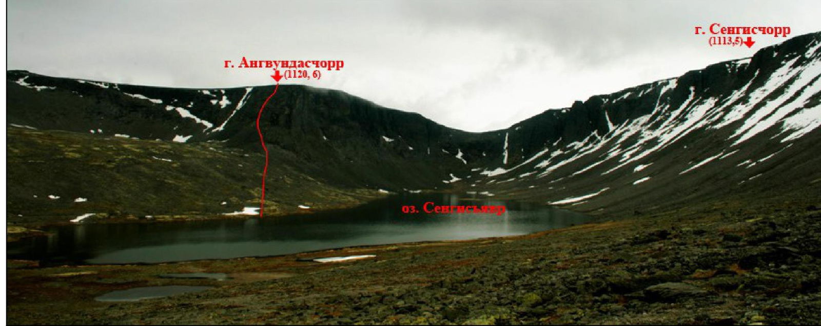
Photo panorama of the area
Route on the left edge of the S wall
August 21, 2012, photo taken from the shore of Lake Sengis-yavr, absolute height 724 m
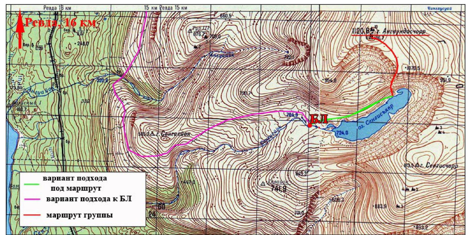
6 Fragment of map sheet Q-36-10, VG and Q-36-9 VG, scale 1:50 000
Area overview
Lovozerskie Tundry mountains are located in the center of the Kola Peninsula, east of the Khibiny mountains, between Lovozero and Umbozero lakes. The highest peak is Angvundaschorr, 1120.6 m.
Most interesting for climbing:
- walls around Lake Sengis-yavr,
- 1st and 2nd Raslak cirques,
- Ray-yavr cirque,
- many interesting walls around Lake Seidozero.
Wall heights reach 400 m, with many steep and complex sections; one can even find extended overhanging sections up to 50 m long. The difficulty of individual routes can reach 5B category.
To get to the area of Lake Sengis-yavr and the Raslak cirques, one can take a car or a bus from Olenegorsk to Revda. The optimal path to Lake Sengis-yavr depends on the season and the transportation available to the group.
In winter, the approach is very difficult due to deep snow and can be done:
- on skis,
- on snowmobiles.
If the group does not have its own snowmobile, it's better to plan 2 days for the journey from Revda to Lake Sengis-yavr in winter.
In summer, one can drive a car to the abandoned combine near Lake Umbozero and then hike for 4-5 hours to Sengis-yavr on a very bad road. With a jeep or a truck, one can get even closer, almost to the lake itself.
The base camp can be set up on the shore of Sengis-yavr. The best time for climbing in this area is July and August.
It should be noted that:
- the forest ends in the Azimuth river valley near the abandoned combine;
- there are no trees or firewood on the shores of Sengis-yavr.
Ascent scheme
| Section # | Length | Steepness | Terrain characteristics | Category of difficulty | Number of pitons |
|---|---|---|---|---|---|
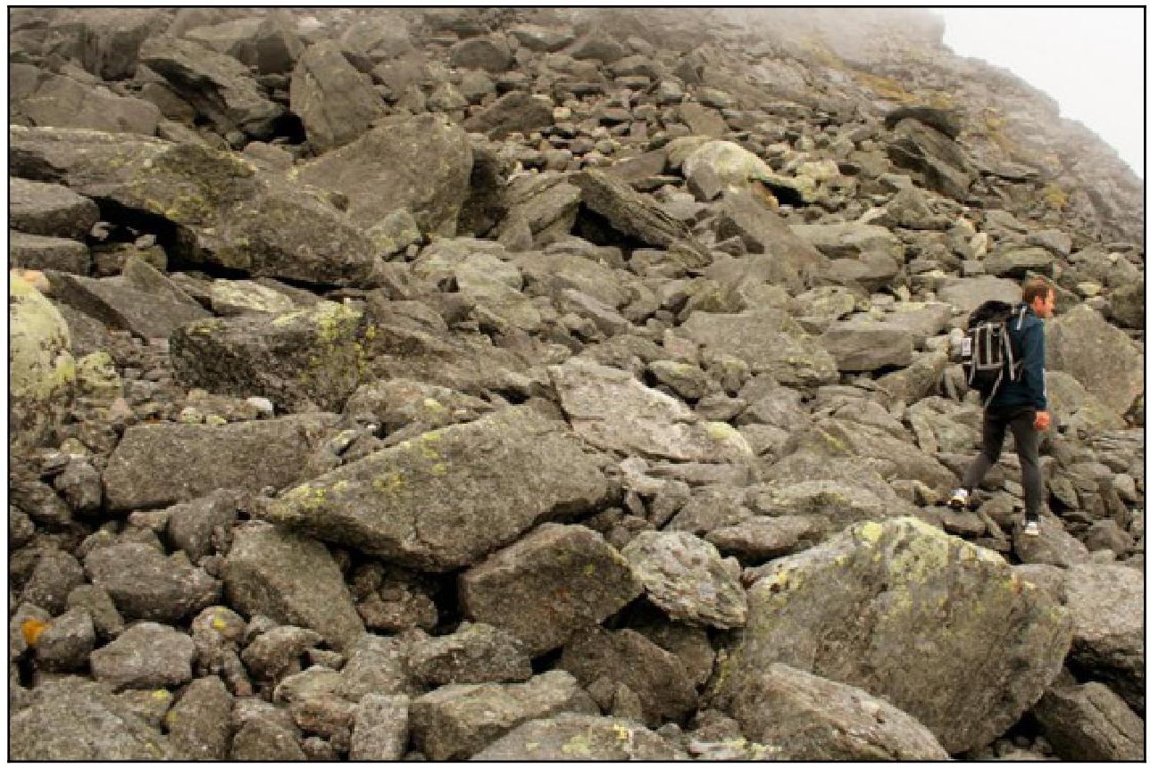
| R1 | 300 | 20-25 | small and medium scree, partially grassy with some rocky outcrops | n/k | - |
| R2 | 100 | 30 | large scree | n/k | - |
| R3 | 100 | 30-35 | large, medium scree, and rocky outcrops | I | - |
| R4 | 40 | 35 | rocks | II | 1 |
| R5 | 20 | 30-35 | bypassing a small wall on the left via a couloir | II | 1 |
| R6 | 20 | 40 | rocks | II-III | 1 |
| R7 | 20 | 30 | via a couloir | II | - |
| R8 | 20 | 50 | onto the wall to the right, exit onto the ridge | III | 1 |
| R9 | 30 | 40 | ridge | II | - |
| R10 | 20 | 40 | broken rocks | II | - |
| R11 | 40 | 75 | rocks | (III+)-(IV-) | 4 |
| R12 | 70 | 50 | alternating ledges and small walls | III | 2 |
| R13 | On the plateau, 400 m to the summit |
11
Technical photography of the route
Route on the left edge of the S wall, August 21, 2012, photo taken from the shore of Lake Sengis-yavr, absolute height 724 m
Description of the ascent
The group departed from BC on August 21, 1953, at 12:00, established near Lake Sengis-yavr. The weather was warm, with clouds hanging about 100 m above the ground, which made navigation somewhat difficult. We decided not to postpone the ascent, as the clouds periodically lifted higher. After ascending via scree from the lake, we approached a distinct ridge — this spot marked the beginning of the wall section of the route. The entire route was climbed using alternating belays. On one of the ledges in the upper part of the wall, a cairn was built, and a note was left. The route's difficulty is not uniform:
- The lower part consists of scree and simple rocks
- The upper third features rocks of IV category of difficulty
After reaching the plateau, it was necessary to walk another 400 m on R3 to the summit — a distinctive group of rocks and a broken triangulation point — where a note was left. We descended along the slope of the same cirque towards the lake, bypassing the rocks further to the south.
The direction of movement on the route is unambiguous. The only hazards are a small number of "live rocks".
The route was classified as 2B category of difficulty.
In winter, the route's difficulty is unlikely to decrease, as the key section cannot be completely covered in snow.
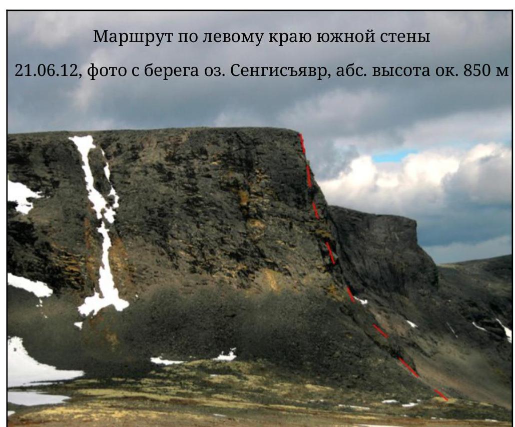
Photo illustrations of the report
Start of
the route
Section
R10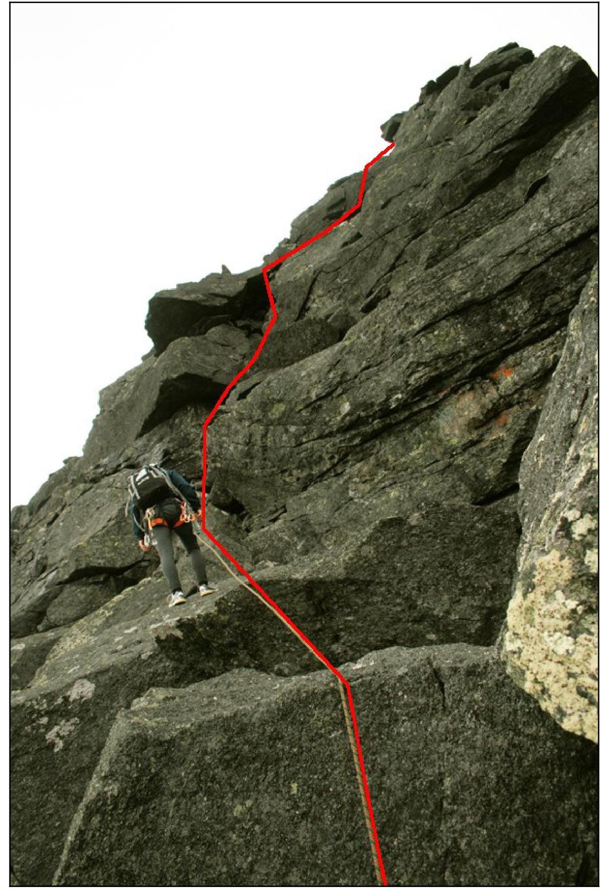
Section
R12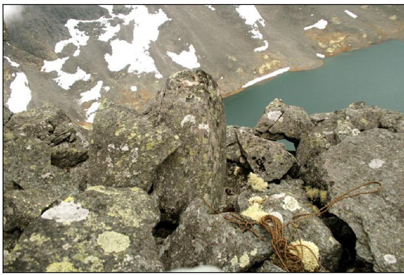
Edge of
the plateau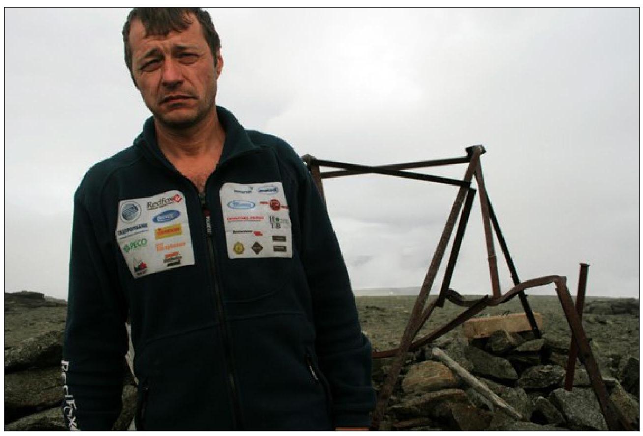
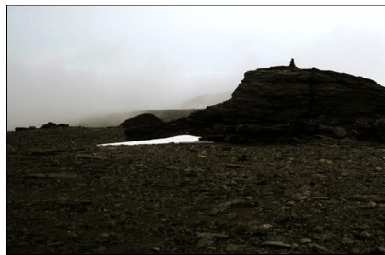
Shamalo V. on the summit of
Angvundaschorr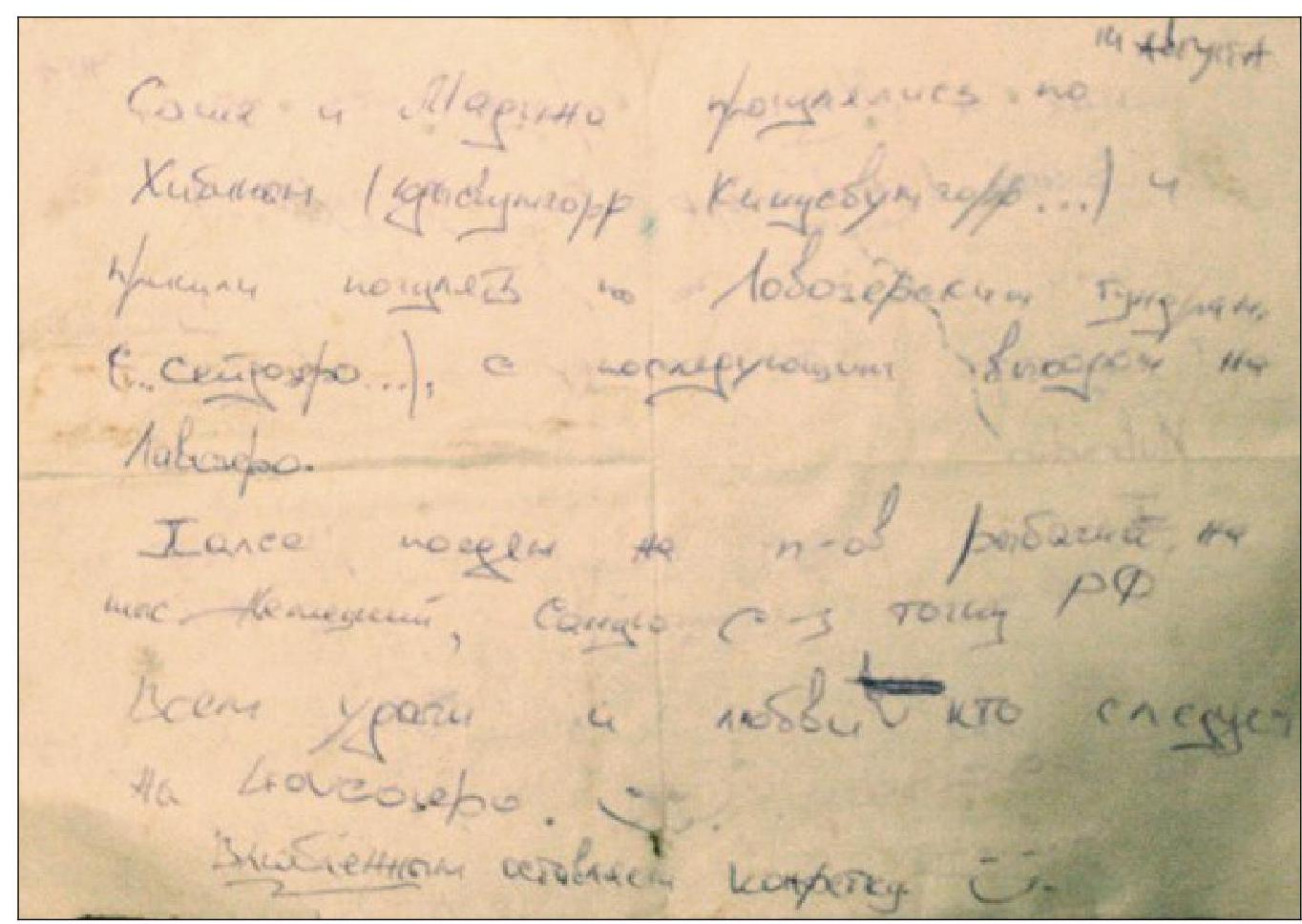
A note was found on the summit