
Ascent Passport
-
Region: Sultanate of Oman, Western Hajar range. Peak name: Jabal Misht
-
Route name: Up the center of the southeast wall
-
Proposed 6A category of difficulty, third ascent, combination of German routes
-
Route type: rock
-
Route elevation gain: 900 m.
Route length: 1000 m. Length of sections: V category of difficulty – 250 m., VI category of difficulty – 450 m. Average steepness of the main part of the route – 83°, total route – 73°
-
"Hooks" left on the route: total – 0, including bolted – 0.
Hooks used on the route:
- stationary bolted – 68; including artificial aids – 2.
- removable bolted – 0; including artificial aids – 0. Total artificial points of support (artificial aids) used – 2.
-
Team's travel time: 33 hours, 3 days
-
Leader: Toporkov Alexander Viktorovich, Candidate for Master of Sports
Participants: Toporkova Daria Vyacheslavovna, 1st sports rank
-
Coach: Kiselev Alexander Anatolyevich, Candidate for Master of Sports, 1st category instructor.
-
Departure for the route: 8:50, December 30, 2006.
Arrival at the summit: 18:30, January 1, 2007.
Return to base camp: 10:00, January 2, 2007.
Description of the Area
The object of the ascent – Jabal Misht peak is located in the Sultanate of Oman. The Sultanate of Oman is a state in the southeast of the Arabian Peninsula, bordered by:
- United Arab Emirates,
- Saudi Arabia,
- Yemen.
The north of Oman is occupied by the Hajar Mountains – the extreme southern branch of the Alpine mountain belt of Eurasia. The ridge is over 600 km long, with a height of up to 3035 m (Jabal Sham), the mountains are composed mainly of limestones, basalts, and serpentinites. The mountains of Oman are predominantly gentle scree slopes – a stony desert cut by canyons, dry riverbeds (local name – wadi), and among the desert, steep walls rise, such as Jabal Misht, Jabal al-Khor, etc.
The best time for climbing Jabal Misht is from November to March. It's not too hot during this time. The average temperature of Oman's internal desert regions is around +32°C in summer and +27–29°C in winter, but in winter, the temperature can drop to zero. During our ascent, the temperature was +22°C during the day and around +10°C at night.
The area is very dry. There are no natural sources of water not only on the wall but also in the surrounding area. Water can only be obtained in settlements.
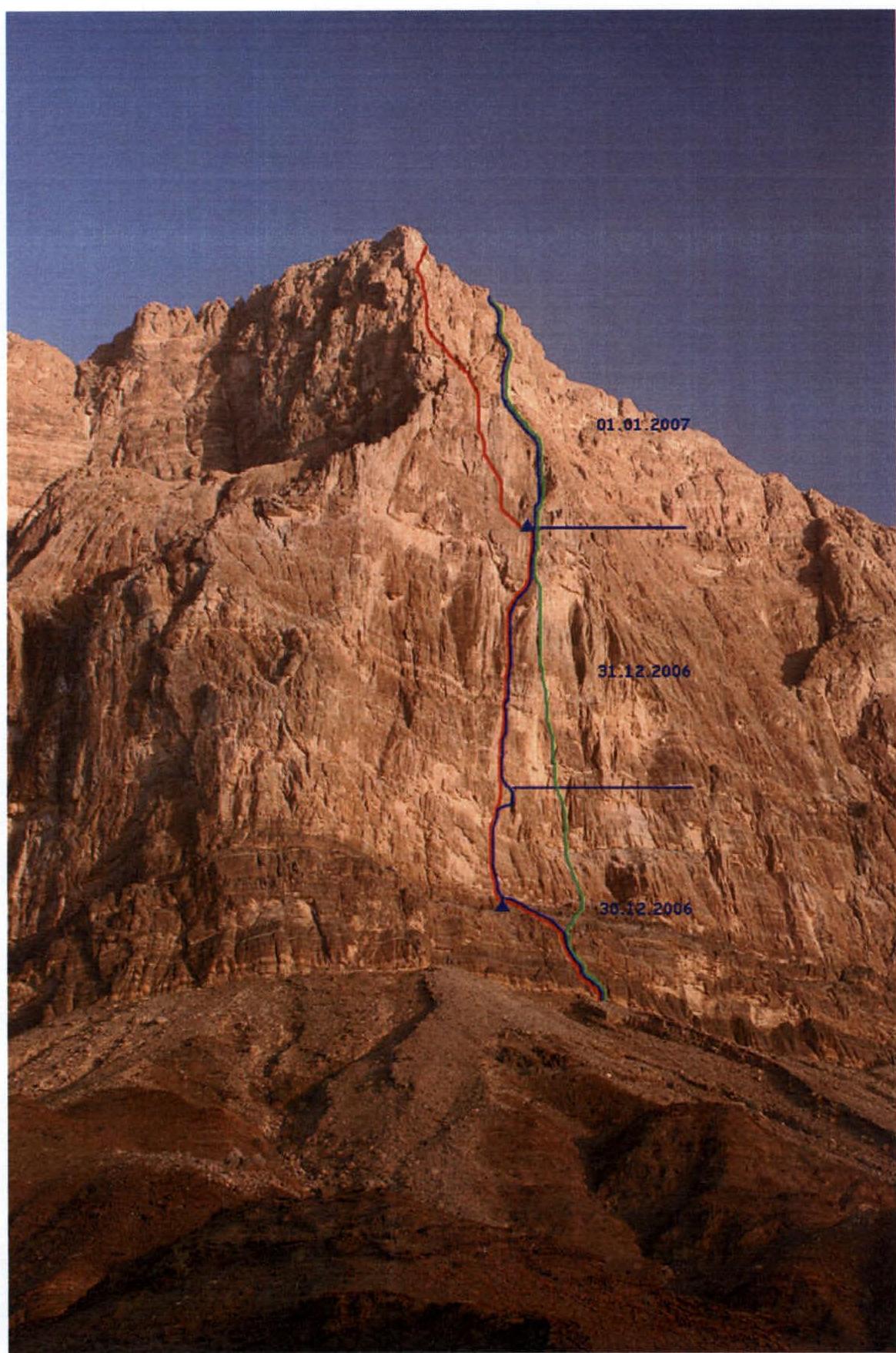
The red thread – "Make Love Not War" route, 2003. The green thread – the right German route, 2004(?) Date taken: December 29, 2006, location: hill above the base camp.
Route profile on the left

Drawn route profile

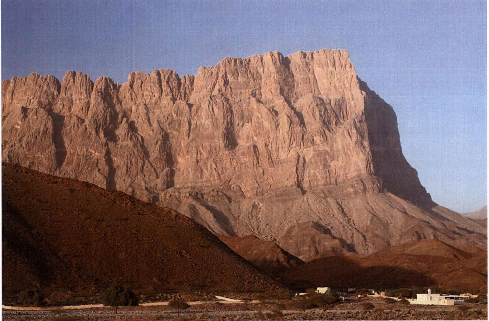
Photopanorama of Jabal Misht massif. The summit is not on the ridge; it stands alone, so there are no other peaks visible on the left and right.
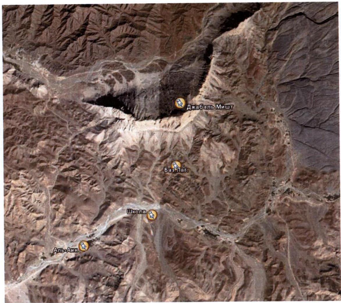
Satellite image of the ascent area. The nearest major city to the base camp is Ibri (about 60 km), and the nearest settlement is Al-Ain (about 3 km).
Oman has a well-developed road network, and the roads are in excellent condition. After driving a couple of kilometers on the highway after Al-Ain, you need to stop near the school. The base camp is located in one of the numerous wadis (dry riverbeds) leading to the walls of Jabal Misht.
On a hill near the entrance to the required wadi stands an ancient tomb – a stone "igloo". You can drive a car right to the base camp, but there is no road as such.
At the base camp:
- No water.
- Water must be carried.
From the base camp to the wall takes about an hour and a half. First, you need to reach the end of the wadi, then:
- climb the scree to the left,
- then navigate by cairns.
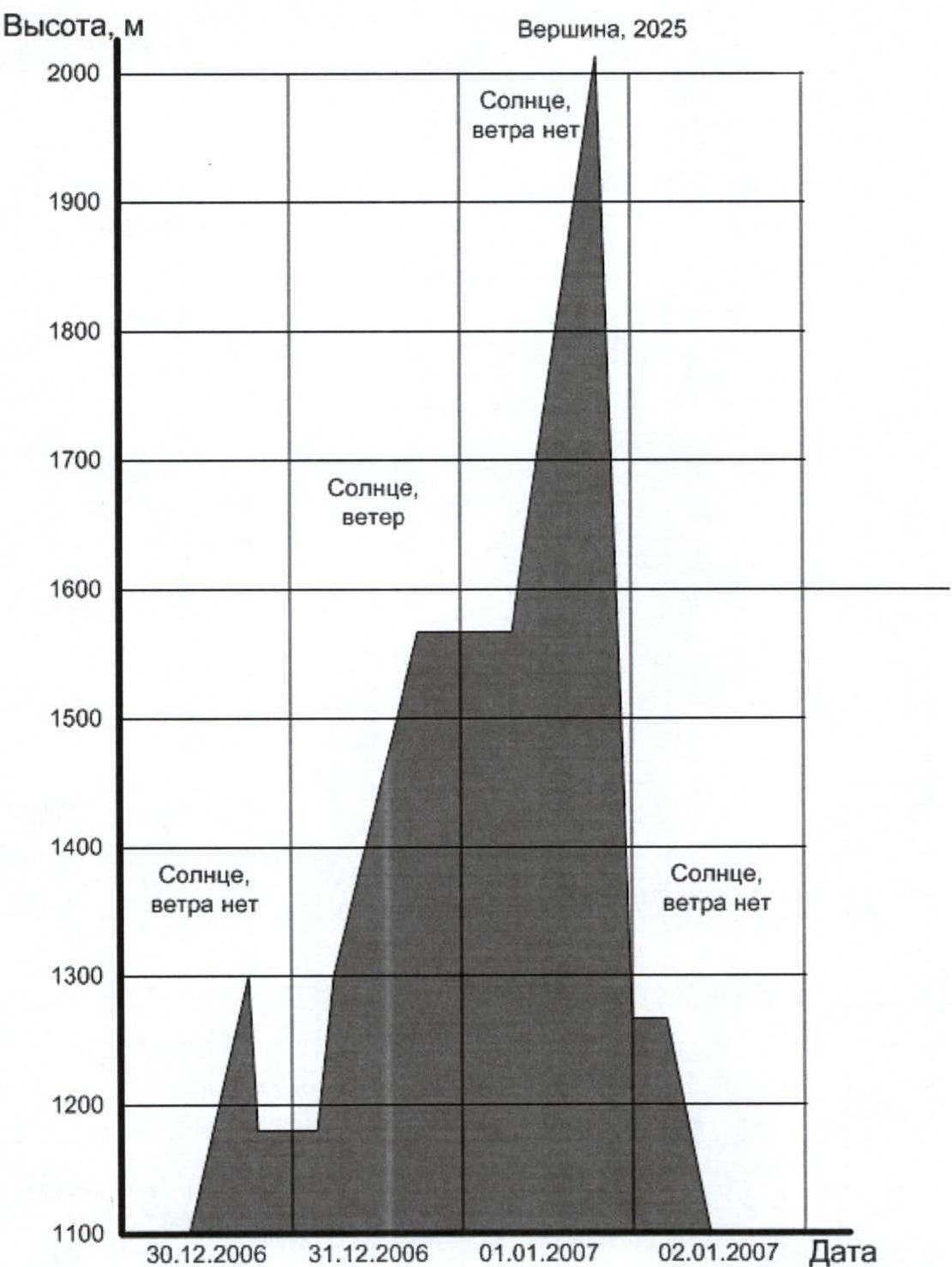
Ascent graph
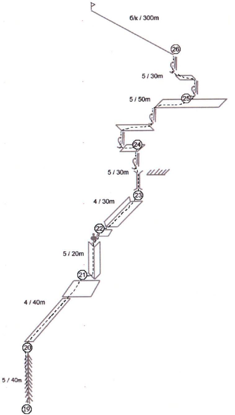
6–8–300 m
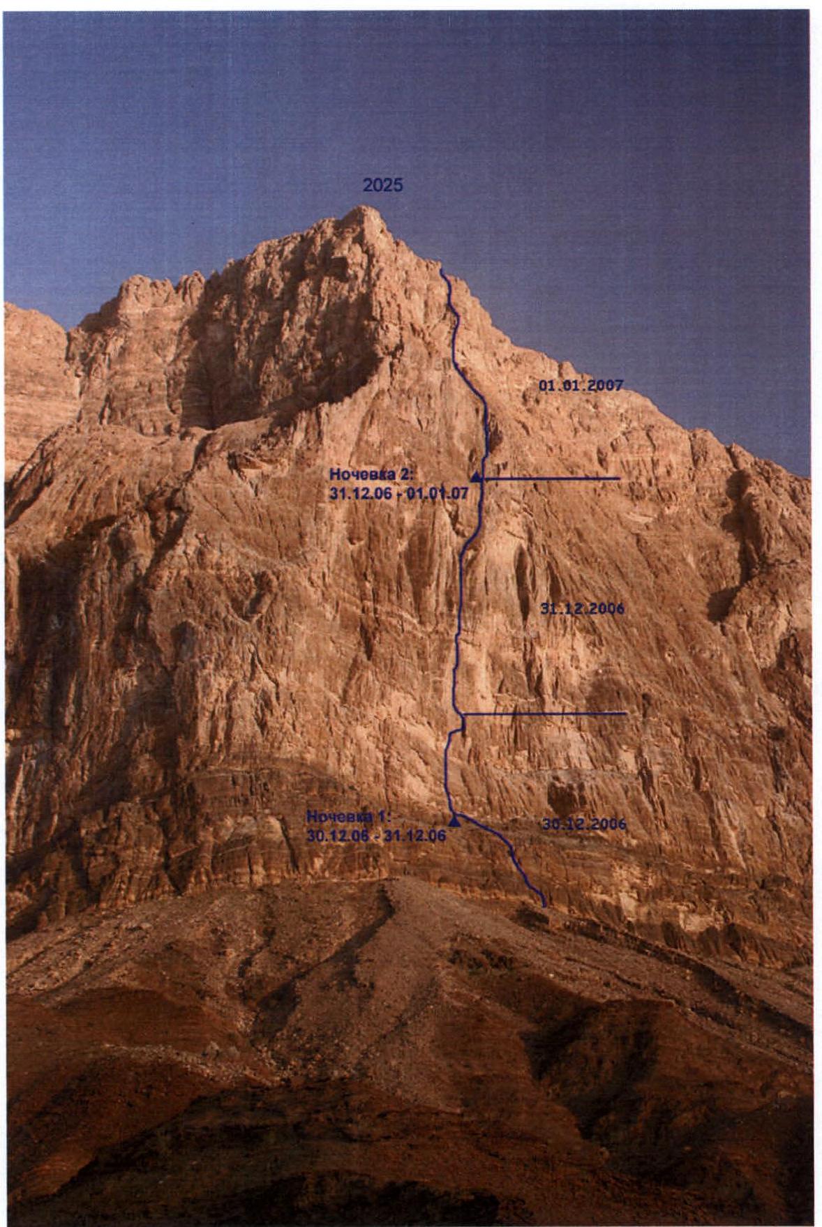
Technical photograph of the route (Horizontal lines divide the route into sections climbed per day). No control tours and, accordingly, notes were found on the route or at the summit. Apparently, it's not customary to leave notes in foreign mountaineering. However, some items left by previous expeditions were found:
- broken sunglasses
- Czech coin
- carabiner with the inscription "Made in GDR"
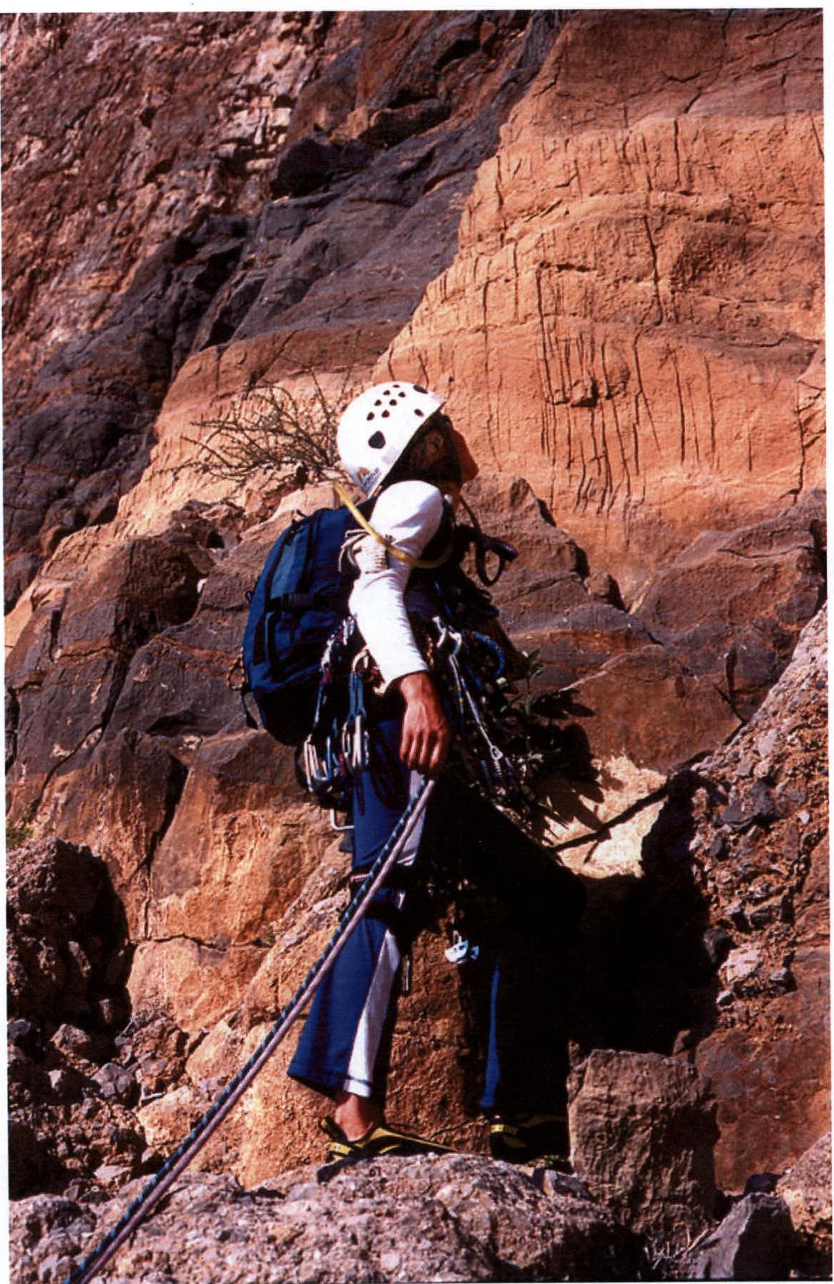
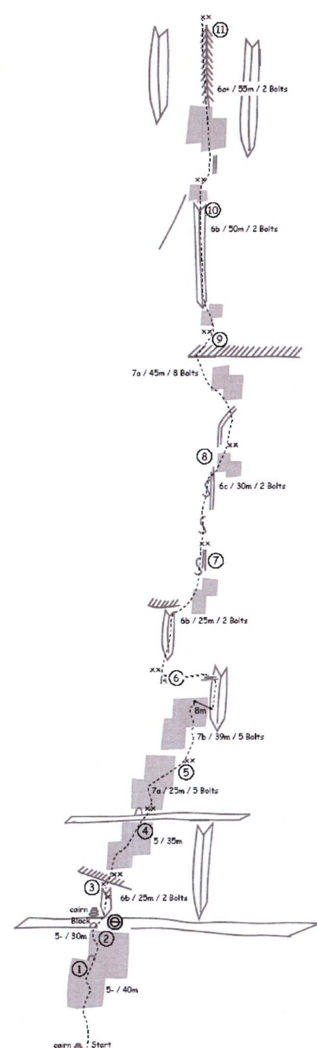
Start of the route (R0)
Cornice at the end of section R2–R3. Immediately behind the cornice is station R3.
Station R6
Section R7–R8
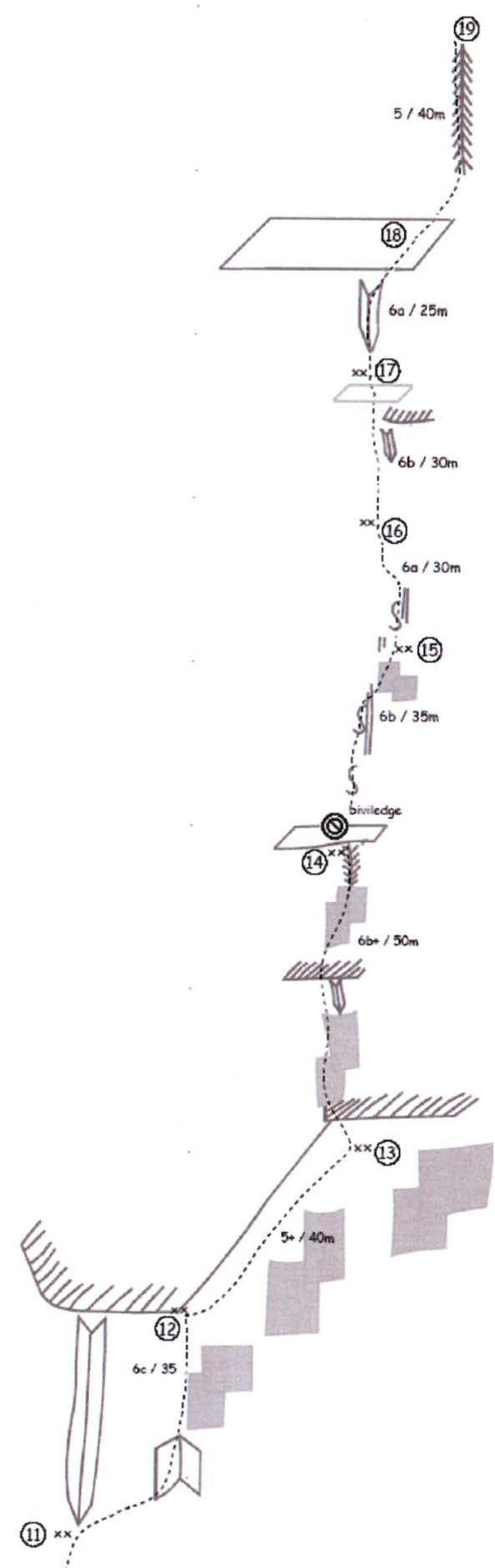
Morning after the second bivouac on the route (R14)
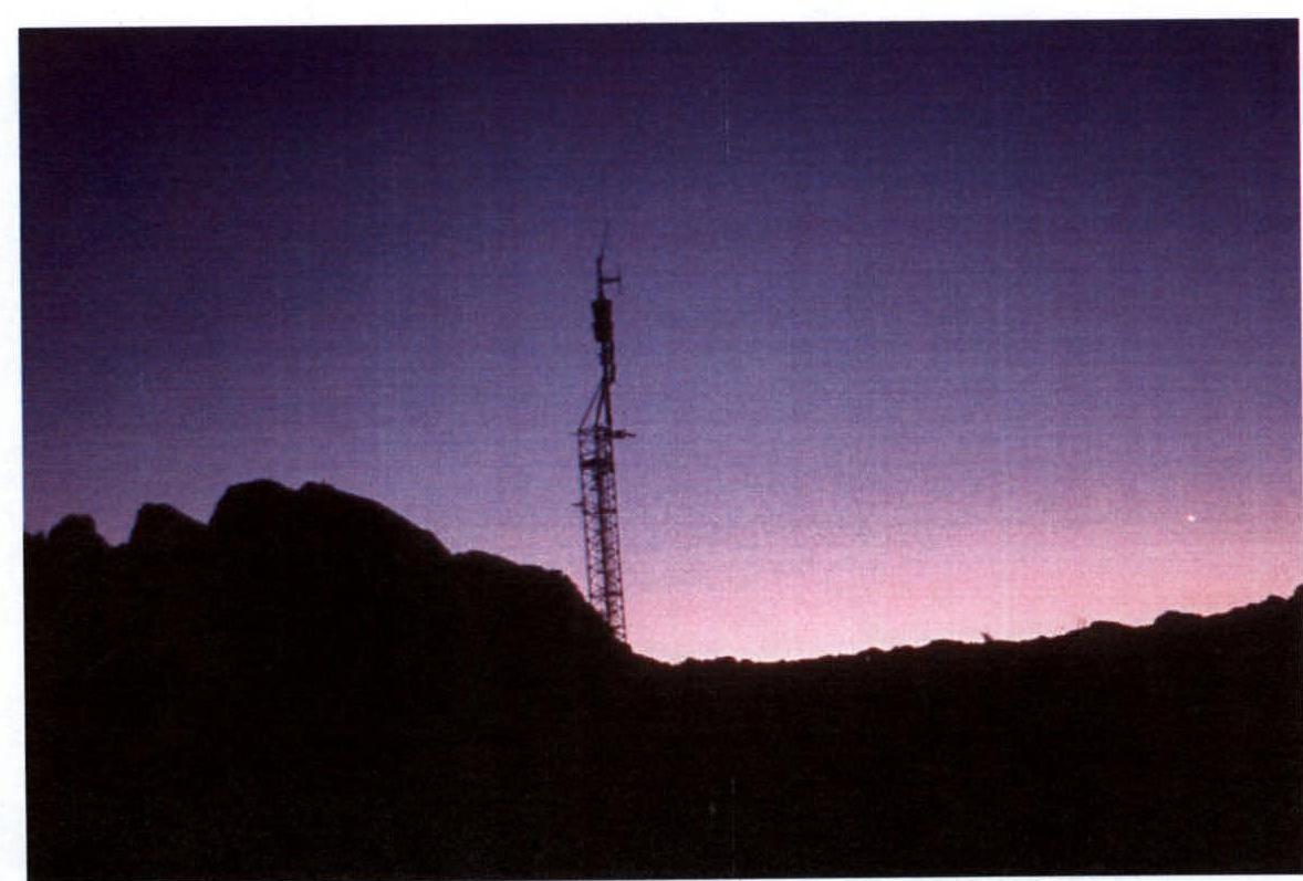
A cellular communication antenna is installed at the summit. We were at the summit in complete darkness, so there is no photograph of the team at the control tour.
Brief Description by Sections
R0–R2: Uncomplicated gentle slabs with rich relief, leading to a large shelf-terrace.
R2–R3: Inner corner ending in a cornice with a 1.5 m overhang.
R3–R4: Gentle slabs, climbing is not difficult, but organizing protection is problematic.
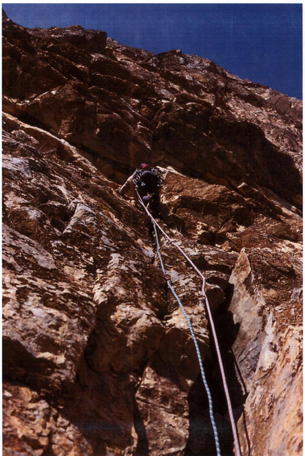
R4–R5: Vertical slabs with poor relief but safely drilled with bolts. Climbing 7a.
R5–R6: Vertical slabs, climbing up to 7b, then a pendulum to the right into an inner corner, ascent through the inner corner to a gentle shelf, and along the shelf, traverse left to the station.
R6–R8: Vertical crack. Climbing up to 7a.
R8–R9: The crack abuts a cornice with a 1 m overhang on the left. Climbing up to 7a.
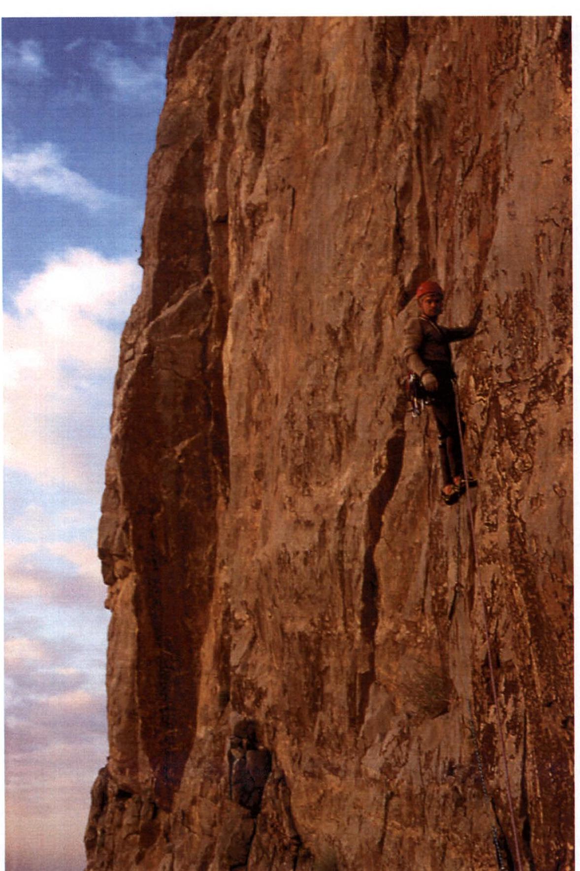
R9–R12: System of inner corners. Climbing up to 6c.
R12–R13: Monolithic slab with a steepness of up to 70°, no possibility to organize protection. Climbing 5b–5c.
R13–R14: Overhanging inner corners. Climbing 6b+.
R14: Shelf suitable for a sitting bivouac.
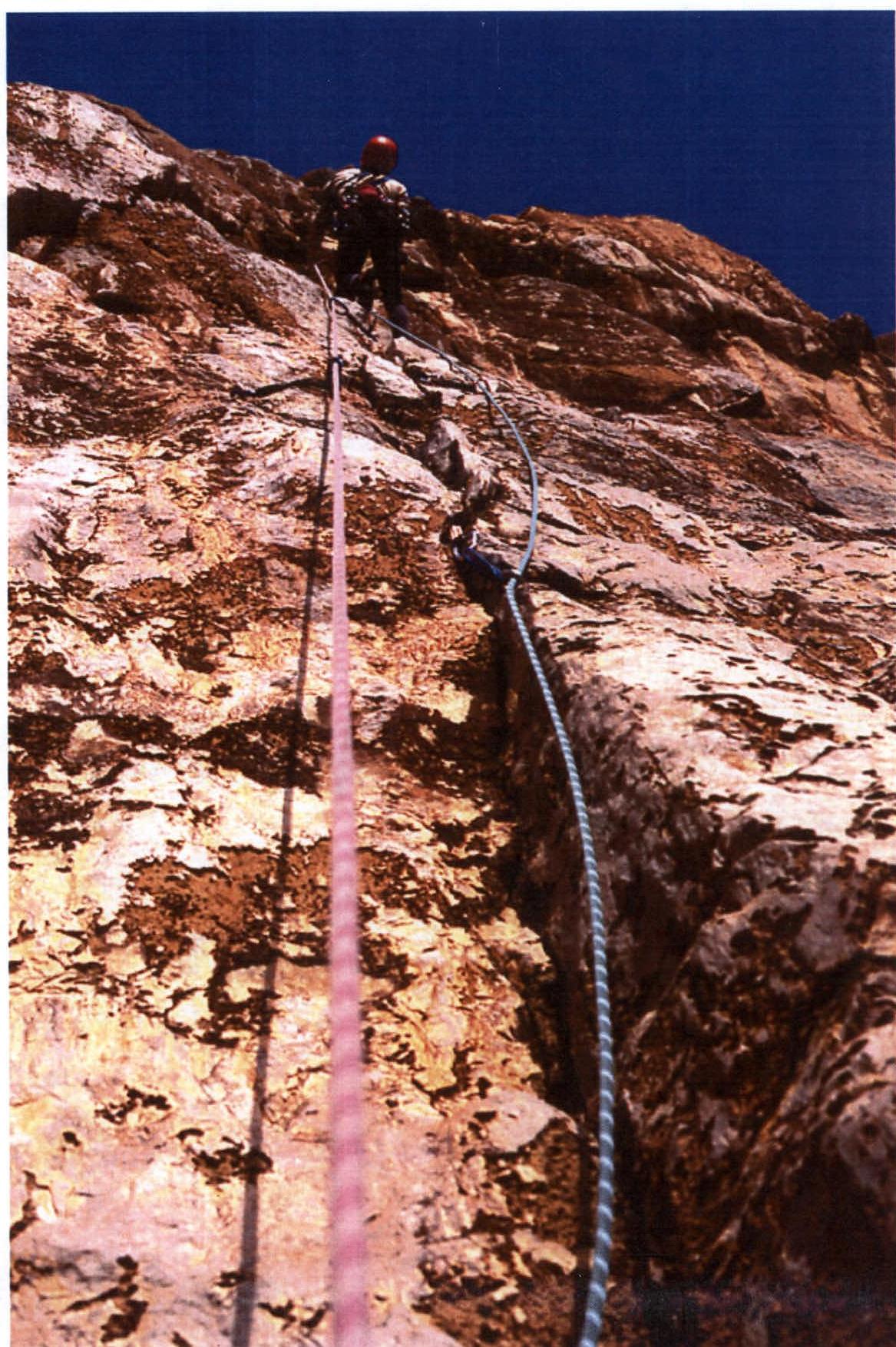
R14–R16: Vertical cracks. The rocks are slightly destroyed.
R16–R18: Inner corner leading to a large shelf-terrace.
R18–R26: The route becomes significantly gentler and represents a system of uncomplicated shelves but with complex 3–10-meter rock sections between the shelves.
The summit of the mountain is a flat plateau, slightly inclined to the north. Above section R26, protection is not required.
The reverse side of the mountain:
- Not steep but cut by many canyons and faults.
- You can descend without a single rappel.
- You need to descend, veering left – towards the settlement.
- In some places, you will have to descend by climbing, descent points are often marked with cairns.
- The descent is long and tiring – 5 hours 30 minutes of unpleasant scree.
After descending:
- You find yourself on the road on the other side of the Jabal Misht massif.
- To the base camp – about 20 km of asphalt road.
Tactical Actions of the Team
The great length of the route and the lack of bivouac sites on the most challenging part of the wall (R2–R14) determined the team's tactics.
On December 29, we scouted the approach to the wall from the base camp and carried the main part of the equipment.
On December 30, we approached the wall and began the ascent. We passed the uncomplicated section at the beginning of the route (R0–R2) and reached a good shelf for a bivouac. Leaving bivouac equipment on the shelf, we processed the section R2–R6, including the first critical section of 7b with a pendulum.
The next day, we climbed the fixed ropes in daylight and continued the ascent. Section R6–R14 is a wall section of the route where all stations are inconvenient and hanging. Our task was to reach section R14 in a day, where we could organize a sitting bivouac. We accomplished the task.
Further, after four more complex ropes R14–R18, we climbed onto a large shelf. From the second bivouac, we reached the ridge in daylight and climbed to the summit in the dark at 19:00 on January 1.
On the same day, we began the descent but spent the night on the descent and descended to the base camp only the next day – January 2.
Throughout the route, the first climber in the team moved on a double rope with free climbing (except for cases of climbing on fixed ropes), and the second climbed on a jumar with top rope or also moved by climbing.
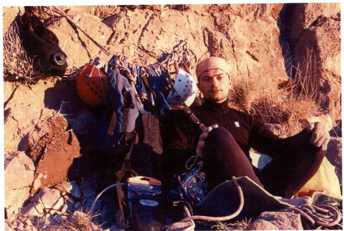
List of Equipment Used
The choice of equipment was determined by the following circumstances:
-
Specific weather and climatic conditions of the ascent area (daytime temperature +22°C and nighttime +8–+10°C)
-
Dry air
-
Lack of water both on the route and on the approaches/withdrawals, the nature of the rocks – monolithic, almost without cracks, limestone. The main weight on the route is water.
-
Water bladder 10 l – 1 pc.
-
Hydration systems (water bottles) 2 l – 2 pcs.
-
Plastic water bottles – 3 pcs.
-
Dynamic ropes diameter 9.8 mm – 2 pcs.
-
Nuts – 1 set
-
Friends – 1 set (10 pcs.)
-
Extension and station loops – 6 pcs.
-
Quickdraws – 14 pcs.
-
Screwgate carabiners – 14 pcs.
-
Chalk bag – 1 pc.
-
Rock shoes – 2 pairs
-
Jumars – 3 pcs.
-
Camping mat – 1 pc.
-
Emergency blanket – 1 pc.
-
Dry fuel – 1 pack
-
1 l pot – 1 pc.
-
Backpacks – 2 pcs. (40 l and 15 l)
-
Mobile phone – 1 pc.
-
Camera – 1 pc.