
Report on the First Ascent of Grosvenor Peak via the East Face, Presumably Category 6A
2011 Russian Mountaineering Championship in the High-Altitude Technical Class.
- Region — Eastern Tibet, Sichuan Province, China
- Grosvenor Peak (Grosvenor), 6376 m, ascent via the East Face
- Proposed category: 6A, first ascent
- Route type: Combined
- Route elevation gain: 1080 m
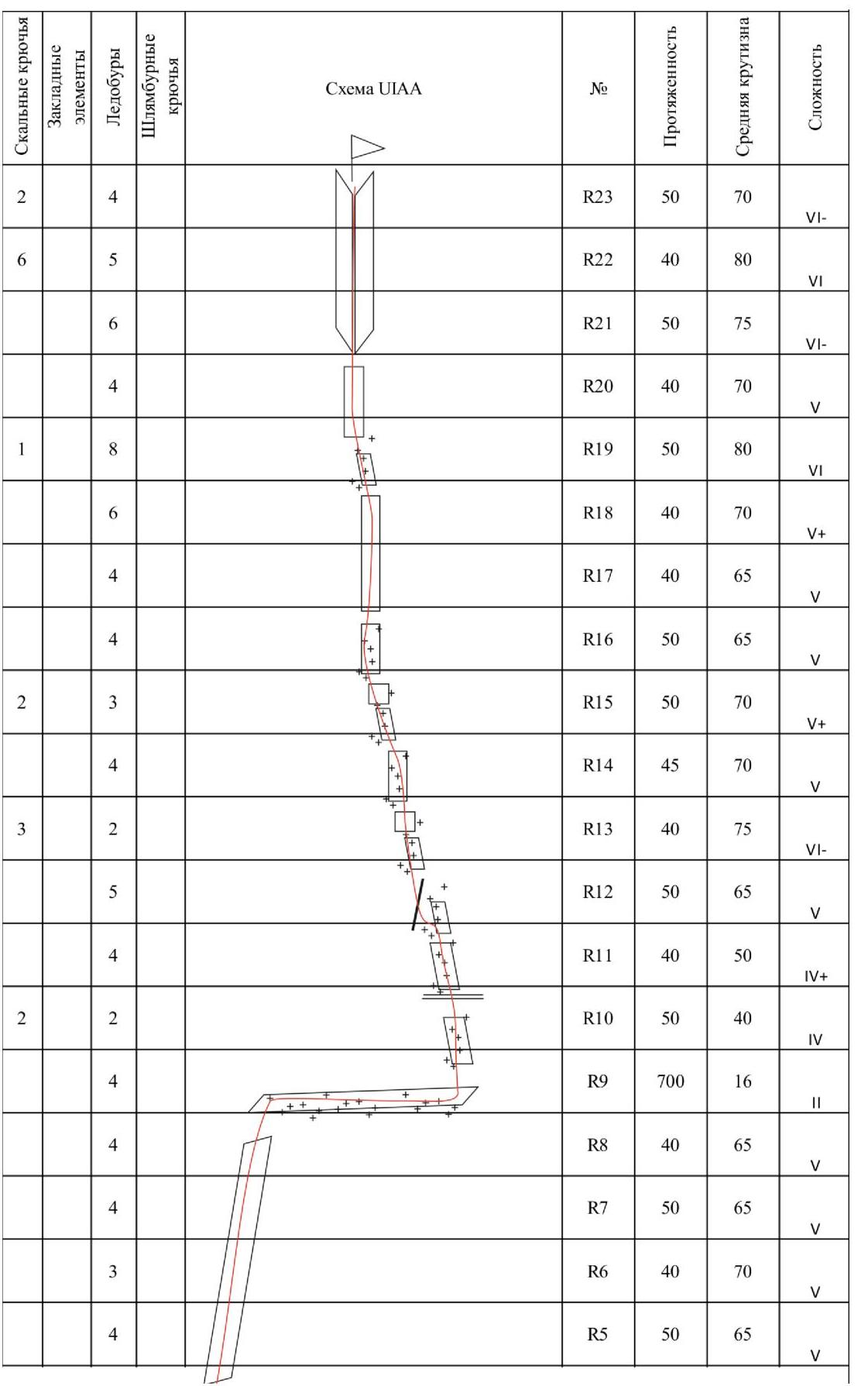
Route length: 1735 m
- Length of 2nd category sections — 700 m
- 4th category — 190 m
- 5th category — 585 m
- 6th category — 260 m
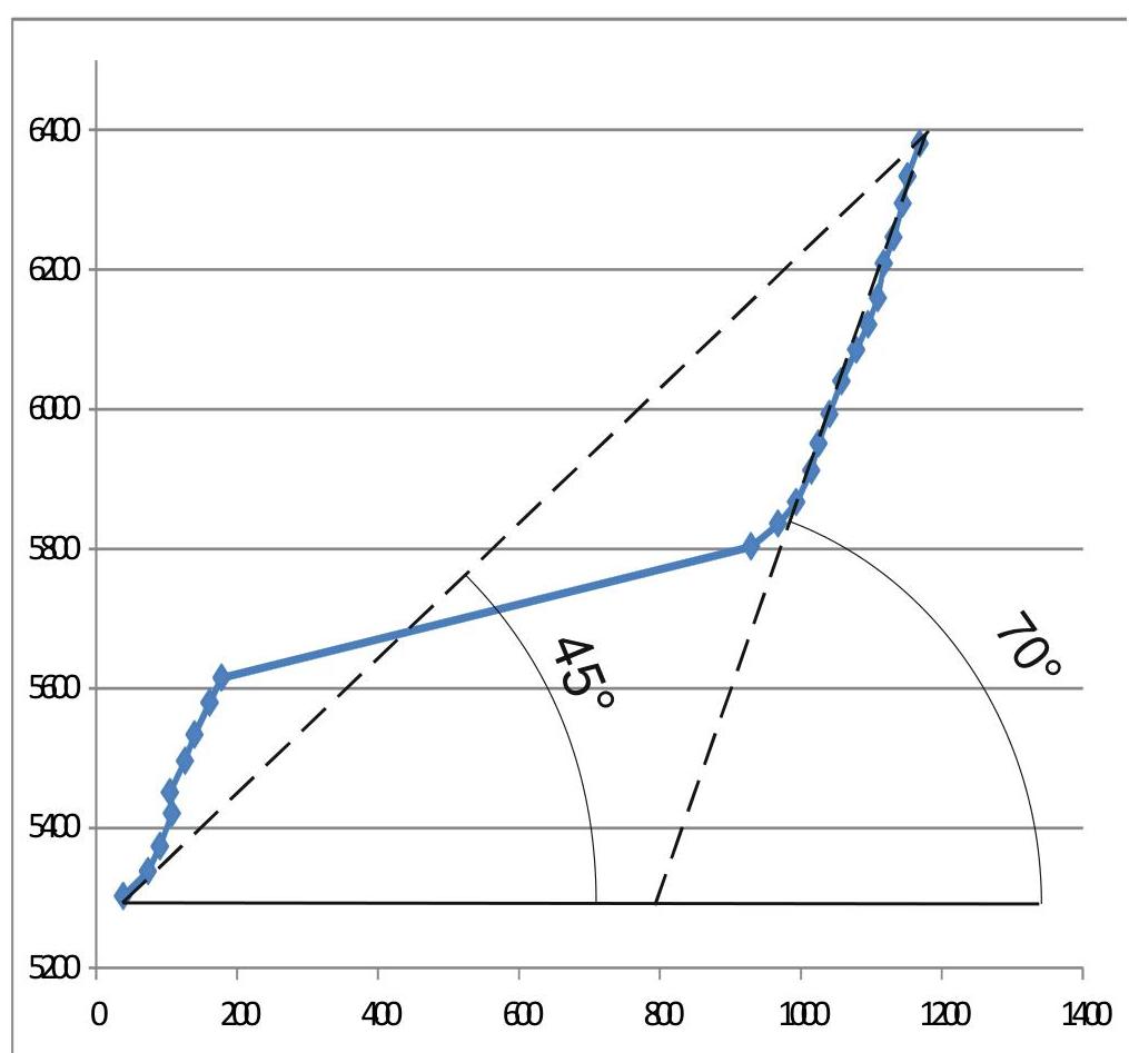
Average steepness of the main wall section: 70°
Overall route steepness: 45°
- Hooks left behind: 3
Used rock anchors: 19, ice screws: 89, placements: 4
- Team's total climbing hours: 56, including 11 hours of approach
- Participants:
Sushko Denis Sergeevich, Master of Sports Paramonov Dmitriy Andreevich, Candidate Master of Sports
- Departure to the route: October 31 Reached the summit: November 4 Returned to base camp: November 6
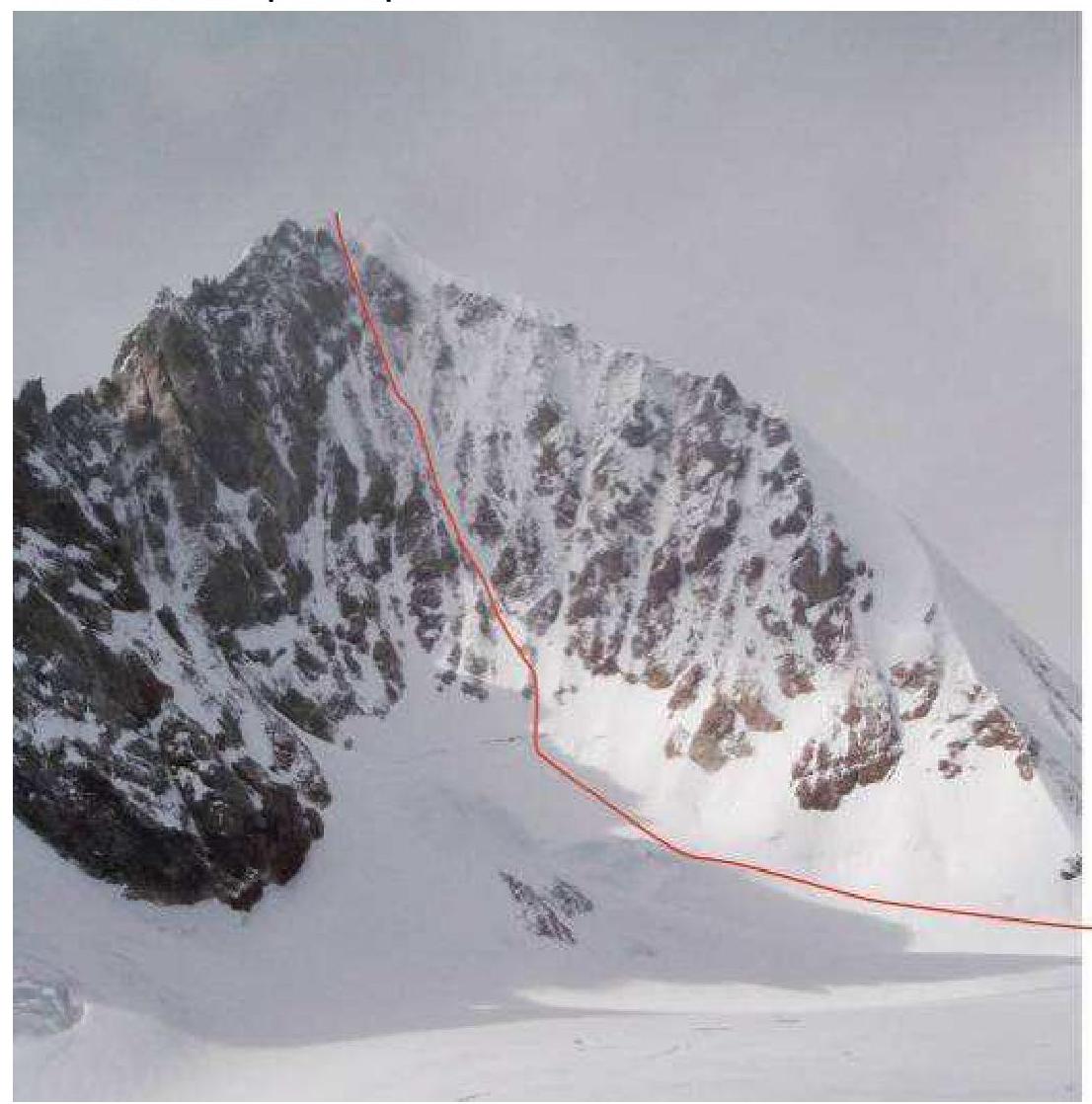
Grosvenor East Face
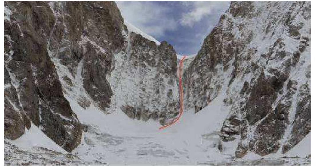
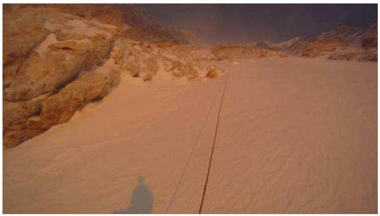
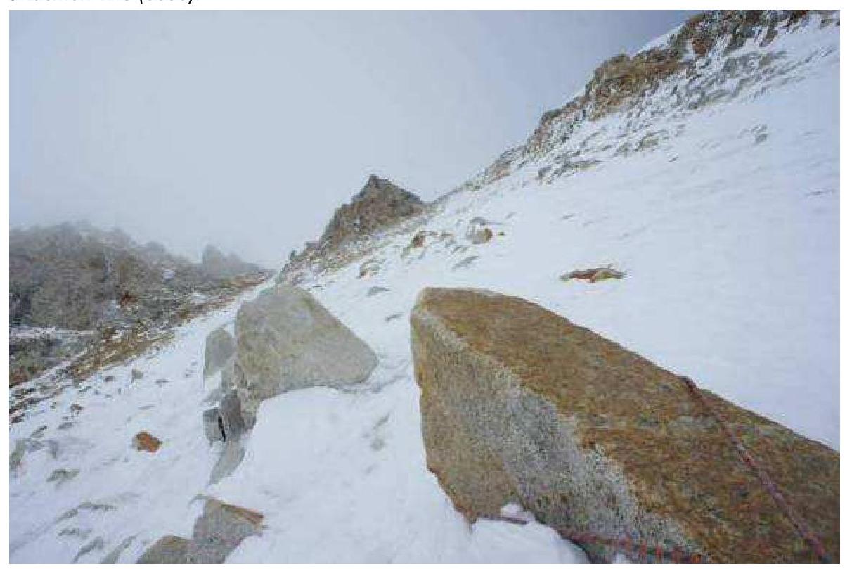
Start of the route — reaching the pass
Profile view of Grosvenor's East Face (Google Earth)
View of Grosvenor and surrounding peaks
Drawn Route Profile
Y-axis: height difference, X-axis: horizontal deviation of the route (in meters).
Absolute heights: start of the route — 5300 m above sea level, summit — 6376 m above sea level.
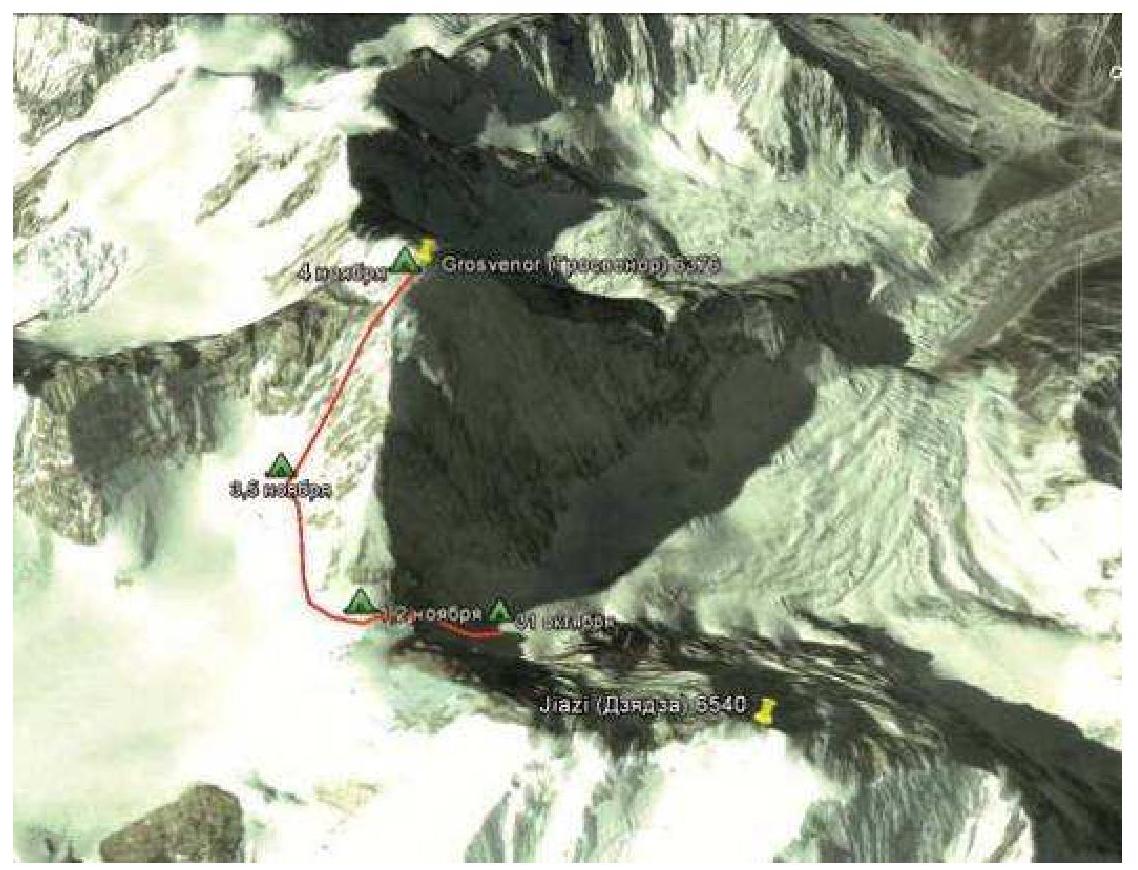
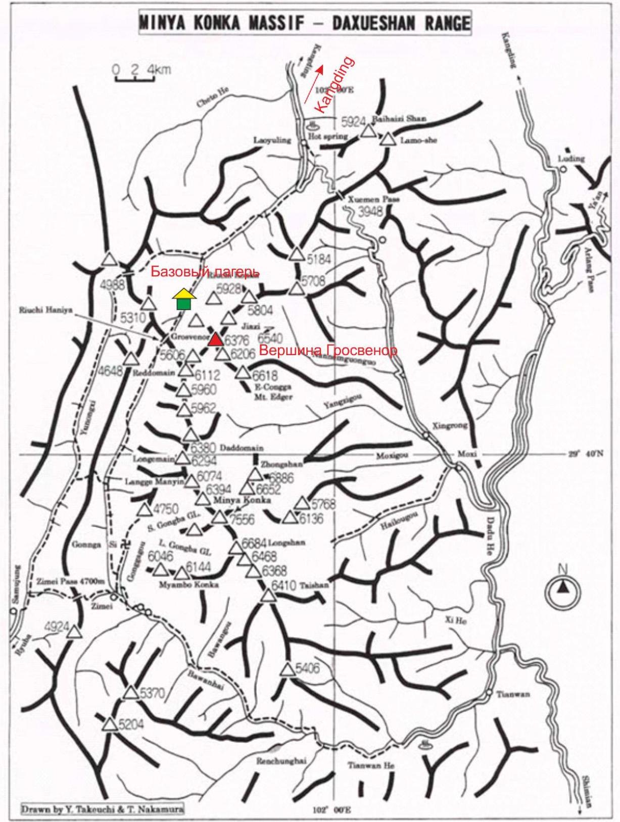
Area Overview
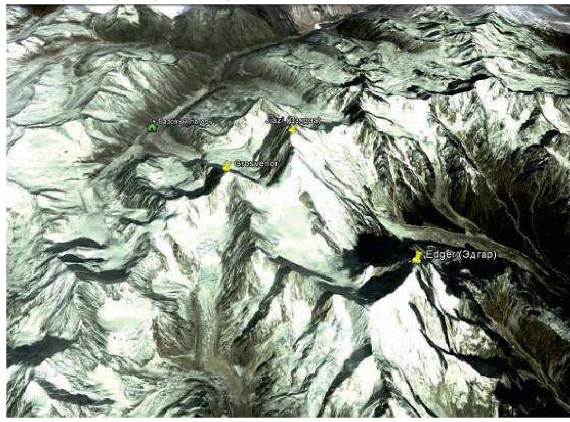
The eastern spurs of the Himalayas are rich in relatively unexplored peaks above 6000 m. The highest among them, Daxue Shan and Miya Konka, exceed 7000 m. In the Minya Konka ridge and its spurs, there are over 10 peaks above 6000 m, some of which are unnamed. This group includes the peaks of Dzyadza (6540) and Grosvenor (6376), located in the upper part of the valley rising from the town of Kangding.
The region is characterized by a monsoon climate. The best time for climbing is spring to autumn. However, weather conditions, unlike in the greater Himalayas, are less stable. The monsoon's influence is weakened.
Grosvenor Peak faces the valley and base camp with its west face. The west face was first ascended in 2003 by a team of English climbers. This face currently has 3 routes and is the most popular among climbers. The north face, oriented towards Dzyadza Peak, and the east face remained unascended until now. The north face poses an objective danger due to the overhanging pre-summit ice cap. During the expedition, the wall experienced multiple icefalls.
The east face is oriented towards Edgar (6618) and is the most inaccessible. The approach to the wall is from a plateau at an elevation of 5700–5800 m. The ascent to the pass on the plateau is technically challenging and is done via a couloir with combined terrain (ice and rock), with an overall steepness of 70° and sections up to 95°. Apparently, due to its inaccessibility, Grosvenor's east face remained unclimbed until now.
Area map
Ascent graph

UIAA Scheme
Route Description
The route goes through the center of the east face, leading to the summit. The wall has a weakly pronounced concave profile, gradually increasing in steepness as it approaches the summit. The main landmark along the route is the summit ridge, which is reached from a couloir (R21–R23). The exit from the couloir is visible throughout the route and serves as a good landmark. Overall, moving up the wall is accompanied by a gradual, slight shift to the left. Due to daily snowfalls, rock slabs were often covered with non-firn snow, creating additional difficulties in movement. In the lower part of the route, snow depth exceeded 1 m in places, significantly slowing the pace and complicating belay organization. During the ascent, additional challenges were posed by unstable weather, characterized by continuous cloud cover and snowfalls, typically in the second half of the day. Temperature conditions were relatively favorable, not dropping below –25 °C and averaging –10–15 °C.
Ice screws were primarily used for belays. The ice was layered and thin. Rocks were monolithic but covered in snow, making belay organization difficult. The route's wall section is relatively rockfall-safe due to the absence of melting even in sunny weather. The pass ascent poses an objective danger. In the upper part of the couloir, ice contains embedded rocks that are easily dislodged by rope. The couloir is well "shot through." The degree of rockfall danger is medium.
Here is a description of the route by sections:
- The route begins on a flat plateau at 5300 m below the wall, leading to the pass. The ascent is via the right couloir. After crossing the bergschrund, the ascent follows the snow-filled gully (R0–R2). Then, leftwards up the left wall of the couloir, the route leads under a weakly pronounced steep internal corner (R3). Section R4 is the most challenging, featuring a 15 m overhanging wall covered in ice. After passing the overhang, the route follows an inclined slab to a more gentle slope (65°–70°), then continues on ice (R5–R8) to the pass, exiting onto the plateau and approaching the wall to the right. (10 hours)
- From the 5800 m camp, through the bergschrund, left and up a snowy slope, the route reaches a rock "island" in the center of the wall (R10–R12), crossing a weakly pronounced counterfort.
- Further left and up, the route progresses with firn mixed with rock slabs at 65°–70° (R13–R16). Above R16, firn gives way to ice, also mixed with rock outcrops, with steepness increasing to 70°–75°.
- The summit is reached via a narrow couloir with 75°–80° steepness (ice and rock) and a length of 120 m.
Team's Tactical Actions
The goal was the first ascent of Grosvenor Peak's east face. The main challenge was the wall's inaccessibility and the area's unstable weather. Given the multi-day ascent (over 3 days), relying on short-term weather forecasts was not feasible. Weather conditions generally alternated between days with variable cloud cover and days with heavy snowfalls. Typically, in days with variable cloud cover, the second half of the day also saw snowfalls and strong winds.
For this reason, planning focused heavily on increasing the group's autonomy in case the ascent took longer. Most of the gear was cached during acclimatization trips to the advanced camp at 5300 m. The route was ascended in alpine style.
Here is the route chronology:
- 31.10: Arrived at the route base from BC (8 hours)
- 1.11: Covered 400 m. Reached the pass. Set up camp on the pass (10 hours)
- 2.11: Started the first attempt at 7:00. Deep snow hindered the approach to the wall (2 hours); by 9:00, reached the bergschrund area (5800 m). After covering 100 m up the wall, couldn't proceed further. Deep fresh snow had thawed in the sun and wouldn't hold on the firn. Slipping down several meters periodically. By 12:00, decided to abort the attempt, leaving a fixed rope, and descended to camp. Planned to start earlier the next morning, using the tracks, approach the wall, and climb the lower part of the wall with deep, thawing snow before sunrise.
- 3.11: Strong wind. Snow. Tracks were snowed under. Decided to move the camp under the wall at 5800 m to save time.
- 4.11: Departed at 6:00; by 7:30, reached the fixed rope anchorage (altitude 5850 m), continued upwards. Snow was frozen, significantly increasing the pace compared to the previous attempt. Began encountering mixed terrain — slabs covered with a thin layer of firn. Ice was thin and layered; anchor hooks worked well on rocks. Weather was favorable. By 14:00, weather deteriorated; the summit was clouded over, and wind picked up (altitude 6150 m). By 16:00, approached the pre-summit couloir (altitude 6250 m). Decided to continue the ascent and bivouac on the summit without a camp. By 18:00, reached the top of the couloir and the summit, dug a cave in the ridge, practically on the summit.
- 5.11: Began descent at 9:00. By 11:00, weather worsened again. Strong wind and snowfall. Descended via rappel on the ascent route, leaving loops and anchor hooks. By 18:00, crossed the bergschrund and descended to the tent at 5800 m.
- 6.11: Continued descent. Departed at 11:00; by 21:00, descended to base camp.
Team leader: Sushko Denis.
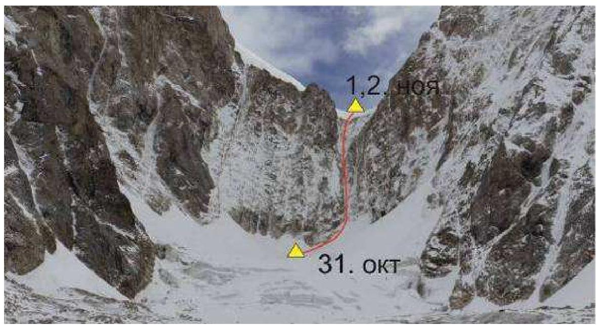
Photo Report
- Start of the route — reaching the pass.
- Start of the wall just above the bergschrund (5850 m).
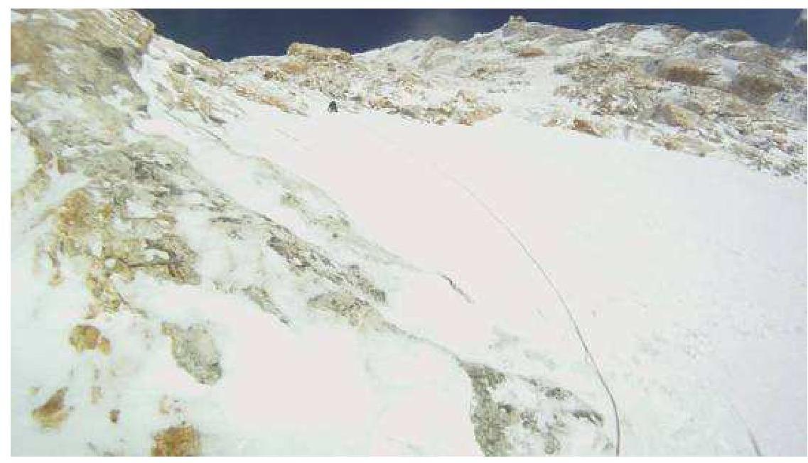
- R13 — end of the firn section, transition to rocks (5900 m).
- Left view of section R14 (5950 m).
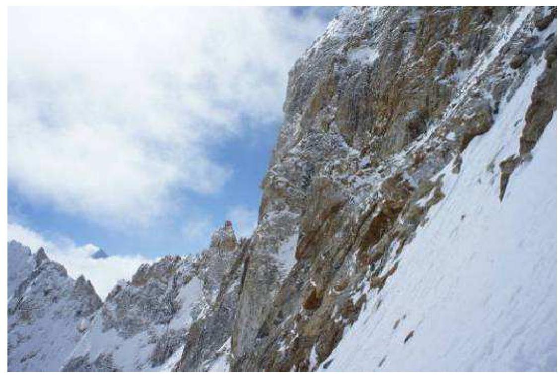
- Section R15 (6000 m).
- Below the couloir near the summit — section R20 (6200 m).
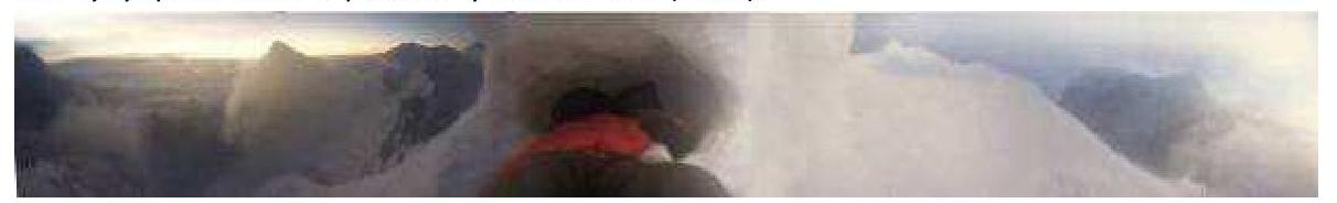
- Panorama from the bivouac site on the summit.
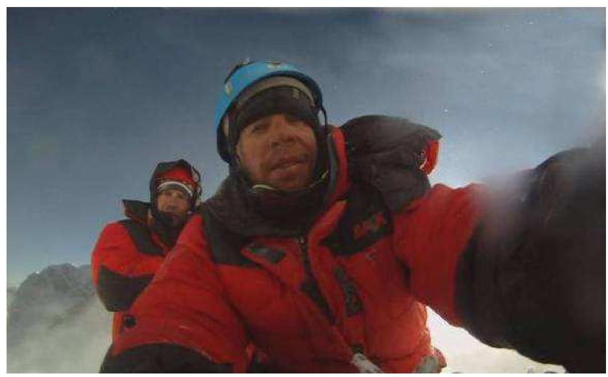
- Photo on the summit. In the foreground is Dmitriy Paramonov; in the background is Denis Sushko.
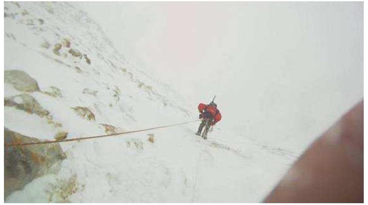
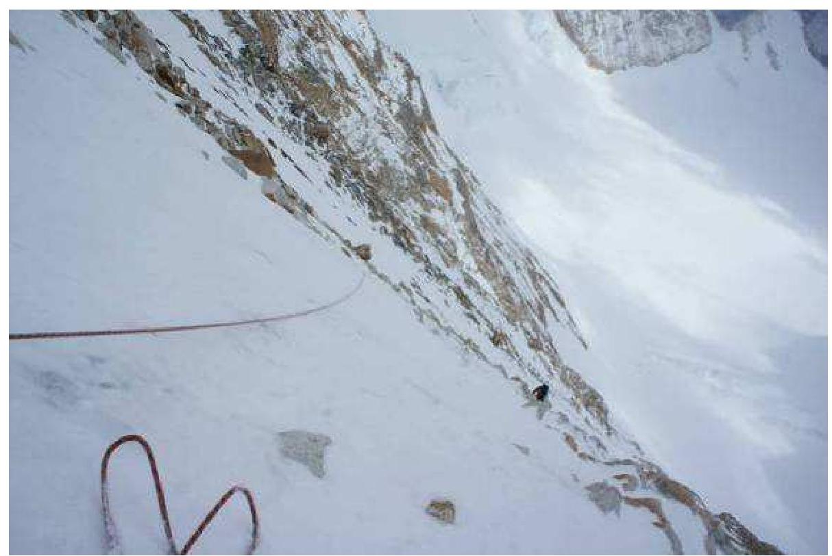
- Descending at R16 (6050 m). Strong wind, snowfall.