
Ascent Passport
-
Central Karakoram, upper reaches of Baltoro Glacier.
-
Broad Peak (8047 m), Southwest Face, first ascent
-
Submitted as category 6B complexity
-
Route type – combined
-
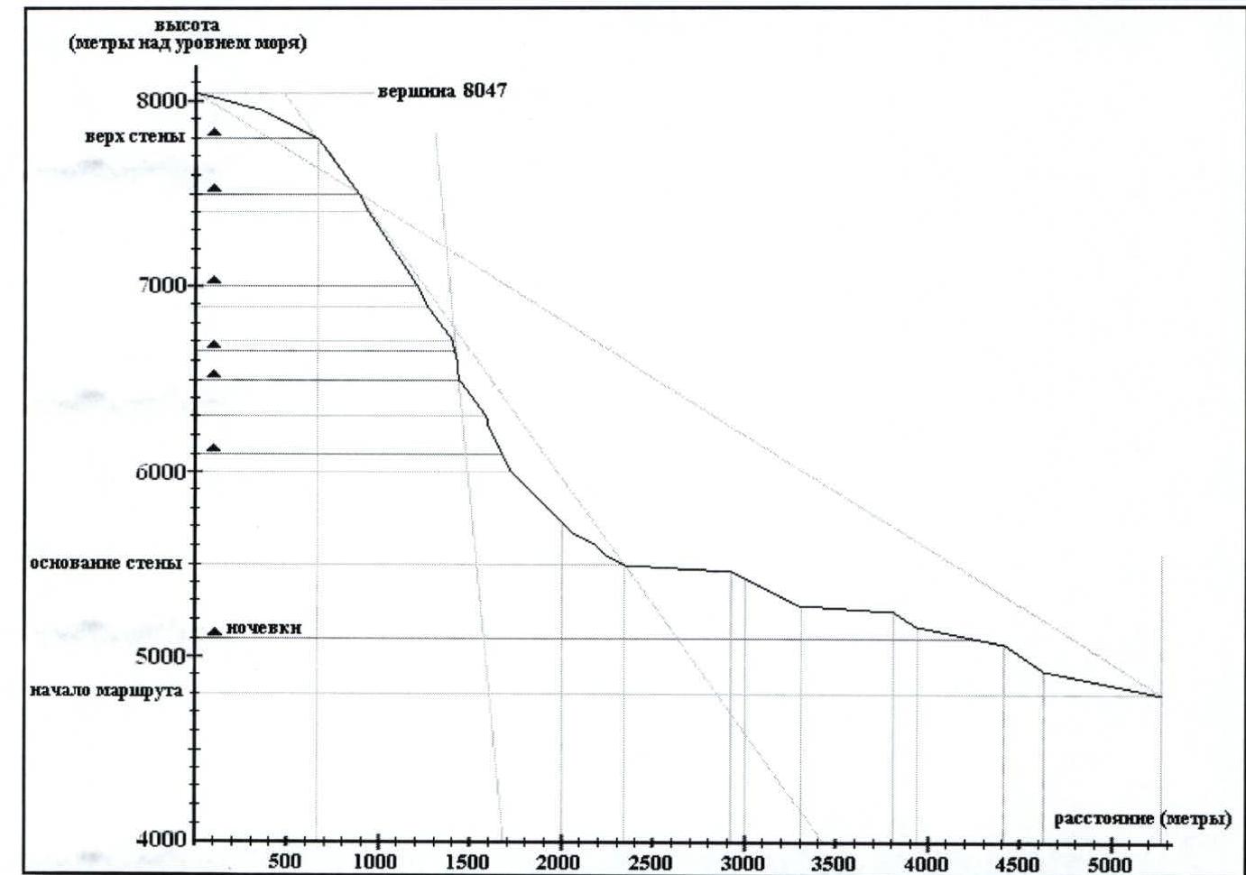
Route height difference – 3247 m Route length – 6067 m Section length: category V – 93 m, category VI – 12 m. Average slope: main part of the route (sections R18–R70) – 54°, entire route – 31.5°.
-
Pitons left on the route: total – 0, bolted – 0
Pitons used:
Rck Bolt Ice Cam. elem. Friend 46 0 61 30 31 2 0 0 1 1 -
Team's working hours on the route: 97 h 30 min
-
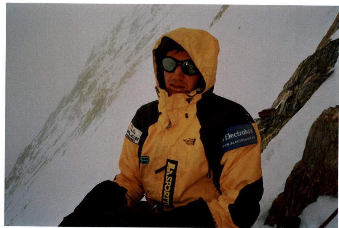
Participants: Uryubko Denis — Master of Sports of International Class Samoilov Sergey — Candidate Master of Sports
-
Team coaches: Samoilov Sergey — coach of the Kazakhstan ЦСКА, Gorbunov Yuri — coach of the Kazakhstan ЦСКА
-
Departure to the route: July 18, 2005, 13:00 Summit: July 25, 2005, 11:30. Descent to Base Camp: July 25, 2005, 20:30
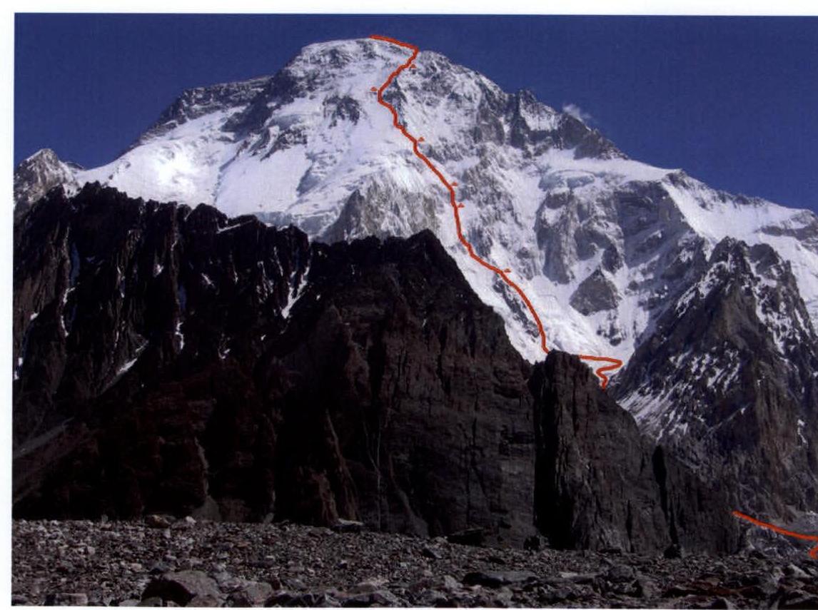
Route on Broad Peak's Southwest face traversed by the Kazakhstan ЦСКА team
Photo of the route from West–Southwest, from a distance of about 6000 m from the face.
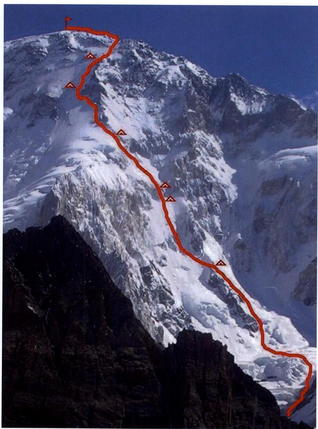
Drawn profile of the route
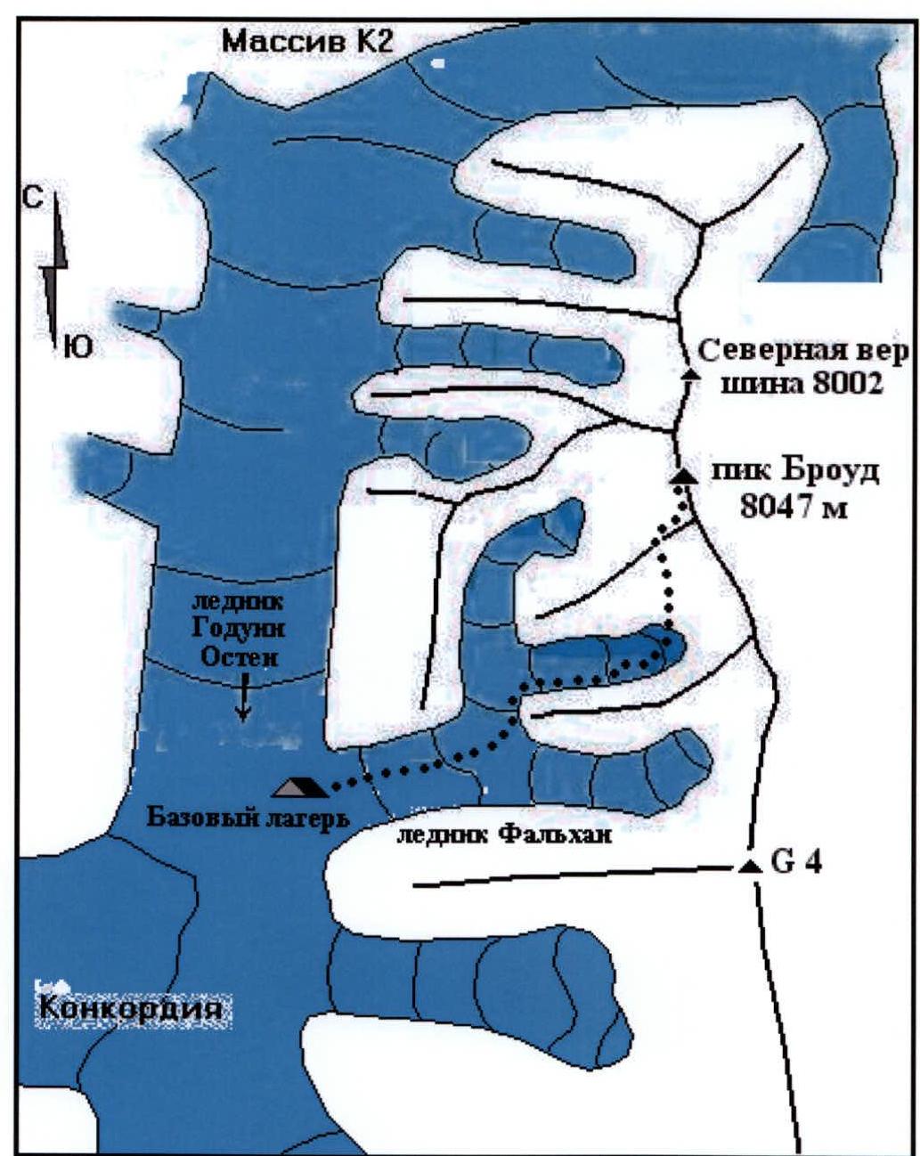
Map of the ascent area
Ascent Schedule
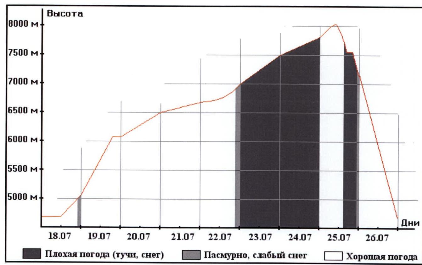
Note: on the summit day, July 25, the weather was clear only above 7600 m; below that, everything was covered in clouds, and it was snowing. Moreover, above the cloud layer, there was a strong wind – about 80 km/h.
Brief Description of the Ascent Area
Broad Peak is located in the Karakoram system (Black Debris), part of the overall Asian mountain system – the mountain node. Karakoram is a "nodal" point of mountain ranges (Pamir, Kunlun, Himalayas, Hindu Kush) and has been known to people for a very long time. Caravan routes from China and India to the West passed through five-thousand-meter passes and along the spurs of these mountains. Scientific research in these mountains during the period of British expansion in Asia was conducted by British geodesists, who gave names to most local relief features, including peaks.
Weather conditions here are not as strongly influenced by monsoon cycles as the Himalayas, although their influence is felt. The winter monsoon is particularly noticeable due to the proximity to the Tibetan Plateau and the Gobi Desert. In the summer, due to the remoteness from the ocean, Karakoram does not receive the bulk of precipitation that falls on the plains and foothills, resulting in a drier climate than in the Himalayas. However, it is still in the summer that a huge amount of snow accumulates here, forming the modern glaciation of Karakoram. Valley glaciers reach 50 km in length: Siachen, Biafo, Baltoro.
Due to the relative youth of the mountain system and the strength of the constituent rocks, the relief here is extremely dissected, alpine, with pronounced peaks, ridges, and deep valley depressions. The height differences are grandiose: Broad Peak (8047 m) rises above Concordia (4600 m) by almost three and a half kilometers. K2 (8611 m) rises from its foot (5100 m) by more than 3500 m.
The main climbing season here is summer. This is due to the weakness of the summer monsoon, and the fact that the harsh cold climate of the mountains, located much further north than the Himalayas, does not allow for much activity at other times.
Broad Peak (also known as Falchan Kangri) – the twelfth highest peak in the world – is located in the upper reaches of the Baltoro Glacier, formed by the confluence of the Godwin-Austen and Falchan glaciers. This place is called Concordia and is located at an altitude of 4600 m above sea level. The Gasherbrum ridge stretches in a meridional direction and contains a group of independent peaks: Broad Peak, Gasherbrums 6–1 (the latter also has an independent name, Hidden Peak).
Attempts to climb Broad Peak were not made before World War II. Only speculative statements were made about the possibility of ascent via routes from the west by O. Diemberger and other researchers. At that time, everyone's attention was focused on:
- Everest as the highest point in the Himalayas and the planet;
- K2 as the second highest peak in the world, the highest point in Karakoram;
- Germans were "fixated" on Nanga Parbat.
Broad Peak was first conquered in 1957 by an Austrian expedition. This was the first team in the Himalayas to abandon the use of high-altitude porters and work. On June 9, 1957, Schmuck, Wintersteller, Diemberger, and Buhl reached the summit. Today, their ascent route is called the classic route and is the most commonly used route by the vast majority of climbers.
The Southwest face is a mix of rock and ice belts. This is especially evident in the lower part, and above 7000 m, the overall steepness remains almost the same, making it difficult for glacier ice to form, and the entire route becomes rocky. A particularly unpleasant aspect of these sections was that over millions of years, avalanches and small rocks had smoothed out the relief. Slabs and bastions are almost devoid of cracks, interspersed with smooth grooves. Snow accumulation here is extremely difficult, which applies to the entire route. With a western orientation, it receives precipitation that sticks to it in the form of snow, accumulating even under cornices and on vertical sections.
The rocks that make up Broad Peak are marbleized limestones and shales. This results in:
- various colors of route sections – from yellow to black;
- different structures of the rocks.
Due to the strength of the constituent rocks, the relief is comparatively weakly dissected and destroyed, with few loose rocks. Despite the apparent lack of cracks, they are sufficient for organizing protection points. Climbing the relief is reliable, although extremely tense, as holds are mostly small. The presence of icefalls in the lower and middle parts of the face increases the objective danger of the route, requiring climbers to:
- strictly adhere to the work schedule – in the mornings;
- use alpine style to avoid multiple passes under the base of the face;
- work at a high speed.
Preparation for the Ascent
The duo's functional training took place at the ЦСКА sports bases in Kazakhstan – in Almaty and the Tuyuksu valley at altitudes of 2400–4000 m. Training is conducted year-round and is regular and intense. Additionally, the participants are ЦСКА employees, allowing them to freely regulate their training schedule. The technical part of the training included practicing rock technique at the Ili River rock climbing gym, on natural relief, and during ascents in the winter conditions of the Tian Shan highlands. Immediate preparation included:
- participation in the Winter Championship of Almaty (routes 4A–4B complexity) in the Tuyuk-su valley.
- winter training camp in the Ala-Archa valley (routes 5A complexity).
- competitions in alpine duo – speed ascents along the trail with a height difference of 300 m and on rocks.
- one and a half month rock climbing camp (April–May) in the Tamgaly-Tas tract, participating in two competitions, including those on "Domбайские связки".
Conducting the Ascent (Expedition)
On July 5, the Base Camp (BC) of the expedition was established at an altitude of 4700 m at the confluence of the Godwin-Austen and Falchan glaciers. Here, on the moraine, there was a convenient and safe area for tents.
From July 6 to 8, the team conducted several exits along the right (orographically) bank of the Falchan Glacier to visually familiarize themselves with the proposed route and ascended to an altitude of 5200 m.
On July 9 and 10, preparations were made for the exit, and final discussions were held on the choice of route and tactics, during which:
- Italian participants decided to attempt to ascend Broad Peak via the usual route;
- Kazakhstan participants decided to work on the Southwest face of Broad Peak independently.
On July 11, the Uryubko–Samoilov duo ascended to Camp 2 (6100 m) via the classic route to gain necessary acclimatization.
On July 12, the duo ascended to Camp 3 (7200 m) via the classic route. Bad weather set in, and it started snowing.
On July 13, after an overnight stay, the climbers were forced to begin their descent because further stay at 7200 m became extremely dangerous due to the large amount of snow. By evening, all expedition members had returned to Base Camp.
From July 14 to 17, participants remained in Base Camp, preparing for the ascent and recovering from the acclimatization exit. The weather was bad all these days, with abundant precipitation, which caused heavy snow cover on the route.
On July 18, the weather improved, and the Uryubko–Samoilov duo set out towards the start of the route at an altitude of 4800 m. After crossing the Lower Icefall of the Falchan Glacier, they spent the night at an altitude of 5100 m at the beginning of the next icefall.
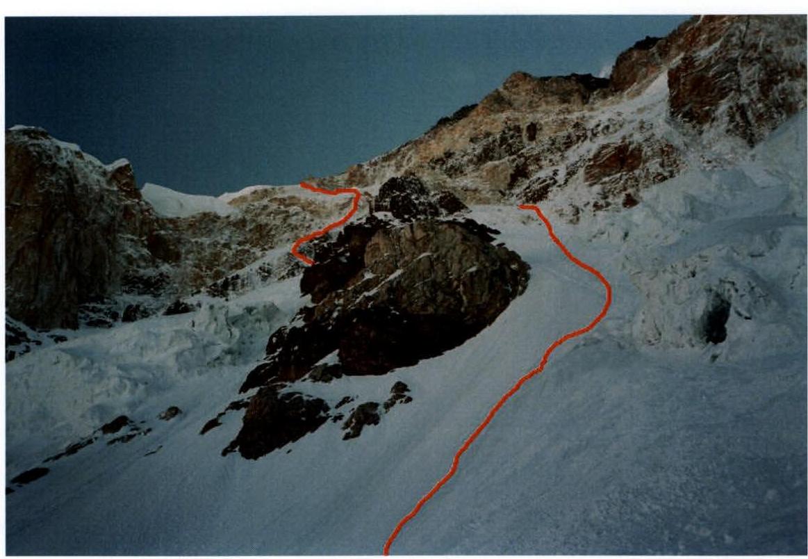
On July 19, having traversed along the left (orographically) edge of the glacier, overcome the Middle Icefall, and ascended through the Upper Icefall to the base of the face at an altitude of 5500 m. From here, along a snow-covered ice slope with a 3–5 cm layer of snow, they continued their ascent along a rock ridge with a characteristic "Fish" shape extending upwards. Movement was done with simultaneous protection, and only at the base of the rock face, before exiting onto the ridge to the left, they had to climb one rope (50 m) with alternate protection. At this safe location, away from rockfall and avalanches, at an altitude of 6100 m, they stopped for the night.
On July 20, they continued their ascent along the ice slope towards the base of the "Black Rock Belt" diagonally left and upwards. The first climber worked with lower protection on a double rope, while the second ascended with upper protection along the perils. The beginning of the ascent went through a wide rock gully filled with ice. After 50 m, fearing rockfall and snow avalanches from the upper part of the face, they turned left under an overhang and climbed up a diagonal slab to the top of the "Black Belt". The rocks are slab-like – shale with deep cracks, weakly dissected. Further along the ice slope to the base of the "Yellow Rock Belt", where, under the cover of the central bastion, they carved out a ledge in the ice and stopped for a sitting bivouac.
On July 21, the duo worked on the rocks. The marbleized limestone provided little room for organizing reliable protection points, which was compensated by experience. The rocks, sometimes sheer, were covered in a layer of snow, making work extremely difficult. The second participant significantly unloaded the leader, allowing them to work faster on steep rocks. For the day, the duo climbed three ropes (150 m) through an exceptionally complex section of the bastion between two steep gullies, dangerous for rockfall and avalanches. They organized their bivouac on a rock ledge, stretching the tent on rock pitons.
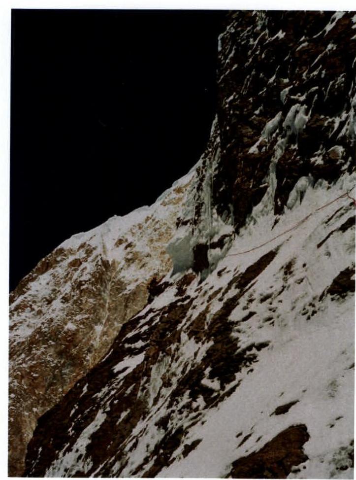
On July 22, with the first signs of dawn, they continued their movement upwards, climbed the remaining section of rock relief, which turned out to be heavily iced, and exited onto an ice slope with a steepness of about 50°. The ascent along the ice was done with protection using a single rope, used by the second climber as a peril. Traversing left and pressing against the rocks, they moved away from the line of possible ice serac fall that had formed here. Above it, they traversed left again, along mixed sections of the "Window" – a section of non-steep rocks that allowed them to bypass the bastion. From here, working directly upwards along an ice-snow slope with a steepness of about 60°, they climbed onto the ridge, where at an altitude of 7000 m they found a small platform. Expanding it, they set up a tent.
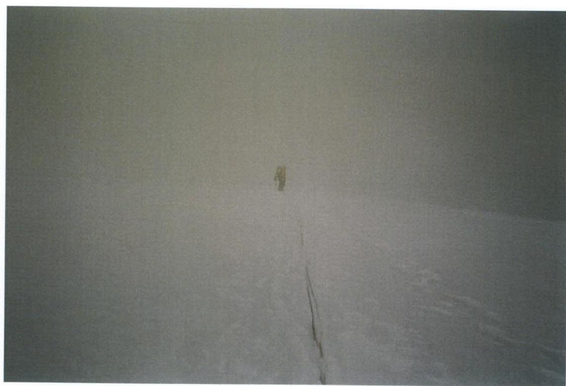
On July 23, the weather deteriorated, snow was falling, and everything was shrouded in dense fog, limiting visibility to 100 m. They continued their ascent along the boundary between snow and rocks. To their surprise, climbing here turned out to be complex, requiring movement with protection, and in some places, setting up perils. Reaching the rock triangles of the ridge, they turned left and followed a series of gullies, ending up at steep bastions. The entire day was spent climbing mixed sections, the last of which was very complex. They bivouacked on a small, sloping rock ledge, in a semi-suspended state, at an altitude of 7500 m.
On July 24, the rock slope, covered in snow, was extremely dangerous due to the lack of good points for organizing protection. The rocks were smooth, sloping, and without cracks. The snow that had fallen the previous day, night, and morning was falling in avalanches, and they had to navigate between rock ridges, searching for a safe path of ascent. Visibility did not exceed 50 m. By evening, the wind and snowfall intensified; in the darkness that had set in, the duo climbed onto the ridge above the gendarmes at 7800 m. Under the cover of the last of them (2 m high), they organized a bivouac on a narrow ledge.
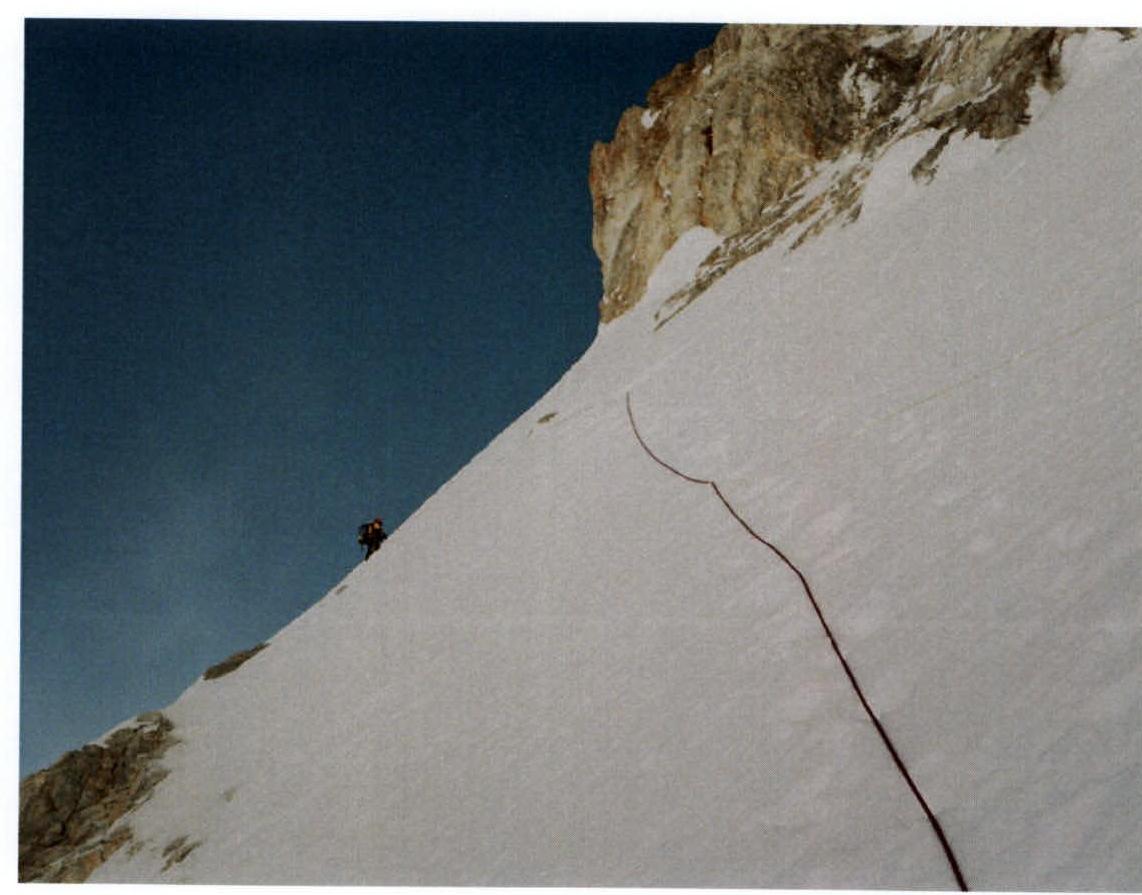
On July 25, the clouds, dispersed by the strong wind, settled in the valleys. Above 7600 m, it was clear, and the duo continued their movement along snow and scree fields towards the pre-summit ridge. Reaching it at around 7950 m, they turned left and moved along the ridge. Snowy sections alternated with gendarmes, which did not present serious problems. At 11:30 Pakistan time, Uryubko and Samoilov reached the highest point of Broad Peak (8047 m).
The descent was made along the classic route:
- first, north along the rocky ridge to the saddle near the North Peak;
- then west along the snowy slope.
High avalanche danger and dense fog below 7600 m delayed the duo for several hours, and only at sunset did they reach the site of Camp 3 (7200 m), where they had bivouacked during their acclimatization ascent. They set up a tent on a convenient platform.
On July 26, 2005, early in the morning, they began their descent along the classic route, equipped with perils, and by 17:00 reached the base of the mountain. At 19:00, they arrived at Base Camp.
On July 27, having packed up all their gear and formed a caravan of porters, the expedition left Base Camp and headed towards the town of Skardu, and then to Islamabad and Kazakhstan.
There were no failures, injuries, or illnesses. Communication via the Thuraya satellite phone was carried out through SMS messages to the expedition leader Roberto Piantoni, the head of the Kazakhstan Ministry of Defense ЦСКА P. M. Novikov, project manager R. R. Khaybullin, and the administrator of the www.russianclimb.com↗ website E. Laletina.
Analysis of the Ascent
Uryubko D. — This event was the first project on a peak above 8000 m organized by us independently. The entire management of the expedition was a significant effort, and valuable experience was gained in working with sponsors. Nevertheless, the main focus remained on the sporting aspect of preparation. Training took place on an intense schedule without breaks.
Assuming technical work at altitude, I placed a strong emphasis on rock preparation under the guidance of coach Gorbunov Yu. A. (Master of Sports in rock climbing and mountaineering) on natural relief. Working in a team was worthy of praise. The significant experience of joint ascents with S. Samoilov led to rare mutual understanding on the route. Sergey’s skill and experience repeatedly helped in complex situations.
We did not neglect protection anywhere and tried, as much as possible, to avoid rockfall and avalanche-prone areas. In terms of gear, we managed to achieve the necessary minimum to avoid overloading backpacks while having everything needed for work on complex sections of the relief. Reconnaissance showed how necessary it was to have a sufficient assortment of rock pitons, so we took exactly as many as needed. Using a single sleeping bag for overnight stays turned out to be the right decision. I believe the route corresponds to the highest category of complexity and was traversed reliably and competently.
Samoilov S. — It was great to work on the face, especially considering it was my first peak above 8000 m. Competent organization, thorough preparation, and training before the expedition, as expected, yielded positive results. Stressful moments during the expedition were successfully resolved by both parties due to:
- tolerance;
- friendship.
Of course, I faced communication difficulties due to not knowing English or Italian, but that was a minor issue. The calculation of gas and food supplies turned out to be correct, and even with a forced one-day delay beyond the planned schedule, we had enough resources to maintain our working capacity on the route. If we had been overloaded, we might have been delayed and not made it to the summit while still having the strength. Overall, in the conditions of 2005, the complexity of the ascent was incredibly high; nevertheless, we managed to find the right solutions when organizing the ascent.
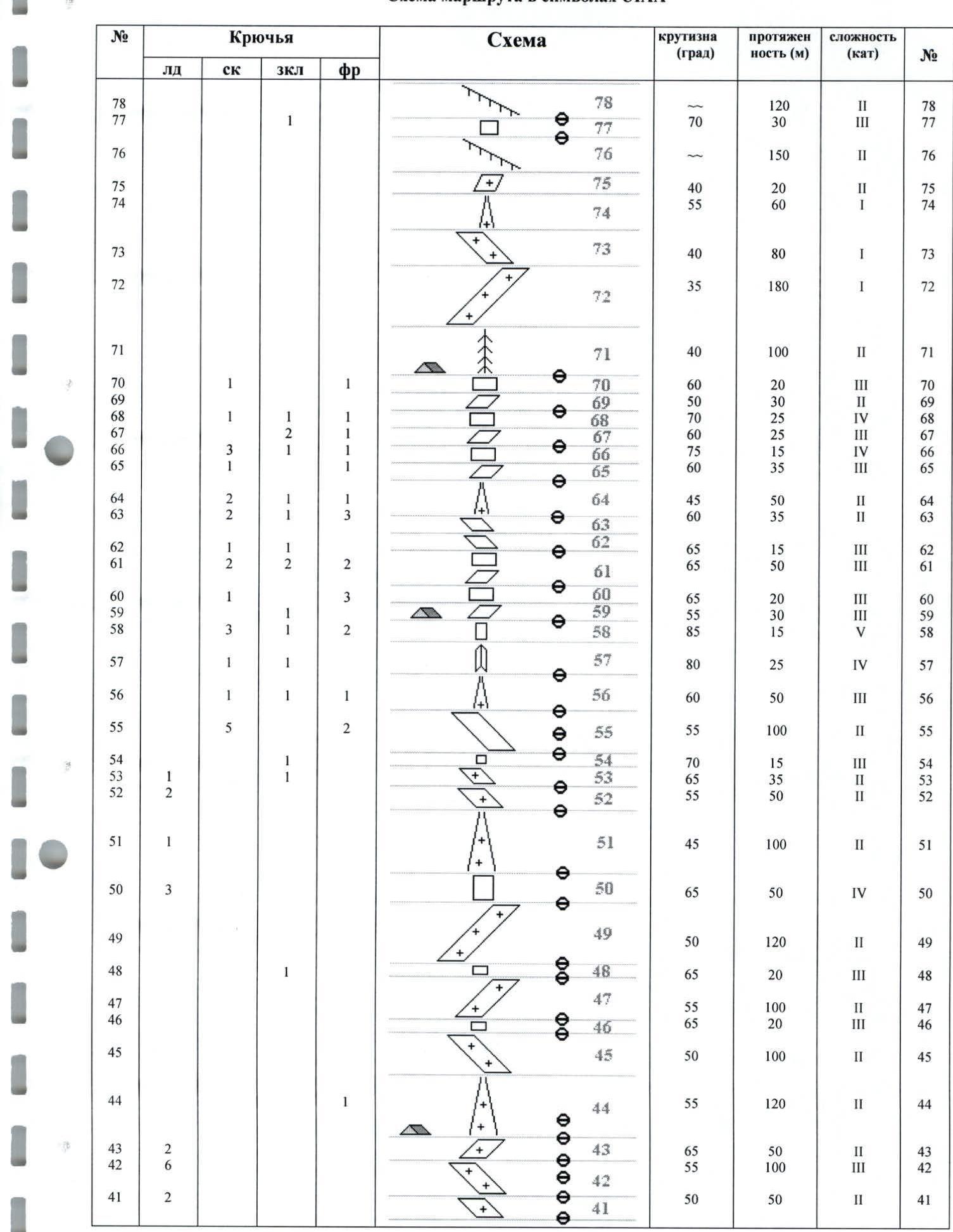
Route diagram in UIAA symbols
| № | Pitons | Slope (°) | Length (m) | Complexity (cat.) | R | |||
|---|---|---|---|---|---|---|---|---|
| Ice | Rock | Cam. elem. | Friend | |||||
| 40 | 9 | 45 | 150 | 2 | R40 | |||
| 39 | 1 | 75 | 15 | 4 | R39 | |||
| 38 | 1 | 1 | 1 | 60 | 35 | 3 | R38 | |
| 37 | 2 | 2 | 1 | 90 | 15 | 5 | R37 | |
| 36 | 1 | 45 | 23 | 2 | R36 | |||
| 35 | 2 | 3 | 1 | 2 | 55 | 28 | 3 | R35 |
| 34 | 1 | 1 | 60 | 15 | 4 | R34 | ||
| 33 | 1 | 90 | 8 | 5 | R33 | |||
| 32 | 4 | 2 | 80 | 20 | 4 | R32 | ||
| 31 | 1 | 1 | 1 | 85 | 15 | 5 | R31 | |
| 30 | 3/2 | 2/1 | 1/1 | 90 | 12 | 6 | R30 | |
| 29 | 1 | 2 | 2 | 1 | 80 | 30 | 5 | R29 |
| 28 | 1 | 1 | 75 | 20 | 4 | R28 | ||
| 27 | 6 | 45 | 75 | 2 | R27 | |||
| 26 | 1 | 60 | 25 | 3 | R26 | |||
| 25 | 9 | 45 | 150 | 2 | R25 | |||
| 24 | 1 | 1 | 75 | 10 | 5 | R24 | ||
| 23 | 2 | 1 | 2 | 1 | 65 | 40 | 4 | R23 |
| 22 | 1 | 45 | 15 | 2 | R22 | |||
| 21 | 1 | 65 | 35 | 3 | R21 | |||
| 20 | 60 | 25 | 3 | R20 | ||||
| 19 | 6 | 50 | 100 | 2 | R19 | |||
| 18 | 1 | 60 | 50 | 3 | R18 | |||
| 17 | 45 | 400 | 2 | R17 | ||||
| 16 | 55 | 50 | 2 | R16 | ||||
| 15 | 35 | 250 | 1 | R15 | ||||
| 14 | 30 | 100 | - | R14 | ||||
| 13 | 20 | 150 | 1 | R13 | ||||
| 12 | 30 | 150 | 1 | R12 | ||||
| 11 | 30 | 200 | - | R11 | ||||
| 10 | 20 | 350 | - | R10 | ||||
| 9 | 65 | 20 | 2 | R9 | ||||
| 8 | 40 | 100 | 1 | R8 | ||||
| 7 | 30 | 300 | 1 | R7 | ||||
| 6 | 20 | 200 | - | R6 | ||||
| 5 | 15 | 300 | - | R5 | ||||
| 4 | 1 | 35 | 100 | 1 | R4 | |||
| 3 | 80 | 2 | 2 | R3 | ||||
| 2 | 45 | 50 | 1 | R2 | ||||
| 1 | 30 | 200 | - | R1 |
Photo report on the route.
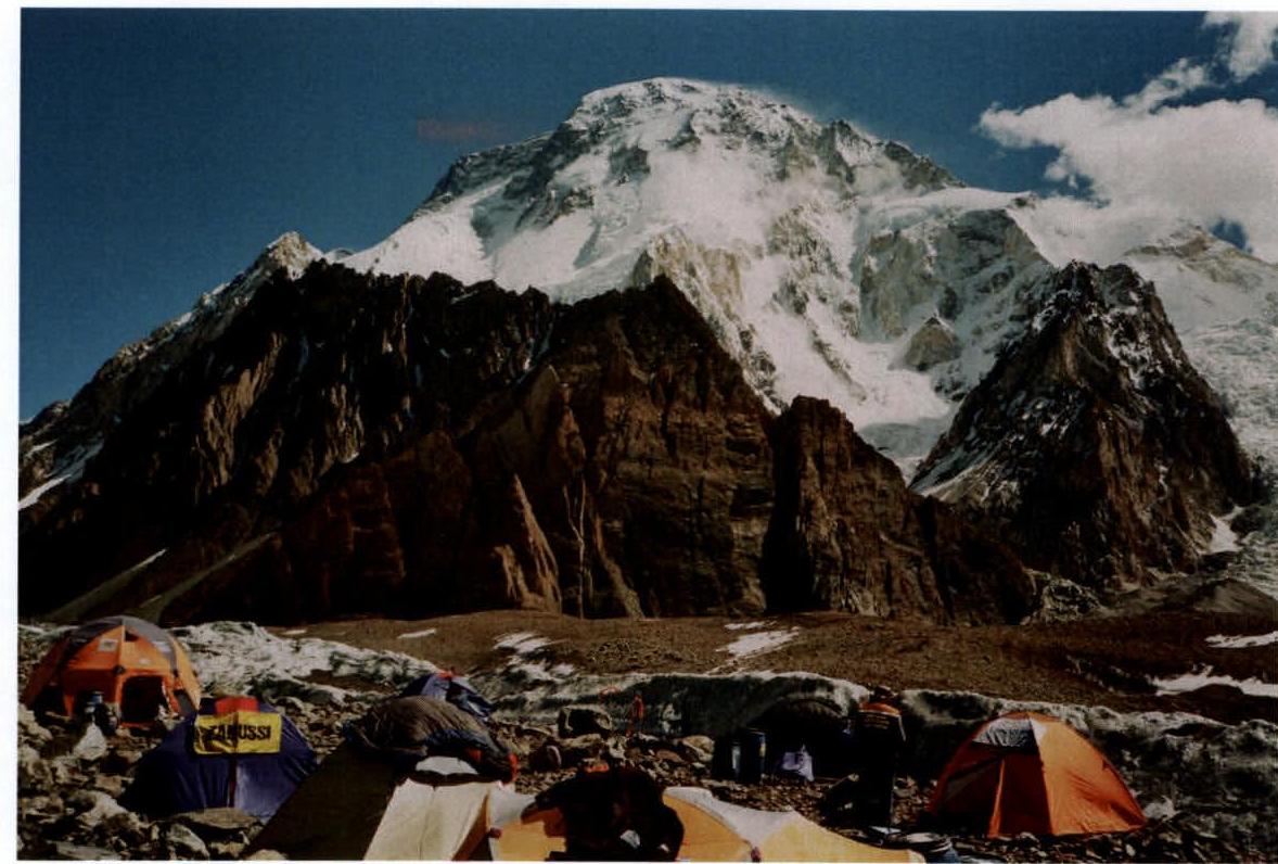
Expedition Base Camp at an altitude of 4700 m. Broad Peak is in the background.
Start of the route from the bivouac site at 5100 m.
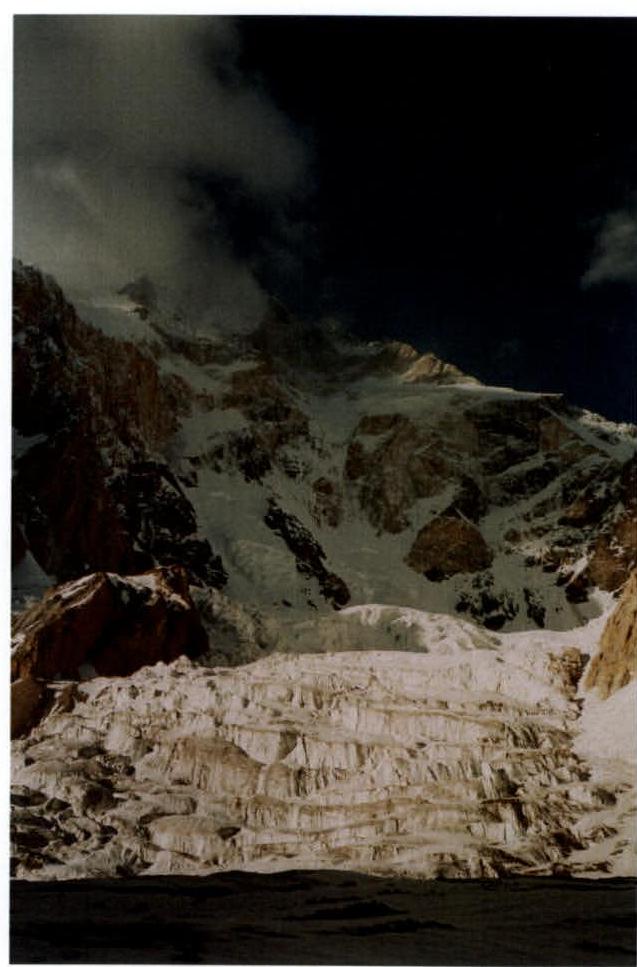
Lower part of the face from its base, altitude 5500 m.
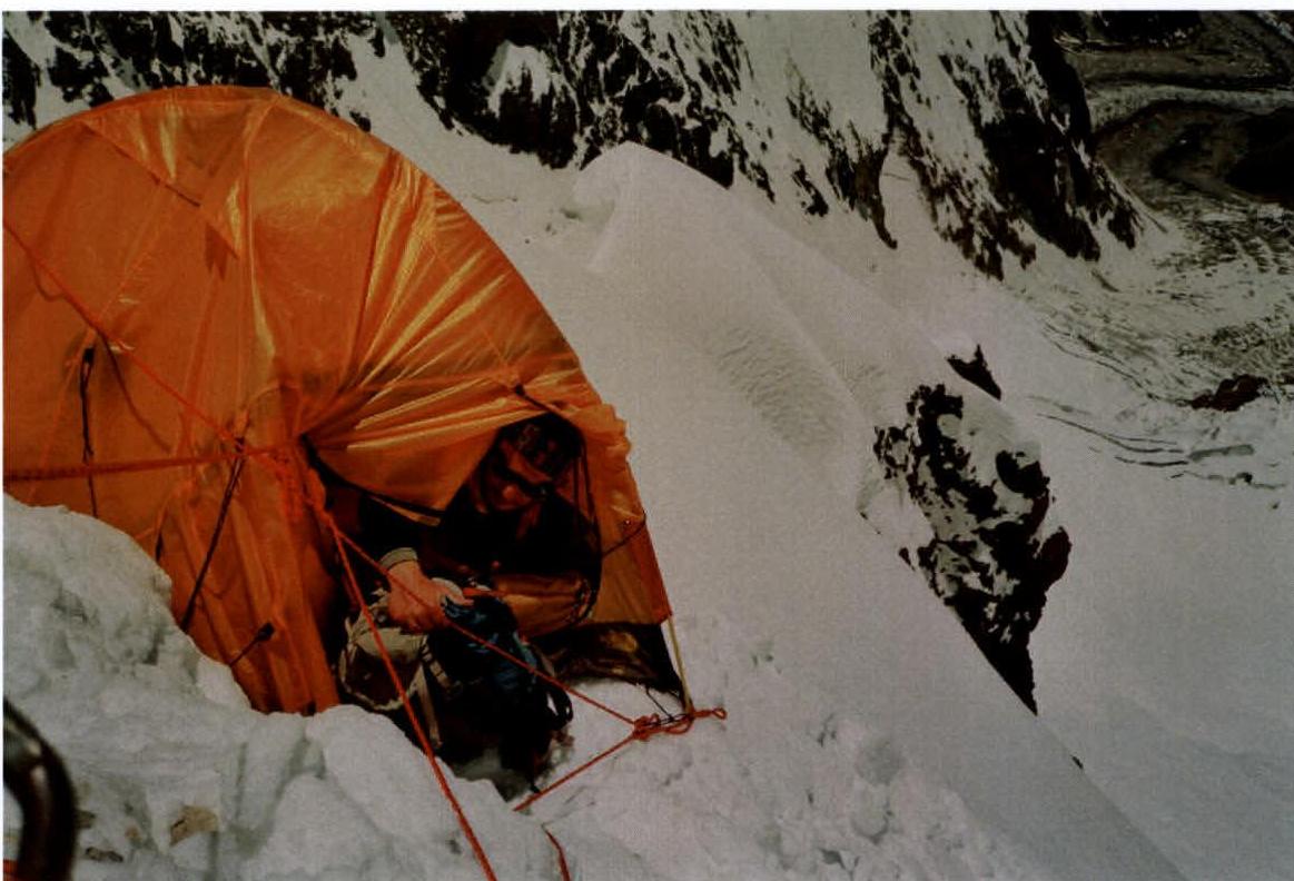
Bivouac at 6100 m.
Black rock belt, sections R23–R24.

Ascent along the ice slope, section R27, under the Yellow rock belt.
Exit to the "Window" at an altitude of 6900 m, section R42.
At an altitude of 7400 m, on a ledge at the end of section R54.
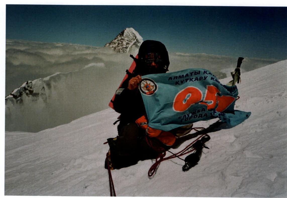
On the summit of Broad Peak, Sergey Samoilov; K2 is in the background.
Descent along the classic route at an altitude of 7400 m.