Russian Championship 2015.
High-altitude category.
Report
on the ascent to Thulagi Chuli (7059 m)
Route via the western wall with exit to the northeast ridge "Happy birthday" Presumably 6A category of complexity, first ascent
St. Petersburg 2015
Ascent details.
- Region — Himalayas, Mansari Himal, Gandaki zone, Nepal.
Coordinates: 26° 31.4′ N, 84° 31.1′ E.
-
Thulagi Chuli 7059 m, western wall with exit to the northeast ridge. Route "Happy birthday"
-
6A category of complexity.
-
Route characteristics: ice and snow.
-
Route characteristics:
elevation gain — 1209 m, wall section elevation gain — 850 m, route length 1850 m, wall section length — 1050 m
Section lengths:
- 5th category of complexity — 950 m
- 6th category of complexity — 430 m
average steepness of the wall section — 55 degrees, average steepness of the route — 46 degrees
- Equipment used on the route:
rock pitons (protection) ice screws bolted pitons 0 (19) 75 (0/0)
- Time taken from the start of the route to the summit — 21 hours.
Descent from the summit to ABC — 10 hours
- Overnight stays: one overnight stay in a cave during the ascent and one during the descent in the same cave.
- Group composition:
| Role | Name | Rank |
|---|---|---|
| 1. leader | Gukov A.B. | CMS |
| 2. participant | Shamalo V.P. | MSMK |
| 3. participant | Kirichenko R.V. | MS |
| 4. participant | Dождев I.S. | MS |
- Coaches: Gukov A., Chernikov A., Shamalo V.
- Departure from BC Dormasala 3665 m — September 21, 2015.
Departure from ABC to the route — September 24, 2015, 5:00. Start of the route 5850 m — September 24, 2015, 6:00. Summit — September 25, 2015, 15:50. Return to ABC — September 26, 2015, 16:00. Return to BC Dormasala 3665 m — September 27, 2015.
Overall photo
of the summit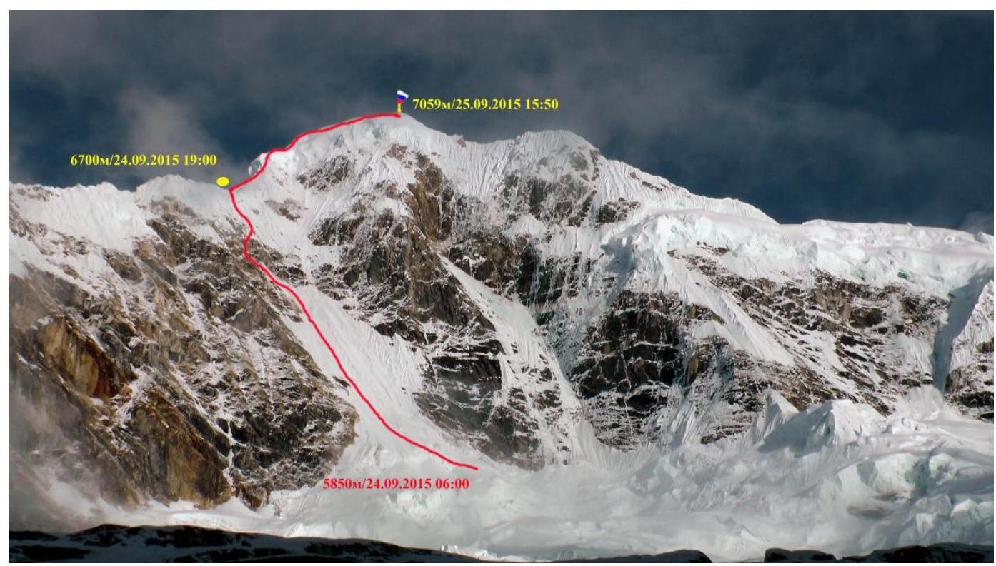 Profile photo
from the right
Profile photo
from the right
Hand-drawn profile
of the route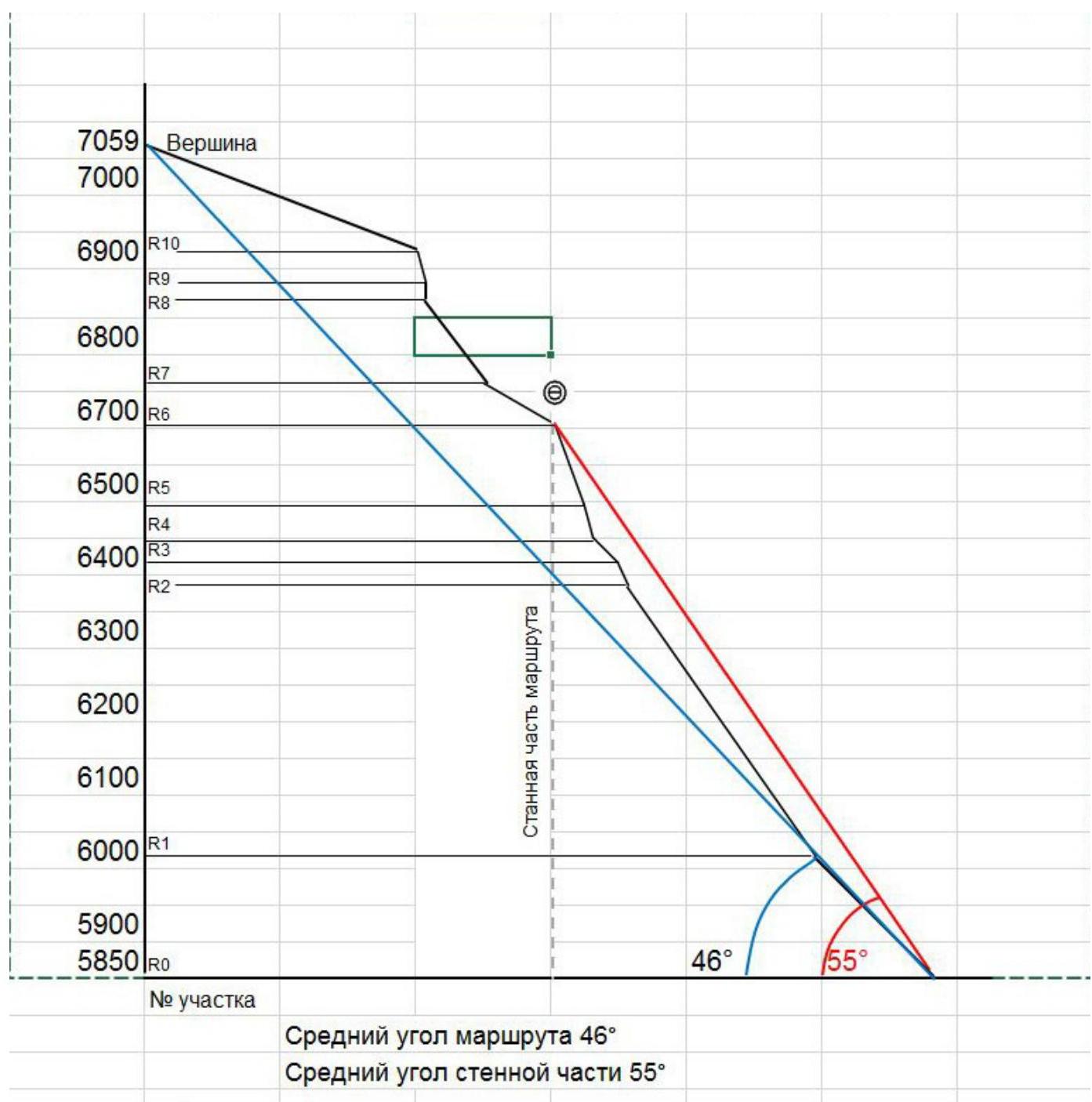
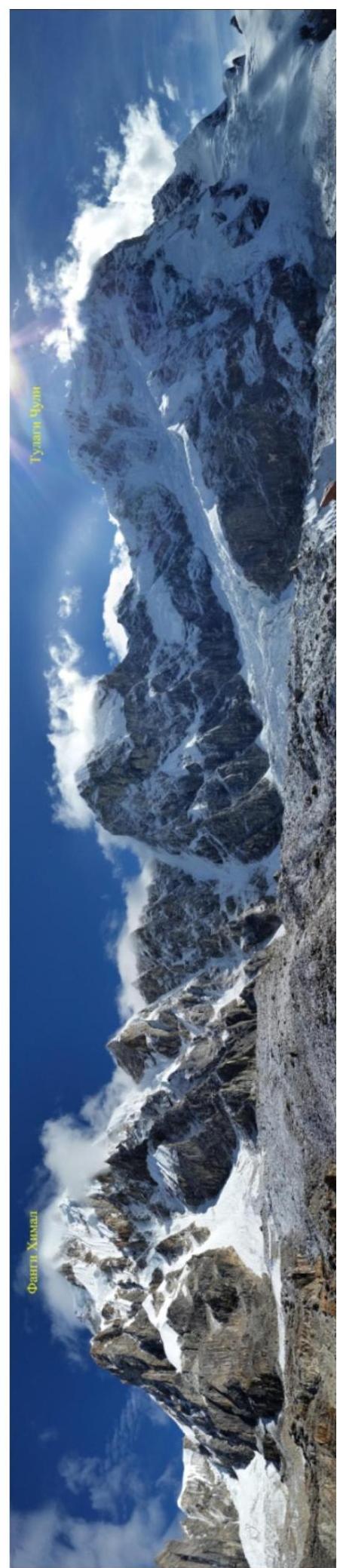
Panorama of the area
Ascent graph
| --- | --- | --- | --- |
| 2 | sunny | sunny | sunny |
|---|---|---|---|
| 7059 | 7059 | ||
| 7000 | M | ||
| 6900 | |||
| 6800 | |||
| 6700 | 6700 | 6700 | |
| 6600 | |||
| 6500 | |||
| 6400 | |||
| 6300 | |||
| 6200 | |||
| 6100 | |||
| 6000 | |||
| 5900 | |||
| 5850 | 5850 | ||
| 5750 | ABC 5750 m | ||
| date | 24.09.2015 | 25.09.2015 | 26.09.2015 |
| time | 06:00-19:00 | 08:00-15:50-18:30 | 08:00 16:00 |
Geographical description of the area.
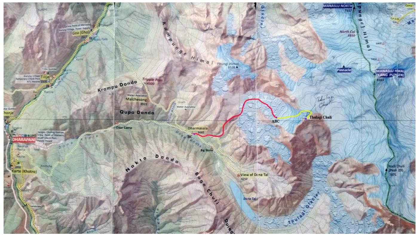
Thulagi Chuli is a seven-thousander in the Himalayas. Thulagi is part of the Mansari Himal massif, located in the north of central Nepal near Mt. Manaslu.
The approach to the western and southwestern walls begins from the village of Dhoropani, which can be reached by jeep from Kathmandu. The trekking trail leads to the settlement of Dharmasala, south of Thulagi Chuli, where there is:
- a government guesthouse for tourists and climbers
- shepherds' huts
The trail then leads to Lake Dona. It takes about a day and a half to reach Dharmasala from Dhoropani.
It is advisable to establish a base camp in Dharmasala, from where a small trail branches off to Lake Dona and the upper pastures, through which we laid a path to the glacier between Mt. Fangi and Thulagi Chuli.
At an altitude of 4700 m, there is a good spot for an intermediate camp near a water source. From there, the trail to the glacier leads across rocks, where we set up cairns.
Upon reaching the glacier, we move left along it, below the first step of the glacier, without reaching the slope between Mt. Fangi and Thulagi Chuli by 200 m. Overnight stay on rocky talus. In this location, rockfall occurs from the slope, so it is not recommended to approach the slope closely.
Then, we move up the glacier, sticking to its central part, with a gradual shift to the right.
The storm camp should be established below the wall, taking into account the relief of the glacier at the given time, approximately at an altitude of 5750–5800 m.
The seracs in the right part, despite their monolithic and majestic appearance, have a tendency to fall.
Weather conditions are favorable for ascents in spring and autumn, as the monsoon prevails in summer and late autumn, resulting in significant snowfall and a substantial drop in temperature at high altitudes. In late winter and spring, starting from March, the weather is quite stable, with rare snowfalls and gradual warming of the air.
It is advisable to descend from the summit via the same route to return to ABC below the wall. It is better to start the descent early, as rocks start falling from the ridge after noon.
History of ascents:
- 2003 — Nepalese authorities open the mountain for ascents.
- 2008 — A Japanese expedition led by Tamotsu Ohnishi attempts to ascend via the northwest wall.
- 2010 — A Belarusian-Russian team attempts to ascend via the northwest wall.
- 2011 — During an ascent via the southern ridge, climbers from the Minsk climbing club "Khan-Tengri" go missing: team leader Nikolai Bandalet (a participant in the 2010 expedition) and Sergey Belous. They were last in contact 100 m from the summit. Confirmation of their reaching the summit is lacking.
-
- A Krasnoyarsk team attempts to ascend. Sergey Cherezov dies in an avalanche at an altitude of 6000 m.
- 2013 — FALS expedition is canceled due to bad weather.
- 2014 — A Russian team consisting of Valery Shamalo, Ruslan Kirichenko, Andrey Golubev,
and Denis Sushko makes an unsuccessful attempt. Technical photograph of the
route
Wall section
of the route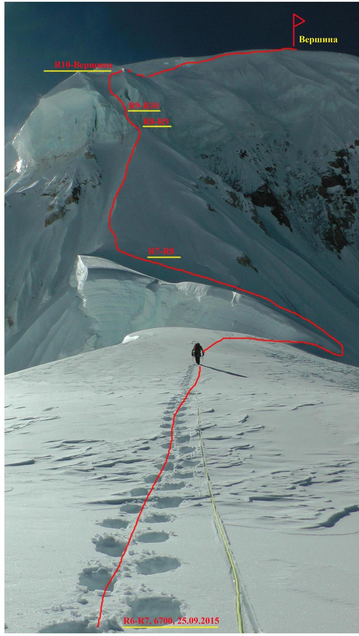
Ridge section of the route. UIAA scheme
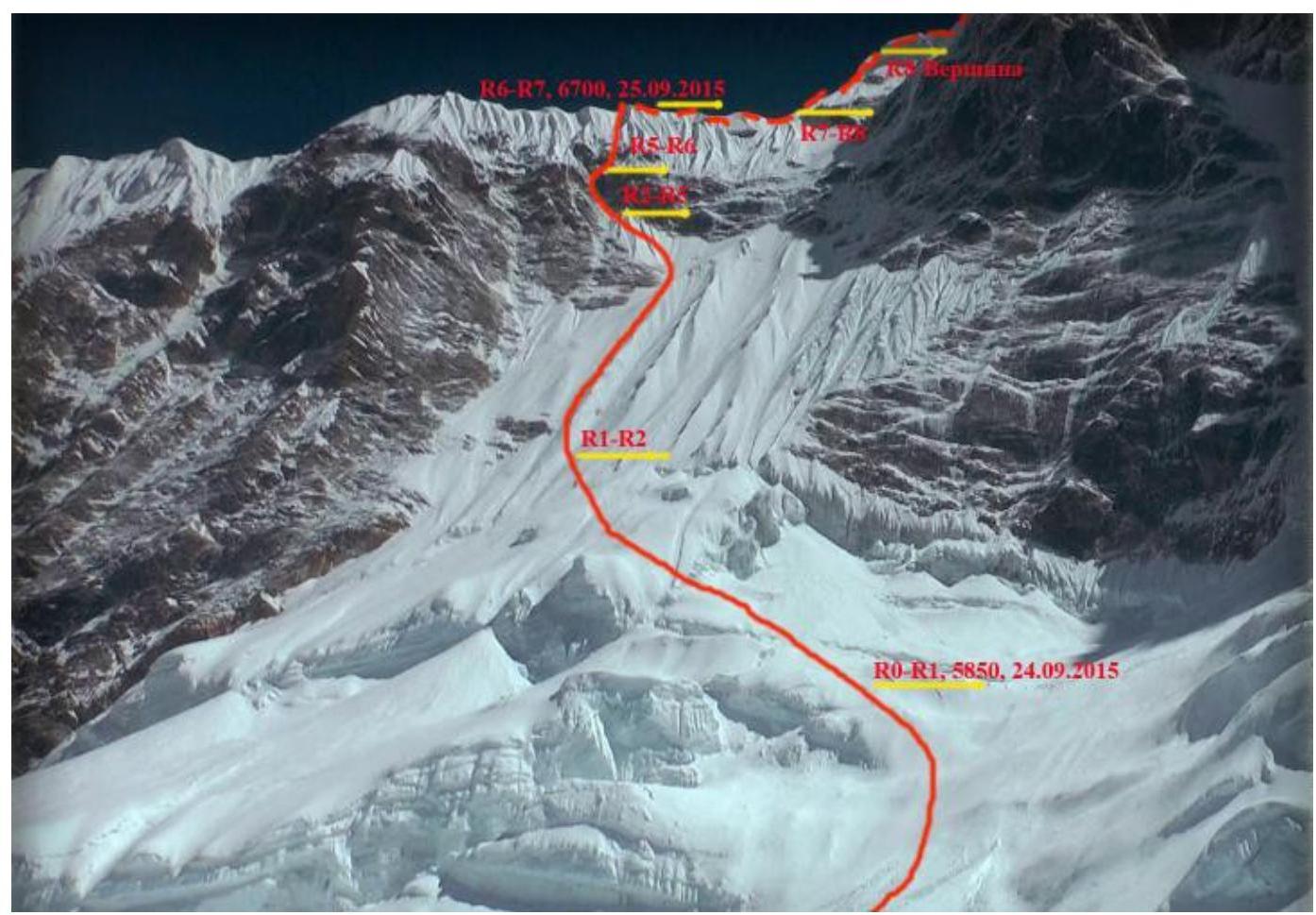
Rock, anchor protection. September 25, 2015 upper ice serac4 R10 500 m 30° 4 R9 45 m 75° 4 R8 15 m 90° 2 R7 125 m 50° 12 R5 115 m 70° many R4 50 m 75° 2 R3 50 m 45°
Route description.
R0–R1. Bypassing crevasses and bergschrunds on the right along the central part of the ice, we move up with a shift to the left part of the ice wall to avoid possible icefall from the upper serac. Gradual increase in the angle of the ice wall. 350 m, average grade 40. Firm snow, possible to belay with snow stakes. Simultaneous movement.
R1–R2. Ice. At the end of the wall, before the rock belt, we turn left towards the visible ice- rock passage. 450 m, average grade 55.
R2–R3. Up the steep snow to a pronounced internal angle. Rocks of moderate difficulty, 30 m, 65°.
R3–R4. Traverse left 10 m and then up the rock-ice angle. Loose rocks, careful movement, 50 m, 45°.
R4–R5. Up the pronounced rock chimney, very difficult climbing, many loose rocks, limited handholds. 50 m, 75°.
R5–R6. After passing the chimney, move up and right along the ice gully. At the end of the gully, exit to the ridge in a nice snow depression with the possibility of digging a cave. Overnight stay. 115 m, 70°.
R6–R7. Up the snow ridge towards the huge upper serac. Large crevasse is bypassed on the right. 120 m, 30°.
R7–R8. Snow ridge, movement with belay via snow stakes, 125 m, 50°.
R8–R9. Upper ice serac is climbed directly, 15 m, 90°.
R9–R10. Continue movement along the ice serac, angle decreases to 75°, 45 m.
D10–Summit. Exit to a wide snow slope with a series of steep climbs, very much snow. Average grade 30°, 500 m
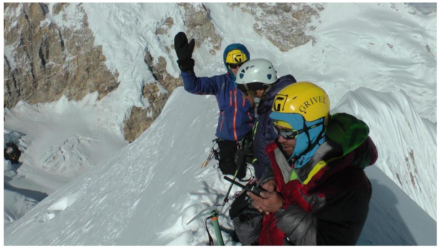
The summit is an acute snow ridge. Very careful movement.
The view from the top is remarkable. Photo illustration
of the report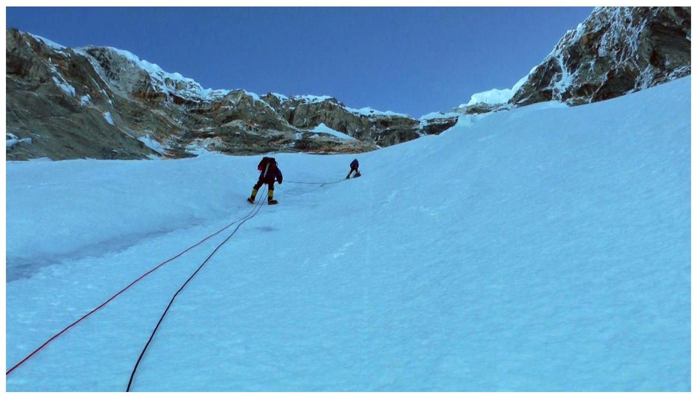
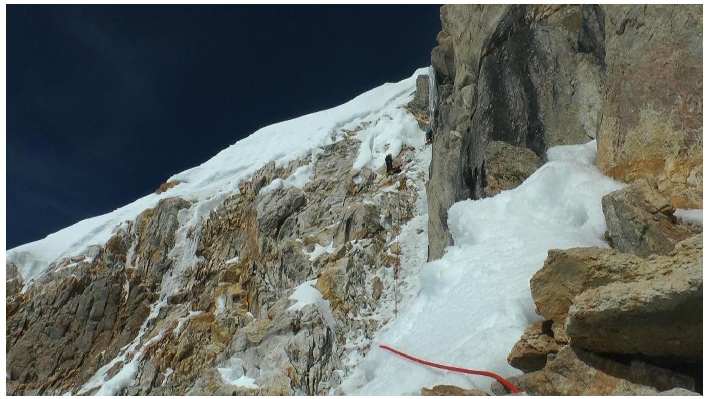
Section
R1–R2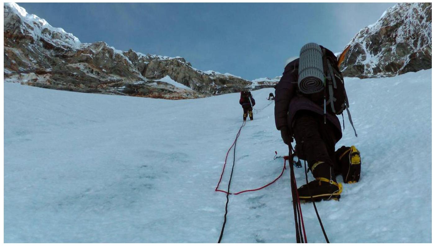
Section
R1–R2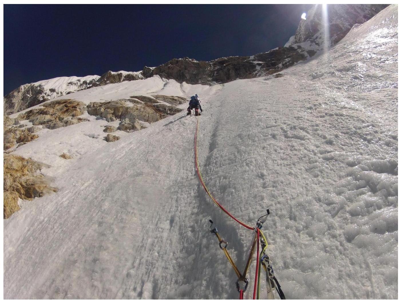
Section
R1–R2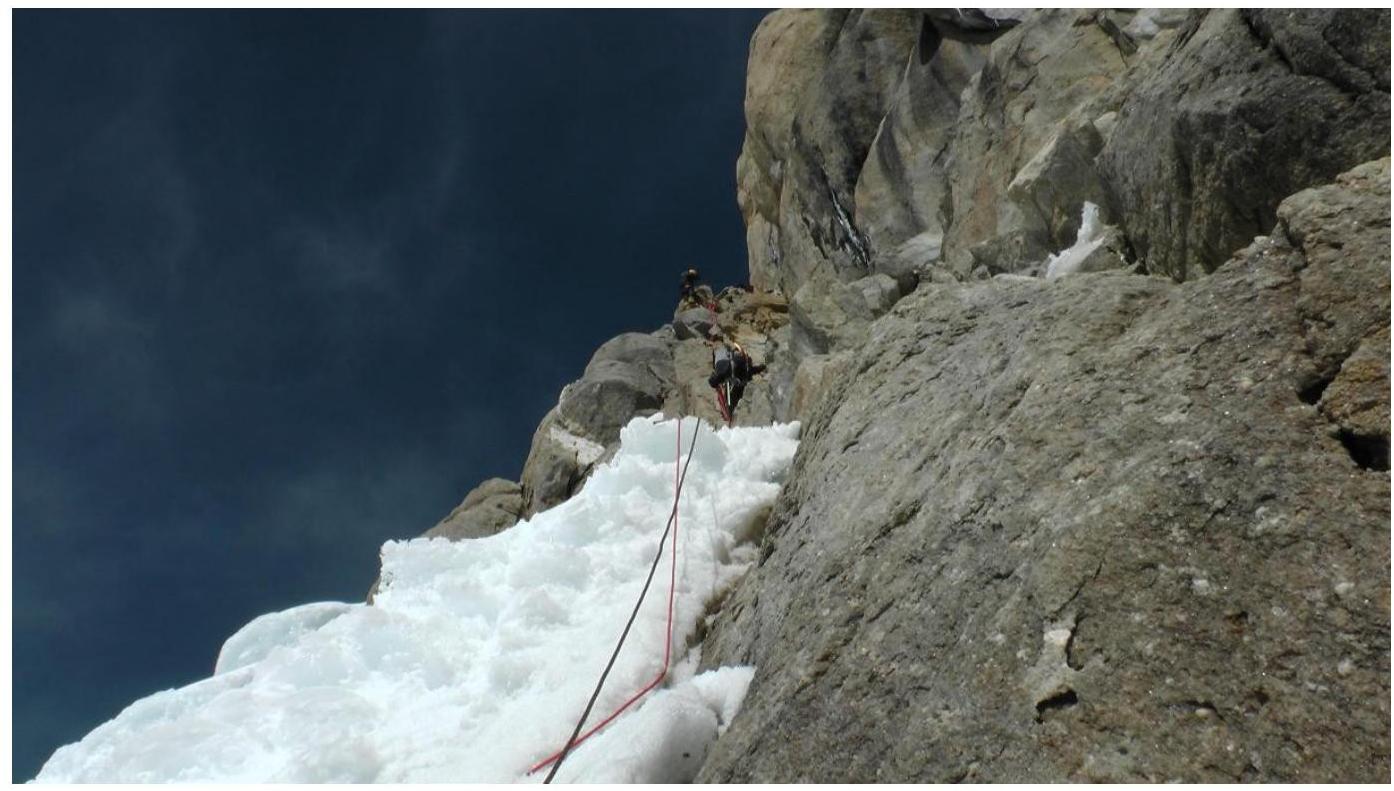
Section
R2–R3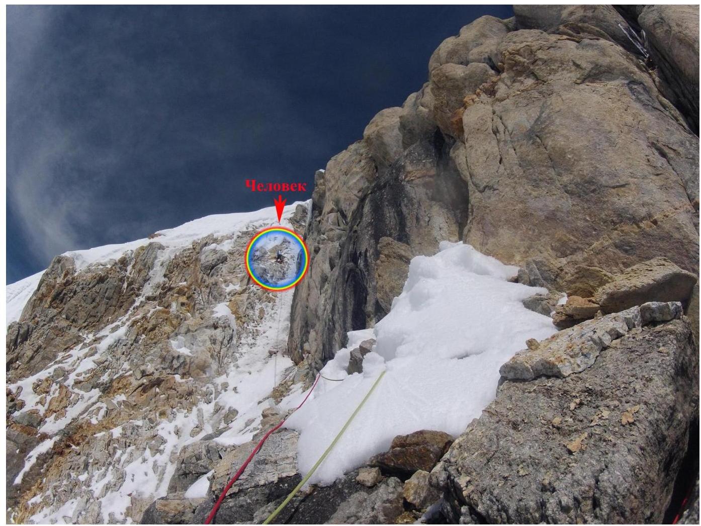
Section
R3–R4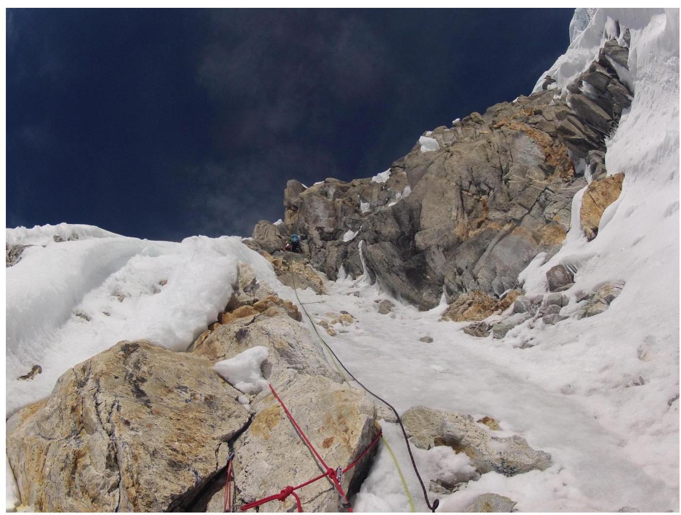 Unfortunately, a photograph of the second rock section of R4–R5 is missing due to the
large number of falling rocks from above and below the participant.
Unfortunately, a photograph of the second rock section of R4–R5 is missing due to the
large number of falling rocks from above and below the participant.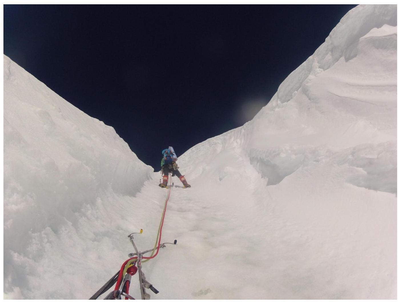
Section
R5–R6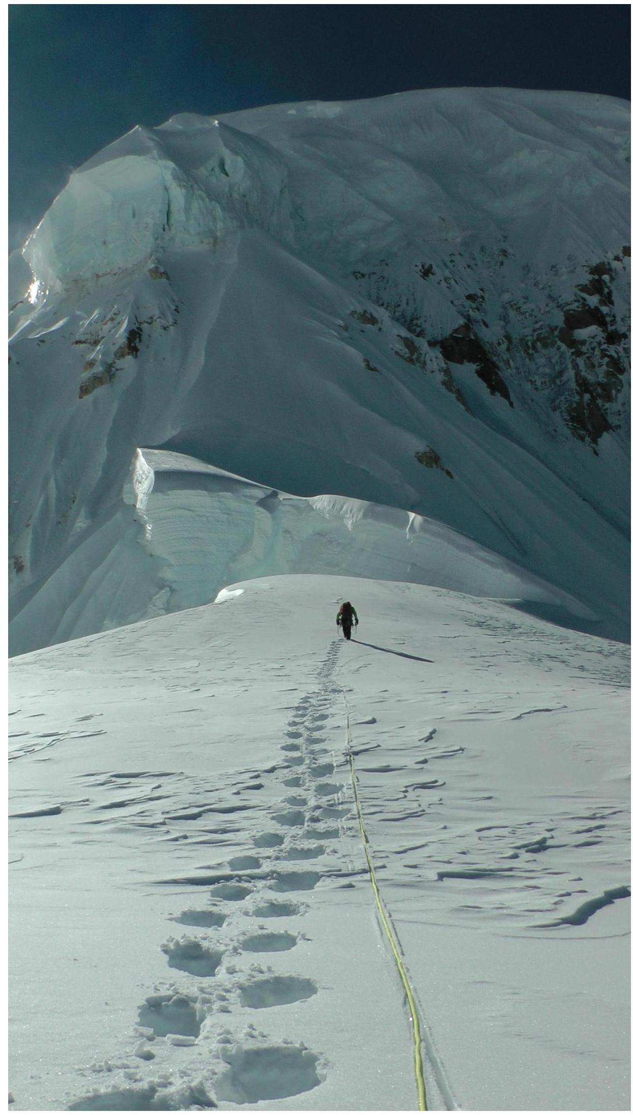
Section
R6–R10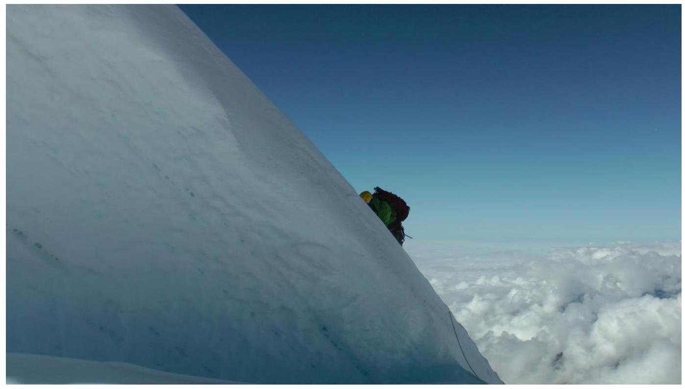
Section
R6–R7
Section
R8–R9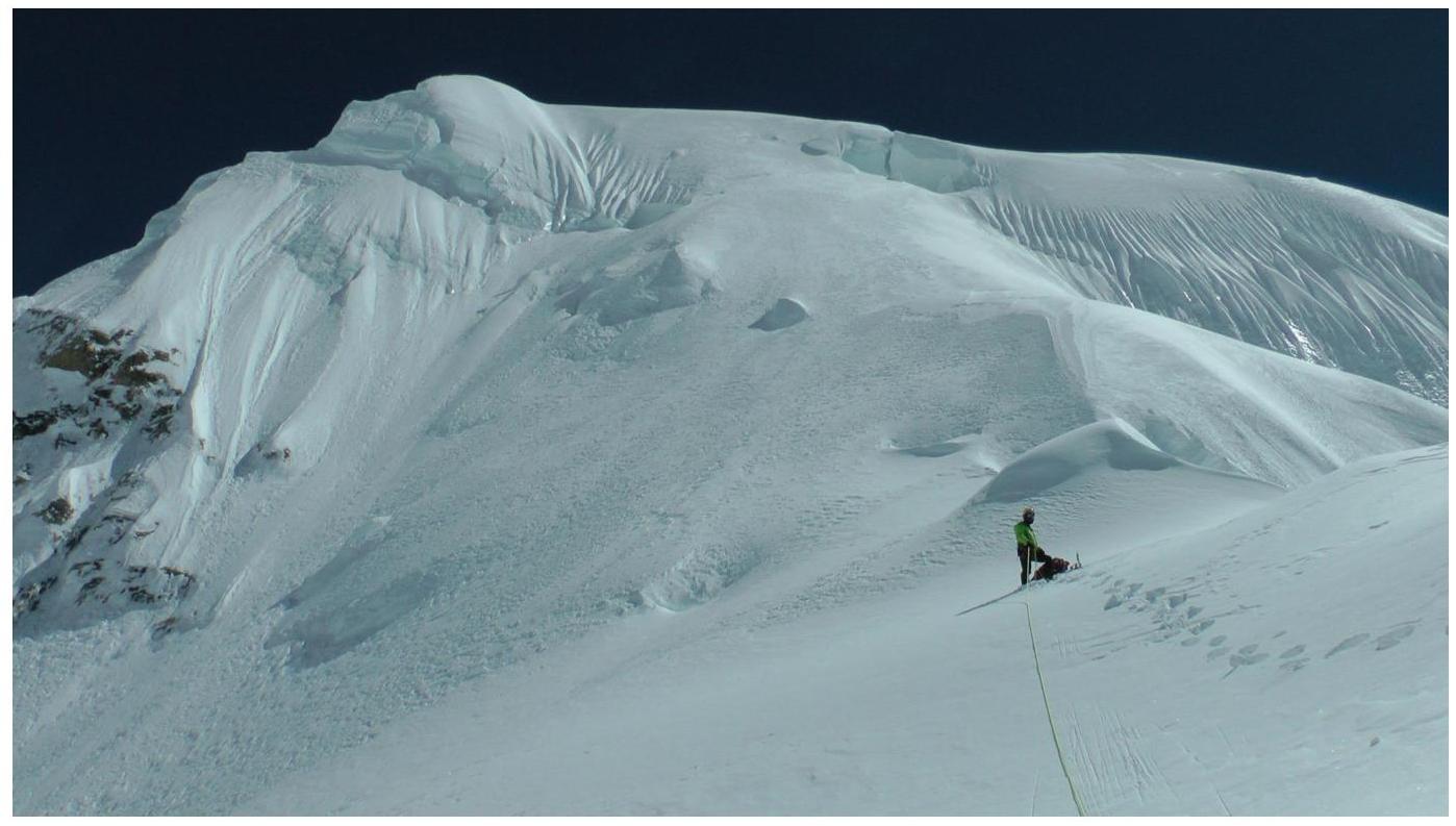
Section
R10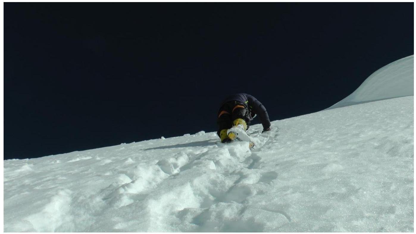
Section R10. Photograph from the summit