
Federation of Alpinism and Climbing of Ukraine
Report on the ascent of Lobuche East, 6119 m, via the right part of the eastern wall ("Two Arrows Flight"), 6A category.
Team report from the Odessa Alpine Club
Ascent Passport
- Ascent class: technical.
- Location of the peak: Himalayas, Sagarmatha National Park, Solu Khumbu region
- Peak name: Lobuche (Lobuje, Lobuche) East, 6119 m
- Route: via the right part of the eastern wall ("Two Arrows Flight")
- Complexity category: 6A (proposed)
- Route type: combined
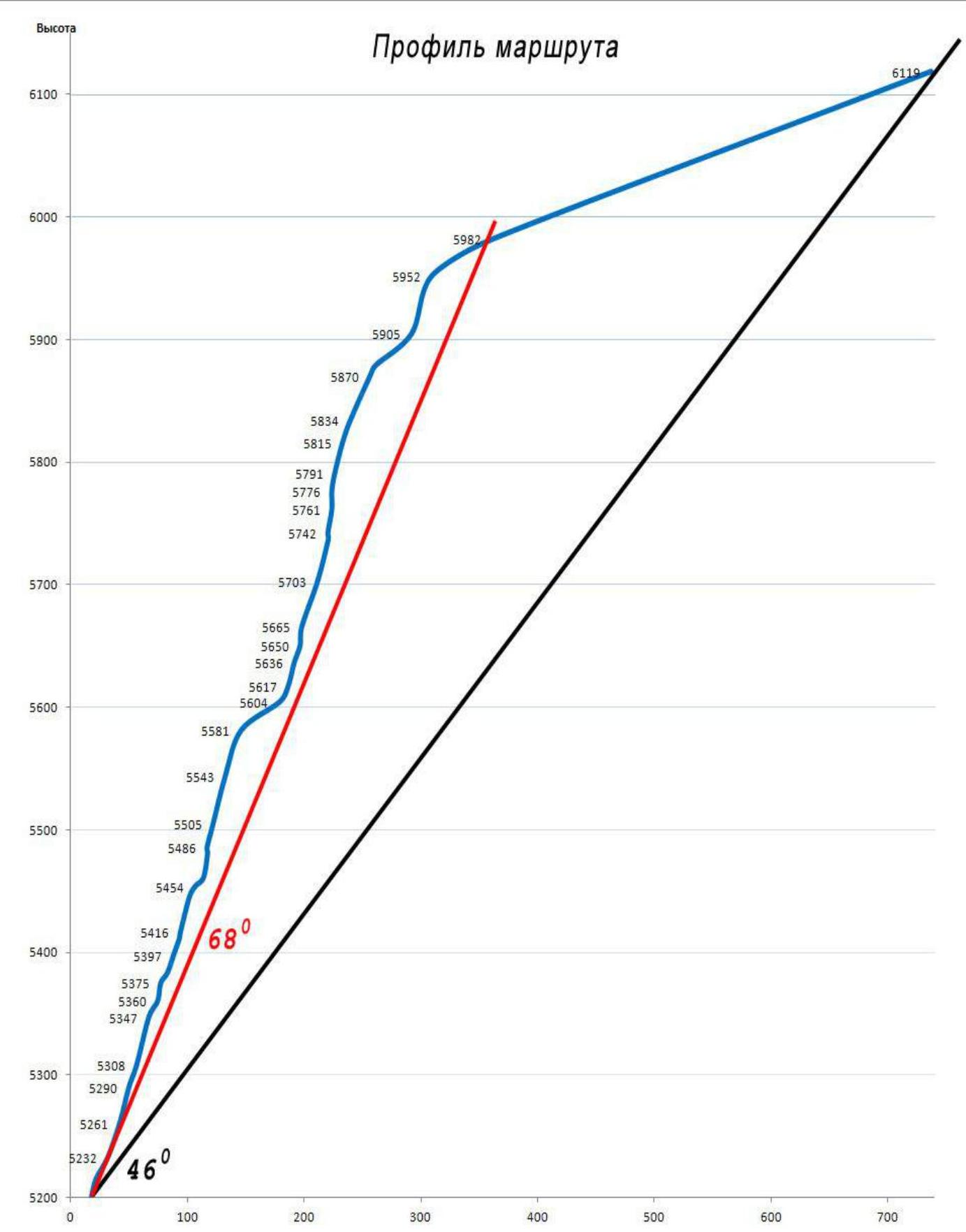
- Route elevation gain: 949 m
- Wall section elevation gain: 705 m
- Route length: 1320 m
- Section lengths: V cat. sl. – 165 m, VI cat. sl. – 485 m.
- Average slope: wall section – 68°, entire route – 46°.
- Equipment used:
| Rock anchors: | 58 |
|---|---|
| Placement elements | 39 |
| Camalots | 50 |
| Ice screws | 7 |
| Bolt anchors | 11 |
| Rock anchors left | 0 |
| Holes for ITO | 18 |
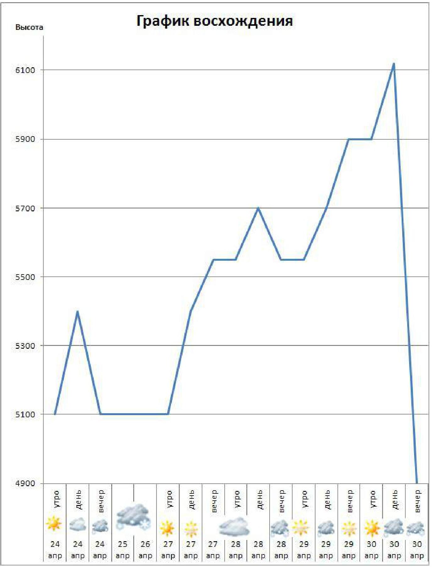
- Ascent duration: 69 working hours, 7 days (two days spent in bad weather)
- Team leader: Kiliichenko Yuri Valentinovich, CMS. Participants:
- Perevalov Maxim Viktorovich, MSMS
- Vasenkov Yuri Valerievich, 1st sp. discharge
- Poberezhny Petr Pavlovich, 1st sp. discharge
- Coach: Gorbenco Mstislav Mstislavovich
- Route entry:
| 06:00 | April 24 | 2014 |
|---|---|---|
| April 25–26 | ||
| 13:30 | April 30 | 2014 |
| 21:30 | April 30 | 2014 |
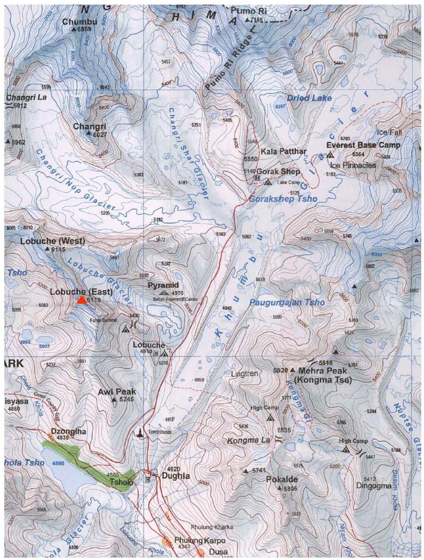
Map-scheme of the ascent area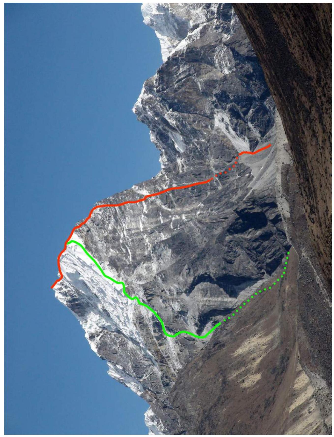
General photo of the peak, from the southeast
- Green line — route via the SE ridge, "classic", approximately 2B cat. sl.
- Red line — team route via the right part of the eastern wall, proposed 6A cat. sl.
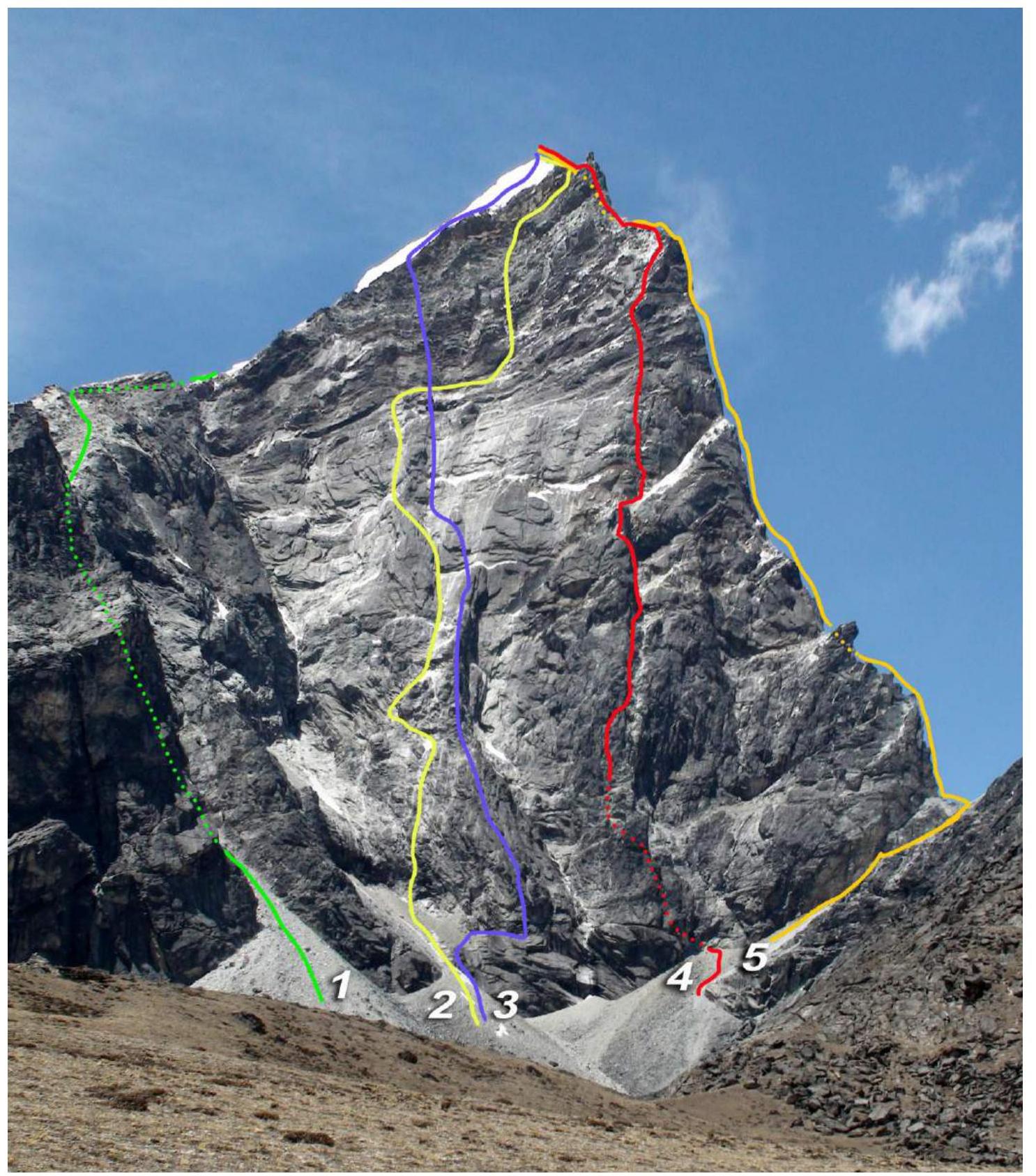
General photo of the eastern wall.
- Henry Kendall, Jeff Lowe, 1986 — ice couloir, 5A–5B cat. sl.
- Korean route, 1992, approx. 6A cat. sl.
- Michal, Miroslav Coubal, 1990 — "Ave Maria" route, approx. 6A cat. sl.
- Team route via the right part of the eastern wall, "Two Arrows Flight", proposed 6A cat. sl.
- Todd Bibler, Catherine Freer, 1984 – northeast ridge, approx. 5B cat. sl.
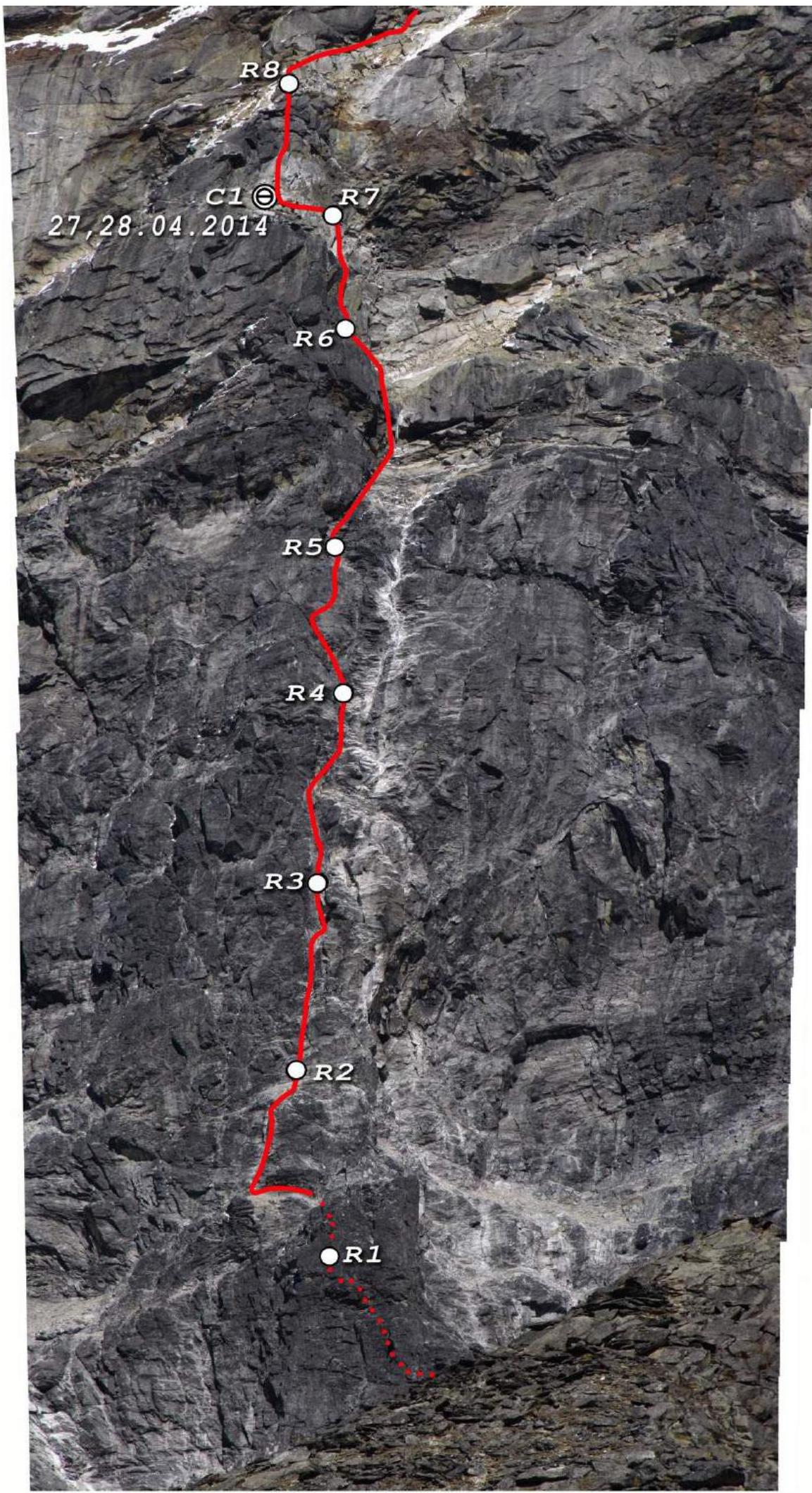
Photo 1. Lower part of the route.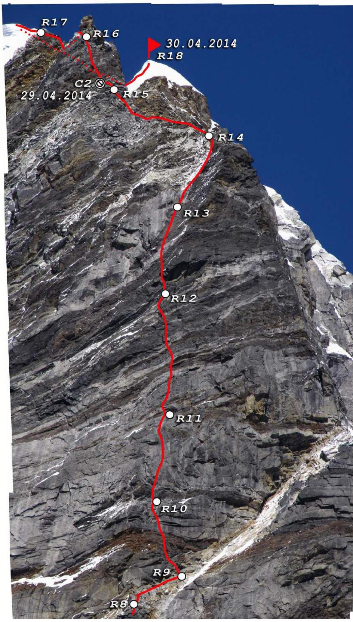
Photo 2. Upper part of the route
ROUTE SCHEME IN UIAA SYMBOLS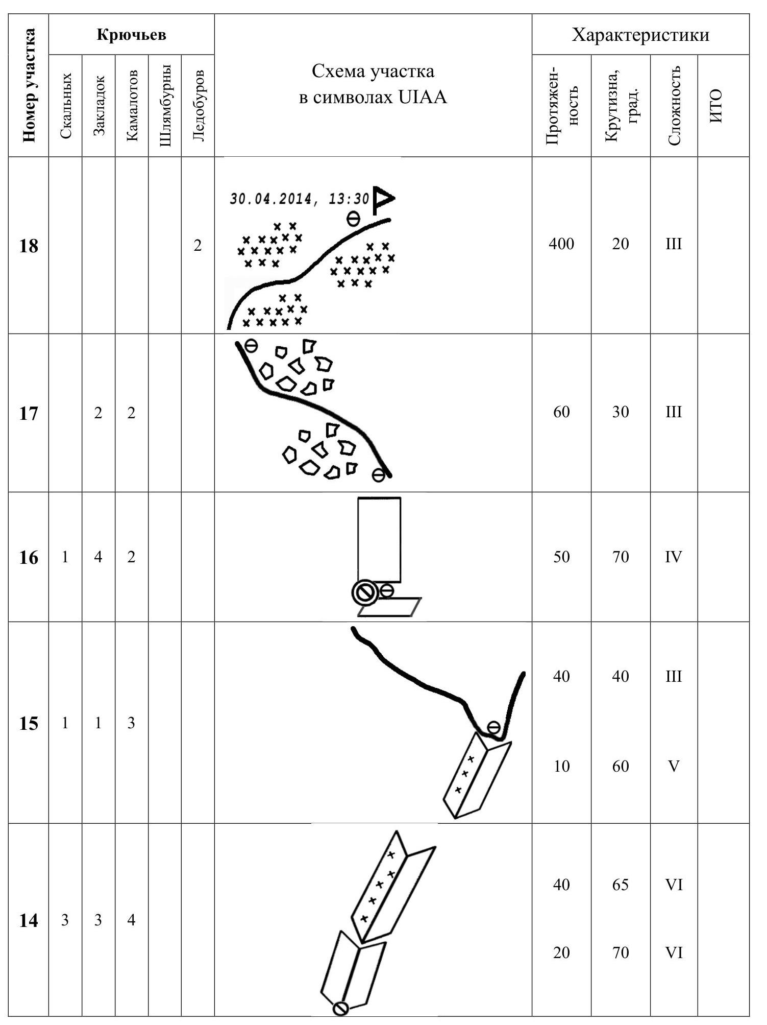
| 13 | 5 | 2 | 1 | 2 | 20 | 75 | VI | A2 10 m | |||
|---|---|---|---|---|---|---|---|---|---|---|---|
| 20 | 80 | VI | |||||||||
| 15 | 90 | VI | A3 20 m | ||||||||
| 12 | 6 | 3 | 1 | 3 | 20 | 80 | VI | A3 15 m | |||
| 5 | 95 | VI | |||||||||
| 35 | 75 | VI | |||||||||
| 11 | 5 | 2 | 3 | 2 | 40 | 70 | VI | A2 10 m | |||
| 15 | 85 | VI | A3 10 m | ||||||||
| 10 | 4 | 3 | 4 | 15 | 70 | VI | |||||
| 15 | 75 | VI | |||||||||
| 20 | 60 | V | |||||||||
| 9 | 3 | 40 | 35 | III | |||||||
| 8 | 3 | 1 | 4 | 40 | 70 | V | |||||
| 7 | 5 | 1 | 3 | 50 | 75 | VI | |||||
| :--: | :--: | :--: | :--: | :--: | :--: | :--: | :--: | :--: | :--: | :--: | :-------: |
| 6 | 6 | 2 | 2 | 1 | 15 | 75 | VI | A2 10 m | |||
| 10 | 95 | VI | |||||||||
| 20 | 80 | VI | |||||||||
| 10 | 45 | II | |||||||||
| 5 | 6 | 3 | 2 | 3 | 10 | 65 | VI | A3 20 m | |||
| 40 | 80 | VI | |||||||||
| 10 | 70 | VI | |||||||||
| 4 | 4 | 3 | 5 | 15 | 70 | VI | |||||
| 10 | 60 | V | |||||||||
| 15 | 80 | VI | |||||||||
| 15 | 60 | V | |||||||||
| 3 | 5 | 3 | 5 | 40 | 75 | VI | |||||
| 20 | 70 | V | |||||||||
| 2 | 2 | 5 | 4 | 1 | 30 | 75 | VI | ||||
| :--: | :--: | :--: | :--: | :--: | :--: | :--: | :--: | :--: | :--: | :--: | |
| 30 | 70 | V | |||||||||
| 1 | 2 | 1 | 2 | 4 | 15 | 60 | IV | ||||
| 20 | 75 | V | |||||||||
| 25 | 45 | III |
General description of the route and team's tactical actions
Lobuche East peak, 6119 m, was chosen by the team as an acclimatization objective before ascending Ama Dablam via the Bashkirov route, 6A category. After researching several peaks in the area, we concluded that a new route on Lobuche via the right part of the eastern wall was feasible. The planned route was outlined in Odessa, following the bastions on the right part of the wall. The descent was initially planned to follow the classic route along the SE ridge, which is technically straightforward.
The base camp was set up in the village of Lobuche (4900 m), and an advance camp (ABC, one tent) was established on April 23 at around 5100 m below the wall. The site for the camp was chosen on suitable sandy-pebbly platforms 100 m below the base of the wall. Water was obtained from snow between the rocks.
The tactical plan was to process the lower part of the wall in one day and return to ABC for the night.
On the day of the approach, after inspecting the lower part of the wall, a couloir was found between the main wall and a large standalone rock formation, about 80 m high. The couloir was chosen as the starting point due to the absence of falling rocks.
On the first day, the Kiliichenko – Vasenkov team fixed three ropes, 60 m each. After processing, the team returned to camp to "get away" the next day.
However, a strong snowfall began that night, lasting for almost two days and forcing the team to delay their exit.
On April 26–27, the weather cleared, and the team exited to the wall at morning. While climbing the fixed ropes, most of the snow on the wall had melted, remaining only on the ledges. The team, led by Kiliichenko – Perevalov, climbed three new ropes, found a suitable ledge for a bivouac, and spent the night there.
The next day, they exited the bivouac and climbed three more ropes by 16:00. A suitable bivouac site was not found; a large sloping ledge was not suitable due to its outward inclination and exposure to falling rocks. Kiliichenko – Vasenkov returned to the previous bivouac site, while Perevalov – Poberezhny climbed another rope and descended to the tent by 19:00.
On April 29, they climbed the previously fixed ropes by 10:00 and then Perevalov – Poberezhny processed the most challenging part of the wall (R12–R14). As darkness fell, the team reached the ridge leading from the northeast edge to the snowy "roof." A semi-reclined bivouac was set up below the last large pinnacle on a narrow sloping ledge, with a tent tarp stretched over it.
The next day, April 30, they exited around 9:00 and reached the snowy ridge leading to the summit without significant difficulties by 11:00. This point is known as the "false summit," where some teams completing the "classic" route terminate their ascent.
From this point to the summit, they climbed with simultaneous protection in 1.5 hours, as the weather deteriorated.
On the summit, the weather worsened, with snowfall and visibility reduced to 15–20 meters.
The descent to Lobuche village via the classic route took 8 hours; in good weather, this could be reduced to 5–6 hours. The ascent was completed according to the tactical plan, except for the two-day delay due to bad weather. There were no injuries or frostbite.
Description of the route passage
Approach
The village of Lobuche was used as the base camp and starting point, where the team stayed at the "Above the clouds" lodge. From the village, the team ascended a gentle slope to the west, then turned north and descended via the right side of the cirque towards the visible wall.
The path and camp location are shown in the photo below.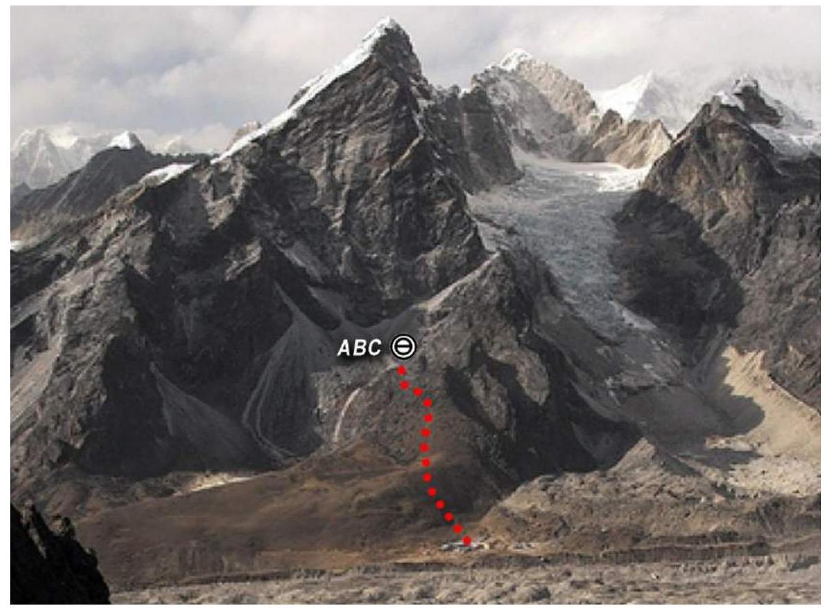
Photo 3. Path to the wall and camp under the wall.
Day 1
The Kiliichenko – Vasenkov team exited the camp at 7:00. The first climber began ascending the snowy couloir at 9:00, with a slope of 40–45° (Photo 4). The snow turned to ice, and the couloir became steeper, with a maximum slope of around 75°. The ice was thin and unreliable (Photo 5). The first climber used two ice tools and placed protection through short ice screws, anchor hooks, and camalots.
The couloir flattened out after 45–50 meters, and the ice became more solid. A short wall (about 2 meters) was climbed on the right, leading to a good ledge for two people. The ascent to this point took about an hour. The next two ropes were led by Vasenkov.
The second rope was climbed slightly left (Photo 6), with more possibilities for protection. The terrain was rugged, and the rock was rough, allowing for good friction. Protection was placed using anchor hooks, placement elements, and camalots.
The third rope involved climbing a 30-meter section with a slope of up to 75°, using large placements, medium camalots, and an ice screw. An old bolt with a carabiner was found at the top.
The fourth rope involved climbing a 20–25 meter wall (Photo 7) with a slope of 70°, using anchor hooks and small camalots. The wall led to a small ledge before an internal angle.
The team descended to the camp at 17:00 due to worsening weather.
Day 2–3
Snowfall continued throughout the night, and the team was forced to delay their exit. The weather improved on the night of April 26.
Day 4
The Kiliichenko – Perevalov team exited the camp at 6:00. The task was to quickly reach the top of the fixed ropes and begin processing new ropes. Vasenkov and Poberezhny followed with bivouac gear.
The snow on the wall had mostly melted by the time they reached the end of the fixed ropes. The team climbed new ropes, using various protection methods.
Day 5
The Poberezhny – Perevalov team exited at 7:00, followed by Kiliichenko – Vasenkov at 8:30 with bivouac gear.
The first rope was climbed from the right edge of the ledge, with a station on a ledge. A ridge to the right led to a large sloping ledge that bisected the wall.
Poberezhny led the next rope, climbing a wall with monolithic terrain and limited protection. The team used various protection methods and left some gear on the ledge.
Day 6
The team exited the bivouac at 8:00 and climbed to the top of the fixed ropes by 10:00. Perevalov led the next ropes (R12 and R13), which were the most challenging on the route (Photos 18–21). The ascent took around 7 hours, involving difficult climbing, thin protection, and the use of skyhooks.
The final section before the ridge (R14) involved climbing a steep internal angle (Photos 22, 23). The team reached the ridge by 19:00 and set up a bivouac on a narrow ledge.
Day 7
On April 30, the team exited at 9:00 and quickly climbed the wall of a large pinnacle (Photo 25), followed by a 60-meter section of broken rock ridge. They reached a snowy ridge leading to the summit by 11:00 and the "false summit" shortly after.
The team ascended to the summit in a deteriorating weather, using simultaneous protection. They reached the summit at 13:30.
The descent via the classic route took 8 hours, and the team returned to Lobuche village by 10:00 PM, where they were welcomed by the staff and guests of the "Above the clouds" lodge.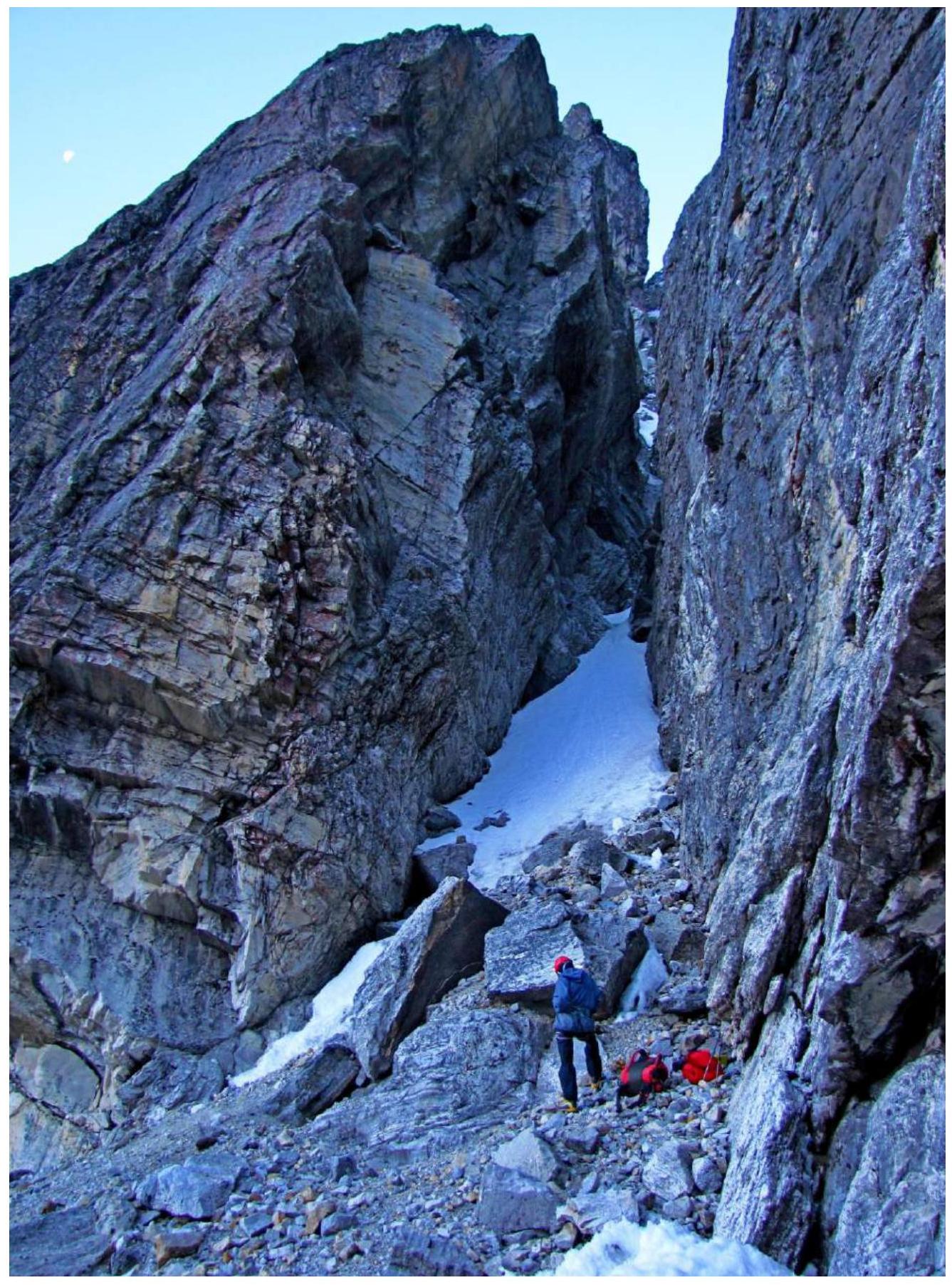
Photo 4. Start of the route.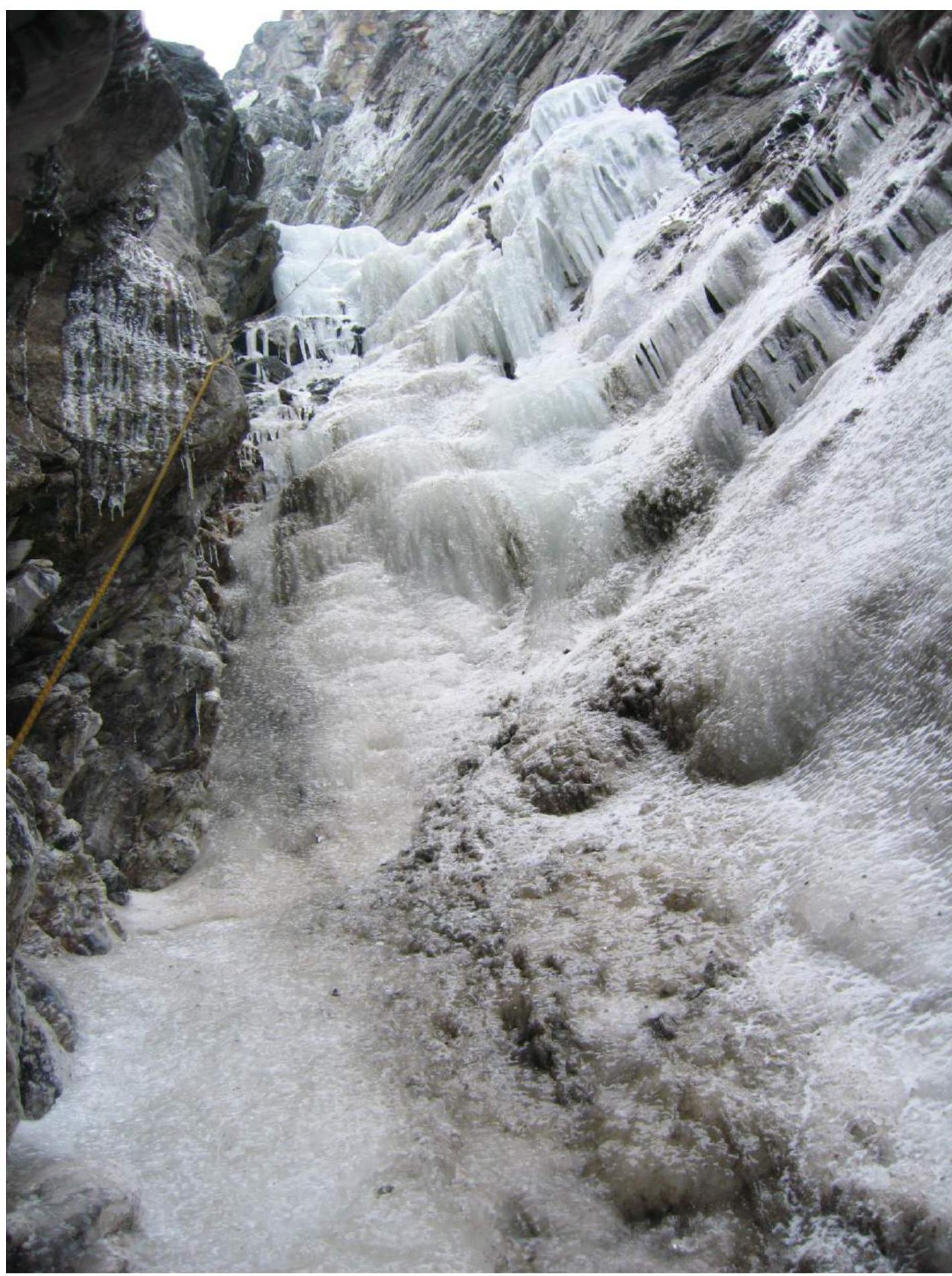
Photo 5. Ice couloir, upper part of R1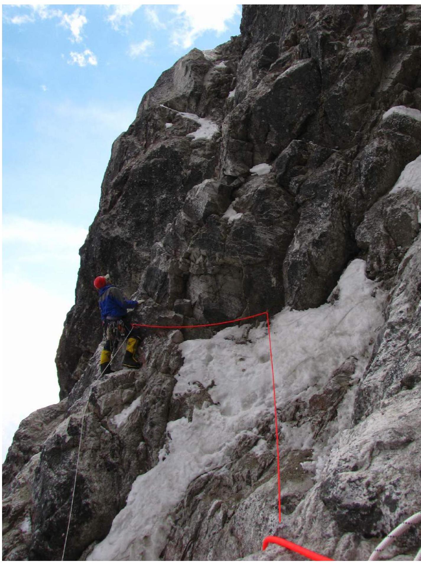
Photo 6. Yuri Vasenkov at the start of R2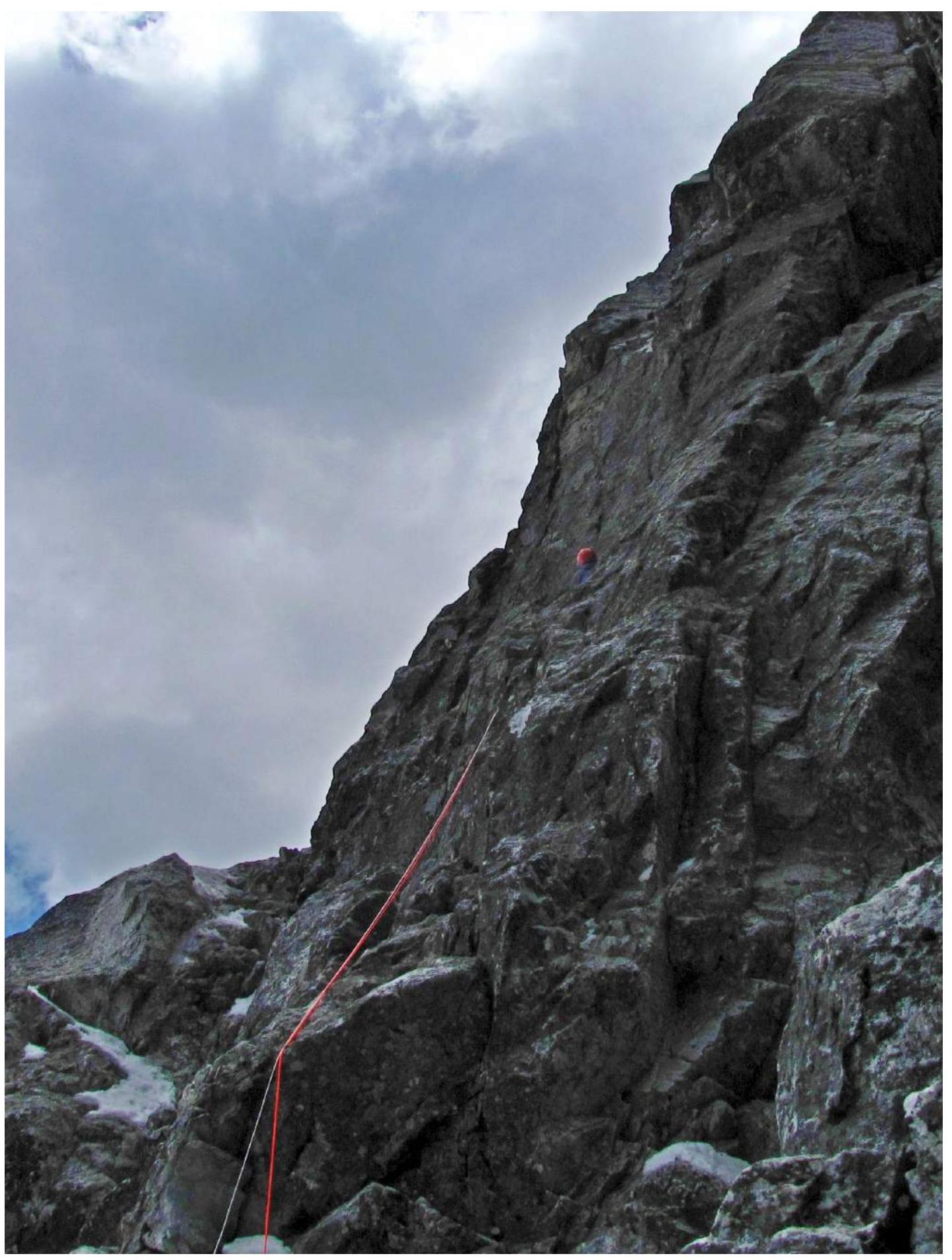
Photo 7. Before R3
Photo 8. Climbing the chimney at the end of R3
Photo 9. Lower climber (Y. Kiliichenko) at the end of R3, Maxim Perevalov (above) climbing the internal angle in the middle of R4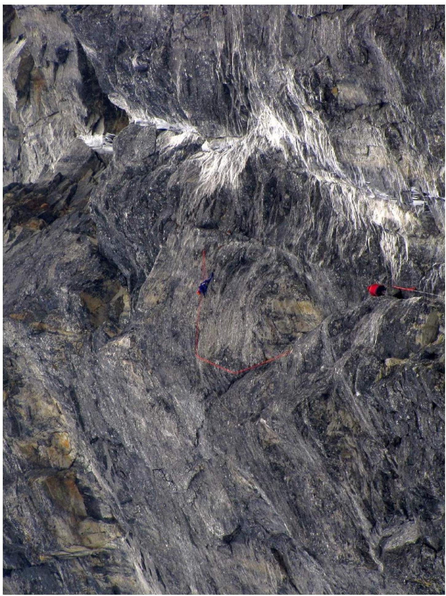
Photo 10. Climbing R5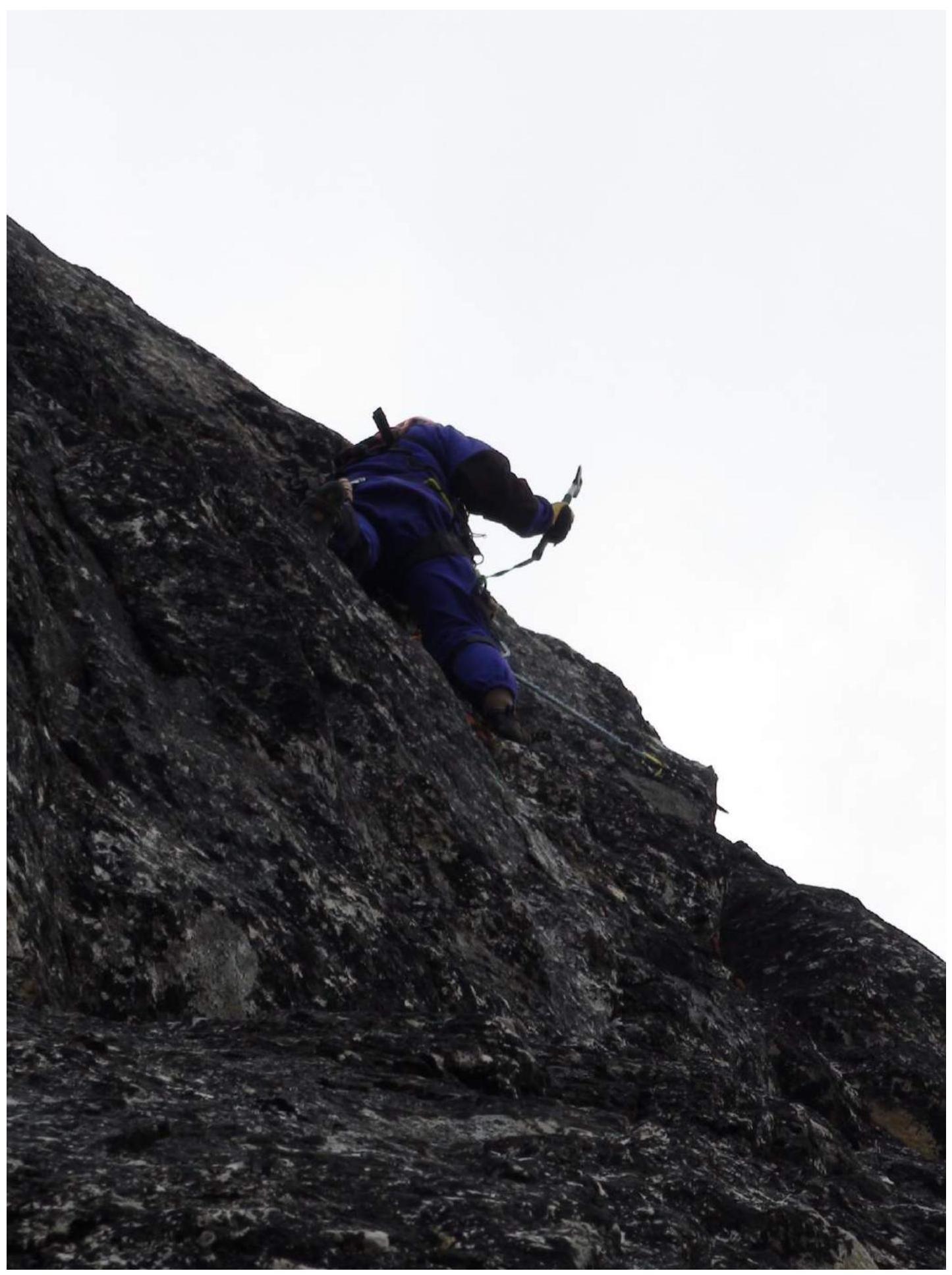
Photo 11. Perevalov on ITO in the middle of R5
Photo 12. Climbing R6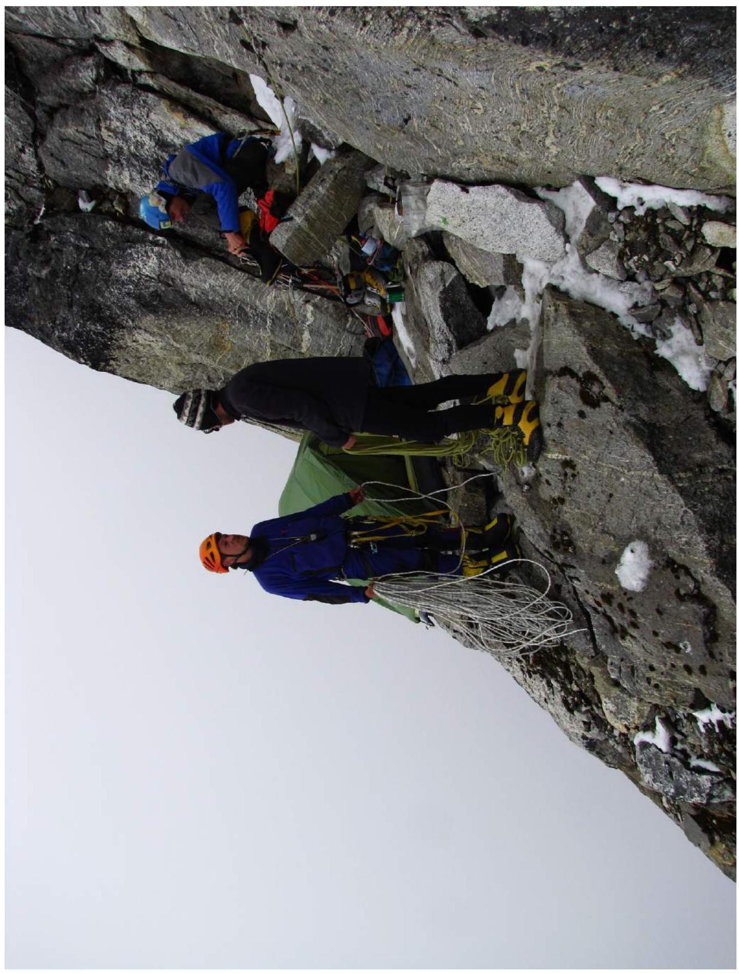
Photo 13. Camp C1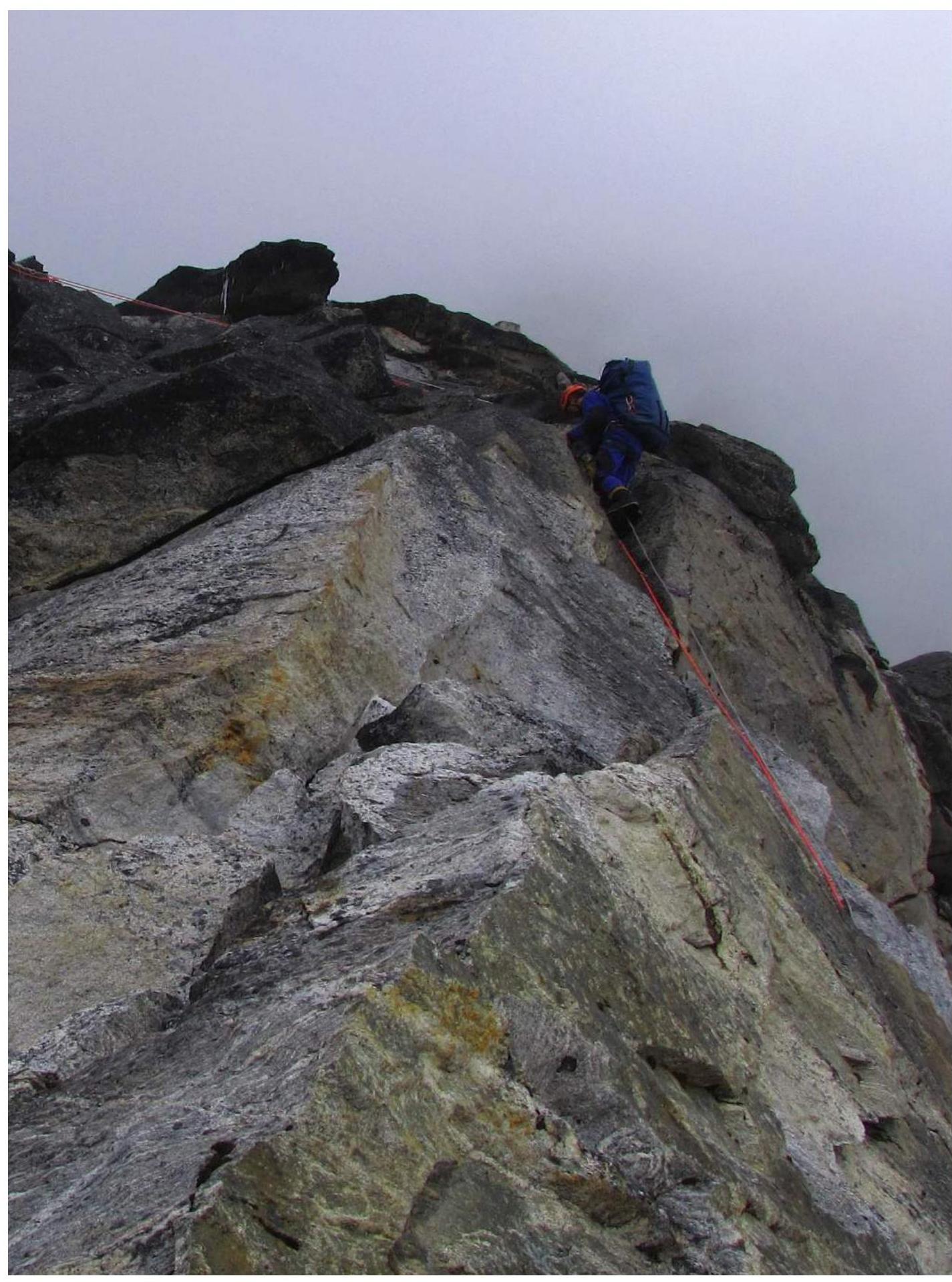
Photo 14. Rope above camp C1, upper part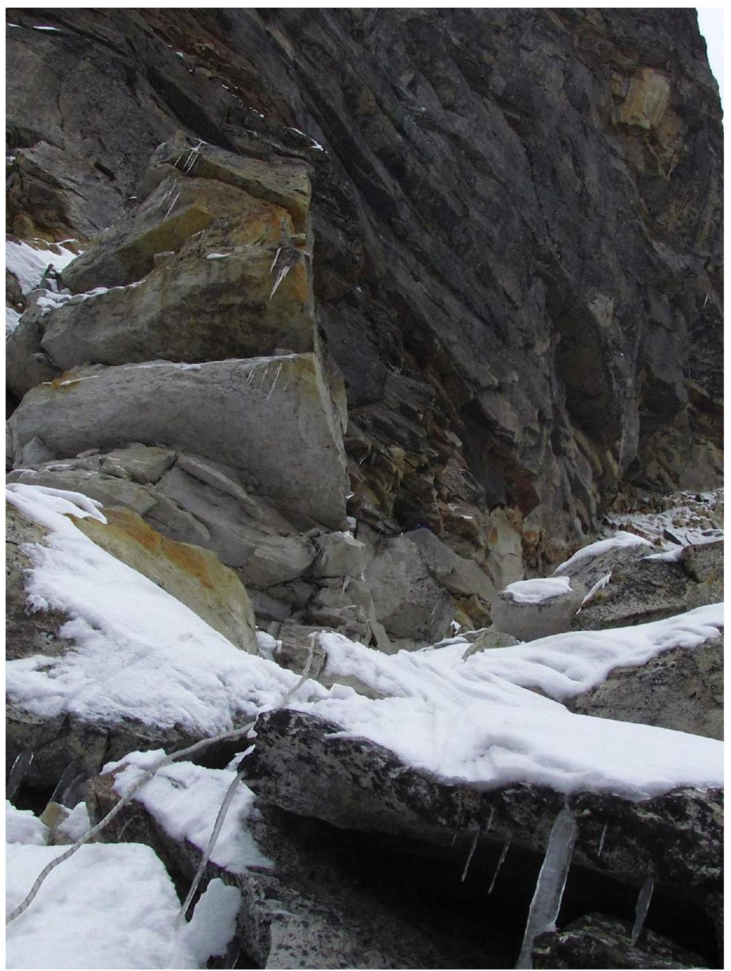
Photo 15. End of R9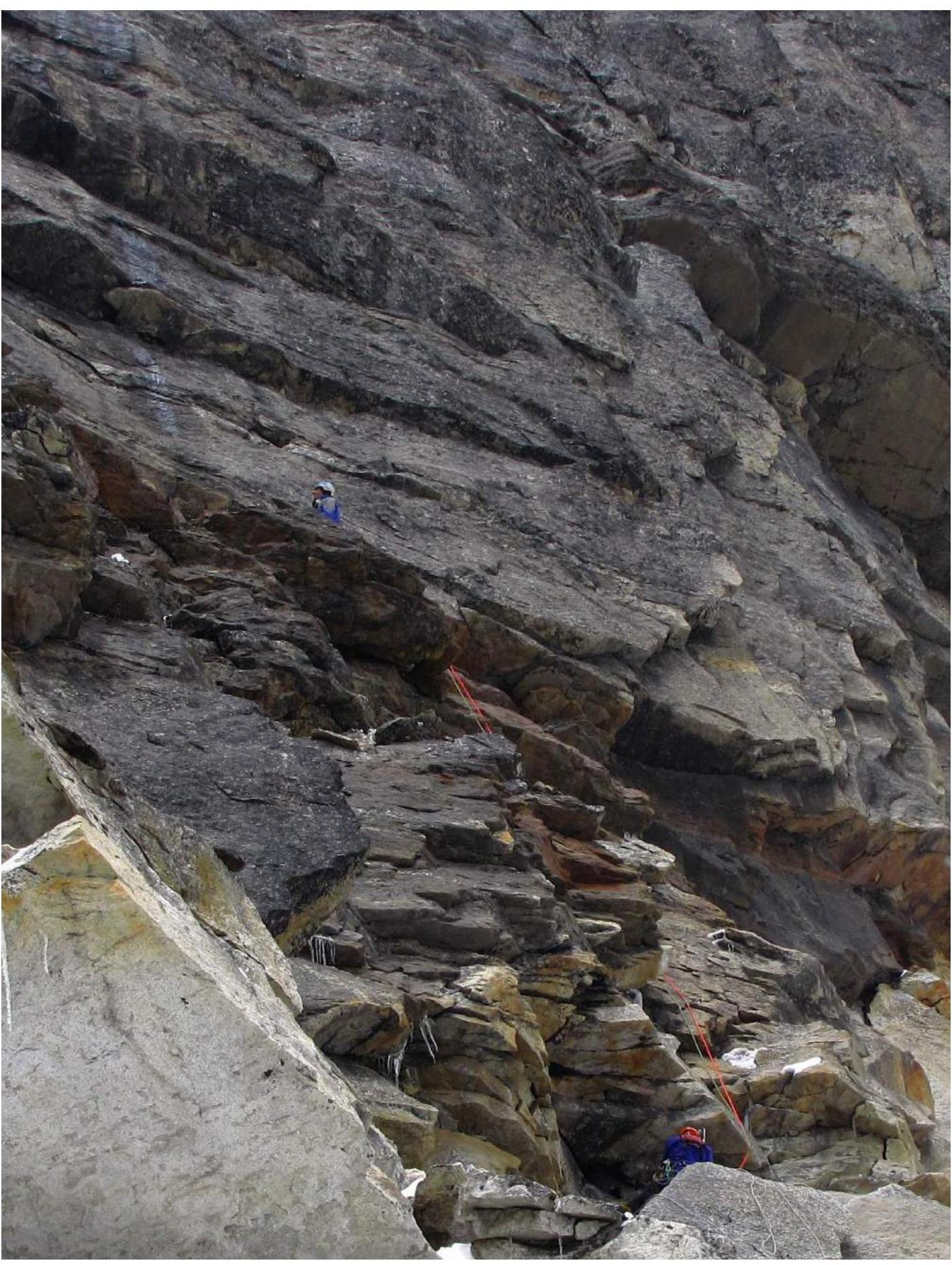
Photo 16. Start of R10, Perevalov and Poberezhny working.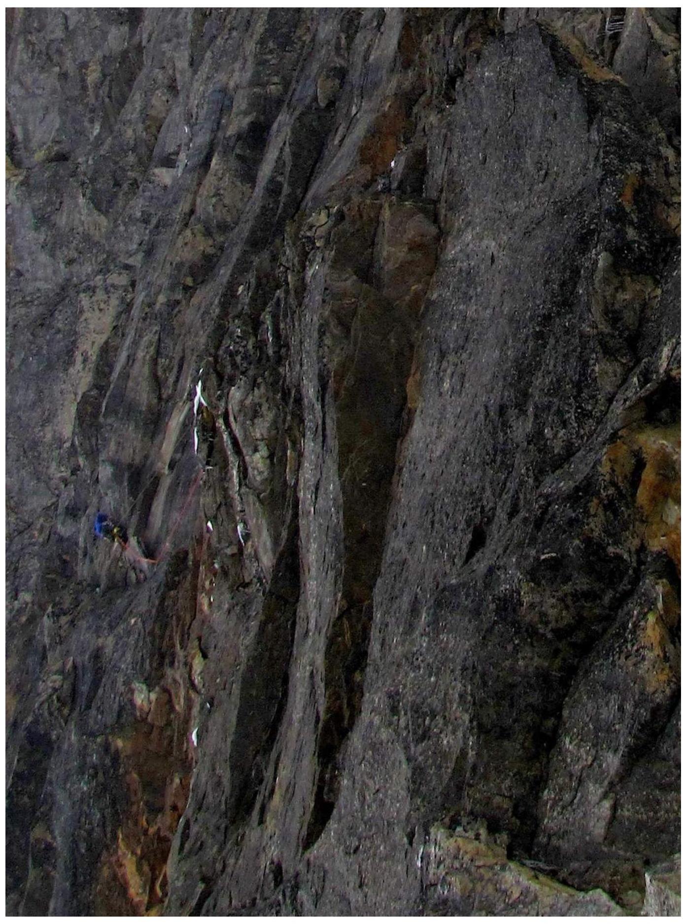
Photo 17. R11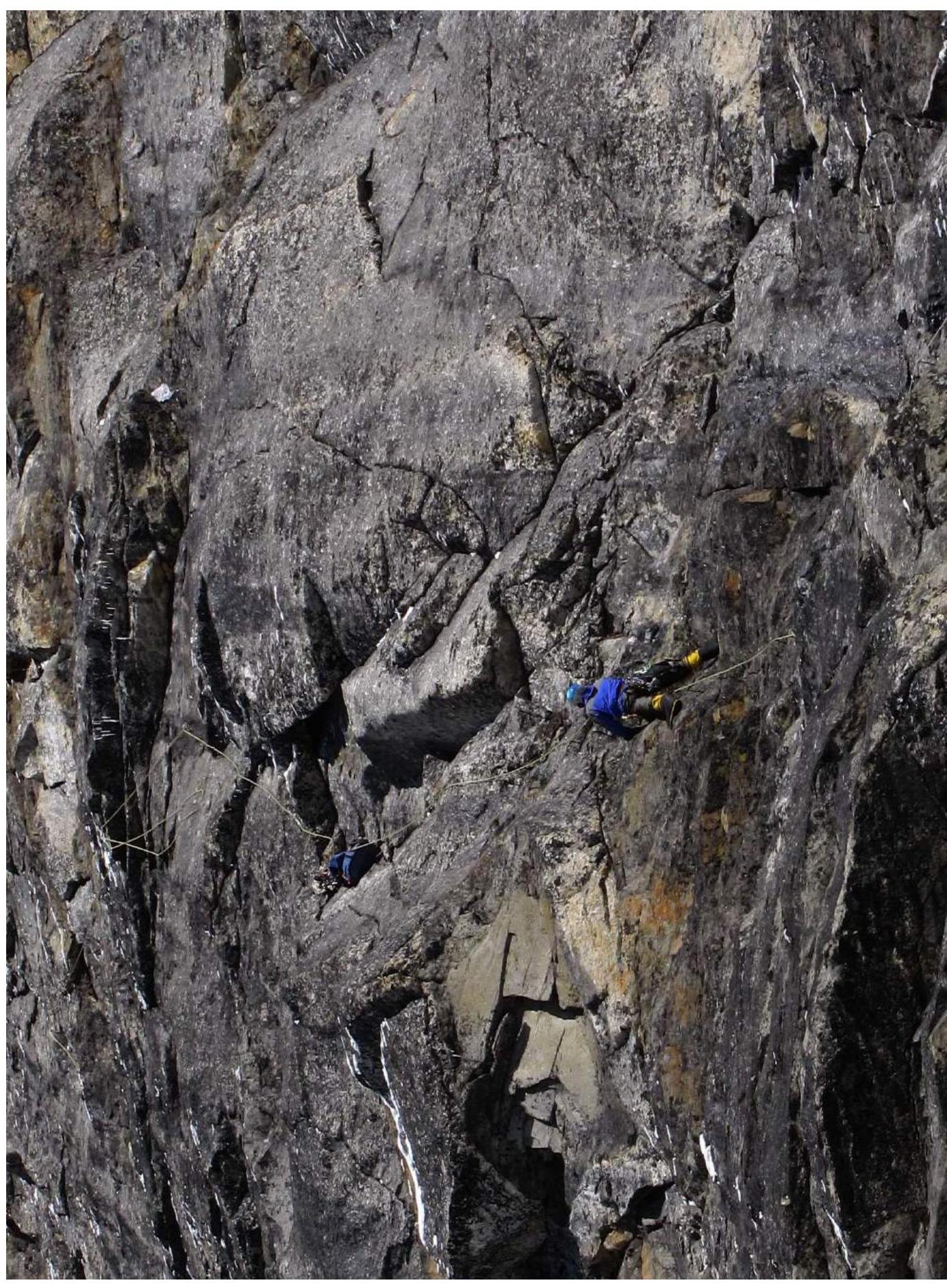
Photo 18. Middle of R12, overhangs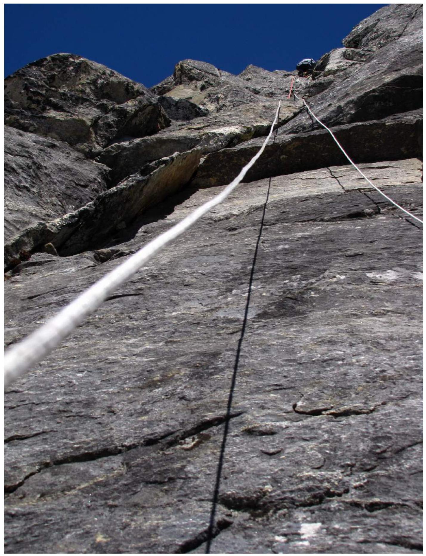
Photo 19. Overhang at the end of R12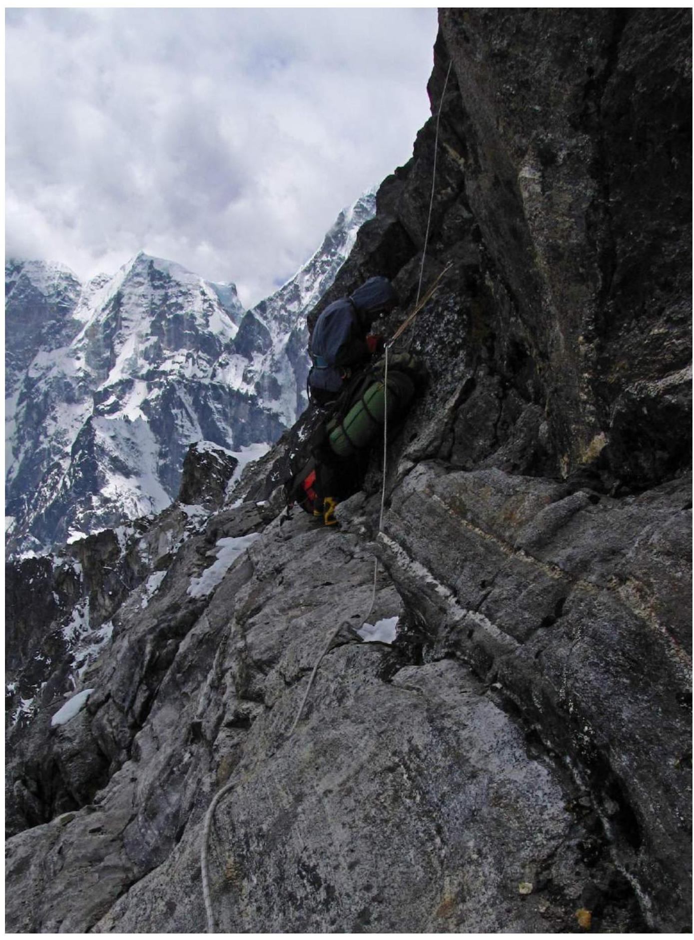
Photo 20. Ledge 30–40 m below the large overhang on R13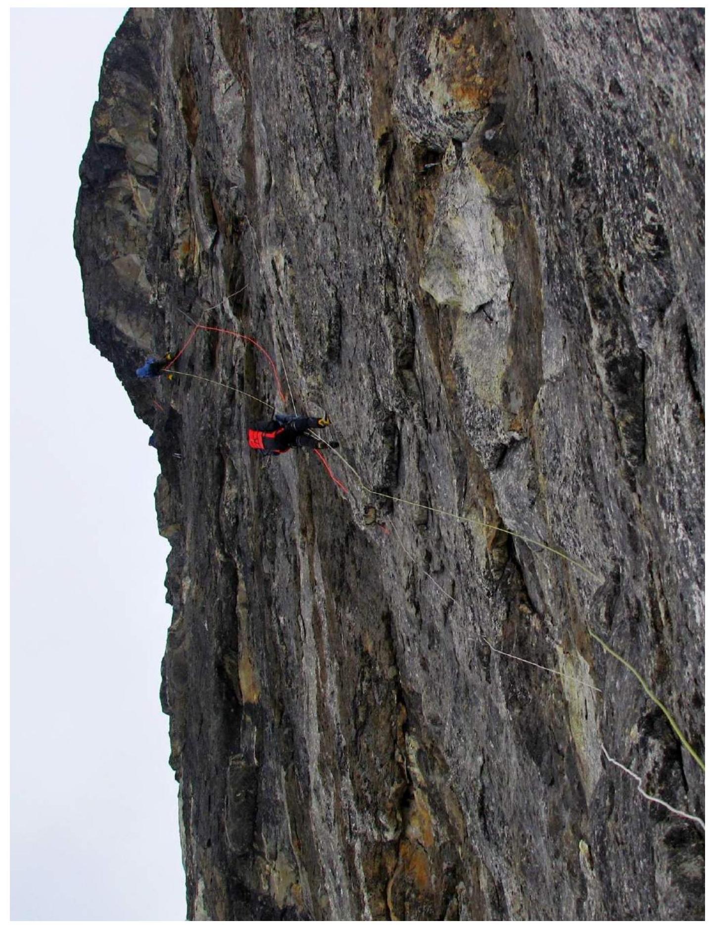
Photo 21. R13 with a large overhang on the right.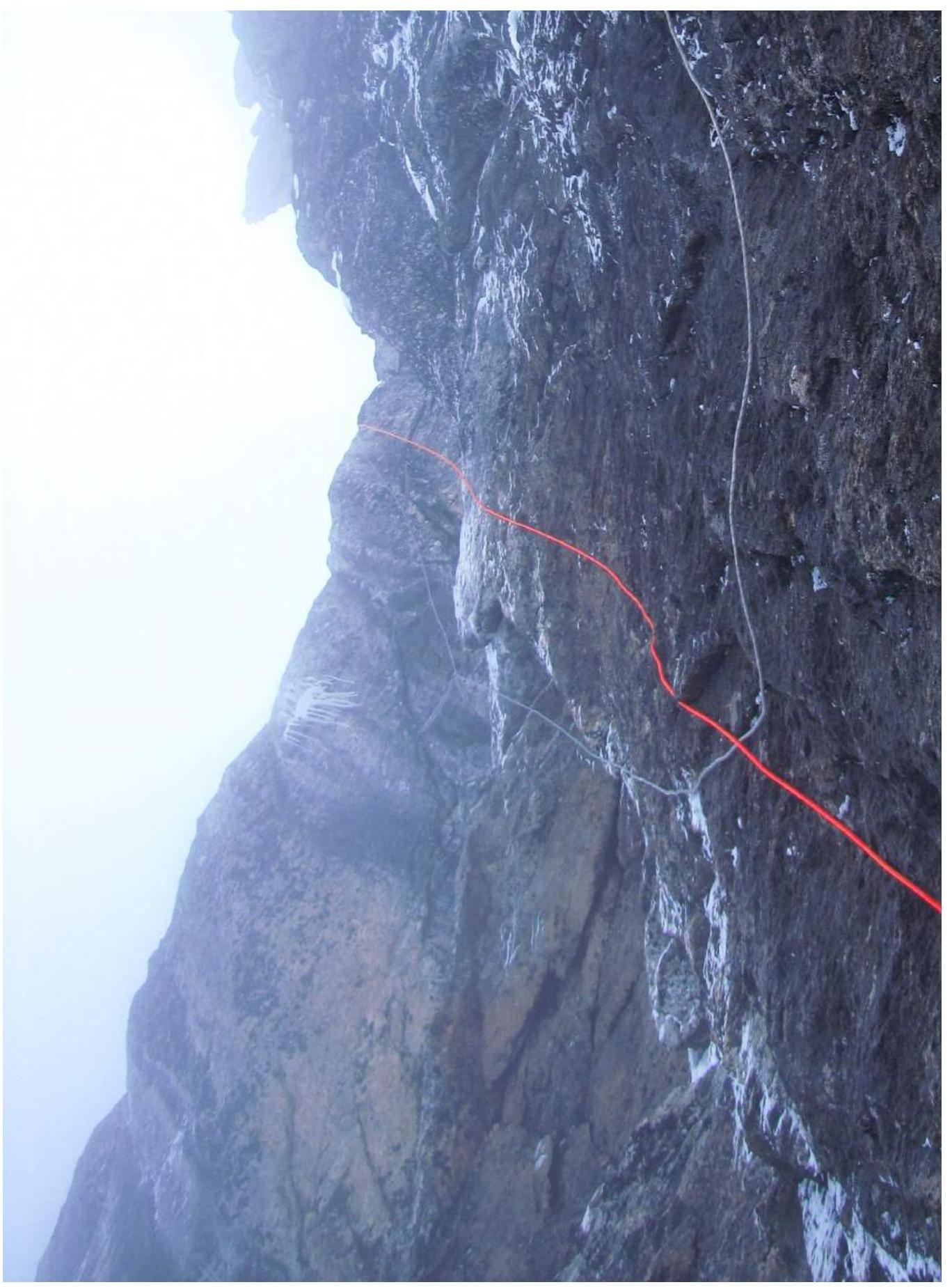
Photo 22. Exit from the wall to the ridge, view from below.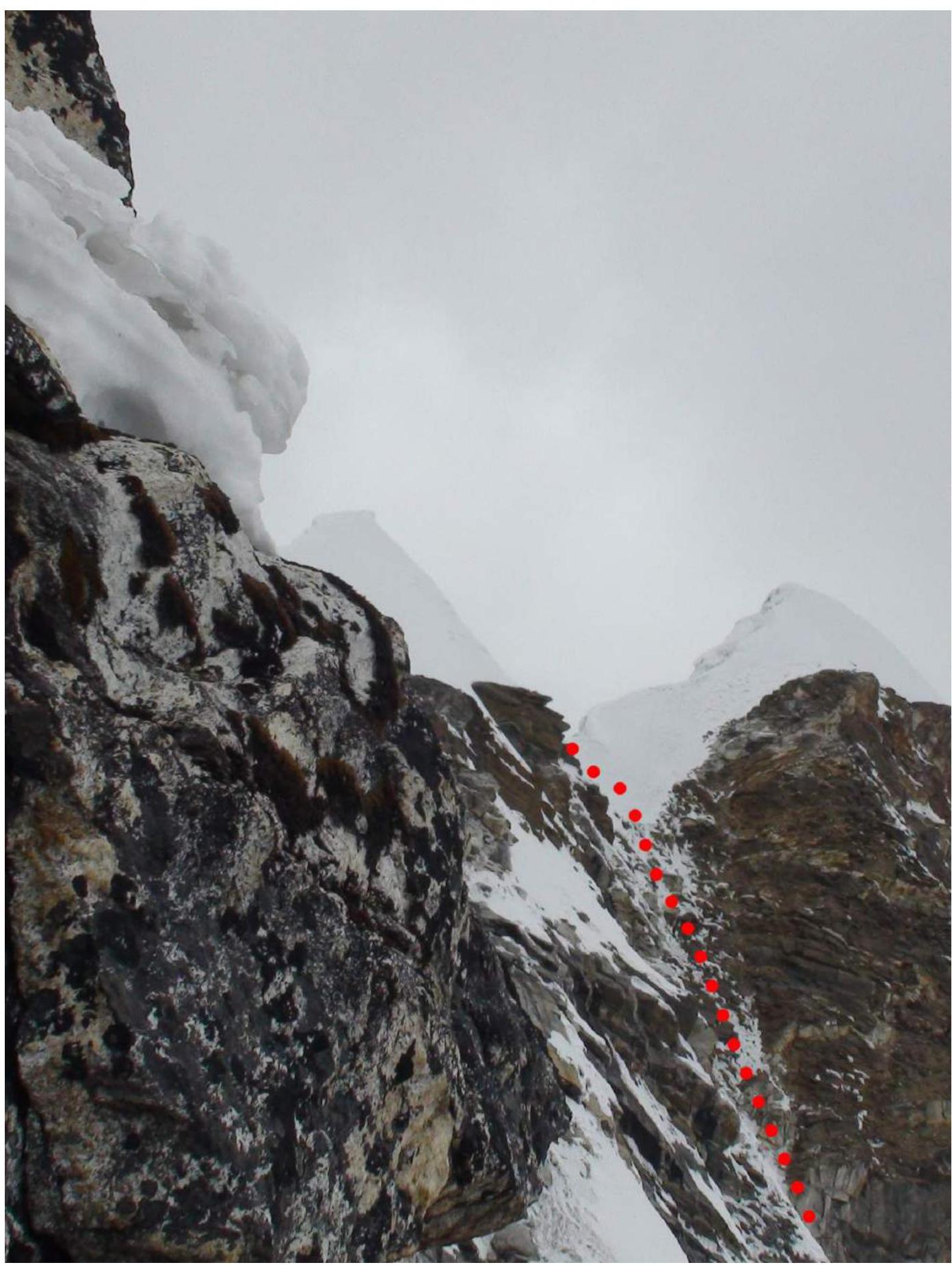
Photo 23. Exit to the ridge, view from the bivouac, path shown with a dotted line.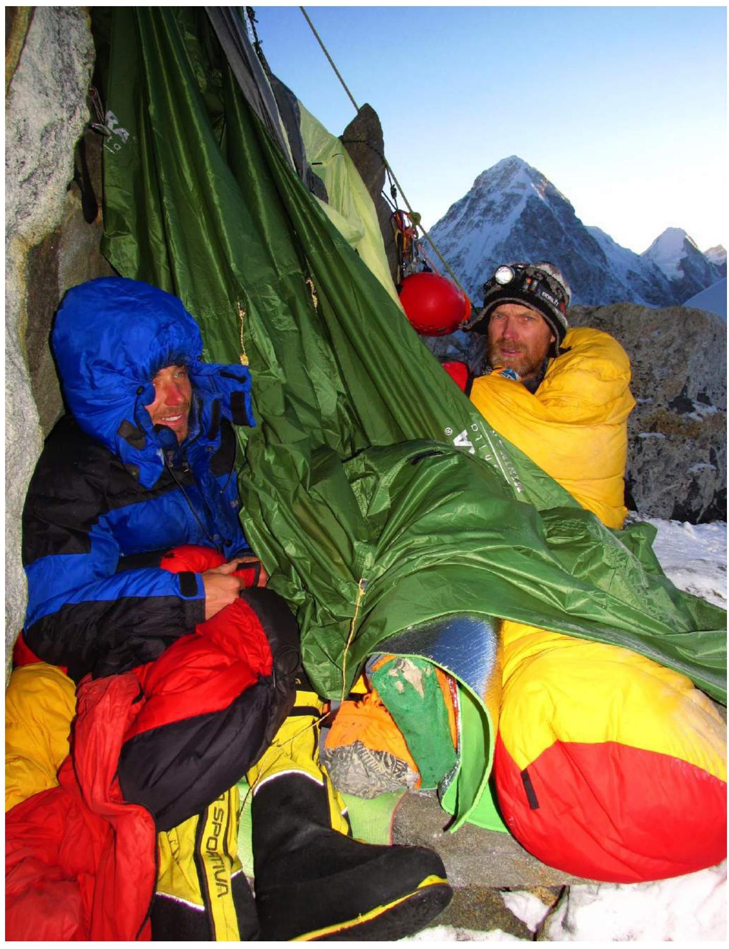
Photo 24. Camp C2.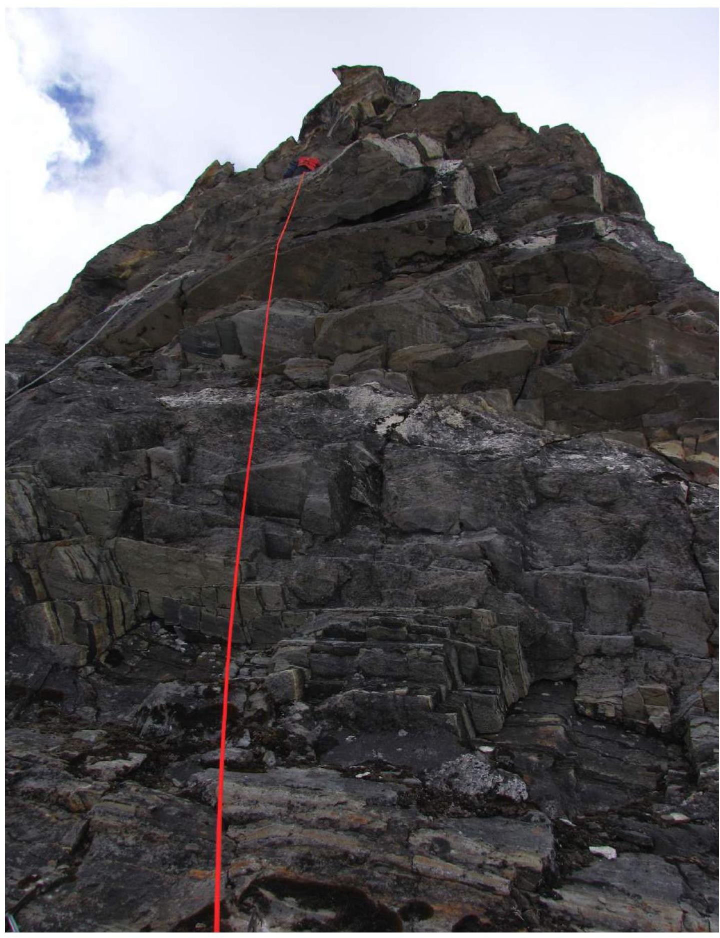
Photo 25. Pinnacle above camp C2
Photo 26. "False summit", height approx. 6000 m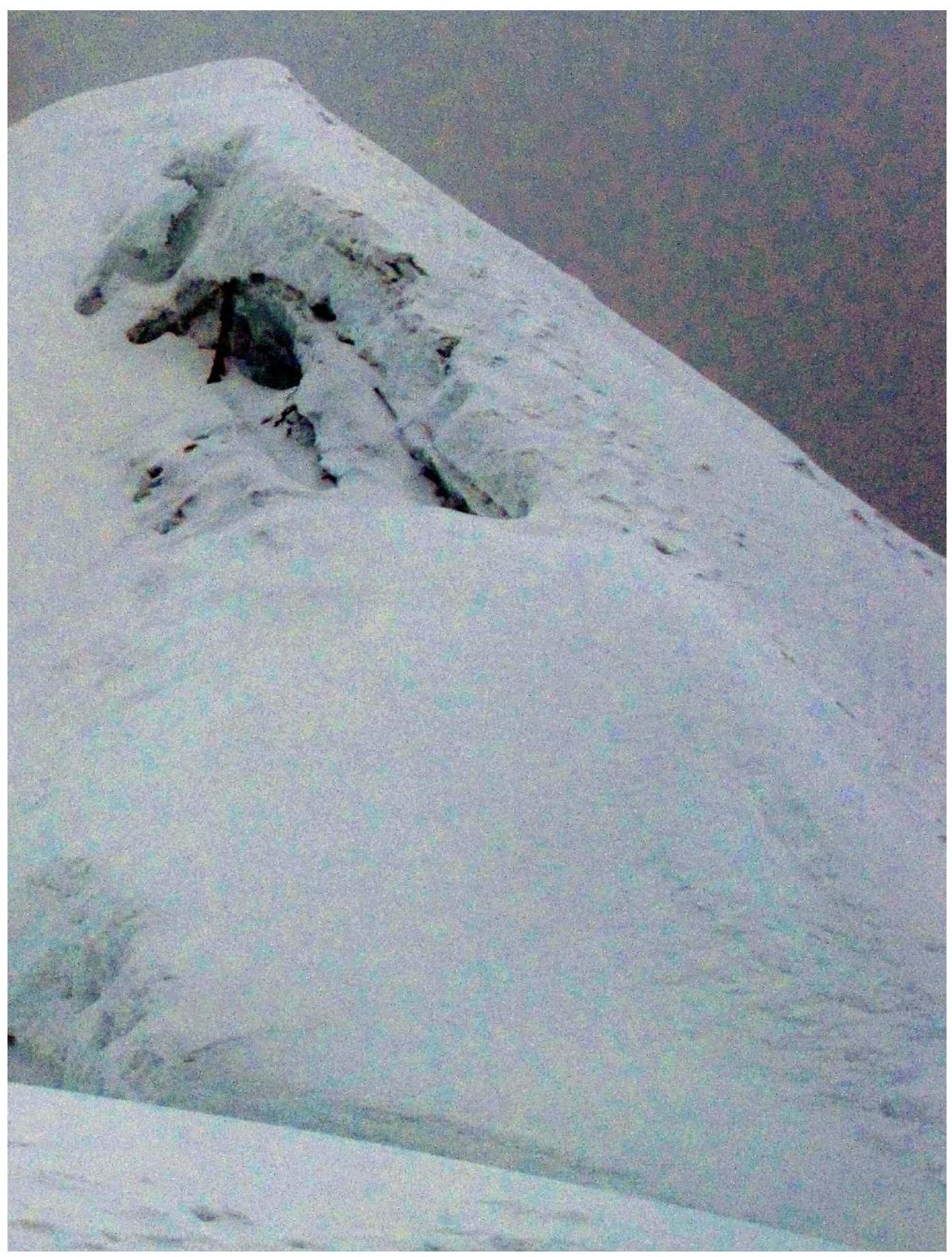
Photo 27. Summit.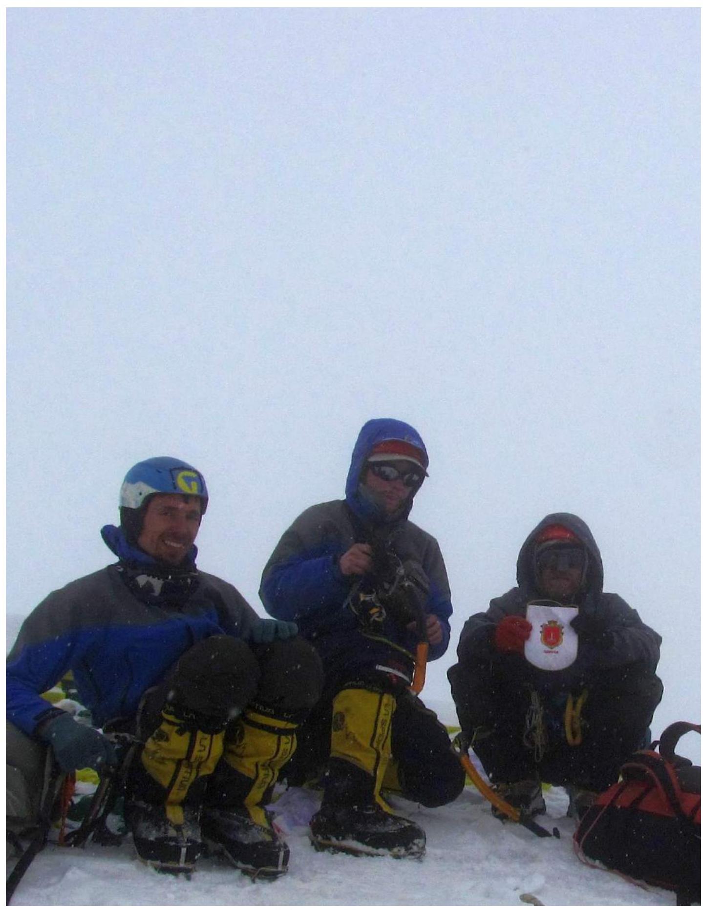
Photo 28. Team on the summit. Sitting:
- Poberezhny;
- Vasenkov;
- Kiliichenko;
- Perevalov — taking a photo.
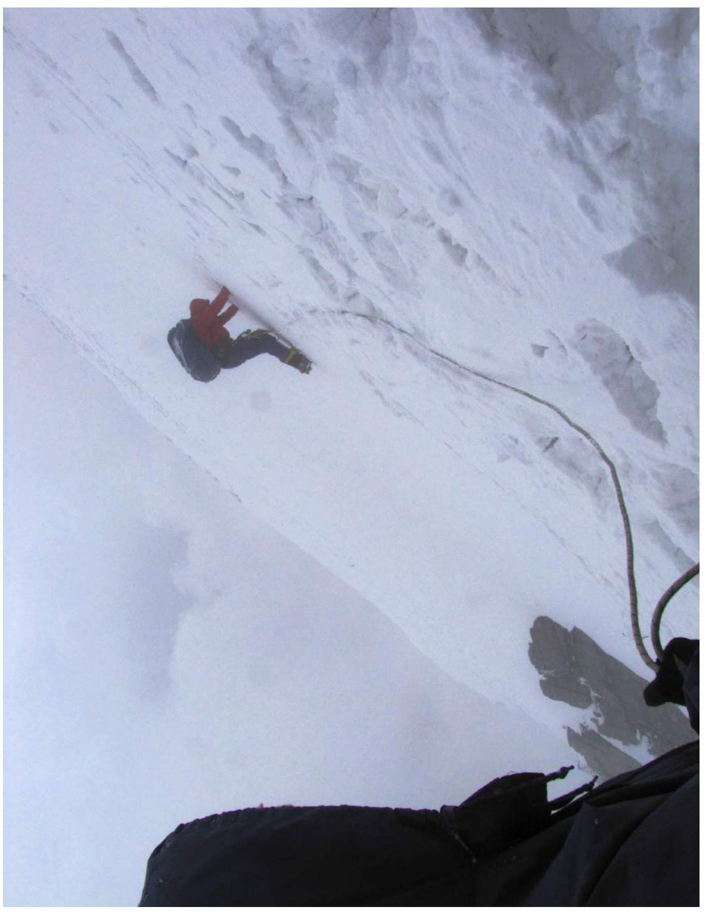
Photo 29. Moment of descent along the SE ridge, height approx. 5800 m.