
Route Descriptions for Climbing Fregat Peak
Via the Central Counterfort, Category 2B
From the base camp, move along the right bank of the Ulun River towards Fregat Peak, heading towards the central counterfort. After 1 hour, start ascending via the couloir, keeping to its right side. In the upper part, the couloir becomes steeper, leading to a wide snow-ice chimney. Climbing is tense. In the upper part of the chimney, there are "live," slightly overhanging, crosswise blocks that require careful passage. It is recommended to set up a station or belay above them, in the lower part of a small chimney that leads to the ridge.
Further movement is possible:
- Simultaneous or alternating movement to the gendarme (the first key point of the route).
A sloping shelf to the right of it transitions into a steep, snow-covered wall with ice in the crevices. After passing it, we enter a steep internal angle with smooth walls, leading to the top of the gendarme, where a station needs to be set up.
Subsequent movement occurs strictly along the ridge, requiring accuracy and attention. After the ridge, depending on the route's condition, one can:
- Go through an icy chimney with a transition to the wall and ascend it to the left,
- Or move along the right wall of the chimney, only reaching the wall in its upper part.
The last 40 meters of the counterfort, as well as further movement along the ridge to the summit, must be done in alternating steps, carefully belaying, as a fall from here could have the most severe consequences.
The descent from the summit is done on the opposite side of the ascent via a wide couloir and then by traversing around Morion Peak in the direction of Edelweiss Pass.
Time on the route — 8 hours.
Route Safety Assessment
The route is logical. Potential danger, apart from passing rocky key sections, is posed by snow-covered, ice-filled, and moss-grown rocks and slabs along the entire route.
The ridge of the counterfort in its middle and upper parts is destroyed, with many "live" stones frozen in ice. One should be very careful when passing them and organizing belays.
Sections of the ridge with Category 3B difficulty are also dangerous due to their pointedness and the possibility of falling onto rocky and icy slopes to the right and left of the route.
One should be cautious of snow cornices:
- On the summit;
- When moving towards Edelweiss Pass;
- When passing the pass.
Snow avalanches are possible:
- When ascending via the couloir;
- When descending from the pass.
Recommendations for Equipment Use
For a group of 6 people, it is necessary to have:
- 4 ropes
- Helmets, crampons, ice axes for each participant
- 8–12 pitons
- 8–12 protection elements
- 10 quickdraws with carabiners
Characteristic Signs of the Route's Beginning
The route is clearly visible from a distance, as it is a straight line from the bottom of the wall to the summit with a fork into right and left branches. The couloir leads us directly to the rocks of the most noticeable left, necessary branch of the counterfort. To the right, the rocks of the right edge of the central counterfort are clearly visible, and to the left, there are sheer, smoothed rocks with an icefall in the upper part.
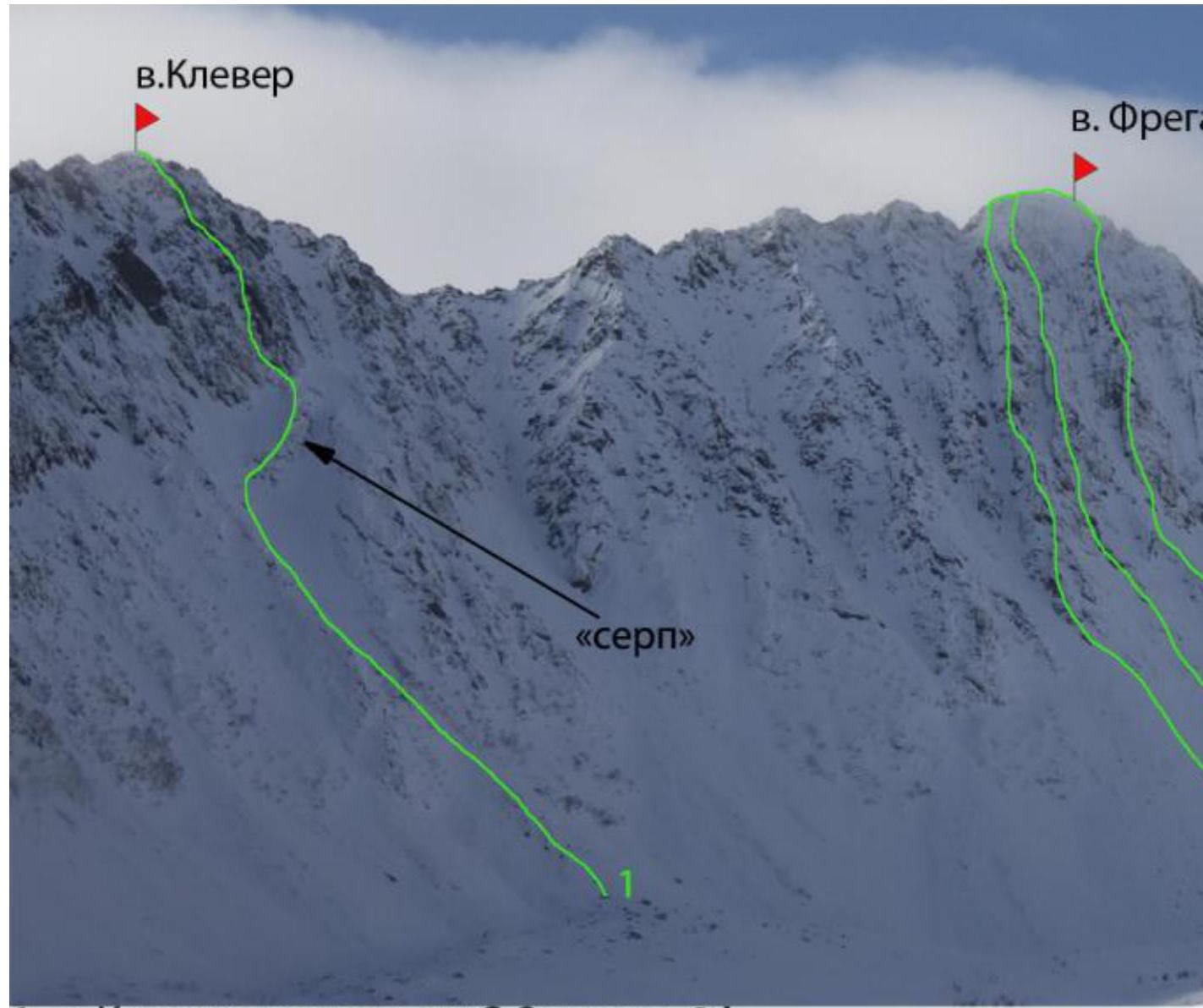
- Klever Peak, via the center of the NW wall, Category 3A
- Fregat Peak, via the left NW counterfort, Category 3A
- Fregat Peak, via the central counterfort, Category 2B
- Fregat Peak, via the right NW counterfort, Category 3B
- Morion East Peak, via the NW counterfort, Category 2A
- Morion Peak, via the NW counterfort, Category 3A