
Passport
- Altai, Severo-Chuysky Ridge, Karakbak gorge, 1:2 scale
- The summit of Geroev Altaya via the center of the North-West slope, height 3511 m (GPS measurement).
- Proposed category — 4A, first ascent.
- Route type — ice
- Elevation gain: 480 m; length — 1100 m.
Average steepness of the route — 35–45 degrees.
Length of sections with 5th category difficulty — 80 m.
-
Number of pitons used on the route: ice screws — 24.
-
Team's travel time: 6 h 30 min from the glacier to the summit;
12 h 00 min from the glacier to the glacier; 14 h 30 min from the advanced base camp to the advanced base camp.
-
No overnight stays.
-
Climbing pair: Barnov Sergey Ivanovich, 1st sports category;
Komissarov Dmitry Alexandrovich, 3rd sports category.
-
Coach: Drakin Andrey Valentinovich, 1st category (№68).
-
Departure from the advanced base camp: 8:00, July 10, 2001.
Arrival at the glacier: 9:45, July 10, 2001. Start of the route: 10:30, July 10, 2001. Reaching the summit: 16:15, July 10, 2001. Return to the glacier: 21:45, July 10, 2001. Back at the advanced base camp: 22:30, July 10, 2001.
-
Organization:
Joint gathering of the Tomsk Alpinism Federation and ZS TPSS.
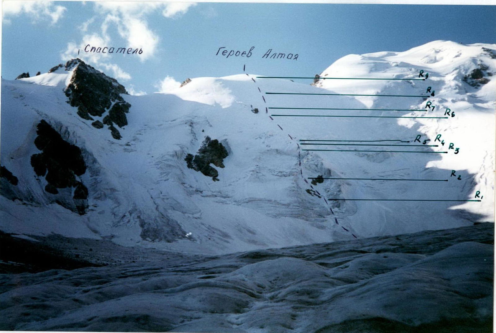
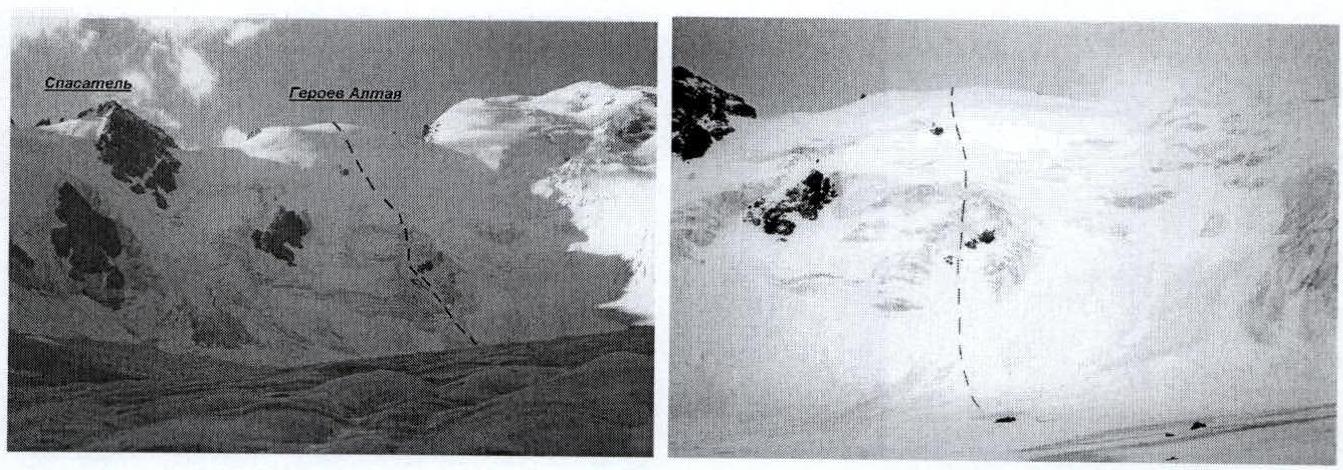
The summit of Geroev Altaya via the center of the North-West slope, shooting point № 2
The summit of Geroev Altaya via the center of the North-West slope, shooting point № 1

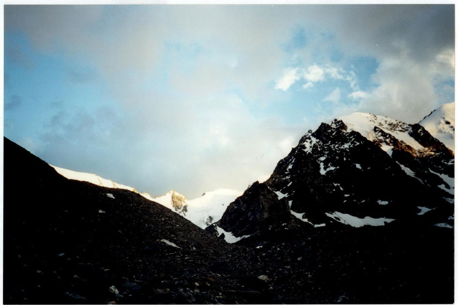
v. Spasatel

The route to the summit of Geroev Altaya via the center of the North-West slope (ice). Approximately 4A category.

View from the base camp: upper part of the route
View from the glacier
From the advanced base camp, located near the last confluence of the Karakbak river and the river from the cirque of the Karakbak peaks, move along the left orographic bank to the glacier tongue. Approach the North-West slope of the Geroev Altaya peak via the glacier. The approach from the advanced base camp takes 1.5–2 hours.
Movement on ice. Two possible route variations are visible:
- directly through the icefall
- to the right of it
The variation to the right of the icefall is easier but clearly more avalanche-prone. During the descent after completing the route, a large avalanche was observed exactly at this location.
In the direction of the rock outcrops near the icefall, 200 m from the bergschrund (4 ropes of 50 m) — steepness: 15°–25°, simultaneous movement with protection via ice screws.
Between the rock outcrops, 50 m to the left and upwards, steepness: 40°–50°, movement on fixed ropes, protection via ice screws. Further, steep ice directly upwards 80 m, steepness: 60°–80°, then 50 m of crevasses at 5°–85° — with short walls, followed by 30 m ascent at 60°–75°, movement on fixed ropes, protection via ice screws.
Further, in the direction of a small rock outcrop, 200 m along the slope with gradually increasing steepness 25°–40°, crevasses!
To the right of the rock outcrop, a small (10 m, 60°) ledge, followed by a gentle slope ~300 m with a steepness of 30°–40°, and then 100 m of a flattening (5°–25°) slope in the direction of the rocks under the summit.
Reaching the summit: broken rocks 10–15 m, easy climbing in crampons (rocks in snow and ice).
Descent via the ascent route.
Route Safety Assessment
The route is not rockfall-prone. In 2001, despite a large amount of snow, no avalanches occurred on the route. Ice fall onto the route is possible in principle near the icefall. During the approach and especially during the return, it is necessary to stay in the center of the glacier: to the left of v. Geodezicheskoi in 2000, large masses of ice fell, forming 3 glacial tongues on the glacier.