
Report
on the first ascent
To the summit: Zholтая стена (3800 m) Via the route: Left of the Center of the Eastern wall, from the shelf Category of complexity: 5A cat. sl. (proposed) By the team of the Irkutsk region: Klepikov A.A., Lazarev S.A., Tokmachev A.A., Vitvitsky D.S., Kazantseva E.V. The ascent was made on July 31, 2023.
I. Ascent Passport
| № п.п. | 1. General Information | |
|---|---|---|
| 1.1 | Full name, sports rank of the leader | Klepikov Alexander Alexandrovich, Master of Sports, 3rd category |
| 1.2 | Full name, sports rank of the participants | Lazarev Stanislav Alexandrovich (Candidate for Master of Sports) Tokmachev Andrey Andreevich (1st sports rank) Vitvitsky Dmitry Sergeevich (2nd sports rank) Kazantseva Evgenia Vasilievna (2nd sports rank) |
| 1.3 | Full name of the coach | Afanasiev Andrey Evgenievich, Master of Sports, 1st category |
| 1.4 | Organization | FASIО |
| 2. Characteristics of the ascent object | ||
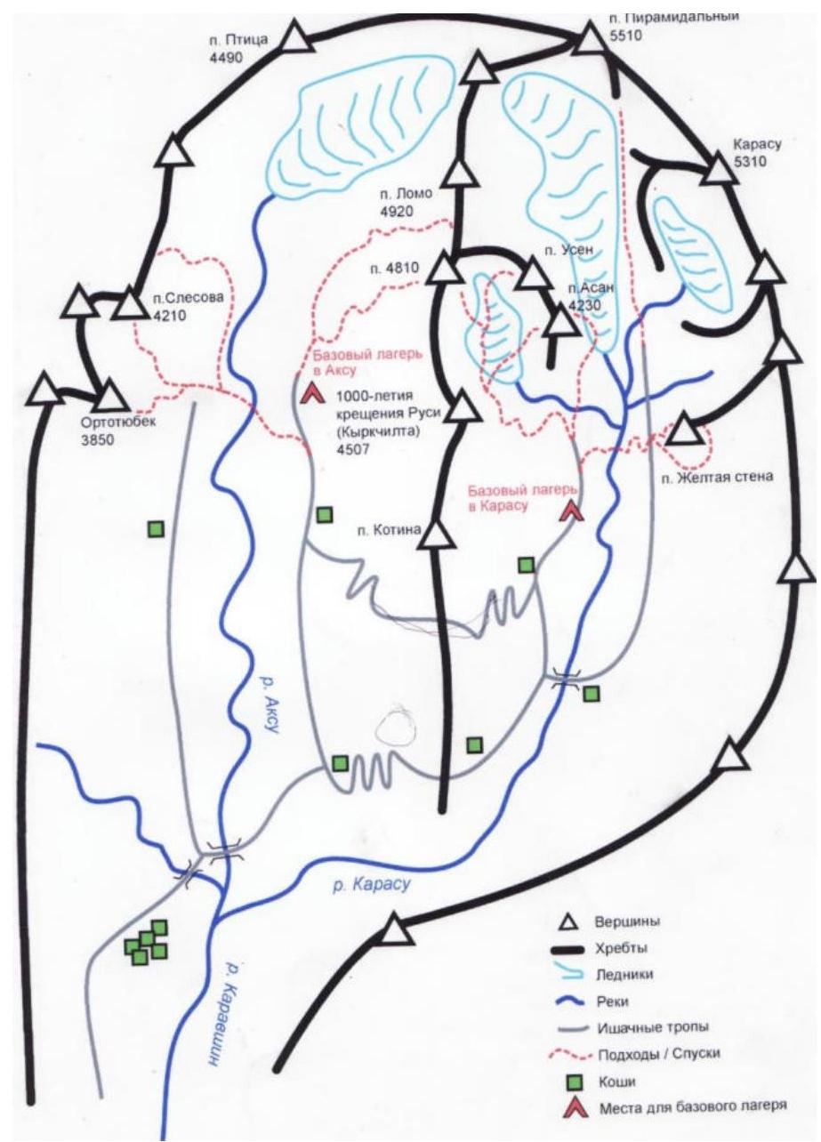
| 2.1 | Region | Gissar-Alay |
| 2.2 | Valley | Karavshin |
| 2.3 | Section number according to the 2020 classification table | 5.4.3 |
| 2.4 | Name and height of the summit | Zholтая Стена (3800 m) |
| 3. Characteristics of the route | ||
| 3.1 | Route name | Left of the center of the Eastern wall from the shelf |
| 3.2 | Proposed category of complexity | 5A |
| 3.3 | Degree of route development | First ascent |
| 3.4 | Character of the route terrain | Rock |
| 3.5 | Height difference of the route and the main part | 600–343 m |
| 3.6 | Length of the route and the main part | 720–375 m |
| 3.7 | Technical elements of the route (total length of sections of various complexity categories with indication of terrain character (ice-snow, rock)) | III cat. sl. rocks — 325 m. IV cat. sl. rocks — 60 m. V cat. sl. rocks — 165 m. VI cat. sl. rocks — 170 m. |
| 3.8 | Average steepness of the route | 59 |
| 3.9 | Average steepness of the main part | 68 |
| 3.10 | Descent from the summit | To the Southwest via the descent couloir |
| 3.11 | Additional characteristics of the route | In summer, there is no water on the route under normal conditions |
| 4. Characteristics of the team's actions | ||
| 4.1 | Time of movement (team's walking hours, indicated in hours and days) | 17:30 hours to the summit, 1 day |
| 4.2 | Overnights | No |
| 4.3 | Start of the route | 06:50 July 31, 2023 |
| 4.4 | Reaching the summit | 00:20 August 1, 2023 |
| 4.5 | Return to the base camp | 03:30 August 1, 2023 |
| 5. Responsible for the report | ||
| 5.1 | Full name, e-mail | Klepikov A.A., Baikalteam@gmail.com |
1.1. General photo of the Zholтая стена summit 3800. (Photo taken from under the Kыркчилта summit, shooting height 3400 m, date of shooting August 2023)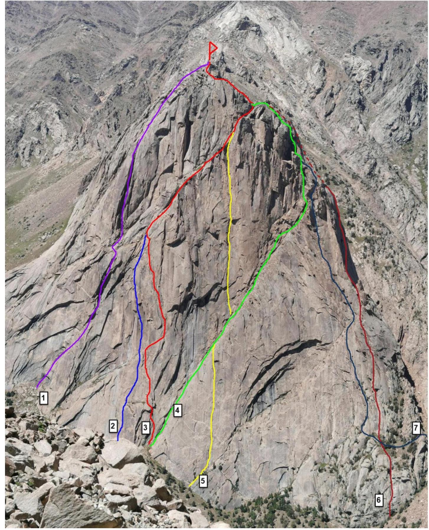
- Left part of the Eastern wall 5A (Zhigalov 2014)
- Left part of the Eastern wall 5A n/c (Korulin–Mukhametzyanov 2019)
- Team's route left of the center of the Eastern wall from the shelf 5A cat. sl. n/c. 2023
- Center of the Eastern wall 4Б (Solonnikov 1987)
- Center of the Eastern wall 5Б (Yanushevich 2005)
- Right part of the Eastern wall 5A (Terekhin–Khvostenko 2019)
1.2. Photo of the route profile
(Photo taken from the Kara-Su glacier, distance approximately 3 km, shooting height 3150 m)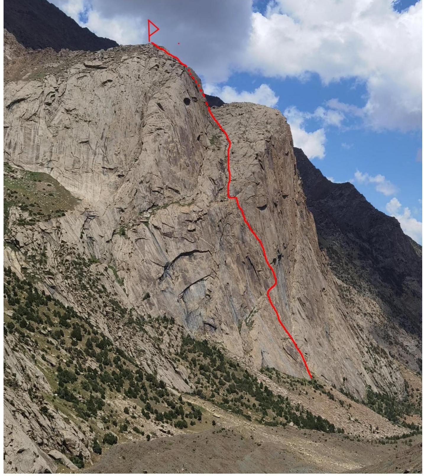
1.3. Drawn profile of the route.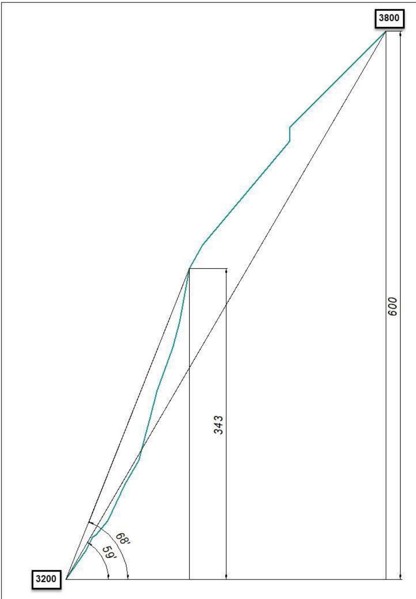
1.4. Photopanorama of the Karavshin valley summits.
(Photo taken from under the slope of the Kotina summit, shooting height 2900 m)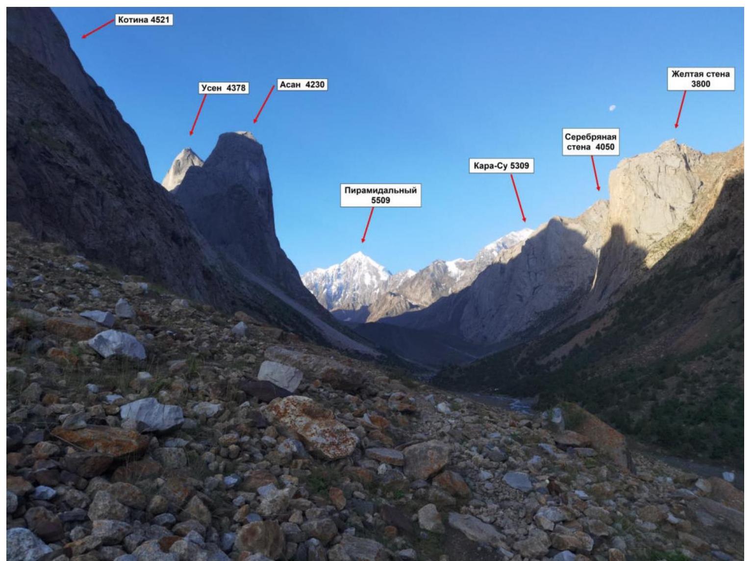
1.5. Map-scheme of the Karavshin valley
2.1. Technical photo of the route
(Photo taken from under the Kыркчилта summit, shooting height 3400 m, date of shooting August 2023)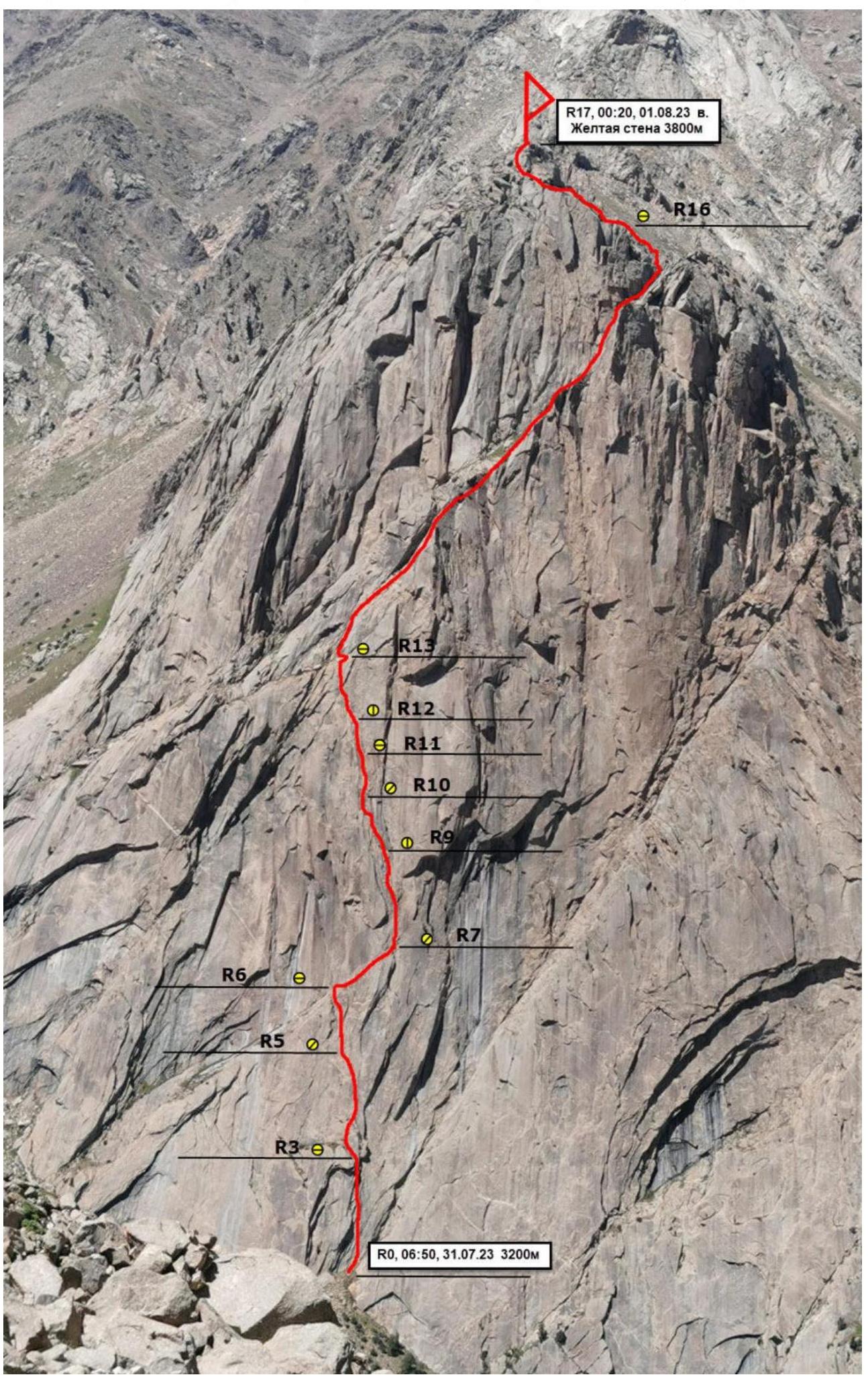
Description and characteristics of the terrain
The starting point of the route is the beginning of the classic route to Zholтая стена 4Б/5А by Solonnikov in 1987. From the shelf, we move up the slab in the direction of a simple transition through the inner corner that limits the slab on the left.
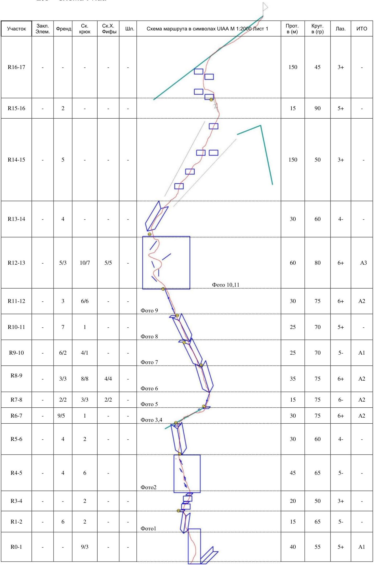
Rope 1
R0–R1 40 m, 55°, 5+, A1. Slab with poor relief, up to the cornices and passage in the inner corner limiting the slab on the left, belay on anchors. 9 anchors. R1–R2 15 m, 65°, 5–. Through the inner corner with rich relief for belay, with a transition from the corner to the left, and exit to a ledge. 5 friends. R2–R3 5 m, 35°, 3–. Along the ledge to the belay station. 2 anchors, friends.
Rope 2
R3–R4 20 m, 50°, 3+. Through a system of small ledges and walls. 2 anchors. R4–R5 45 m, 65°, 5–. Through a system of flakes with blind cracks from right to left. Belay station under a destroyed inner corner. 4 friends, 6 anchors.
Rope 3
R5–R6 30 m, 60°, 4–. Through a destroyed corner slightly to the left, with an exit to a balcony crossing the entire wall. 2 anchors, 4 friends.
Rope 4
R6–R7 30 m, 75°, 6+, A1–A2. Along a crack-ledge to the right with a slight gain in height. Difficult climbing over the ledge and then transitioning into a crack on artificial support.
Rope 5
R7–R8 15 m, 75°, 6–, A2. Up through complex relief. R8–R9 35 m, 75°, 6+, A2. Through an inner corner to the left. 8 anchors, 3 friends.
Rope 6
R9–R10 25 m, 70°, 5–, A1. Through inner corners, slightly to the left, exit to a small ledge. 6 friends, 4 anchors.
Rope 7
R10–R11 25 m, 70°, 5+. Not ярко expressed inner corner, up slightly to the left onto a ledge. 1 anchor, 7 friends.
Rope 8
R11–R12 30 m, 75°, 6+, A2. Blind cracks. Strenuous climbing.
Rope 9
R12–R13 60 m, 80°, 6+, A3. Difficult climbing and artificial support on descending relief, poor relief for belay. There are occasional blind cracks sloping downwards. The most challenging rope of the route, no pitons were used.
Further movement is simultaneous
R13–R14 30 m, 60°, 4–. Inner corner leading into a couloir. 3 friends. R14–R15 150 m, 50°, 3–/3+. Large inner corner/couloir, periodically interrupted by simple walls, leading to an intersection with Solonnikov's route, under a small wall with a crack. 8 friends. R15–R16 15 m, 90°, 5+. Wall with a crack on Solonnikov's route. 2 friends. R16–R17 150 m, 45°, 3–/3+. Exit to the ridge and along the ridge to the summit, large-block relief with rich belay opportunities on the terrain.
Descent is made to the Northwest with feet first.
2.3. UIAA scheme
Characteristics of the route and the team's actions
The day before the ascent, a reconnaissance of the wall was conducted, and a visual inspection was performed in both profiles and facades, identifying the most logical line tied to the relief.
The Eastern wall has several routes laid out at different times by strong teams. The wall's relief is rich and simultaneously monolithic, allowing the use of its routes as warm-up before serious ascents on the main peaks of the valley.
On the first rope, Kazantseva Evgenia worked as the leader. Then, Tokmachev Andrey worked on four ropes, after which he was replaced by Lazarev Stanislav.
The route has a key section in the upper part of the main section. The decision not to use pitons on the route set a high bar for overcoming the key rope. Due to the complex relief and limited number of safe belay points, the leader's passage of the key rope took about three hours. On this section, Lazarev Stanislav, CMS, with a free climbing level of 8A, and at the time of the ascent, an active member of the Russian national alpine team, led.
The descent from the summit is made to the Southwest via the classic descent route, on foot, without rappelling.
The author's experience with routes of the 5th category of complexity includes 38 ascents in the Sayan Mountains and the Caucasus, Gissar-Alay, and the mountains of Transbaikalia.
In terms of technical complexity, the route is a strong 5A, even by the elevated standards of Karavshin, exceeding some 5B routes climbed by the author.
Photo 1. Section R1–R2. The leader has moved from section R0–R1. Inner corner leading under the cornices, above which is the first belay station.
Photo 2. Section R4–R5. Friction climbing on a slab with short cracks.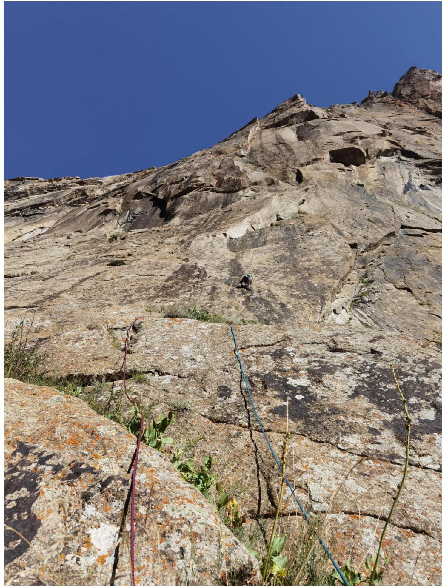
Photo 3. Section R6–R7. Beginning of an oblique ledge — cracks, difficult balance climbing.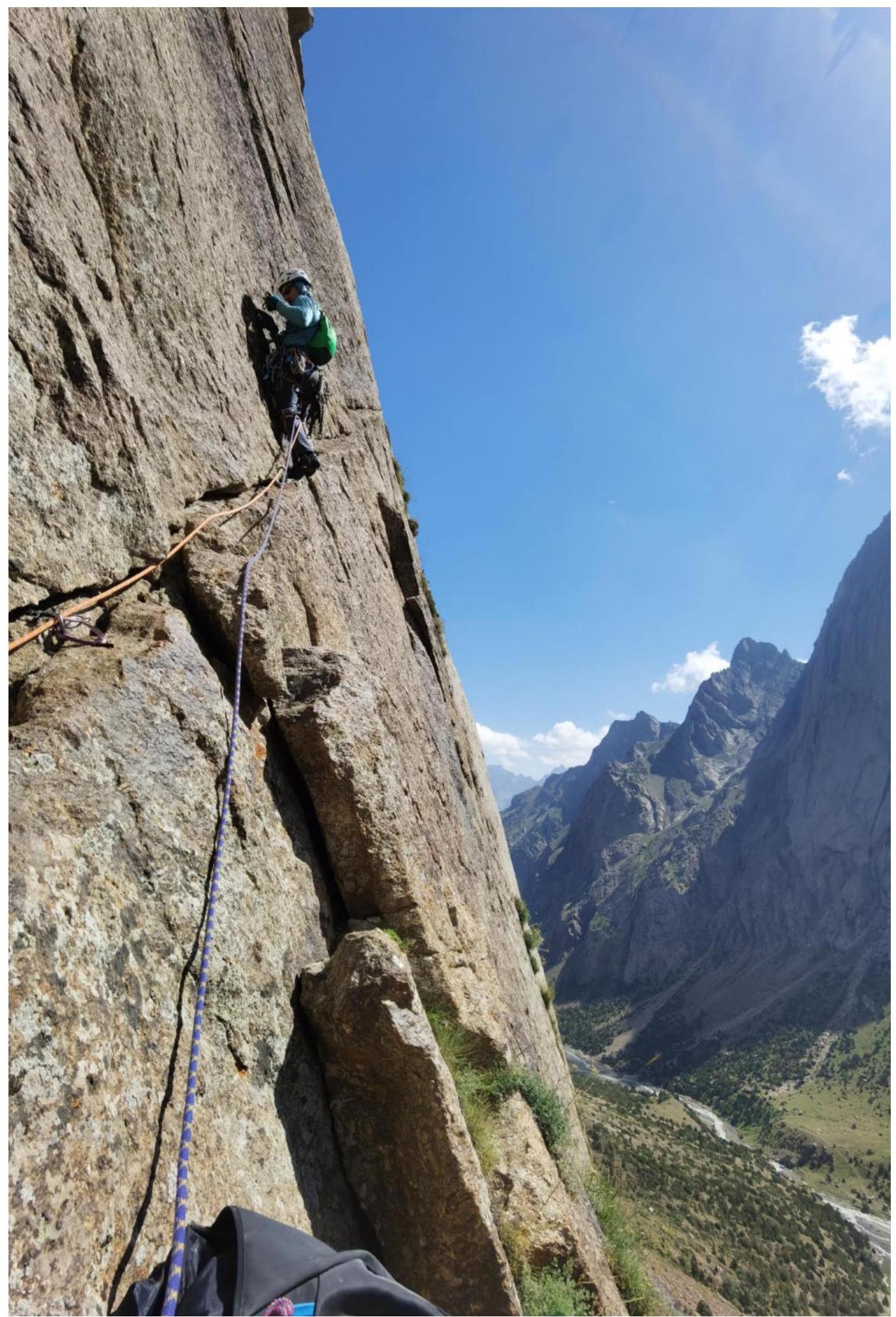
Photo 4. Section R6–R7. End of the oblique ledge — cracks, artificial support.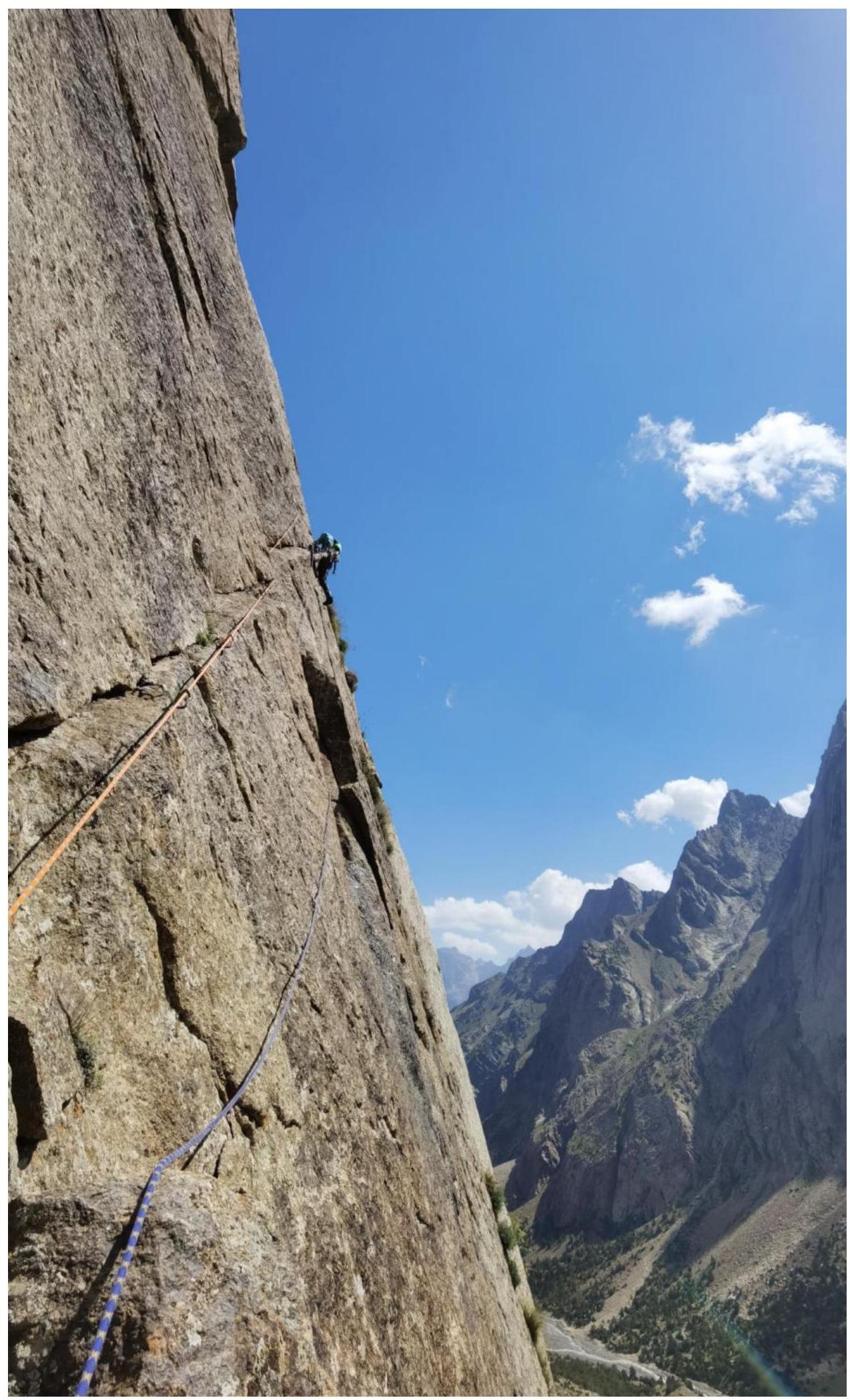
Photo 5. Leader on section R7–R8. Transition into an inner corner.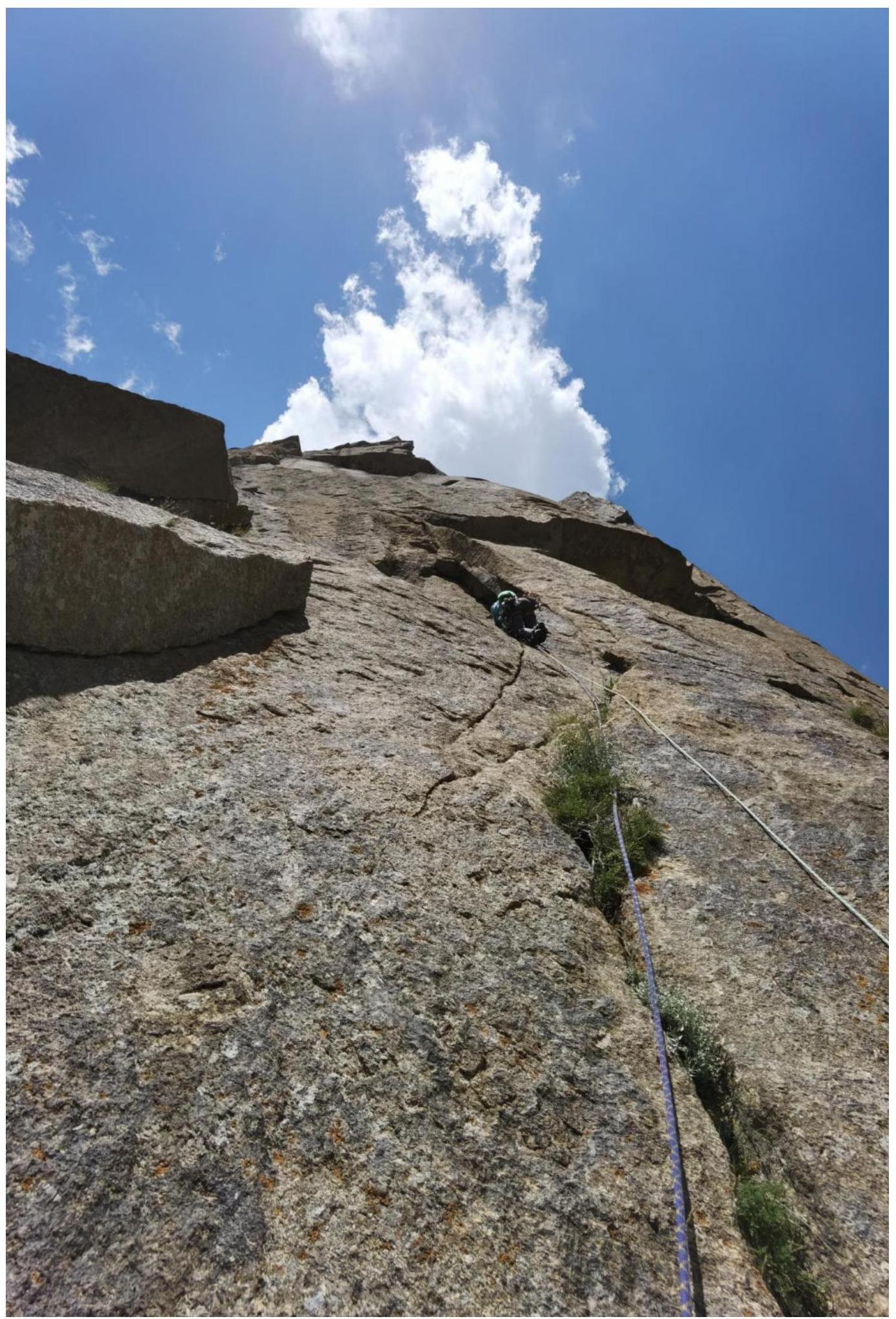
Photo 6. Inner corner on section R8–R9. The belay point at R9 is visible, and the leader is working on section R9–R10.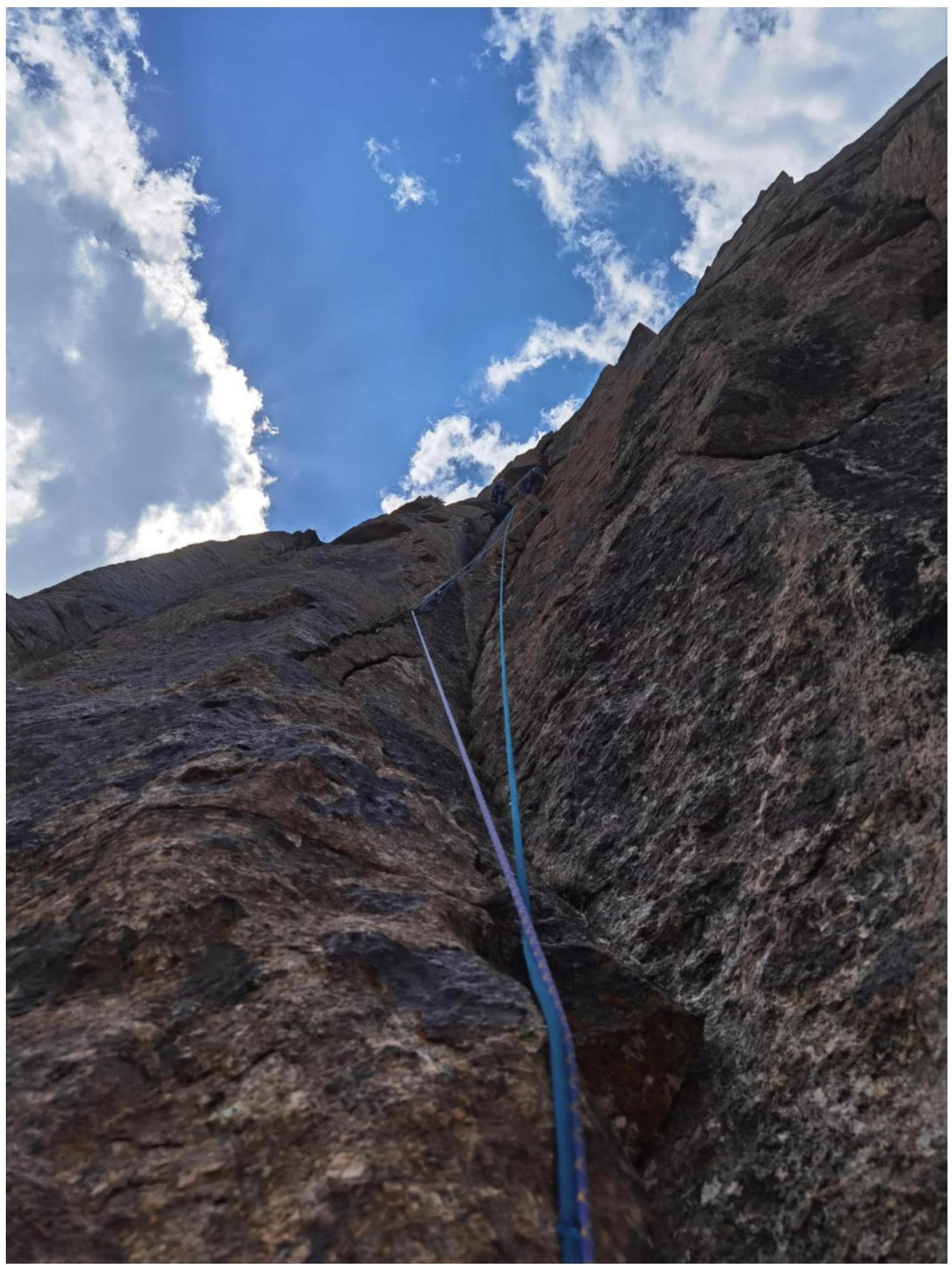
Photo 7. Section R9–R10. Small inner corners.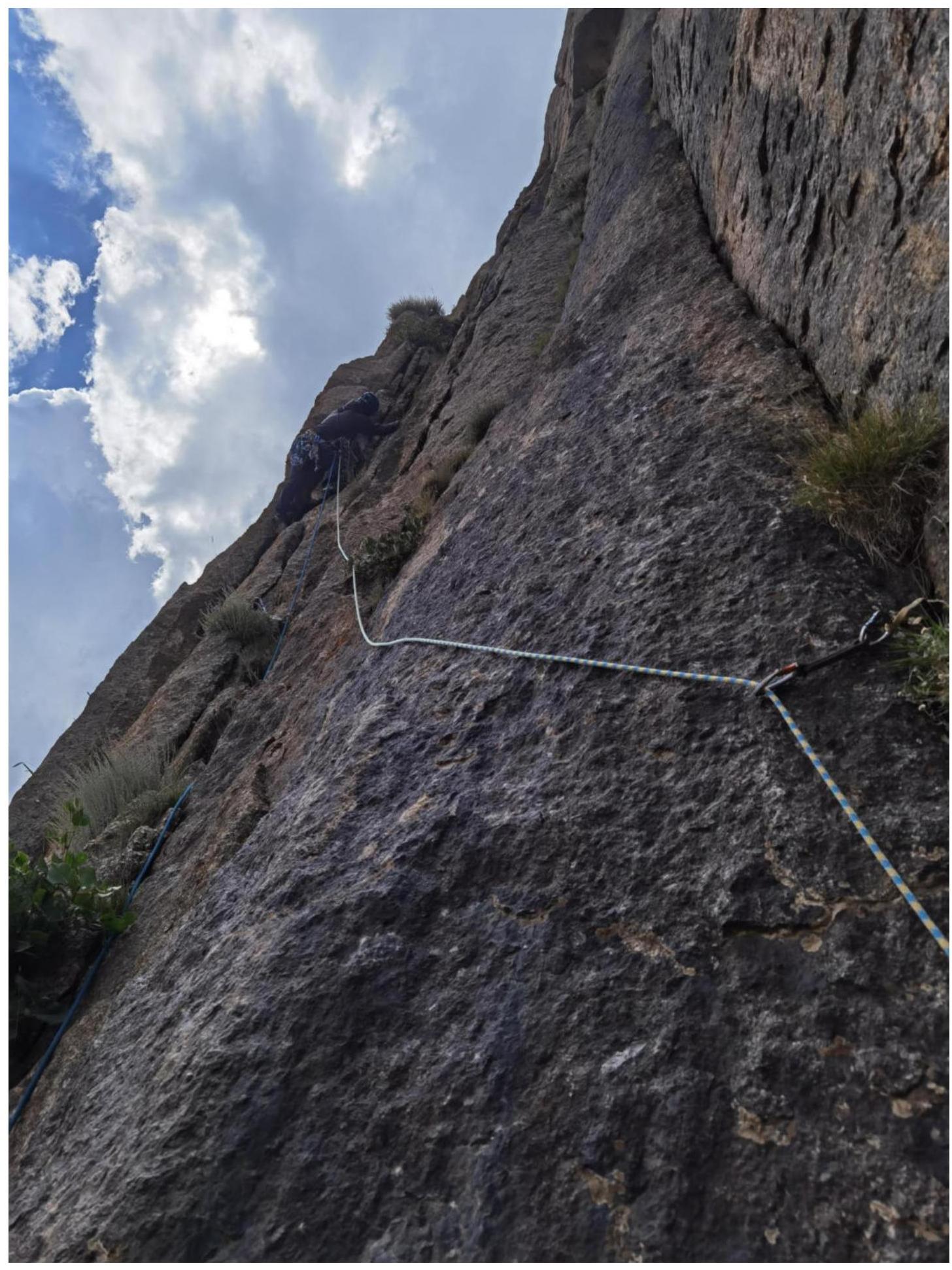
Photo 8. Section R10–R11.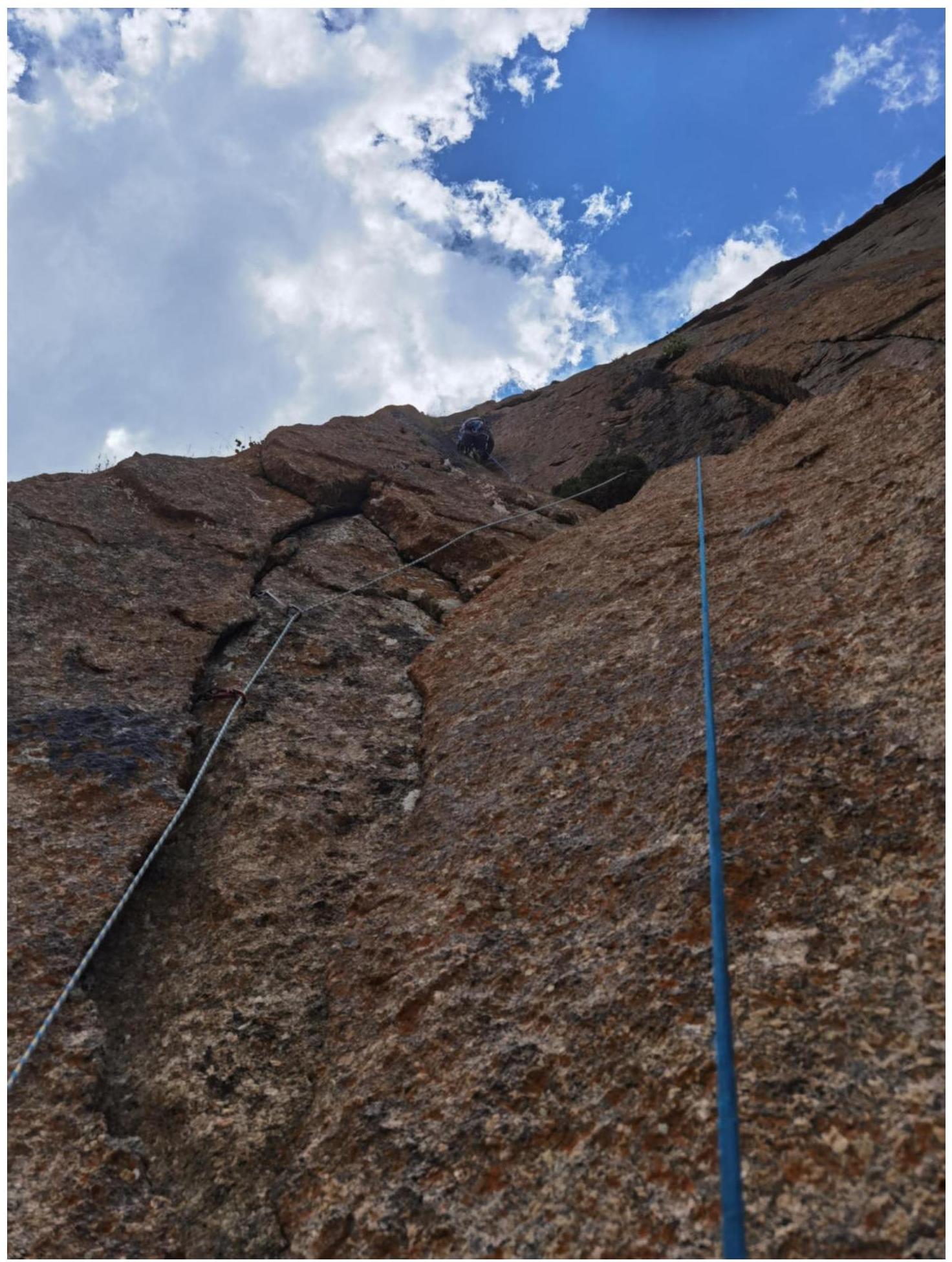
Photo 9. Section R11–R12. Beginning of the key section of the route, cracks become blind.
Photo 10. Section R12–R13. Key section of the route, interrupted blind cracks, reverse relief.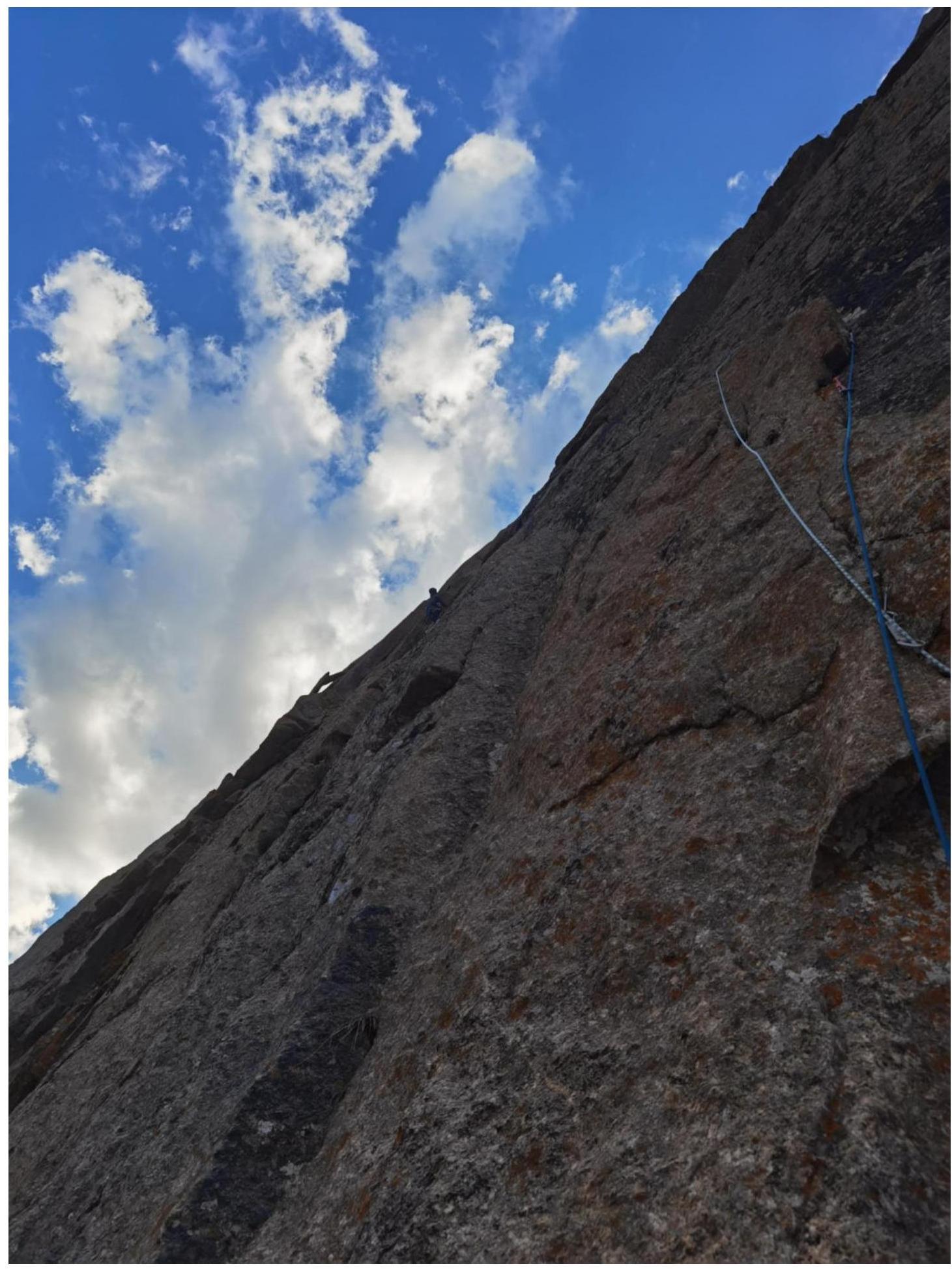
Photo 11. Section R12–R13. Key section of the route, interrupted blind cracks, reverse relief, upper part with rope protection.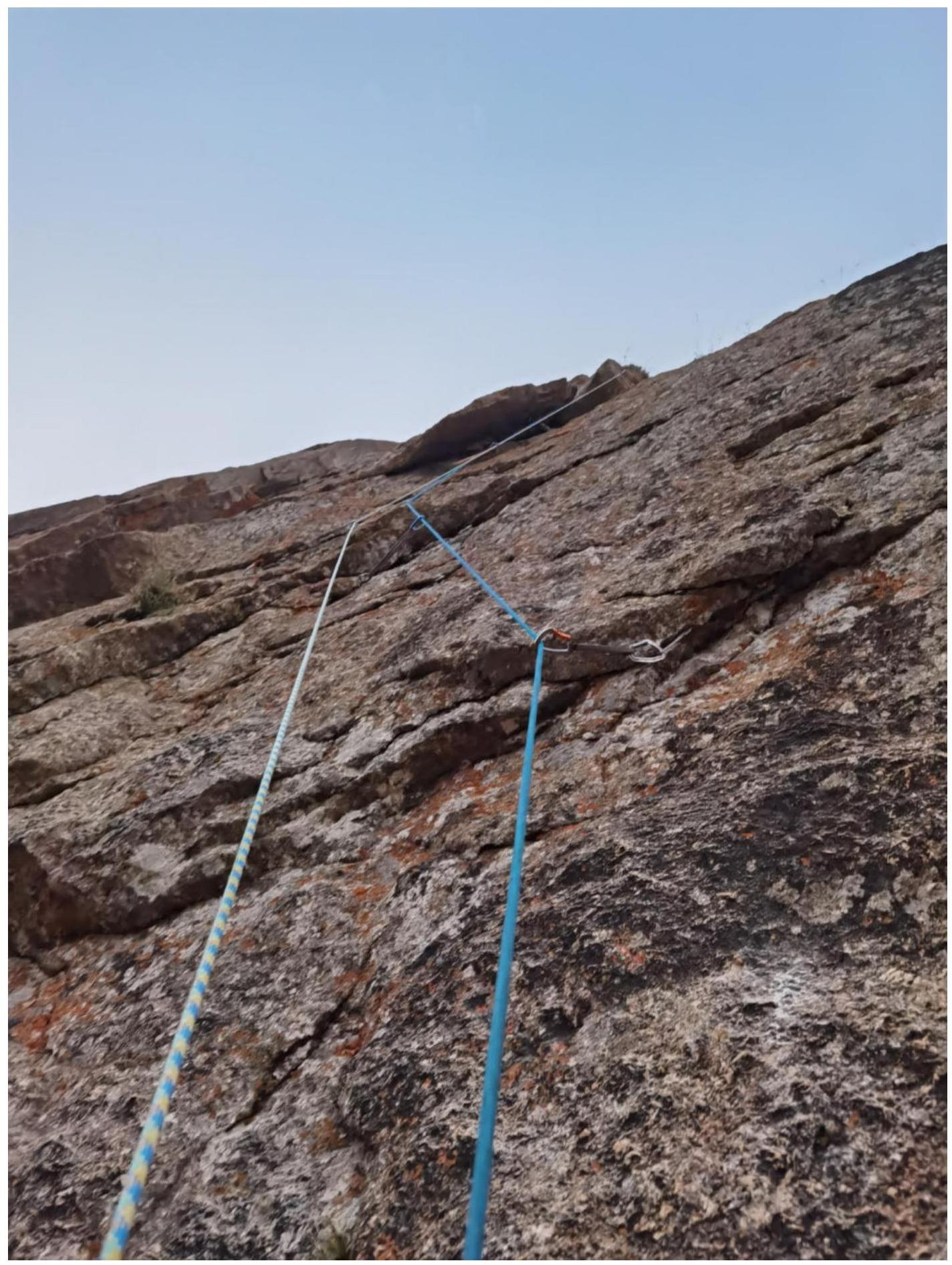
Photo from the summit, in the background Kыркчилта: Klepikov A.A., Lazarev S.A., Vitvitsky D.S., Tokmachev A.A., Kazantseva E.V.![img-18.jpeg]({"width":1530,"height":1146,"format":"Jpeg","uri":"https://summitx.info/media/1/5MKr1U3TCjh4gxSKr3Zq4cGh30TsJHhY/img-18.jpeg","id":64798451}↗]