
Ascent Passport
-
Ascent category — technical.
-
Ascent area — Pamir-Alai, Turkestan Range.
-
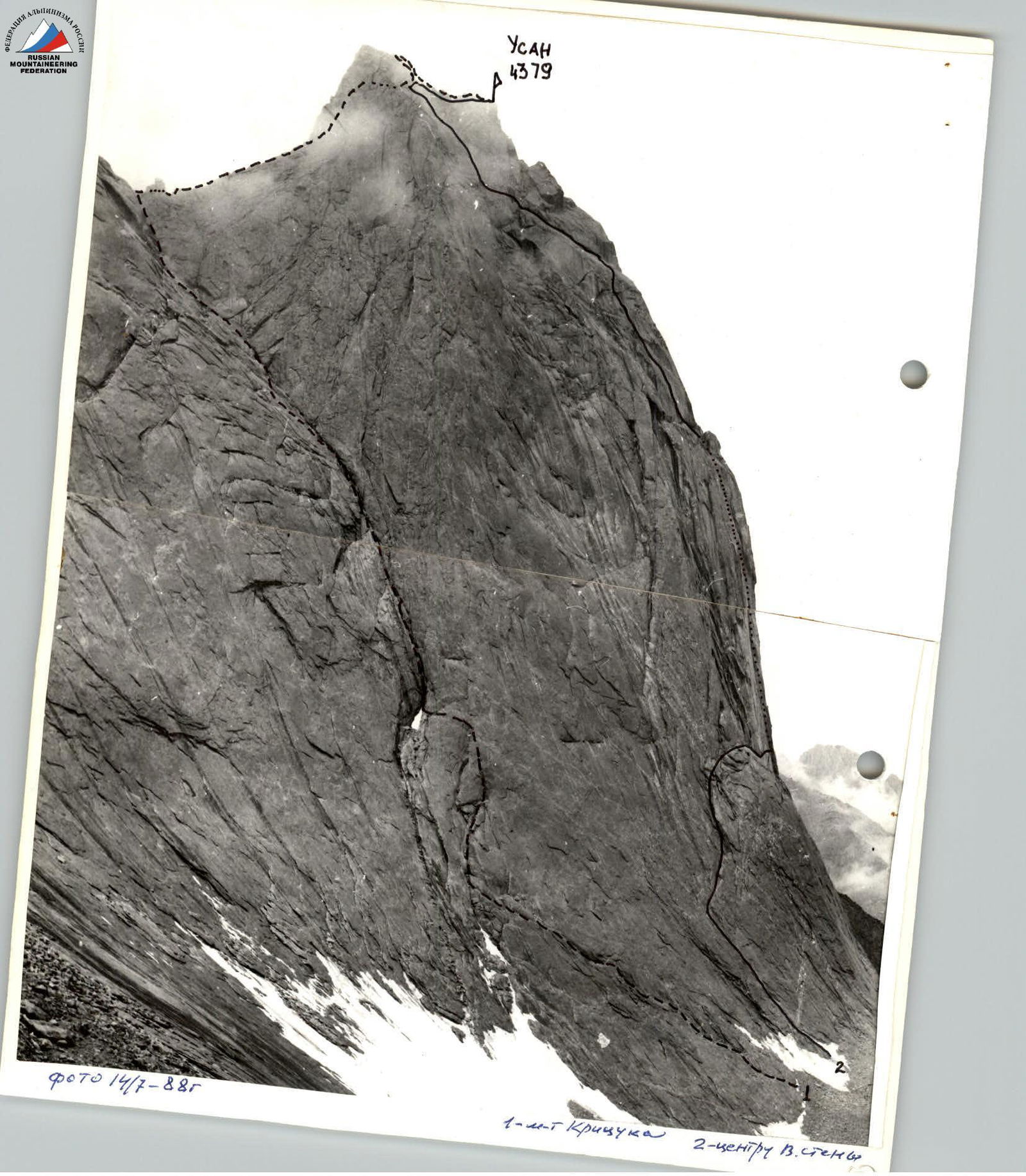
Peak — Usan (4379) via the crevice on the eastern wall.
-
Proposed category — 4B cat. diff., first ascent.
-
Route length — 765 m.
Length of sections with IV–V cat. diff. — 555 m. Average steepness of the wall section — 60°. Height difference — 470 m.
-
Pitons hammered in: rock — 9, chocks — 58.
-
Climbing hours — 12.
-
Leader — Sergey G. Kritsuk — 1st sports category.
Team members: Marina A. Belova — 1st sports category, Alexander B. Vasiliev — 2nd sports category, Andrey P. Sagurov — 1st sports category.
-
Coach — Vyacheslav I. Glushko — Master of Sports of the USSR.
-
Group of climbers from the "Gornjak" professional mountaineering club.
-
Departure for the route — July 14, 1988.
Summit reached — July 14, 1988. Return to camp — July 15, 1988.
Route Profile
to peak Usan (4379 m) via the crevice on the eastern wall, 4B cat. diff.
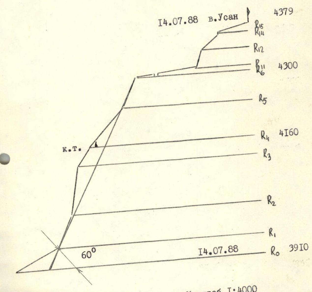
Route Diagram
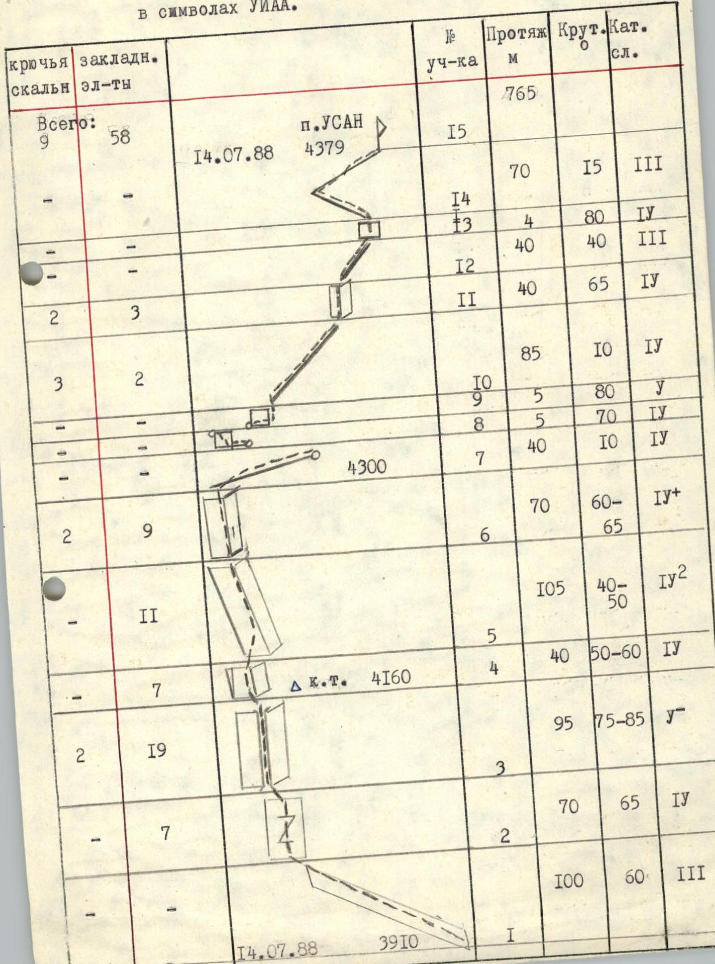

Photo 2. Technical photograph of the route. Date and time of shooting — July 14, 1988, 13:00. Lens — "Volna 3M" (30 mm).
Route Description by Sections
The approach to the route from the base camp, located in the Karasu river valley under the western slopes of peak 3800, takes 3–3.5 hours. On the approach, when moving along the western wall of peak 4810, it is necessary to overcome a steep snowy slope with a bergschrund (attention — rockfall hazard). For this, depending on the snow conditions, appropriate equipment is required. Overnight stay under the route is recommended (there are platforms for tents).
Section R1–R2: ascend along an inclined (about 30°) shelf towards the base of a large internal corner with a rock, 100 m 60° 3. Section R2–R3: after the shelf ends, enter the base of the large internal corner via slabs, using a system of small internal corners and shelves, 70 m 65° 4. Section R3–R4: internal corner with an indistinct rock. The left wall of the corner is typically wet. Many cracks. Belay using chocks and pitons, 95 m 75–85° 4. Section R4–R5: the left wall of the internal corner becomes gentler, it is possible to move left onto slabs, but belay locations are limited there, 40 m 50–60° 4. Control cairn. Section R5–R6: the left wall of the internal corner "lies down" even more, with many shelves and loose rocks appearing on it. For reliable belay, it is recommended to stay on the right part of the slabs, 105 m 40–50° 4. Section R6–R7: exit onto the ridge via an internal corner with a crack, 70 m 60–65° 4. Section R7–R8: traverse along the ridge, bypassing a gendarme on the left, 40 m 10° 4. Section R8–R9: descend a small wall, 5 m 70° 4. Section R9–R10: a vertical wall in the ridge is bypassed on the right edge, 5 m 80° 5. Section R10–R11: narrow ridge, 85 m 10° 4.