
Report
On the First Ascent of Ak-Jaman Peak (4490 m)
via the North-Eastern Wall, Category 4A/4B
1. Climbing Passport
- Climbing area: Inner Tien Shan, Jamantau Ridge
- Peak name: Ak-Jaman (4490 m, № 40°54.413′, 74°49.720′ (WGS 84))
- Route name: via the North-Eastern wall
- Route difficulty category: proposed 4A/4B
- Route type: ice climb
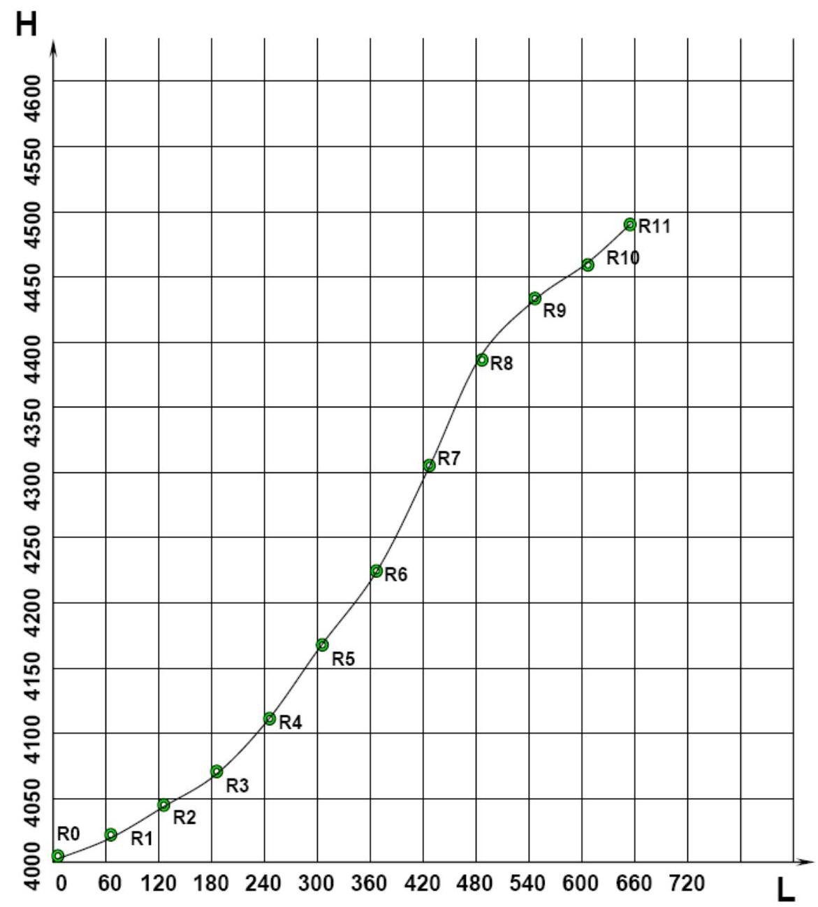
- Route elevation gain: 490 m (according to GPS readings). Route length: 660 m. Average slope: 50°. 11 ice pitches up to 70°, Al2–Al3.
- Equipment used on the route: pitons on the route: rock — 0, ice — 8, including ITO — 0. No bolted pitons (permanent or removable) were used. Ice tools: Petzl Arztarex, Cassin Mirage.
- Start of the route: at 12:30 on July 11, 2007. Summit reached: at 18:30 on July 11, 2007. Return to camp: at 20:00 on July 11, 2007.
- Team's total climbing hours: 7.5 hours.
- Team leader: Dmitry Shapovalov, 1st sports category (tourism).
- Participants: Dmitry Martynenko, 2nd sports category (alpinism).
- Coach: Nikolai Goryunov (Kiev), Master of Sports (alpinism).
- Route features: the last pitches involve a closed glacier with large crevasses.
The ascent was made without prior route preparation.
2. Area Description
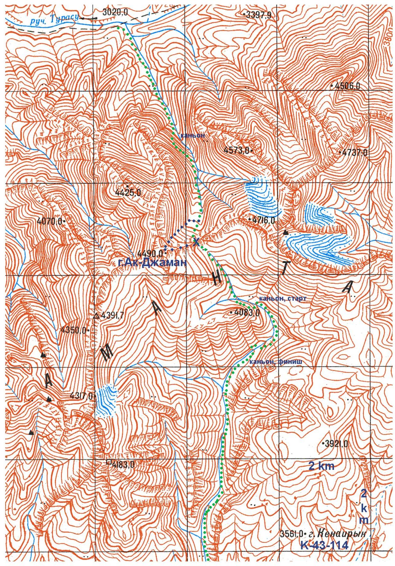
Ak-Jaman Peak is located in the eastern part of the main Jamantau Ridge, Inner Tien Shan, in the upper reaches of the left tributary of the Turasu River. The Jamantau Ridge is oriented in a latitudinal direction and is bounded to the west by the Arpa River canyon, to the north by the Alabuga River valley, to the east by the Karasu River valley, and to the south by the Arpinskaya depression. The ridge's peaks reach 4700 m, while the surrounding valleys are about 3000 m high, and the technical part of the routes typically starts above 3600 m. The ridge is composed of hard Paleozoic sedimentary rocks with a very rough surface. Along with the potential for rock climbing, the northern slopes of Jamantau have significant glaciation, and ice slopes with steepness up to 75° allow for ascents to the summits from the northern side via routes of moderate complexity. There are practically no glaciers on the southern side, only rocks and endless scree that fill the valleys from bank to bank.
The climate of the area is pleasant and not very hot. It is determined by the ridge's orientation and the prevailing direction of air masses. Moist air from the Fergana Valley moves from west to east, is blocked by the Fergana Ridge mountains, and precipitates heavily on its western slopes. The Arpinskaya depression receives little precipitation, and its climate is very dry. Air masses fly over it without stopping, gathering as they approach the slopes of the Jamantau and At-Bashi ridges, which again block the air masses. Due to this, precipitation is observed on the slopes of Jamantau in mid-summer on approximately 30% of days.
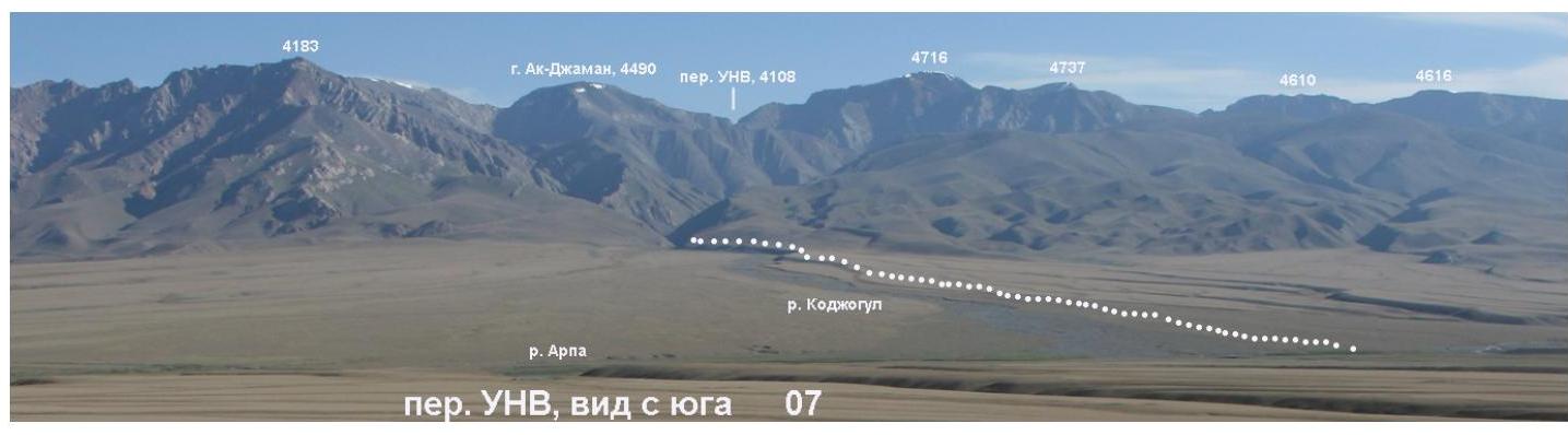
One can approach the Jamantau Ridge from either Naryn or Osh (Osh — Jalalabad — Kal damo Pass — Kazarman). From the north, along the Alabuga valley, through the villages of Jergetal and Dürbeljin, there is a good asphalt road from Kazarman to Naryn. From it, via dirt roads, one can reach the Kashkasu River and from there, within a day, approach any peak of Western Jamantau, including the Kamas and Chontash peaks. It is also possible to approach the ridge from the east, from the Naryn — Torugart Pass highway (Chinese border). A dirt road, accessible to Niva and other 4×4 vehicles, branches off this highway and goes through the Turasu Pass to the confluence of the Turasu and Jamandavan rivers (northern approach to Ak-Jaman Peak). Several other dirt roads diverge from the Naryn — Torugart Pass highway into the Arpa valley. This is the southern approach option. However, in both cases, the hiking approach to the peak is not straightforward: on both sides, it is necessary to bypass the gorges in the middle reaches of the tributaries flowing from under Ak-Jaman Peak. At the same time, when approaching from the north (from Turasu), the detour around the gorges is much shorter at the same level of danger. Both approach options are not recommended during wet weather.
The Jamantau Ridge has no climbing history. The first photographs of the ridge were taken during water trips along the Arpa River. The first trip and the first ascents were made by a group of climbers and sports tourists from Kiev led by D.S. Shapovalov in the summer of 2007. Jamantau has significant potential for rock and ice climbing.
The name "Jamantau" ("Bad Mountains") comes from the practical impossibility of crossing the ridge despite its apparent ease. The approaches to Ak-Jaman Peak and the neighboring pass 1B are a good illustration. To date, there is only one non-category pass through the ridge — Jamandavan.
3. Area Map
4. Photopanorama of the Area
- View from the North-East. Taken on July 11, 2007.
- View from the South. Taken on July 11, 2007.
5. Team's Technical and Tactical Actions
On July 11, 2007, in the first half of the day, the group reached the base of Ak-Jaman Peak. Considering the lack of daylight, it was decided to make the ascent via the ice route in a team of two. Participants of the ascent: D. Shapovalov and D. Martynenko. The third participant of the trip, Katerina Ananyeva, remained in the camp as an observer.
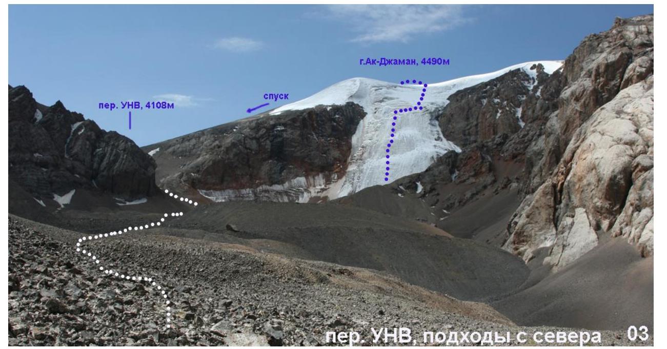
The weather was clear in the first half of the day, but a thunderstorm began in the evening. The team had 8 ice screws and ice tools that allowed for an ice climb of the 4th category. For protection on the pre-summit snow slope, a snow stake — a picket — was used. On the route, the lead changed every rope. The first 3–4 ropes, due to the low slope steepness, are recommended to be climbed simultaneously. The summit is a wide, even field with a rock platform in the far corner.
The descent from the summit was made to the east, towards the camp on a wide saddle of the pass. The descent went first through snow, and lower down, through scree slopes.
6. Route Photos
 3. View from the North-East. Taken on July 11, 2007.
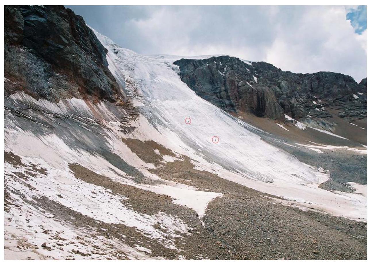 4. View from the East. Taken on July 11, 2007.
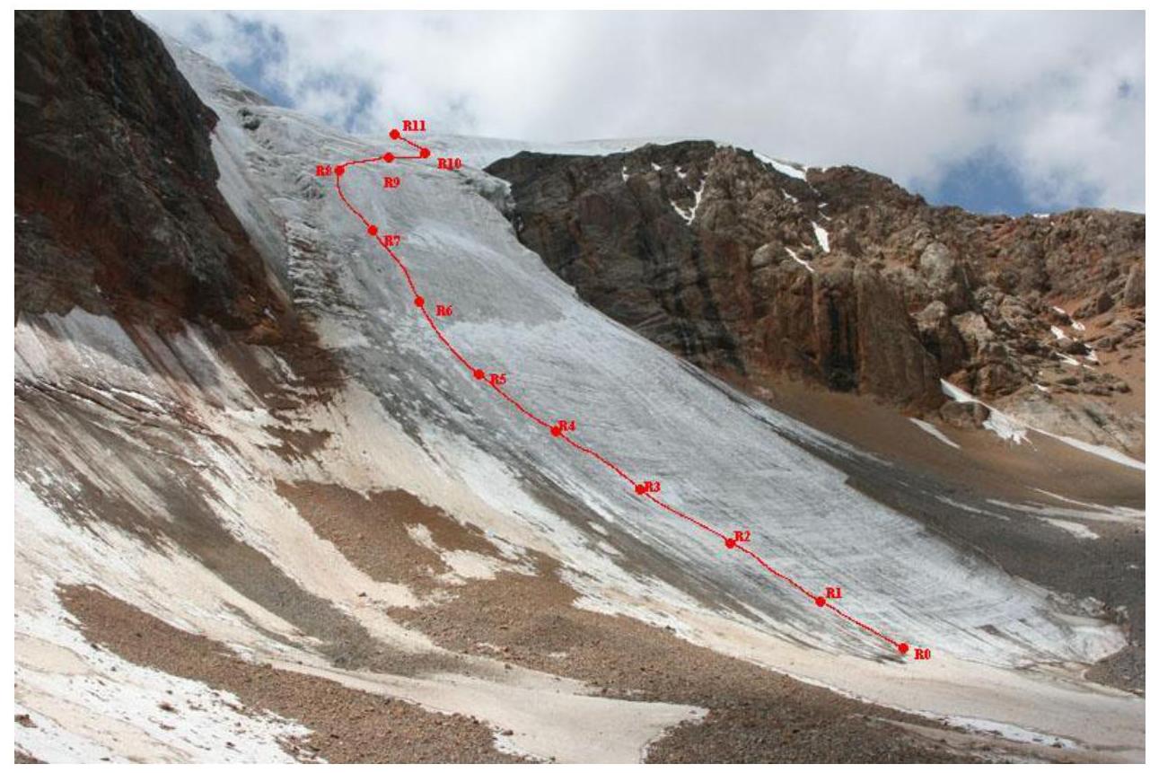 5. View from the East. Taken on July 11, 2007.
7. Table of Complexity of Individual Sections:
| Section № | Length (m) – Steepness |
|---|---|
| R11–R10 | 60 m – 40° |
| R10–R9 | 60 m – 30° |
| R9–R8 | 60 m – 50° |
| R8–R7 | 60 m – 70° |
| R7–R6 | 60 m – 70° |
| R6–R5 | 60 m – 65° |
| R5–R4 | 60 m – 60° |
| R4–R3 | 60 m – 50° |
| R3–R2 | 60 m – 40° |
| R2–R1 | 60 m – 40° |
| R1–R0 | 60 m – 30° |
8. Drawn Route Profile
9. Links
Report on this trip, passports of the passes and peaks completed: www.tkg.org.ua/node/8888↗
Ascents in the neighboring Torugart-Too and At-Bashi ridges: www.alpinist.com/doc/web07f/newswire-kyrghyzstan-exploration-jamantay↗
"Risk Onsite", issue 32. Article by Dmitry Shapovalov.
The report was compiled by D. Martynenko, photographs were taken by D. Shapovalov.
10. Photo Illustrations
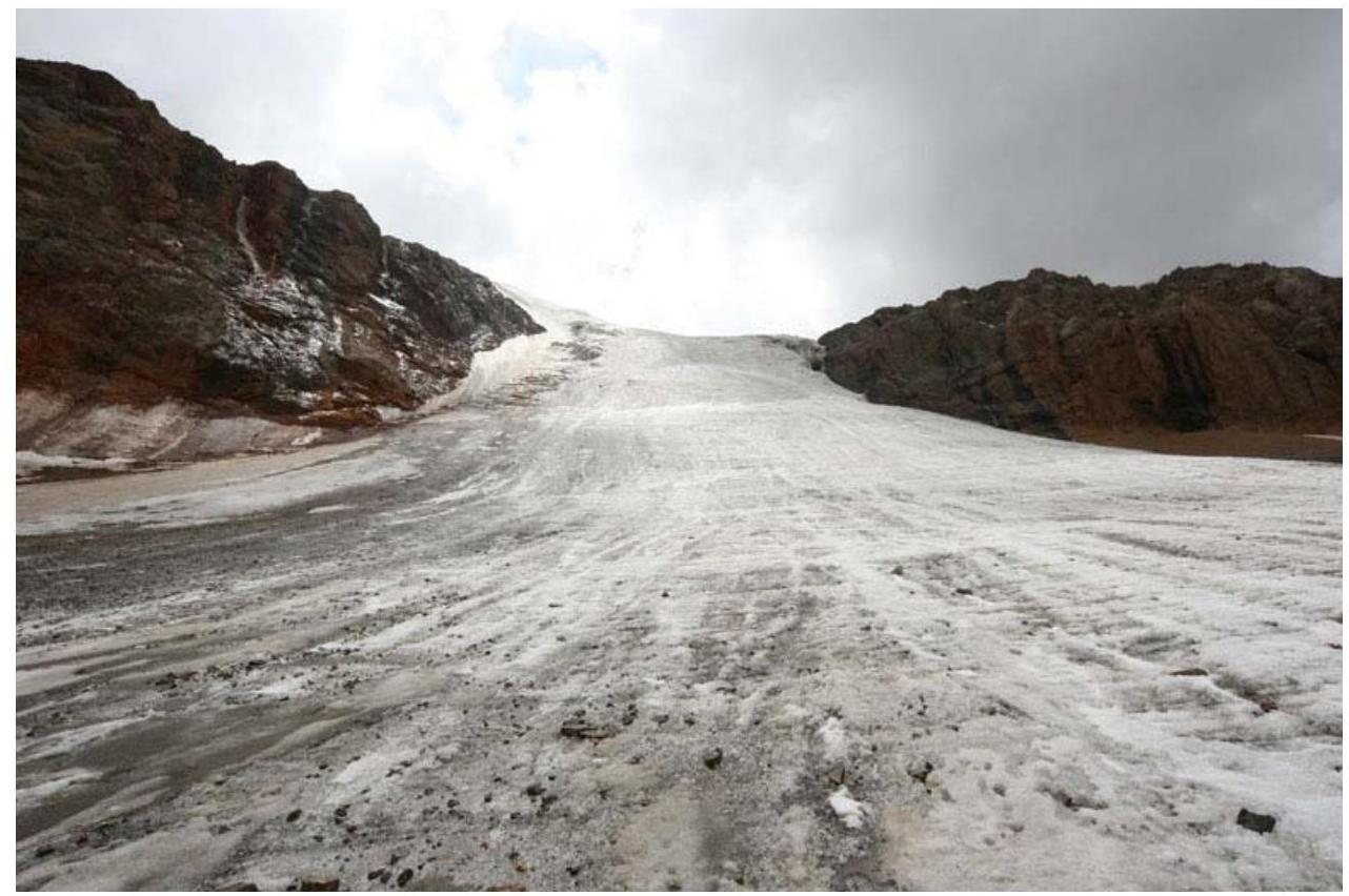 6. Start of the route. Taken on July 11, 2007.
 7. R6–R7. Taken on July 11, 2007.
8. R9. Taken on July 11, 2007.
7. R6–R7. Taken on July 11, 2007.
8. R9. Taken on July 11, 2007.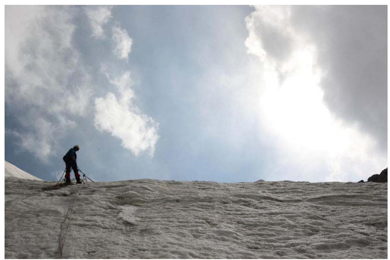 9. R8–R9. Taken on July 11, 2007.
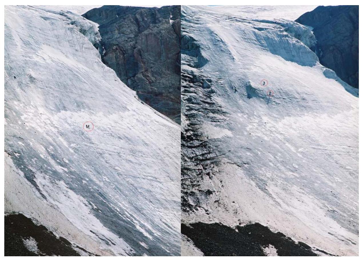 10. R5. Taken on July 11, 2007.
11. R6–R7. Taken on July 11, 2007.
10. R5. Taken on July 11, 2007.
11. R6–R7. Taken on July 11, 2007.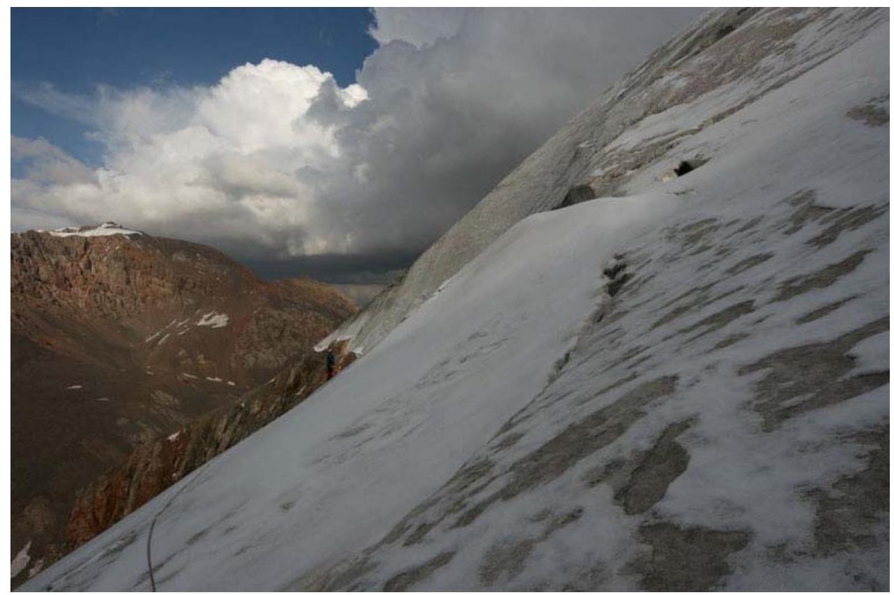 12. Closed crevasses. R9–R10. Taken on July 11, 2007.
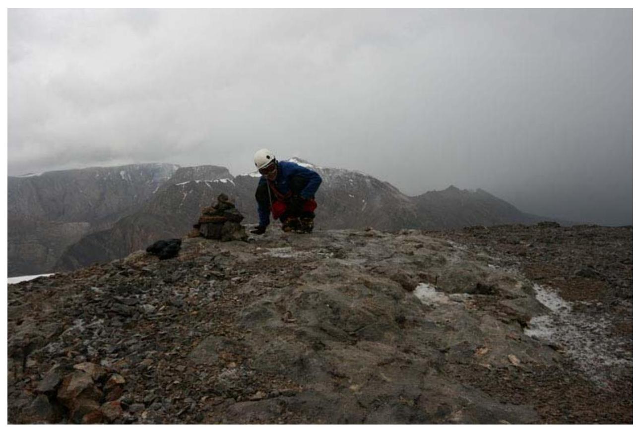 13. Summit. Taken on July 11, 2007.