Report
On the first ascent by the St. Petersburg team to the summit 5588 m (Ulun) via the counterfort of the southern wall (approximately 6A/B category of difficulty) from August 23, 2023, to August 30, 2023.
St. Petersburg 2023
I. Ascent Report
| 1. General Information | ||
|---|---|---|
| 1.1 | Full name, sports rank of the team leader | Murin Evgeny Grigorievich |
| 1.2 | Full name, sports rank of the participants | Penyaev Ilya Nikolaevich, Lukashenko Olga Igorevna |
| 1.3 | Full name of the coach | Timoshenko Tatiana Ivanovna |
| 1.4 | Organization | Alpinism Federation of St. Petersburg |
| 2. Characteristics of the Ascent Object | ||
| 2.1 | Region | Kokshaal-Too ridge |
| 2.2 | Valley | |
| 2.3 | Number of the section according to the 2013 classification table | 7.5 |
| 2.4 | Name and height of the summit | 5588 m, proposed name Ulun |
| 2.5 | Geographical coordinates of the summit (latitude, longitude), GPS coordinates | 41.012309 77.312728 |
| 3. Characteristics of the Route | ||
| 3.1 | Name of the route | Via the counterfort of the southern wall |
| 3.2 | Proposed category of difficulty | 6A/B category of difficulty |
| 3.3 | Degree of route exploration | First ascent |
| 3.4 | Relief characteristics of the route | Combined |
| 3.5 | Height difference of the route | 760 m |
| 3.6 | Length of the route | 960 m |
| 3.7 | Technical elements of the route | 1st category snow – 70 m. 2nd category snow – 200 m. 3rd category combination – 180 m. 4th category combination – 50 m. 5th category combination – 40 m. 6th category combination – 430 m. AID – 350 m |
| 3.8 | Average steepness of the route, (°) | 62° |
| 3.9 | Average steepness of the main part of the route, (°) | 73° |
| 3.10 | Descent from the summit | Along the southeastern ridge, then along the eastern wall. |
| 3.11 | Additional characteristics of the route | Snow for melting is available throughout the route |
| 4. Characteristics of the Team's Actions | ||
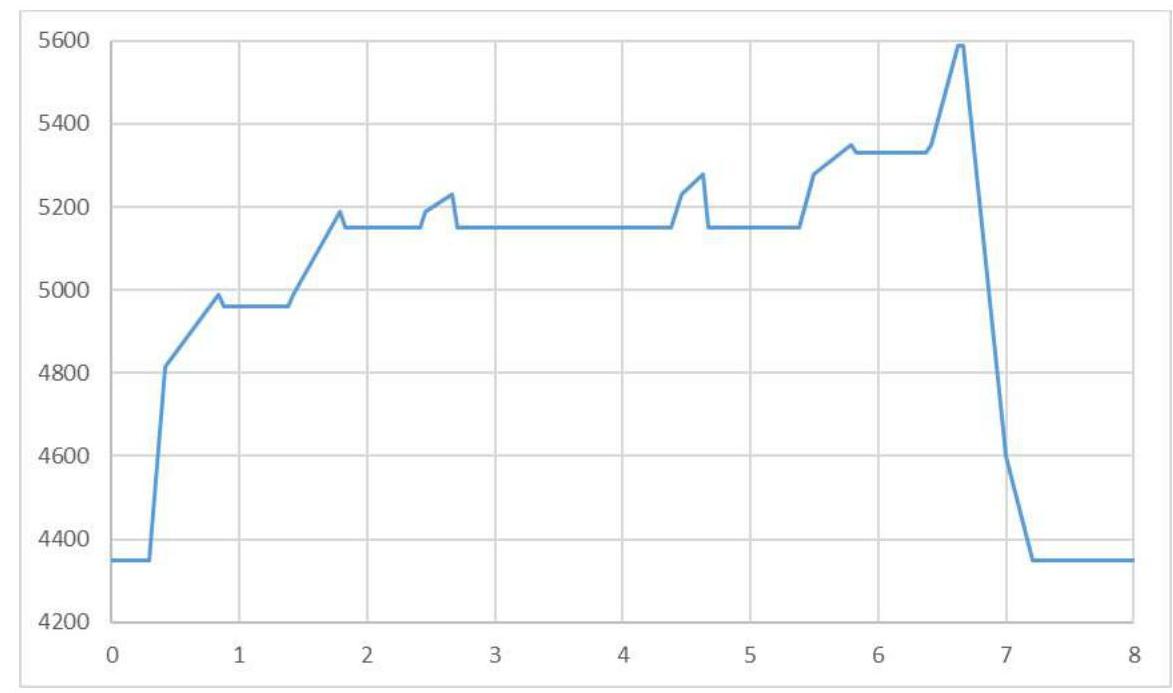
| 4.1 | Time in motion | 30 hours of climbing, 7 days |
| 4.2 | Overnight stays | In a tent on snow ledges |
| 4.3 | Time spent on route preparation | |
| 4.4 | Start of the route | 7:00 August 23, 2023 |
| 4.5 | Summit attainment | 14:30 August 29, 2023 |
| 4.6 | Return to the base camp | 5:00 August 30, 2023 |
| 5. Characteristics of Weather Conditions | ||
| 5.1 | Temperature, °C | From –10 °C to +10 °C |
| 5.2 | Wind speed, m/s | Up to 15 m/s |
| 5.3 | Precipitation | Three out of seven days – snow. About 1 m of snow fell at the glacier over the week |
| 5.4 | Visibility, m | |
| 6. Person Responsible for the Report | ||
| 6.1 | Full name, e-mail | Penyaev Ilya Nikolaevich, kerat@yandex.ru |
II. Ascent Description
1. Characteristics of the Ascent Object
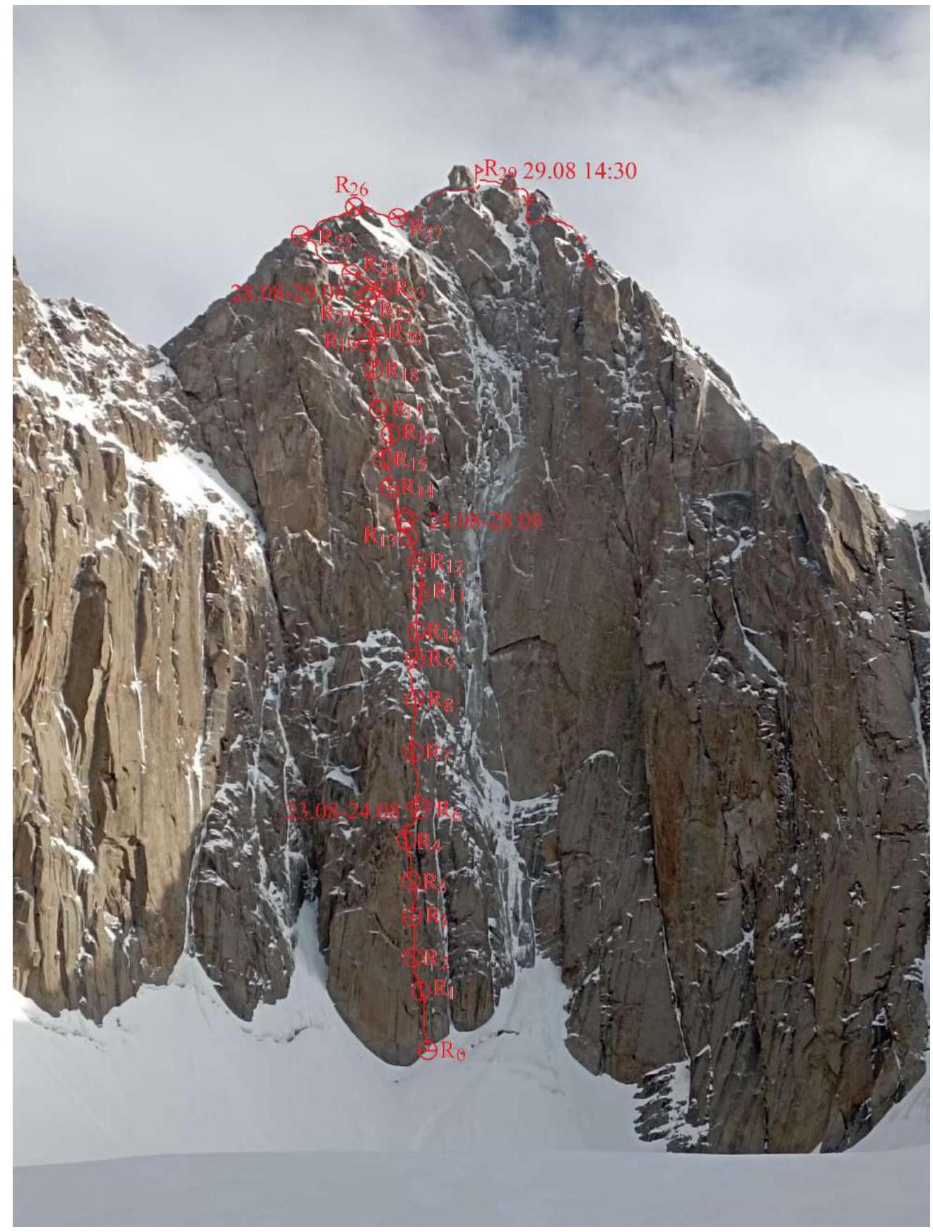
- Photo taken on August 23, 2023, from a three-kilometer distance
During the expedition, the weather did not allow for photographs to be taken from different angles, so we do not have a profile photo or panorama.
-
Route profile

-
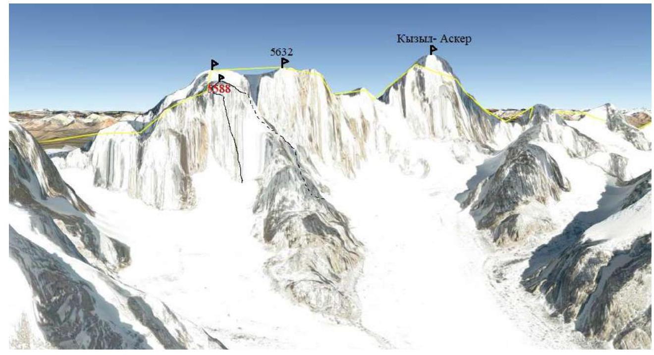
Panorama of the area from Google Earth. View from the South
-
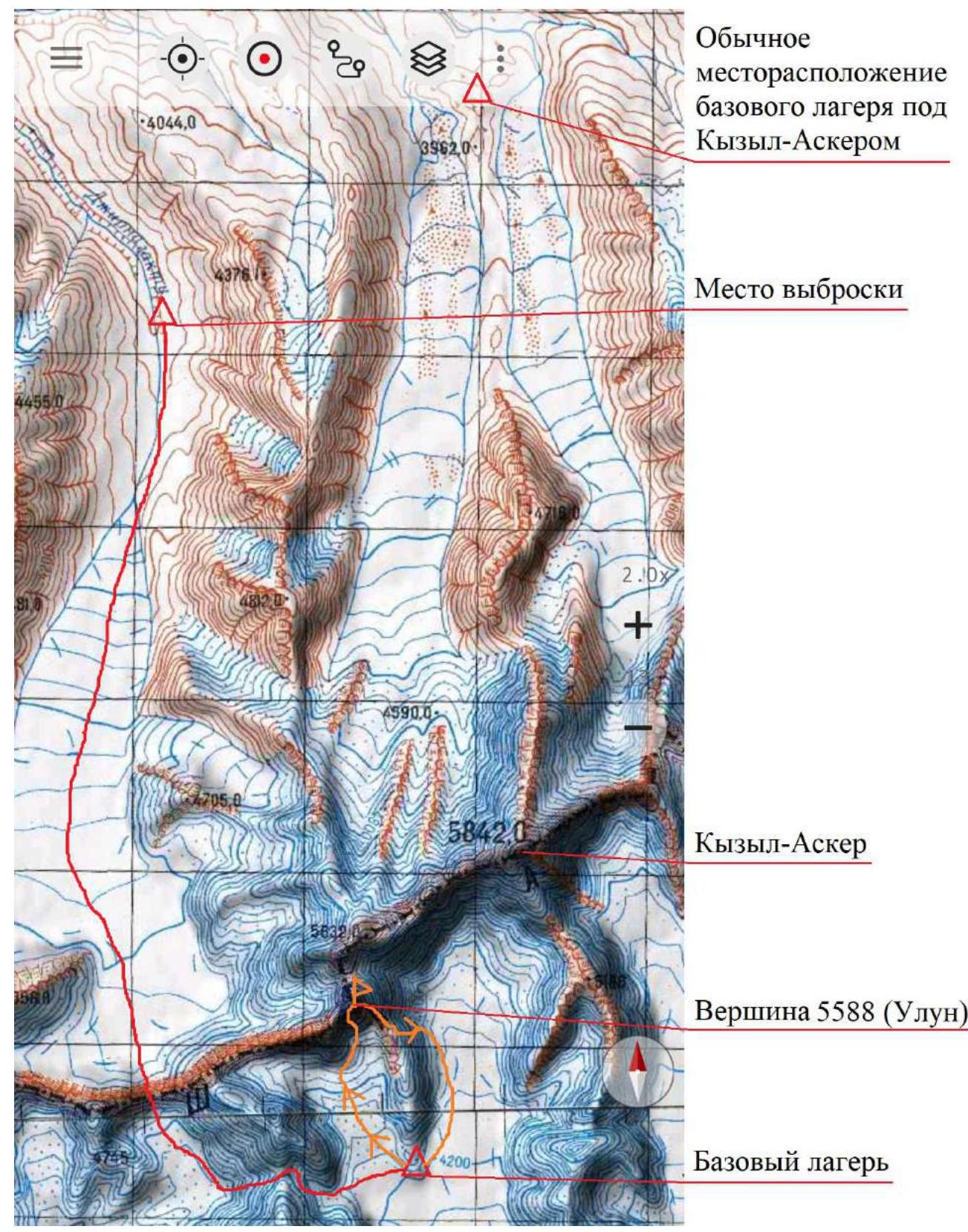
Area map
Description of the Area
The western Kokshaal-Too region is relatively unexplored by mountaineers. There are many peaks approaching 6000 m in this area. The most interesting among them are Kyzyl-Asker (5842 m), Krylya Sovetov (5800 m), Schmidt (5954 m), Dankov (5982 m), Chon-Turasu or Joldash (5729 m), Alpinist (5641 m), Sergei Korolev (5816 m), and Belый (5697 m). There are also many unnamed slightly lower peaks from this area.
The region is characterized by a combination of typically alpine forms (numerous vertical rock walls with a height difference of about 1–1.5 km) and significant glaciation. The entire area, including the lowlands, is a zone of permafrost. Marshy areas are common, even up to elevations of 4000 m. The snow line is at an altitude of about 4000–4500 m above sea level. River valleys have a high absolute height of about 3000–3500 m above sea level. The climate in the valley is harsh, with unstable weather.
The dominant feature of our area is the Kyzyl-Asker summit. The first ascent of this mountain was made by K. Valiева's team in 1985, followed by several other ascents. Another well-known peak in Russian mountaineering circles is the "Great Chinese Wall." For all routes on these two mountains, except Valiева's route, the approach is made through a pass east of Kyzyl-Asker and the Rudnev glacier.
To the west of Kyzyl-Asker, there is a valley of the Kechiksu glacier (here and elsewhere, unknown glaciers are named after the river flowing from them) with unclimbed complex walls.
Description of the Approach
Our team of seven people, based on experience from previous years, traveled from Bishkek through Naryn. They were transported to the foot of the mountains by tracked vehicles, which can reach almost the beginning of the Jirnagaktu glacier.
The hike with gear through two passes required two trips and four days. The one-way distance is 20 km. The passes are unnamed. Elevations:
- 4630 m
- 4780 m
The passes are hiking trails, but:
- on the western slope of the second, insurance may be required due to steepness;
- on the eastern slope – due to hidden crevasses.
We decided to split into two groups to make two independent ascents on one of the walls in the valley. The ascents were made on an unnamed summit, which is the southern peak of a larger unnamed massif located on the main Kokshaal-Too ridge immediately west of Kyzyl-Asker. The proposed name is "Ulun."
2. Characteristics of the Route
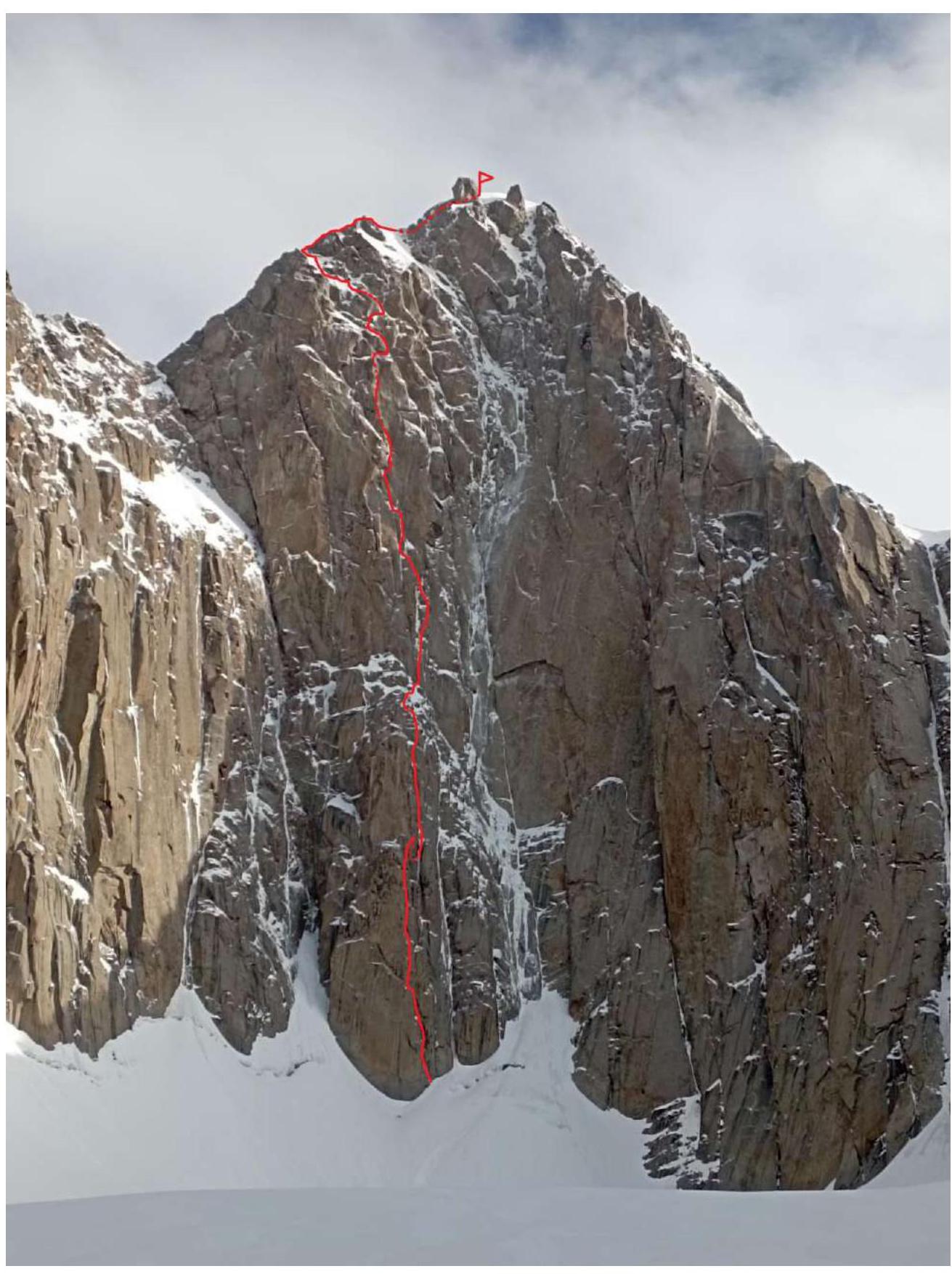
-
Technical photo
-
Daily movement graph
-
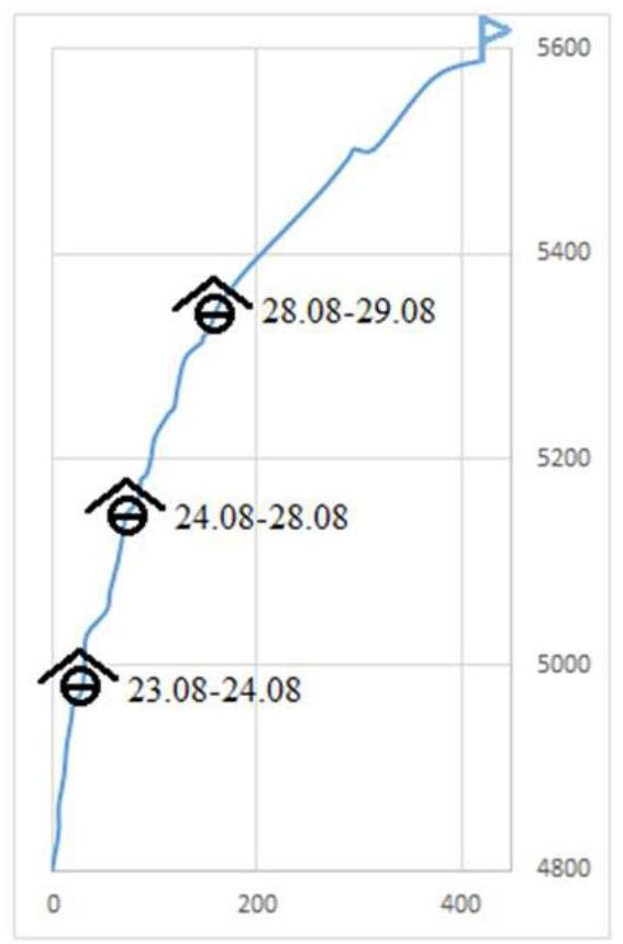
Profile movement graph
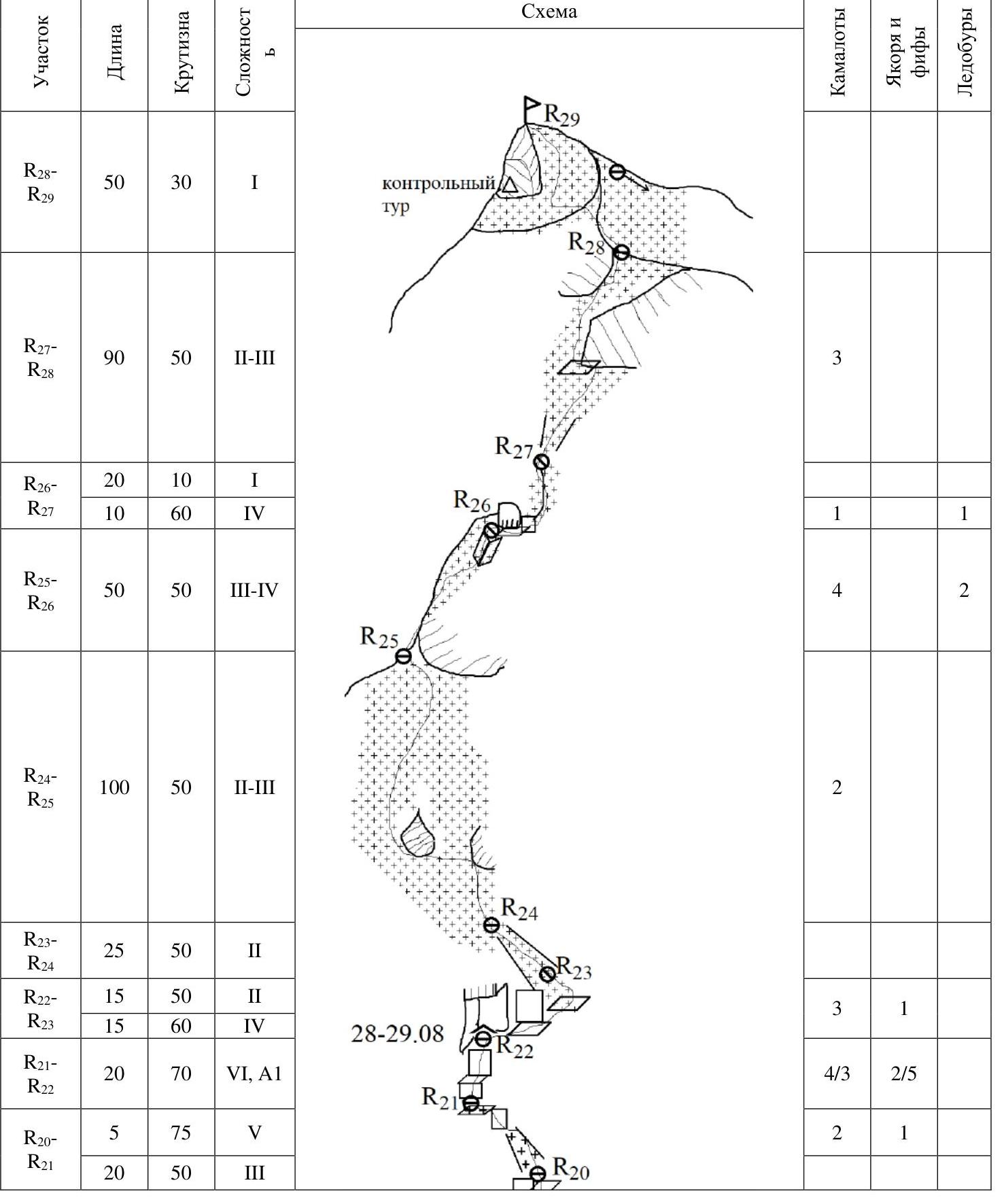
UIAA Scheme
| Section | Length | Steepness | Difficulty | Camalots | Anchors and fiffs | Ice screws |
|---|---|---|---|---|---|---|
| R28–R29 | 50 | 30 | 1 | |||
| R27–R28 | 90 | 50 | 2–3 | 3 | ||
| R26–R27 | 20 | 10 | 1 | 1 | 1 | |
| R26–R27 | 10 | 60 | 4 | |||
| R25–R26 | 50 | 50 | 3–4 | 4 | 2 | |
| R24–R25 | 100 | 50 | 2–3 | 2 | ||
| R23–R24 | 25 | 50 | 2 | 3 | 1 | |
| R22–R23 | 15 | 50 | 2 | 4/3 | 2/5 | |
| R22–R23 | 15 | 60 | 4 | |||
| R21–R22 | 20 | 70 | 6, A1 | 2 | 1 | |
| R20–R21 | 5 | 75 | 5 | |||
| R20–R21 | 20 | 50 | 3 | |||
| R19–R20 | 20 | 50 | 3 | 2 | 2 | |
| R18–R19 | 30 | 75 | 6, A1 | 4/8 | 5/10 | |
| R17–R18 | 20 | 80 | 6, A2 | 5/7 | 3/7 | |
| R17–R18 | 10 | 50 | 2 | 1 | ||
| R16–R17 | 25 | 60 | 6, A2 | 7/10 | 4/7 | |
| R15–R16 | 20 | 80 | 6, A2 | 5/7 | 2/5 | |
| R14–R15 | 15 | 75 | 6, A1 | 5/11 | ||
| R14–R15 | 5 | 55 | 3 | 1 | ||
| R13–R14 | 5 | 45 | 2 | 3/3 | 3/5 | |
| R13–R14 | 15 | 85 | 6, A1 | 4/4 | 1/3 | |
| R13–R14 | 15 | 75 | 6, A1 | 2 | ||
| R12–R13 | 15 | 50 | 3 | 2/3 | 3/5 | |
| R12–R13 | 15 | 80 | 6, A1 | 8/12 | 2/9 | |
| R11–R12 | 30 | 80 | 6, A1 | 7/10 | 4/10 | |
| R10–R11 | 30 | 70 | 6, A1 | 3/3 | 4/7 | |
| R9–R10 | 20 | 80 | 6, A1 | |||
| R8–R9 | 30 | 50 | 2 | 2 | ||
| R7–R8 | 25 | 85 | 6, A1 | 5/7 | 6/10 | |
| R6–R7 | 30 | 85 | 6, A1 | 7/10 | 2/5 | |
| R5–R6 | 15 | 55 | 2 | 3/3 | 0/4 | |
| R5–R6 | 15 | 85 | 6, A2 | |||
| R4–R5 | 30 | 80 | 6, A1 | 3/7 | 7/7 | |
| R3–R4 | 30 | 80 | 6, A1 | 7/12 | 5/7 | |
| R2–R3 | 30 | 80 | 6, A1 | 1 | 4/13 | |
| R1–R2 | 25 | 90 | 6, A1 | 6/15 | ||
| R0–R1 | 40 | 80 | 5–6, A1 | 8/10 | 6/12 | - |

3. Characteristics of the Team's Actions
Brief Description of the Route, Tactical Actions of the Team
Upon arrival in the valley, we had one day to survey the area, but low cloud cover and a thunderstorm prevented good photography. A weather window was approaching, and we decided:
- one group would follow the line that the expedition leader had scouted during a previous visit to the area;
- the other group would follow a neighboring line on the same wall.
The ascent was planned as a complex but acclimatization climb. In fact, due to weather, snow conditions, and resulting speed, it became the only climb for the group.
The route follows the counterfort of the southern wall of the 5588 m peak. The counterfort is wide, slightly inclined to the left, and almost without a clear edge. The central part of the wall to the right of the counterfort is constantly swept by falling snow. The line passes through the right part of the counterfort, sometimes disappearing from view when seen from the valley. Between the counterfort and the central part of the wall, there is a very wide (5–10 m) chimney for half the route.
The terrain is monolithic with many characteristic smoothed forms. Insurance is generally pleasant and reliable, but there are few options for movement on the wall. We had a lot of AID due to:
- dampness;
- many rocks with lichen.
However, the terrain allows for much free climbing in better conditions.
The state of the ice on the route also did not allow for normal climbing due to:
- a small amount of reliable ice on vertical sections;
- ice hidden under a thick layer of snow-ice crust.
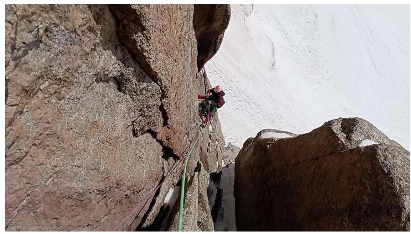
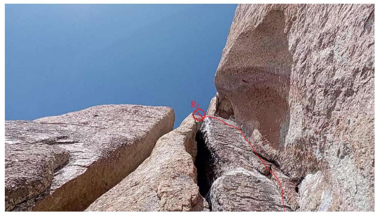
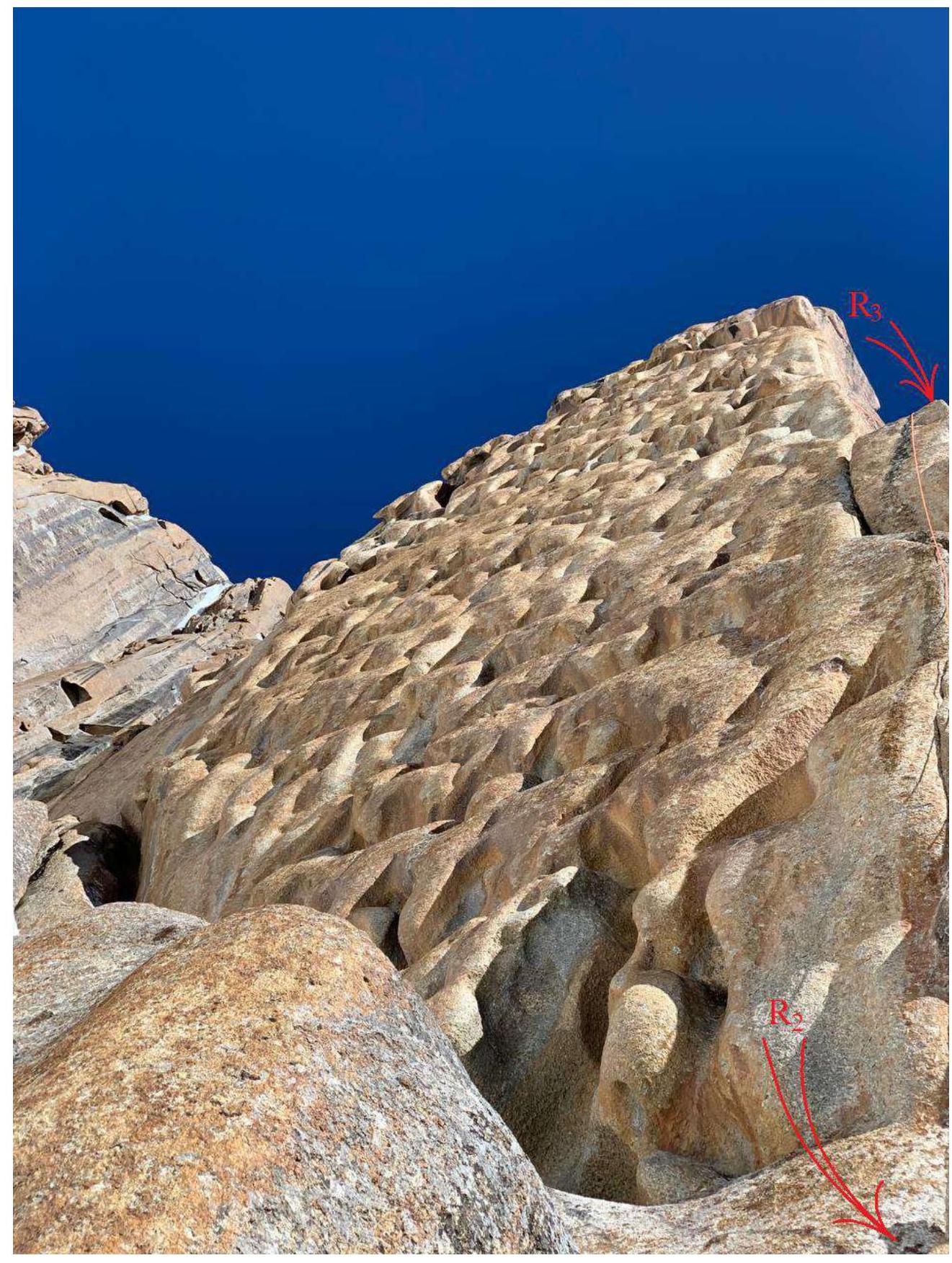
The route begins with overcoming the bergschrund under the counterfort at 4800 m and presents no significant difficulties. Then, it follows a snowy slope under the rock (R0). Our team started work on the route on August 23, 2023, at 10:00. Climbing begins in the right part of the counterfort through a system of cracks and chimneys (photos 10 and 11). From R2, the ascent follows a crack to the right of the "lunar" terrain (photo 12).
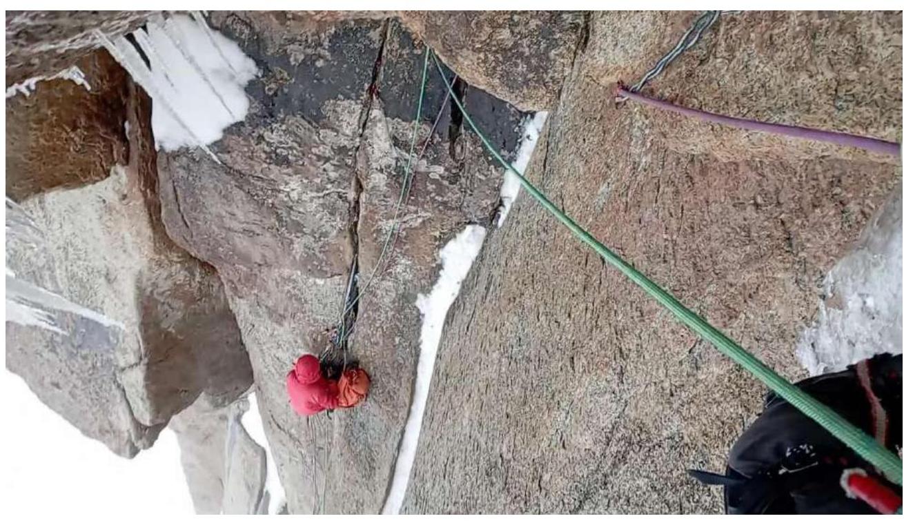
The following sections through points R3 (photo 13), R4, and R5 follow a logical line upwards, although on R3–R4, we had to search for a reliable placement and make a small pendulum. On R5–R6, the pendulum was more significant. Here, we finally overcame the wide chimney along the right board, transitioning to an ice icicle. We set up an overnight stay on a snow bridge but managed to climb another 30 m up the wall with cracks in the evening (photo 14, R7). Above, another 30 m (R8) leads to simple snowy terrain, which continues to R9.
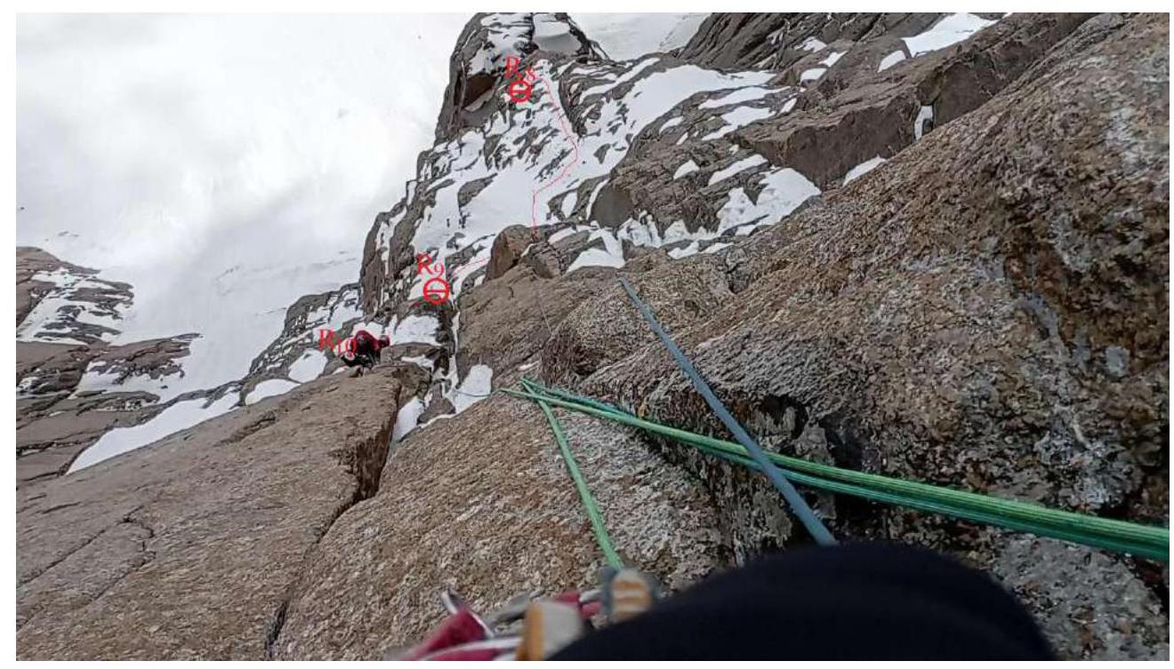
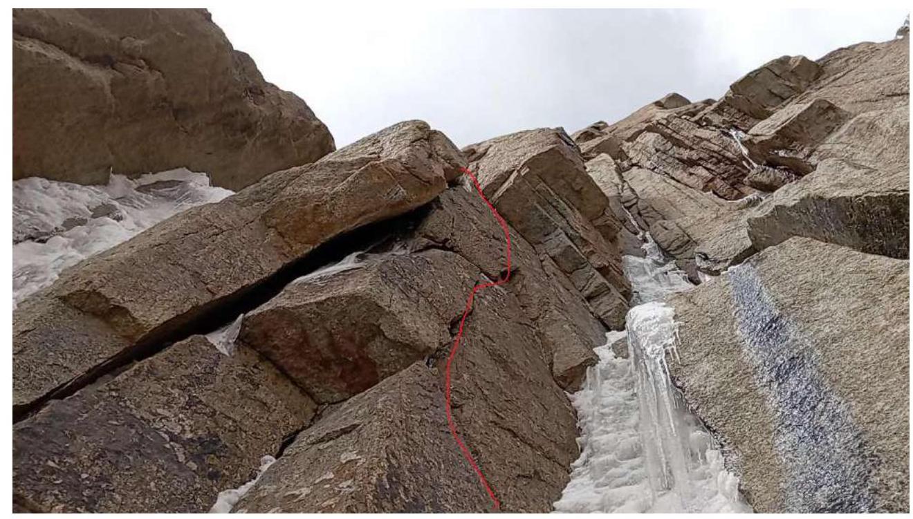
The line then goes from the right part of the snowpatch up the wall with a crack (R10), and then through a system of walls and ledges (photo 15, R11). A nearly vertical wall with a slight overhang leads to a small snow ledge and R12. Further movement requires going left of a large internal angle along a wall with a crack (photo 16) and turning left into a chimney with snow, exiting onto a ledge (R13). From the ledge, a vertical, iced chimney goes left; we went upwards and to the right, around a bend, and left into an internal angle-chimney. Station R14 is on a ledge to the left, protected from falling icicles. Then, we followed the right wall towards a large cornice (photo 17, R15). We worked on this section on the second day and descended below R14 to set up an overnight stay.
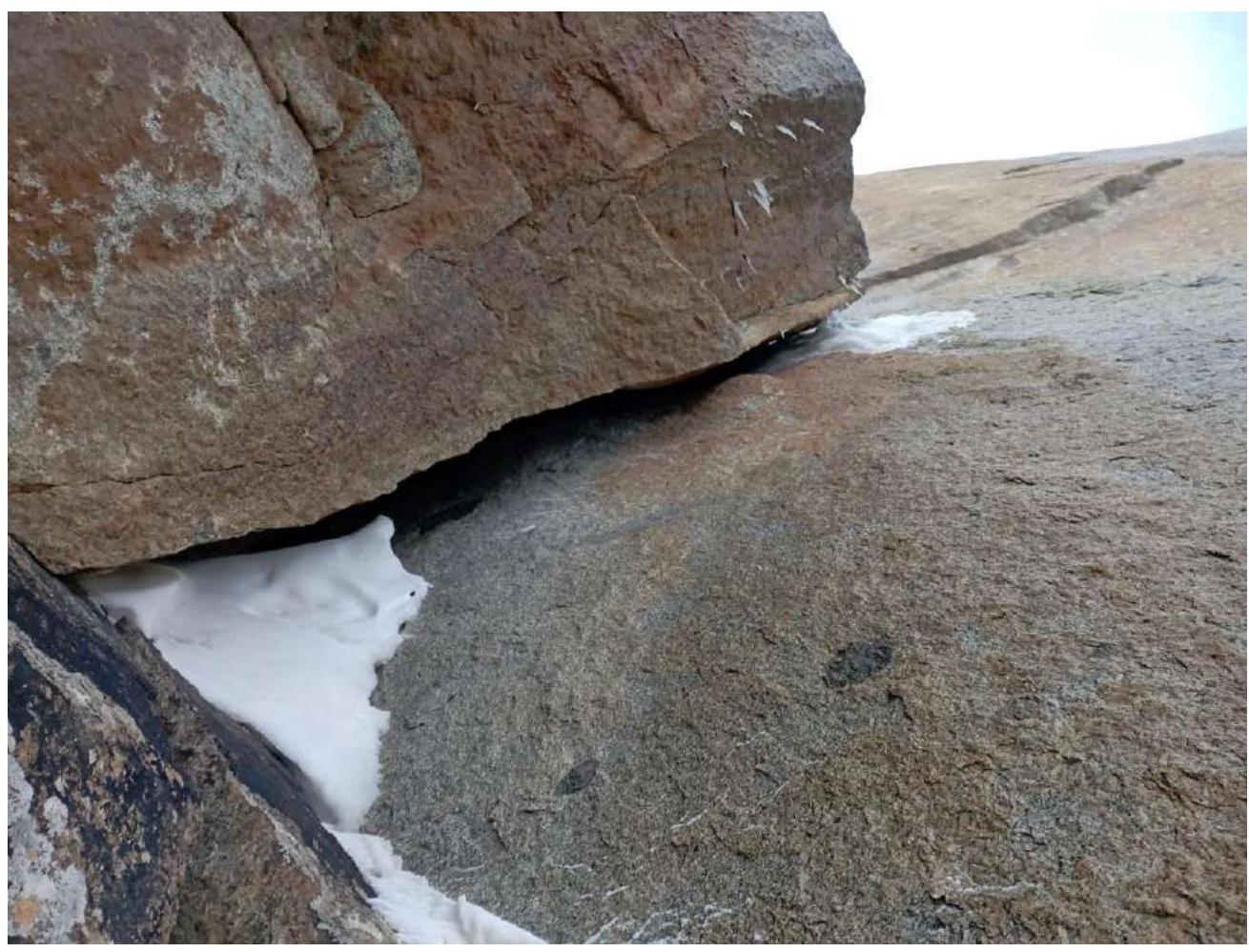
The next day, we tackled the cornice (photo 18), which is climbed via a wide crack at its junction with the right wall. Then, we followed a positive internal angle to the next smaller cornice (R16). Above it, we climbed up through the right part to the base of a snowy couloir to R17. On this section, we spent a lot of time choosing the direction of further movement and were caught in the onset of precipitation. We decided to descend to the same overnight stay location. Up to this point, Penyaev was the lead climber for three days. The following days saw significant precipitation. The section from R12 to R19 is a snow collection area. Fortunately, the steep wall prevents a large amount of snow from accumulating, and it descends immediately.
Therefore:
- we spent one day in the tent without leaving;
- then, without dismantling the tent, we sent a pair led by Murin to process the next section.
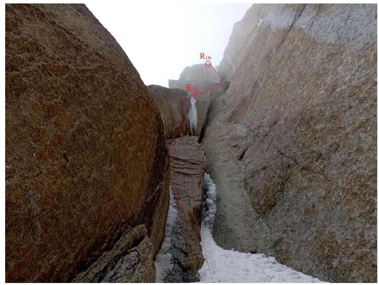
It begins with a wide but short snowy couloir leading to a wall with a cornice (photo 19). Above it lies another wall (R18) and a transition into a very narrow chimney (photo 20), ending on a ledge (R19). At this point, we had used up all our ropes for processing.
Further movement continued the next day when, during a break in the snow, we collected the tent and ascended as a group. That day, there was no snowfall, but powder avalanches constantly descended from the rocks above. From R19, a simpler part of the route begins. The line continues:
- upwards and to the right, bypassing a projecting rock (R20);
- then left and upwards through a snowy couloir (R21).
Further, there is a final complex wall to a snowy ledge under a cornice (R22). Here, we set up another overnight stay during the process of hanging:
- the next rope – to the right along ledges (R23);
- and to the left – along a snowy couloir (R24).
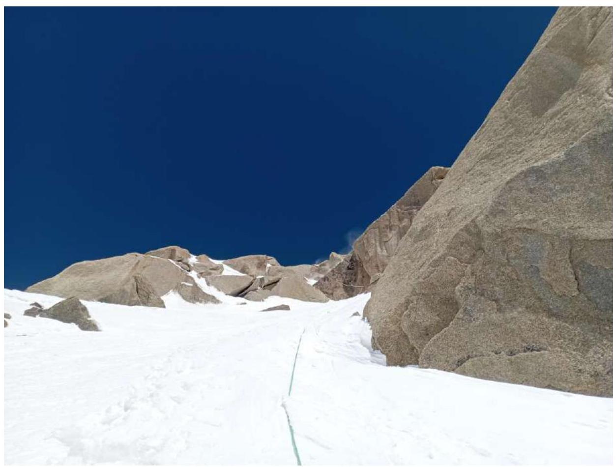
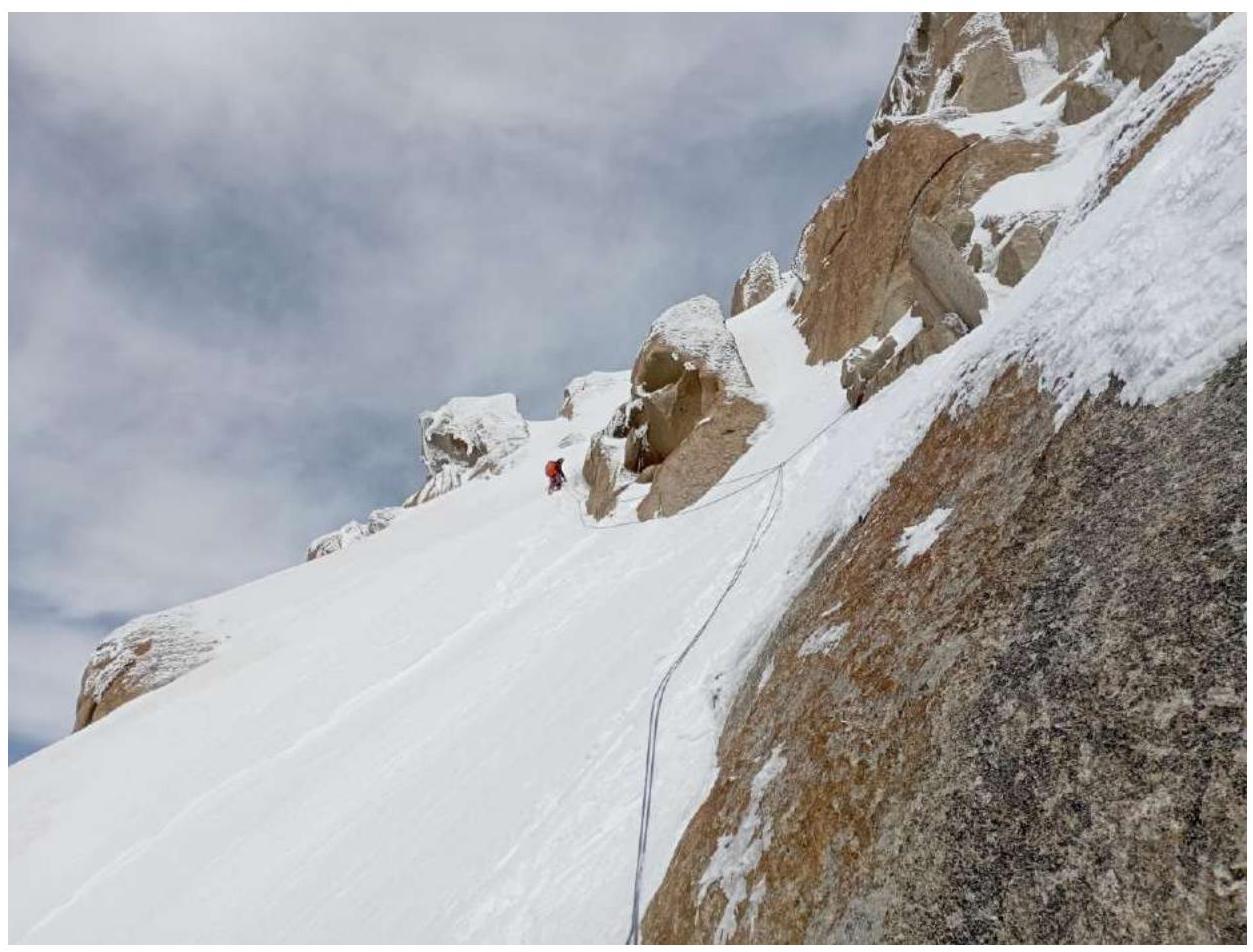
The new day brought good weather. By this time, the other group had been living under the summit for two nights, waiting for the end of the snowfall and the unloading of the slopes. Our route goes mainly along snowy slopes (photo 21), from one rocky outcrop to another. R25 marks the exit to the main ridge.
Along it, first on snow-covered rock slabs, then on snow, and later on ledges and small internal corners, we reached R26.
After passing under a rock and climbing a small vertical ice wall, we reached a simple snowy ridge and R27. Further, there is another ascent on the ridge. We moved upwards, bypassing rocks (photo 22), and soon reached the turn of the ridge R28 and the summit R29.
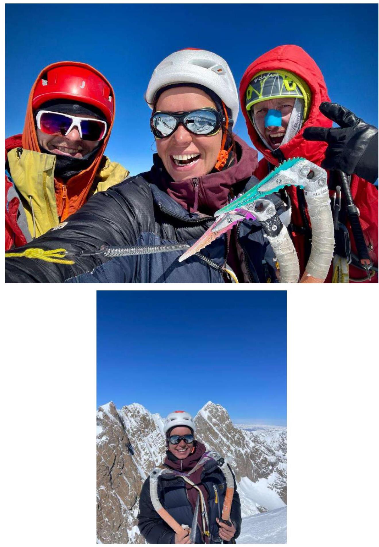
On August 29, 2023, at 14:30, we reached the summit.
A note was left on an anchor hammered into the rock in a depression ten meters below the summit. The location is obvious and easy to find.
- and 9. Photos from the summit. In the background are peaks Kyzyl-Asker and 5632
Descent
The descent from the summit followed the path laid by the other group, which began descending that morning.
- Two rappels down the southeastern ridge on hangers;
- then on anchors and hangers down the eastern wall;
- six rappels to the exit onto a snowy ridge;
- a short traverse along the ridge, then left towards Kyzyl-Asker;
- three rappels down a gentle slope;
- then four rappels down a vertical wall;
- further descent on snow to the glacier, which we also decided to traverse with ropes – another three rappels;
- then down the glacier to the base camp.
Conclusion
The route is good and relatively safe. Insurance is reliable, and the terrain is monolithic. One should be mindful of snow conditions. Upper snowfields can be avalanche-prone. There are no emergency alternative descents from the route, nor are there easy descents from the summit.
Communication with the outside world is only possible via satellite.
The route can be considered a solid 6A or, considering the inaccessibility of the area, a not-so-difficult 6B.
-
View down from R1
-
View up from R1
-
"Lunar" terrain on section R2–R3
-
View from R3 upwards

-
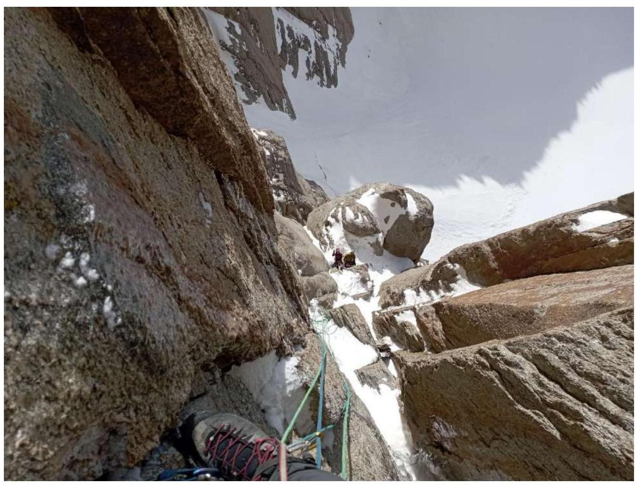
View from R7 to the overnight stay location
-
View from R11 downwards
-
View from R12 upwards
-
Photo of the cornice from station R15
-
Photo from section R15–R16 downwards
-
View from R17 upwards
-
View from R18 upwards

-
Section R24–R25
-
Section R27–R28