
Belarusian Federation of Alpinism
Report
on the ascent to the summit of Peak Pobeda 7439, Zap. Pobeda, Main, via the north edge from Dikiy Pass, 5B, by D. Medzmariashvili 2019
Route Passport
- Mountain region: Tian Shan, Kyrgyzstan.
- Name of the summit: Peak Pobeda (7439 m).
- Category of difficulty: 5B high-altitude.
- Nature of the route: snow-rock-ice.
- Route:
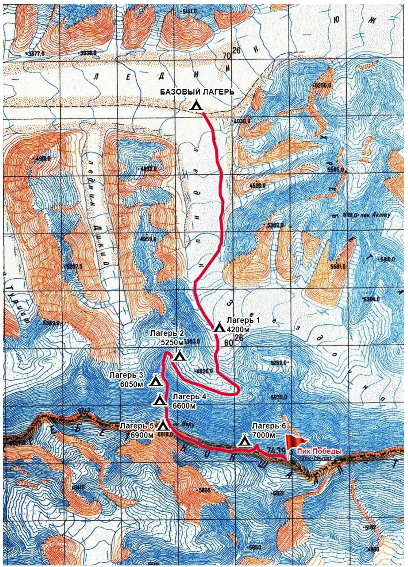
- Zvezdochka glacier, Dikiy Pass, Peak Pobeda West along the northern edge, Peak Pobeda Main, 7439 m, descent via the ascent route;
- Number of pitons and placements used on the routes:
- not used;
- Number of travel days:
- 8 days.
- Participants: Polyanskiy Maksim (3rd sports category, Minsk), Sviridov Nikolay (1st sports category, instructor 3rd category, Soligorsk).
- Coach: Sviridov Nikolay (1st sports category, instructor 3rd category).
- Organization: "Magadan" club of the Belarusian Federation of Alpinism, Minsk.
Ascent to Peak Pobeda, 7439 m, August 2-10, 2019
Brief chronology:
- August 2, 2019: Zvezdochka glacier, first camp, 4200 m - 4 hours;
- August 3, 2019: ascent to the second camp via Zvezdochka glacier, through Dikiy icefall, to Dikiy Pass, 5250 m - 7 hours, including:
- snow-ice slope 40-60°, in rope teams - 3 hours;
- snow-ice slope 30° - 4 hours.
- August 4, 2019: ascent along the northern edge of Peak Pobeda West, 6050 m:
- snow-ice slope;
- snow-rock slope, fixed ropes.
- August 5, 2019: continuation of movement along the northern edge of Peak Pobeda West, 6600 m:
- snow-rock slope;
- rope teams, fixed ropes.
- August 6, 2019: ascent to Vazhi Pshavela Peak, 6914 m:
- snow-rock slope.
- August 7, 2019: movement along the western ridge of Peak Pobeda Main to the Obelisk, 7000 m:
- snow slope, rope teams.
- August 8, 2019: ascent to Peak Pobeda Main, 7439 m, descent to the Obelisk:
- snow-rock-ice slope, individual.
- August 9, 2019: descent to the hollow below Dikiy Pass via the ascent route.
- August 10, 2019: descent to the base camp via the ascent route.
Route thread
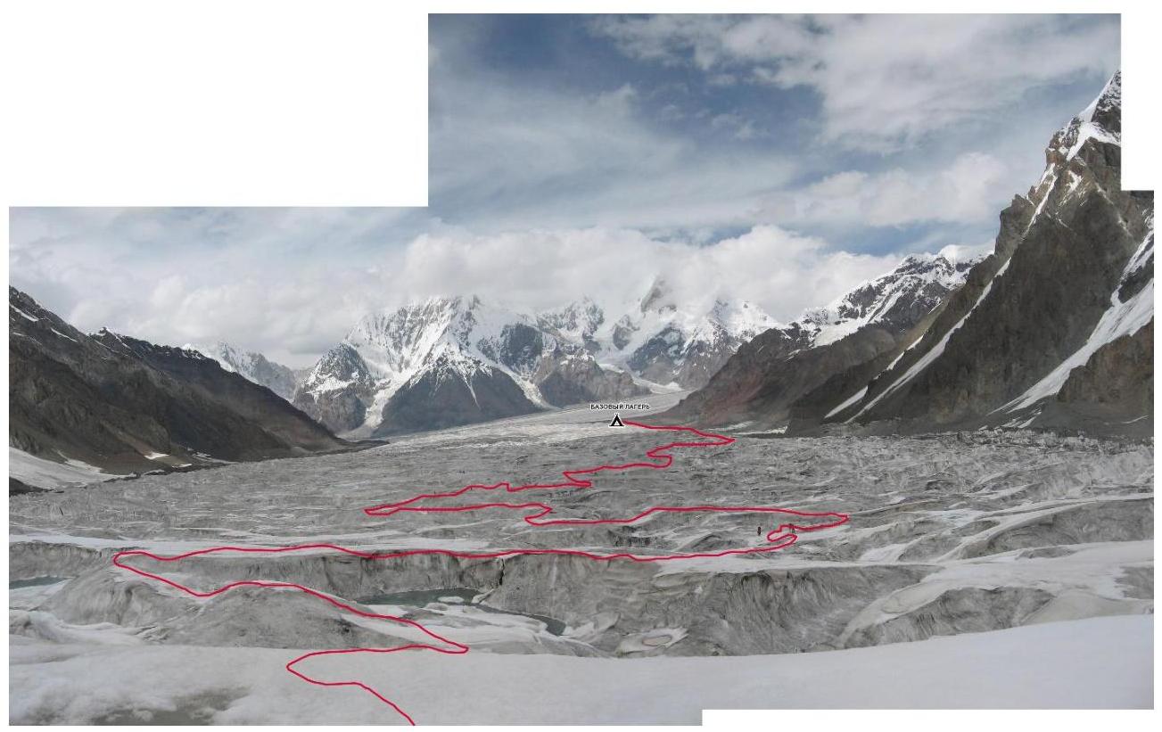
Movement line along Zvezdochka glacier:
- The path to the first camp initially follows the right orographic moraine of Zvezdochka glacier.
- Then movement proceeds along the center of the glacier, shifting towards the left side.
- Camp 1 is located below the icefall of Dikiy glacier on the path to Dikiy Pass from the east.
- Zvezdochka glacier is heavily broken and abounds with crevasses in its closed sections.
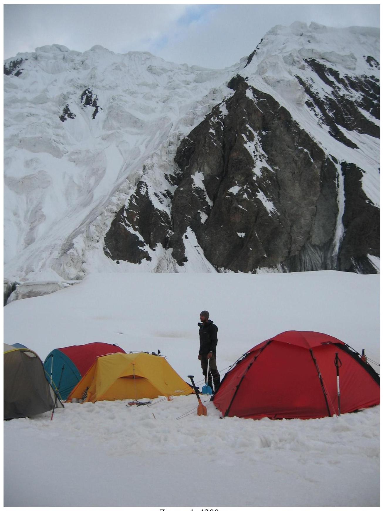
Camp 1, 4200 m
Panorama of Zvezdochka glacier
The path to the second camp passes through the icefall of Dikiy glacier and then along the upper part of the glacier. Approaching the foot of the icefall takes some time. We stop to rest before the ascent, put on helmets, attach ice screws, prepare the rope, and ice axes. Two ropes of fixed lines, ice with a thin layer of snow. Further, it involves maneuvering between crevasses, walls with a gentle gain in altitude.
The trail is marked, but flag markers indicate snow bridges or visible elevations. A couple of bridges were crossed with belay.
Further up to the pass, the trail ascends gently, snow sticks but is tolerable; we move in a rope team at a steady pace. Then individually. We ascend to the pass, set up a tent on a terrace before the pass ridge.
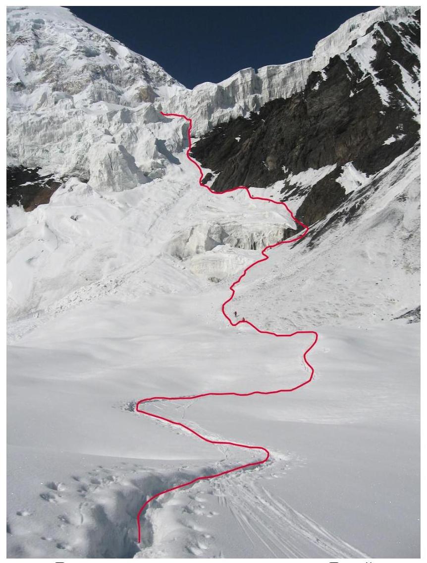
Movement line through Dikiy glacier icefall
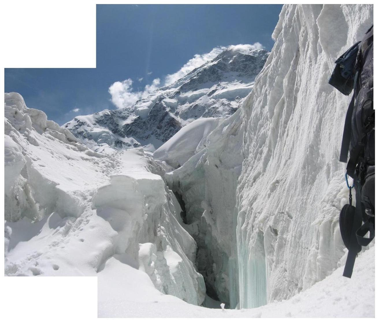
Passing crevasses on the icefall
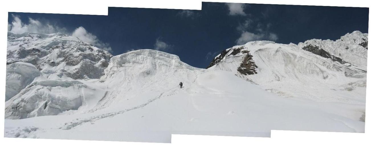
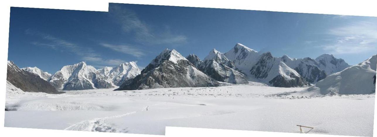
Panorama above the icefall
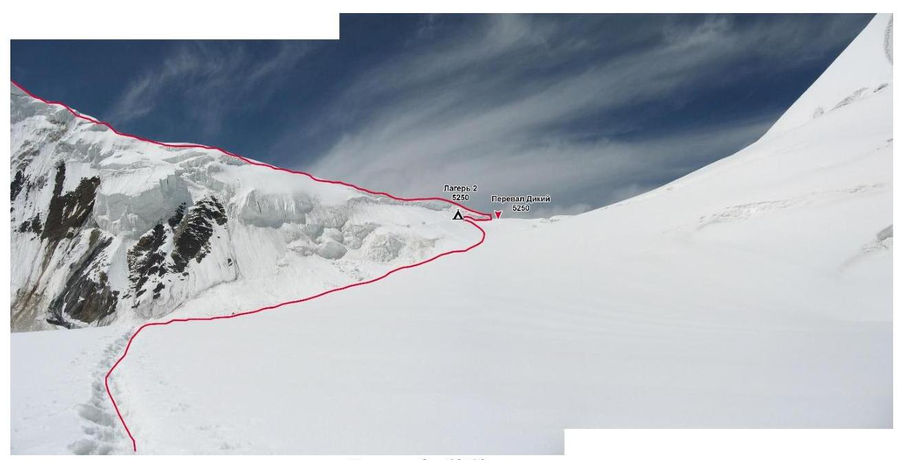
Camp 2, 5250 m

On the northern edge of Peak Pobeda West

Movement line along the northern edge of Peak Pobeda West
The next day, we begin the ascent to the third camp. Initially, there's a gentle gain. There are a few crevasses. Then the ridge starts to gain height and angle. No crevasses. Further, snow-rock steps begin. There are fixed rope lines of varying quality and type. On nearly vertical sections, the fixed ropes are reliable. Soon, we come under a steep snow wall. We step through. We emerge onto a ledge, altitude 6050. We set up camp.
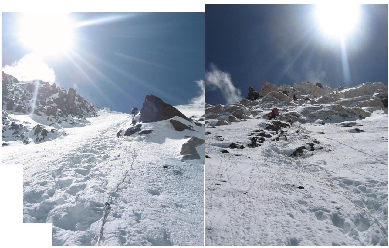
On the way to Camp 3
Camp 3, 6050 m.
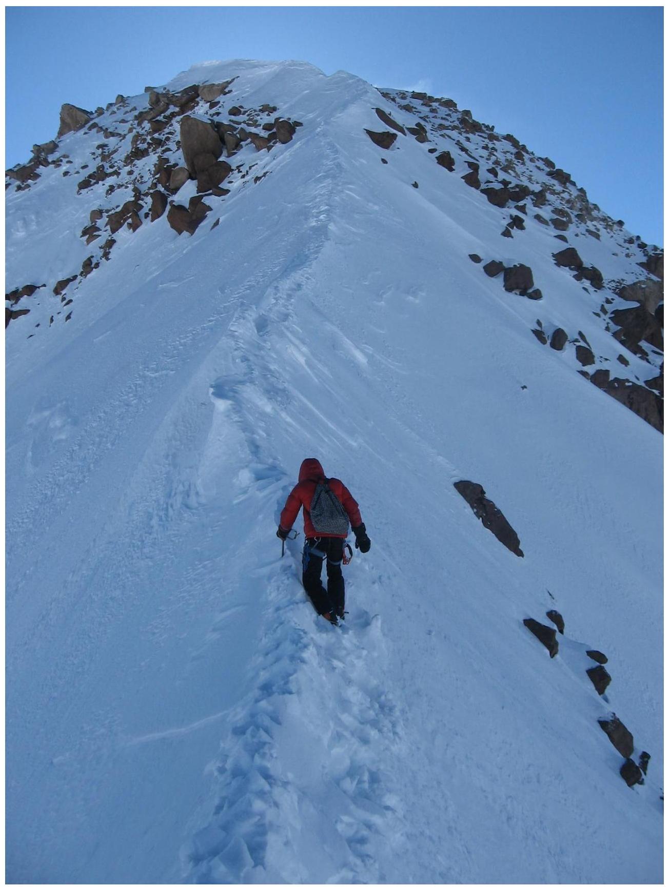
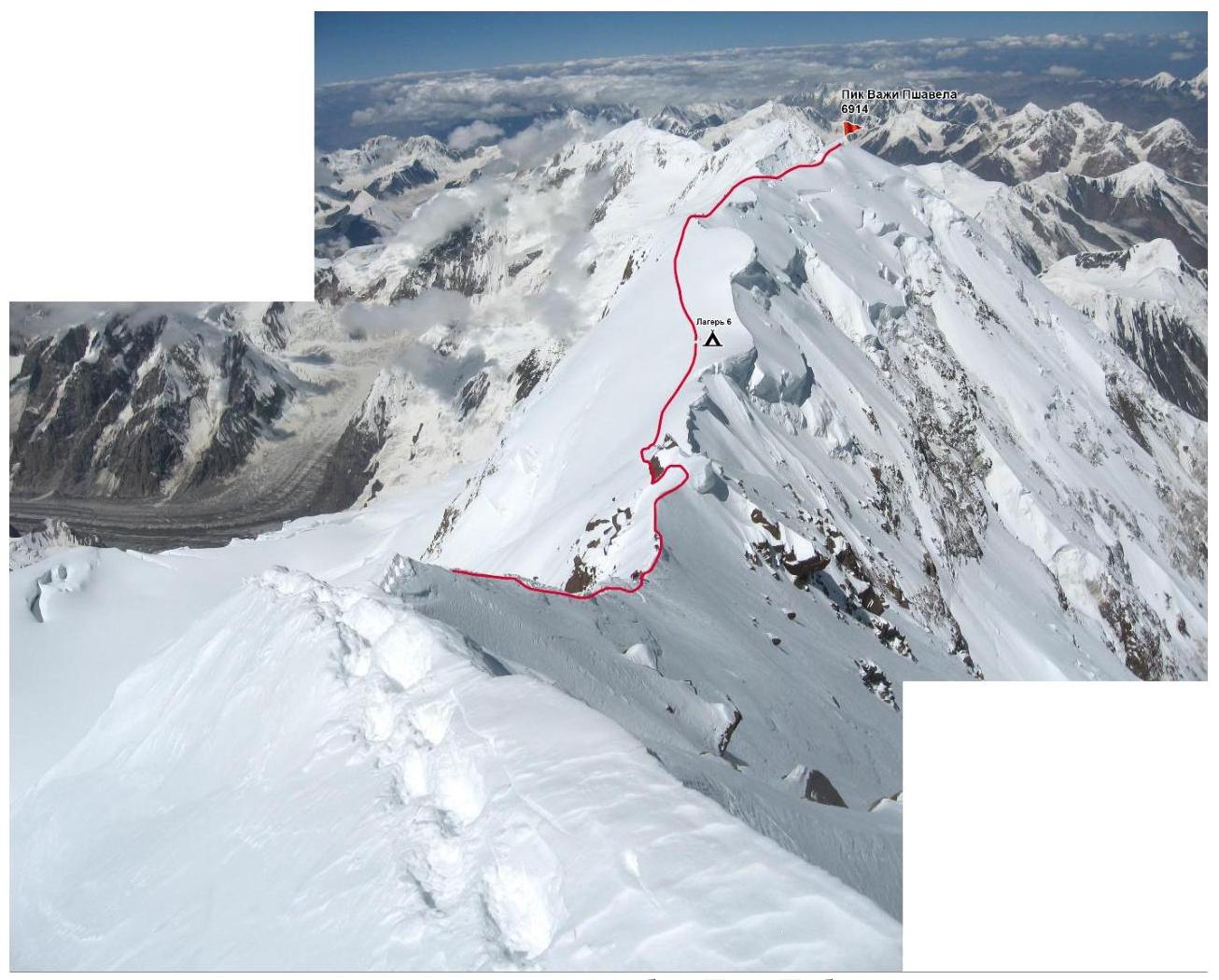
We continue moving towards Camp 4. Snow-rock slope, fixed ropes. Movement without rope teams. Further along the slope, we reached a large boulder, next to which is an excellent site, protected on one side from the wind. Altitude ~6600 m.
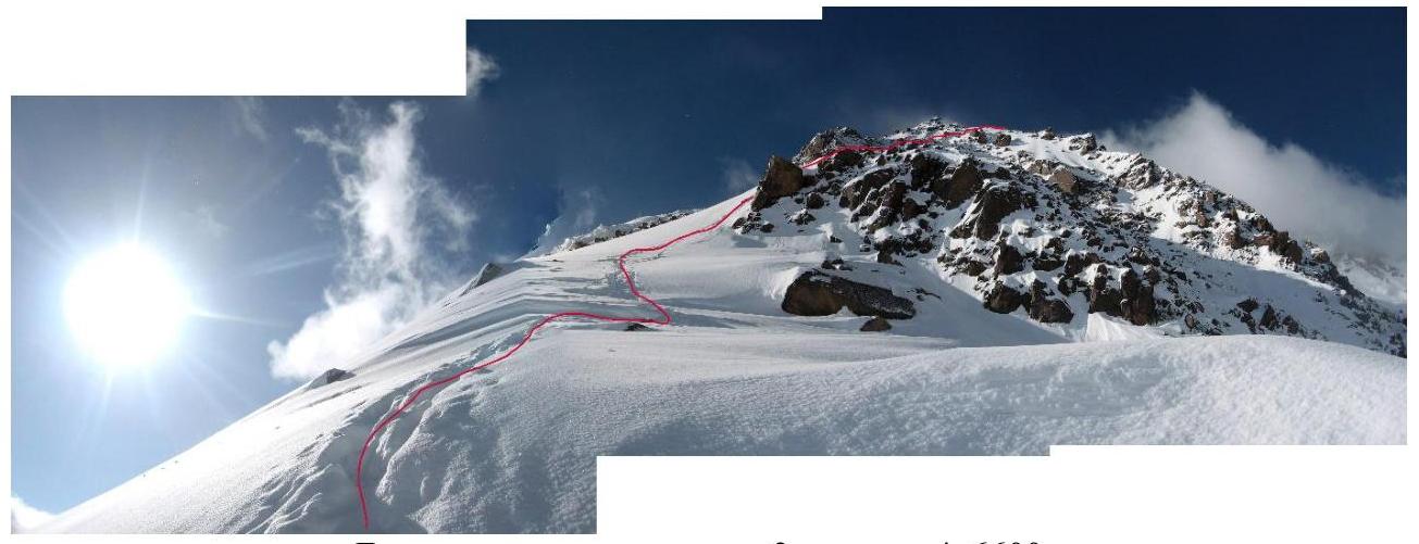
Movement line from Camp 3 to Camp 4, 6600 m. The ascent from Camp 4 to Camp 5 is initially along a snow-rock slope, passing a belt of rocks, and leading to a slope without rocks, which leads to a snow dome; we reached Vazhi Pshavela Peak (6914 m) along a snow slope.
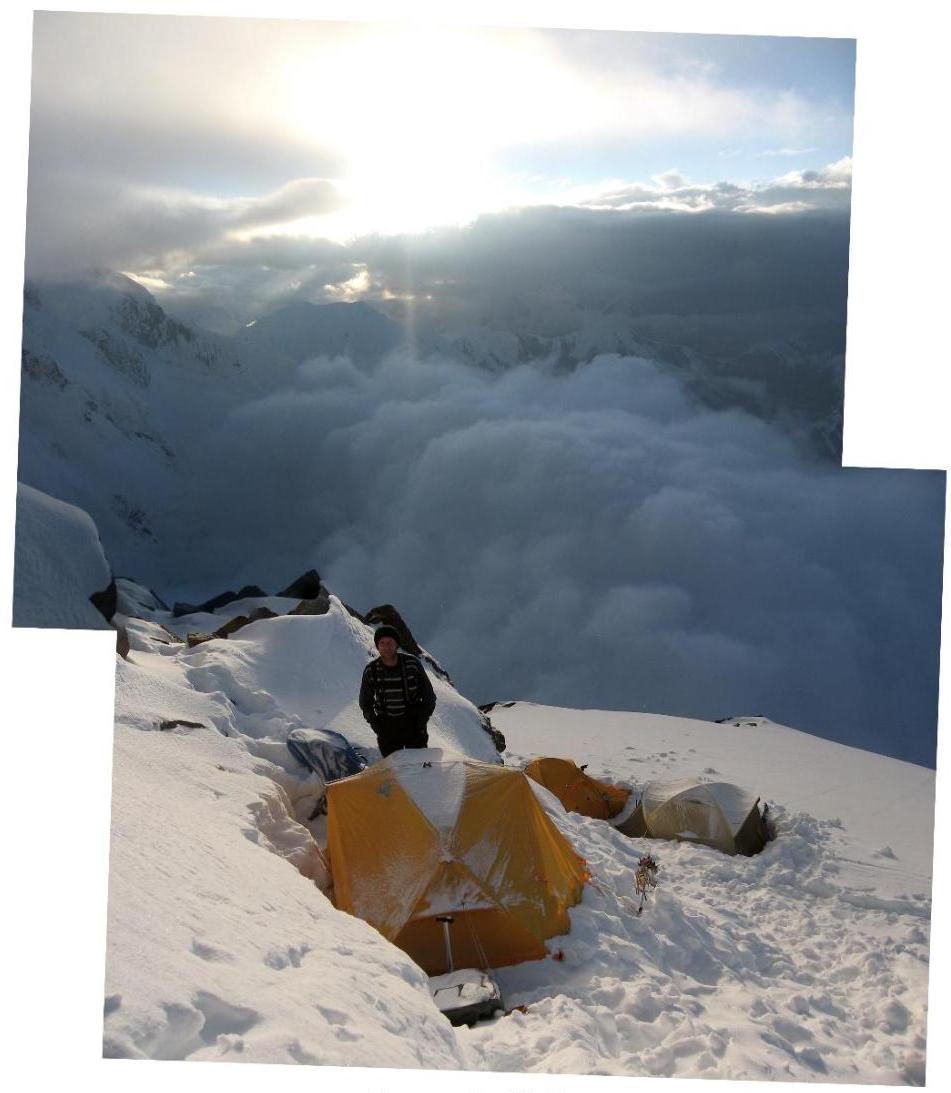
Snow slope before ascending to Vazhi Pshavela Peak. To Camp 6 (7000 m), we moved along the western ridge of Peak Pobeda, a distance of 2.5 km. After a climb to bypass a huge cornice — a long descent. No trail, hard snow. To the right, below, a slope descends. Movement is partially with alternating belay. At the end of the descent, the slope transitions into a broad saddle. On this saddle, we set up camp.
Movement line along the western ridge of Peak Pobeda
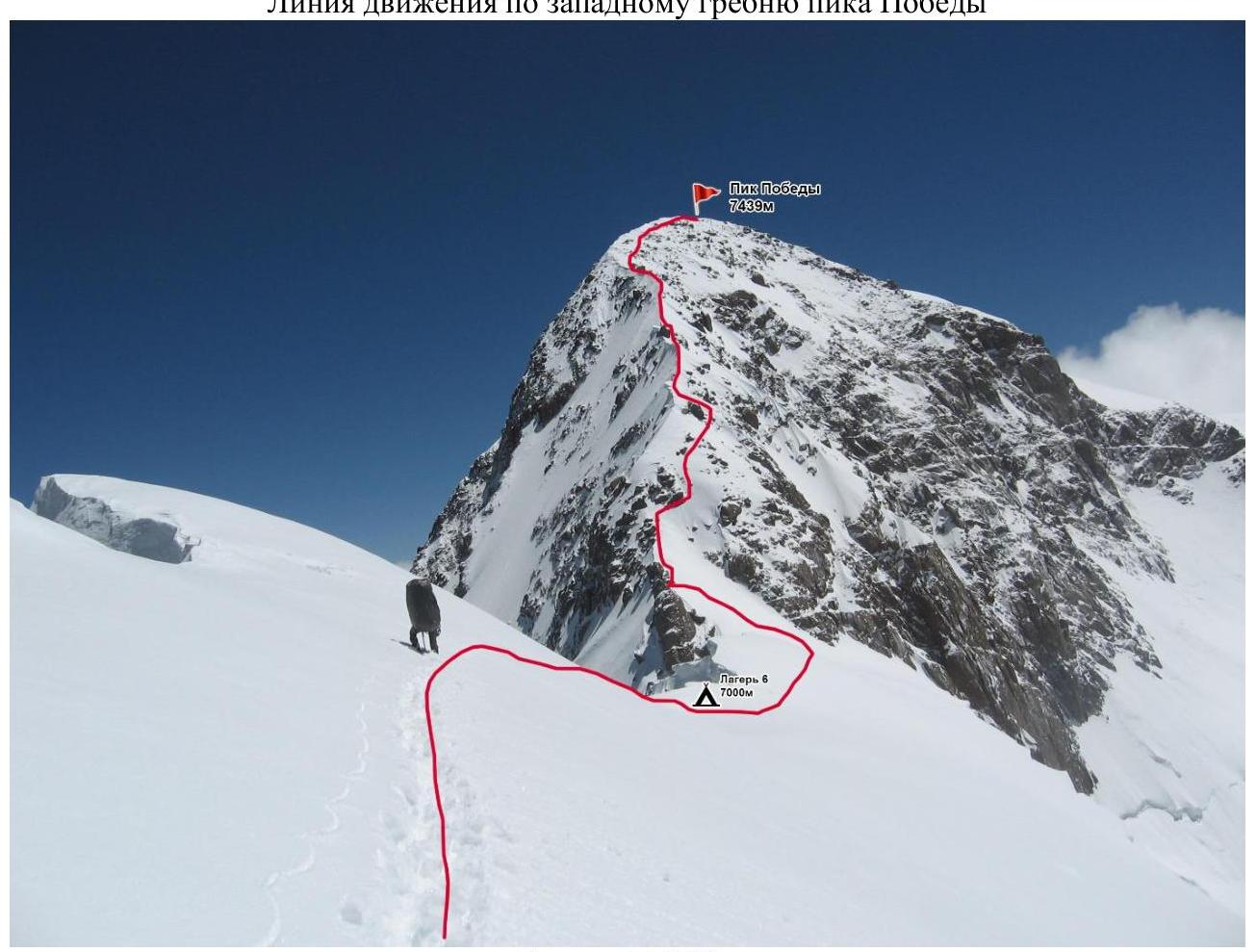
Camp 6, 7000 m
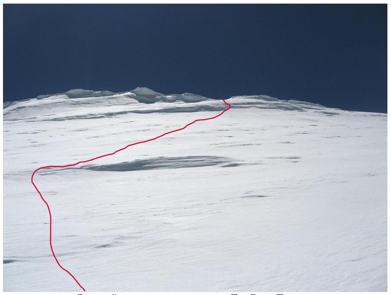
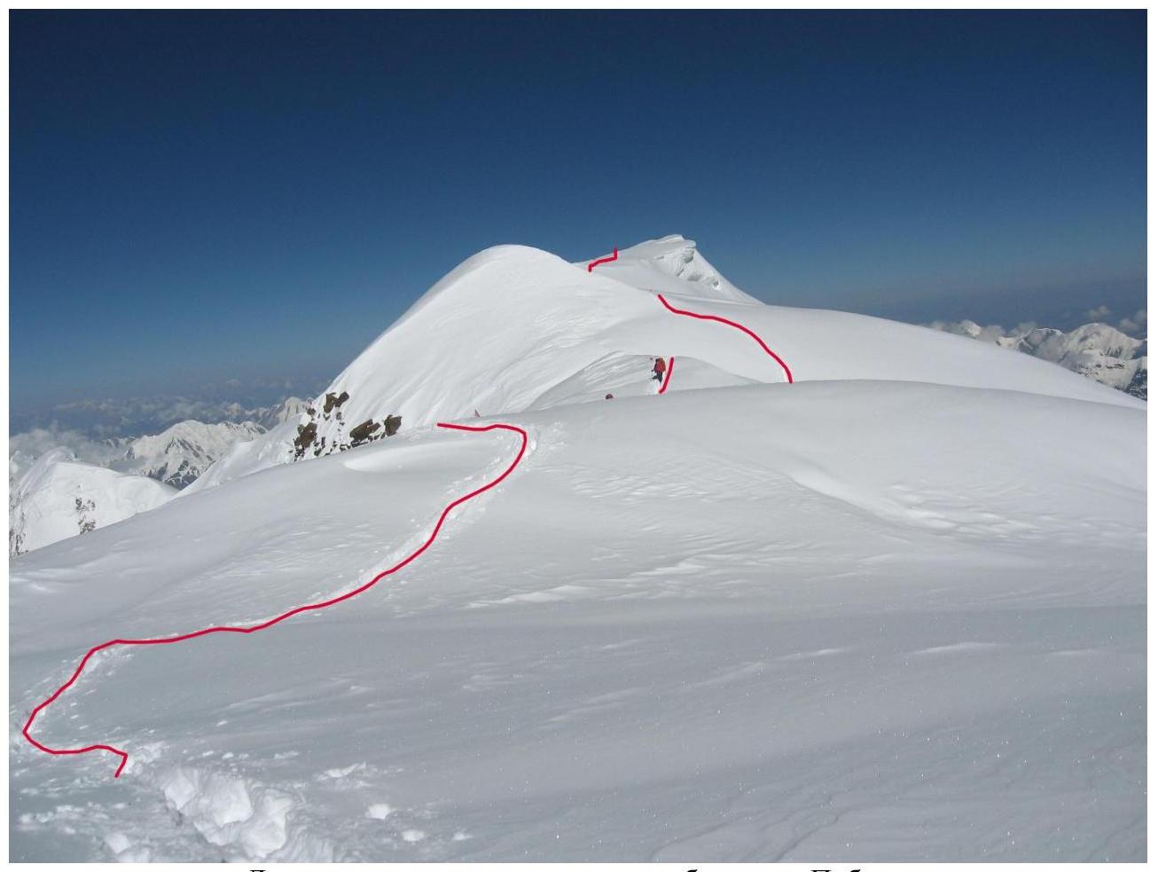
The ascent to Peak Pobeda Main from Camp 6 is individual, along a snow-rock slope. The ascent follows the slope to the right of the Obelisk; a snow slope ends in rocks. Further, traverse to the right along a snow slope and before a rock — straight up, onto the ridge. On the ridge to the right, then up, under a rock. From under the rock — onto steep snow and up onto the ridge. Ahead — a sharp ridge and wind. We cross a snow wall on the ridge: to the right — from China, to the left — into Kyrgyzstan. We move exactly along the border. Below, a steep slope descends into the clouds, into the abyss, towards Zvezdochka glacier. The ridge narrows into a sharp knife-edge, steeply dropping on both sides. On top — like walking on a blade. We have to move to the side: feet on the right wall, and the ice axe, leaning over the ridge, on the left. Behind — China, before our faces, beyond the ridge — Kyrgyzstan. So, for about 150 meters. Then the ridge broadens into a gentle slope. Above, rocks are visible on the slope. The top of the dome is the summit. To the right, a rocky ridge approaches from China; to the left, the top of a steep snow ridge is visible from the north. We are at the summit. We navigate around the rocks. And here's a very gentle section, on which a black rock protrudes. The ascent is complete.

Obelisk before the ascent to the ridge of Peak Pobeda Main
Passing the knife-edge on the ridge of Peak Pobeda
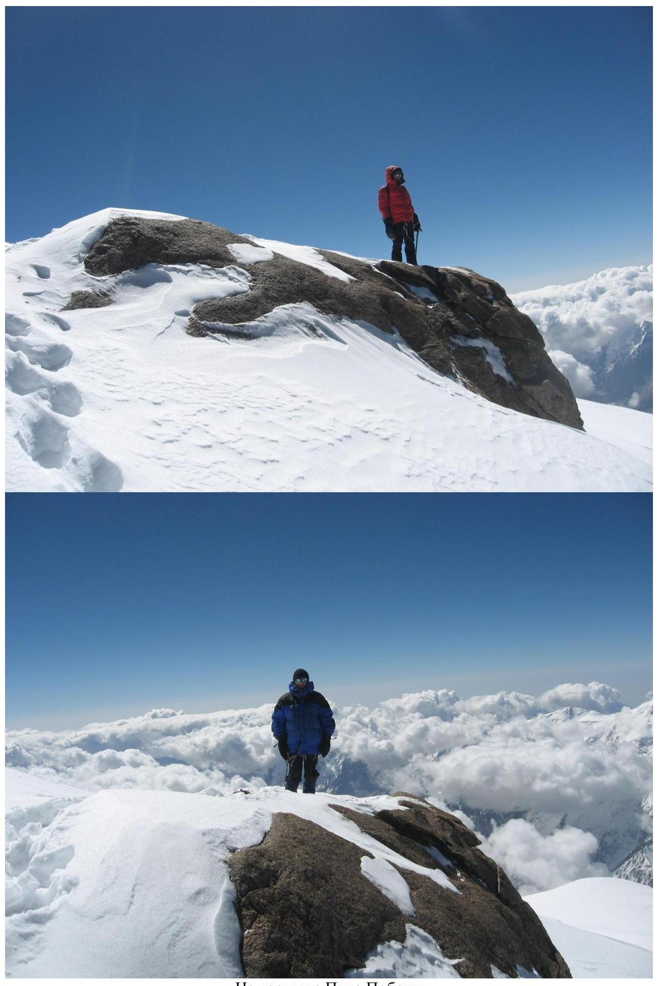
At the summit of Peak Pobeda
Movement line along the ridge of Peak Pobeda Descent via the ascent route.