REPORT
ON THE ASCENT TO THE SUMMIT OF KORONA, 5-YA VIA THE WESTERN RIDGE, CATEGORY 5B, BY THE KAIS MEI TEAM FROM AUGUST 12, 2021 TO AUGUST 13, 2021
Moscow, 2021
I. ASCENT DOCUMENTATION
| 1. General Information | ||
|---|---|---|
| 1.1 | Full Name, Sports Rank of the Leader | Gvakov Fedor Vladislavovich, 2nd sports rank |
| 1.2 | Full Name, Sports Rank of the Participants | Vasnev Danila Olegovich, 1st sports rank |
| 1.3 | Full Name of the Coach | Kutkin Sergey Anatolyevich |
| 1.4 | Organization | KAiS MPEI |
| 2. Characteristics of the Ascent Object | ||
| 2.1 | Region | Tian-Shan |
| 2.2 | Valley | Ala-Archa |
| 2.3 | Classification Table Section Number (2013 edition) | 7.4 Kyrgyz Range |
| 2.4 | Name and Height of the Summit | Korona, 5-ya, 4860 m |
| 2.5 | Geographical Coordinates of the Summit (latitude/longitude), GPS Coordinates | – |
| 3. Route Characteristics | ||
| 3.1 | Route Name | 3-mu rebu (V. Ruzhevsky) |
| 3.2 | Proposed Category of Difficulty | 5B |
| 3.3 | Degree of Route Exploration | – |
| 3.4 | Relief Characteristics of the Route | Combined |
| 3.5 | Height Difference of the Route (altimeter or GPS data) | 700 |
| 3.6 | Route Length (in meters) | 870 |
| 3.7 | Technical Elements of the Route (total length of sections with different difficulty categories, indicating relief characteristics (ice-snow, rock)) | Rock V cat. diff. — 240 m, Rock VI cat. diff. — 85 m |
| 3.8 | Average Steepness of the Route, (°) | 62° |
| 3.9 | Average Steepness of the Main Part of the Route, (°) | 82° |
| 3.10 | Descent from the Summit | From the col between 3 and 4 towers to Korona Glacier |
| 3.11 | Additional Route Characteristics | Water on the route is present in the form of ice and snow on ledges |
| 4. Team Actions Characteristics | ||
| 4.1 | Time of Movement (team's walking hours, in hours and days) | 22 hours, 2 days |
| 4.2 | Overnight Stays | One, on ledge R12 |
| 4.3 | Route Preparation Time | – |
| 4.4 | Departure onto the Route | 05:30 August 12, 2021 |
| 4.5 | Arrival at the Summit | 15:00 August 13, 2021 |
| 4.6 | Return to the Base Camp | 19:00 August 13, 2021 |
| 5. Weather Conditions | ||
| 5.1 | Temperature, °C | – |
| 5.2 | Wind Speed, m/s | 17–20 m/s from 18:00 August 12 to 09:00 August 13 |
| 5.3 | Precipitation | Periodic snowfall from 14:00 August 12 to 12:00 August 13 |
| 5.4 | Visibility, m | – |
| 6. Responsible for the Report | ||
| 6.1 | Full Name, e-mail | Vasnev Danila, vasnevdo@gmail.com |
II. ASCENT DESCRIPTION
1. Characteristics of the Ascent Object
1.1–1.2. General photo of the summit
 Korona, 5-ya (4860)
Korona, 6-ya (4860)
Dvurogaya (4380)
Korona, 5-ya (4860)
Korona, 6-ya (4860)
Dvurogaya (4380)
- Egorov, 5A
- Sadovsky, 5B
- Balezin, 6A
- Ruzhevsky, 5B
- Glukhovtsev, 5B
- Andreev, 4B
1.3. Route Profile
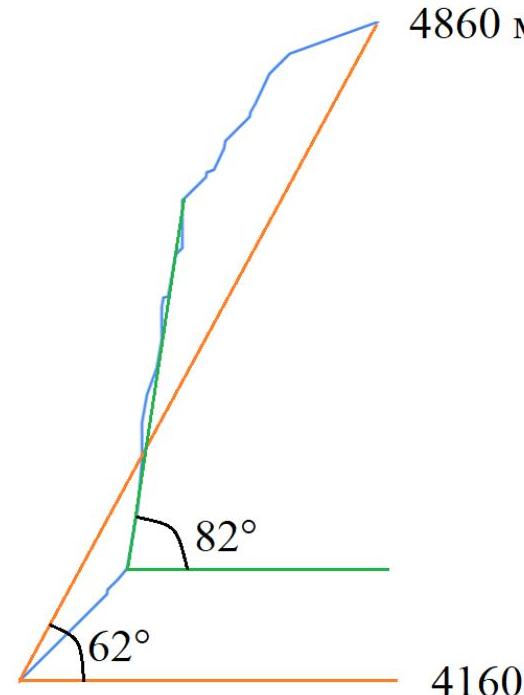 Steepness: 82°, 62°
Heights: 4860 m, 4160 m
Steepness: 82°, 62°
Heights: 4860 m, 4160 m
2. Route Characteristics
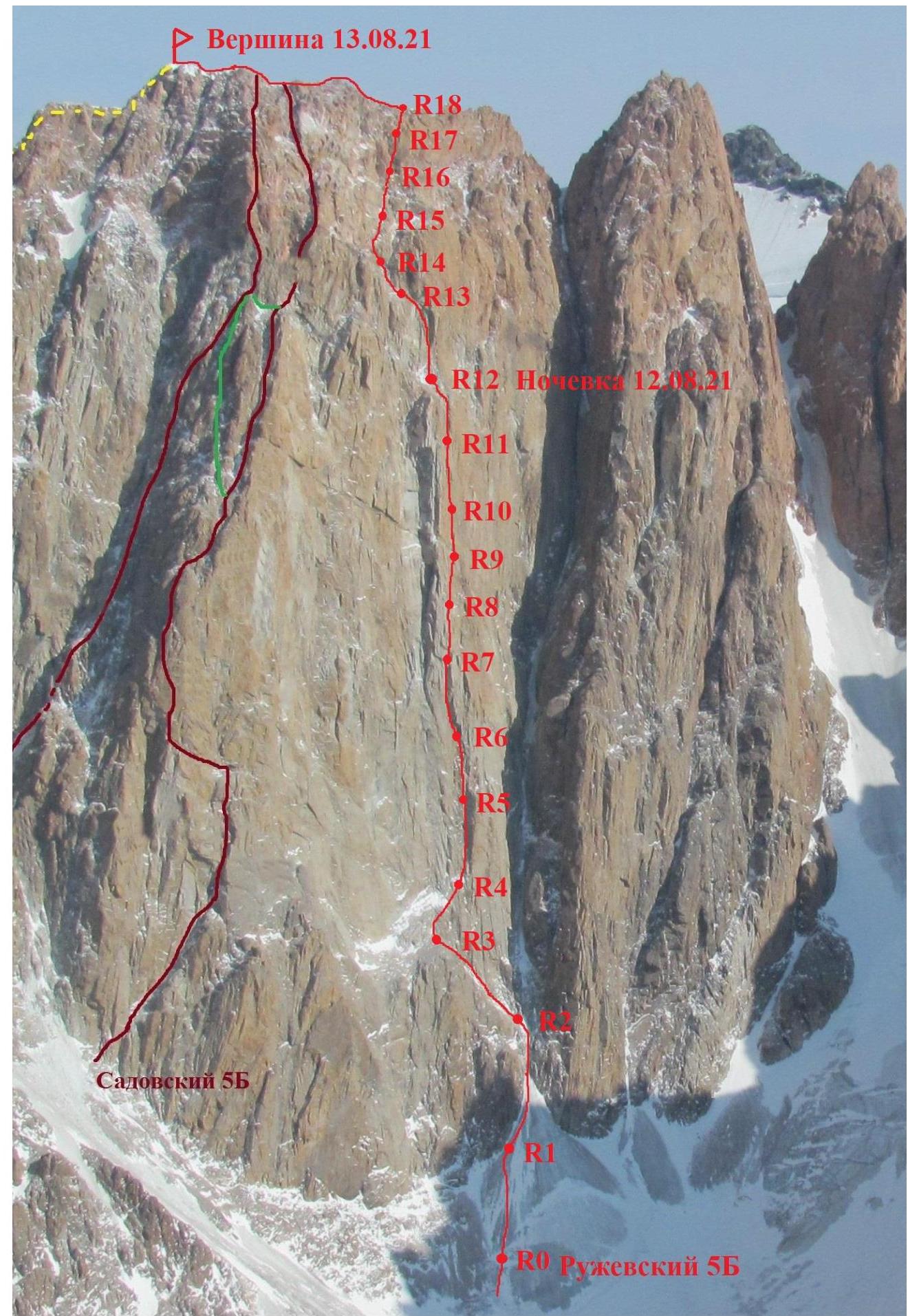
2.1–2.2. Technical photograph of the route
2.3. Technical characteristics of the route sections
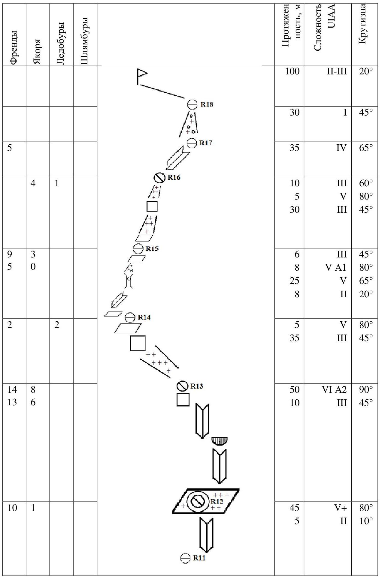
| Section | Friends | Anchors | Ice Screws | Bolts | Length, m | Difficulty UIAA | Steepness, ° |
|---|---|---|---|---|---|---|---|
| Start | 100 | II-III | 20° | ||||
| R18 | 30 | I | 45° | ||||
| R17 | 35 | IV | 65° | ||||
| R16 | 4 | 1 | 10 | III | 60° | ||
| 5 | V | 80° | |||||
| 30 | III | 45° | |||||
| R15 | 9 | 3 | 6 | III | 45° | ||
| 5 | 0 | 8 | VA1 | 80° | |||
| 25 | V | 65° | |||||
| 8 | II | 20° | |||||
| R14 | 2 | 2 | 5 | V | 80° | ||
| 35 | III | 45° | |||||
| R13 | 14 | 8 | 50 | VI A2 | 90° | ||
| 13 | 6 | 10 | III | 45° | |||
| R12 | 10 | 1 | 45 | V+ | 80° | ||
| 5 | II | 10° | |||||
| R11 | 12 | 10 | 5 | 4 | 10 | V | 80° |
| 35 | VI A2 | 90° | |||||
| R10 | 5 | 1 | 1 | 30 | IV | 80° | |
| R9 | 4 | 2 | 2 | 30 | IV | 70° | |
| R8 | 6 | 2 | 30 | V | 80° | ||
| R7 | 4 | 5 | 8 | 8 | 40 | V+ A1e | 90° |
| 2 | 2 | ||||||
| R6 | 7 | 4 | 50 | V A2 | 85° | ||
| 4 | 2 | ||||||
| R5 | 7 | 3 | 45 | V+ | 80° | ||
| R4 | 5 | 3 | 20 | IV | 80° | ||
| 15 | IV | 50° | |||||
| R3 | 2 | 2 | 1 | 15 | III | 45° | |
| 5 | V | 80° | |||||
| 35 | III | 45° | |||||
| R2 | 2 | 3 | 50 | III | 45° | ||
| R1 | 1 | 1 | 3 | 50 | III | 45° | |
| R0 |
3. Team Actions Characteristics
3.1. On August 12, 2021, at 03:30, the group departed from Koronskaya Hut. At 05:30, they began working on the route. At 19:30, they gathered on a ledge for an overnight stay at R12. The snow-ice ledge contained many rocks, making it difficult to carve out a horizontal section for a comfortable overnight stay.
On August 13, 2021, they resumed work on the route at 07:00 and reached the summit at 15:00. They descended to Koronskaya Hut by 19:00.
Guvakov Fedor worked first on sections R0–R9, and Vasnev Danila worked first on sections R9–summit.
Movement on sections R0–R13 was carried out using simultaneous technique: the first participant climbed on two ropes, switching between the climbing rope and the safety rope, while the second participant moved along the fixed rope, simultaneously belaying the leader. On sections R13–R18, alternating movement was used. Along the ridge from R18 to the summit, they moved simultaneously.
The second participant carried the entire bivouac gear. They had:
- a sleeping bag
- a mattress
- a tent (which was torn by a gust of wind in the morning)
- a burner
- a 230 g gas canister
- food for two people for two days
- a first-aid kit.
Route Description by Sections
R0–R2. Through the couloir between the fifth and sixth towers of Korona, firn and ice (100 m). R2–R3. The couloir narrows and turns left, 25 m to a steep wall. Climb the wall (5 m), then left-up to a ledge (15 m). R3–R4. Along the sloping ledge, right-up to the base of a large internal angle, the steepness gradually increases (35 m). R4–R5. Up the internal angle to a small ledge, the rocks are broken (45 m). R5–R6. From the ledge, up the wall and then up the internal angle, the rocks are broken, with some ITO on friends and anchors (50 m). R6–R7. From the station, slightly left-up through a small cornice and then up the internal angle. Some old bolts are present, some of which appear unreliable. Mainly ITO on friends and bolts (40 m). R7–R8. Up the wall to a small ledge (30 m). R8–R9. Up the internal angle to a sloping ledge with snow. There are bolts on the station, and a sitting bivouac is possible (30 m). R9–R10. Up the internal angle to a small ledge (30 m). R10–R11. Up the vertical wall, mainly on ITO: anchors, friends, with 2 bolts that appear unreliable (35 m). Then, easier climbing leads up to a ledge (10 m). R11–R12. Right along the ledge (5 m). Then up the internal angle. Climbing is complicated by snow and ice on ledges and in cracks (45 m). Exit to a large sloping ledge, covered with snow and ice. Semi-reclining bivouac. R12–R13. Up the ledge to its end (10 m) and then up the internal angle (50 m). Short traverse left across the wall to the base of an ice couloir. R13–R14. Left-up the ice couloir with firn exits to its end (35 m). Cross up through a short steep wall (5 m). R14–R15. Left along the ledge (8 m), then right-up the sloping internal angle (25 m), turning into a wide chimney with a plug at the top (8 m).
- Above the plug, up the ice with firn (6 m)
- Exit to a horizontal ledge the size of a tent, a red tent is possible.
R15–R16. Up the ice couloir (30 m), cross up through a short wall (5 m), and then up the ice to its end (10 m). R16–R17. Up the sloping internal angle, right-up (35 m). R17–R18. Up the snow-covered rocks to the ridge (30 m). R18–R19. Along the ridge with mixed relief to the summit of the fifth tower of Korona (100 m).
Photo 1. View of R0–R1
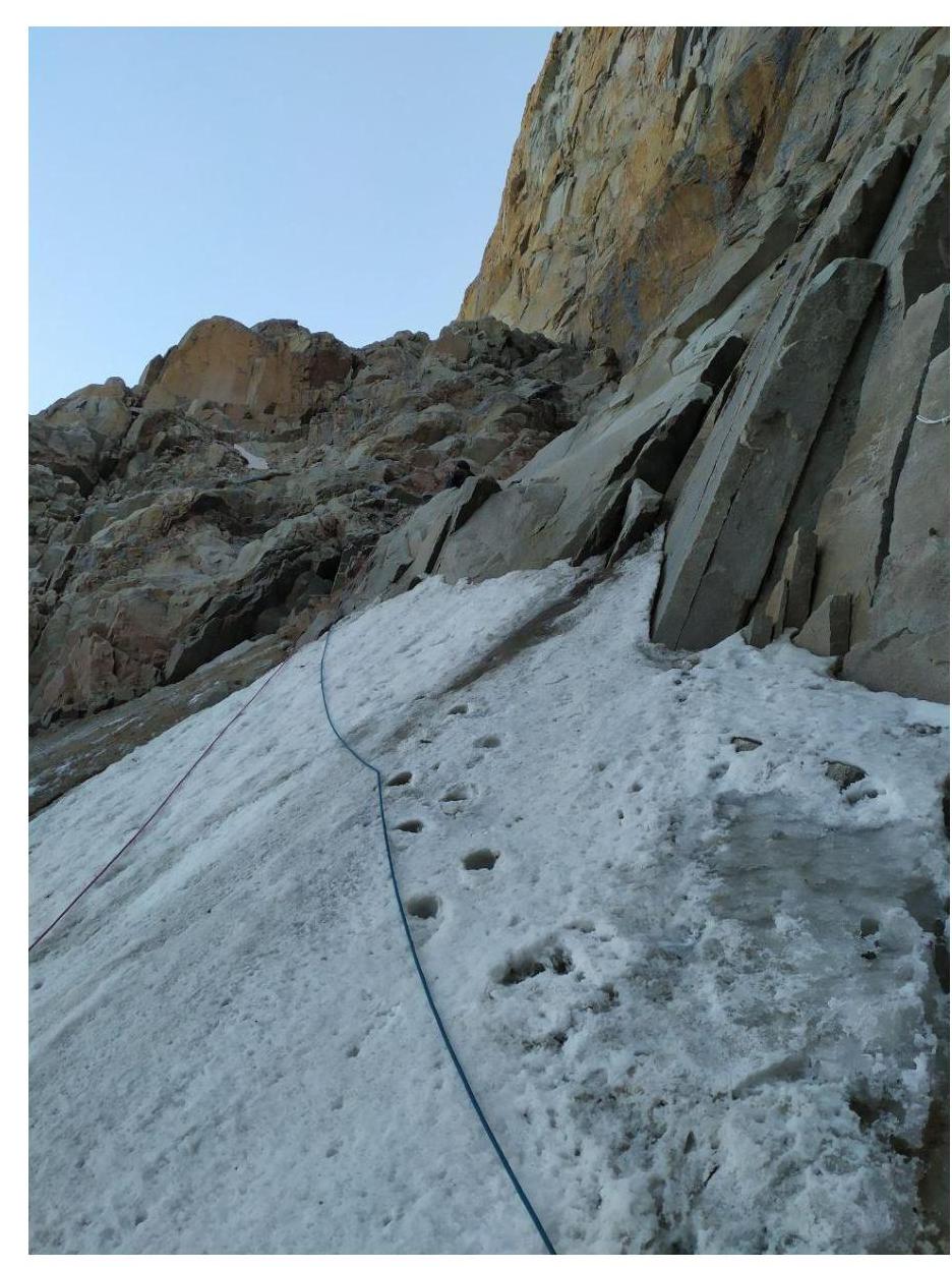
Photo 2. View of R2–R3
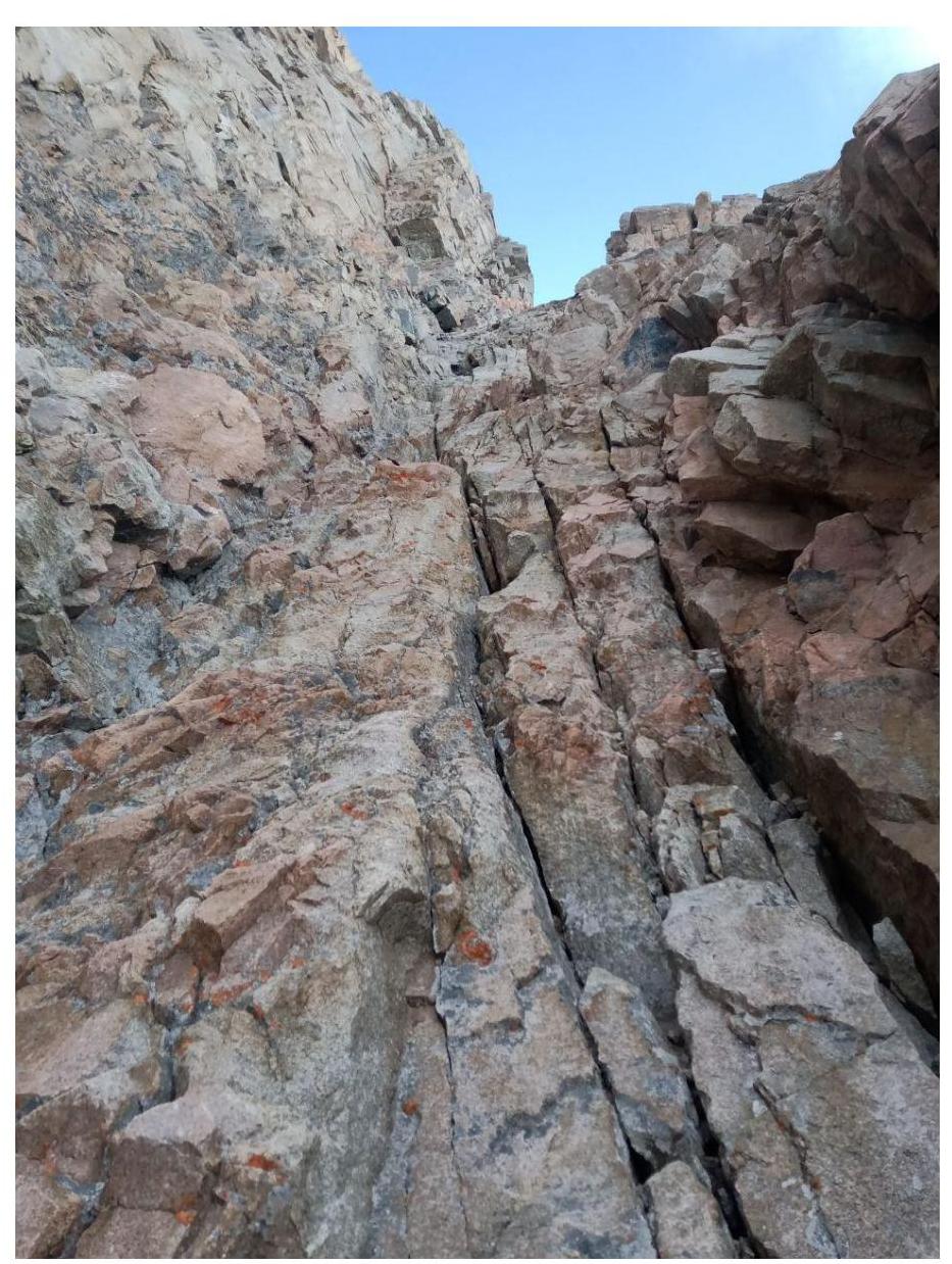
Photo 3. View of R4–R5
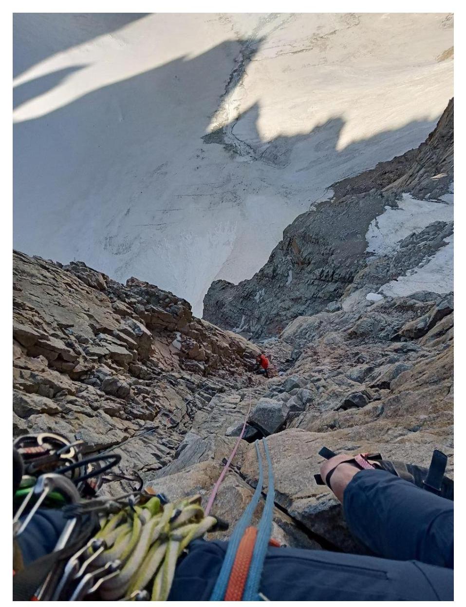
Photo 4. View down on R5–R6
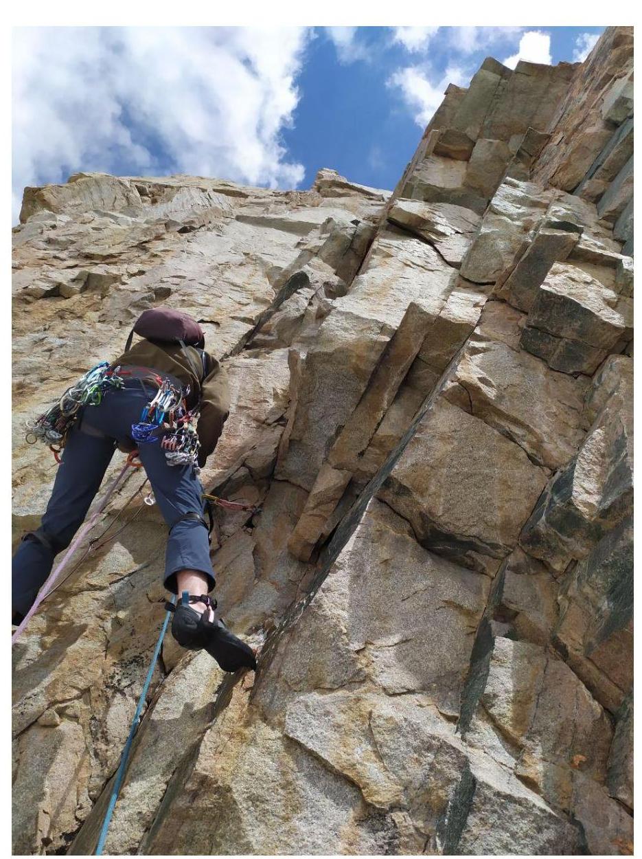
Photo 5. View of the start of R6–R7
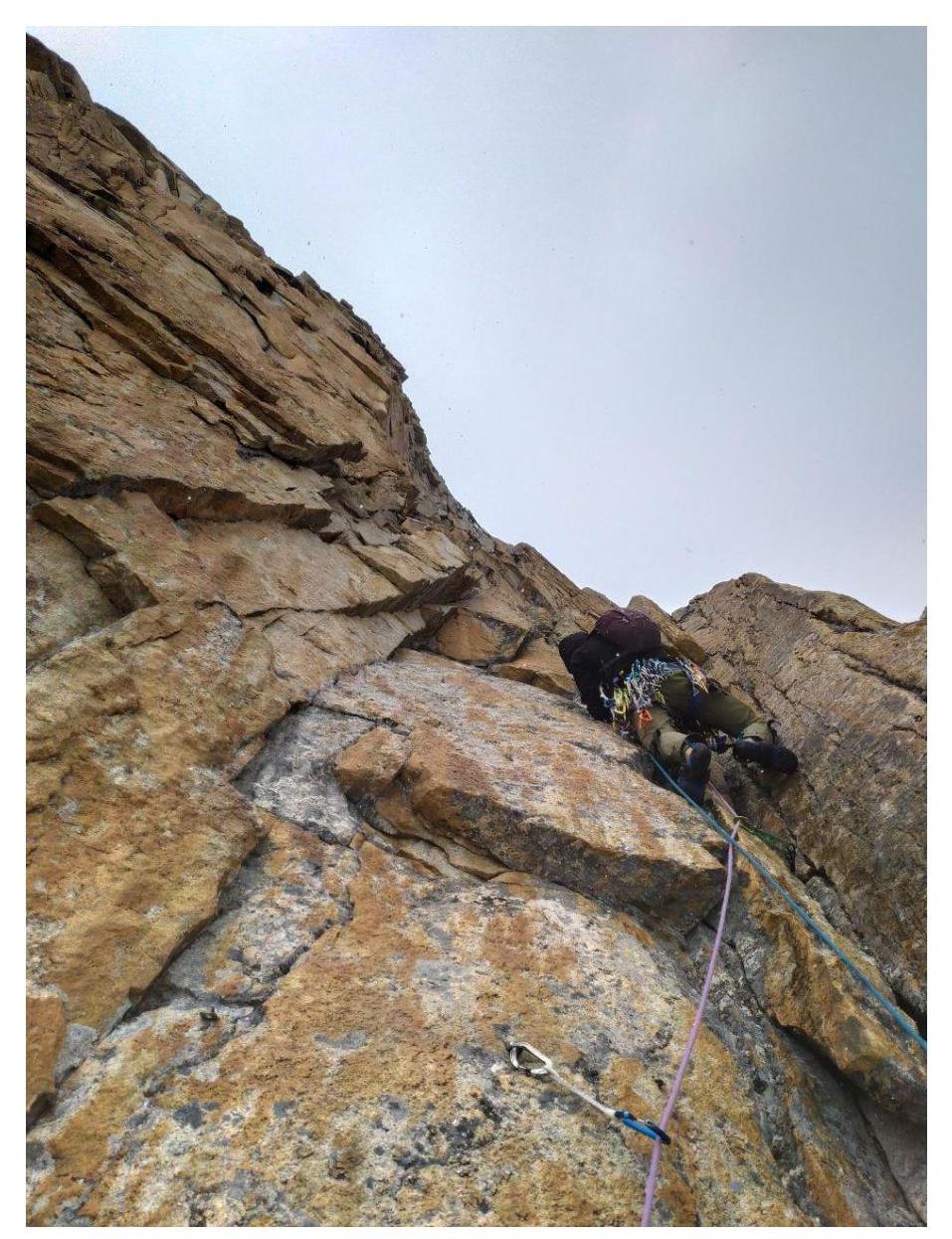
Photo 6. View of R9–R10
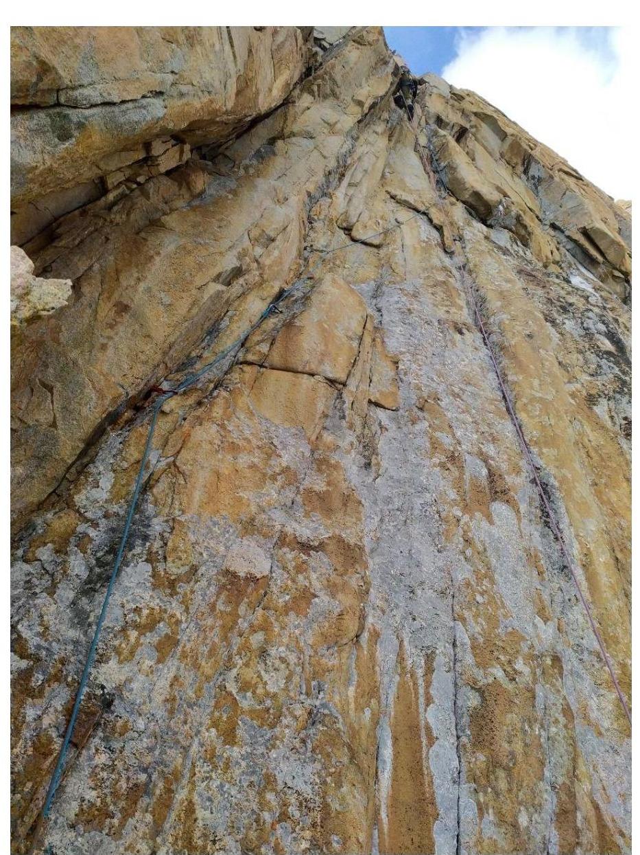
Photo 7. View of R10–R11
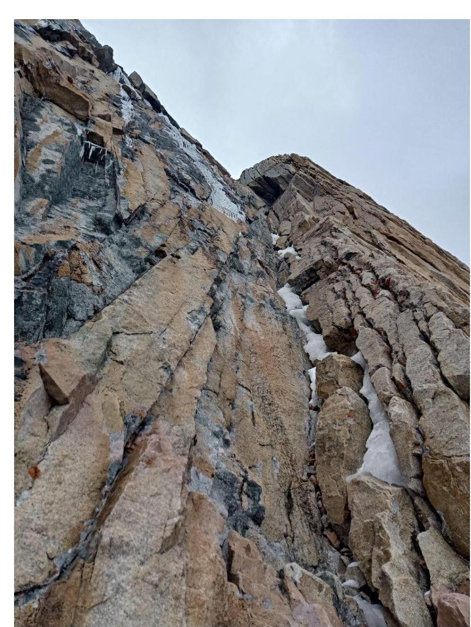
Photo 8. View of R11–R12
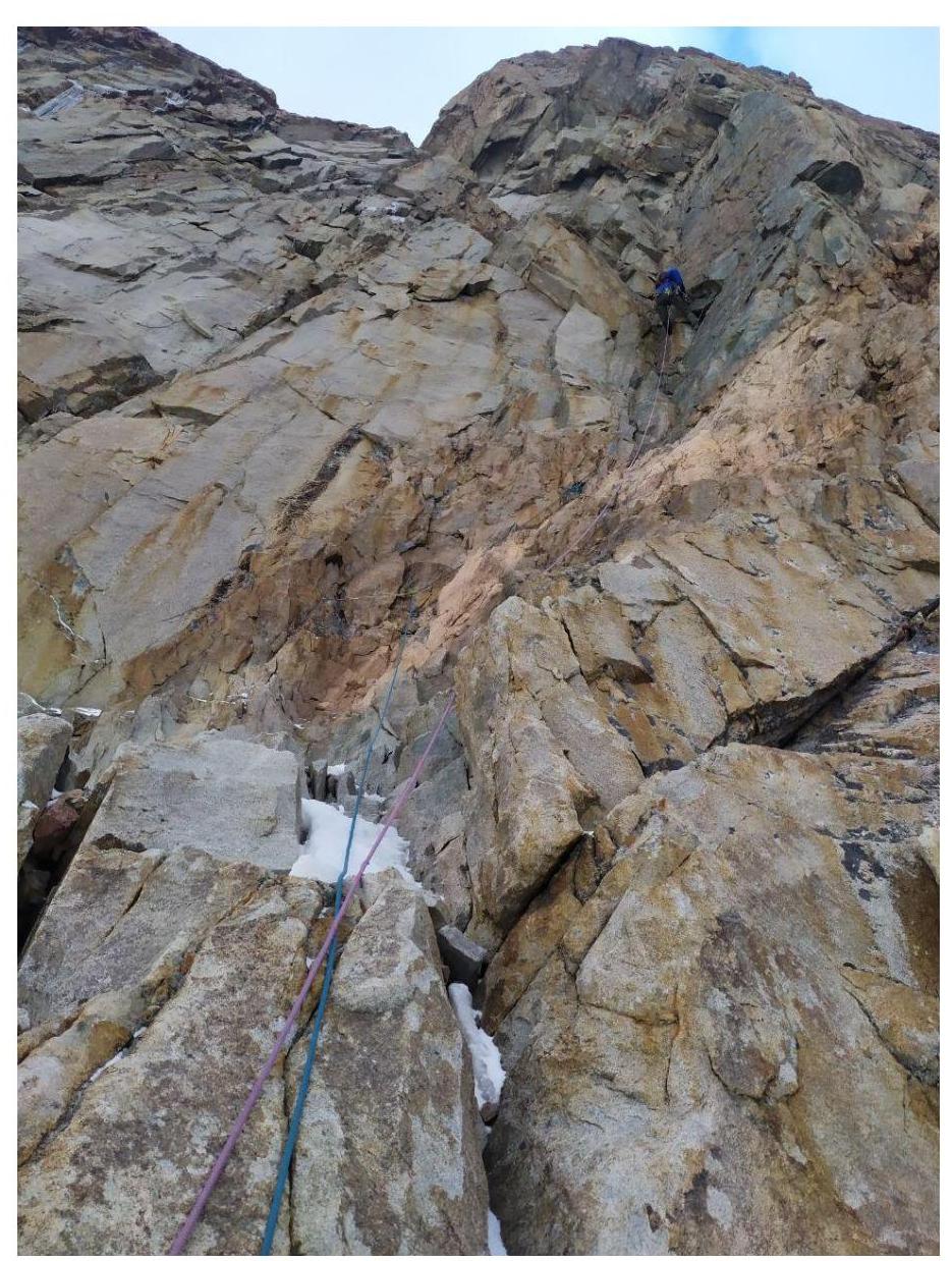
Photo 9. View of R12–R13
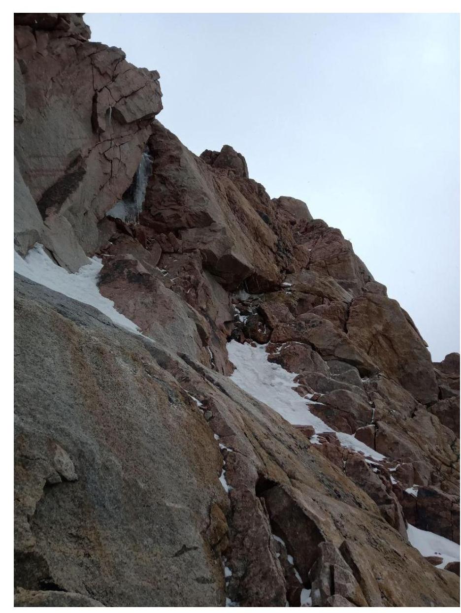
Photo 10. View of R16–R17
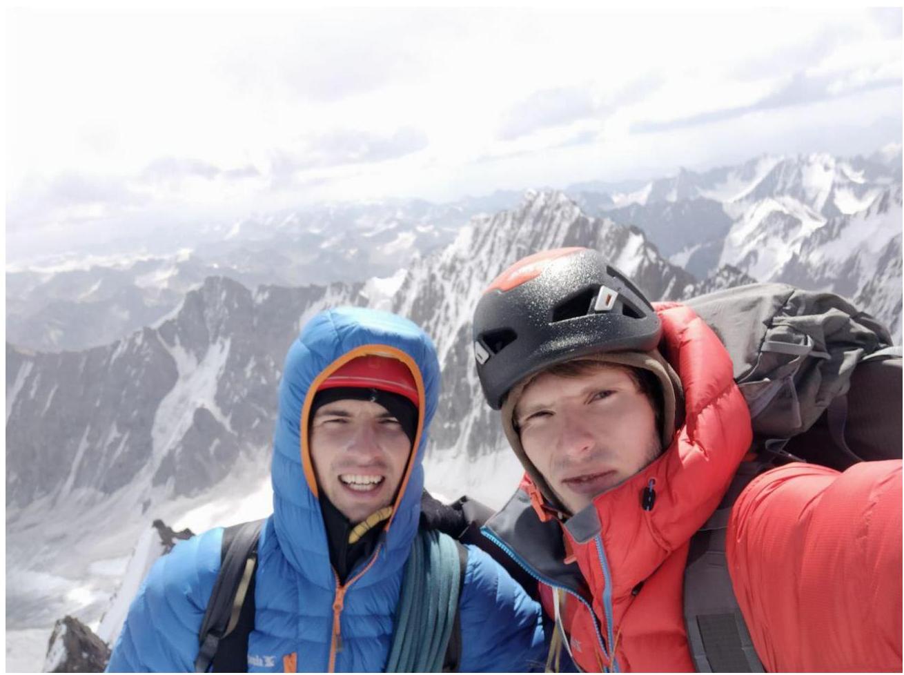
3.2. Photo of the Team on the Summit
 3.3. Ruzhevsky's route is considered challenging within its category in this region. To successfully complete it, one needs:
- rock climbing skills
- ability to move on ice and mixed terrain
- ITO skills
Except for sections R4–R6, the route is quite monolithic and therefore relatively safe. During the ascent, no spontaneously falling rocks were observed. The route is interesting, beautiful, and highly logical, making it difficult to get lost.
Throughout the ascent, radio communication with the base camp was maintained every 3 hours.
To descend, continue along the ridge towards the fourth tower of "Korona". Reach the col between the third and fourth towers (two rappels of 30 m will be encountered along the way). From there, 4 rappels of 60 m to Korona Glacier (it's necessary to descend below the bergschrund) lead to the upper cushion of "Korona". Then, walk to Koronskaya Hut.