
Ascent Passport
- Ascent class — technical
- Ascent area, range Pamir, Yazgulemsky Ridge.
- Peak, its height, ascent route — 6277 (Peak Parrot), NE ridge
- Estimated difficulty category — 4A
- Route characteristics: height difference — 760 m average steepness — 30°
- Protection anchors driven: ice screws — 2
- Number of climbing hours — 18
- Number of nights on the route and their characteristics — 3 nights on snow (snow shelf on the ridge and glacier).
- Group composition:
Lõhmus Alfred Alfredovich 2nd sports category — group leader
Tõht Toomas Konstantinovich 2nd sports category — participant
Suuk Helme Arnoldovna 1st sports category — participant
Parmas Ivo Kallevich 2nd sports category — participant
Sikka Alar Rolanovich 2nd sports category — participant
Goldi Ivo Voldemarovich 2nd sports category — participant
10. Team coach — Aedviir Kallle
11. Date of departure and return —
August 1, 1982 — August 4, 1982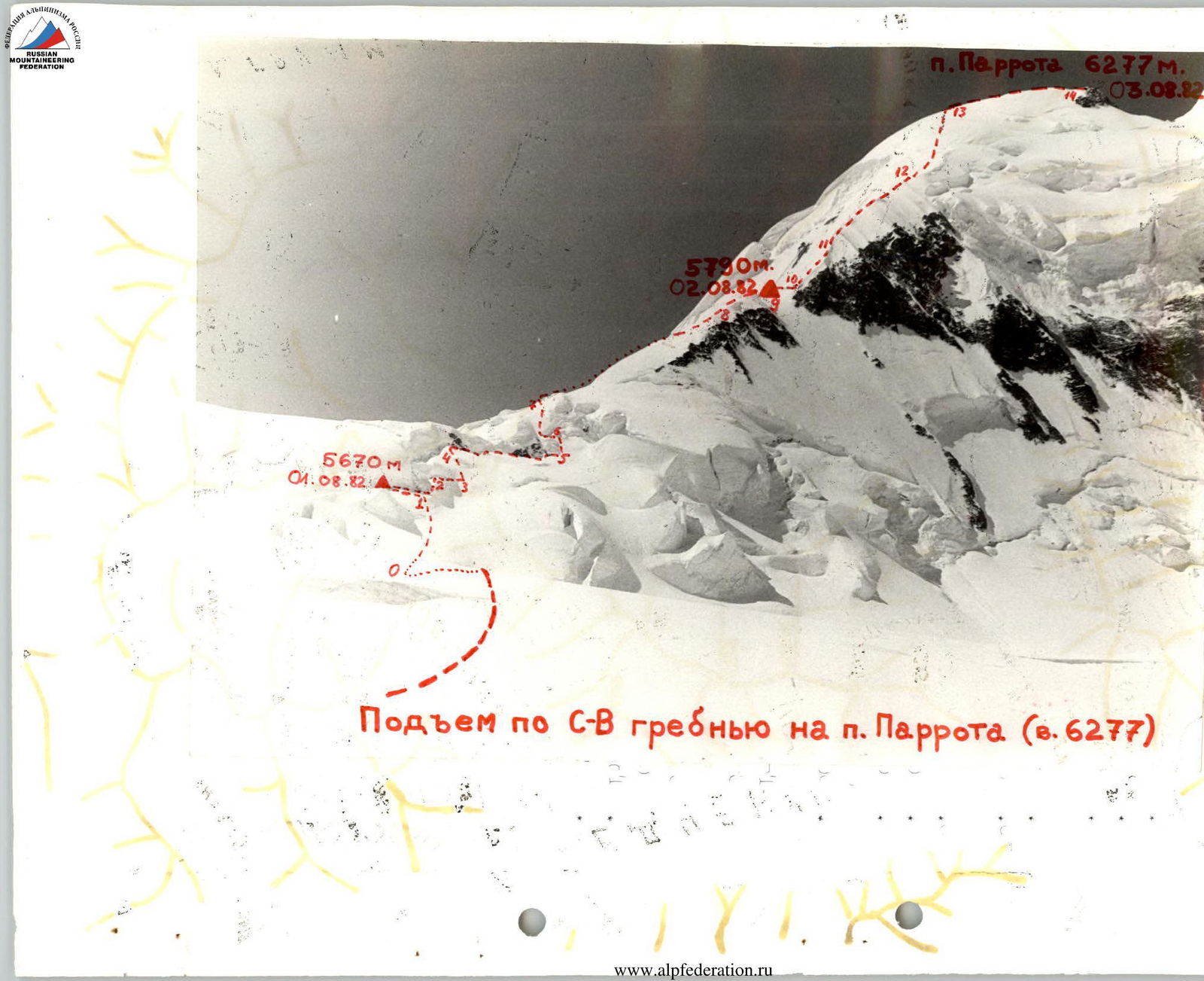
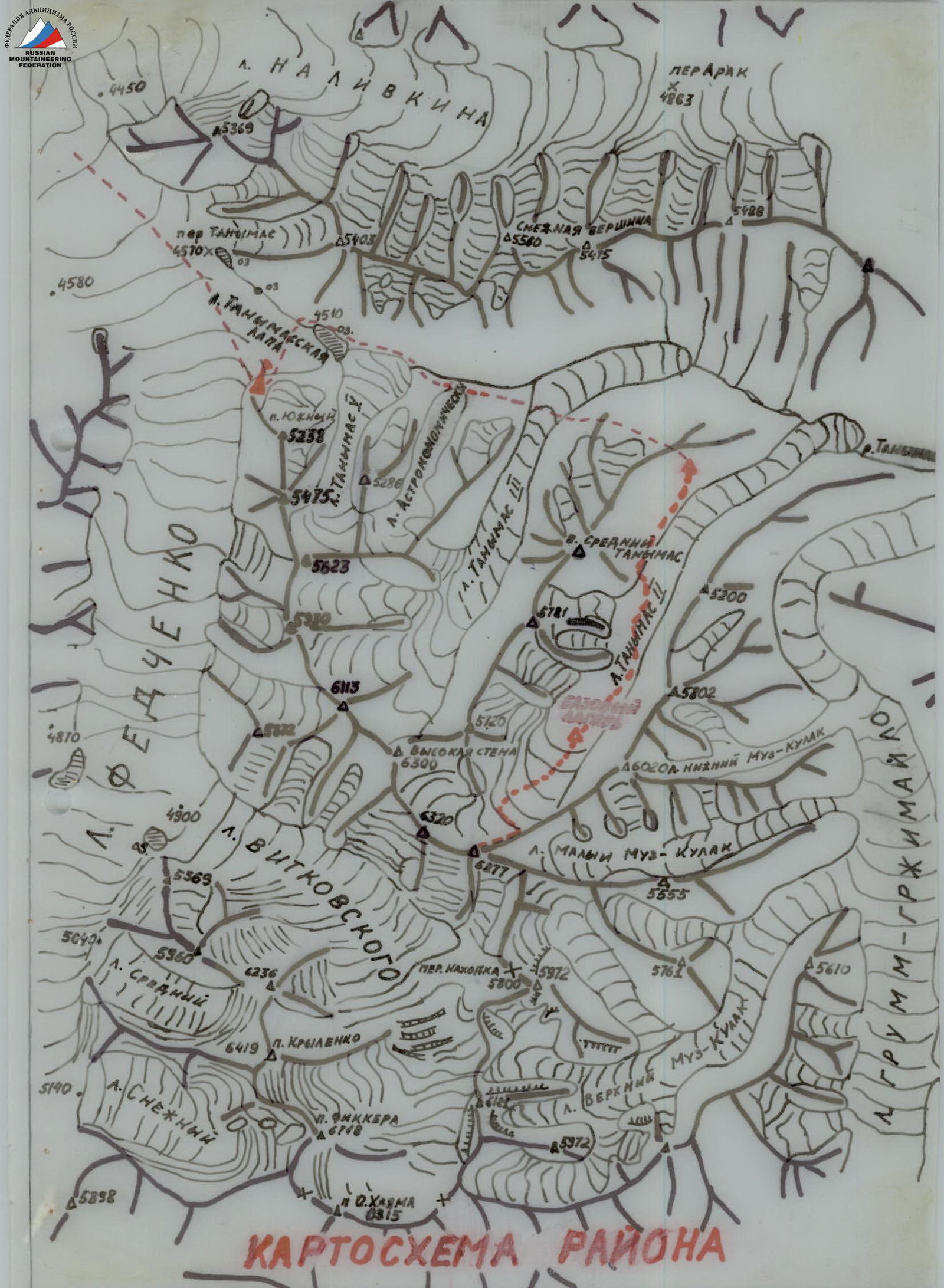
Approach to the Route
There are 2 options to approach the NE ridge of Peak Parrot:
- via Maly Muzkulak Glacier;
- via Tanymas-2 Glacier.
If the expedition goes from Fedchenko Glacier through Tanymas Pass, then the second option is logical. The lower icefalls of Tanymas-2 Glacier are bypassed on the left (orographic) bank, traversing gentle scree slopes of Peak Sredny Tanymas. The upper icefall is passed approximately in the middle. Height difference is 300-350 m, glacier steepness is up to 40° (crampons, ice screws). Above the upper icefall, the glacier is closed. Before entering the upper cirque, there is a gentle ascent (many crevices). The starting point of the route — the ascent to the saddle of the NE ridge of Peak Parrot — is located in the left (in the direction of travel) corner of the upper cirque.
The approach via Maly Muzkulak Glacier (left tributary of Grumm-Grjimailo Glacier) is somewhat simpler, and the ascent to the NE ridge is similar: a steep snow slope without seracs, but with a corniche at the top.
Table of Main Route Characteristics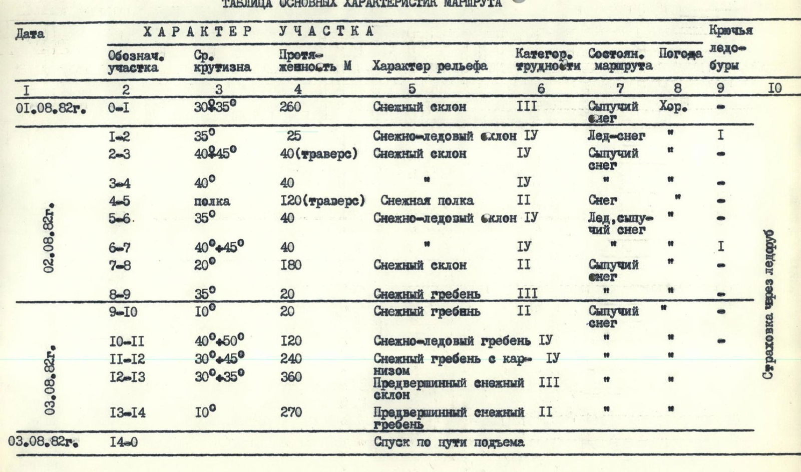
Explanations for the Table of Main Route Characteristics
0–1 The beginning of the route — a wide snow couloir between seracs (At the beginning of August, it is sunlit from approximately 10:00 to 18:00). On a large ice ledge, there is a site for 2-3 tents — a convenient and safe place.
1–2 Along the sharp lower edge of the bergschrund to the right — upwards. Movement with cross-belay (crampons, ice screw).
2–3 Traverse along the snow slope to the right, cross-belay.
3–4 Steep snow ascent to the lower edge of the bergschrund; using handlines is advisable.
4–5 Simultaneous movement along the lower edge of the bergschrund.
5–6 Snow-ice ascent, alternate belay (crampons).
6–7 Snow-ice ascent, alternate belay (crampons, ice screw).
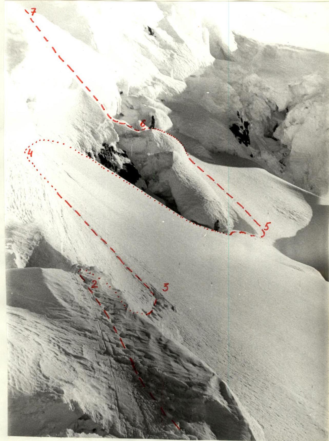
7–8 Simultaneous movement upwards along the wide snow ridge. Crossing the bergschrund via a snow bridge.
8–9 A small bergschrund is crossed via a snow bridge. On the snow shoulder, there is a site for 3-4 tents.
9–10 Approach to the base of the steep, sharp snow-ice ridge (sections 10-11-12).
10–11 Through the bergschrund, ascent along a steep snow slope to the ridge. Ascent along the sharp snow ridge with ice outcrops (crampons). Handlines on firn slopes.
11–12 Ascent along the sharp snow ridge with steep pitches, corniche on the right. Handlines on firn slopes.
Note: On sections 10-11-12, preliminary processing is advisable. Approximately from 17:30 (at the beginning of August), the ridge remains in the shade.
12–13 Upwards along the wide snow ridge. If the snow is soft, handline belay is used. The bergschrund is crossed via a snow bridge. The section can be avalanche-prone.
13–14 Via the left slope of the snow ridge, exit to the summit dome. Further along the ridge, descend 4-5 m to the slopes — a cairn.
Route Scheme
8 hazardous
areas
 www.alpfederation.ru↗