
Report
On the first ascent of Peak Kommunizma (7495 m) from the north from the Walter Glacier by the Central Council team of the "Burevestnik" DSDO in the class of high-altitude and technical ascents.
| Team Captain | Yu. Borodkin |
|---|---|
| Coach | L. Dobrovolsky |
Moscow 1968
1. Brief Geographical Description and Sporting Characteristics of the Ascent Object
The highest peak in the Soviet Union — Peak Kommunizma (7495 m) — rises at the junction of the Academy of Sciences and Peter I ridges (photo №4). The main orographic questions of the Peak Kommunizma mountain node were finally resolved in 1933 by the expedition of the USSR Academy of Sciences. In the same year, the first ascent to the summit was made from the east.
The powerful glaciation of Peak Kommunizma belongs to the basins of the Bivachny, Garmo, and Fortambek glaciers.
To the south, the summit drops with a three-kilometer sheer wall onto the Garmo Glacier.
To the east, a series of large combined ridges extends from the summit towards the Bivachny Glacier.
From the north, the Pamiro Firn Plateau is located under the summit at an altitude of 6000 m, which drops with a two-kilometer wall towards the Fortambek and Walter glaciers.
To the west, the summit tower faces a steep rocky slope, to which a horizontal slope — the "shoulder" of Peak Kommunizma — is adjacent at an altitude of 6900 m. From the shoulder, a snow-ice slope descends onto the plateau with a clearly defined counterfort. Another snow-ice ridge extends from the shoulder towards the southern edge of the plateau to Peaks Kuibyshev and Leningrad.
The height difference from the upper reaches of the glaciers to the summit reaches 3000–3500 m.
2. Brief Description of the Fortambek Glacier Area
(see the map of the area on page №5)
If you ascend the Fortambek valley, you first come to the Fortambek Glacier. To the right (in the direction of travel), the Shanak Glacier flows into it. Higher up, to the left, under the southwestern slopes of the E. Korzhenevskaya massif, lies the Moskvin Glacier. At the head of the valley, the following glaciers originate:
- Walter Glacier,
- Traube Glacier,
- Fortambek Glacier,
- Turamys Glacier.
The Traube Glacier is located under the northern slopes of Peak Kirov and flows into the Walter Glacier. The Moskvin and Walter glaciers are separated by a ridge extending from the Academy of Sciences ridge in the area of Clara Zetkin Peak. In this ridge lies a relatively accessible panoramic peak — Vorobiev Peak (5691 m).
The Moskvin and Fortambek glaciers are separated by a rocky ridge extending north from Peak Kirov. Currently, the surface of the Moskvin Glacier does not reach the Fortambek Glacier by several kilometers.
In its upper part, the Turamys Glacier flows into the Fortambek Glacier.
The upper reaches of the Fortambek and Walter glaciers adjoin a two-kilometer wall, which at an altitude of 6000 m turns into an extensive snow plateau (photo №4). The plateau stretches from the Academy of Sciences ridge westward along the Peter I ridge on its northern side. The plateau is oval in shape, elongated from east to west.
Plateau boundaries:
- To the south — the northern slopes of Peak Kommunizma, Kuibyshev Peak, Leningrad Peak, E. Abalakova Peak.
- To the west and north — a rugged line of cliffs descending to the Fortambek and Walter glaciers.
- To the north — a short section of the plateau is bounded by the southern slopes of Peak Kirov (6350 m).
- To the east — the western slopes of Peak Kommunizma.
The length of the plateau is 12 km, the width is about 3 km. The thickness of the snow and firn cover is approximately 150–300 m. The surface of the glaciers near the slopes limiting the plateau has the following absolute height marks: near the Walter Glacier — 4100 m, near the Fortambek Glacier — 4000 m. Consequently, the plateau drops with "glaciers" — two-kilometer walls.
To the west of Peak Kirov lies the "Trampolinny" Glacier, which serves as a drain for excess firn masses. Every 5–10 minutes, ice avalanches crash down from the Trampolinny Glacier onto the surface of the Fortambek Glacier. In the northeastern part of the plateau, a pointed peak "6700" rises, which had no ascent attempts until 1968. The edge of the plateau cliff stretches from Peak "6700", located in the Academy of Sciences ridge, almost to E. Abalakova Peak, forming a front over 11 km long. Almost along this entire front, continuous collapse of the plateau occurs. Blocks of ice fall from the plateau for over two kilometers down and spread on the surface of the Fortambek and Walter glaciers. We advise against getting under this firn and ice waterfall. Avalanches accompany the collapses. Some avalanches completely block the Fortambek and Walter glaciers.
The firn masses accumulating on the plateau move northward and almost entirely belong to the Fortambek Glacier basin.
One of the largest glaciers in the Pamir — the Fortambek Glacier (25 km) — is fed and exists solely due to avalanches falling from the slopes.
At the eastern end of the plateau rises a massive, trapezoid-shaped peak — Peak Kommunizma. It stands out sharply among the surrounding mountains (photo №1). It exceeds the surface of the Fortambek Glacier by more than 3500 m. To the north and south of Peak Kommunizma stretches the Academy of Sciences ridge with peaks:
- Peak "6700",
- Peak "Izvestiy",
- Peak "6856 m",
- Peak "Pravda" (6400 m),
- Russia Peak (6858 m).
3. History of Peak Kommunizma Ascents
1933 — the first ascent to Peak Kommunizma was made from the Bivachny Glacier. Along the eastern ridge, Yevgeny Abalakow climbed alone, straining his last strength.
1955 — from the south, from the Garmo Glacier, a team of climbers from the Georgian sports club ascended via the hanging glacier to the ridge of the Academy of Sciences and then along this ridge reached the summit.
1957 — from the south, from the Garmo Glacier, a team from the "Burevestnik" expedition through Kuibyshev Peak reached the plateau and from the plateau along a snow-ice slope through the "6900" shoulder reached the summit.
1959 — a "Burevestnik" team from the Garmo Glacier cirque ascended along a counterfort to the "6900" shoulder and from the shoulder along snow-ice slopes reached the summit.
By 1968, several teams had laid out a few more routes to Peak Kommunizma. Ascents were made from the Bivachny and Garmo glaciers. In their lower parts, the routes differed from those previously traversed, but in their upper parts, they all led to the Academy of Sciences ridge.
If Peak Kommunizma was first conquered from the east in 1933, then from the north, from the Fortambek valley, there were no concrete attempts at ascent until 1968.
This is due to the inaccessibility and poor exploration of the area, as well as the complexity of the ascent to Peak Kommunizma from the north.
4. Fortambek Valley
The inaccessible Fortambek valley is rarely visited by researchers and climbers. This is due to difficult and prolonged approaches. It takes from four to seven days of walking to reach the nearest settlements — Lakhsh and Darout-Kurgan — and it is necessary to cross the turbulent mountain river Muksou. There are no bridges across the river.
Near the village of Khodzhi-tou and opposite the Ayu-dzhilga valley, there are cable crossings.
Movement along the slopes of the Muksou River is hindered; in some places, it is impossible. The slopes of the river are constantly collapsing and in some places turn into sheer walls, requiring steps to be cut in a closed stance, like on ice slopes.
Entering the Fortambek valley is complicated. To cross the Fortambek River, the following are necessary:
- ropes,
- pitons,
- ladders.
In 1932–1933, the Tajik-Pamir expedition worked in the Pamir, one of whose tasks was to study the glaciers of the Pamir and determine the possibility of ascending Peak Kommunizma from the north. In the basin of the Fortambek Glacier, a group of topographers led by geologist Moskvin and a group of climbers led by N.V. Krylenko conducted a survey. The group included well-known climbers Barkhash L., Vorobiev V., Khodakevich S. This group even attempted to reach the plateau but, encountering insurmountable difficulties, retreated.
Note: in 1968, our group found a note from N.V. Krylenko dated August 28, 1933, during reconnaissance. The note was found on the moraine of the Walter Glacier under the slopes of Vorobiev Peak.
In 1932, Moskvin A.V., by comparing the surveys and reports of various research groups, determined the exact location of Peak Kommunizma.
A detailed description of the Pamiro Firn Plateau and the upper reaches of the Fortambek valley was given in 1948 by Yevgeny Timashev (see the yearbook of mountaineering for 1953). Timashev first mapped the firn plateau on Pamir maps in 1948.
In 1961, an expedition of "Trud" worked in the Fortambek valley, one of whose goals was to ascend Peak Kommunizma from the north through the Pamiro Firn Plateau.
Due to a lack of time for reconnaissance, the expedition abandoned the ascent to Peak Kommunizma from the north that year.
Before the "Trud" expedition, the upper reaches of the Fortambek valley were rarely visited by climbers.
For three consecutive years — 1966, 1967, 1968 — the "Burevestnik" expedition visited the Fortambek valley. The main goal of all expeditions was:
- reconnaissance of the area,
- ascent to Peak Kommunizma from the north.
In 1966, the expedition limited itself to reconnaissance and made an ascent to E. Korzhenevskaya Peak via three new routes.
In 1967, all participants of the expedition ascended to the plateau from the north along the counterfort descending from the plateau in the area of E. Abalakova Peak.
Note: hereafter, for brevity, we will refer to this counterfort as the "Burevestnik Ridge".
In 1967, four members of our team reached the plateau: V. Masyukov, L. Dobrovolsky, Yu. Borodkin, and E. Kusov. They ascended Kuibyshev Peak from the plateau and conducted reconnaissance:
- the possibility of ascending Peak "6700" from the plateau along the western ridge;
- they examined the exit to the plateau along a snow-ice counterfort from the Walter Glacier.
The best time for ascent in the Fortambek Glacier area is the first half of August. In July, there is still a lot of snow. For three consecutive years, in 1966, 1967, and 1968, bad weather with snowstorms was observed on August 18, followed by a cold snap in the valley.
Special attention should be paid to ice and snow avalanches during ascents. The locations of observed collapses and avalanches are indicated on photo №10. The area is prone to rockfalls. The rocks are heavily weathered and mostly have a slab-like structure.
As a result of reconnaissance in 1966 and 1967, four paths for ascending to the plateau were identified (see photo №1):
- One of them — the "Burevestnik Ridge" — was used to reach the plateau in 1967.
Ascent attempts via the other three routes were claimed by our team for Union primacy. Thus, our team declared three routes for ascending Peak Kommunizma from the north. All three routes start from the Walter and Traube glaciers.
Paths for ascending Peak Kommunizma from the north with an exit to the plateau:
- Along a rocky counterfort in the area of Peak "6700" (from the Walter Glacier).
- Along a snow-ice slope in the area of Peak Kirov (from the Walter Glacier).
- Along a ridge through Peak Kirov. The ridge begins from the saddle between Peak Kirov's ridge and Peak Gushchin (from the Traube Glacier).
5. Team Training. Reconnaissance. Tactical Ascent Plan. Composition of the Assault Team (5 people)
All team members conducted year-round training together for several years according to the following program:
- Autumn:
- Cross-country runs on Sundays, 2–3 hours.
- Climbing in Tsaritsyno.
- Playing football.
- Total training duration — 5–6 hours.
- On weekdays — training in the MVТУ gym: gymnastics, weightlifting, basketball.
- Winter:
- Skiing on Sundays, 5–6 hours, 40–50 km per training session.
- MVТУ gym on weekdays.
- Spring:
- Climbing in Tsaritsyno.
- Cross-country runs.
- Joint training sessions at the "Mayak" base in Khimki.
For all team members, the following control training sessions were mandatory:
- Autumn cross-country 5 km.
- Skiing distances of 15, 20, 30, and 50 km.
- Spring cross-country 5–10 km.
- Alpine biathlon: cross-country running and climbing.
Before high-altitude ascents, team members jointly conducted training ascents in the "Ala-Archa" guesthouse.
The goal of training ascents was to unite the team, test equipment, food, and acclimatize. Particularly useful for the group was the ascent attempt on Simagin Peak. Although the group returned from the route due to bad weather, they gained much valuable experience for subsequent high-altitude ascents.
After gathering in the "Ala-Archa" guesthouse, all team participants ascended Lenin Peak. After Lenin Peak, the team rested for 7 days in Fergana and simultaneously prepared for the ascent to Peak Kommunizma from the north.
August 8. The team, consisting of Yu. Borodkin (leader), L. Dobrovolsky (coach), V. Masyukov, E. Kusov, V. Putrin, and two traversers, N. Chernov and G. Kurochkin, flew by helicopter from Fergana to Darout-Kurgan and then to the Fortambek valley. The helicopter landed in the base camp located on a flat green meadow behind the left-bank moraine of the Fortambek Glacier, opposite the "Burevestnik Ridge". The altitude of the base camp was 4000 m.
As mentioned earlier, the team planned three routes for ascending Peak Kommunizma from the Walter and Traube glaciers:
- Along a counterfort; from the Walter Glacier (photo №3).
- Along a snow-ice slope; from the Walter Glacier (photo №2).
- Along the northern ridge of Peak Kirov. From the Traube Glacier (photo №2).
On the same day, they prepared a container for airdropping into the base camp on the Walter Glacier in the area of the lake under the slopes of Vorobiev Peak. V. Putrin and E. Kusov remained in the base camp to load the container onto the helicopter and drop it onto the Walter Glacier.
The other group — Borodkin, Masyukov, Dobrovolsky, Kurochkin, and Chernov — set out on the same day to organize a base camp on the Walter Glacier, receive cargo, and conduct reconnaissance.
To get from the Fortambek Glacier to the Walter Glacier, they usually walked around the northern ridge of Peak Gushchin, i.e., descended to the fork between the Moskvin and Fortambek glaciers.
 Along the left-bank moraine of the Moskvin Glacier to the 1966 base camp (see the map on page №5).
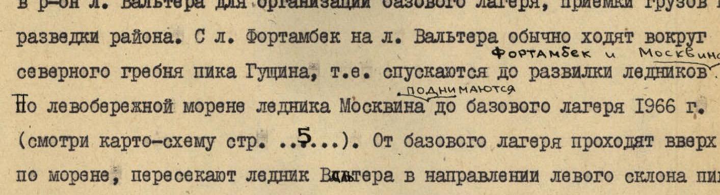 From the base camp, they proceeded up the moraine, crossed the Walter Glacier towards the left slope of Vorobiev Peak, and reached the lake.
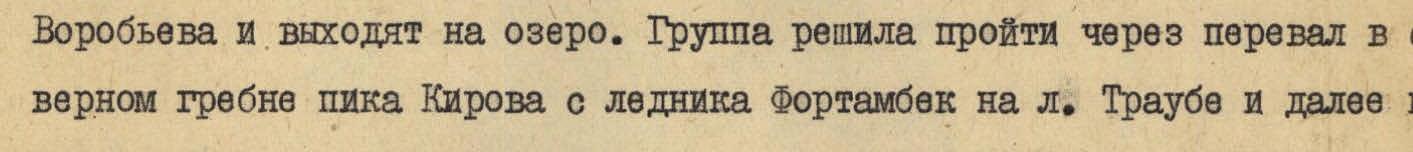 The group decided to pass through the pass in the northern ridge of Peak Kirov from the Fortambek Glacier to the Traube Glacier and then to the Walter Glacier.
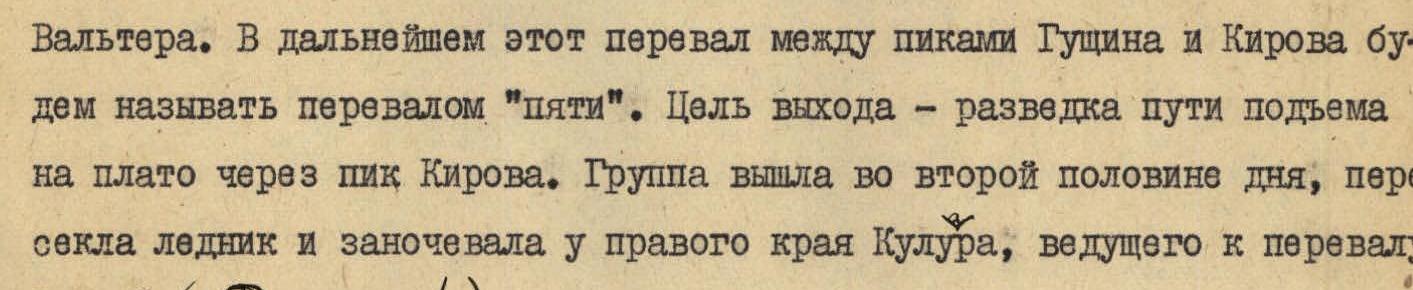 Hereafter, we will refer to this pass between Peaks Gushchin and Kirov as the "Five's Pass".
 The goal of the exit was to scout the path for ascending to the plateau through Peak Kirov. The group set out in the second half of the day, crossed the glacier, and spent the night at the right edge of the couloir leading to the "Five's Pass".
 (see photo №4).
August 9. At 12:00, the group ascended to the pass. The ascent to the pass from the Fortambek Glacier took 8 hours.
 From the pass, the northern ridge of Peak Kirov is clearly visible. The ridge is combined; in its lower part, it is horizontal but has difficult-to-pass gendarmes; in its upper part, the ridge turns into a wall with a slope of 70–80°. The pre-summit ridge is gentle but has many cornices. The exit to the plateau along this ridge is possible but laborious. After Peak Kirov's summit, it will be necessary to descend about 400 m to the plateau.
The ascent to the "Five's Pass" from the Fortambek Glacier along the couloir is prone to rockfalls, and we advise other groups against it. The descent from the pass to the Traube Glacier took 30 minutes. The upper reaches of the Traube Glacier are located 500–600 m higher than the surface of the Fortambek Glacier. They descended along the left side of the Traube Glacier to the Walter Glacier. The slopes of Peak Gushchin facing the Traube Glacier are prone to rockfalls. They crossed the Walter Glacier and reached the lake, where they set up a base camp right on the lake shore near a large stone.
During the transition, they constantly observed the counterfort and snow-ice slope.
August 10. At 9:00, the pair Borodkin and Dobrovolsky set out on reconnaissance to the upper reaches of the Walter Glacier. They proceeded along the right-bank moraine of the Walter Glacier. Not far from the lake, on a green meadow, they found a note from N.V. Krylenko dated August 27, 1933. The text of the note is as follows: "On the night of August 27–28, 1933, a group consisting of N.V. Krylenko (head of the expedition), B. Khodakevich, and V. Vorobiev spent the night here in two tents".
The end of the last sentence is hard to decipher, but its meaning is: "The group is moving along the right branch of the Moskvin Glacier."
We were fortunate to find the note left by the first explorers of the Fortambek area.
They observed the routes from the moraine of the Walter Glacier, located directly opposite the counterfort and ice slope. At the bottom of the counterfort (photo №3), traces of large collapses are visible (ice fragments, black marks from stones). When approaching the counterfort, it is necessary to overcome a bergschrund, the upper edge of which overhangs. The counterfort is a one-and-a-half-kilometer rocky wall, turning into steep snow-ice slopes in its upper part, before reaching the ridge of Peak "6700". In this area, it is impossible to find a point from which the counterfort can be viewed in profile. Places for overnight stays are not visible. In the upper part, to the left and right of the counterfort, huge ice cornices hang.
Simultaneously, they observed the snow-ice slope (photo №2) extending north from the eastern ridge of Peak Kirov. A not clearly defined ridge is observed on the slope. In the lower left part, the snow-ice slope turns into a rocky slope with several rocky ridges converging at a single point at the top. They planned to ascend along the right edge of this rocky slope. They had been observing this edge since 1966. No avalanche traces or cones were observed under this rocky slope. Constant rockfall occurs to the left and right of this rocky slope.
They observed until 18:00. In the evening, they descended to the camp. On the same day, products, equipment, and fuel were dropped into the base camp from a helicopter. The cargo was dropped accurately, not far from the lake. Without much effort, they carried the cargo to the tents.
August 11. Ascent at 8:00. Borodkin, Dobrovolsky, and Masyukov set out on reconnaissance. During this exit, they made a cache under the route: products, fuel, and equipment. From the moraine, they continued observing the counterfort and snow-ice slope. In the lower part of the counterfort, the number of black stripes formed by falling stones increased.
During observations, they established that to the left and right of the snow-ice slope, constant rockfall occurs.
In the afternoon, they returned to the camp. As expected, the pair Putrin and Kusov arrived at the lake from the base camp on the Fortambek Glacier.
They held a team meeting to discuss the reconnaissance results. They analyzed three possible options for ascending to the plateau with a subsequent ascent to Peak Kommunizma:
- The counterfort — the lower part of the counterfort is exposed to rockfall and ice collapses (photo №3).
- The snow-ice slope — during three years of observation, no avalanche traces were observed on the ridge itself or under the planned route (photo №2). The slope is currently not prone to avalanches (on the Pamir, there was good weather for about 15 days before their ascent).
- The northwestern ridge of Peak Kirov — the route is combined and laborious. After the summit, it will be necessary to descend 1–2 days to the plateau along a long, corniced eastern ridge. It would be more logical to make a first ascent to Peak Kirov along this ridge (photo №4).
Considering the favorable condition of the snow-ice slope, the team decided to ascend to the plateau along the ice slope. The ascent was scheduled for the morning of August 12.
The assault team consisted of: Yu. Borodkin, L. Dobrovolsky, V. Masyukov, E. Kusov, and V. Putrin. The ascent was planned for August 12. On the same day, the groups of traversers led by Bozhukov and the group of Maximov were to begin their ascent along the "Burevestnik Ridge" from the base camp on the Fortambek Glacier.
They were to meet on the plateau in 2–3 days. They distributed public equipment and food. Each team member knew their responsibilities, determined during training ascents.
- Masyukov was in charge of the primus stove, fuel, and pots;
- Putrin was responsible for the high-altitude tent;
- Borodkin selected pitons;
- Dobrovolsky oversaw the first-aid kit;
- Kusov distributed food.
The public load per person was 5–6 kg. For the ascent, they sewed small backpacks.
The quantity of food was calculated for 10 days at 200–300 g per day. The total weight of food was about 13–14 kg. Per participant, this amounted to 250–275 g of food per day. At first glance, this seems very, very little. However, as the ascent showed, the participants' performance was at a high level.
August 12, 1968 (1st day of ascent). Ascent at 7:00. Departure at 8:00. At 11:30, they began crossing the Walter Glacier towards the snow-ice slope. The path was set towards the lower point of the right rocky edge (see photo №5). The pair Kusov and Borodkin led the way. They overcame the randkluft and reached the snowy slope. The lower part of the edge was circumvented to the right along a steep snowy slope (section 0–1). Insurance was alternating. The slope's steepness was 35–40°. After two ropes, the snowy slope turned into an icy one (section 1–2). They traversed left towards the edge, using pitons for insurance. Further movement was upward along the edge. The rocks were weathered. The average steepness was 50–55° (section 2–3). Insurance was with pitons.
They approached an icy ridge (3–4). Steepness 50°. Length 2 ropes.
Further movement was along weathered rocks (4–5). The average steepness of the ridge was 55°. In some places, the ridge turned into a wall (5–6). Steepness up to 80°. The section was traversed by free climbing.
After the wall, they reached an icy slope (6–7), which they overcame with step-cutting. Insurance was with pitons. From the right edge, they moved to the left edge of the rocky slope.
They traversed the rocky slope for another three ropes upward (7–8) and set up a bivouac. About an hour and a half was spent laying out a platform for the tent.
On August 12, they traversed the edge. Movement was unambiguous and strictly along the edge. The height gain was about 1000 m. Throughout the section, insurance was with pitons.
August 13 (2nd day). Ascent at 7:00. The pair Dobrovolsky and Borodkin led the way. Directly from the tent, an icy slope began (8–9), with a length of two ropes. They traversed it with step-cutting and piton placement.
Further movement was up a steep snowy slope (9–10). A large bergschrund was circumvented to the right. Steep sections were traversed "in three steps" with alternating insurance via an ice axe.
They approached a difficult section (10–11) — an ice-firn wall with loose snow on top. The bergschrund under the wall was circumvented to the right. On the wall, before cutting a step, they had to clear a layer of snow up to 70 cm thick from above. First, they dug a trench, then cut steps at the bottom of the trench.
Features of traversing the wall:
- It was impossible to place an ice piton as the slope was in an intermediate state between firn and ice.
- At the top of the wall, there was a platform for insurance.
Further movement was up a steep snowy slope (11–12). The snow was deep. It was very hard to make steps in such snow. After four ropes, they approached an ice wall. The trio began to clear a platform for the night, while the pair Masyukov and Kusov went ahead, circumventing the wall to the right to scout the further path. They set up a bivouac at 19:00.
On this day, the route passed through snow-ice slopes. The teams changed every 2–3 ropes.
They traversed several extremely difficult snow-ice sections. Particularly challenging were sections 10–11–12. The height gain was about 600–700 m.
August 14 (3rd day). At 8:30, the pair Dobrovolsky and Borodkin went to process the route. They traversed two ropes along the steps cut the previous evening. Along a steep snowy slope (12–13), they approached large ice gates. On the snowy slope, two large ice ledges protruded, between which lay a steep snowy slope (13–14). They approached the left ice ledge; circumvented it to the right and moved up the snowy slope. Movement was "in three steps". After one and a half ropes, they entered a snowy area located under the left ice wall. The trio Masyukov, Putrin, and Kusov led the way. From the area, they traversed two ropes up to a large crevasse crossing the slope. Then movement proceeded along the crevasse to a bridge on the right. From the bridge, movement was up along the bergschrund (14–15). The slope was shrouded in clouds. Movement slowed down. They had to wait for breaks in the clouds to determine the further path. They gathered together under the bergschrund.
The pair Dobrovolsky and Borodkin moved to the right along the bergschrund (15–16). They crossed the crevasse via a bridge. Further movement was left and up. They felt that they were close to the eastern ridge of Peak Kirov. To the left, the plateau was visible, already 200 m below them. After traversing another five ropes up the steep slope, at 15:20, they reached the eastern ridge of Peak Kirov.
On the ridge, there was a strong wind. Directly below them lay the plateau. They could see that a bрезентовая tent (a tarpaulin tent) they had left in 1967 should be directly below them. The tent was not visible.
On the plateau, under the slopes of Leningrad Peak, they noticed black dots moving towards Peak Kommunizma.
They also examined the paths for ascending Peak Kommunizma from the plateau. There were two paths:
- along a snowy slope leading to the "shoulder" of Peak Kommunizma;
- through Peak "6700".
In 1967, traces of avalanches were visible under the snowy slope.
The ridge of Peak Kirov towered 200–250 m above the plateau. From the ridge to the plateau led a snow-ice slope with a steepness of 45°. They put on crampons and began descending. After 2 hours, they descended to the plateau. They set up a bivouac at 18:00. At 19:00, the weather began to deteriorate. The plateau was shrouded in clouds.
August 15 (4th day). On the night of August 14–15, there was bad weather. It snowed all night. About 30 cm of snow fell on the plateau.
They finally decided to ascend Peak Kommunizma via the safe but steep rocky ridge of Peak "6700".
- The pair Dobrovolsky and Borodkin set out at 8:00 to lay a track towards the Western Ridge of Peak "6700" (17–18).
- The trio set out to meet the groups that had ascended to the plateau along the "Burevestnik Ridge".
While they were laying tracks, the others were to negotiate with the groups about interaction. Upon their arrival, they would begin movement.
They traversed a small bergschrund and reached the rocks of the Western Ridge of Peak "6700". The beginning of the ridge (18–19) consisted of rocks of medium difficulty, heavily snowed. During movement, they had to carefully clear handholds and footholds. Movement was alternating. Insurance was via outcrops.
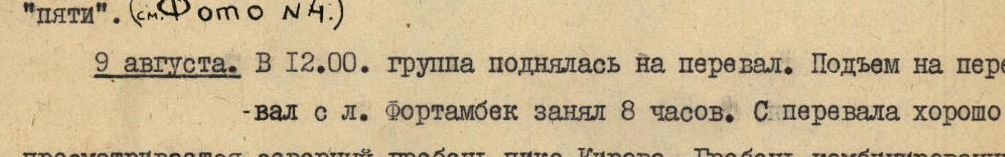
They approached the bastions (19–20) of the Western Ridge. What the bastions looked like (see photo №8):
The average steepness of the bastions was 80°. Some sections overhung. They traversed the bastions by climbing. Insurance was with pitons, especially well-suited were ice pitons. Particularly complex were two walls ending in overhanging stones. After seven ropes of the most difficult climbing, they reached a ledge located approximately in the middle of the Western Ridge. At the beginning of the ledge, they set up a bivouac. An hour and a half was spent laying out the platform. They settled in for the night at 20:00. The rocks of the Western Ridge turned out to be much more complex than they had anticipated. They had planned to traverse the ridge in one day. On August 15, they ascended 350 m.
August 16, 1968 (5th day). They set out on the route at 8:30. From the bivouac, they traversed a snowy ridge (20–21). They entered an icy slope (21–22) leading to the bastions. They circumvented the bastions to the right along walls (see photo №10) with a subsequent exit to the ridge. The average steepness of the walls was 75°. Insurance was with pitons.
Along the ridge, they traversed five ropes. The team reached the summit at 13:00 (section 23). They did not find any tours. Nor did they find any traces of climbers. Thus, they made the first ascent to Peak "6700". They left a note requesting that Peak "6700" be named Peak 50th Anniversary of VLKSM in honor of the 50th anniversary of the Leninist Komsomol.
They took photos. Despite the strong wind, they stayed on the summit for about 30 minutes, admiring the panorama:
Below them lay the plateau, visible like an open book; to the northeast, the two towers of Peak Izvestiy were visible; to the north, the powerful massif of E. Korzhenevskaya Peak rose; to the south, the tower of Peak Kommunizma rose above all the peaks; Peak Moscow and Peak 30 Years of the Soviet State faced them with snow-ice slopes.
At 13:30, they began descending to the saddle (24–25) between Peak "6700" and the ridge of Peak Kommunizma. Movement was simultaneous. There was a strong wind. After traversing several ropes along the northern ridge of Peak "6700", they stopped for a bivouac at 18:30.
August 17 (6th day). The bivouac was at an altitude of 6800 m. It was very cold, and their feet froze instantly. They rose at 6:30. They set out on the route at 9:00. About 30 minutes were spent warming up their footwear, which they thawed with dry alcohol.
A hearty breakfast:
- 3 crackers,
- a cup of broth,
- a piece of sugar,
- a candy,
- a fifth of an apple,
- a cup of tea.
 Photo №8. Section 3 of the ridge of Peak "6700" (19–20). Bastions. Altitude 6300 m.
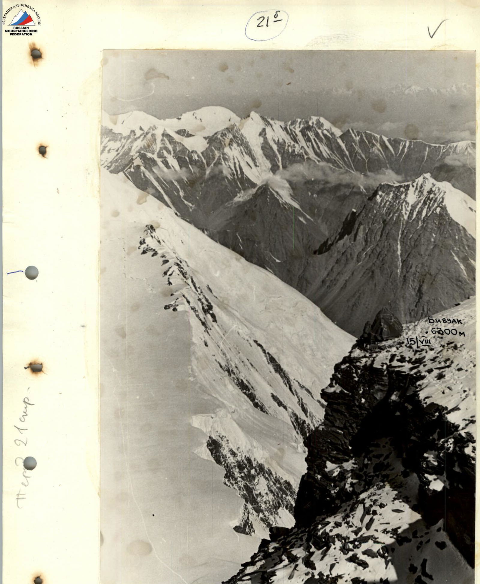 Photo №9. Bivouac on the western ridge of Peak "6700". Altitude 6300 m. After traversing section 19–20.
From the bivouac, movement was along the ridge leading to the summit. The ridge (26–27) was combined. Characteristics of the section:
- Rocks of medium difficulty.
- Firn slopes.
- Strong wind with fine snow grains; no shelter.
- Movement was simultaneous, with some sections having alternating insurance.
At 14:30, they reached a site located at an altitude of 7300 m. They left a tent, took one backpack for every two people, and continued towards the summit. Section (27–28) was a straightforward section of the ridge.
The second ascent of the ridge (29–30) was traversed along a steep snowy ridge. At 17:30, they reached the summit.
On the summit, in the tour, was a flag left by