
Ascent Log
- Ascent class: high-altitude.
- Ascent area, ridge: Central Pamir, Akademiya Nauk ridge.
- Peak, its height, ascent route: Peak E. Korzhenevskaya, 7105 m, via the central counterfort of the 3rd wall.
- Difficulty category: 6A.
- Route characteristics:
- height difference: 1900 m;
- height difference of the wall section: 1250 m;
- length of sections:
- 5th difficulty category — 1040 m;
- 6th difficulty category — 360 m;
- average steepness of the wall section: 70°;
- Number of pitons hammered and belay points organized:
- rock pitons: 128;
- friends: 3;
- chocks: 149;
- ice screws: 20.
- Total climbing hours: 53 h 40 min.
- Number of bivouacs and their characteristics: 6 bivouacs.
- 1, 2, 3, 5, 6 — lying-down bivouacs;
- 4 — sitting bivouac.
- Surname, name, patronymic of the leader, participants, and their qualifications:
- Gennadiy Alekseyevich Shaferov — CMS — leader.
- Sergey Borisovich Dementyev — CMS — participant.
- Sergey Viktorovich Shcheglevatykh — CMS — participant.
- Igor Nikolayevich Shapovalenko — 1st sports category — participant.
- Team coach: Gennadiy Alekseyevich Shaferov.
- Date of departure and return:
22 August — 28 August 1993.
Brief Description of the Approach to the Route
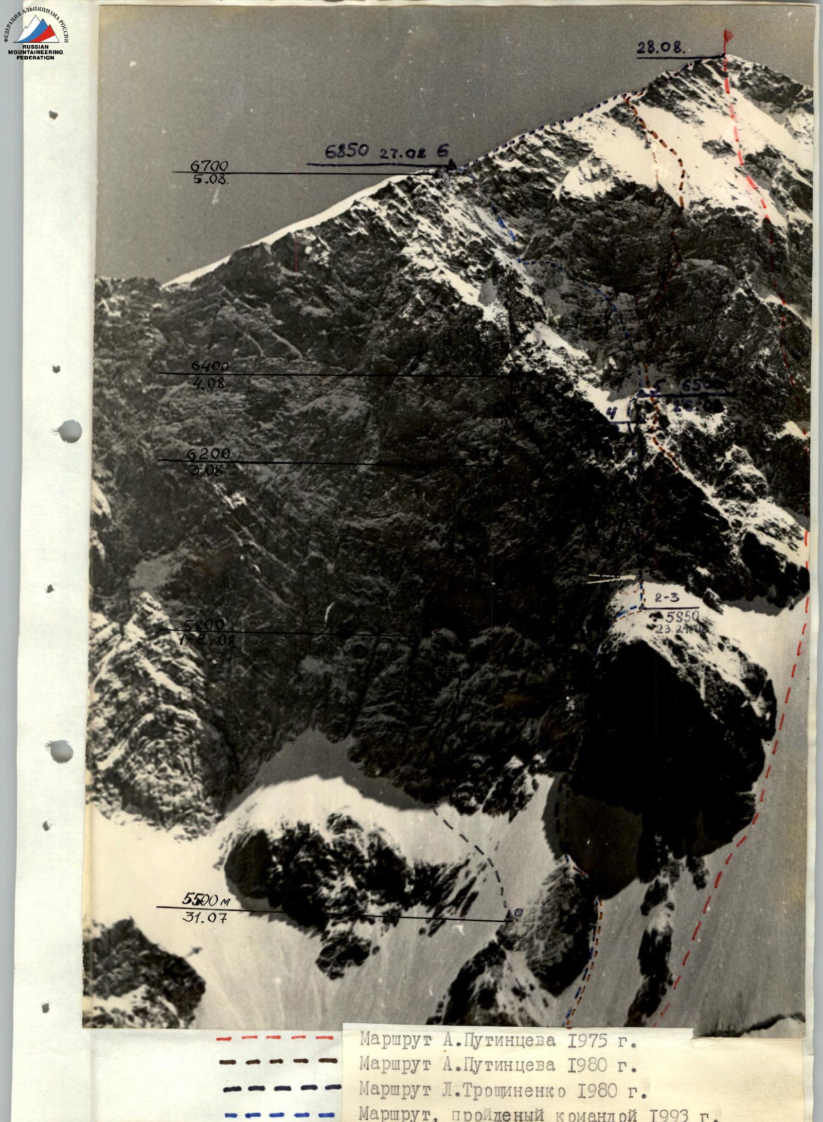
Peak Evgeniya Korzhenevskaya (7105 m) is located at the northern end of the Akademiya Nauk ridge. As the fourth seven-thousander in the country, the peak has attracted the attention of many mountaineers. Routes from the south lead from the Moskvina Glacier and its tributaries. The most accessible route is V. Tsetlin's route, which follows the southern ridge. West of this route, there is I. Khatskevich's route, which bypasses the southern and southwestern walls to the west. Between Tsetlin's and Khatskevich's routes, a route by L. Dobrovolsky runs along the southern wall, and routes by A. Putintsev and L. Troshchinenko run along the western wall.
The team chose A. Putintsev's 1980 route along the central counterfort of the Western wall, as it was objectively the safest. Over several years, the team had made high-altitude ascents to all the seven-thousanders of the former USSR. Just before starting the route, they had climbed Peak Kommunizma (7495 m), which provided excellent acclimatization. Additionally, they had trained in the Fann Mountains and climbed several technically challenging routes.
The approach to the route from the base camp on the Moskvina Glacier follows its tributary, the Soldatova Glacier. From the "Dusty Bivouacs," a destroyed moraine leads to the tongue of the glacier, which rises steeply. To reach the upper part of the glacier, one needs to go left along the destroyed rocks. Further on, after the bergschrund, there are rocky outcrops at the foot of the southern and southwestern walls.
Specifics of the Ascent Object
Peak Evgeniya Korzhenevskaya and, in particular, the Western wall are composed of highly fractured layered siltstones, aleurolites, tuff siltstones, and tuff conglomerates. As a result, characteristic forms of micro-relief and relief include:
- slabs
- "mirrors"
- chimneys
Holds are typically rounded and often unreliable (due to the layered rock), with many loose rocks. There are very few good cracks for organizing belays. These are either micro-cracks for blade pitons or wide cracks with crumbling edges for large chocks or friends.
Another specific feature is that due to the high porosity of the rock, fallen snow sticks to even steep slabs and walls.
The weather at the beginning of the ascent was unstable. The wind often brought fog, making orientation difficult. Snow showers occurred, and up to 30 cm of snow fell overnight. Only the last three days had good weather, allowing the team to increase their pace towards the summit and descend quickly.
It should be noted that despite choosing an objectively safe route, there was a constant rockfall hazard during the wall section. The team moved very cautiously, carefully choosing:
- the direction of movement,
- places for bivouacs.
The tent on bivouac №5 was hit by a rock.
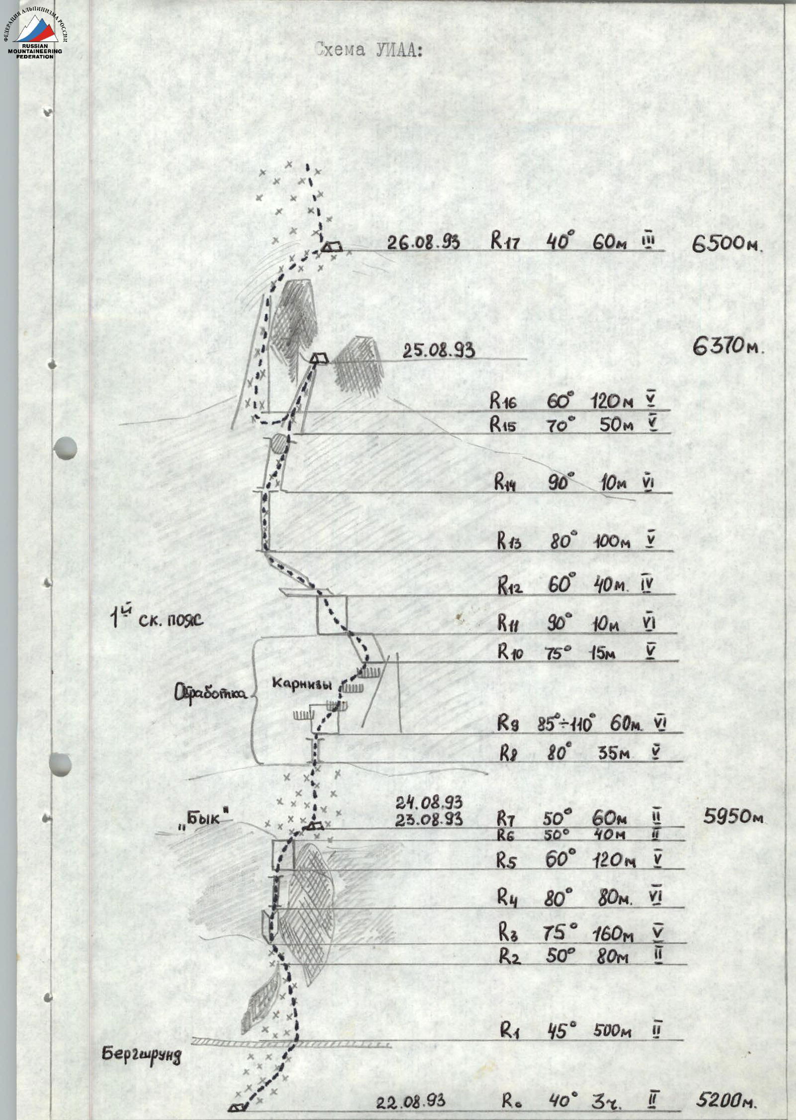
22 August 1993. R0: 40°, 3 h, 5200 m.
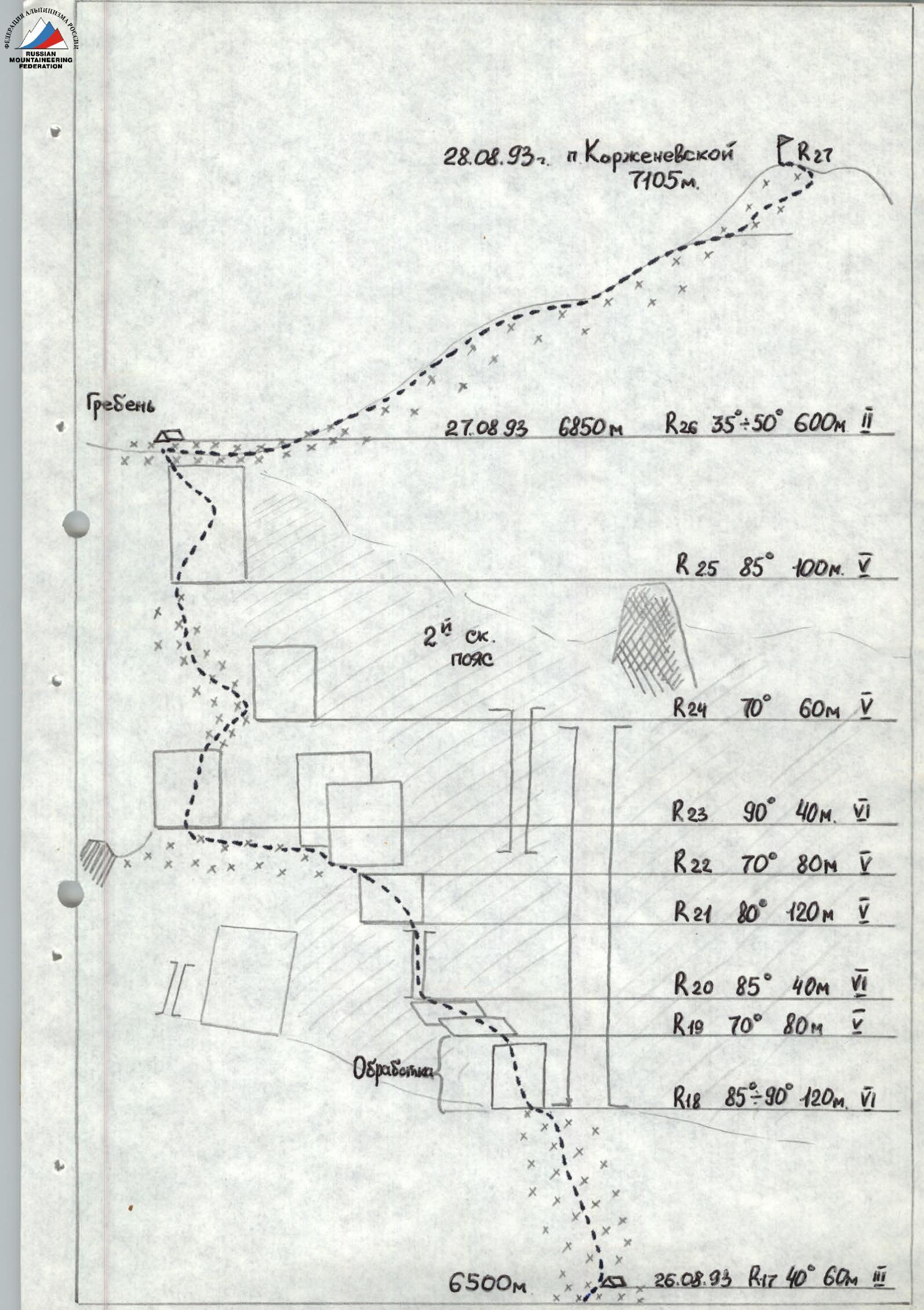
Table of Main Characteristics
| Date | Designation | Steepness, ° | Length, m | Terrain character | Difficulty | Condition | Weather | Rock pitons | Chocks | Ice screws |
|---|---|---|---|---|---|---|---|---|---|---|
| 22.08 | Approach to Soldatova Gl. Need to go along the left slope, bypassing the icefall to the left via rocks. | |||||||||
| 23.08 | R0 | 40 | 3 h | Snow-ice slope | 2 | Crevasses | Overcast | - | - | - |
| R1 | 45 | 500 | Snow-ice slope | 2 | Bergschrund | —"— | - | - | - | |
| R2 | 50 | 80 | Snow-ice slope | 2 | Wet snow | —"— | - | - | - | |
| R3 | 75 | 160 | Inner corner | 5 | Destroyed, iced | —"— | 18 | 22 | - | |
| R4 | 80 | 80 | Narrow chimney | 6 | Iced | —"— | 10 | 9 | - | |
| R5 | 60 | 120 | Dissected wall | 5 | Destroyed, iced | —"— | 10 | 15 | - | |
| R6 | 50 | 40 | Snow-ice slope | 2 | Deep snow | —"— | - | - | - | |
| Departure: 7:00. Stop: 20:30. Climbing hours: 13 h 30 min. | ||||||||||
| 24.08 | R7 | 50 | 60 | Snow-ice slope | 2 | Deep snow | Fog. Snow. | - | - | - |
| R8 | 80 | 35 | Chimney | 5 | Destroyed, iced | —"— | 5 | 4 | - | |
| R9 | 85–110 | 60 | Wall, eaves | 6 | Destroyed, iced | —"— | 9 | 16 | - | |
| R10 | 75 | 15 | Dissected wall | 5 | Destroyed, iced | —"— | 1 | 3 | - | |
| Processing. Departure: 12:00. Return: 17:00. Climbing hours: 5 h 00 min. | ||||||||||
| 25.08 | R11 | 90 | 10 | Dissected wall | 6 | Destroyed | Overcast | 2 | - | - |
| R12 | 60 | 40 | Slabs | 4 | Iced, snow | —"— | 5 | 4 | - | |
| R13 | 80 | 100 | Narrow chimney | 5 | Iced | —"— | 11 | 13 | - | |
| R14 | 90 | 10 | Chimney | 6 | Plug, iced | —"— | 3 | 2 | - | |
| R15 | 70 | 50 | Ice couloir | 5 | Snow on ice | —"— | - | 2 | - | |
| Departure: 10:00. Stop: 21:30. Climbing hours: 11 h 30 min. | ||||||||||
| 26.08 | R16 | 60 | 120 | Narrow couloir, ice | 5 | Snow on ice | Clear | - | - | - |
| R17 | 40 | 60 | Snow-ice slope | 3 | Rocks in ice | —"— | - | 4 | - | |
| R18 | 85–90 | 120 | Monolithic wall | 6 | Eaves | —"— | 2 friends, 16 | 10 | - | |
| Relocating bivouac. Processing. Departure: 12:00. Return: 18:30. Climbing hours: 6 h 30 min. | ||||||||||
| 27.08 | R19 | 70 | 80 | Steep, destroyed slabs | 5 | Snow-covered | Clear | 6 | 8 | - |
| R20 | 85 | 40 | Destroyed chimney | 6 | Iced | —"— | 1 friend, 3 | 5 | - | |
| R21 | 80 | 120 | Dissected wall | 5 | Iced, destroyed | —"— | 9 | 14 | - | |
| R22 | 70 | 80 | Ice slope | 5 | Traverse under rocks | —"— | 4 | 3 | 6 | |
| R23 | 90 | 40 | Monolithic wall | 6 | Iced | —"— | 3 | 3 | 2 | |
| R24 | 70 | 60 | Snow-covered slabs | 5 | Loose snow | —"— | 4 | 2 | 6 | |
| R25 | 85 | 100 | Dissected wall | 5 | Iced | —"— | 2 friends, 9 | 16 | - | |
| Departure: 8:00. Stop: 21:40. Climbing hours: 13 h 40 min. | ||||||||||
| 28.08 | R26 | 35–50 | 600 | Snow-ice slope | 2 | Crevasses | Clear | - | - | - |
| Departure: 11:00. Summit: 14:30. Climbing hours: 3 h 30 min. |
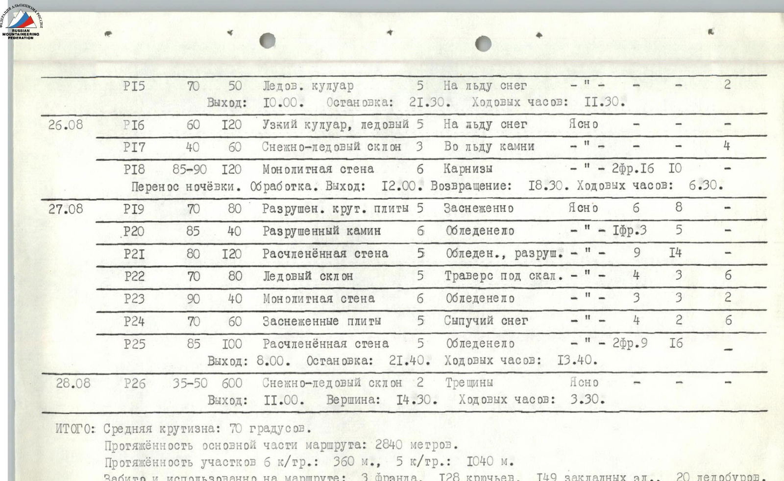
TOTAL: Average steepness: 70°. Length of the main part of the route: 2840 m. Length of sections:
- 6th difficulty category: 360 m
- 5th difficulty category: 1040 m
Pitons hammered and used on the route:
- 3 friends
- 128 pitons
- 149 chocks
- 20 ice screws
Total climbing hours there: 53 h 40 min.
Brief Explanation of the Table
22 August. At 12:00, the team left the base camp on the Moskvina Glacier. Beyond the "Dusty Bivouacs," they turned right onto the Soldatova Glacier and crossed it to the left side. Along the left slope, they ascended via scree with a high content of grey dust to the icefall. Then, via destroyed rocks on the left slope, they climbed to the upper plateau above the icefall and continued along the glacier. At 19:30, they stopped for the night (Photo №2). From the bivouac, the entire route was visible (Photo №1).
23 August. They departed at 7:00. After 3 hours, through a labyrinth of closed crevasses, they reached the bergschrund R0–R1. The bergschrund was traversed via a small bridge, and they continued up the slope in crampons. Along the right edge of the rocky outcrop, under its protection, they ascended to a couloir dissecting the outcrop. Then, turning sharply left, they crossed the couloir and reached its left edge R1–R2, continuing to the top of the rocky outcrop. Along the snowy slope R2–R3, they approached the base of the "Bull." Considering their good pace and time reserve, they decided to continue. Shaferov G. and Shapovalenko I. worked first. Upward, behind the left edge of the "Bull," they followed a large inner corner R3–R4. (Photo №3). The inner corner led to a cornice. Under the cornice, via a series of ledges, they made a sharp traverse and ascended via a narrow chimney-cleft on a smooth slab R4–R5. Then, along a series of small counterforts and couloirs R5–R6. The rocks were heavily iced and dusted with snow, which somewhat limited rockfall but complicated the ascent. After traversing the snowy slope R6–R7 a bit, they stopped for the night at 20:30 (Photo №4).
24 August. The weather worsened at night, with snow starting to fall. In the morning, they decided to begin processing the 1st rock belt. The duo Shapovalenko I. — Dementyev S. departed at 12:00 to process the 1st rock belt. From the tent, a snowy slope R7–R8 led to the base of a chimney R8–R9. After climbing the chimney, they processed a very complex section with overhangs R9–R10 (Photo №6) and a wall R10–R11. They returned to the tent at 17:00. The weather became even worse.
25 August. They departed at 10:00. (Photo №5). The fog persisted in the morning, but the snow had stopped, and the clouds began to clear. After the processed section, Shapovalenko I. went first. The wall R11–R12 (Photo №7) led to slabs (Photo №8). Then, through a narrow chimney R13–R14 (Photo №9), and further into a wide, iced chimney R14–R15, with a plug in the upper part that they bypassed to the right. Further on, Shaferov G. led. Along a steep, icy couloir with loose snow, they reached a snowy col in the upper part of the 1st rock belt of the counterfort. They stopped for the night at 21:30 (Photo №11).
26 August. The bivouac was a sitting one — the only thing they could carve out on the ridge, but they managed to secure the tent and have a good meal. They continued further at 12:00. First, they descended from the ridge and followed a couloir, then an icy slope R16–R17 (Photo №10), reaching a suitable spot for a bivouac. They reviewed the further route. The bastions of the 2nd rock belt were heavily snow-covered due to the previous two days' bad weather. To proceed, they needed to wait for the conditions to improve. Therefore, they decided to go left, in the upper part of the belt, reaching snow-covered slabs. The route by L. Troshchinenko 1980 led there. Initially, they followed a steep snow-ice slope and then a steep, monolithic wall R18–R19 (Photo №14). Dementyev S. and Shcheglevatykh S. went on processing. They returned at 18:30. They decided to rest well.
27 August. The weather had completely improved. They departed at 8:00. Further on, from the belay points, Shapovalenko I. went first. The previous day's good weather had reduced the amount of snow on the rocks. Along steep slabs R19–R20 and a destroyed chimney R20–R21, they reached a wall, and after passing it, a steep ice slope R22–R23. After traversing the slope (Dementyev S. went first), they reached an iced wall R23–R24. After passing it, they reached the planned slabs. Further on, there was a very iced and snow-covered complex section of the rock wall. They passed this wall R25–R26 and reached the ridge. The ridge was firm, with firn snow and even. They stopped for the night at 21:40. For the first time, they didn't need to carve out a platform for the tent.
28 August. They departed at 11:00. The weather was clear. They climbed simultaneously, avoiding crevasses and staying close to the ridge. The snow-ice slope R26–R27 led to the summit. They reached the summit at 14:30. (Photo №15, Photo №16). There were no notes in the cairn. They wrote their own and began descending via the D ridge. They reached the base camp on the Moskvina Glacier the same day.
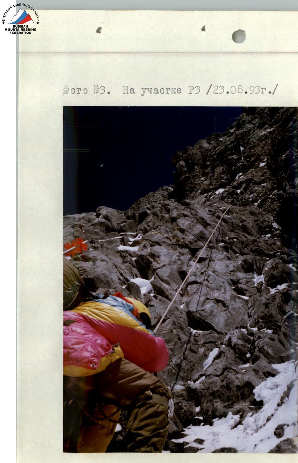
Photo №4. Bivouac №2 on the "Bull" (25 August 1993)
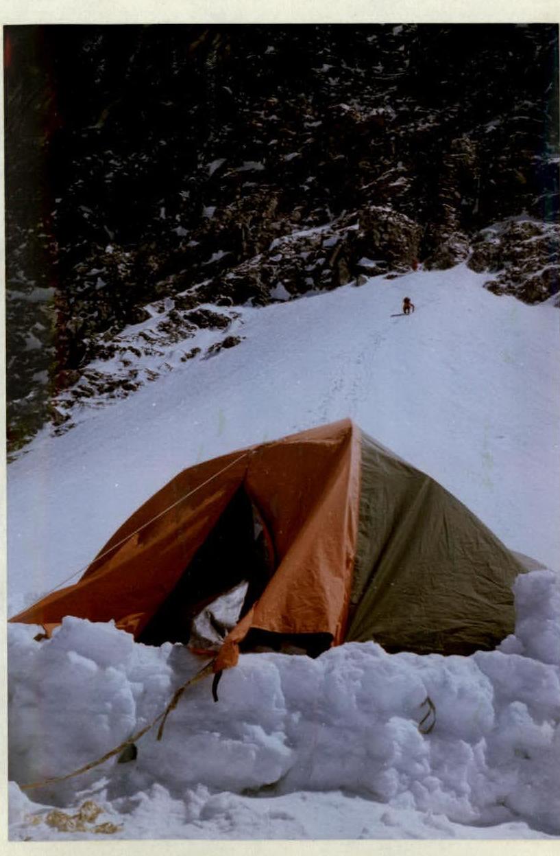
Photo №6. On section R10 (25 August 1993)
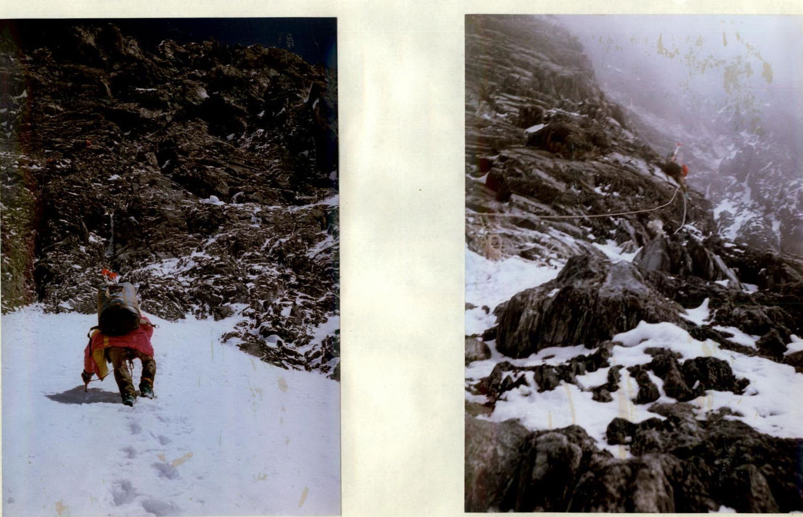
Photo №7. On section R11 (25 August 1993)
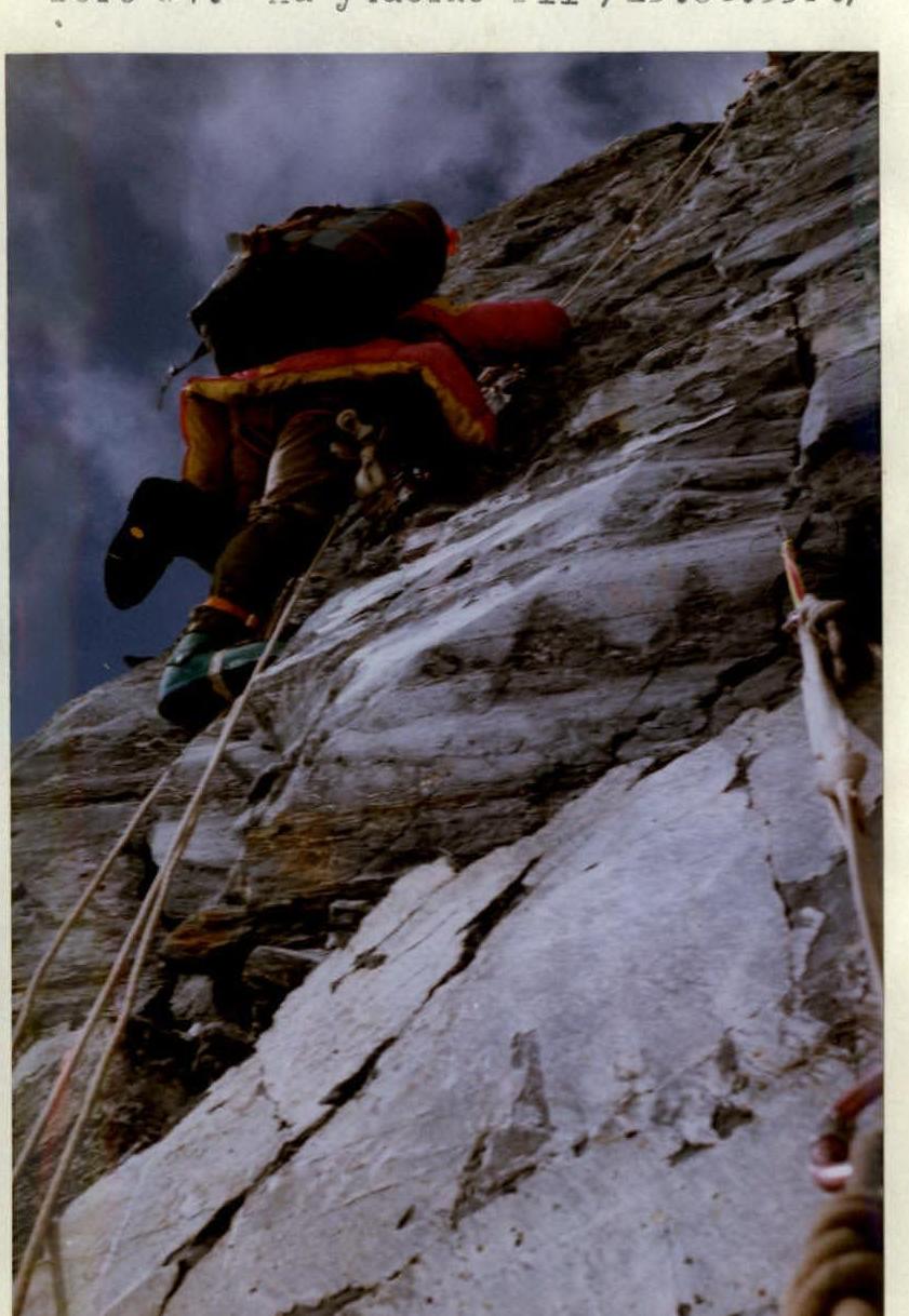
Photo №8. On section R12 (25 August 1993)
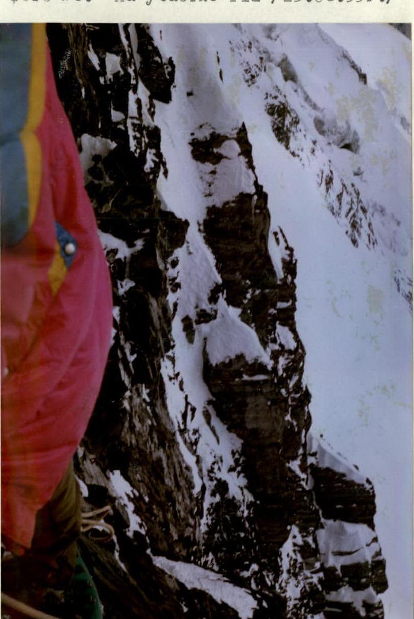
Photo №9. On section R13 (25 August 1993)

Photo №10. On section R16 (26 August 1993)
Photo №11. Bivouac №3 (26 August 1993)
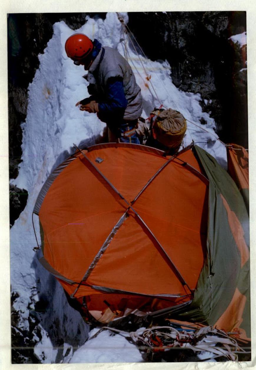
Photo №12. From bivouac №4 (26 August 1993)
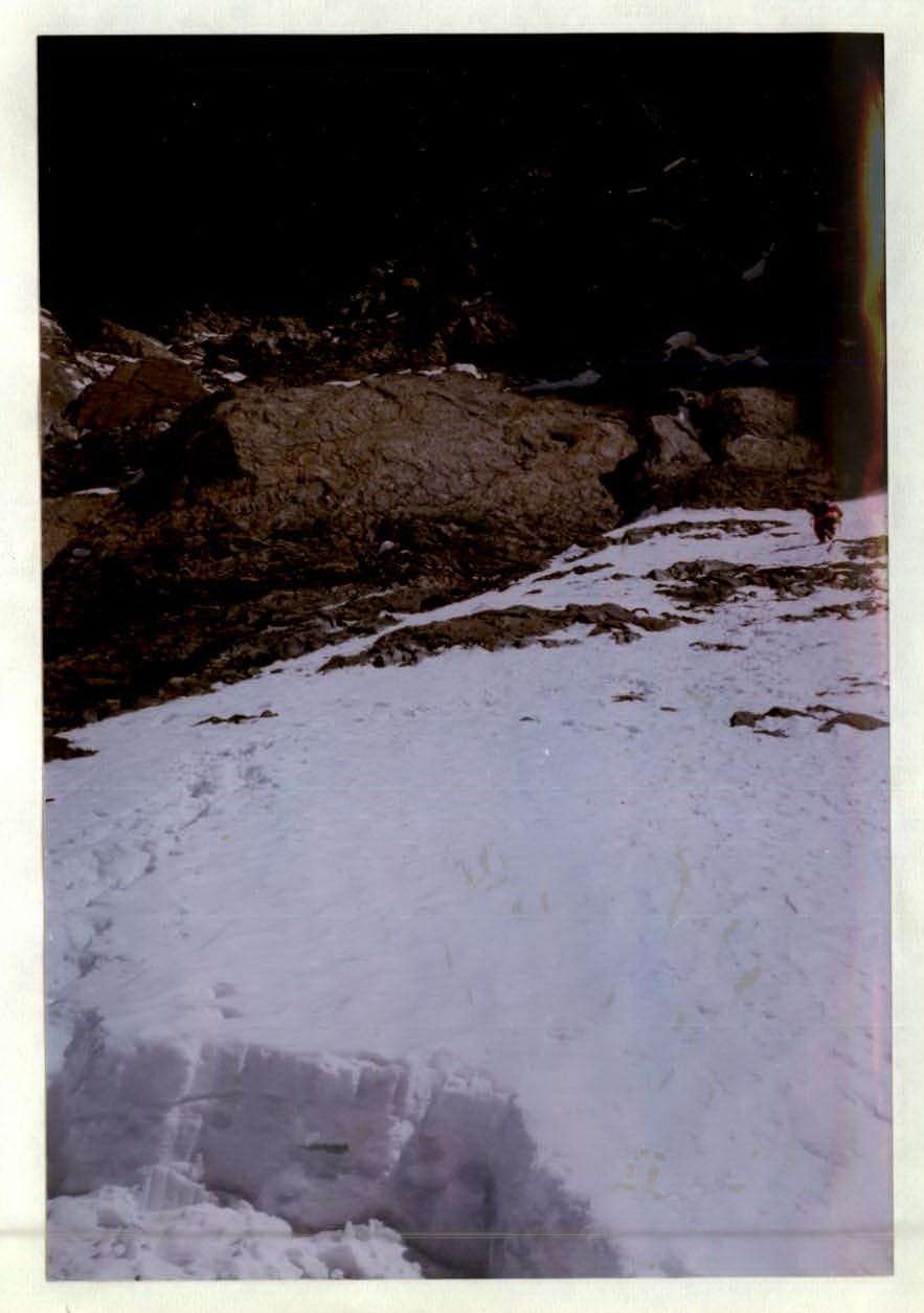
Photo №13. At the start of section R18 (27 August 1993)
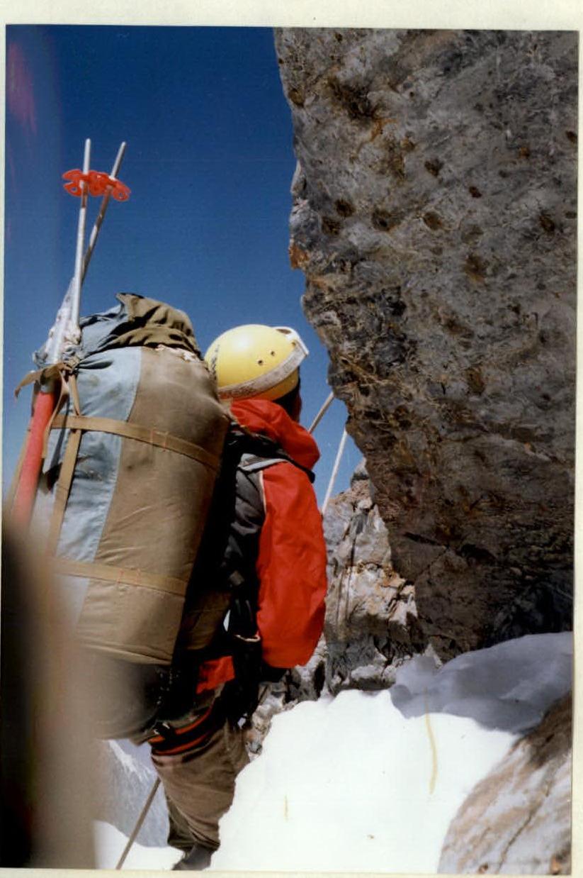
Photo №14. On section R18 (27 August 1993)
