
Ascent Passport
- Class of high-altitude ascents.
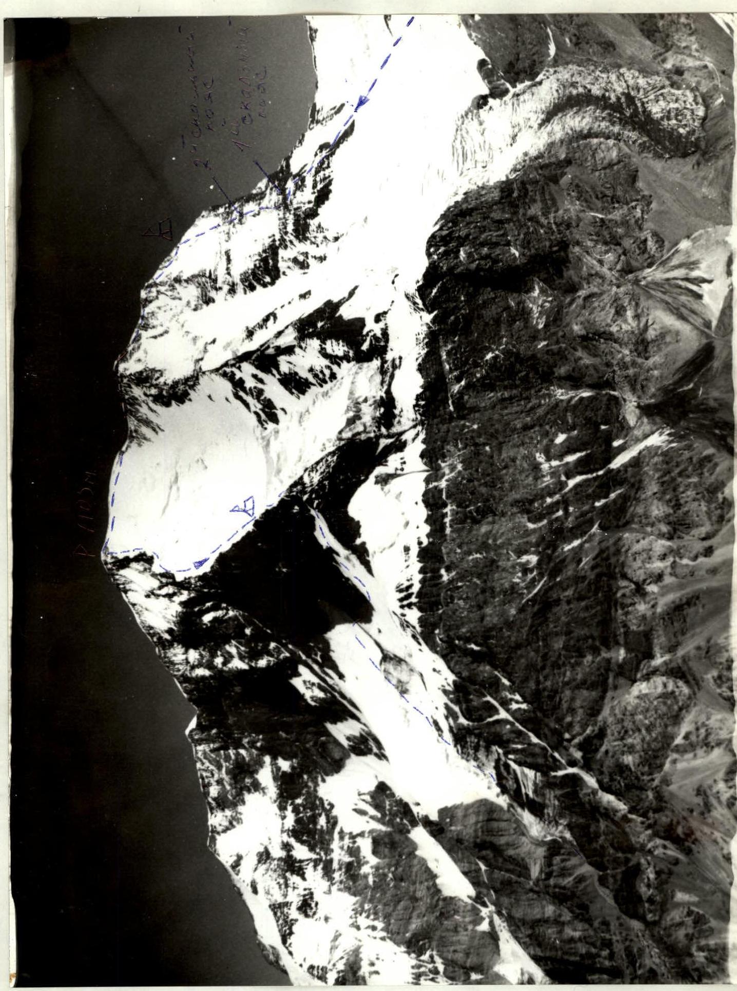
- North-Western Pamir. Northern spur of the Academy of Sciences Range.
- Peak Korzhenevskaya. Height 7105 m. Via the South-Eastern slope. The route is combined.
- Route category 5B.
- Height difference 2925 m.
- Pitons hammered in: rock 16, ice 50. Used 12 pieces of protection gear.
- Travel time: 18 hours 30 minutes.
- One bivouac was made on the route. The bivouac site was carved out in a snowy-ice ridge. The bivouac was comfortable and met safety requirements.
- Selivanov M.A. CMS — leader Gostishchev S.G., Krutashinsky Yu.V., Selivanova L.N., Sedusov B.A., Tserkovnikov S.I.
- Kadtsin V.M. MS instructor 1st category.
- Departure on the route August 5, 1988. Return from the route August 8, 1988.
- Perm Regional Committee for Physical Culture and Sports.
 △ — bivouac sites, → — stream
Brief description of the approach to the route
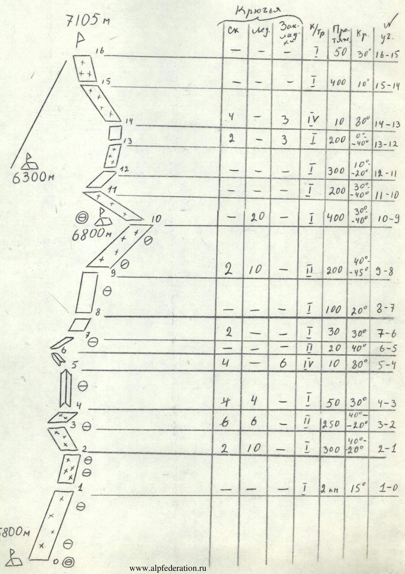
PATH MAP
Departure from the base camp located near the lake, near the confluence of the Moskvina and Walter glaciers at 11:00. The path goes along the stream between Peak Moskvina and the slopes of MPTI through the talus moraines to the upper reaches of Peak Moskvina (1 hour 30 minutes). Then we go through the open glacier to the left. We bypass several wide crevasses. We cross the glacier and go up towards the ridge leading to the route. At 20:00 we stop for the night on a convenient shoulder of the snowy-ice slope of the ridge. The site is comfortable, there is water. The height is about 5800 m.
Explanation for the diagram
- The route is abundant with heavily snow-covered rocks — sections 3, 4, 13.
- The route has two rock belts: section No. 5, section No. 9, which are the most technically challenging.
- Overcoming section No. 10 is only possible with good snow conditions.
- Third bivouac — on descent — 6300 m.