Ascent Passport
I. Ascent class - rock climbing
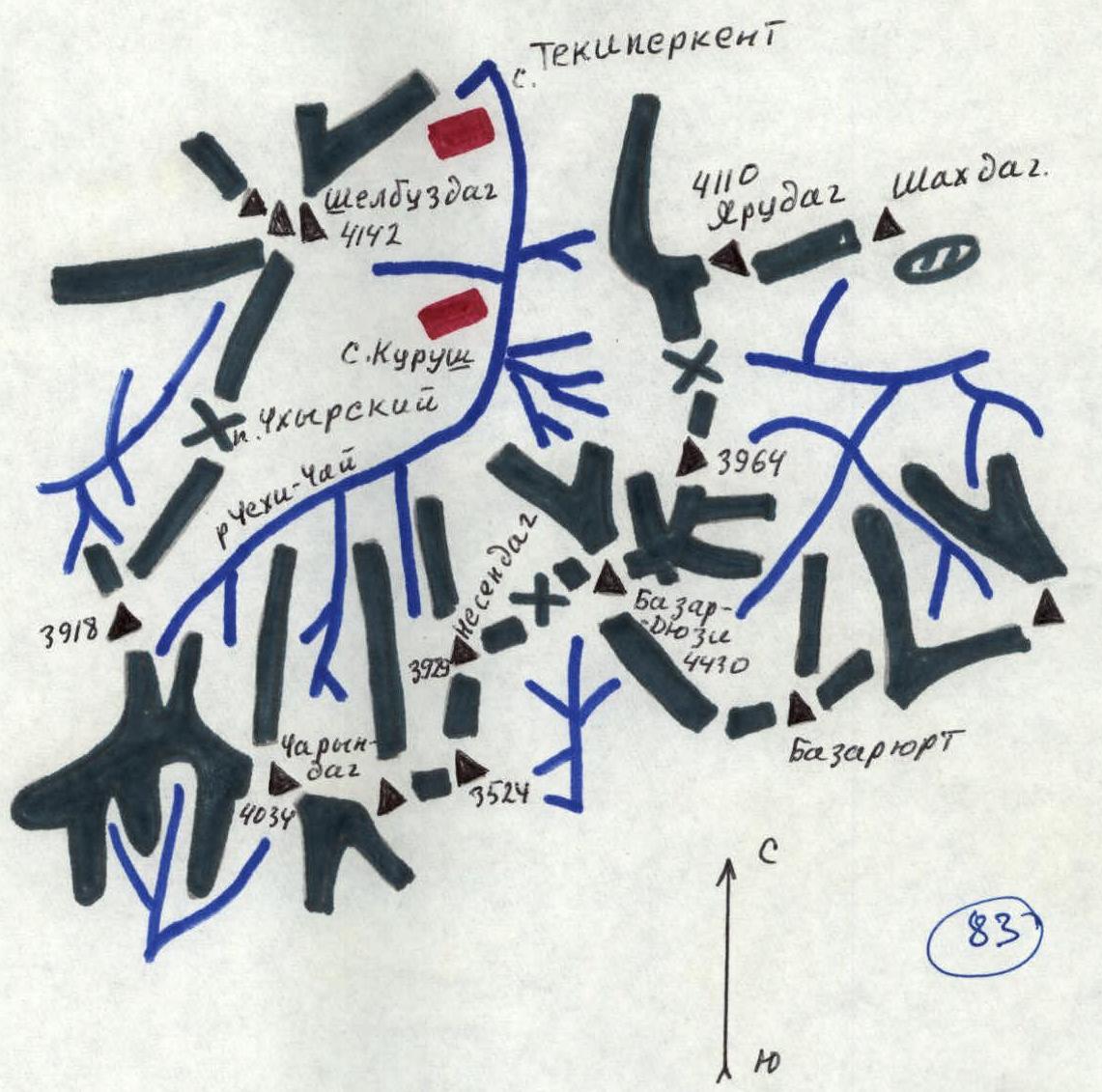
- Ascent area - 2.9 Eastern Caucasus
- Peak, its height, and ascent route - Central Shalduzdag (4142 m) via the southwest counterfort
- Proposed difficulty category - 3B, protocol No. 481 dated 22.08.1979
- Route characteristics: elevation gain - 642 m
average steepness - 50–55°, section lengths: R1–R12, R2–R3, R3–R15, R4–R2, R5–R25, R6–R30, R7–R7, R8–R3, R9–R30, R10–R8, R11–R5, R12–R80, R13–R60
- Pitons driven: for belaying, for creating I.T.O.
rock - 10, ice - 0, bolt - 0
- Number of travel hours - 8 hours
- Number of nights and their characteristics - night under the southwest counterfort
- Surname, name, patronymic of the leader and participants, their sports classification:
Melnikov V.N. - 2nd sports category Ivanov A.S. - 3rd sports category Peresada A.V. - 2nd sports category Titenko A.P. - 2nd sports category Falin V.S. - 2nd sports category
- Team coach - Nezamutdinov A.B.
- Date of departure and return - February 6, 1979
Table
| Date | Designation | Average steepness in degrees | Length, m | Terrain character | Difficulty | Condition | Weather conditions | Rock | Ice | Bolt |
|---|---|---|---|---|---|---|---|---|---|---|
| 06.02.1979 | R0–R1 | 80 | 12 | inner corner | 3 | snow-covered | sunny, wind | 2 | ||
| R1–R2 | 75 | 3 | difficult rocks | 4 | 2 | |||||
| R2–R3 | 80 | 15 | wall | 3 | 1 | |||||
| R3–R4 | 90 | 2 | slab | 4 | smooth, snow-covered | 1 | ||||
| R4–R5 | 75 | 25 | medium difficulty rocks | 3 | snow-covered | 2 | ||||
| R5–R6 | 60 | 30 | medium rocks | 3 | heavily destroyed | 2 | ||||
| R6–R7 | 70 | 7 | wall | 3 | snow-covered | exposed | ||||
| R7–R8 | 70 | 3 | slab | 3 | ||||||
| R8–R9 | 60 | 30 | wall | 3 | ||||||
| R9–R10 | 50 | 8 | ridge | 3 | ||||||
| R10–R11 | 75 | 5 | chimney | 3 | ||||||
| R11–R12 | 60 | 80 | medium rocks | 3 | ||||||
| R12–R13 | 50 | 60 | simple rocks | 2 | ||||||
 |
Description
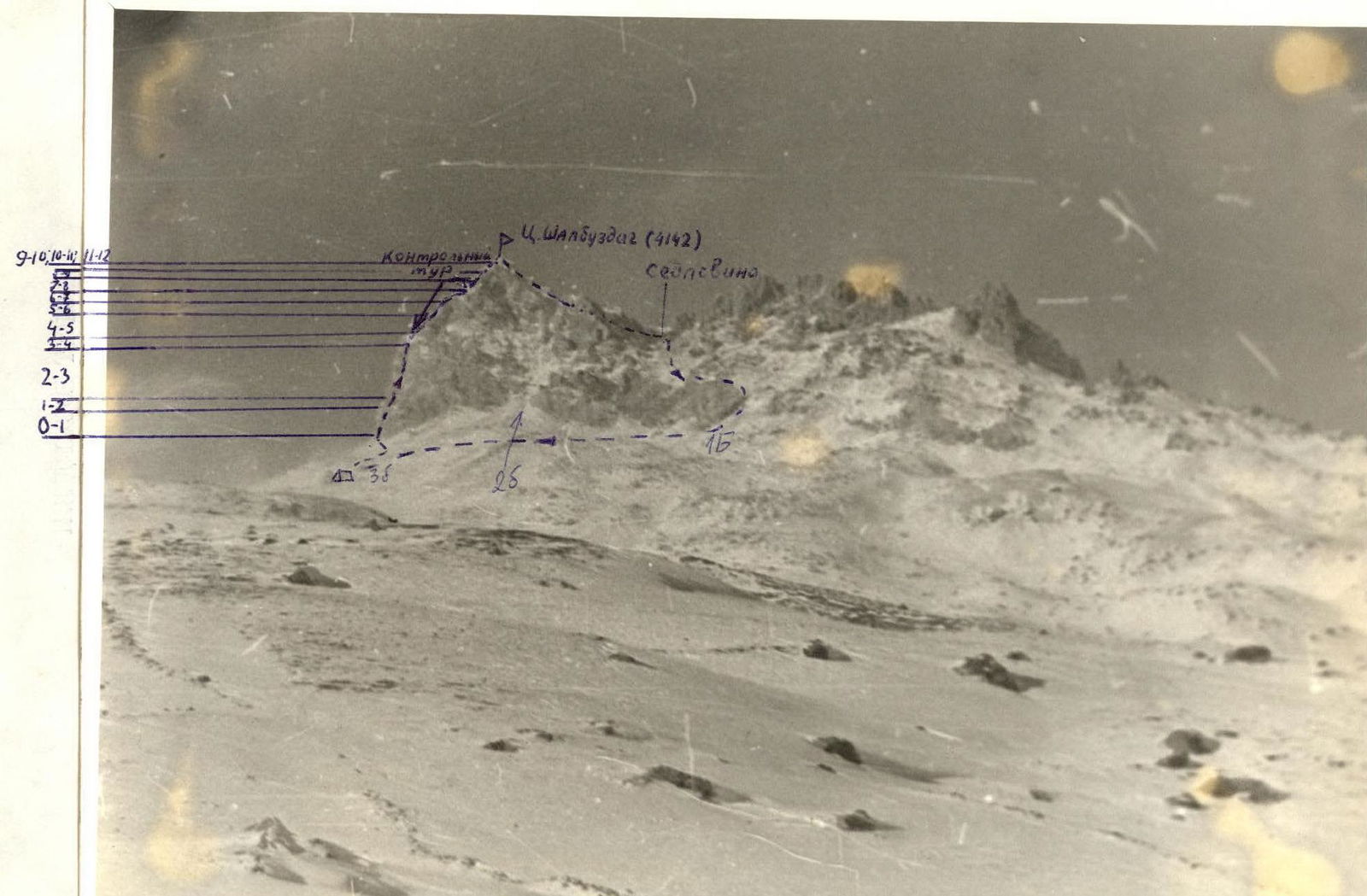
of the ascent route via the southwest counterfort to the peak Central Shalbuzdag, 3B difficulty category (first ascent)
From the village of Kurush, the sheer southern wall of the peak Central Shalbuzdag serves as the main landmark. Up the trail to the cairn takes 3 hours. From the cairn along the ridge to the southern wall takes another 3 hours. There are good places to camp everywhere. Having passed the base of the wall towards the Western peak of Shalbuzdag, the group approaches the start of the route, which is the base of a wide rocky couloir with:
- the right side being a sheer wall,
- the left side being a wide 10–20-meter inclined slab with a steepness of 40–50°, and a length of 150 m.
The route goes along the slab. The rocks are smoothed, holds are small, and there are few cracks for pitons. Climbing is friction-based. In winter conditions, the presence of snow complicates climbing. The exit onto the 150-meter slab goes through a vertical inner corner, 10–12 m, with good holds, leading to a convenient ledge for belaying. From the ledge, 3–4 m of difficult climbing lead to the start of the route on the slab. The slab ends at a platform, from which a vertical narrow rocky wall, 15 m high, with good holds, departs; the last 2 m are a smooth vertical slab. Again, a platform - possibly a bivouac site.
From the platform straight up - a vertical wall, 25 m, with rocks of medium difficulty, and piton belays. The wall leads to a small saddle. Control cairn. Bypassing the walls is rockfall-prone.
From the saddle towards the peak - along heavily destroyed simple rocks, 20–30 m, to the base of the next wall. After the saddle, the character of the rocks changes significantly. Further on, the rocks have a tile-like structure, easily crumbling under load.
- The wall, 7–8 m high, with a steepness of 60–70°, is overcome head-on.
- Bypassing the wall is rockfall-prone but possible on the right.
After the wall - a descent onto the next saddle along a vertical slab, 3 m.
After the small saddle - a wall, 25–30 m, is overcome head-on. Rocks are of medium difficulty. Having passed 80 m to the right along the ridge, we overcome a vertical chimney, 5 m high. Another 80 m up along rocks of medium difficulty, with variable belays, and 60 m up to the right along simple rocks - to the peak. The cairn of Central Shalbuzdag is next to the triangulation point. From the control cairn to the peak takes 2 hours.
Descent is along the eastern ridge via the 1B category route.
The ascent is recommended for training and sports groups.
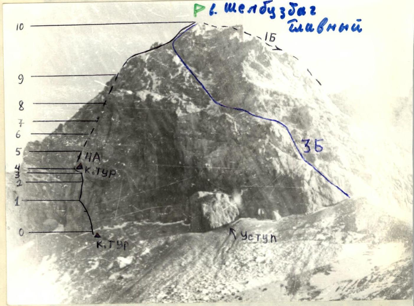
Route along the southern wall of Shalbuzdag Main
Brief geographical description and sports characteristics of the ascent object
The highest point of the area - the peak Bazardyuzi (height 4430 m) - is a peak of the Main Caucasian Range. It is located on the border of Dagestan and Azerbaijan.
The peak is covered with an ice cap. Several small glaciers descend from the peak. The eastern ridge of the mountain ends at the Kurush pass, through which a pack trail passes.
The following routes are laid to the peak Bazardyuzi:
- route 1B category via the western ridge from the saddle between Bazardyuzi and the peak Nesindag
- route 1B category via the eastern ridge
- route 2A category via the northern ridge
Approaches from the southern side have not been explored. From the north, a logical route is visible: via the northeast counterfort.
The peak is composed of clayey, destroyed shales. To the northeast of Bazardyuzi is the Yarudag massif (4110 m), which is located in a spur of the Main Caucasian Range. Of the two available transcriptions, "Yarydag" and "Yarudag", the more correct one is "Yarudag". This transcription is given in Anokhin's book "Eastern Caucasus". To the east of the peak Yarudag is the peak Shakhdag (4249 m). The Yarudag-Shakhdag massif forms a large plateau, which drops off with almost sheer walls on all sides.
Three peaks stand out in the Yarudag massif:
- Yarudag Main
- Yarudag I Western
- Yarudag 2 Western
Five routes are laid on the peak Yarudag 2 Western:
- Via the Western wall through the right well, 4B category (Sidorenko, 1979)
- Via the Western wall, 3B category (Peresada, 1979)
- Via the Southwest counterfort, 3B category (Sidorenko, 1979)
- Via the Southern wall of the southwest counterfort, 3A category, non-classified
- Via the Southern wall to the right of the "Finger" gendarme, 4B category, non-classified (Ruma, 1981)
Traversing 1 Western and Main peaks of Yarudag - 2A category.
To the northwest of Bazardyuzi is the Shalbuzdag massif (4142 m), composed of limestones. There are three peaks in the massif:
- Western Shalbuzdag
- Main Shalbuzdag
- Eastern Shalbuzdag
Eastern Shalbuzdag consists of four destroyed towers.
Four routes are laid on Main Shalbuzdag:
- 1B
- 2B
- 3B
- 4A (non-classified) category
Traversing the towers of Eastern Shalbuzdag from west to east is classified as 3A category.
No routes are laid on Western Shalbuzdag.
The Shalbuzdag massif is composed of gray-yellow-red limestones.
To the east of Bazardyuzi is the peak Nesindag (3925 m). A route is laid on it via the northwest ridge (non-classified).
In February 1981, the following first ascents were made by the LGSK team in the described area:
- peak Nesindag via the northwest edge, 1B category
- peak Shalbuzdag via the southern wall, 4A category
- peak 2 Western Yarudag via the southern wall to the right of the "Finger" gendarme, 4B category