I. The route is combined
- East Caucasus 2.9.
- Mt. Shalbuzdag (4142) via the Western ridge.
- Proposed category of difficulty 3A.
- Route characteristics a. Height difference: 750 m b. Average steepness of main sections: 40° c. Length: 1340 m. (I category — 580 m; II category — 560 m; III category — 120 m; IV category — 80 m)
- Pitons driven:
- rock: 9
- chocks: 8
- ice: 1
- Travel time: 8.5 hours
- Overnight stays: without overnight stays
- Participants: Pashuk E.G. — 2nd sports category № 3189 Amirkhanov A.A. — 2nd sports category Leonov P.G. — 2nd sports category № 3184 Malikov Yu.B. — 2nd sports category
- Coach: Timoshin M.E., Master of Sports of the USSR
II. Approach to the route, ascent, and descent — May 13, 1983
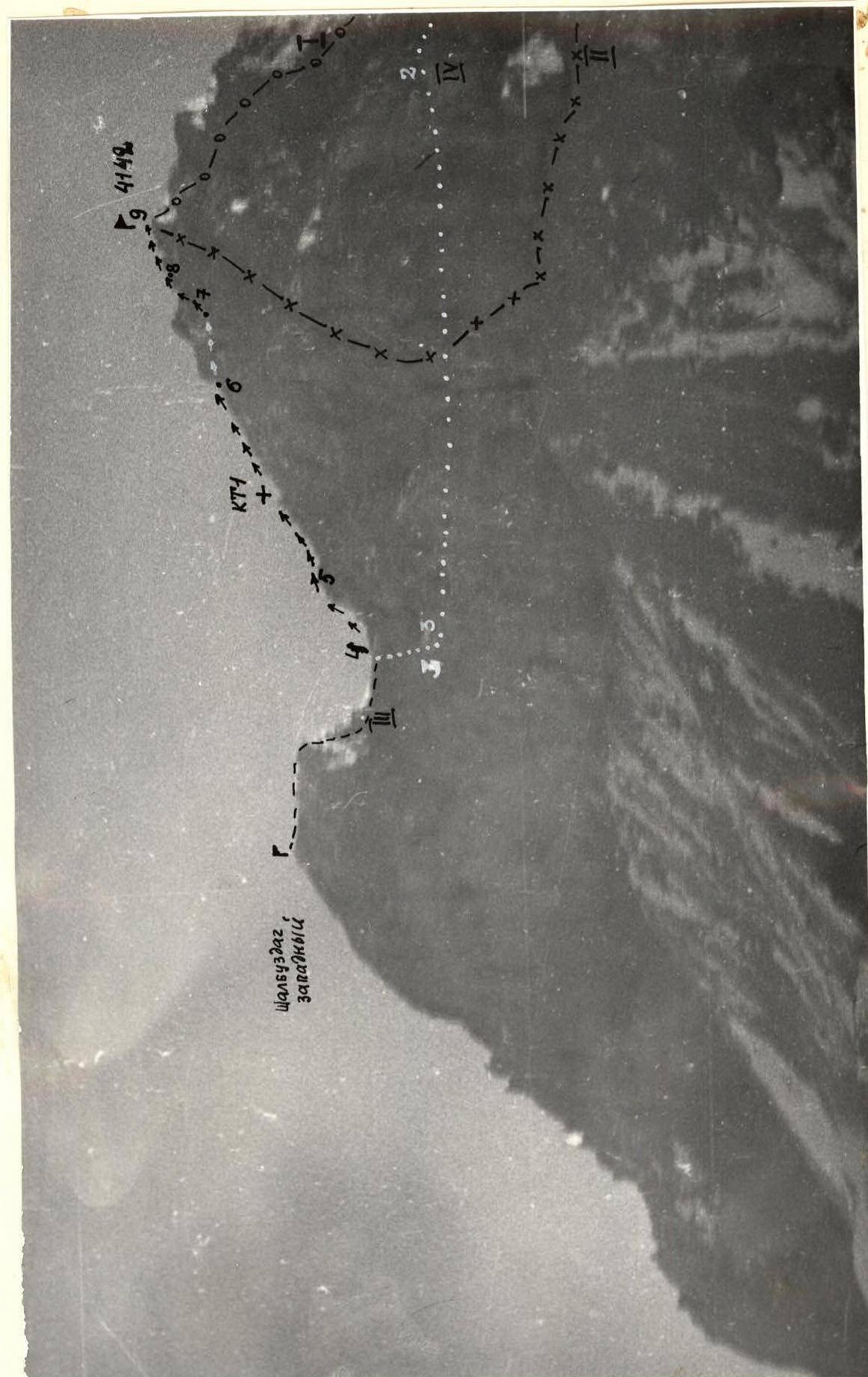
Photo 1. General view of the summit.
- I — Shalbuzdag via the SW (3B) ridge;
- II — Shalbuzdag via the Western wall 4A category of difficulty;
- III — Shalbuzdag Western (3A) via the Eastern ridge;
- IV — the described route.
Taken on May 11, 1980, "Industar - 50" F=50 mm. Shooting point № 1 on the diagram. Distance ≈ 3500 m. Height ≈ 3100 m.
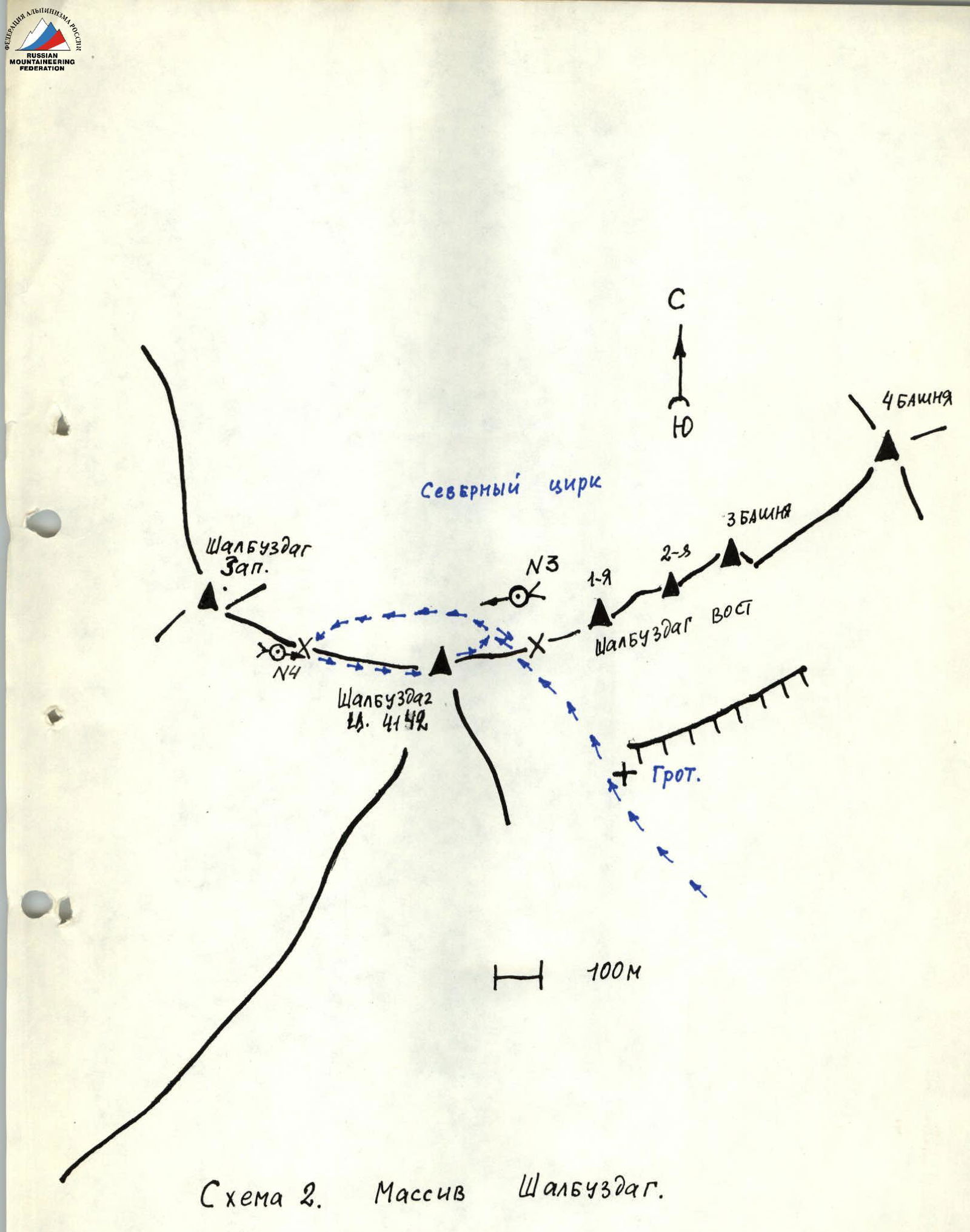
Diagram 2. Shalbuzdag massif. ×N — shooting points.
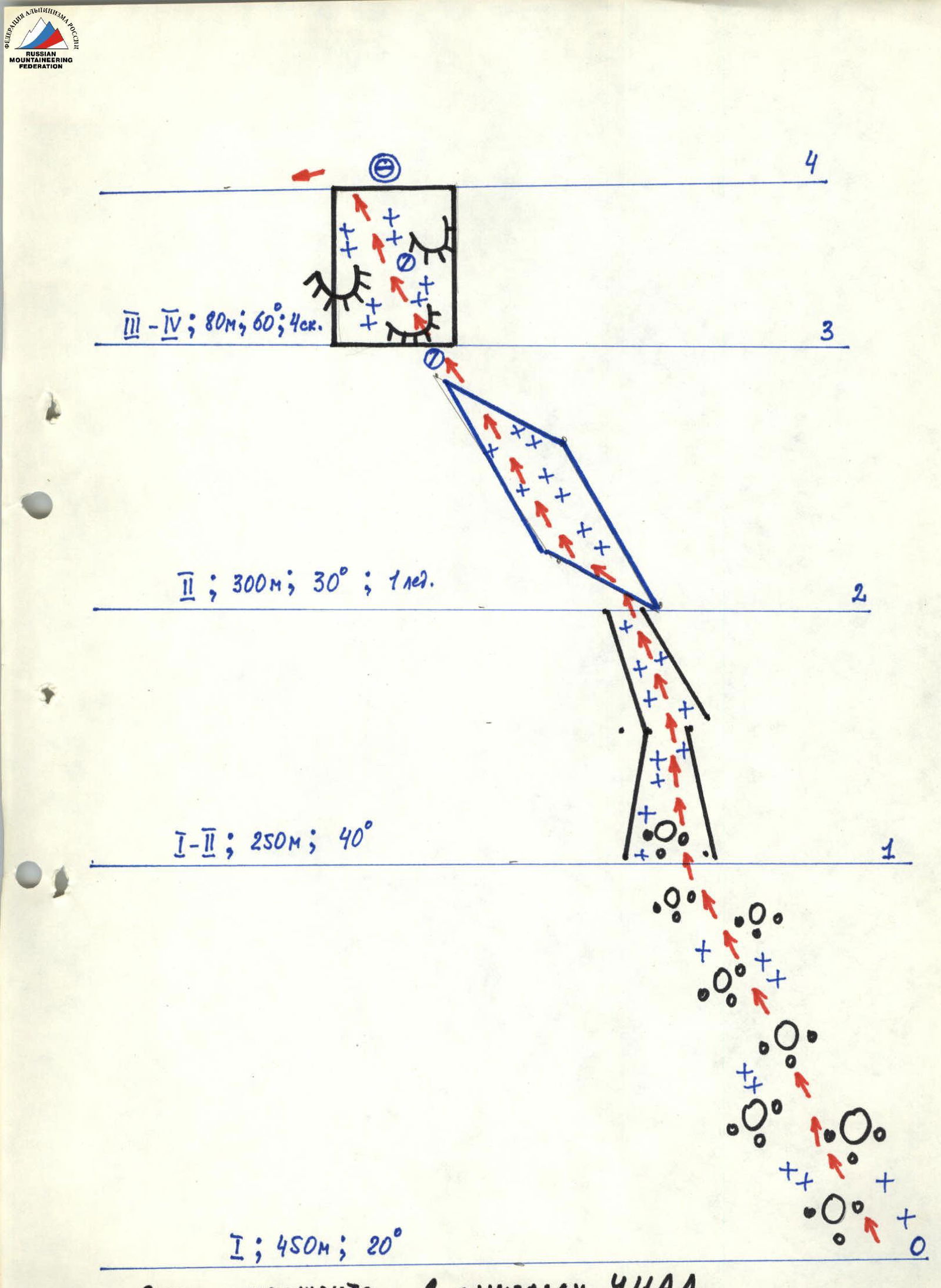
Route diagram in UIAA symbols.
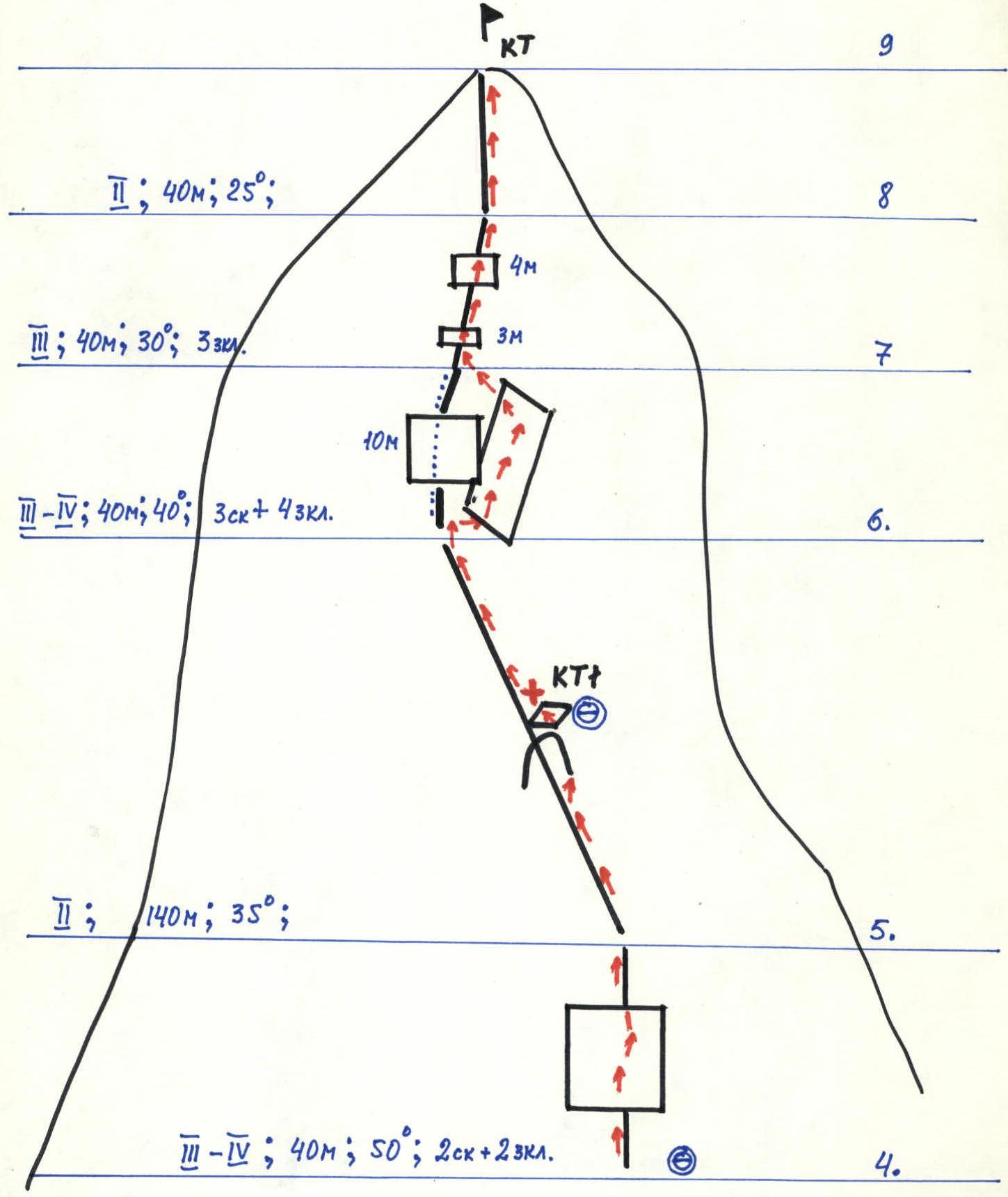
Route diagram in UIAA symbols (Continued).
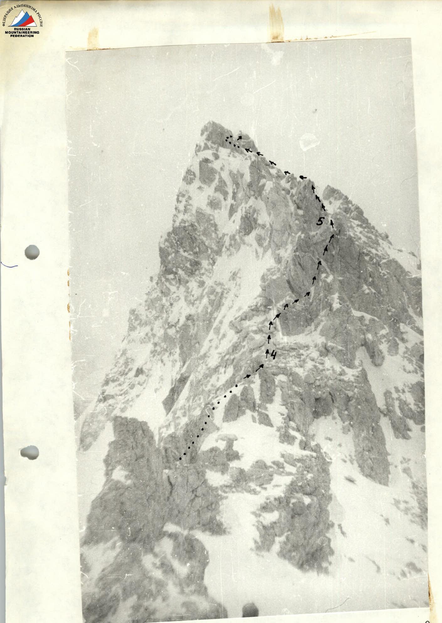
Photo 4. View of the route from the saddle between Mt. Shalbuzdag Central and Western. Shooting point № 4 (diagram 2). "Industar - 50" F=50 mm. Height ≈ 3900 m.
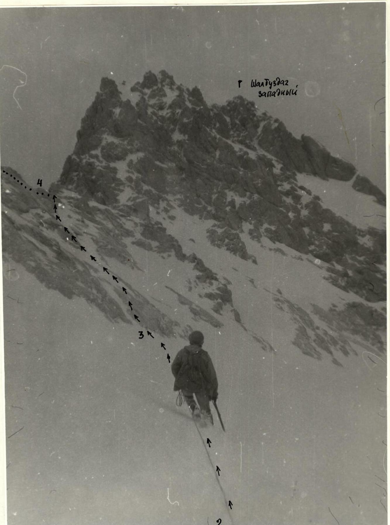
Photo 3. Approach to the saddle between Mt. Shalbuzdag Central and Western. Taken from point № 3 on diagram 2. "Industar - 50" F=50 mm. Height ≈ 3750 m.
Brief description of the route
The section of the route to the saddle between Mt. Shalbuzdag Main and Western coincides with the route to the Western summit of Shalbuzdag via the Eastern ridge (3A category of difficulty).
Movement in this part goes along a snow-covered scree (R0–R1), then along a narrow steep snow-and-ice couloir (R1–R2) (crampons!). Traverse of the snow-and-ice slope (R2–R3) under the NE wall of Mt. Shalbuzdag is done simultaneously. With a small amount of snow, crampons are desirable for all. Steep snow-covered rocks like "ram's foreheads" (R3–R4), alternating with sections of flow ice, are advisable to pass with suspended belays.
From the saddle, turn left. A section of a steep ridge with a wall (R4–R5) is passed with suspended belays. Further — simultaneously along a heavily dissected ridge. Behind the second large gendarme — a control cairn.
Section (R6–R7) is a bypass of a steep section of the ridge with a 10 m wall on the right along an inclined ledge. It is advisable to hang belays. Passing the section along the ridge is possible. The first 6–7 m of the wall — 4–5 category of difficulty.
On sections (R7–R9), small walls are passed head-on.
Descent from the summit along the NE ridge (2B category of difficulty) to the saddle between the Main and Eastern Shalbuzdag and further along the ascent route takes 1.5–2 hours.
TABLE OF MAIN ROUTE CHARACTERISTICS
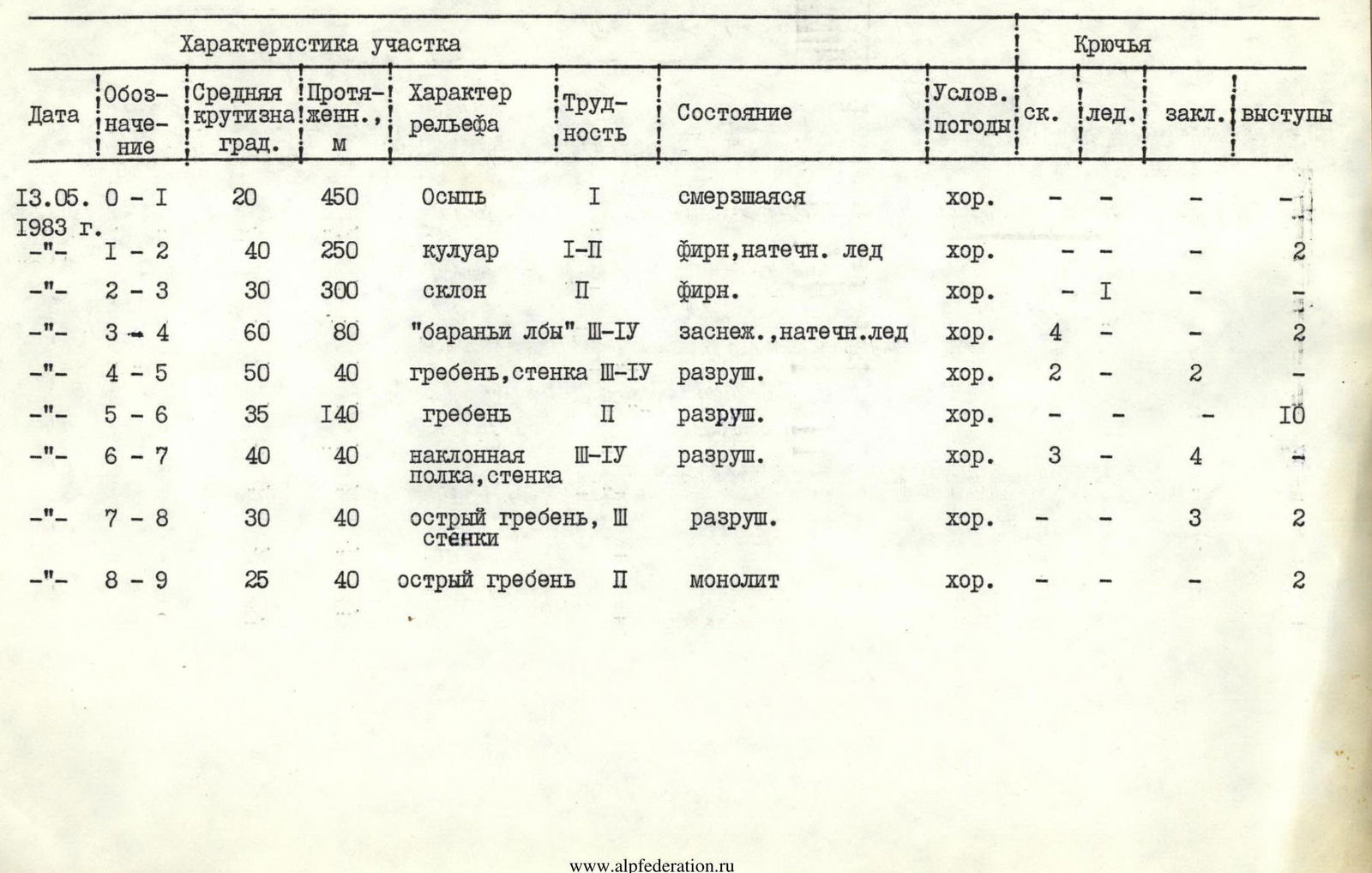
| Date | Designation | Average steepness, degrees | Length, m | Terrain characteristics | Difficulty | Condition | Weather conditions | Pitons (rock, ice, chocks, outcrops) |
|---|---|---|---|---|---|---|---|---|
| May 13, 1983 | R0–R1 | 20 | 450 | Scree | 1 | frozen | good | – – – – |
| " | R1–R2 | 40 | 250 | Couloir | 1–2 | firm snow, flow ice | good | – – – 2 |
| " | R2–R3 | 30 | 300 | Slope | 2 | firm snow | good | – 1 – – |
| " | R3–R4 | 60 | 80 | "Ram's foreheads" 3–4 | 3–4 | snow-covered, flow ice | good | 4 – – 2 |
| " | R4–R5 | 50 | 40 | Ridge, wall 3–4 | 3–4 | rocky | good | 2 – 2 – |
| " | R5–R6 | 35 | 140 | Ridge | 2 | rocky | good | – – – 10 |
| " | R6–R7 | 40 | 40 | Inclined ledge, wall 3–4 | 3–4 | rocky | good | 3 – 4 – |
| " | R7–R8 | 30 | 40 | Sharp ridge, walls 3 | 3 | rocky | good | – – 3 2 |
| " | R8–R9 | 25 | 40 | Sharp ridge | 2 | monolithic | good | – – – 2 |


