Fig. 22
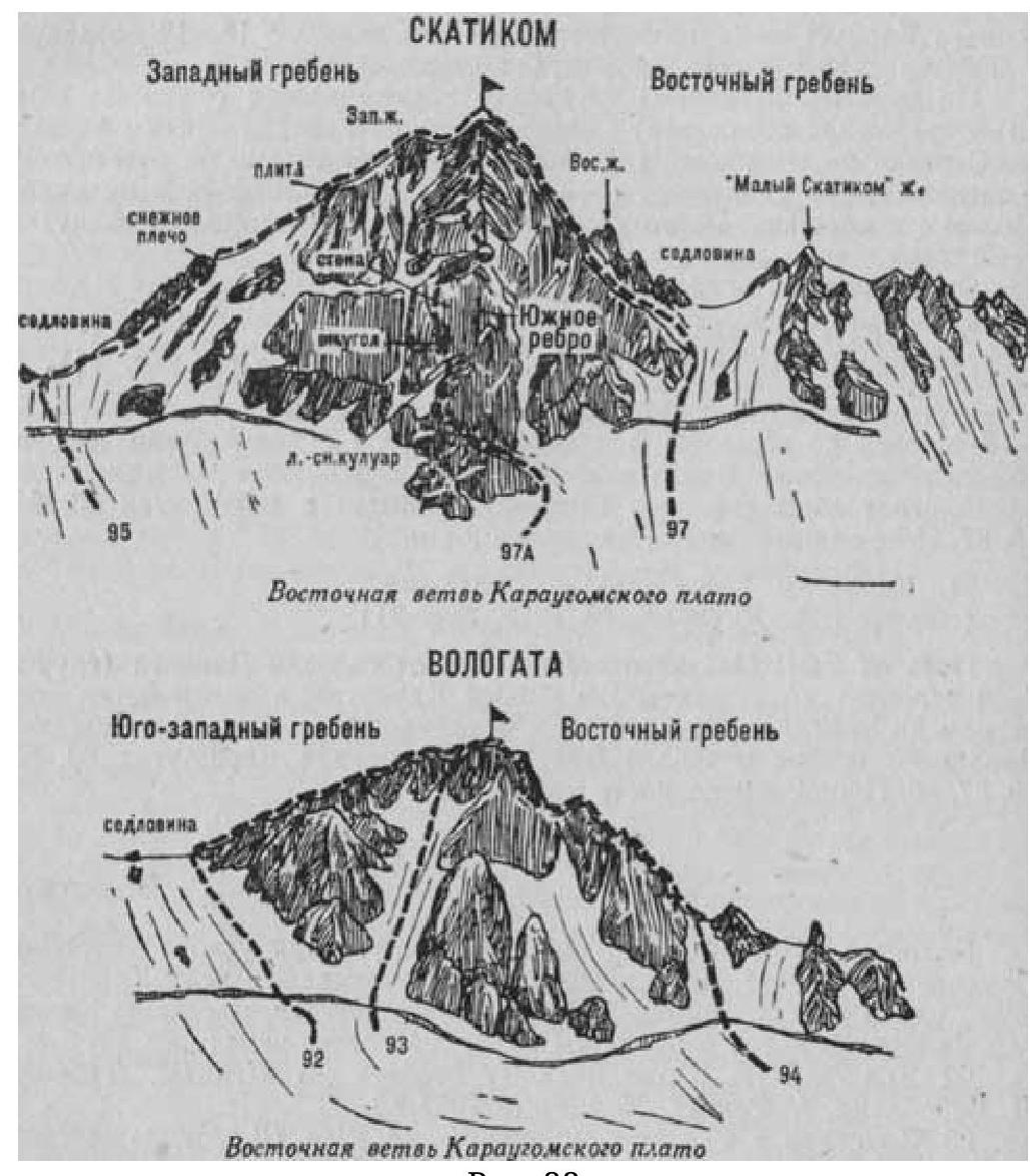
- Vologata (4396 m) from the south via the couloir (combined route, category 2A difficulty, fig. 22).
The path from the CSP of the Tsey region or from the village of Dzinaga (group of 4-12 people) to the initial bivouac on the platforms of the Western ridge of the Bivouachnaya peak is described in route 83.
From the bivouac, cross the Eastern branch of the plateau (closed crevices) and approach the wide snowy couloir descending from the Southwest snowy ridge from under the Vologata peak, to the right side of the wide snowy slope of the saddle connecting Vologata and Karaugom.
Ascent:
-
From the plateau, having crossed the bergschrund via a snow bridge, ascend the wide, steep 700-800-meter snowy couloir, going to the right from the slope of the saddle (avalanches and rockfall are possible — insurance).
-
Then, via a narrow, steep, possibly snow-covered, rocky middle couloir, ascend to the Southwest ridge and along it to the summit of Vologata.
-
From the initial bivouac — 5-7 hours.
Descent follows the ascent route.
Naumov A. F. Karaugom, Digoriya, Tsey (Central Caucasus), M., "Fizkultura i sport", 1976.