Fig. 19
- Taymaz West via West Ridge (a combined route, 3A category of difficulty, Fig. 19).
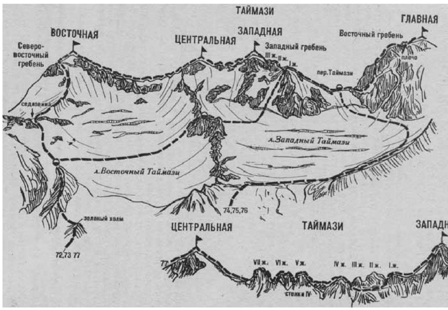
The path from the "Taymazi" meadow (a group of 4–8 people) to the red cliffs at the head of the Taymazi River is described in route 72. At the red cliffs (rockfall):
- ford the Taymazi River;
- ascend through the boulder field on the right bank to the talus slopes.
Climb the talus slopes to the northern ridge — a spur of Tcentral'naya Taymazi Peak. From here, move right and, traversing the moraines beneath the broad tongue of the Zapadny Taymazi Glacier, reach its right-lateral moraine. Ascend along the moraine crest, which gradually turns left, to almost beneath the northeastern rocky slopes of Glavnaya Taymazi Peak. Here, leave the moraine and move left onto the Zapadny Taymazi Glacier, staying on its right side (closed crevasses), and reach the Taymazi Pass that connects the Zapadnaya (left) and Glavnaya Taymazi (right) peaks.
From the glacier, overcome the bergschrund via a snow bridge and ascend a steep 250–300-meter ice-and-snow slope to the Taymazi Pass. On the narrow rocky ridge's flat areas of the pass is the starting bivouac. From the "Taymazi" meadow — 8–10 hours.
On the pass, turn left and:
- ascend a 60–80-meter snow slope,
- then traverse the talus slopes to reach the West Ridge of Zapadnaya Taymazi Peak.
Continue along the long, straightforward West Ridge to the first pinnacle. The further ascent to Zapadnaya Taymazi with a detour around the first pinnacle on the left is described in route 73. From the starting bivouac — 4–5 hours.
The descent follows the ascent route. The duration of the route is 2–3 days. Naumov A. F. Karau gom, Digoria, Tsey (Central Caucasus), M., "Fizkultura i sport", 1976.
