Report on the First Ascent by the Team of the Multifaceted Mountaineering Club "FREELINE" from Essentuki
To the Summit of Meshchana Zapadnaya
via the south wall and southwest ridge Presumably 4A category of difficulty. Team Leader: Popov Mikhail Lvovich Coach: Motienko Nikolai Ilich Essentuki, 2019
Addresses:
- 357600, Stavropol Krai, Essentuki, ul. Oktyabrskaya, 434, apt. 59, Popov M.L. +7 928 265-71-30, mikl_popov@inbox.ru
- 357524, Stavropol Krai, Pyatigorsk, ul. Fuchika, 8, building 3, apt. 41. Konstantinov G.A. Ph. +7 988 860-73-77, bargest2008@gmail.com
- 357500, Stavropol Krai, Pyatigorsk, ul. Sovetskaya, 137. Motienko N.I. Ph. +7 928 361-90-66, nik-motienko@mail.ru
Ascent Passport
- Region 2.4. Digoria, Skalisty Ridge.
- Summit Meshchana Zapadnaya via south wall and southwest ridge.
- Proposed — 4A category of difficulty, first ascent.
- Nature of the route: rock.
- Height difference of the route: 257 m.
Route length: 297 m.
Length of sections:
- I category of difficulty — 0 m.
- II category of difficulty — 80 m.
- III category of difficulty — 107 m.
- IV category of difficulty — 45 m.
- V category of difficulty — 65 m.
- VI category of difficulty — 0 m. Average steepness: wall — 60°; ridge — 40°.
- Number of belay points used: Total/ITO — 36/0 rock pitons — 0 placed elements — 25 bolt pitons — 0 Belay points left on the route: Total — 0 rock pitons — 0
- Team's working hours: 12 hours, 1 day. Of which work on the route: 5 hours 00 minutes, 1 day.
- Leader: Popov Mikhail Lvovich, Candidate Master of Sports. Participants: Konstantinov Gennadiy Andreevich, 2nd sports category.
- Coach: Motienko Nikolai Ilich, Candidate Master of Sports, instructor 1st category No. 754.
- Route started: 7:00 September 15, 2019. Reached the summit: 12:00 September 15, 2019. Returned to base camp: 17:00 September 15, 2019. Descent from the summit: via the ascent route.
- Team: Multifaceted Mountaineering Club "FREELINE" Essentuki.
- Responsible for the report: Popov M.L. +7 928 265-71-30, mikl_popov@inbox.ru
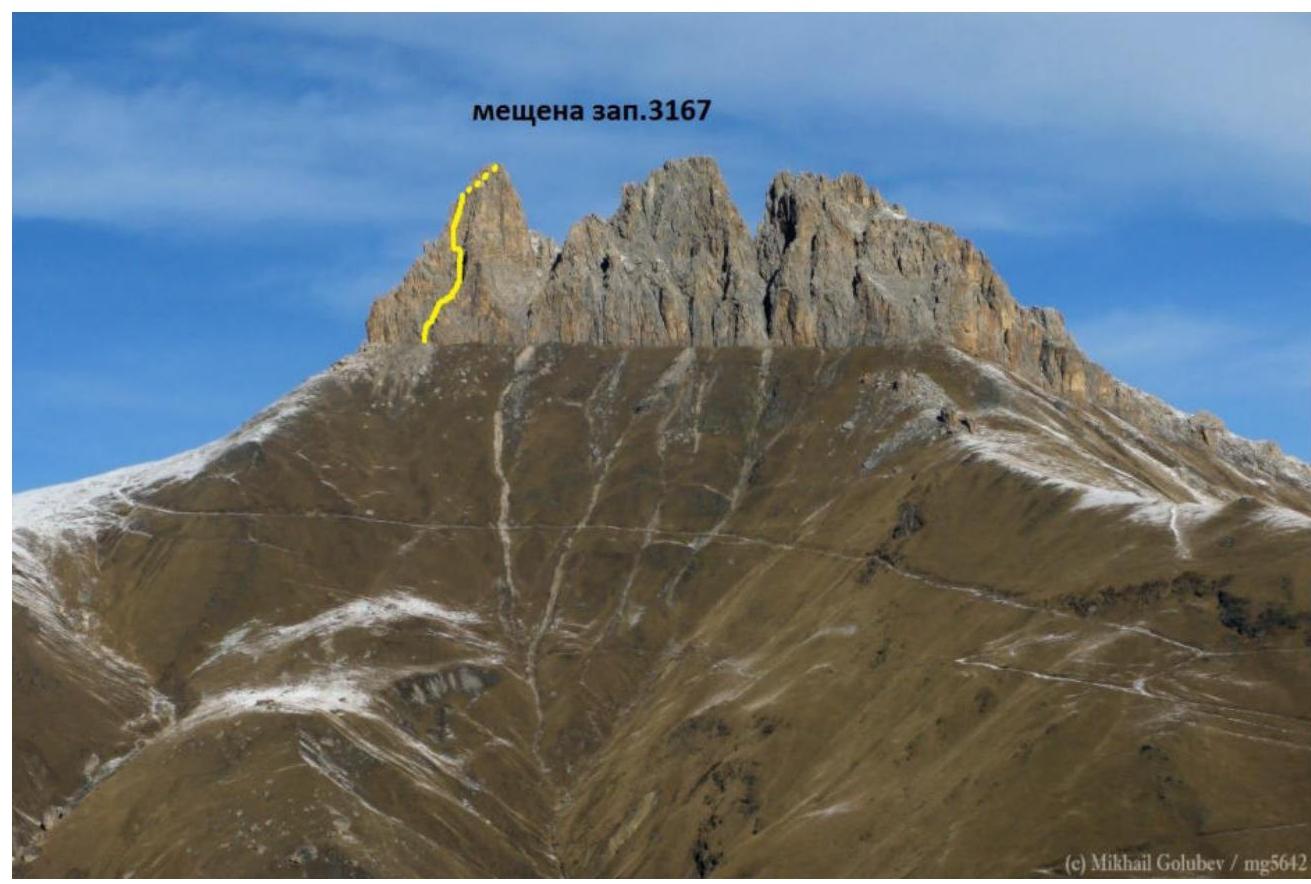
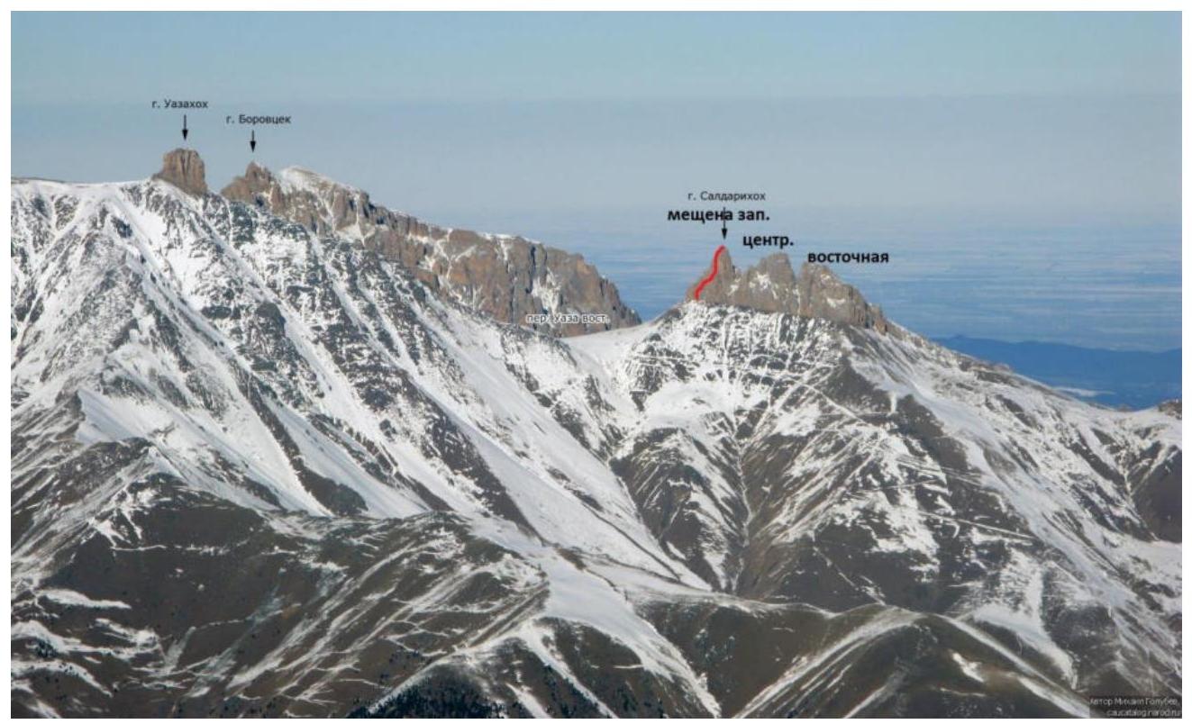
Skalisty Ridge, North Ossetia, Meshchana
First ascent route
Brief Overview of the Ascent Area
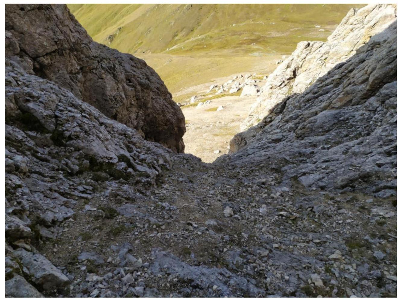
The summit of Meshchana Zapadnaya is part of the Skalisty Ridge in the Greater Caucasus mountain system (Republic of North Ossetia, Irafsky district). The path to the mountain goes through the Uruh river gorge. Turn right 2 km after the village of Matsuta. The road is dirt, partially in poor condition. After about 5 km, the road leads to a large "estate" built on the site of the ruins of the village of Kumbulta. There is a fork: straight to the village of Donifars, to the summit turn left. This fork can also be reached from Donifars, but the bridge over Uruh is in poor condition. After Kumbulta, the road is very bad, only suitable for off-road vehicles even in summer. For those traveling in winter, it is recommended to leave the car on a gentle grassy slope just above the "estate". On foot, it takes about 1 hour 30 minutes to reach the last кош (there are 3 in total on the way) (about 30 minutes by car in summer). The кош is located right at the foot of the mountain. Muldzugy-barzond serves as the base camp. Its coordinates are 43.0112° N, 43.7169° E, elevation 2480 m. It is marked on the View Ranger navigator at maximum scale. There is water. Mobile connection (Megafon) is available in the area but is not stable. Registration with the Ministry of Emergency Situations by phone: 8 928 492-09-62.
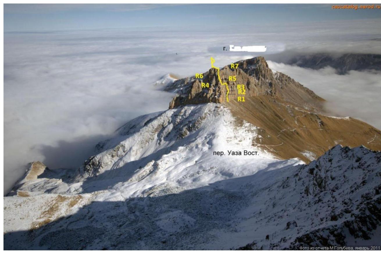
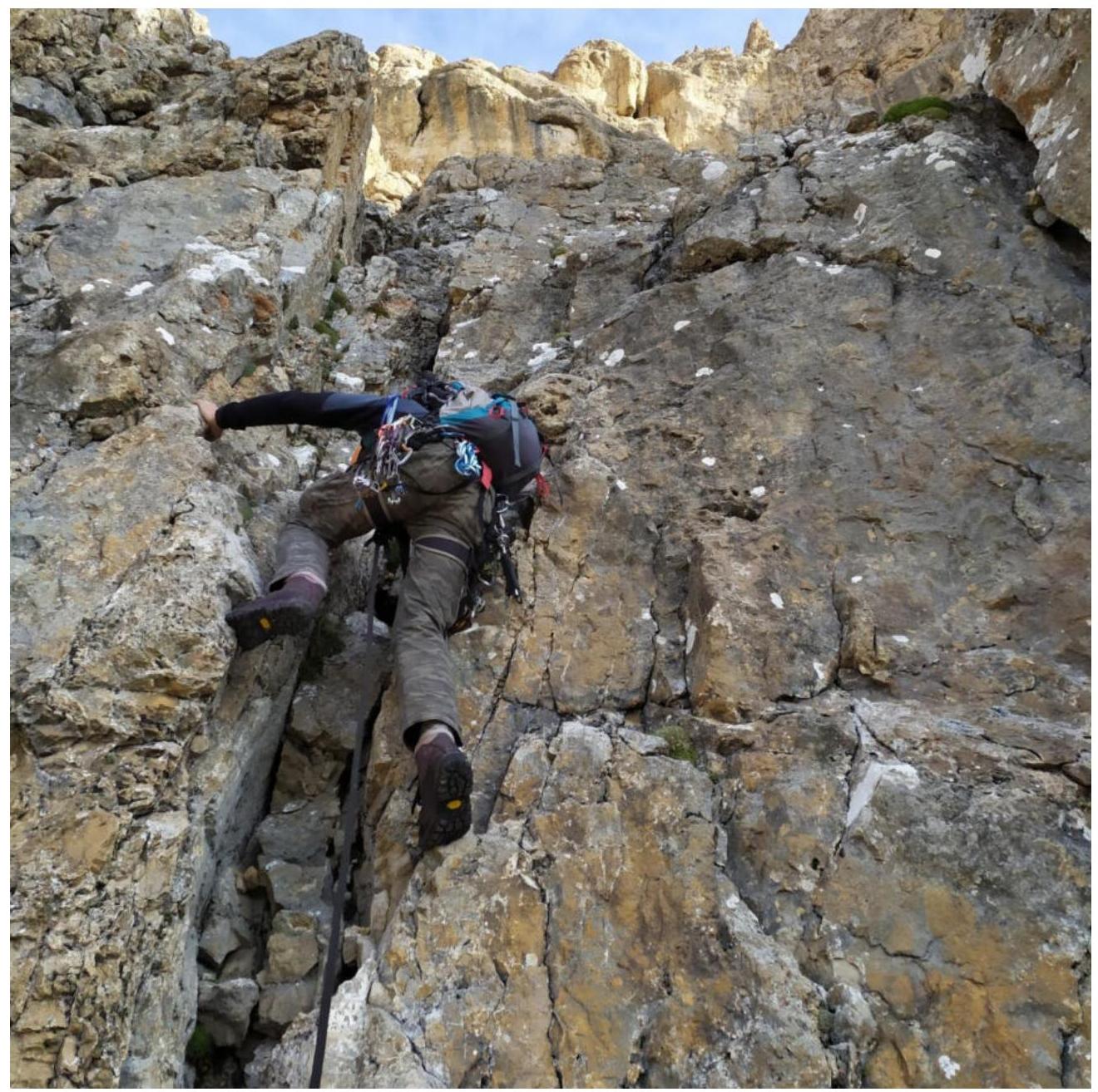
Technical photograph of the route. View from the summit of Uaz.
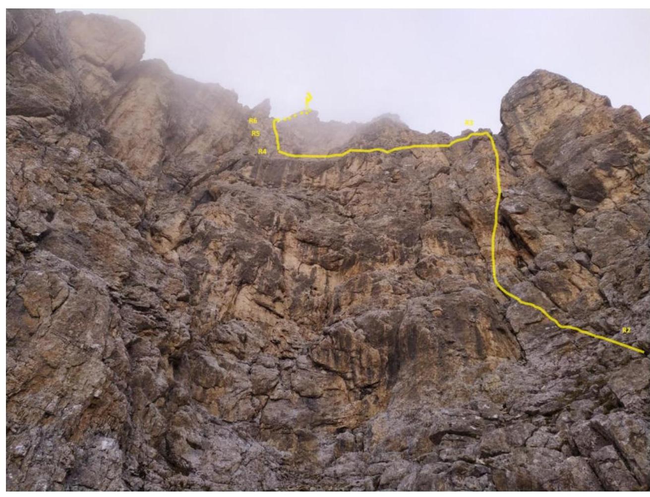
Technical photograph of the route, view from the cirque with R1.
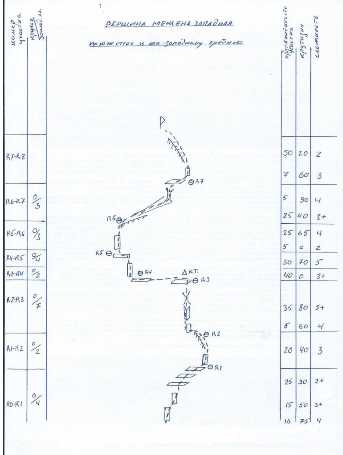
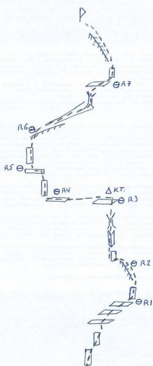
Route diagram
Technical Description of the Route (Presumably 4A Category of Difficulty) to the Summit of Meshchana Zapadnaya via the South Wall and Southwest Ridge
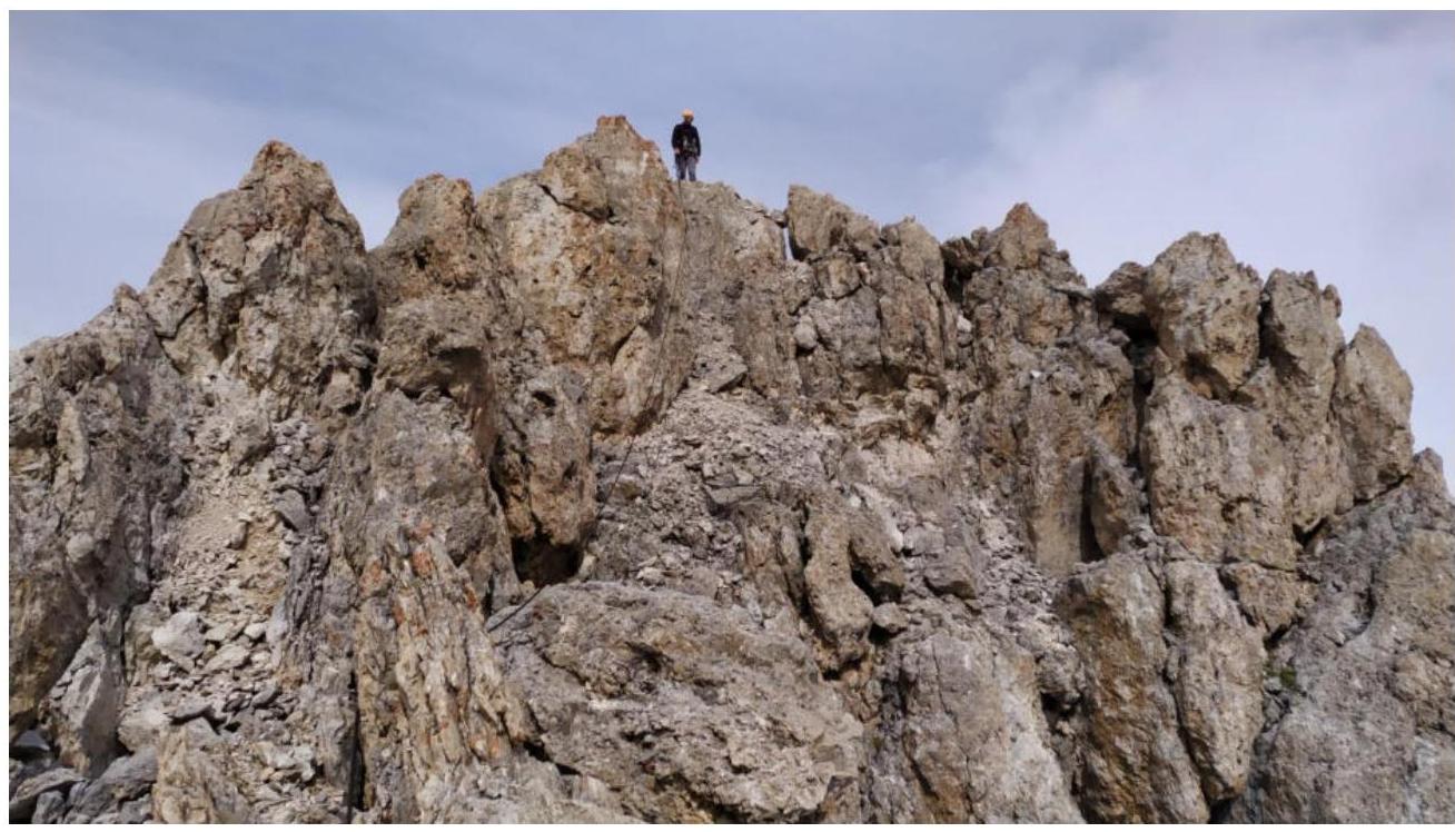
R0–R1. The route begins 80 meters to the right of the end of the south wall of Meshchana Zapadnaya, from a large boulder. 10 m up the wall, 4, 75°. Then the wall eases to 50°, 15 m, 3+ — exit to a rock cirque, then up and right 25 m, 2+ 30° to a rocky ridge. R1–R2. Ascend right to the ridge and along it to the wall 20 m, 3, 40°. R2–R3. Traverse left along the wall 5 m under an internal corner, 4, 60°. Then up the internal corner transitioning into a chimney 35 m, 80°, 5+ to a convenient ledge. On the ledge, there is a control cairn. R3–R4. Traverse left along the ledge 40 m, 3+ to a mini-cirque. On its left wall — a belay station. R4–R5. Up the left wall and internal corner 30 m to a wide ledge, 70°, 5. R5–R6. Traverse left along the ledge 5 m, 2, and from the left part of the ledge up the wall 65°, 25 m, 4 — exit to the southwest ridge. R6–R7. Traverse to the left side of the ridge into a large internal corner — a couloir and up it to a chimney 25 m, 40°, 3+. Then up the chimney 5 m, 90°, 4 — exit to an inclined scree ledge. R7–R8. From the ledge up and right 7 m, 60°, 3 — exit to a broken pre-summit ridge and along it 50 m, 20°, 2 — to the summit. Descent via the ascent route, 4 rappels. Recommendations: The route corresponds, in our opinion, to the declared category of difficulty. Comparison was made with similar 4A category routes on Meshchana Tsentralnaya (Egorin) and on MNR — southwest ridge via the south edge "Konfeta". Except for the last rope, the rocks are monolithic. The terrain is convenient for organizing belay points. Medium friends, medium and small placements go well. Pitons and anchors were not needed. In winter and during the off-season, there may be ice in the cirque and the left part of the southwest ridge.
R0–R1
Continuation of section R0–R1
Section R1–R2

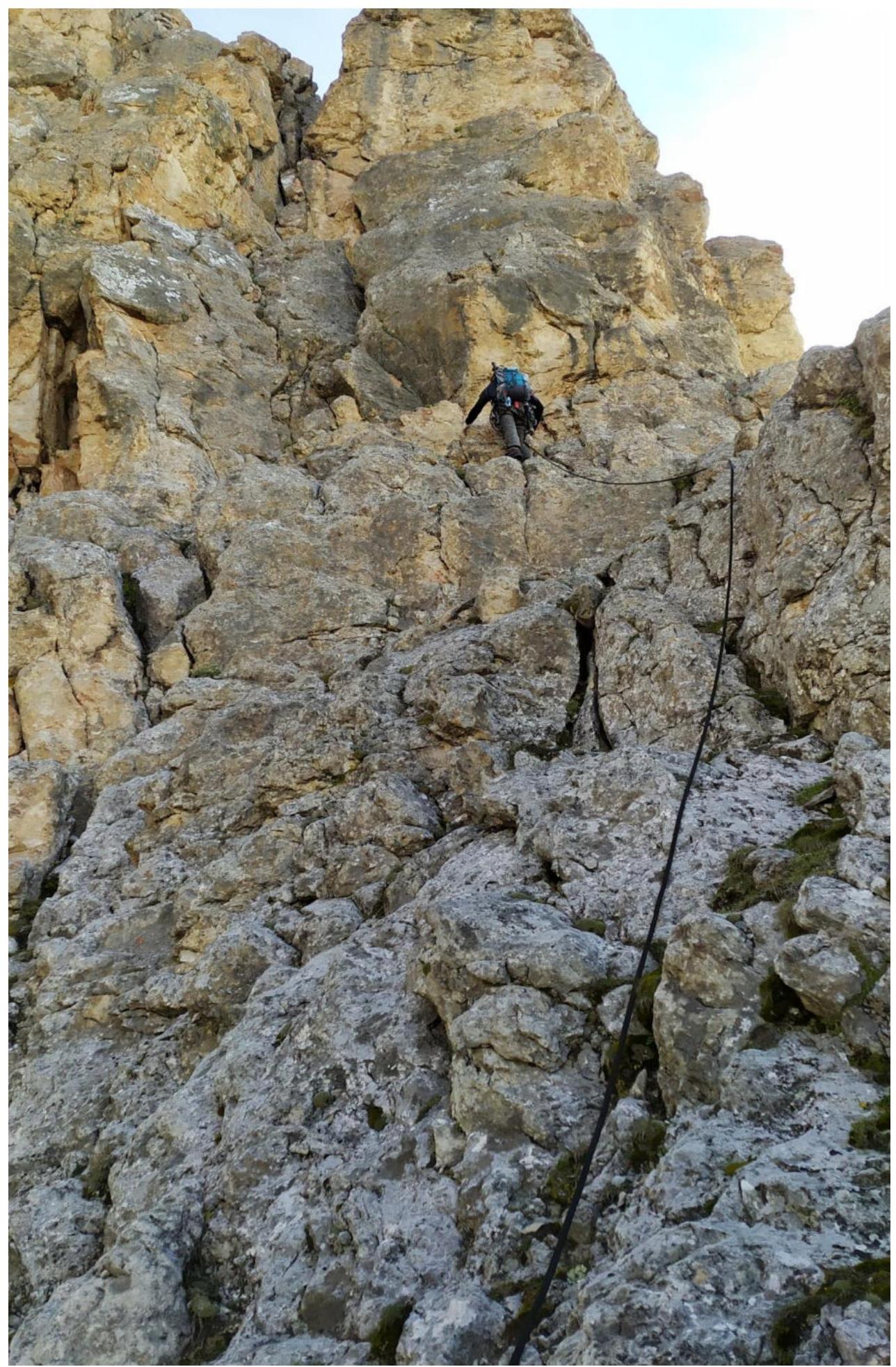
R2–R3
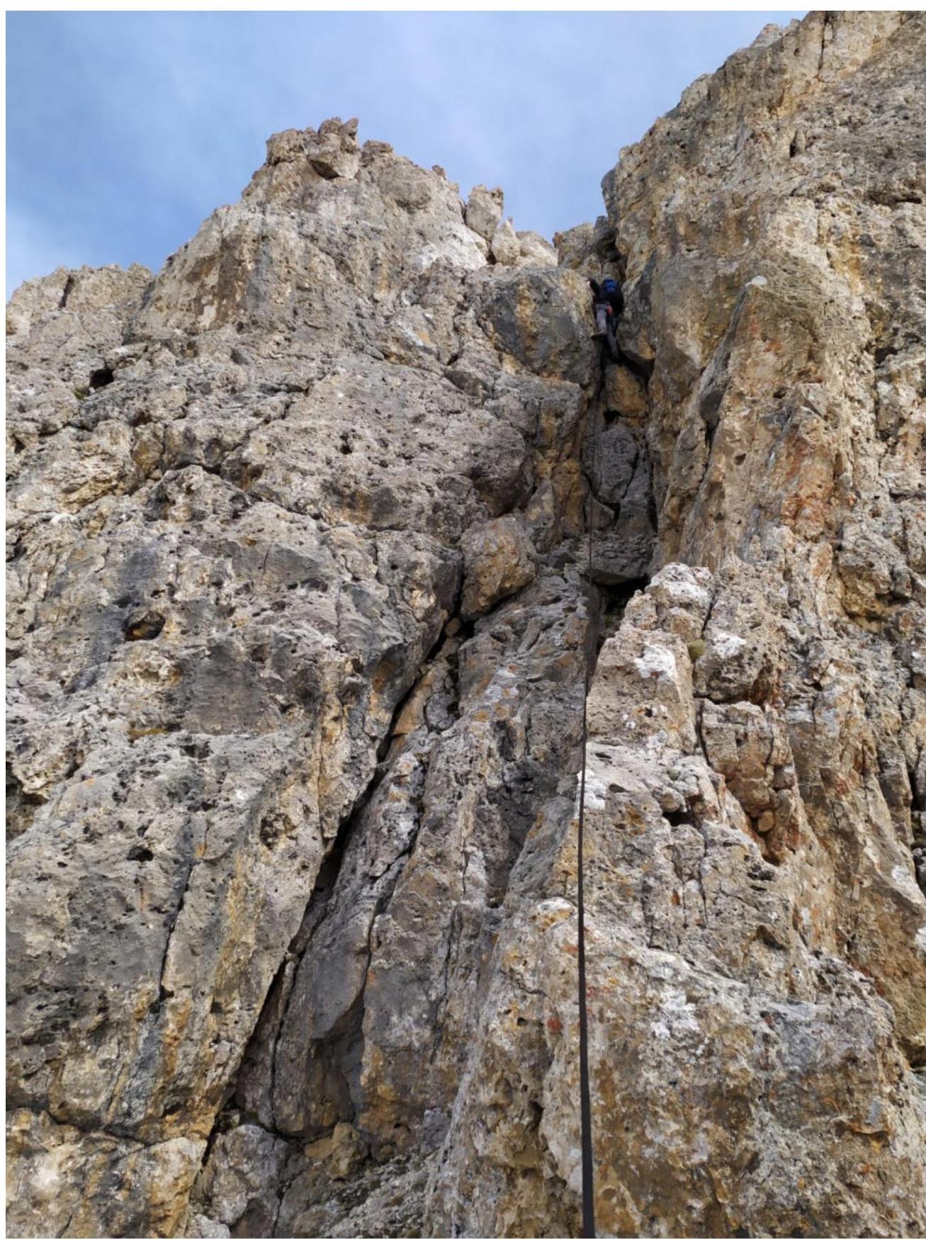
Section R3–R4
Section R4–R5
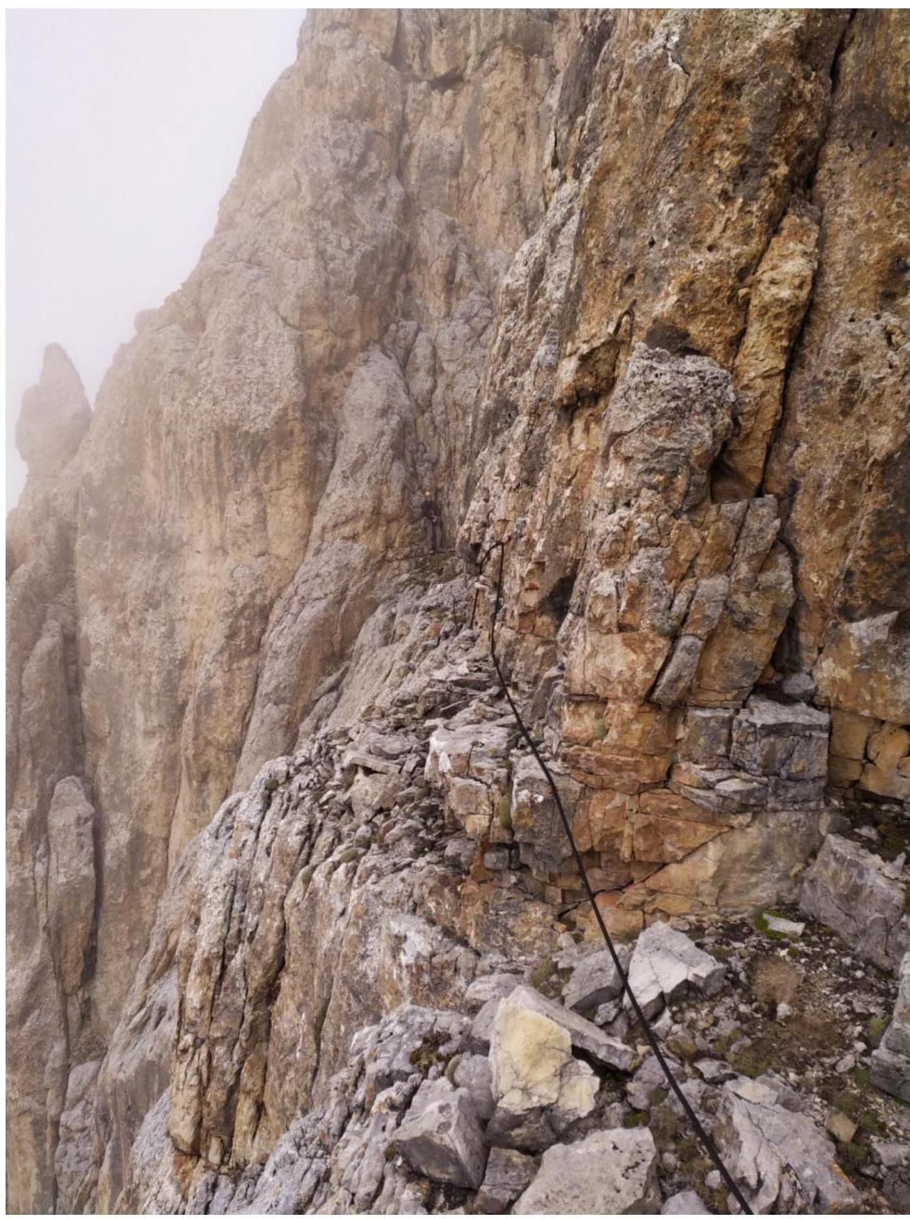
R5–R6
Section R6–R7
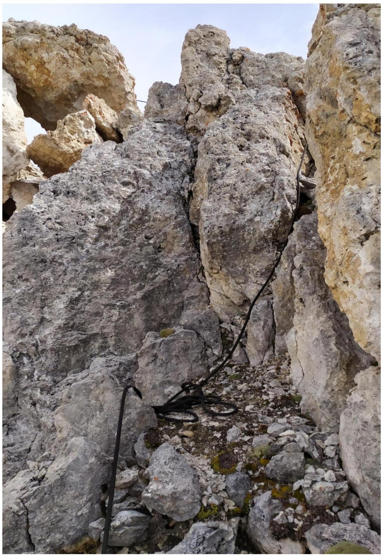
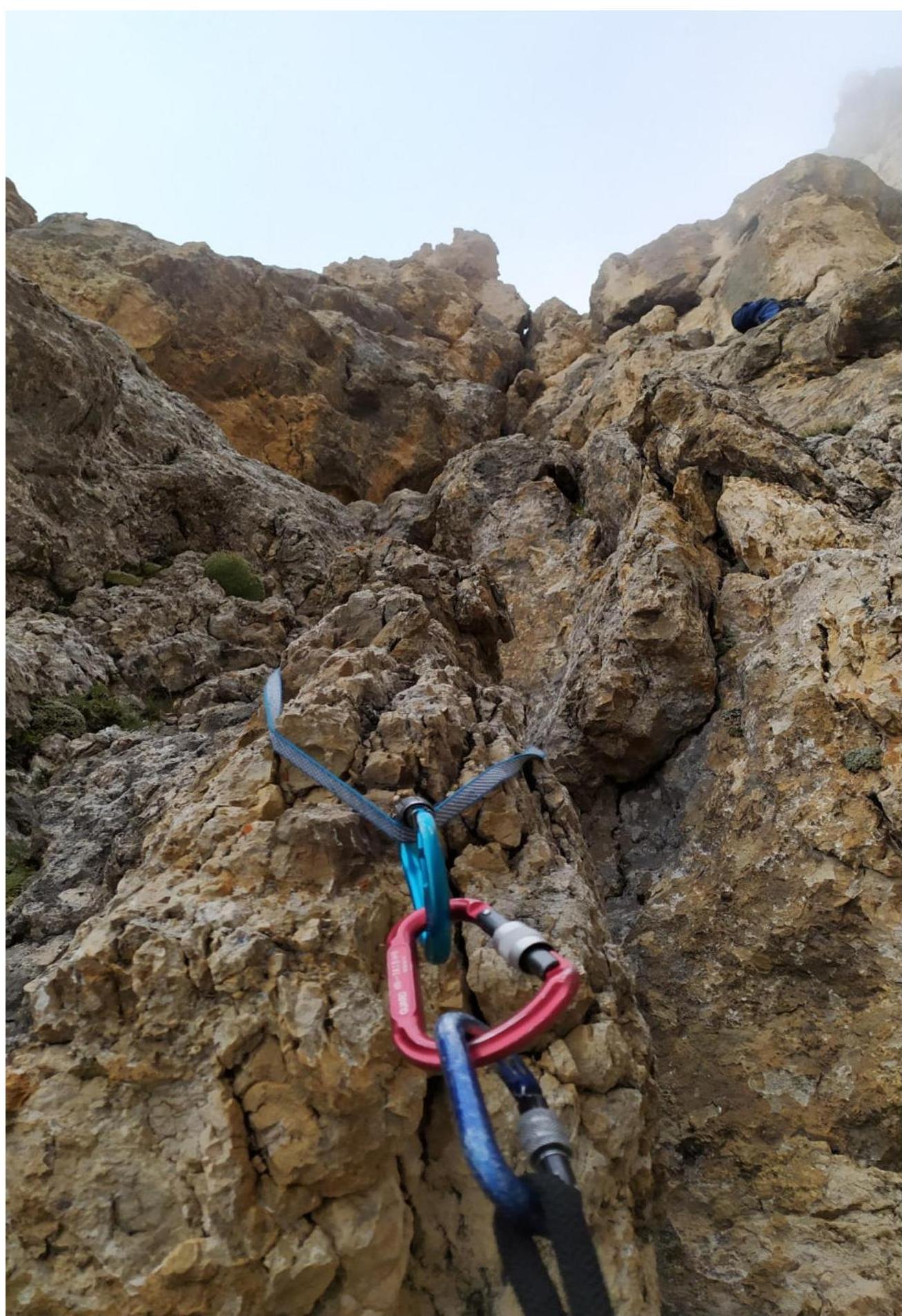
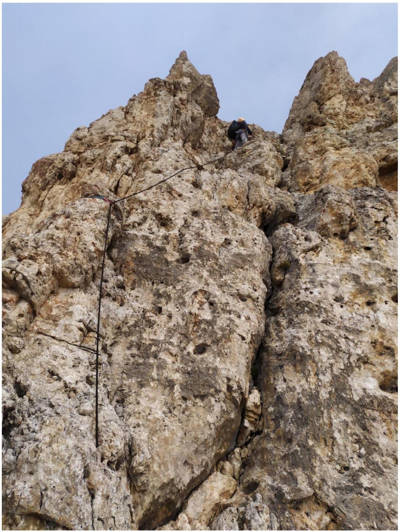
Section R7–R8, beginning
Section R7–R8, continuation
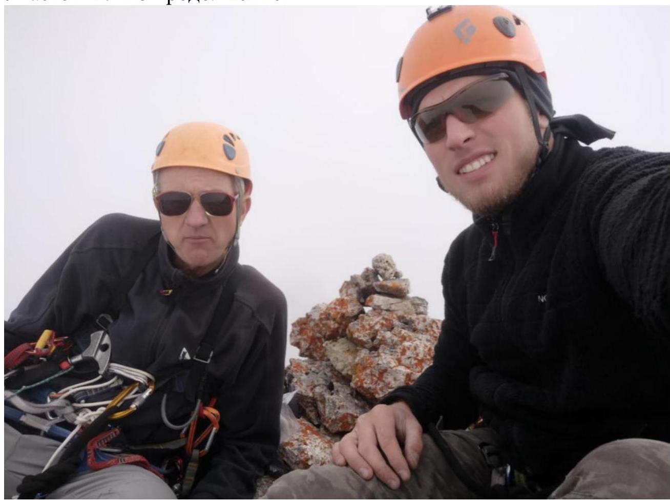
Photo at the summit


