Ascent Passport
-
Climbing category: rock.
-
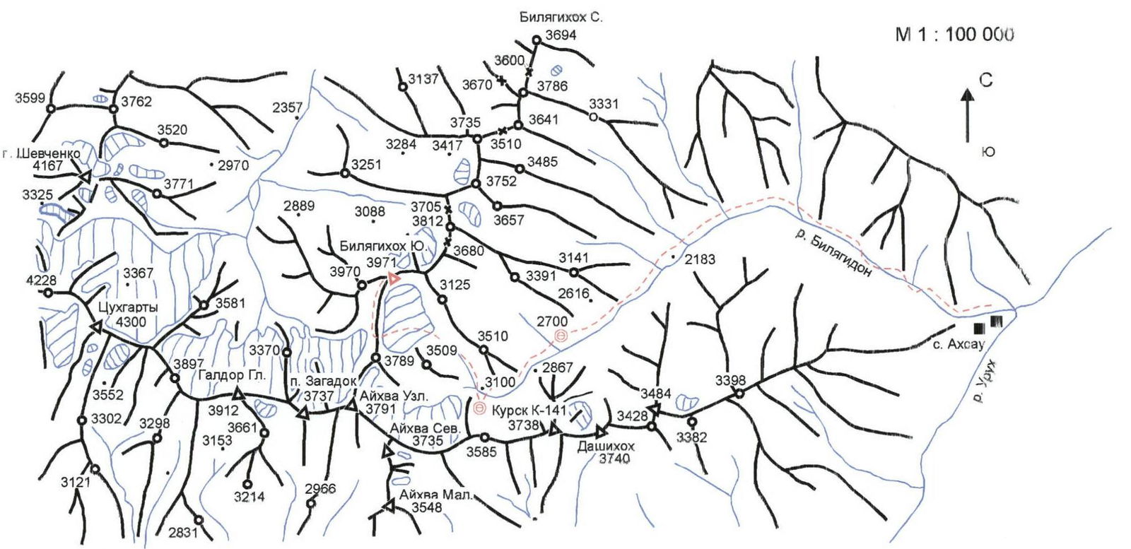
Ascent area: Caucasus, 2.0, Bilyagidon gorge.
-
Peak, route: Bilyagikhokh South (3971) South ridge.
-
Expected category of difficulty: 1B rock.
-
Route description:
height difference — 400 m, route length — about 800 m, length of sections:
- 3rd category of difficulty — 60 m.
- 2nd category of difficulty — 350–400 m, average steepness of the main part of the route — 45°
-
Pitons driven: protection through ledges.
-
Number of climbing hours/days: 3/1
-
Number of bivouacs: 2 in the upper reaches of Bilyagidon.
-
Leader: Levkovsky Yu. V. — CMS.
Participants:
- Gudenko N. V. — 1st sports category
- Gorbunov A. I. — 2nd sports category
- Suslova T. A. — 3rd sports category
- Chupin V. M. — 1st sports category
- Chupin R. M. — 1st sports category
-
Coach: Levkovsky Yu. V. — CMS.
-
Route entry: June 13, 2004. Return to bivouac: June 13, 2004.
-
Organization: KM FA RSO-Alania.
View from the East
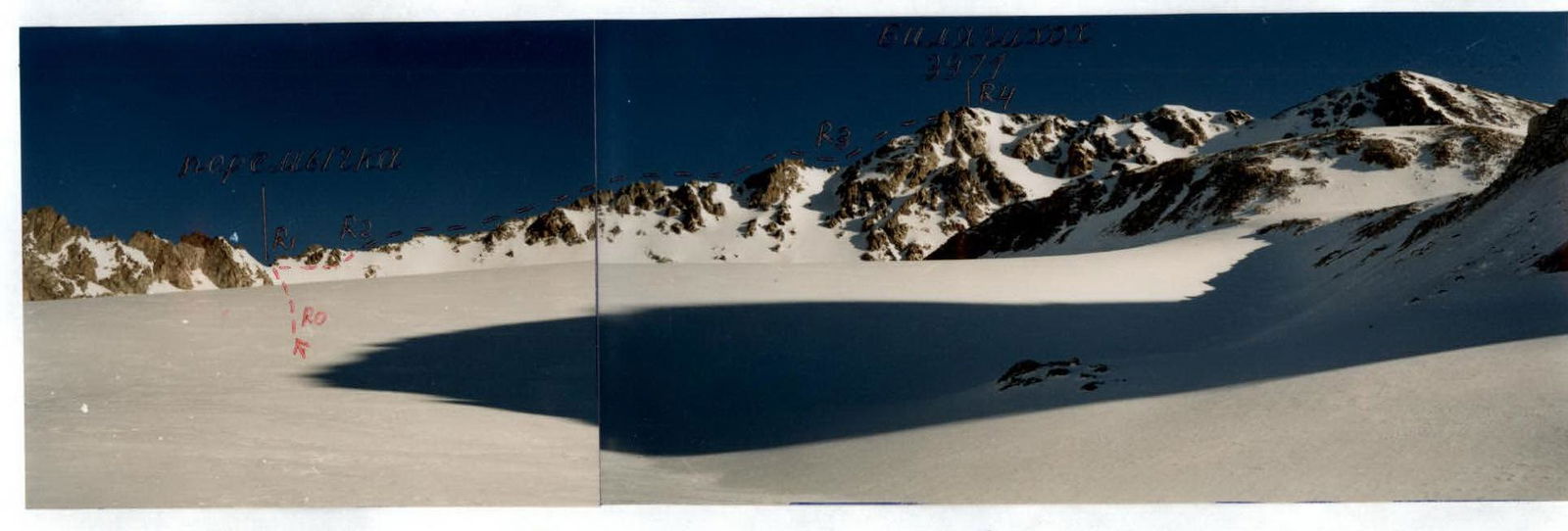
Taken from the upper circus of Northern Belag glacier. June 2004 (3550 m)
View from the East
R0–R1: 100 m; 40°; R1–R2: cat. diff. 2; 150 m; 45°; R2–R3: cat. diff. 2; 400 m; 45–50°; R3–R4: cat. diff. 3; 60 m; 50°; cat. diff. 2; 100 m; 45°
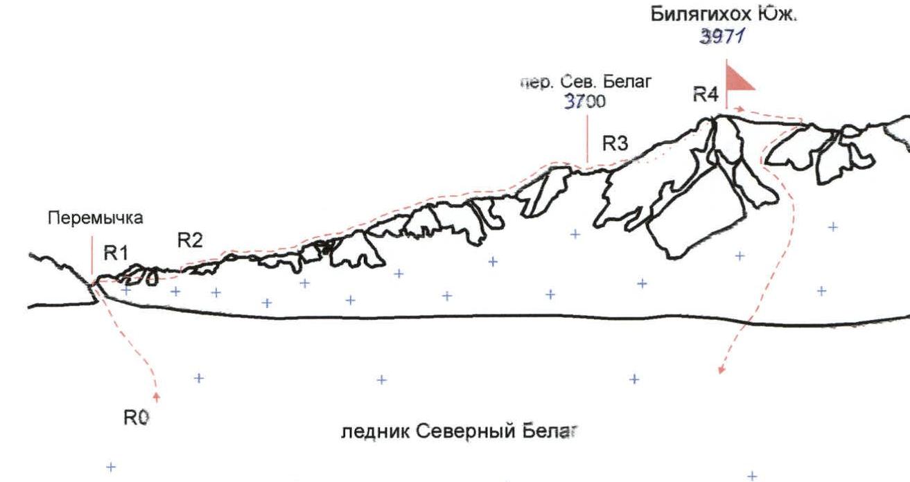
Route Description
From the bivouac in the upper circus, ascent along the left-bank moraine, then along the stream flowing from under the Northern Belag glacier. Further up along scree and snowfields (25–30°) from terrace to terrace. From the flat part of the upper terrace of the Northern Belag glacier, the view opens up to the peak of Bilyagikhokh South. From the bivouac 2 hours.
Along a wide snow-covered couloir with a steepness of 40°, ascent to the saddle at the end of the southern ridge of Bilyagikhokh South. From the saddle, move to the right, traversing along the slope of the ridge, bypassing rocks from below. After 150–200 m, reaching the ridge, move along simple, destroyed rocks of the ridge until reaching the Southern Belag pass. From the pass, 50 m up, then traverse left and up along rocks to reach the ridge. Before the pre-summit rise of the ridge, move left and then right and up along the rocky-scree slope to ascend to the summit. The summit is located in the western part of the massif and is an overview point. It is a not very pronounced rise of a narrow rocky-scree ridge. From the bivouac to the summit 4–5 hours.
The descent from the summit goes 120 m east along the ridge (protection through ledges), then down along a wide snow-scree couloir towards the Northern Belag glacier. In the upper part of the couloir, it is possible to hang rappel lines or make a rappel descent.
Brief Overview of the Ascent Area
In Digoria, the Sugansky ridge stretches in a latitudinal direction. In the eastern part of the Sugansky ridge, from the peak of Aikhva Uzlovaya (3791 m), the Belagsky spur (ridge) branches off to the north, with dominant peaks of Bilyagikhokh North (3694 m) and Bilyagikhokh South (3971 m). To the north, it connects with the Uazakhokh massif via a saddle of the Uazakhokh ridge. The Belagsky ridge separates the Khasnidon river gorge from the Urukh river gorge. The average height of the Belagsky ridge is 3500 m. The ridge is composed of destroyed shales; the peaks have the form of pyramids and trapezoids. Bilyagikhokh South is the highest peak of the Belagsky ridge, located in its southern part. It is connected to the peak of Aikhva Uzlovaya by a long saddle with frequent high gendarmes.
Modern glaciation on the Belagsky mountain node is poorly developed, represented by small cirque glaciers. The largest of them are the Southern and Northern Belag-cete, lying in the upper reaches of the Bilyagidon river. On the western slopes of the Belagsky massif, in the upper reaches of the Khasnidon river, lie two smaller glaciers — Aikhva and Geologov.
Approach Description
From the village of Akhsau in the Digor gorge, move along the Bilyagidon gorge along a dirt road, bypassing four bridges across the river. After 1.5 hours, behind the fourth bridge, the river goes into a canyon. From here, the trail now climbs up the slope, bypassing the canyon. After another 1.5 hours, it descends to the river, leading to a large koshu located on a high hill at the confluence of the left tributary, the Uazadon river (2000 m). From here, the view opens up to the upper part of the valley. Further up the valley, within one transition — an island of pine forest (2200 m), ruins of GRP. Further movement along the trail, crossing small streams by stones. To the south, the gorge is closed by a high (up to 300 m) ledge, from which the sources of the Bilyagidon river flow down in three waterfalls. They originate from under the Belag glaciers, located above the ledge in a three-stage circus. At the confluence of the two main sources of Bilyagidon, under the ledge — a bivouac (2700 m). From the village of Akhsau 5–6 hours.
Further movement from the bivouac along the grassy-scree slope of the left side of the river, gradually gaining height. The exit to the upper circus above the ledge passes in a smooth arc to the left and up. On the platforms of the right-bank moraine, there is a good bivouac (3100 m).

View from the summit of Uruimagovoy peak (3912)
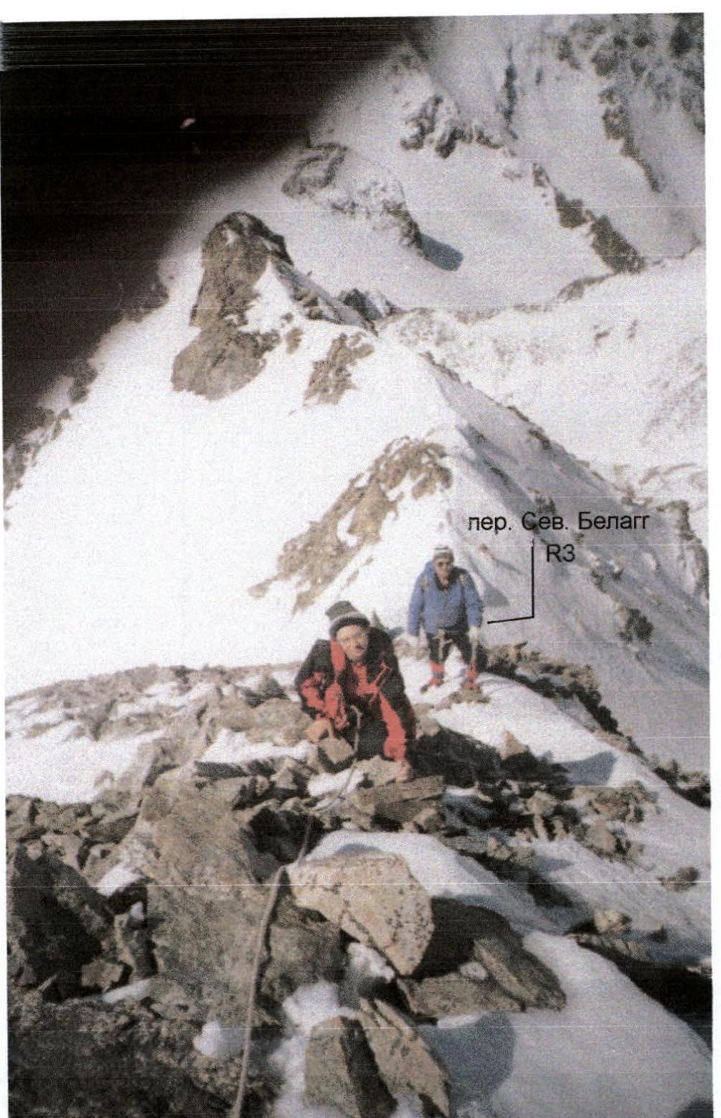
Section R3