Ascent Passport
- Central Caucasus, Bezengi gorge, section No. 2.5 of the route classifier for mountain peaks
- Peak name: Gestemony; route name: via the North wall (M. Khergiani, 1959)
- Complexity category: 5Б
- Route character: combined
- Route height difference: 1960 m (by altimeter)
Route length: 2990 m. Section length: V category: 938 m, VI category: 140 m. Average steepness:
- main part of the route: 65 °
- entire route: 56 °
-
Pitons hammered (in the denominator for artificial aids): rock: 20/6 chockstones: 91/4 ice: 89/4 bolts: 0 Total artificial aids used: 14
-
Team's walking hours: 53 h, 6 days
-
Leader: Gukov Alexander Borisovich, 1st category
Team members:
- Bukinich Alexey Radevich, candidate master of sports
- Ivanov Kirill Germanovich, candidate master of sports
- Izotov Albert Olegovich, candidate master of sports
- Koval Viktor Alexandrovich, 1st category
- Kondrashkin Sergey Vladimirovich, 1st category
- Coach: Kapitanov Oleg Viktorovich, master of sports, instructor 1st category
- Route entry: January 6, 2008, 4:30
Summit: January 11, 2008, 14:30
Return to base camp: January 12, 2008, 18:00
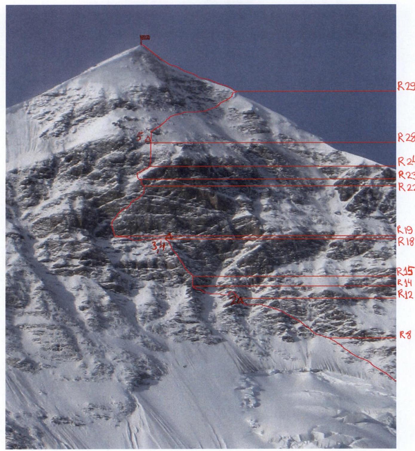
Overall photo of the summit
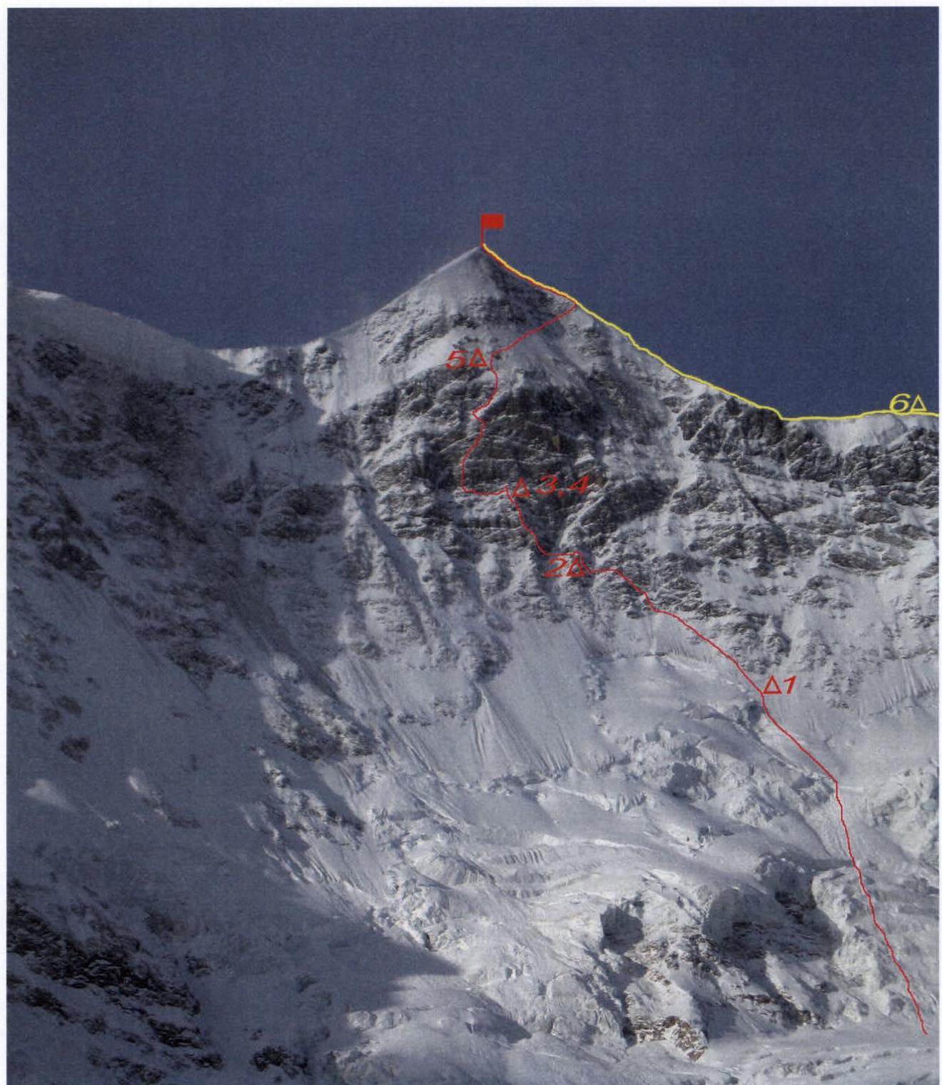
Note: the route taken by the team is marked with a red line; the descent path is marked with a yellow line.
The photo was taken in January 2008 from the Bezengi glacier.
Half-profile of the wall from the left
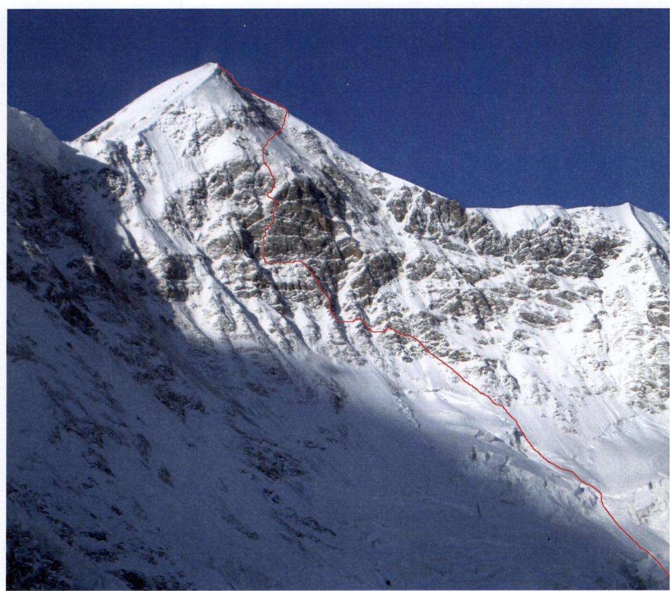
The photo was taken in January 2007 from the moraine behind the turn of the Bezengi glacier towards the Dzhangi-Kosh hut.
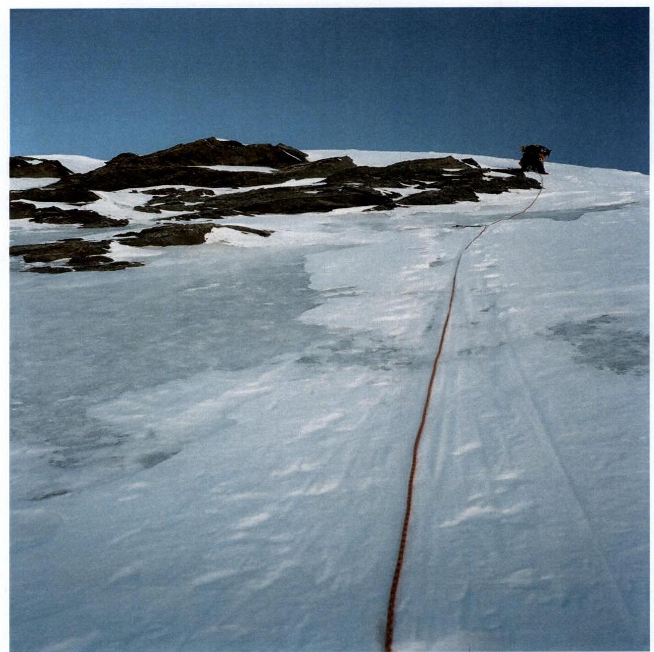
Profile of the route taken by the team

The photo was taken from the upper part of the Tsanner icefall on January 12, 2008.
Drawn profile of the route up v. Gestola via the North wall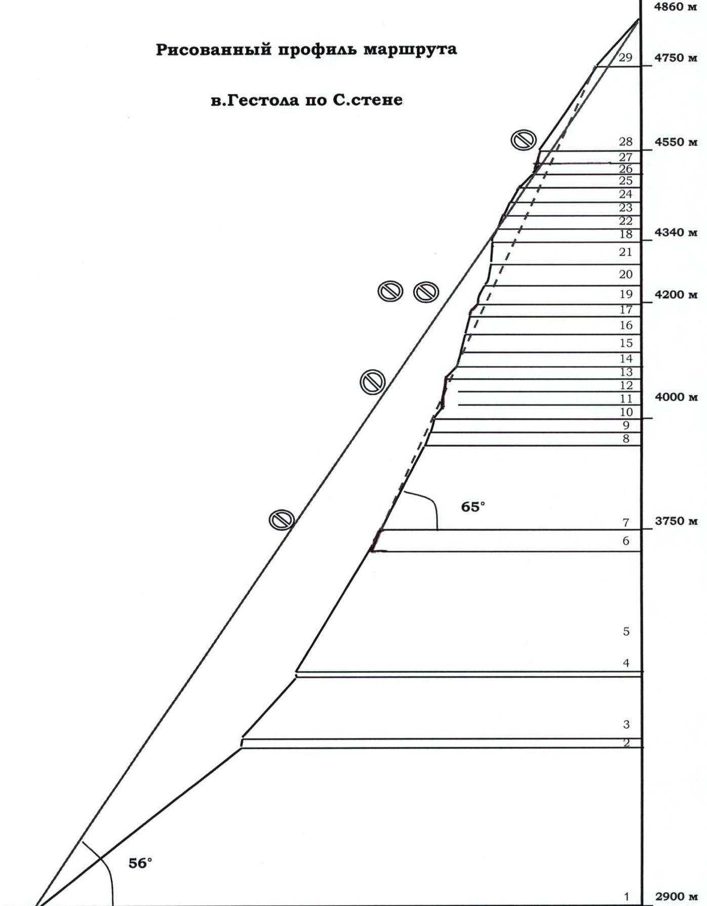
The average angle of the route is 56 °, the average angle of the wall section is 65 °. Overall photo of the Bezengi wall and the peak Gestola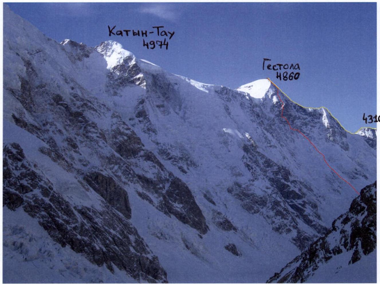
Note: The route taken by the team is marked with a red line. The yellow line marks the traverse route p. 4310 – Gestola (also the team's descent route).
The photo was taken in January 2007 from the slope of Pushkin Peak.
Ascent graph to v. Gestola via the North wall
| Section # | Pitons | UIAA scheme | Category | Length (m) | Average steepness (°) | Photo | |||
|---|---|---|---|---|---|---|---|---|---|
| rock | chock | Bolt | A | ||||||
| 7 | 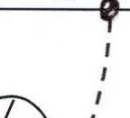 | 4 | 30 | 55° |  | ||||
| 6 | 6 | ice wall | 5 | 80 | 70° | ||||
| 5 | 0 | 0 | 0 | 4 |  | 4 | 520 | 60° | 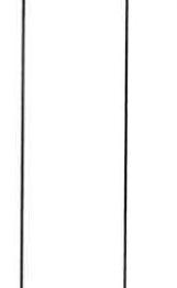 |
| 4 | 0 | 0 | 0 | 3/4 |  | 5+ | 5 | 95° | |
| 3 | 0 | 0 | 0 | 5 | 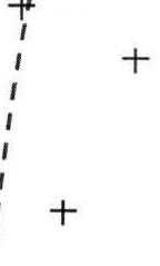 | 4 | 150 | 50° | |
| 2 | 0 | 0 | 0 | 8 | 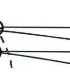 | 5+ | 40 | 85° | |
| 1 | 0 | 0 | 0 | 0 | 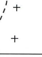 | 3 | 700 | 35–40° | |
| Section # | Pitons | UIAA scheme | Category | Length (m) | Average steepness (°) | Photo | |||
| :------: | :----: | :-: | :-: | :-: | :---------: | :------: | :-------: | :----------: | :--: |
| rock | chock | Bolt | A | ||||||
| 17 | 0 | 3 | 0 | 0 | R17–R18 | 4 | 30 | 50° | |
| 16 | 2 | 6 | 0 | 0 | 5 | 45 | 75° | ||
| 15 | 2 | 7 | 0 | 0 | 5 | 45 | 75° | ||
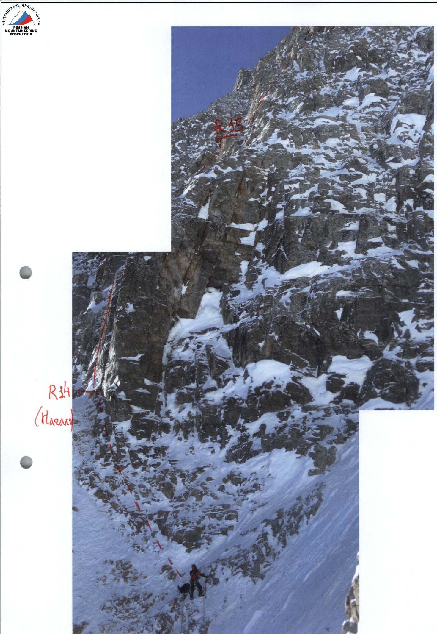
| 14 | 3/1 | 7/2 | 0 | 0 | Start of movement along the central buttress R14 | 6 A1 6 | 5 35 | 85° 85° | |
| 13 | 0 | 3 | 0 | 1 | 4 | 50 | 50° | ||
| 12 | 0 | 6 | 0 | 0 | 5 | 40 | 65° | ||
| 11 | 1 | 5 | 0 | 0 | 5 | 45 | 75° | ||
| 10 | 0 | 7 | 0 | 0 | 5 | 45 | 70° | ||
| 9 | 8 | 10 | destroyed rocks | 5 | 150 | 65° | |||
| 8 | 0 | 0 | 0 | 15 | |||||
| Section # | Pitons | UIAA scheme | Category | Length (m) | Average steepness (°) | Photo | |||
| :------: | :----: | :-: | :-: | :-: | :---------: | :------: | :-------: | :----------: | :--: |
| rock | chock | Bolt | A | ||||||
| 29 | 0 | 0 | 0 | 0 | summit ridge R29 | 2 | 200 | 50° | |
| 28 | 0 | 5 | 0 | 22 | + ice slope with rock outcrops R28 | 5 | 300 | 55–60° | |
| 27 | 0 | 1 | 0 | 2 | 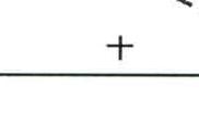 | 4 | 30 | 55° | |
| 26 | 0 | 0 | 0 | 3 | 4 | 40 | 55° | ||
| 25 | 2 | 5 | 0 | 0 | 5 | 55 | 65° | ||
| 24 | 1/1 | 2 | 0 | 1 |  | 3 5 3 | 10 8 20 | 60° 90° 60° | |
| 23 | 0 | 2 | 0 | 1 | 4 | 40 | 60° | ||
| 22 | 0 | 7 | 0 | 2 | 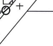 | 5 5+ | 25 15 | 70° 80° | |
| 21 | 4/2 | 5/1 | 0 | 0 | 6 A1 | 50 | 85° | ||
| 20 | 4/2 | 4/1 | 0 | 0 |  | 6 A1 5 | 35 10 | 85° 50° | |
| 19 | 1 | 2 | 0 | 5 |  | 5 6 | 30 15 | 60° 85° | |
| 18 | 0 | 6 | 0 | 1 |  | 4 | 60 | 55° |
The photo was taken in January 2008 from the Bezengi glacier.
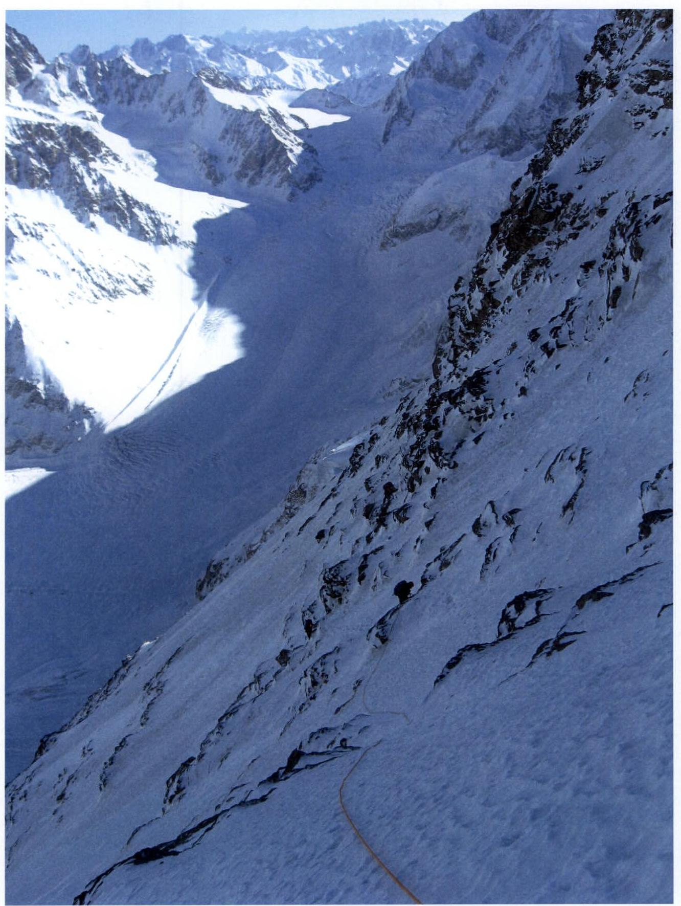
Δ2 – May 7, 2008; height ≈ 4000 m
Δ3,4 – January 8–9; height ≈ 4200 m
Δ5 – January 10; height ≈ 4550 m
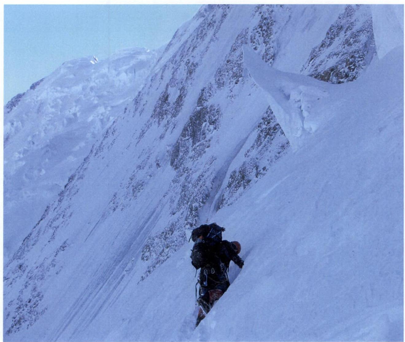
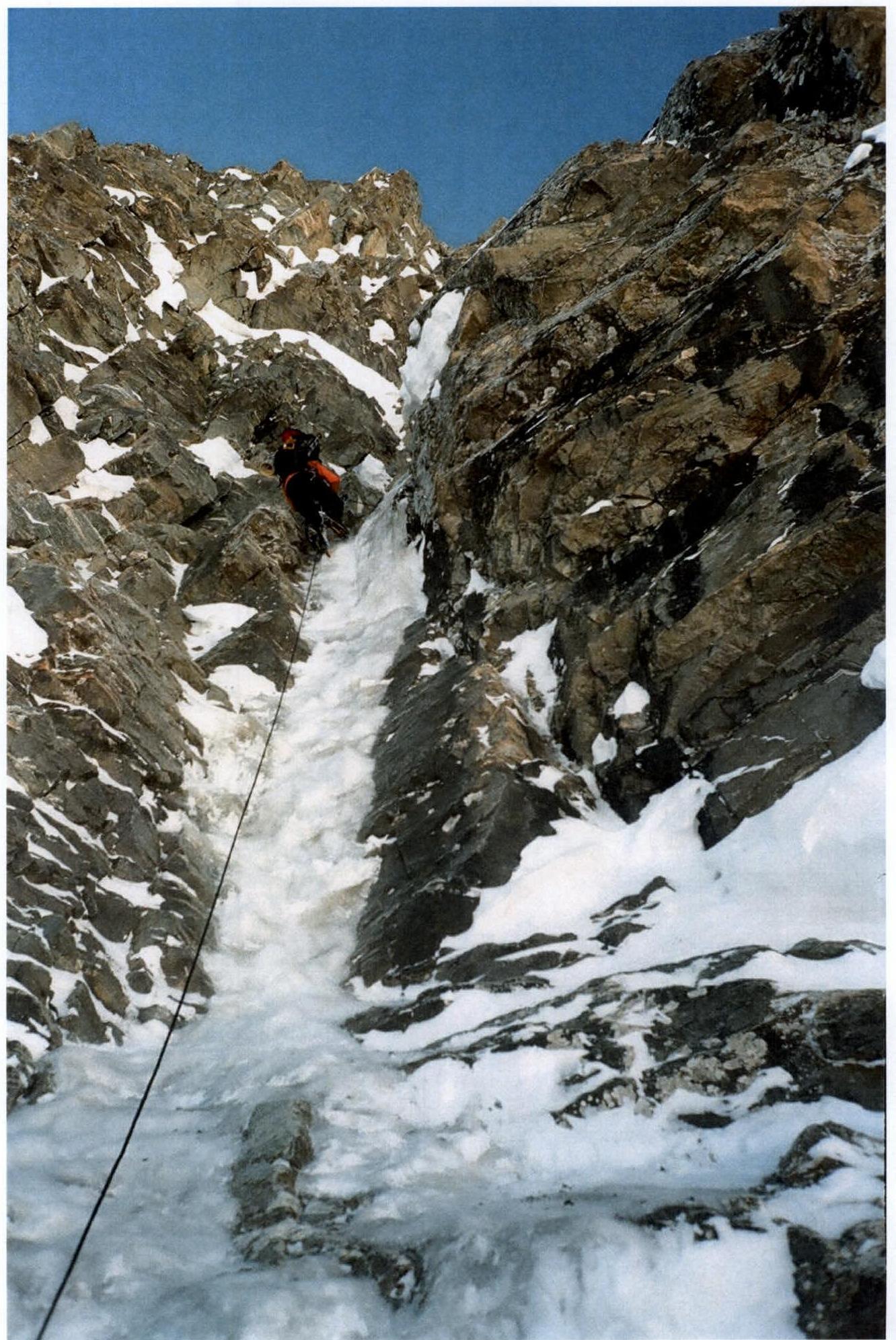
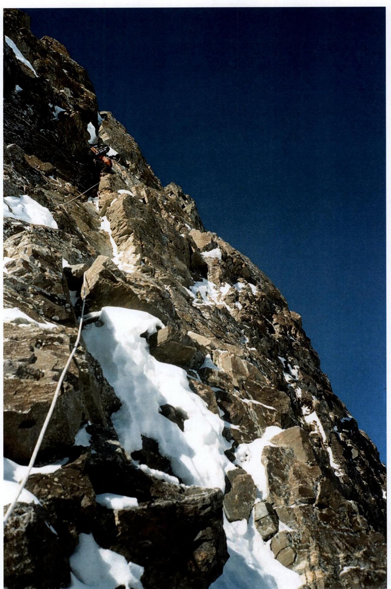
Passing the snowy slope in the upper part of section R4, Izotov
January 6, 2008
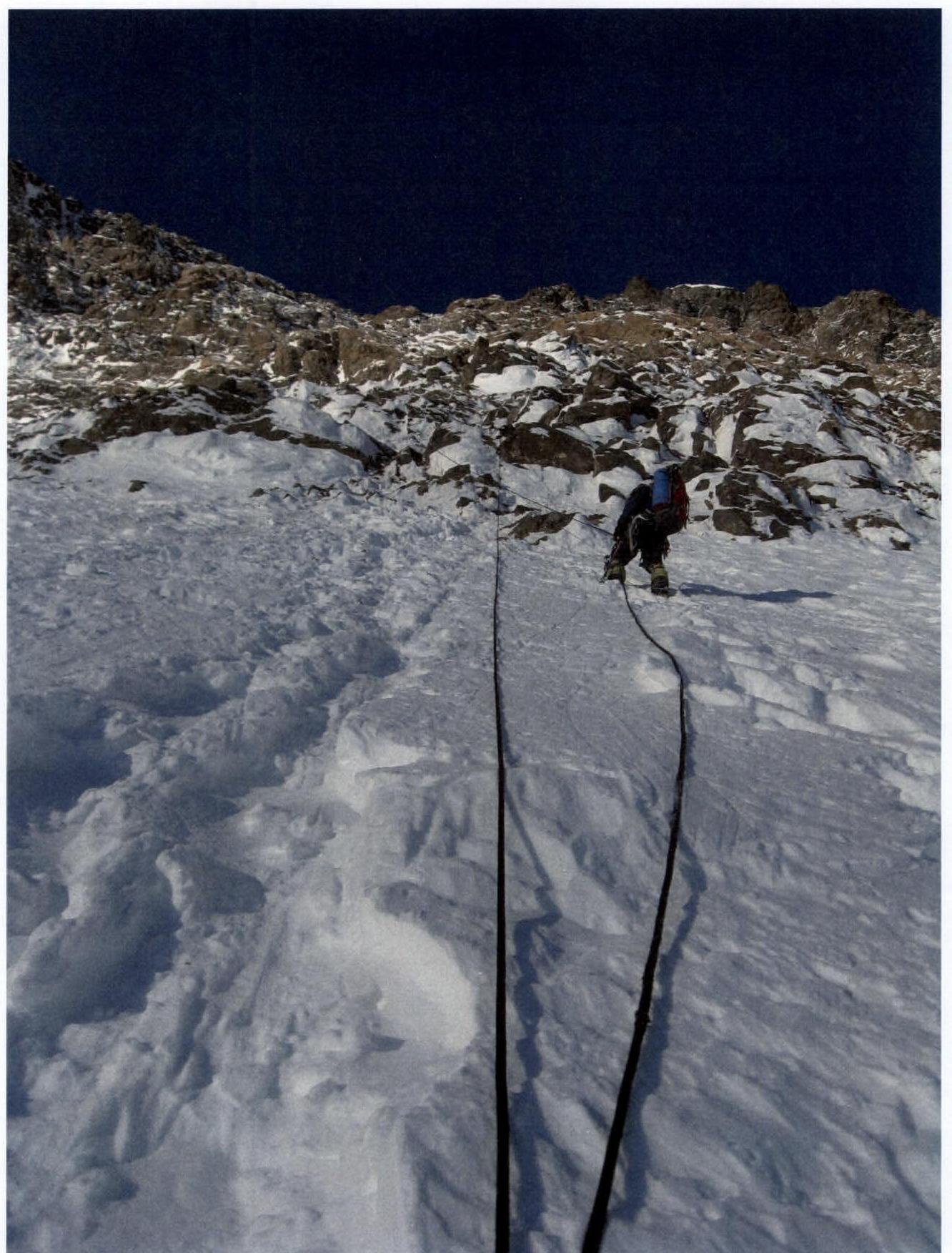
End of the snowy slope and exit under the wall. Section R10, Gukov January 7, 2008
Section R9. Gukov January 7, 2008
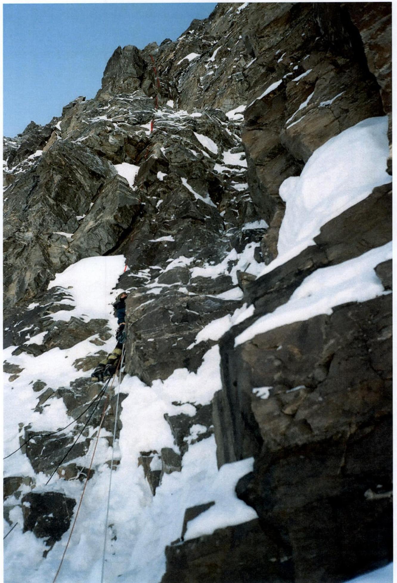
Exit from the snowy couloir and start of movement along section R14. Kondrashkin January 8, 2008

Internal angle on section R14, Gukov January 8, 2008
Ascent via ladders through the frozen internal angle of section R19, Koval January 9, 2008
Processing section R20. Kondrashkin January 9, 2008
Processing section R20. Gukov
January 9, 2008
Ascent via ladders on section R20, Koval
January 10, 2008
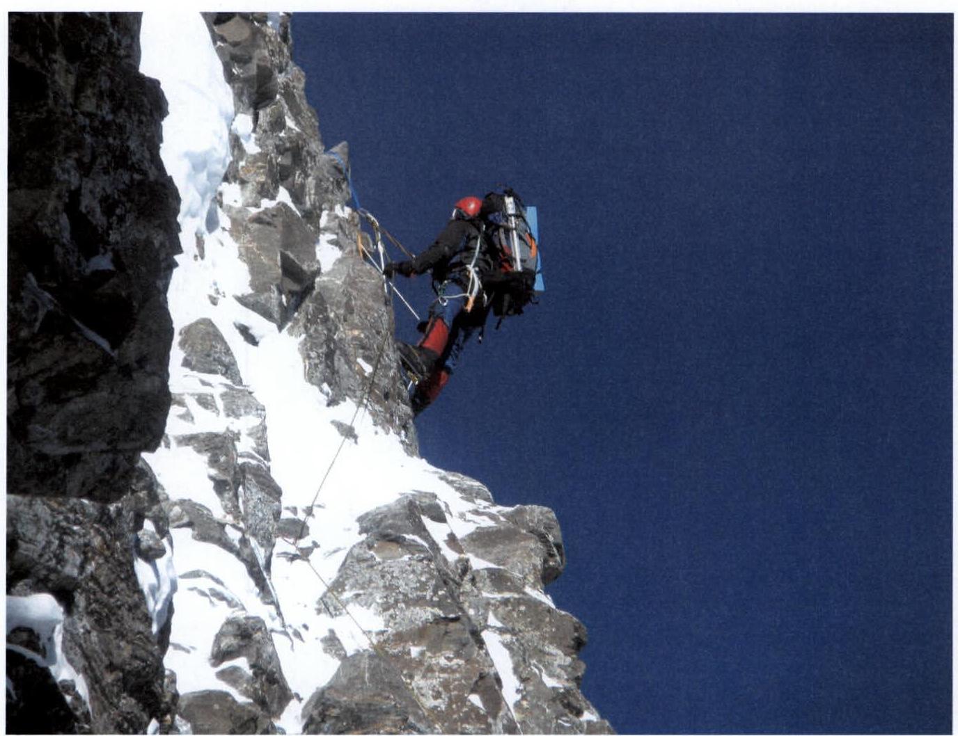
Station after passing section R20. Izotov
January 10, 2008
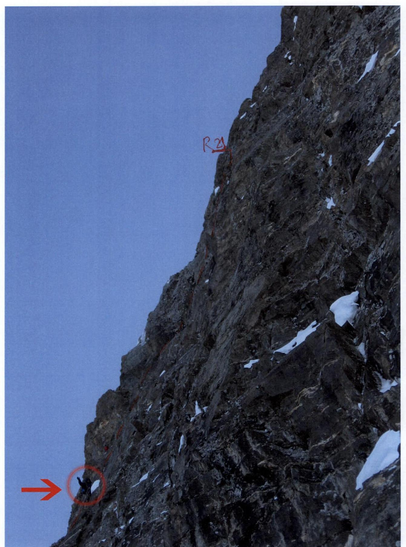
Start of movement on section R21. Koval January 10, 2008
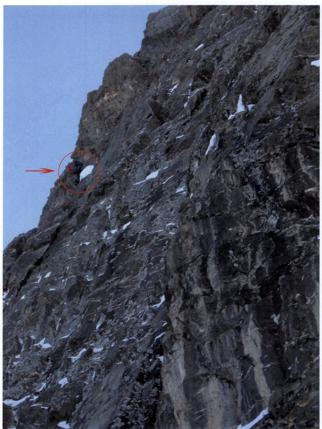
Exit from the main wall mirror onto an inclined snow shelf (couloir). Section R22, Koval January 10, 2008
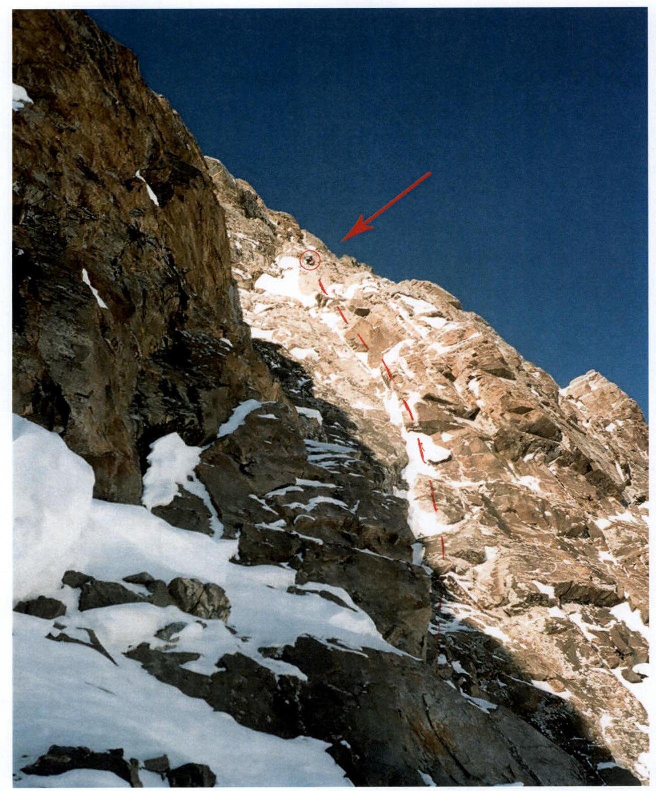
Movement along the snowy-icy dome of the summit. Middle part of section R28, Kondrashkin, Izotov, Gukov January 11, 2008
Exit onto the summit ridge (end of section R28), Koval
January 10, 2008
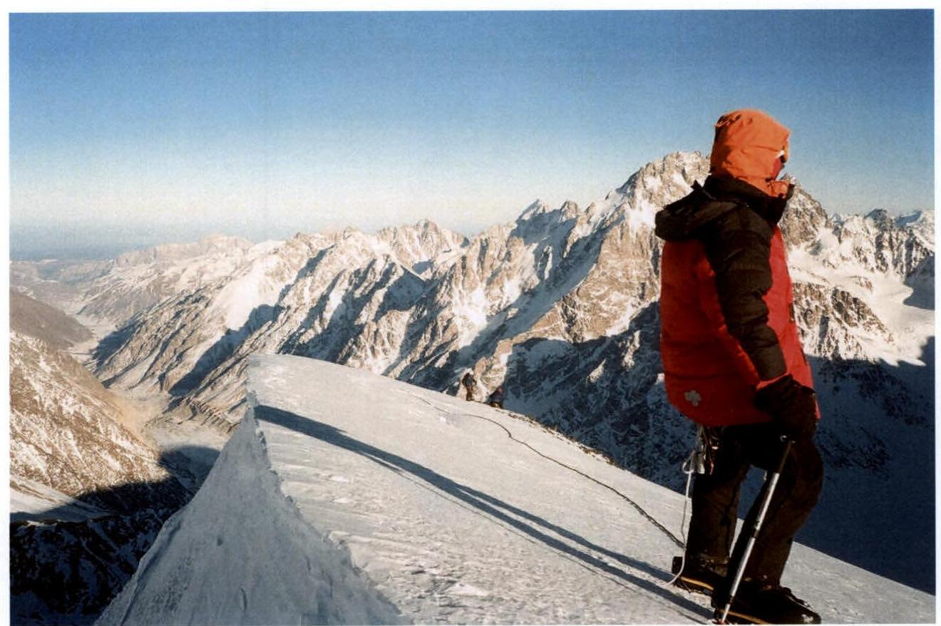
Photo at the summit of Gestola Peak. In the foreground is V. Koval. In the background, A. Gukov and S. Kondrashkin are at the control tour. Photo by A. Izotov. January 11, 2008
Team's Tactical Actions
The route to Gestola Peak via the North wall was chosen by the team as the target for a winter ascent back in January 2007. Observations of the route in winter 2007 (in January and late February) showed that it is significantly safer than in the summer period when the route is regularly "hit" by avalanches, icefalls, and rockfalls.
All team members had experience in winter ascents, including in the Bezengi area.
Upon arrival at the camp on December 29, 2007, on December 30 and 31, a reconnaissance and observation of the route was conducted directly from the starting point (the confluence of the Tsanner glacier and the Bezengi glacier), and a route was chosen for the most objectively hazardous part of the route - the snowy-icy slope leading to the wall. On January 2 and 3, as acclimatization, the group made an ascent to Gidan Peak (4100 m).
Observations of the route showed that the seemingly simpler and more logical ascent via the snowy-icy slope on the left side with an exit directly under the central buttress of the wall is objectively very hazardous due to:
- overloaded snowy slopes along the ascent route;
- possible icefalls from the Katyn Plateau.
Therefore, a more technically difficult but safer ascent route was chosen on the right side of the slope, along an ice "board" between two rock outcrops and icefalls.
The lengthy snowy-icy slope with a height gain of about 900 m must be traversed in one day to set up a camp under the cover of the wall. Given the short daylight hours, a nighttime departure is necessary.
Possible emergency descent options are considered:
- Before reaching the summit dome, descent is only possible via the ascent route!
- From the summit dome, it is possible to traverse to the right onto the shoulder of Gestola.
- From there, as an option, descent via the Chyurlenis Pass.
From the available report on the ascent via the 1969 route by P.V. Egorov's group, it is clear that there are very few places for setting up camps on the route (at the base of the central buttress of the wall and on a snowy ridge under the main wall mirror). There are no campsites in the upper part of the route. Comparing the summer ascent speed of the 1969 team with the winter conditions, we infer the possible speed of our ascent and determine possible campsite locations. We plan to reach a convenient shelf under the main wall mirror on the third day. We decide to process the most challenging section of the route from the convenient shelf under the main wall mirror so that we can ascend via the pre-fixed ladders onto the snowy-icy dome of the summit where a camp can be set up in the ice (a "lochanka").
The overall tactical plan for the ascent is 10 days:
- Day 1 - approach to the route;
- Day 2 - traverse the snowy-icy slope, exit under the wall;
- Day 3 - traverse to the central buttress of the wall and start moving along it;
- Day 4 - exit under the main wall mirror;
- Day 5 - process the main wall mirror;
- Day 6 - exit onto the snowy-icy dome of the summit;
- Day 7 - ascend to the summit and descend towards peak 4310 m with a camp on the "shoulder" or at the Chyurlenis Pass;
- Day 8 - descend to the Tsanner glacier via peak 4310 m (via route 4A category);
- Day 9 - return to the camp;
- Day 10 - reserve day.
On the evening of the first day after departing from the AUSB "Bezengi" and camping at the confluence of the Tsanner glacier and the Bezengi glacier, two team members felt unwell: Bukinich A.R. (fever and sore throat) and Ivanov K.G. (pain in fingers that had suffered 2nd-degree frostbite during the summer season of 2007). After receiving information via communication with the camp about the expected temperature drop to -35 °, the team decided to avoid possible health complications for Bukinich and Ivanov by terminating the ascent. Bukinich was sent to the camp for treatment, and Ivanov was tasked with observing the team from the starting point. At the Tsanner glacier camp, the team left one tent, a burner, and a set of products for observer Ivanov.
The planned movement schedule and campsite locations largely coincided with the actual execution.
In the lower part of the route, when exiting under the base of the wall, considering the increased avalanche hazard of the slopes, the team decided to abandon the traverse to the left along the snowy-icy slope to the base of the central buttress of the wall (the route taken by the first ascenders). Instead, they moved towards the central buttress initially along the boundary and then along the lowest rock belt. The descent from the "shoulder" of Gestola to AUSB "Bezengi" took 1 day instead of the planned 2.
The lengthy and logical route, requiring thorough tactical planning, physical and technical preparedness of the participants, with diverse forms of mountain relief, is considered by all participants to deserve a qualification of 6Б category. All routes of 5Б category completed by the team members in the Bezengi area (Shkhara Main via the North ridge, Koshtan-Tau via the NW ridge of the 3rd Crest, Shota Rustaveli via the North wall, Ural V. via the SE wall of the South counterfort) are technically much simpler than the present route.
Route Description: Day 1 (January 6)
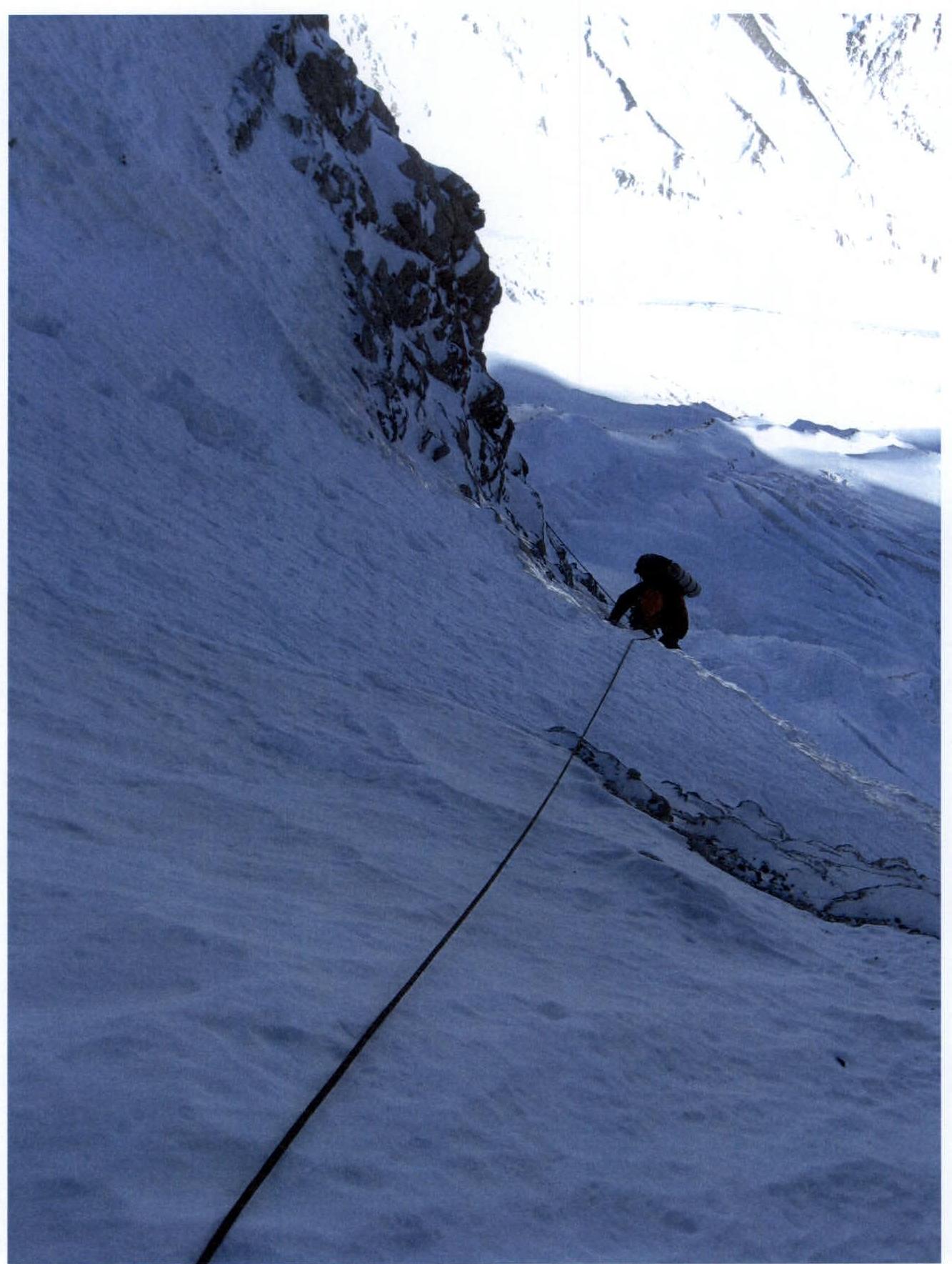
R0. From the campsite on the Bezengi glacier at the turn towards the Tsanner glacier - upwards along a heavily crevassed, closed ice-snow slope with numerous crevasses and difficult ice walls (avalanches, icefall collapses) under the rock belt of the North wall. Ascent initially onto a "cushion" (crevasses, avalanches, ice collapses), and then along the right side of the slope, moving directly towards a characteristic gap between two rock outcrops with icefalls in the middle of the slope. The seemingly more gentle and logical ascent on the left part of the slope with an exit directly to the central buttress of the wall is objectively hazardous and is hit by avalanches and icefalls from the Katyn Plateau.
R1. Ice wall 40 m with a steepness of about 85 °. Stick to the left side; possible ice collapses on the right.
R2. Steep (about 50 °) and lengthy (150 m) snowy-icy slope. Move vertically upwards; insurance with ice screws and snow anchors.
R3. Wide bergschrund, passed via a snow plug. Exit from the crevasse at the lowest point with about 5 m of overhanging ice and snow, overcome with the help of ice screws used as artificial aids.
R4. Steep (about 60 °) and lengthy (about 520 m) snowy slope. Move vertically upwards, sticking to the icefalls on the left. Insurance with ice screws and snow anchors.
R5. Ice wall with a steepness of up to 70 ° and a length of 80 m.
R6. Steep snowy slope leading to the boundary of the ice-rock belt. Insurance with snow anchors. Camp under the rocks; a "lochanka" is dug.
Day 2 (January 7)
R7. Left-upwards along the boundary of the rock-ice belt, 200 m. Insurance on ice with ice screws.
R8. Left-upwards along frozen rocks, 150 m, then through a snowy couloir (avalanches!).
R9. Strongly destroyed but steep rocks (live rocks; difficult to find a place for reliable insurance).
R10. Internal angle. Many "live" rocks.
R11. Inclined rock shelf. Semi-sitting camp on a rock shelf, carved out with ice axes.
Day 3 (January 8)
R12. From the campsite, left-upwards along steep but strongly destroyed rocks 40 m (live rocks!) - exit onto the first rock counterfort descending from the right part of the wall. Station on a rock ridge.
R13. Traverse left through a wide steep snowy couloir.
R14. Ascent along the left rock wall of the couloir to a very difficult internal angle (artificial aids), exiting onto the central buttress of the wall.
R15. Along frozen steep rocks directly upwards towards a pronounced "rusty wall".
R16. Internal angle (live rocks).
R17. Along a frozen inclined shelf, exit onto a snowy ridge at the junction of the central buttress and the main "mirror" of the wall. Lying camp on a shelf carved out of the ice.
Day 4 (January 9)
Due to the short winter daylight, it was decided to process the most challenging part of the route to exit onto the snowy-icy dome the next day where a camp can be set up.
R18. Traverse left 60 m along an inclined frozen and snowy shelf to a pronounced internal angle.
R19. Ascent along a frozen internal angle. Further upwards along a frozen slab. Rocks are very difficult.
R20. Right-upwards along steep frozen slabs, interrupted by inclined shelves. Rocks are very difficult; artificial aids.
R21. Upwards along a vertical crack, then right-upwards bypassing an overhanging rock; station on an inclined slab.
Day 5 (January 10)
Ascent via the pre-fixed ladders (5 ropes) to section R22.
R22. Left-upwards along inclined slabs (many live rocks), then along a narrow horizontal shelf under an overhanging rock - exit into a large steep snowy couloir leading onto the pre-summit dome.
R23. Movement along the left side of the couloir along the rock boundary. Snow is very avalanche-prone; no insurance in the couloir!
R24. Along simple rocks along the couloir boundary, then through a steep crevice-chimney - exit onto rocks like "ram's foreheads".
R25. Left-upwards along not very steep but difficult rocks like "ram's foreheads" - exit onto the pre-summit dome.
R26. Ascent directly "head-on" along a steep snowy-icy slope to a stone "finger" frozen into the ice.
R27. Ascent upwards, bypassing a large stone on the left along inclined and frozen slabs; sitting camp is organized above it.
Day 6 (January 11)
R28. Movement right-upwards along the snowy-icy dome with alternating rocks like "ram's foreheads" with a steepness of 50–60 degrees. Steepness increases upwards. Ice is very hard; ice screws are screwed in with difficulty. Exit to the summit "head-on" is objectively hazardous due to hanging ice cornices from the summit and the left ridge. The right ridge from the summit contains a gap in the cornice line, towards which our movement is directed. Exit onto the ridge.
R29. Along a simple snowy slope - exit to the summit. Descent from the summit along the classic route towards peak 4310 m. Camp on the shoulder of v. Gestola.
Day 7
Descent through peak 4310 m onto the Tsanner glacier, and then to the tourist camp "Bezengi".