- ROUTE DESCRIPTION
Ascent to the Main peak of Sakashil-Bashi (4100 m) via the northern edge
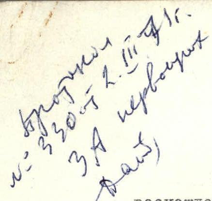
Day 1 - approach through the Sakashil-do gorge to the bivouac on the left-bank moraine of the Central Glacier (at an elevation of 3430 m) - see the general description of ascents to the Sakashil-Bashi massif. From Tyrnyauz - 9:00-10:00.
Day 2 - departure should be early - at 3-4 am; from the bivouac, follow the glacier to the foot of the rock buttress, approach the bergschrund (at the beginning of summer, the glacier is snow-covered, by the end of summer - open, crevices are easily bypassed). The elevation of the bergschrund edge under the buttress is 3530 m. Cramp-ons are put on here. Crossing the bergschrund is not complicated - at the beginning of summer it is closed, at the end (September 1969) it is possible to cross on snow bridges.
One rope is passed directly up the ice couloir (at the beginning of summer - firn) between the two rock ridges of the buttress. Steepness is about 45°. Then, crossing the couloir to the right and upwards, we approach the rocks of the right (along the route) ridge and move along the edge of the ice and rocks; at the end of the second rope, a rock piton is hammered in for belay.
After crossing a small ice tongue, we emerge onto the rocks. Cramp-ons are removed and we ascend the rocks upwards along the couloir for one rope. Rocks are of medium difficulty, heavily destroyed (unstable rocks).
Further:
- to the right - along a vaguely expressed internal corner, one rope, one intermediate piton is hammered in;
- then slightly to the right and up along a steep internal corner with a small number of holds, exit to the ridge of the buttress.
Further along the gentle section of the ridge, one rope with belay through outcrops to a rock ascent - a small wall 5-6 m. In the photo - (I) "unstable rocks!".
After exiting onto the wall:
- the 1st control cairn is built (it was not possible to build a cairn at the exit to the ridge due to the lack of large stones);
- ascent along the destroyed rock ridge to the beginning of the final ascent (2) - a wall 25 m, piton belay.
After the wall - an almost horizontal section of the ridge, 25-30 m long, which ends the buttress. At the end of the ridge, the 2nd control cairn is built. Elevation - 3700 m, thus the height of the rock section (vertically) is 170 m, length - 10 ropes. 9 rock pitons are hammered in, including 2 for self-belay.
From the bergschrund - 5-5.5 hours of walking. At the 2nd control cairn, we put on cramp-ons and exit onto the firn slope; we ascend first to the right and upwards, passing over the firn above the upper exit of the rocks, then, bypassing crevices, we ascend, orienting ourselves towards the 1st (Eastern, closest to the Main peak) gendarme.
The entire northern slope of the massif is icy and covered with a layer of snow or firn, the thickness of which depends on the time of year and the relief of the slope. The average steepness of the slope is 45°, in some places reaching 50-60°.
Movement:
- alternate, with belay through an ice axe (which often had to be hammered in with a hammer);
- in the most dangerous places - near crevices, where the thickness of the firn layer did not exceed 5-10 cm - through ice pitons (2 pitons in total);
- Screw-type, titanium pitons were used.
A total of 22 ropes (30 m each) are passed to the foot of the gendarme.
Exit to the ridge - traversing the slope under the gendarme from right to left on good, dense firn, approximately 50-60 m. Simultaneous movement.
The elevation of the foot of the gendarme is 4050 m, thus the relative height of the snow-ice section is 350 m, length (along the route line) - about 600 m, average steepness along the movement line - 36°.
From the gendarme, we descend into the saddle of the ridge and slightly to the right, into a hollow with rock outcrops on the southern side of the ridge. Here, it is possible to rest well, there is water.
From the hollow, we ascend to the ridge - from here, the peak is clearly visible: a small ridge of rocks with a pole above a snow hummock.
We descend into the second, wide and shallow snow hollow and ascend to the peak along a gentle snow slope 150-200 m.
From the 2nd control cairn:
- 4.5-5 hours to the peak;
- from the "3430" bivouac - 10-11 hours.
The elevation of the peak is 4100 m, as well as all intermediate elevations, measured by an aviation altimeter.
Descent:
- to the east along a gentle snow ridge ~200 m;
- here, it is necessary to be very attentive not to "miss the place of descent from the ridge to the North-East slope, to the saddle";
- descent to the saddle follows mainly along the ascent route of group A.
Forduy ZA k.t.
The steepness of the slope is 45°-50°, belay through an ice axe and in the most steep places, where the firn thickness is minimal - through an ice piton. It is necessary to descend to the left of the rock outcrops (since the slope is most icy near them), orienting oneself towards an oval-shaped crevice ("hole") and from it - to the right and downwards to the ridge. The rock ridge, running from the saddle, joins a steep snow-ice slope with an almost horizontal section. To the right, along the route, is an elongated hollow. Exit to the ridge along the edge of the hollow, on fixed ropes. At the beginning of the ridge, there is a convenient place for an overnight stay. After 75-100 m of horizontal ridge (to the left, from the West - snow, to the right, from the East - destroyed rocks, scree), the descent to the saddle begins. Rocks are slab-like, heavily destroyed ("unstable rocks!").
The descent goes along the right side of the ridge, first along a chimney, one rope, sport climbing style, to a ledge, from which a steep scree slope leads to the Eastern Glacier, then to the left along a ledge, approximately ½ rope descent, and, crossing an ice tongue, along destroyed rocks, traversing the steep eastern slope of the ridge, we exit onto the "3700" saddle.
Descent from the saddle:
- to the right - down along destroyed rocks and slabs, approximately one rope;
- then descent on a rope along steep, destroyed rocks 15 m to the scree (a rock piton is hammered in to secure the rope);
- and along the scree - to the glacier, to the "3430" bivouac.
Features at different times of the year:
- In May-June: descent from the saddle along a steep (up to 50-60°) snow slope, kicking steps "in 3 beats";
- By mid-summer: ice is exposed, descent must be bypassed along the rocks to the right along the route.
Descent from the Main peak to the "3430" bivouac - 3.5-4 hours, and the entire route takes 14-15 hours. The group evaluates the route as Category 3B.
Recommendations
- Group size - 4-8 people. (A larger number will significantly delay movement along the buttress due to rockfall danger).
Equipment (for a group of 4)
- Main rope - 2 x 30-40 m
- Repschnur, expendable 1.5-2 m.
- Crampons - 4 pairs
- Ice axes - 4 pcs.
- Ice pitons 2-3 pcs. (preferably screw-type)
- Rock pitons 6-8 pcs.
- Carabiners - 8 pcs.
- Hammers - 2 pcs.
- Helmets - 4 pcs.
- Tent - 1.
- Sleeping bags - 2 (or down suits for all participants)
- Departure from the bivouac should be timed so as to start moving along the rocks at dawn (i.e., approximately 1 hour before dawn).
- Possible overnight stay locations: 1) in the second hollow under the peak; 2) at the beginning of the ridge leading to the saddle.
- In case of sudden bad weather (snowstorm, fog, thunderstorm), it is better not to start descending from the peak, but to spend the night in the hollow under the peak, since in conditions of poor visibility, it is easy to get lost and not reach the ridge of the saddle, and on the steep snow-ice slope, there is nowhere to stop. To the left (under the "hole" and to the left) the slope ends in sheer ice cliffs (see photo).
- Crampon teeth should be sharp, since in some places, under a thin layer of firn, the ice is very hard, glassy.
- At the beginning of summer (May-June), the snowy part of the route may be avalanche-prone.
The description was compiled by the group leader:
Junior Mountaineering Instructor Kuzminsky D.V.
Group composition:
| №№ | Last name, First name | Year of birth | Sports rank and instructor title | Climbs of the previous and current season by category 2, 3, 4, 5A, and 5B |
|---|---|---|---|---|
| 1 | 2 | 3 | 4 | 5 |
| 1. | Kuzminsky D.V. lead | 1909 | 1st junior instructor | 0/3, 0/3— |
| 2. | Forduy A.A. | 1935 | II sports rank — | 2/1, 1/1, 0/0, 1/1 |
| 3. | Vas'kovich L.A. | 1950 | III sports rank — | 3/2, 2/2 |
| 4. | Arbuzova T.V. | 1946 | III sports rank — | 3/0 |
Appendix: 5 photos