
Ascent Passport
I. Ascent class — technically challenging. 2. Ascent area — Main Caucasian Ridge and its spurs from Chipperazau Pass to Ortokara peak, Adyrkh spur, Dzhaulyak. 3. Peak, its height, ascent route — p. Dzhaulyak, 4533 m, via the eastern wall. 4. Proposed difficulty category — 5B. 5. Route characteristics: height difference — 590 m, average steepness — 75 °, length of sections with 5th cat. diff. – 83 m. 6. Pitons driven: * rock: for belaying — 43, for creating I.T.O. – 34 * ice: for belaying — 2, for creating I.T.O. – 1 * bolt: for belaying — 1, for creating I.T.O. – 4 7. Number of climbing hours — 25 (excluding descent). 8. Number of overnight stays and their characteristics — 2, comfortable ledges, overnight stays in a tent, lying down. 9. Surname, name, patronymic of the leader, participants, and their qualification: Inyutkin Aleksey Nikolayevich — CMS, Ortin Anatoliy Anatol'yevich — 1st sports rank, Kuznetsov Kharlampiy Kuz'mich — CMS, Ketenchiyev Ali M. — CMS. 10. Team coach: Porokhnya Yuriy Ivanovich — MS. II. Date of departure and return: Departure — August 18, 1976. Return — August 20, 1976.
4533 m
General View of the Peak
First Ascent Route
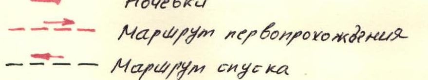
Photo 1. General view of the peak. First ascent route. Overnight stays.
Description of the Approach to the Route
Dzhaulyak, view from the south.
Photo 2. Overnight stays. First ascent route. ––– Descent route.
 From "Dluta" tourist center down the road to "Dzhaulyak" tourist center — 800 m, then right through the camp and crossing the wooden bridge over the Kullumkol-su River. Along the river on the right (orographic) side, exit to the terminal moraine of the South Onom glacier.
Left along the route:
From "Dluta" tourist center down the road to "Dzhaulyak" tourist center — 800 m, then right through the camp and crossing the wooden bridge over the Kullumkol-su River. Along the river on the right (orographic) side, exit to the terminal moraine of the South Onom glacier.
Left along the route:
- steep grassy slope;
- clearly visible almost vertical trail leading to the "Paradise campsite". Leaving the trail on the left — ascent to the terminal moraine of the D. Knom glacier. Here are the Nizhne-Kichkidarskiye campsites. From the camp — 2 hours.
From Nizhne-Kichkidarskiye campsites, exit towards the glacier tongue, with the river flowing out on the right remaining on the right. Ascent to the glacier and further along the middle part of the glacier or its right-bank moraine — exit to Sredne-Kichkidarskiye campsite — 1 hour. The glacier is open. Crossed without being roped.
From Sredne-Kichkidarskiye campsite, along the left (orographic) part of the West Onom glacier upwards to its steep part under the slopes of Nomkaratau peak. From here, cross the glacier to the left towards the scree ridge between Kichkidar and Yunomkaratau peaks and steep ascent to the ridge to Verkhne-Kichkidarskiye campsite. Be cautious of falling rocks! From Sredne-Kichkidarskiye campsite — 1 hour. The glacier is open; there was no need to rope up.
From Verkhne-Kichkidarskiye campsite, leaving the glacial lake on the left, move along the glacier towards Dzhaulyak peak. The glacier is closed; it is necessary to be cautious of hidden crevasses; crossed in rope teams. Upon reaching the steep part of the glacier, turn right towards the false Donkin Pass. Exit to the false pass in scree, as there is no snow on the steep ice. From Verkhne-Kichkidarskiye campsite — 1 hour.
On the false pass, there is a platform where, after some preparation, a tent was set up.
Description of the Ascent
(explanation to the table, appendix 2)
August 17, 1976. The group left the camp at 13:00 and stopped for a bivouac on the false Donkin Pass at 18:00, where there was a platform for overnight stay. From the camp to the overnight stay location — 5 hours (see description of the approach to the route).
August 18, 1976. Departure from the bivouac at 6:00. From the false Donkin Pass, descent down to a scree ledge via a route of 3B cat. diff. and approach to the start of their route, which begins with a 40-meter internal corner going left upwards and leading to an overhanging rock, 3 m high. To the left and above the overhanging rock, the rocks are wet, with water seeping, making it difficult to ascend. The first person ascends without a backpack, with piton belay. The ascent of the others — on jammers. From the overhanging rock to the right — up a 60 ° internal corner. After 60 m, the internal corner turns into a 20 m long, 45 ° ledge (rocks of medium difficulty), which leads to a 7-meter wall with a chimney (section 5–6). To the left of the wall is a smooth slab.
- The first person passed the wall without a backpack, driving in 2 titanium box pitons.
- The others — on jammers.
After the wall, a 5-meter ridge, 40 ° steep, leads to a small earth ledge for two with belay through a projection. From this point upwards, there is a vertical chimney, approximately 40 m. But it's better to go left 2 m to an inclined ledge, from it — a 90 ° vertical wall, 25 m with two cracks, with a transition from one to another along a smooth little wall — 1 m (swings). A total of II pitons were driven, including 2 bolt pitons. The first person passed the wall using ladders, the others — on jammers (see photo №34).
On a bolt piton, a can with a note is hung — a control cairn. Above the wall, rocks of medium difficulty — 10 m — and exit to a ledge with loose rocks. On the ledge, it is possible to organize an overnight stay. Above the ledge and to the right, there are overhanging rocks. To the left of the ledge, there is an ice chimney, 80 ° steep, and snow-covered vertical stepped rocks (kivs) leading to another ledge, 30 ° steep.
After 50 m along snow-covered rocks of medium difficulty — a platform, convenient for organizing a bivouac. Here, at the level of the "Monk" gendarme, a platform was cleared and laid out, on which a tent was set up. The last person reached the platform at 18:20.
Table of Main Characteristics of the Ascent Route
Appendix 2.
| Date | Designation | Average steepness in degrees | Length in m. | Character of relief | Difficulty | Condition | Weather conditions | Rock pitons | Ice pitons | Bolt pitons | Rock I.T.O. | Ice I.T.O. | Bolt I.T.O. | Time of departure and stop for bivouacs, climbing hours, conditions of overnight stays |
|---|---|---|---|---|---|---|---|---|---|---|---|---|---|---|
| August 17, 1976 | Approach. Initially along the trail, and then along the South Onom glacier and the Donkin ice pass | |||||||||||||
| August 18, 1976 | R0–R1 | From false Donkin Pass along scree ledges to the start of the route | 2 | Good. | - | - | - | - | - | - | Departure from bivouac at 6:00 | |||
| R1–R2 | 45 ° | 40 m | Internal corner | 3 | Loose rocks | -"- | 2 | - | - | Free climbing | ||||
| R2–R3 | 90 ° | 3 m | Overhanging rock | 5 | Monolith, water | -"- | 1 | - | - | -"- | ||||
| R3–R4 | 60 ° | 60 m | Internal corner | 4 | Loose rocks | -"- | 8 | - | - | -"- | ||||
| R4–R5 | 45 ° | 20 m | Ledge | 4 | -"- | 1 | - | - | -"- | |||||
| R5–R6 | 90 ° | 7 m | Wall with chimney | 5 | Monolith | -"- | 3 | - | - | -"- | ||||
| R6–R7 | 40 ° | 5 m | Ridge | 4 | -"- | - | Protrusions | |||||||
| R7–R8 | 90 ° | 25 m | Wall | 5 | -"- | 6 | - | - | 5 | - | 2 | Control cairn | ||
| R8–R9 | 40 ° | 10 m | Ledge | 4 | Loose rocks | -"- | 1 | - | - | Free climbing | ||||
| R9–R10 | 80 ° | 5 m | Ice chimney | 4 | Snow-covered rocks | -"- | - | Protrusions | ||||||
| R10–R11 | 30 ° | 50 m | Ledge | 3 | Snow-covered, loose rocks | -"- | - | Stop for bivouac at 18:20. Climbing hours — 12–20. Overnight stay semi-reclined in a tent. | ||||||
| August 19, 1976 | R11–R12 | 70 ° | 2 m | Wall | 5 | Monolith | -"- | 1 | - | - | Free climbing | Departure from bivouac at 6:00 | ||
| R12–R13 | 30 ° | 15 m | Internal corner | 3 | Loose rocks | -"- | - | Protrusions | ||||||
| R13–R14 | 90 ° | 5 m | Wall | 5 | Monolith | -"- | 1 | - | - | 2 | - | |||
| R14–R15 | 50 ° | 8 m | Inclined slab | 5 | -"- | 2 | - | - | Free climbing | |||||
| R15–R16 | 90 ° | 3 m | Wall | 5 | Monolith, water | -"- | 2 | - | - | 1 | - | |||
| R16–R17 | 60 ° | 4 m | Ledge | 5 | Monolith | -"- | 1 | - | - | Free climbing | ||||
| R17–R18 | 85 ° | 20 m | Wall with internal corner | 6 | -"- | 8 | - | 1 | 22 | - | 2 | Control cairn | ||
| R18–R19 | 70 ° | 6 m | Wall with cleft | 5 | Monolith | Good. | 2 | - | - | 4 | - | - | ||
| R19–R20 | 50 ° | 45 m | Wide internal corner | 4 | -"- | 4 | - | Protrusions | Free climbing | |||||
| R20–R21 | 20 ° | 50 m | Ledge | 3 | Loose rocks | Protrusions | Stop for bivouac at 16:50, climbing hours — 11. Overnight stay conditions good. | |||||||
| August 20, 1976 | R21–R22 | 50 ° | 85 m | Wall with ledges | 4 | Monolith | Satisfactory | Protrusions | Departure from bivouac on the route at 7:00 | |||||
| R22–R23 | 0–20 ° | ~120 m | Ridge | 2 | Snow-covered | -"- | Simultaneously, protrusions | |||||||
| R23–R24 | 20 ° | 40 m | Ledge | 3 | Snow-covered, ice | -"- | ||||||||
| R24–R25 | 40 ° | 40 m | Couloir | 3 | -"- | 2 | - | |||||||
| R25–R26 | 0–5 ° | ~80–100 m | Ledges | 2 | Snow-covered | -"- | Simultaneously | |||||||
| R26–R27 | 20 ° | ~60 m | Ledges | 2 | -"- | Simultaneously, protrusions | ||||||||
| R27–R28 | 0–10 ° | 30 m | Ridge | 2 | -"- | Simultaneously | Reach the summit at 9:00 |
August 19, 1976, at 6:00, the first rope team started processing the route. Immediately from the overnight stay, there is a 2-meter wall, 70 ° steep, leading to a wide 15-meter internal corner with loose rocks, which leads to an inclined ledge, from which the hauling of backpacks was done. Further, after the ledge — a 5-meter wall, 90 ° steep. The first person — on ladders. After the wall, there is a monolithic inclined slab with a cleft at the top, which was passed "further from the ogee". The slab ends with a chip, on which a large, tightly wedged stone lies. From the overnight stay to the stone — 1.5 hours. Further ascent up a 3-meter wall, 90 ° steep, using ladders and traverse to the right along a narrow (10 cm) ledge — 4 m to a wall with a vaguely expressed internal corner going left-up-right; on the left part — a cleft. In the middle part of this internal corner — a cornice. When passing, it constantly swings to the right like a pendulum. There are few cracks for pitons. There are almost no footholds. The character of the cracks — blind, short. Very difficult climbing. Passage on ladders (see photo №5, 6). The section ends with a small ledge, on which two people can barely fit. From here, the hauling of backpacks was organized. The length of hauling — 40 m. When hauling, a downward pull from below is necessary. On section R , the following was driven for passage and belaying:
| Wooden wedges | — 5 pcs. | Rock pitons | — 9 pcs. |
|---|---|---|---|
| Titanium boxes | — 15 pcs. | Bolt pitons | — 3 pcs. |
| Titanium wedges | — 10 pcs. |
This number does not include pitons used for hauling and suspending backpacks. On a bolt piton, a can with a note is hung — the second control cairn. From the ledge, where the backpacks were hauled, up a 6-meter wall with a cleft (average steepness 70 °), exit to a wide internal corner (first person without a backpack, with the use of ladders), 45 ° steep, 45 m, and along it to a large snowpatch descending from the ridge. From here — 50 m to the left to the overnight stay above the "Monk". The platform is very good; no preparation is required. The tent is freely set up (see photo №7, 9). The last person reached the overnight stay at 16:56.
August 20, 1976. Cloudiness, snow grains, strong wind, thunderstorm. By 7:00, the thunderstorm had moved away; the wind and snow continued. From the overnight stay at 7:00, along an 85-meter wall with ledges, exit to the ridge and along it to a large couloir. Through the couloir, exit to a saddle, from here along ledges to the pre-summit ridge and along it to the summit. Reach the summit at 9:00. Descent from the summit to the overnight stay along the ascent route. Further descent along the SE wall through the "Monk" via a route of 5A cat. diff. Return to the camp at 18:30.
 Photo 3. General view of the lower part of the route.
