
Report of the Rostov Region team on the ascent to the summit of Jailyk (4424) via the 1st South Bastion of the Western Edge "Franzuzov's Route" 5B
1. Ascent Passport
-
Region: Caucasus, 2.4.1. From Gumachi pass to Kitlod pass (Adyrsu, Lekzyr, Chegem valleys);
-
Peak, route: Jailyk 4424 m via the 1st South Bastion of the Western Edge "Franzuzov's Route" 1970;
-
Category: 5B;
-
Route type: rock;
-
Route height difference: 670 m;
Route length: 905 m
- Length of sections: V category — 180 m
- Length of sections: VI category — 80 m
- Average steepness of the wall part of the route — 79°
- Average steepness of the entire route — 58°
-
Pitons left on the route: total 0;
Pitons used on the route:
- anchors/fifs — 10
- stoppers — 28
- friends — 20
Total artificial protection points (APPs) used: 14.
-
Team's travel hours: 15.5 hours, 2 days (ascent made without prior processing);
-
Leader: Eizeman Kirill Emilievich, 1st sports category
Participants:
- Shchekinova Tatyana Viktorovna, 1st sports category
- Demidov Dmitry Evgenievich, 1st sports category
-
Coach: Vasiliev Andrey Sergeevich, Master of Sports;
-
Departure to the route: 3:10 August 6, 2020; Reach the summit: 7:35 August 7, 2020.
2. Technical photo of the route

Fig. 1: General photo of the route
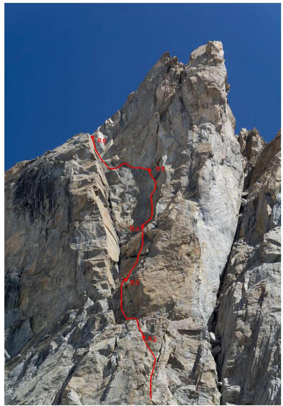
Fig. 2: Wall part of the route
3. Route diagram
Diagram in UIAA symbols

Fig. 3: Diagram of the wall part of the route in UIAA symbols
4. Route description by sections
From the bivouac at the upper Kichkidars camping sites, cross the S Yun glacier in the direction of the Jailyk massif and approach the right side of the 1st South Bastion of the Western Edge of Jailyk peak via an ice-snow slope. From the glacier, exit onto the rocks on the right side of the 1st South Bastion without entering the steep, narrow, icy couloir in the lower part, which separates the 1st and 2nd South Bastions of the Western Edge. Ascend via the snow-ice couloir with a large boulder-plug in the upper part.
R0–R1: 45 m. Move in the couloir along the right part of the rocks for 20 m. Then, reaching the outcrop, continue moving left. Station on a ledge.
R1–R2: 35 m. Up-left via simple rocks, then right under an overhang. There's a drilled hole. The overhang is traversed on APPs via a crack. Further via an internal corner. Station 5 m from the ledge.
R2–R3: 30 m. Up 5 m via the internal corner — exit onto a wide ledge. Overnight stay possible. Move up via a 4 m crack — exit onto a steep slab under the wall. Via it, exit onto the right side of a large internal corner.
R3–R4: 30 m. Right-up via a cleft by climbing. After a small overhang — exit left onto a comfortable ledge. There are several old drilled holes. It's possible to bypass the overhang on the right.
R4–R5: 40 m. Up 35 m via a steep wall, under a 2 m overhanging cornice into a crack. The cornice is traversed on APPs from the left side. There are very old drilled holes on the cornice. Exit onto an inclined ledge.
R5–R6: 50 m. Traverse along the inclined ledge 10 m left. Further 10 m via an internal corner to a narrow chimney. 10 m climbing via the chimney, then 10 m via the wall. Via simple rocks, exit onto a wide platform. Overnight stay possible, there are places for a tent.
R6–R7: 50 m. Up via simple rocks.
R7–R8: 60 m. Right-up via simple destroyed rocks. Exit onto a wide ledge.
R8–R9: 20 m. Bypassing a gendarme on the right via ledges and destroyed rocks by traversing — exit onto a ridge connecting spur. It's better to make an oblique rappel onto the connecting spur.
R9–R10: 30 m. From the connecting spur, bypass the gendarme on the left via simple rocks.
R10–R11: 50 m. Further up via simple rocks — approach to the snow-ice couloir.
R11–R12: 40 m. Up via the snow-ice couloir, exit onto a wide inclined ledge.
R12–R13: 30 m. Further traverse via simple rocks — approach to the upper part of the large snow couloir.
R13–R14: 40 m. Up via the right part of the couloir — exit onto a snow connecting spur.
R14–R15: 50 m. Then, via a steep ice-snow ridge, ascend to the platform of the South Ridge connecting spur under the summit rise.
R14–R15: 200 m. Up-right 70 m to exit onto a system of rock ledges with clinging, encircling the summit tower from left to right in a serpentine manner. Via the ledges, then via inclined slabs — exit onto the summit.
5. Tactical actions of the team
August 6, 2020.
3:10. Team departure in the composition of Eizeman K.E., Demidov D.E., and Shchekinova T.V. from the upper Kichkidars camping sites. Crossing the S Yun glacier, exit to the start of the route under the 1st bastion of the South Ridge.
5:00. Start working on the route. Throughout the wall part of the route, the first climber worked with two ropes: static and dynamic. After the first climber exited the entire rope length:
- the static rope was fixed as a handrail,
- the dynamic rope was used for top-rope for subsequent participants.
Equipment, climbing techniques, and belaying were classical.
13:30. R5–R6. Completion of the wall part of the route.
16:30. R8–R9. On the connecting spur between gendarmes. The second gendarme is better bypassed on the left via simple rocks.
20:00. R14–R15. Exit to the pre-summit tower. As it was getting dark, a decision was made to organize an overnight stay on the ledge and ascend to the summit in the morning (the team had the necessary equipment for a bivouac).
August 7, 2020.
7:00. Departure from the bivouac to the summit.
7:35. Summit. Movement was carried out with simultaneous belaying.
6. Photo illustrations of the report
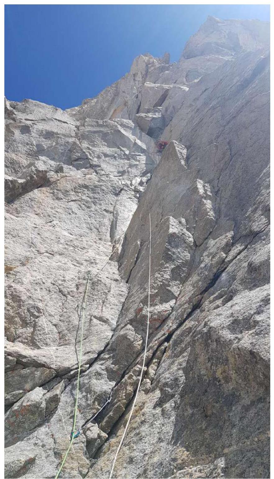
Fig. 4: Section R4–R5
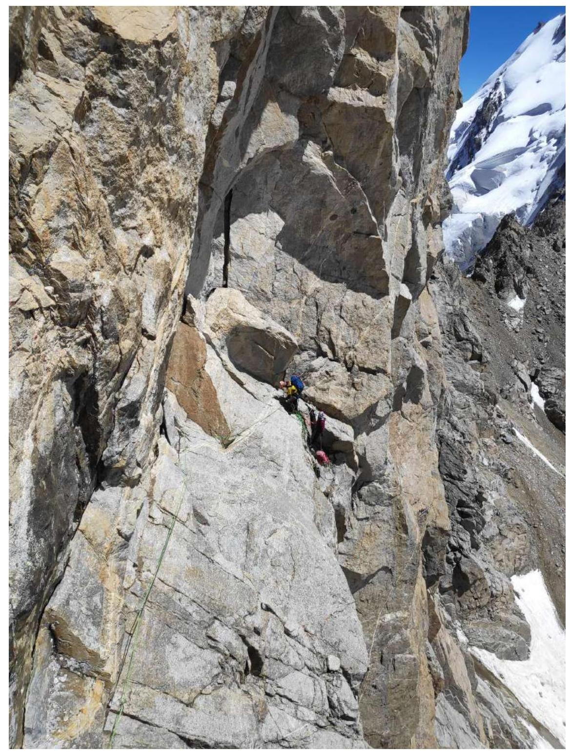
Fig. 5: Section R5–R6
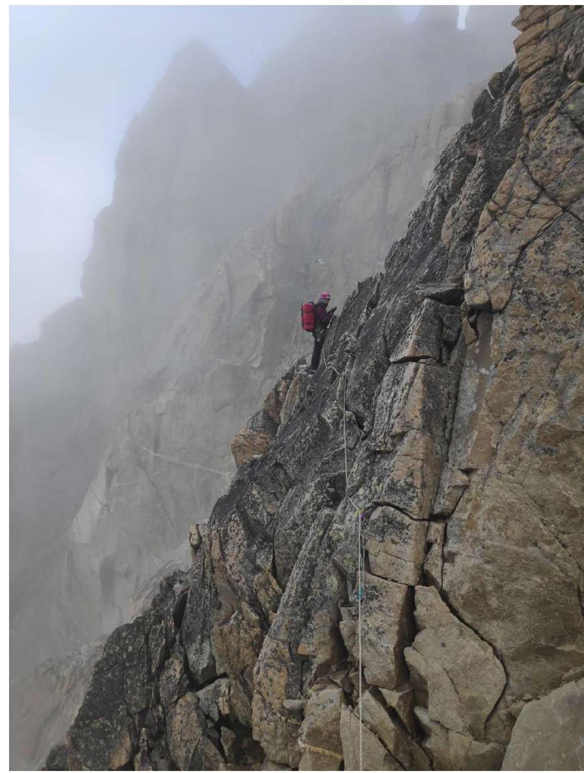
Fig. 6: Section R9–R10
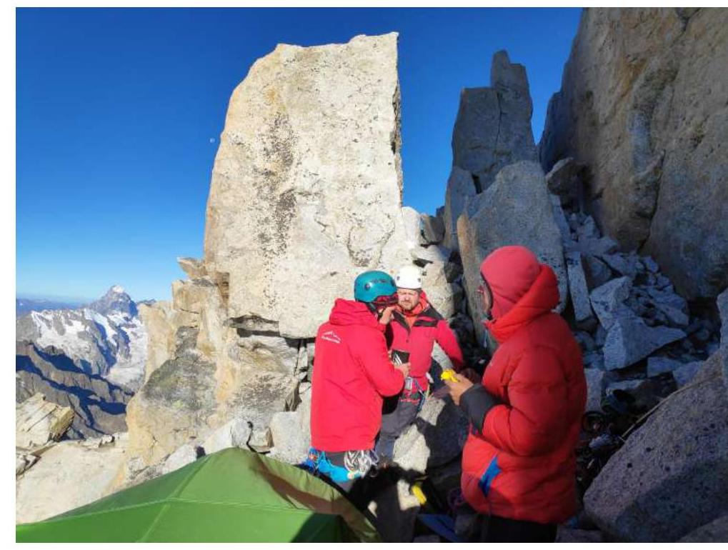
Fig. 7: Bivouac on section R14–R15
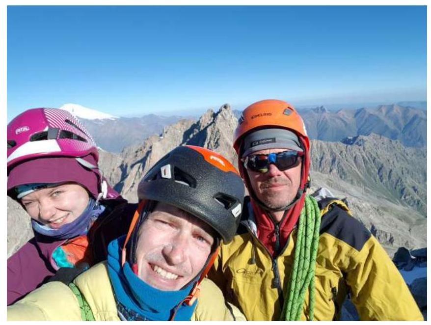
Fig. 8: Summit