Report
On the first ascent of the national team of Karachay-Cherkessia to the summit of Klych-Kara-Kaya 3578 m via the eastern edge. Category 2B difficulty. Presumably Category 2B difficulty. Ascent on September 11, 2022.
Semenov M. A. — MS team leader Maksimov K. M. experience of 2nd sports category Alpclub — "Gornoe Bezumie" 2023
2. Caucasus
2.2 From Marukh pass to Nakhar pass
Participants of the ascent
- Team leader — Semenov Mikhail Alexandrovich. CMS. Born on June 5, 1988. Coach — Shipilov V. A. Address: 144001, Elektrosteel, Oktyabrskaya st., 8, apt. 117. Tel. +7 (906) 724-94-53. Email aravigehc@mail.ru
- Maksimov Konstantin Mikhailovich, experience of ascents of 2nd sports category, Dmitrov. Born on November 6, 1994. Coach — Semenov M. A. Alpclub: "Gornoe bezumie"
2. Characteristics of the ascent object
2.1 Western Caucasus, Dombay region, section 2.2 of the route classifier for mountain peaks. 2.2 Khakel gorge. 2.3 Section number according to the classification table 2.2. 2.4 Klych-Kara-Kaya 3677 m. 2.5 Geographical coordinates GPS coordinates
3. Characteristics of the route
3.1 Via the eastern edge from Khakel-Achapara pass 3.2 Category 2B difficulty. 3.3 First ascent, no data or traces of earlier human presence were found by us. 3.4 The proposed route line is rocky, the exit to the pass from the Khakel glacier side is combined. 3.5 Height difference: 427 m. 3.6 Route length: m. 3.7 Average steepness of the glacier: 20 °. Category 1B difficulty. 3.8 Descent from the summit via the ascent route. Alternatively, via Category 1B difficulty route Delone. 3.9 Water in the form of snow is available on the pass and along the route. The ascent line is very long, with many descents and ascents, some of which are more reasonably traversed by rappelling.
4. Characteristics of the team's actions
4.1 Number of pitons left on the route: 2. Team's working hours: 5 hours, 1 day. 4.2 Completed without an overnight stay in one day, upon return they camped on the eastern ridge — a logical exit point from the Khakel glacier. The site is poor and inconvenient. It is more reasonable to move along the ridge to the west through a wide gendarme to Khakel-Achapara pass and camp there. 4.3 Start of the route: 11:30, September 11, 2022. 4.4 Reaching the summit: 16:00, September 11, 2022. 4.5 Return to the logical exit point on the eastern ridge from the Khakel glacier: 20:20, September 11, 2022.
5. Responsible for the report
5.1 Responsible for the report Semenov M. A. aravigehc@mail.ru
Description of the ascent area
The summit of Klych-Kara-Kaya 3677 m (according to the data of the Russian Mountaineering Federation) is located east of Khakel-Achapara pass. At the time of writing the report, the border between the Russian Federation and Abkhazia passes through the summit of the mountain. Khakel-Achapara pass is located at the end of the Khakel gorge. From the Russian side, the ascent to the pass goes via the Khakel glacier, which is quite broken at the end of the season. There are no camping spots on the pass itself; a camping spot can be found by moving along the ridge towards the Khakel peak, from where there is a simpler descent down towards Abkhazia. Khakel-Achapara pass is in direct visibility from the border outpost located near Klukhorskoe Lake. To avoid problems, such ascents need to be documented. The outpost near Klukhorskoe Lake is perhaps the most guarded point in the entire Teberda region. Klukhor pass is of strategic importance. In the USSR, a popular all-Union route 43 passed through this pass to the sea in Sukhumi and back. The uniqueness of the route was that it started from the Caucasian Mineral Waters, crossed the Main Caucasian Range, and went to the sea and back. About 6000 people passed along this route per year. The route was perhaps the most colorful and visited of all routes in this area. With the closure of this route, tourism in the region declined significantly, and later almost died out due to the collapse of the USSR.
Description of the approach
To the lake in the Gonačhir gorge, called Tumanlykël or Frelene lake, via a well-maintained asphalt road. It is possible to drive by car. Further along the road, about a kilometer or one and a half, there is a border outpost; there is a small parking lot in front of the outpost where a car can be left. Then on foot along the Military-Sukhumi road, it is possible to reach the meteorological station; there is a small parking lot just behind the meteorological station. It is also possible to drive to the meteorological station by car with the appropriate permits from the Teberda Reserve and the Border Administration. From the parking lot, one needs to move in the direction of the Khakel glacier. Immediately from the parking lot, one enters a clearing with monuments from the Great Patriotic War. Further along an old, partially overgrown, and disappeared trail to the Khakel glacier. The entrance to the glacier is simple. Along the glacier, we reach Khakel-Achapara pass. The eastern ridge leading from the pass to the summit of Klych-Kara-Kaya looked very long and quite logical. We found no evidence of its earlier passage.
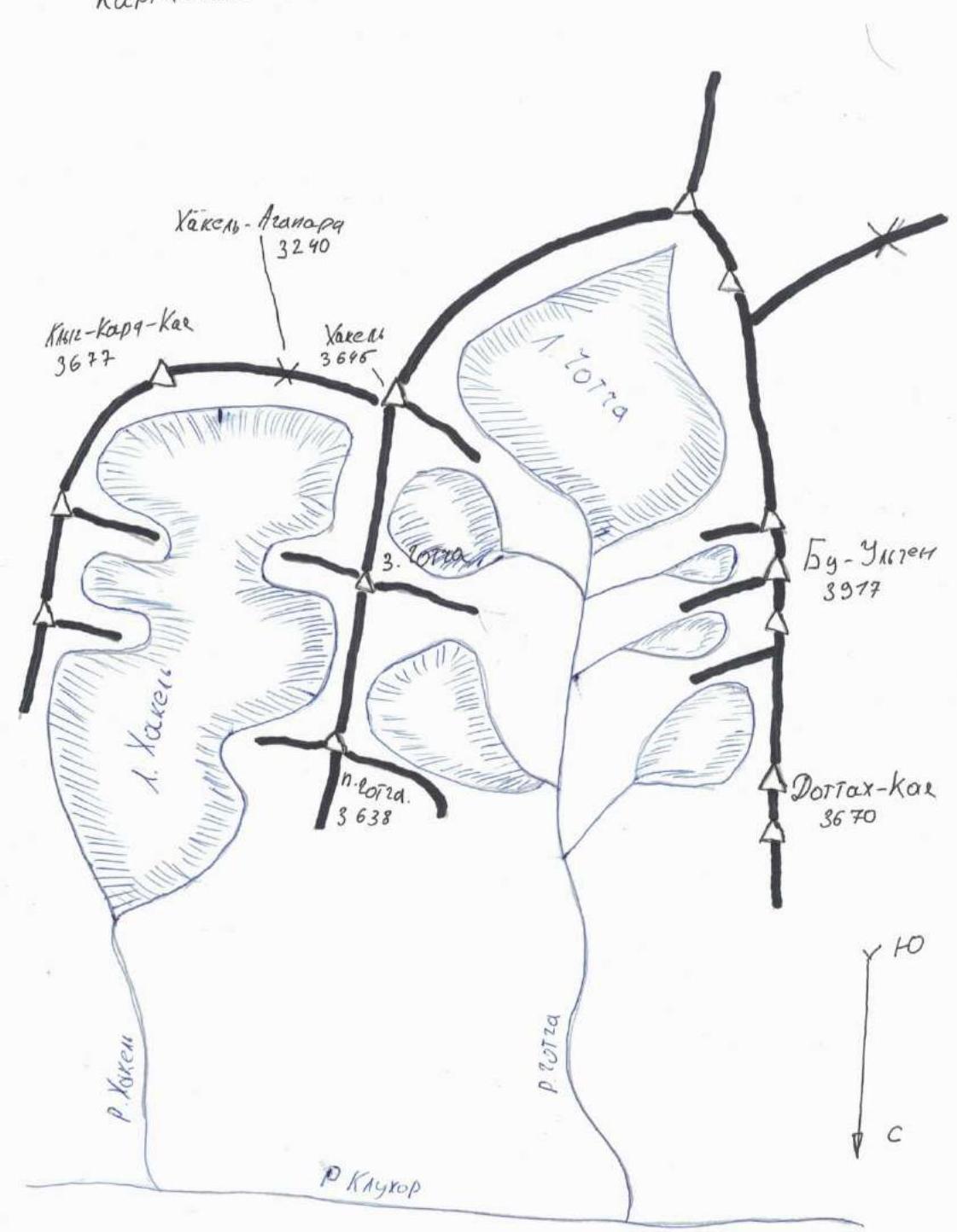
Map-scheme of the ascent area.
Tactics of the team's ascent
September 11, 2022
6:00 — left the meteorological station in the direction of Khakel-Achapara pass.
11:00 — moved left of Khakel-Achapara pass, into a depression, where the glacier logically leads, to reach the pass itself, one needs to traverse along the ridge towards the Khakel peak. We figured this out later. Stopped in the depression of the ridge to have tea and snack.
11:30 — started ascending along the eastern ridge towards Klych-Kara-Kaya summit.
16:00 — reached Klych-Kara-Kaya summit.
20:20 — returned to the point left of Khakel-Achapara pass, stopped for the night.
September 12, 2022.
4:00 — woke up.
5:00 — moved towards Khakel-Achapara pass.
6:30 — found the actual Khakel-Achapara pass, the cairn was barely visible, the note inside was completely soaked, and the data could not be recovered. Wrote a new note, built a proper cairn, and started descending; they promised a strong storm for the next day, so they needed to descend today.
14:00 — reached the parking lot near the meteorological station.
Route scheme
Ascent to Klych-Kara-Kaya from Khakel-Achapara pass along the eastern ridge Category 2B difficulty.
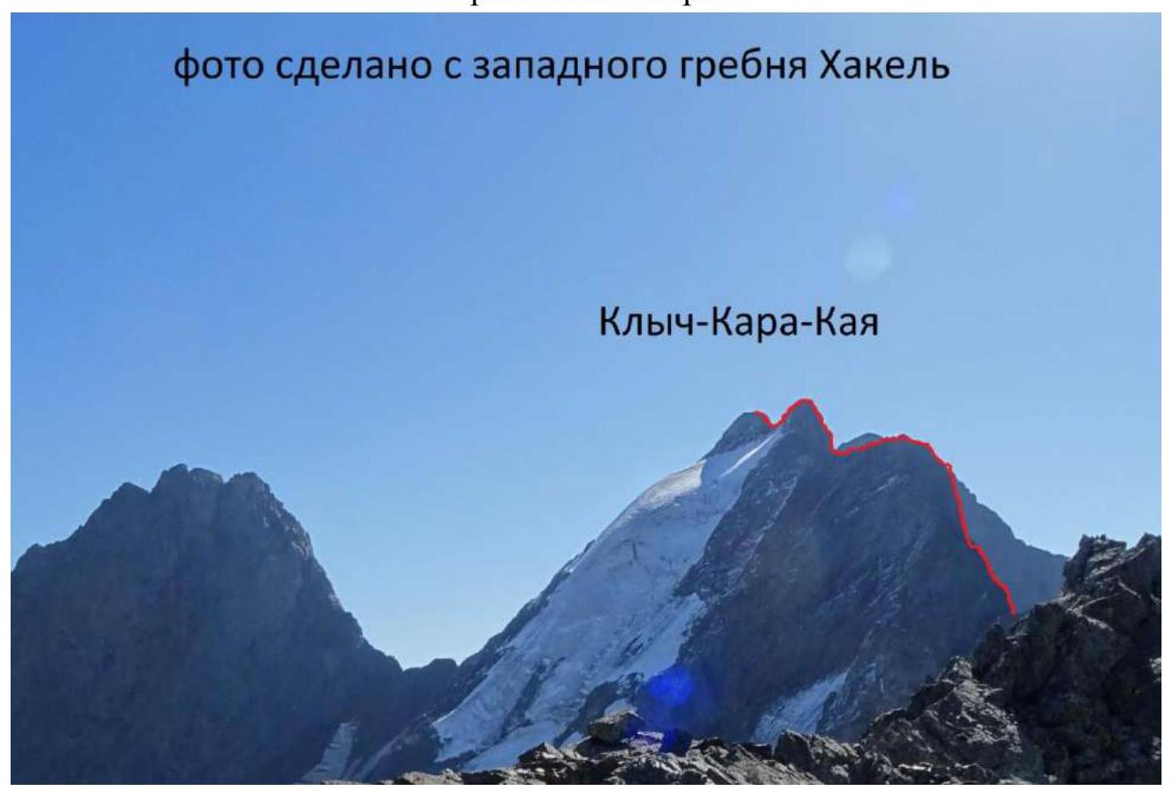
Photo taken from the western ridge of Khakel.
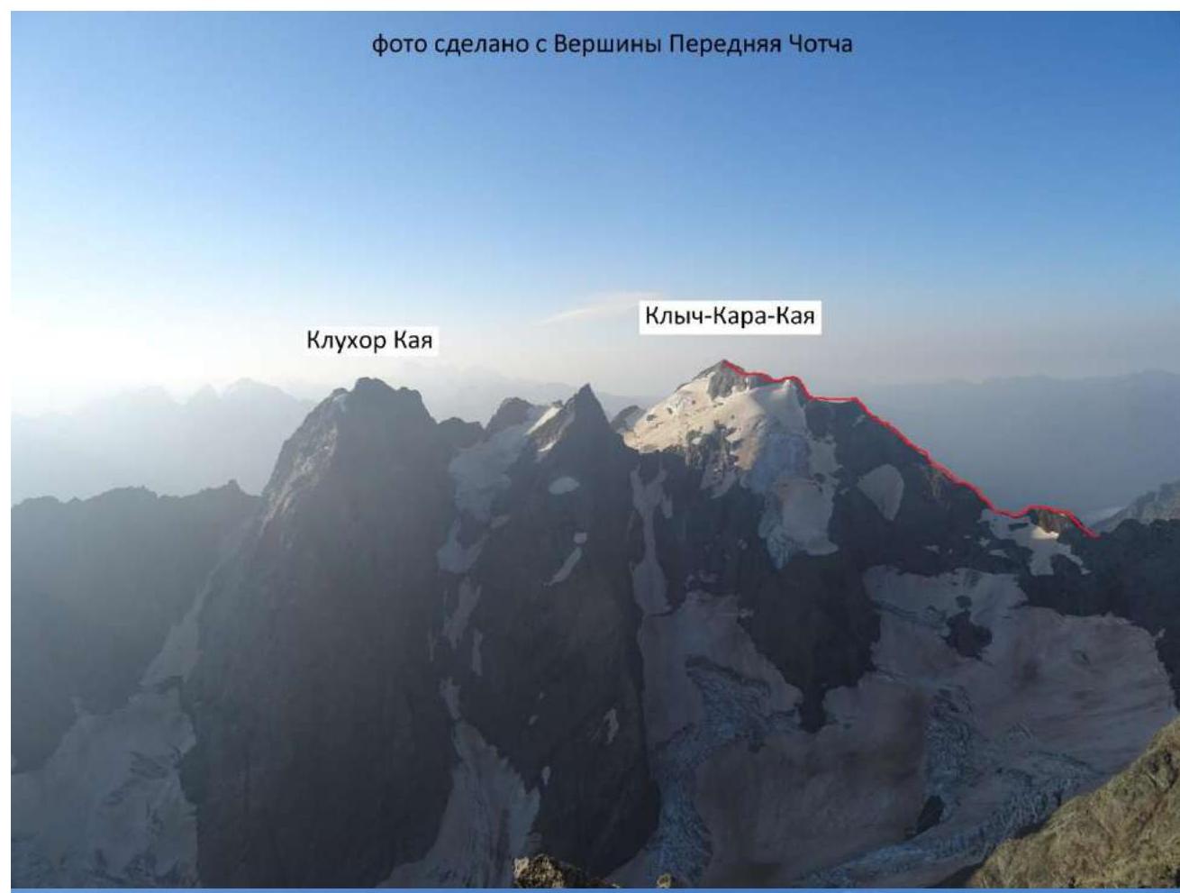
Photo taken from Perednyaya Chotcha summit.

Technical description
Route to Klych-Kara-Kaya summit from Khakel-Achapara pass along the eastern ridge
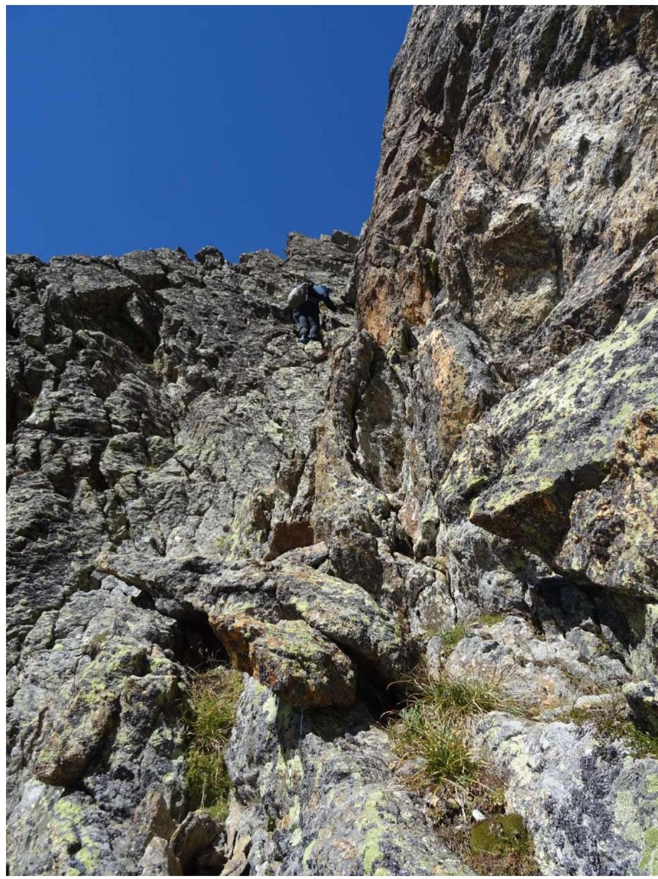
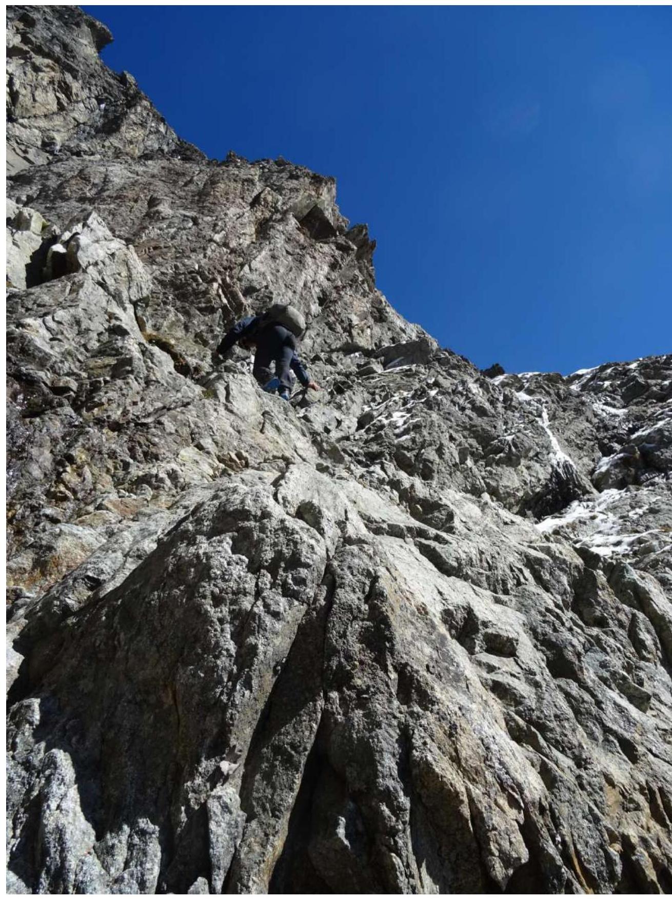
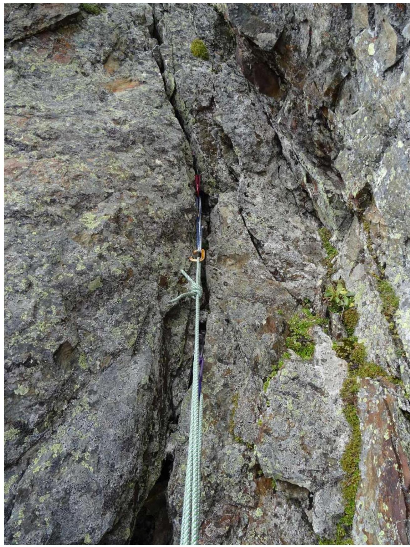
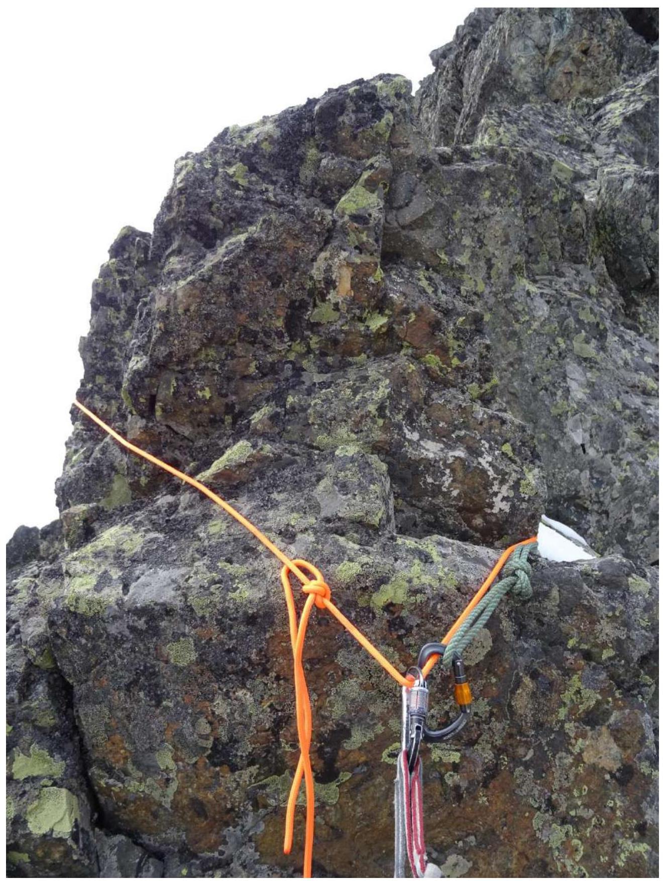
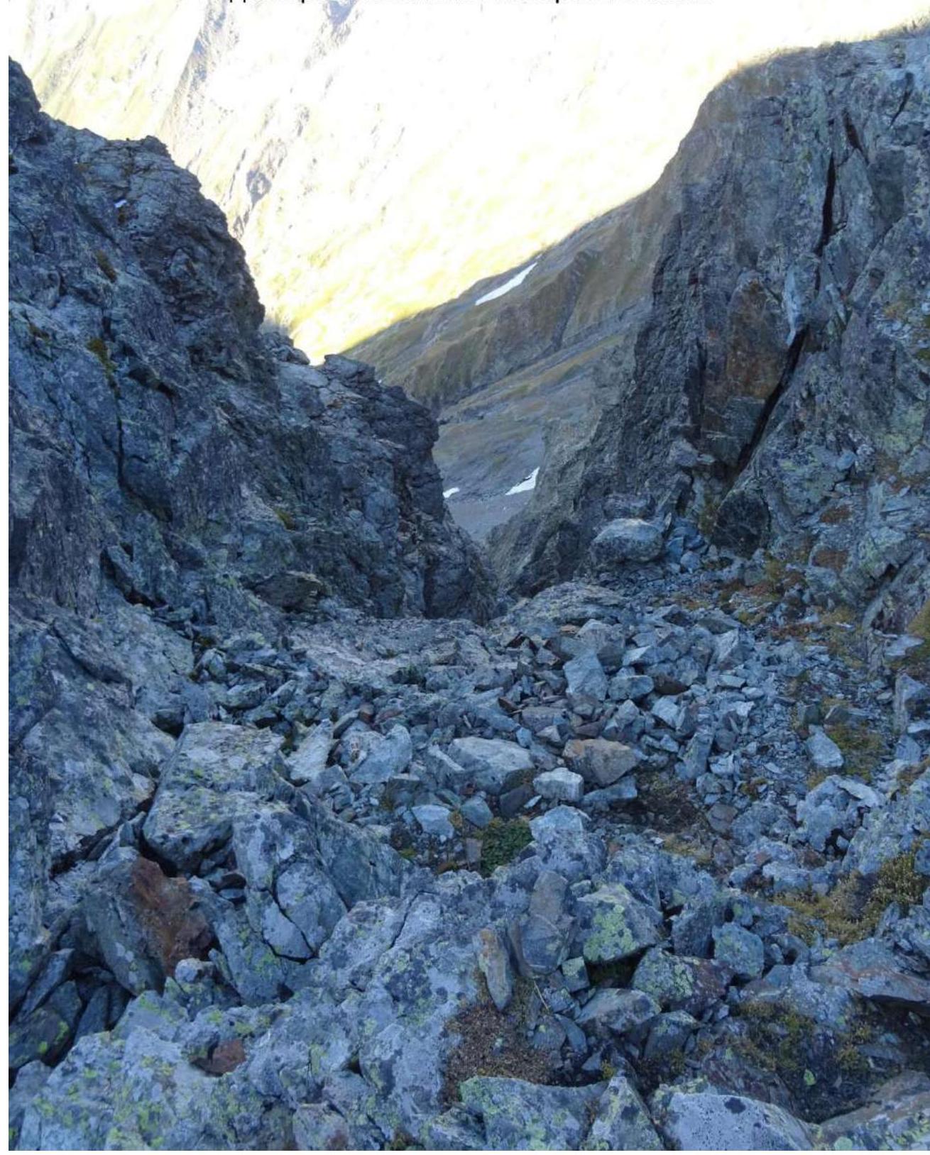
On Khakel-Achapara pass, there is limited space for organizing a bivouac; there are no ready-made sites. From the Khakel glacier, a logical ascent line leads left of the pass along the eastern ridge. From the pass to Klych-Kara-Kaya summit along the eastern ridge, the path is very long, straightforward, and logical. In some places, the ridge is very narrow, sharp, with sheer cliffs on both sides. There are quite a few places where one has to descend steeply, lose altitude, and then regain it. There are no particular detours. The path is quite logical, obvious, and straightforward. Climbing along the route is not more difficult than Category 4B. Two pitons were left during the passage of the ridge. There are plenty of cracks and ledges for organizing belays. Before the summit, the ridge leads to a glacier, with short sections.
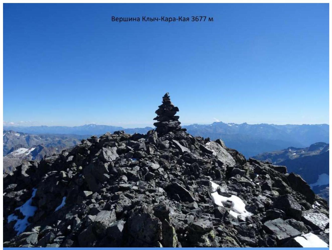
On the summit, there were no signs of a summit cairn whatsoever. Although there is a route Delone from the Abkhazian side classified as Category 1B, it is likely that ascents to this summit have not been made for decades. We built a large cairn, which can now be seen through binoculars from Klukhorskoe Lake. No signs of human presence on this ridge or evidence of earlier passage of this route were found by us.
Descent from the summit via Delone route Category 1B or via the ascent route. During the descent via the ascent route, it seems that a significant part of the ridge can be bypassed (on the right-hand side when descending) along a glacial ledge. However, upon closer inspection, there is no ledge; it's just a steep glacier. Climbing along the ridge is simpler and safer.
Due to its narrowness in some places, the ridge with sheer cliffs on both sides is psychologically quite tense to traverse.
Assessing the great length of the route, psychological and technical complexity of sections, we believe that the route's difficulty is Category 2B. It is also worth considering that just reaching Khakel-Achapara pass is not less than Category 2A difficulty (I don't have much experience in evaluating pass difficulties).
I, Semenov Mikhail Alexandrovich, at the time of the ascent, had completed all Category 2B routes in this area, and most of them more than once. Moreover, I completed Category 2B routes both registered with the Russian Mountaineering Federation and, unfortunately, those that have disappeared from the modern classifier. I can confidently say that among all local Category 2B routes, this is the longest route. Some Category 3B routes in this area are simpler than this ridge. Some Category 2B routes should be downgraded to Category 2A, but since there is a problem with Category 2B routes in this area, I am not rushing to do so.
This route is recommended for a strong, well-acclimatized group. For a successful ascent, one needs to be able to work quickly and simultaneously. It is recommended to ascend with an overnight stay on Khakel-Achapara pass. We had to traverse part of the ridge on our return by the light of flashlights. Our group is well-acclimatized, physically and technically well-prepared.
For comparison: our ascent with Maksimov as a duo to Maly Dombay summit from Dombay Saddle pass Category 2B — from the pass to the summit took us 50 minutes, definitely no more than an hour. Ascent solo — less than 40 minutes. In my opinion, Category 2B on Maly Dombay is one of the benchmark ascents in the area.
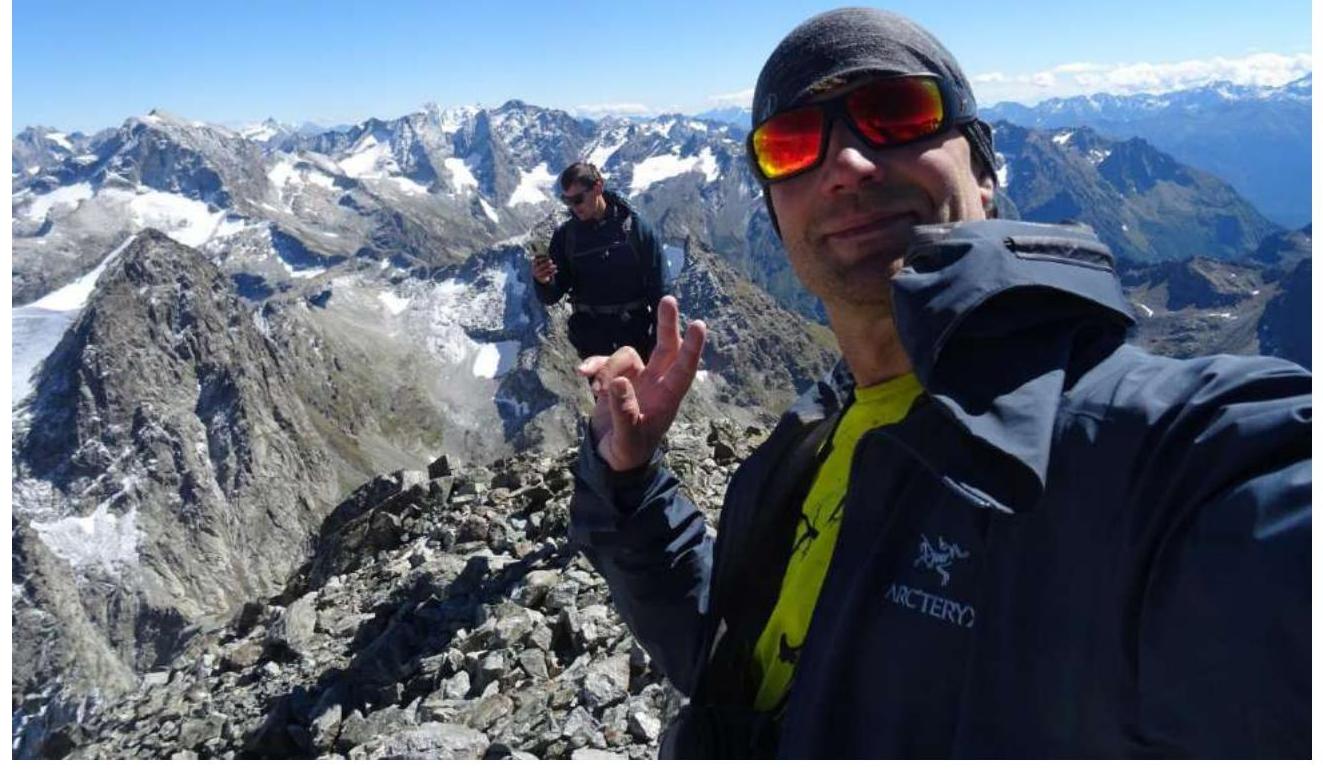
Ascent leader: Semenov M. A.
Participants: Maksimov K. M.
Coaches: Shipilov V. A.
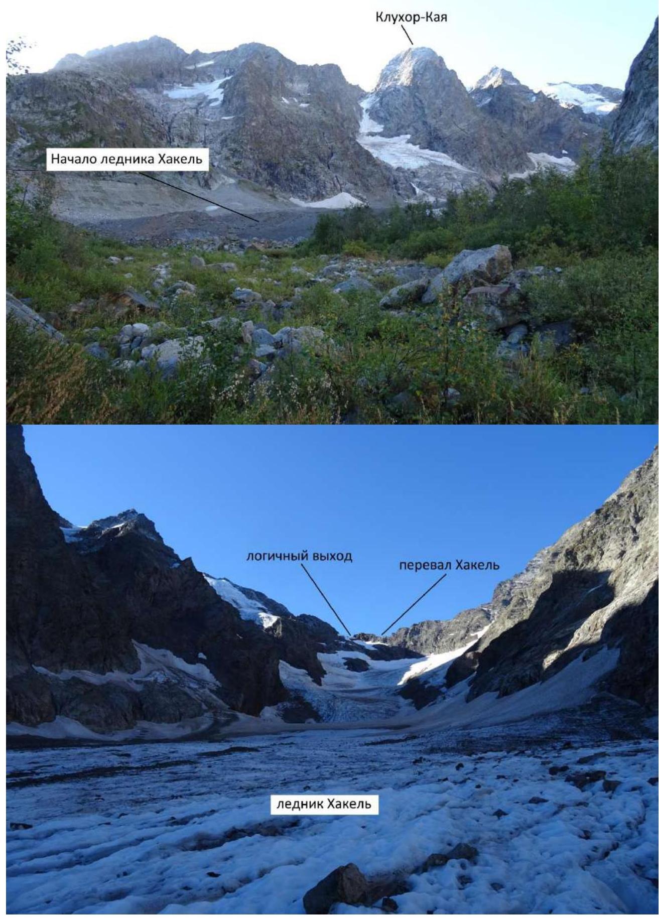
Start of the Khakel glacier. Logical exit. Khakel pass. Khakel glacier.
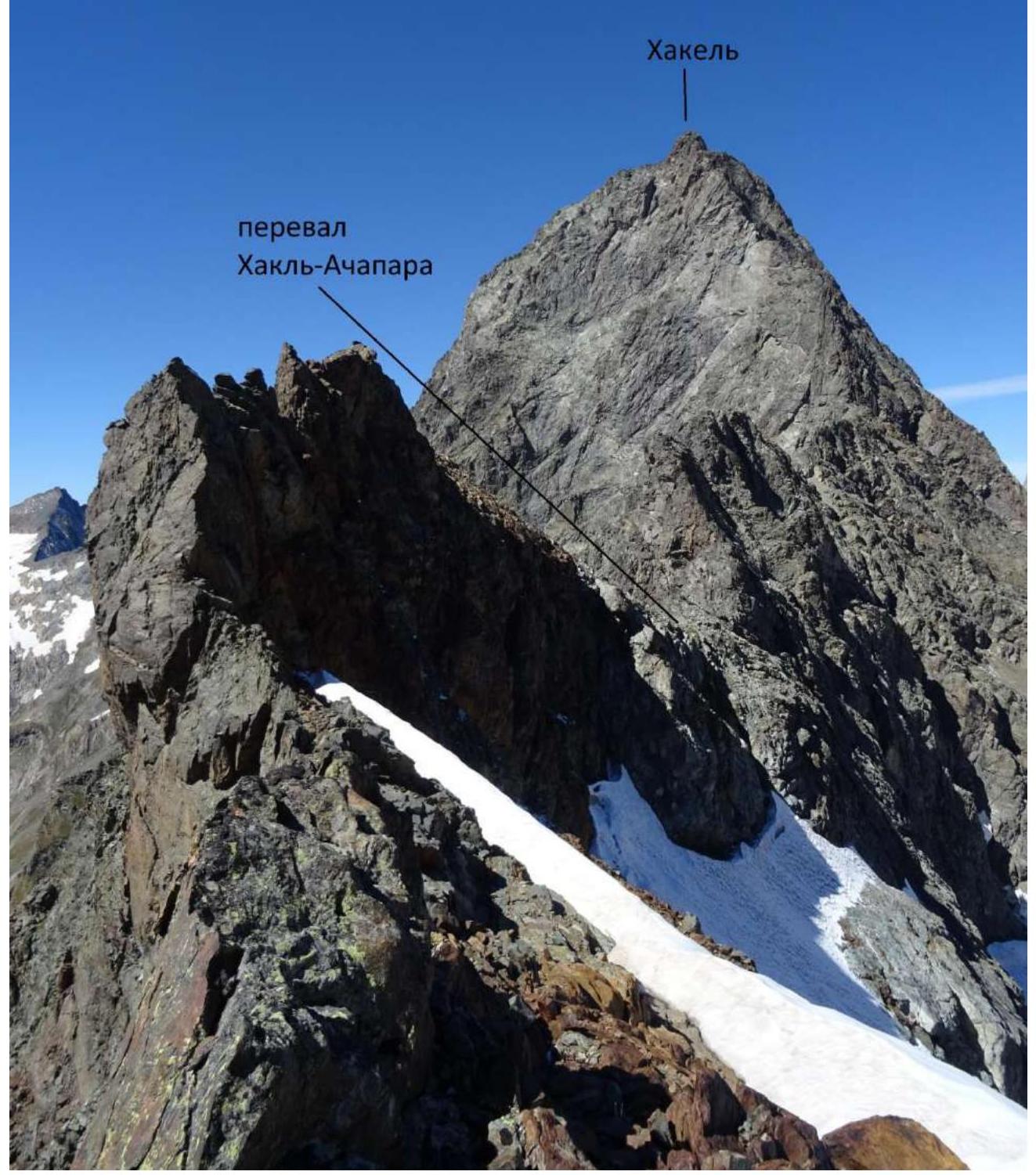
Photo taken from the eastern ridge of Klych-Kara-Kaya from the point where the logical path from the Khakel glacier leads.
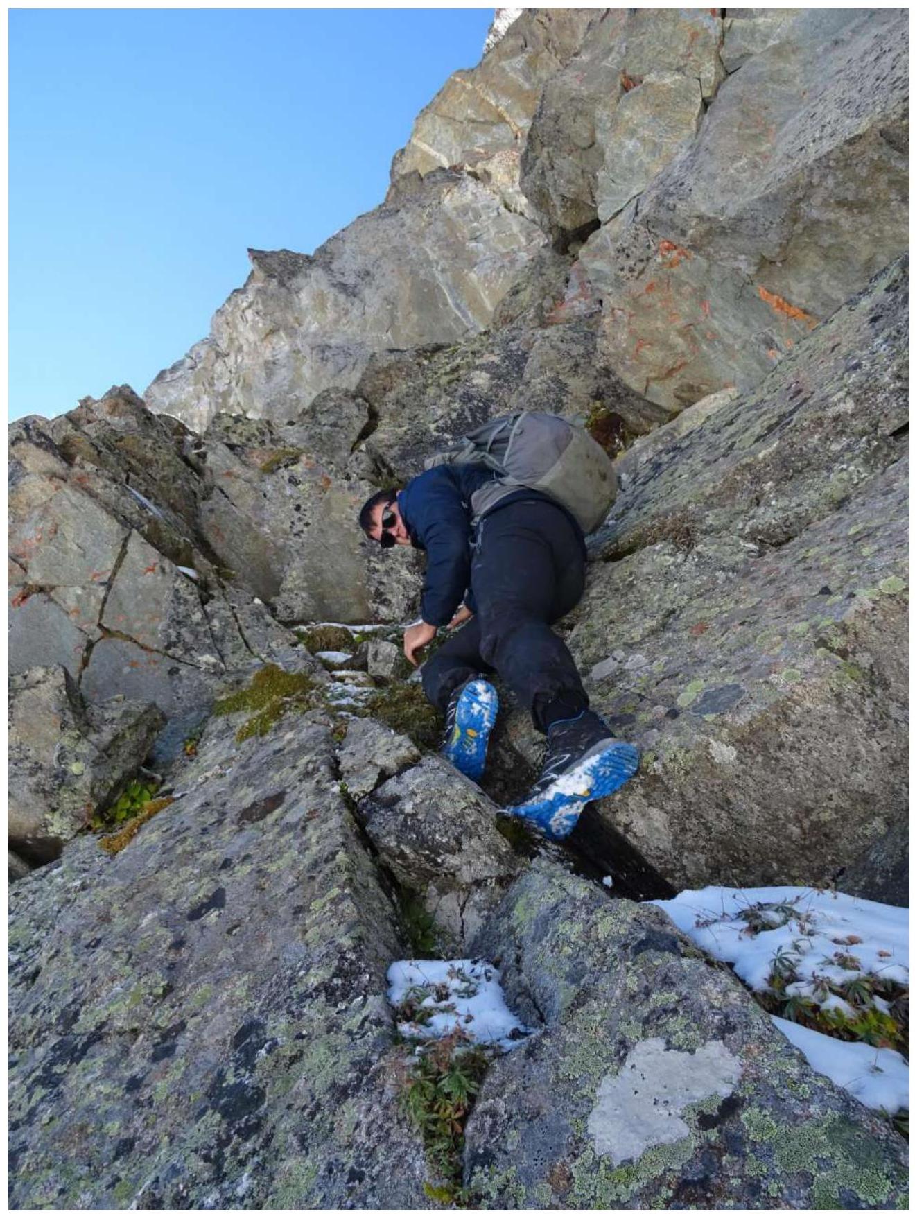
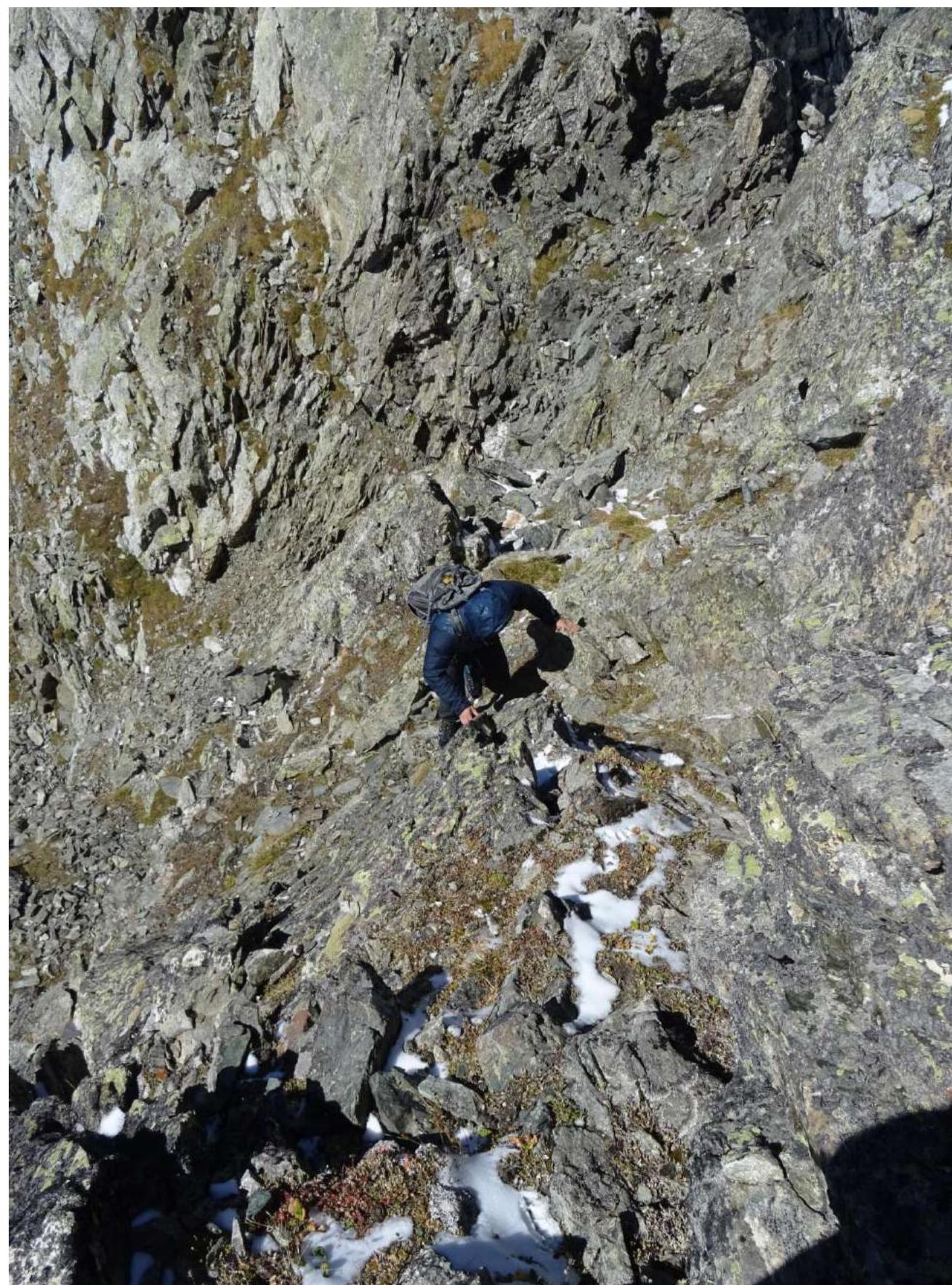

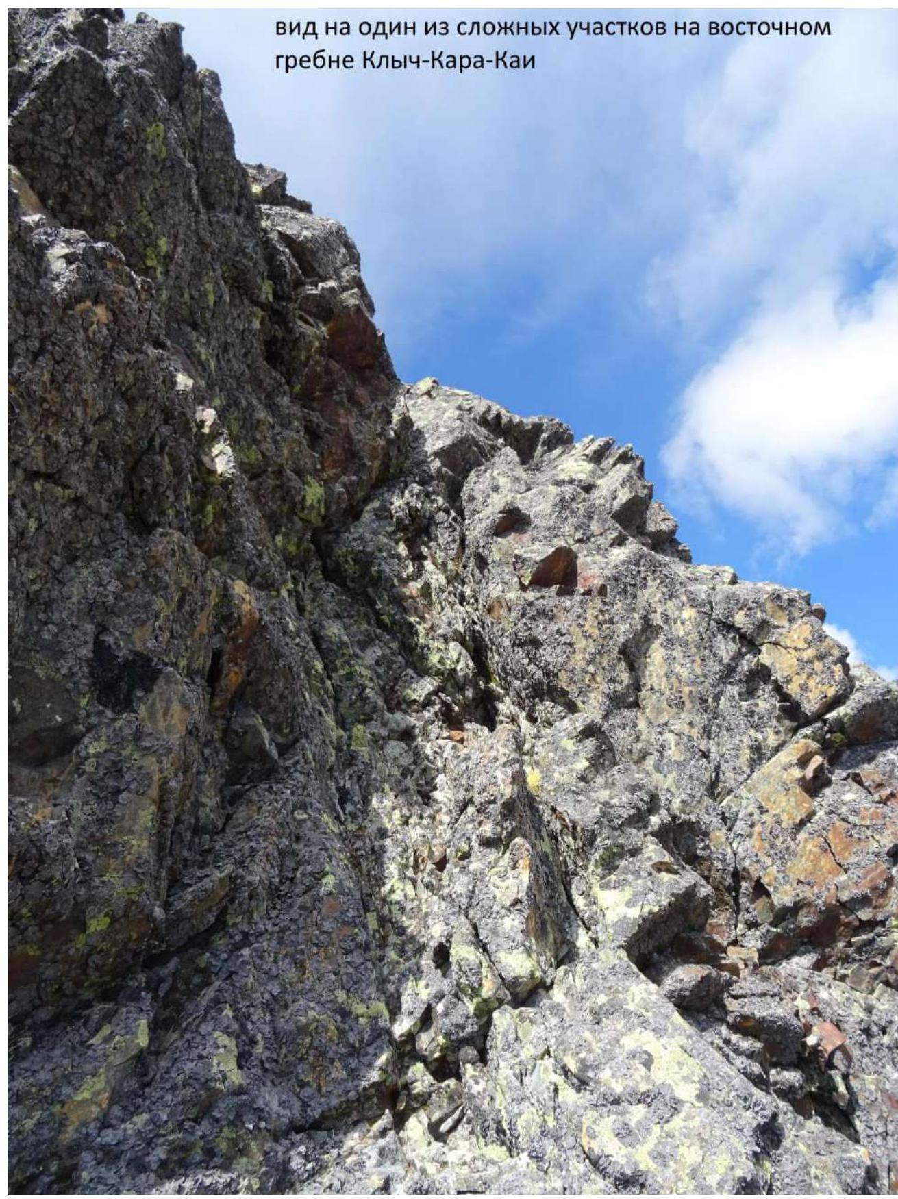
View of one of the complex sections on the eastern ridge of Klych-Kara-Kaya.

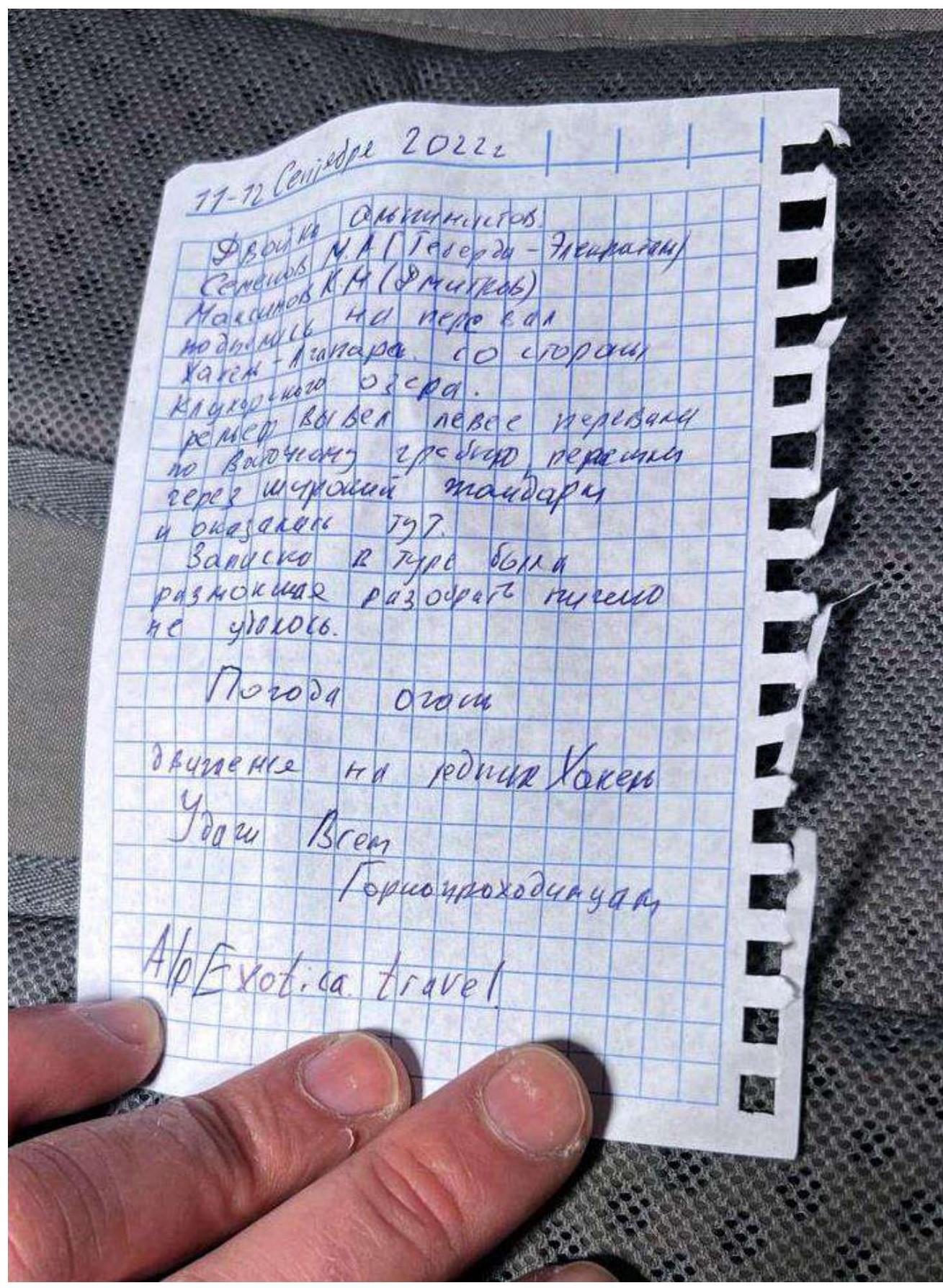
Summit note.
September 11, 2022, 16:00 Duo: Semenov M. A. (Teberda–Elektrostal) Maksimov K. M. (Dmitrov) Completed ascent to Klych-Kara-Kaya first ascent via the eastern ridge. Category 2B difficulty. The route is very long. No cairn or note found on the summit — built our own. Weather: great! Windy. Descent via the ascent route. Good luck to all mountaineers! Alp Exotica travel.
Klych-Kara-Kaya 3677 m summit.
View from Khakel-Achapara pass towards Abkhazia.
Note from the pass.
September 11-12, 2022. Duo of mountaineers: Semenov M. A. (Teberda–Elektrostal) Maksimov K. M. (Dmitrov) Ascended to Khakel-Achapara pass from Klukhorskoe Lake side. Traversed along the eastern ridge through a wide gendarme and reached 797. The note in the cairn was soaked, nothing could be deciphered. Weather: great. Moving towards Khakel glacier. Good luck to all mountaineers! Alp Exotica travel.