REPORT ON THE FIRST ASCENT TO MURUDZHINSKAYA NEEDLE VIA THE WEST RIDGE, CATEGORY 2A, BY THE "FREELINE" MAC TEAM, OCTOBER 1-2, 2022
Climbing Report Form
| № | 1. General Information | |
|---|---|---|
| 1.1 | Full name, sports rank of the team leader | Donskov Andrey Mikhailovich, 1st sports rank |
| 1.2 | Full name, sports rank of the participants | Ankudinov Alexey Ivanovich, 2nd sports rank Popova Varvara Valeryevna, 2nd sports rank |
| 1.3 | Full name of the coach | Motienko Nikolai Ilyich |
| 1.4 | Organization | MAC "Freeline", Essentuki |
| 2. Characteristics of the Climbing Object | ||
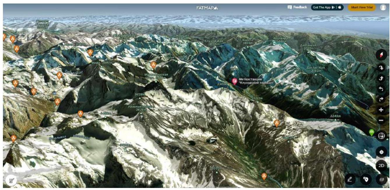
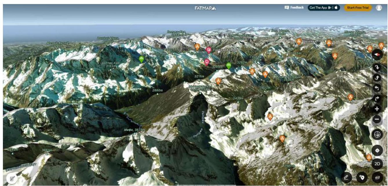
| 2.1 | Region | From Marukh pass to Nakhar pass |
| 2.2 | Valley | Kichi-Murudzhu river |
| 2.3 | Section number according to the 2013 classification table | Section 2.2 |
| 2.4 | Name and height of the peak | Murudzhinskaya Needle, 3591 m |
| 2.5 | Geographical coordinates of the peak | N 43°18′27.36″ E 41°50′34.54″ |
| 3. Characteristics of the Route | ||
| 3.1 | Name of the route | From Murudzhu pass, W ridge |
| 3.2 | Proposed category of difficulty | 2A category |
| 3.3 | Degree of route development | First ascent |
| 3.4 | Nature of the route terrain | Rock |
| 3.5 | Height difference of the route | 328 m |
| 3.6 | Length of the route | 1050 m |
| 3.7 | Technical elements of the route (total length of sections of varying difficulty is indicated) | Category 1 rock — 180 m Category 2 rock — 700 m Category 3 rock — 150 m Category 4 rock — 20 m Movement on closed glacier — 0 m Dülfer descent (on descent) — 1 rope, 50 m |
| 3.8 | Descent from the peak | Via the ascent route |
| 3.9 | Additional characteristics of the route | No water on the route, snow in the off-season |
| 4. Characteristics of the Team's Actions | ||
| 4.1 | Time of movement | 12 hours |
| 4.2 | Overnight stays | Base camp in the valley N 43°17′24.27″ E 41°49′57.44″ |
| 4.3 | Departure to the route | 5:00, October 2, 2022 |
| 4.4 | Arrival at the peak | 13:10, October 2, 2022 |
| 4.5 | Return to the base camp | 17:00, October 2, 2022 |
| 5. Person Responsible for the Report | ||
| 5.1 | Full name, e-mail | Donskov Andrey Mikhailovich, donskov91@mail.ru |
General Photo of the Peak from the Southeast
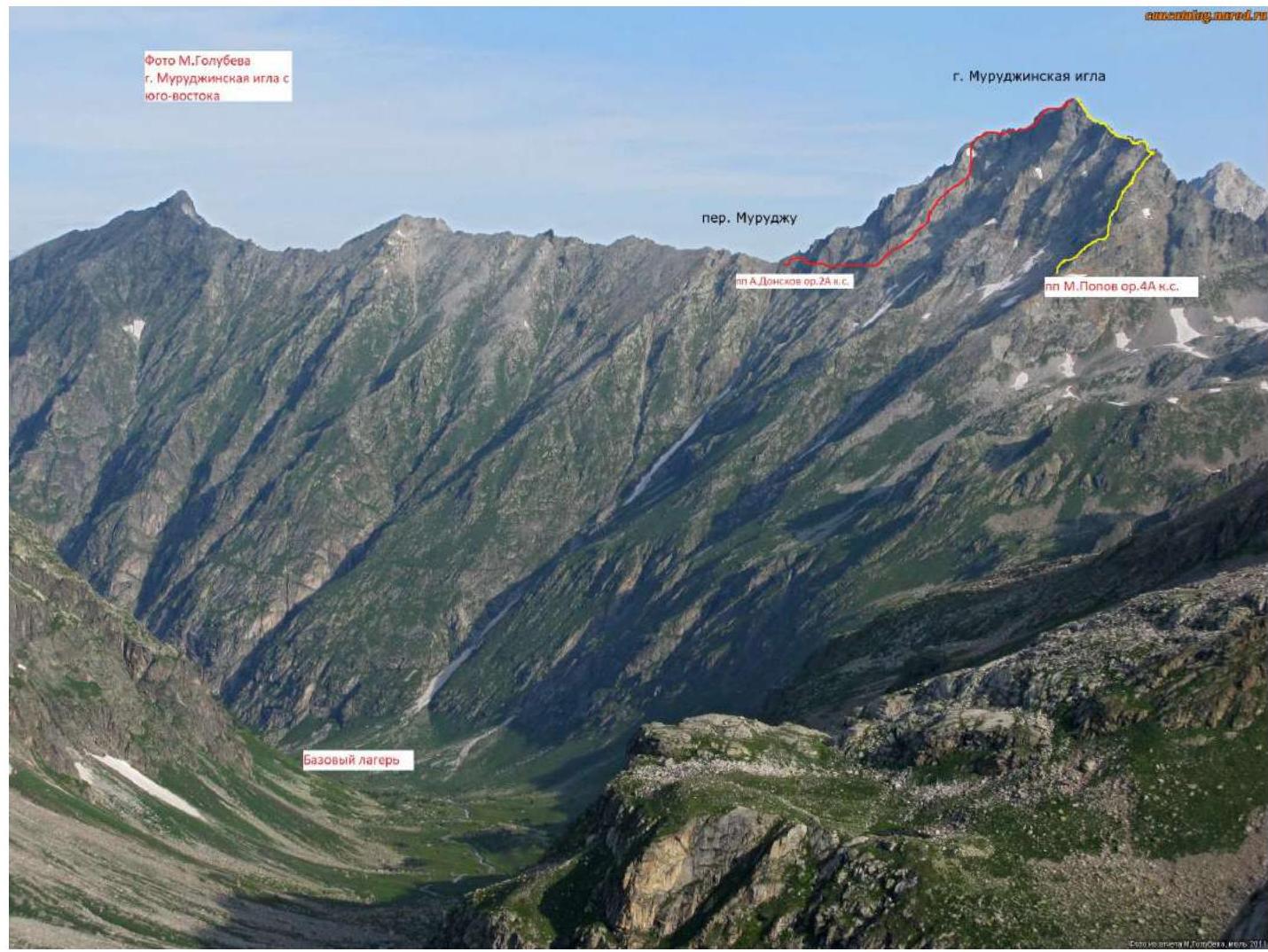
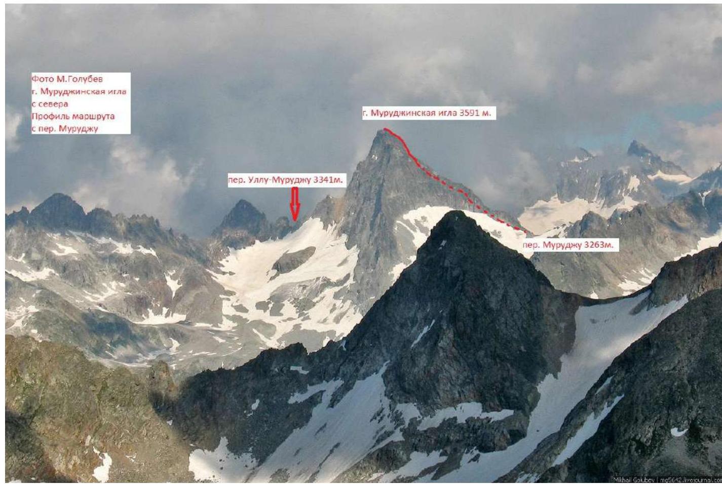
Photo of the Route Profile from the North
Panorama of the Area from the South
Panorama of the Area from the West

Panorama of the Area from the North
Panorama of the Area from the East
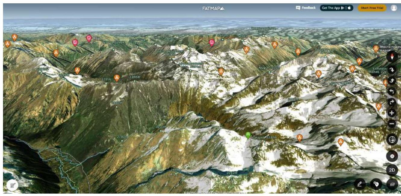
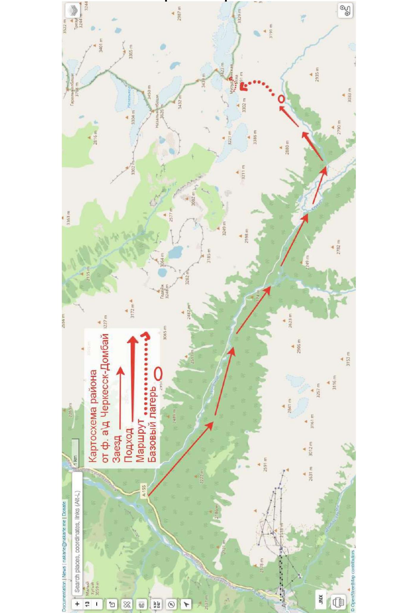
Map of the Area
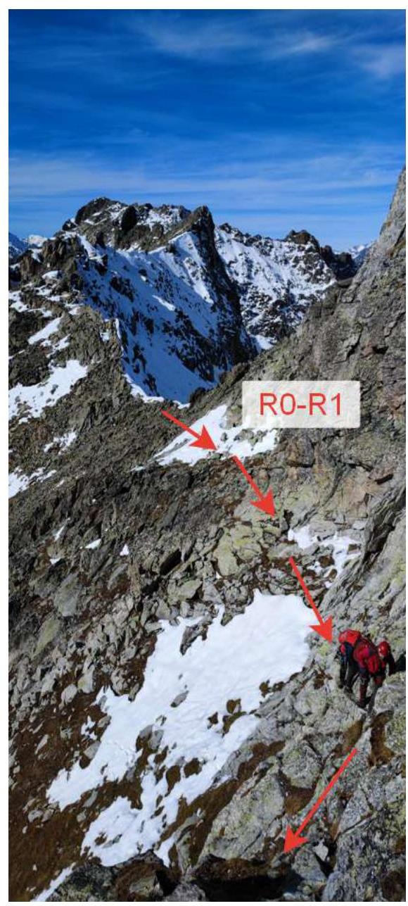
Technical Characteristics of the Route Sections
| Section № | Terrain | Category of difficulty | Length, m | Type and number of belay points |
|---|---|---|---|---|
| R0–R1 | rocks | 1, 3 | 180, 50 | none, belay through terrain features |
| R1–R2 | rocks | 2 | 200 | belay through terrain features |
| R2–R3 | rocks | 2 | 400 | belay through terrain features |
| R3–R4 | rocks | 3 | 70 | belay through terrain features, friends (1) |
| R4–R5 | rocks | 3, 4 | 30, 20 | belay through terrain features, friends (2), pitons (1) |
| R5–R6 | rocks | 2 | 100 | belay through terrain features |
Route Description
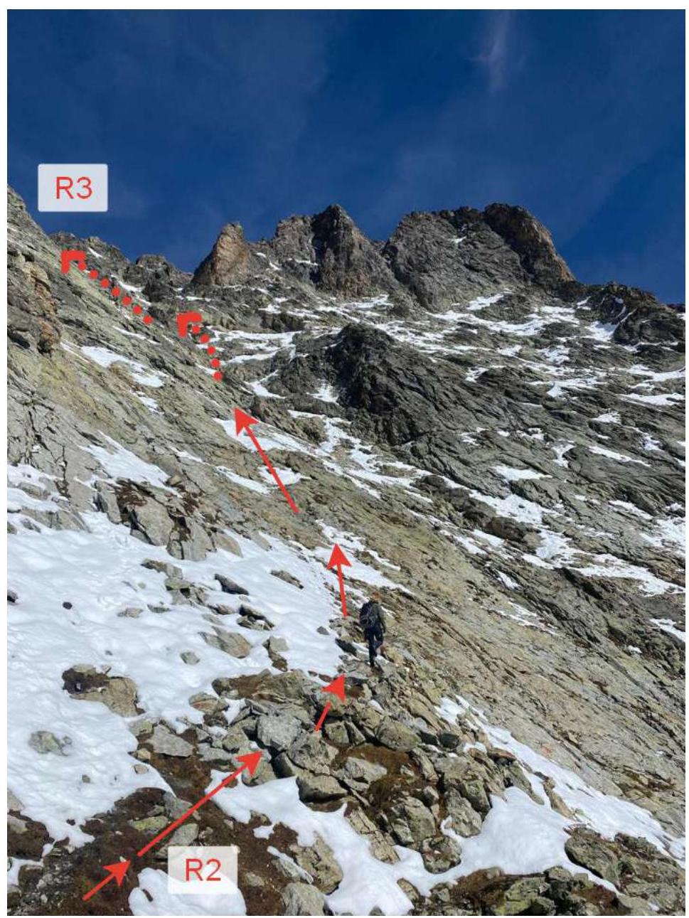
R0–R1. From Murudzhu pass (3263 m), traverse the slope to the right towards the peak and enter a gully, moving along it towards the ridge, first on simple rocks, then on more complex ones before reaching the ridge.
R1–R2. Move directly along the ridge for 20 m, then descend through an inner corner or ledges to a notch and continue without gaining height, traversing the slope to the right for 180 m. Reach a wide rock field where the pre-summit tower is visible towards the peak.
R2–R3. Move upwards towards the peak, bypassing the pre-summit tower on the left, and reach the ridge, 400 m.
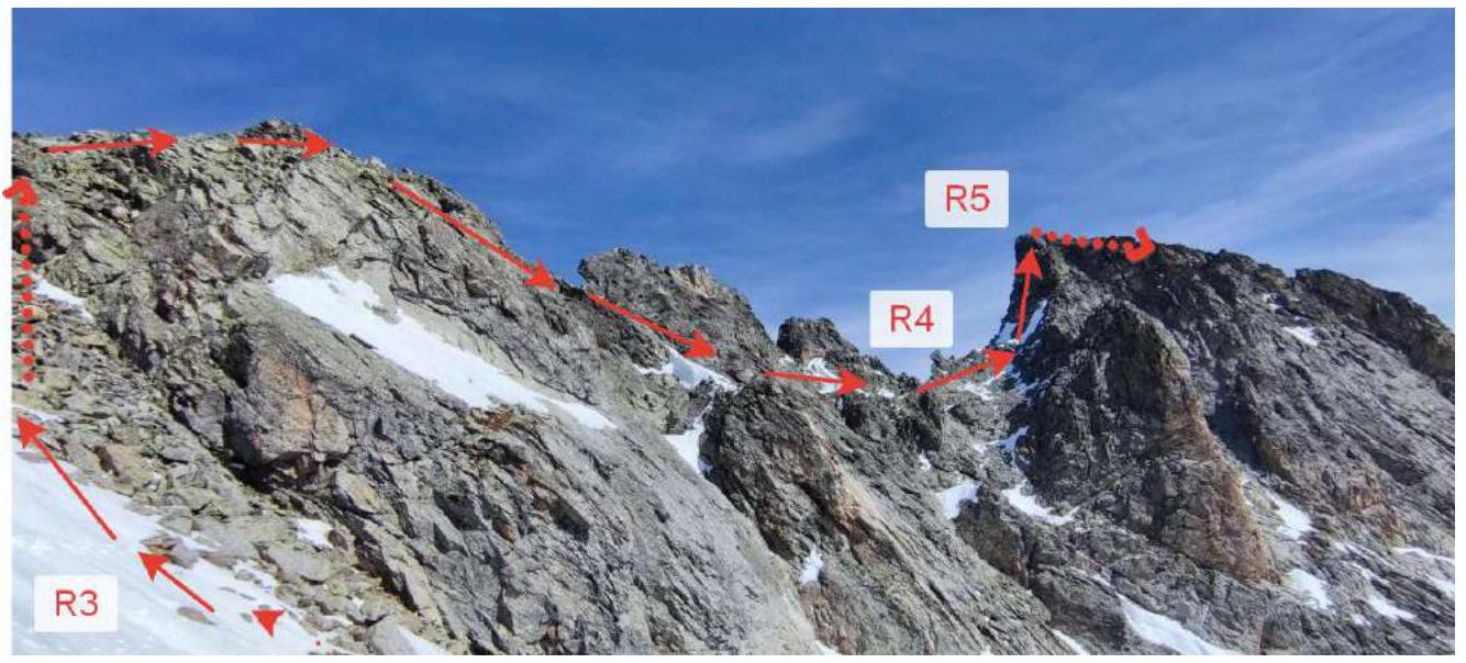
R3–R4. Move along the ridge, bypassing gendarmes on the right, and reach the key point of the route, 70 m.
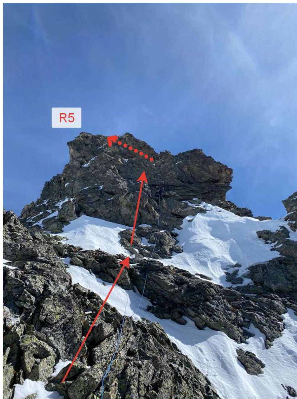
R4–R5. Move directly upwards under the wall and then on complex rocks — exit to the ridge. Pitons and protection gear used. The terrain is reliable and varied. 50 m.
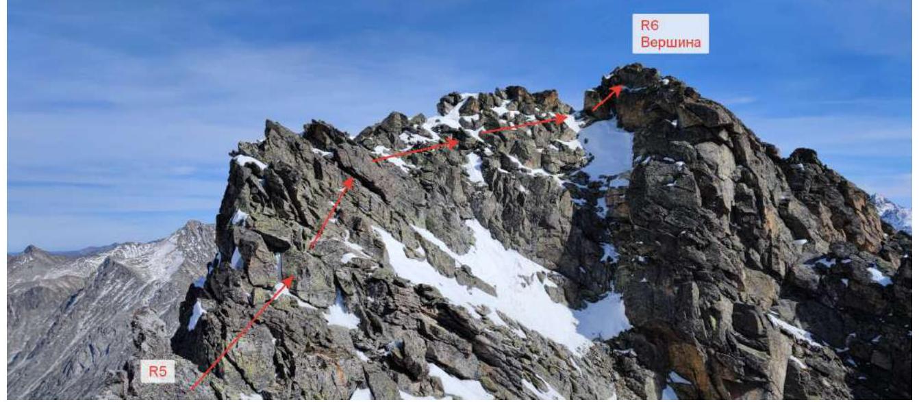
R5–R6. Along the right part of the ridge — exit to the peak. 100 m.

R1–R2
R3


R3
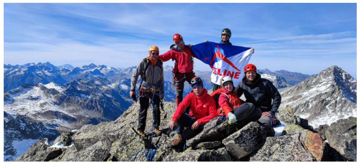
R6 Summit
Tactical Actions of the Team and Description of the Area
The Murudzhinskaya Needle peak is located 4.5 km west of Lake Tumanlykol in the Gonachkhir valley and 7 km north of the state border between Russia and Abkhazia. The asphalted Sukhum Military Road passes through the Gonachkhir valley. The closest access to the peak is through the hanging valley of the Kichi-Murudzhu river (a tributary of the Klukhor river). The trail to the valley starts 100 m before the bridge over the Kichi-Murudzhu river and rises sharply until it exits the pine forest. Further, the valley flattens out, and the trail passes close to the river through alpine meadows (the trail is not clearly visible, with tall grass in the summer).
The MAC "Freeline" team consisted of 13 people. The assault groups and the observer group were divided as follows:
- (1st group) Popov Mikhail Lvovich (leader), Klindukhov Maxim Olegovich, Zbitsky Igor Alexandrovich, Knyazev Dmitry Sergeyevich
- (2nd group) Donskov Andrey Mikhailovich (leader), Ankudinov Alexey Ivanovich, Popova Varvara Valeryevna, Donskova Maryana Zalimovna, Roslyakova Yana Nikolaevna
- (observers) Grishchenko Roman Alexandrovich (senior), Zolotareva Radoslava Viktorovna, Davydova Tatyana Revardovna, Chekulaeva Anna Anatolyevna
The base camp was set up 3 km from the entrance to the valley at the upper forest boundary (N 43°17′24.27″ E 41°49′57.44″). Radio communication between the assault groups and the observer group at this point was stable during the ascent. The base camp had a weak Megafon network signal.
Departure to the routes on October 2 at 5:00 for the 1st group and 5:30 for the 2nd group.
The 1st group ascended to the peak from the southeast, and the 2nd group from the Murudzhu pass. The 2nd group reached the Murudzhu pass at 10:00. At 13:10, the groups met at the peak, having ascended from the west and east on routes of presumably category 2 and 4 difficulty.
Before reaching the peak:
- The 1st group found a rock piton left by previous climbers.
- The 2nd group found a rappel loop from the pre-summit tower.
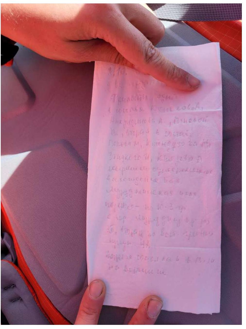
Due to the heavy snow cover on the peak, it was not possible to find a note.
Both groups began their descent at 13:30 via the ascent route of the 2nd group (to the west without reaching the Murudzhu pass). One rappel was made from the summit tower. The groups arrived at the camp at 17:00 and reached their cars by 19:30.
Recommendations
The route corresponds to the specified category of difficulty and is similar to ridge routes in this area of category 2A on Peak Razdelny and category 2B on Peak Kap. The peak is within the responsibility zone of the Dombay PSO EMERCOM of Russia.
Access to the Kichi-Murudzhu river valley:
- Requires passes from the Teberda National Park.
Route features:
- The peak and the approach to it are not within the 5-kilometer border zone.
- A border permit is not required for the ascent.
- It is necessary to notify the duty officer at the border outpost about the route.
Photo of the 1st and 2nd Groups at the Summit
Note Left at the Summit