Report
On the ascent of the KCR team to the summit of Semenov Bashi 3602 m
via the counterfort of the North-Eastern wall.
Presumably 3B cat. dif.
Second ascent.

Semenova E. A. — 3rd sports category, leader Semenov M. A. — CMS, participant Alpclub — "Gornoye Bezumiye"
2. Caucasus
2.2. From Marukh pass to Nakhar pass
Participants of the ascent
- Leader — Semenova Ekaterina Alexandrovna. 3rd sports category. Coach — Shipilov V. A. Address: 144001, Elektrosteel, Oktyabrskaya str., 8, apt. 117. Tel. +7 (977) 753–12–18. Email: katrin_vrn@bk.ru
- Semenov Mikhail Alexandrovich. CMS. Coach — Shipilov V. A. Address: 144001, Elektrosteel, Oktyabrskaya str., 8, apt. 117. Tel. +7 (906) 724–94–53. Email: aravigehc@mail.ru
Ascent Passport
- Western Caucasus, Dombay region, section 2.2 of the route classifier for mountain peaks.
- Semenov Bashi 3602 m. Via the counterfort of the N-E wall.
- Proposed category: 3B cat. dif. Second ascent.
- Rock route.
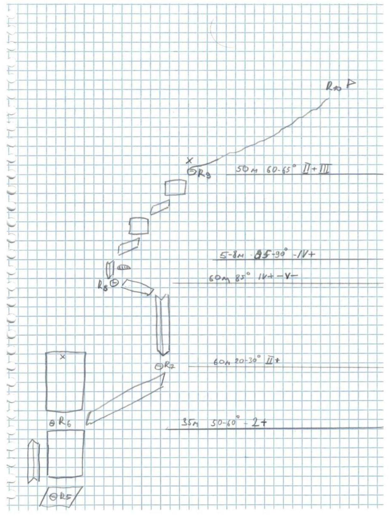
- Height difference: 502 m. Route length: 930 m. To the ridge (classic route 1B) Length of sections with 1 cat. dif.: 200 m Length of sections with 2 cat. dif.: 95 m Length of sections with 3 cat. dif.: 145 m Length of sections with 4 cat. dif.: 120 m After reaching the ridge, follow the classic 1B route to the summit for about 350–400 m. Average steepness: 60–65° (up to the 1B route).
- Pitons left on the route: 3 anchors, 2 bolts.
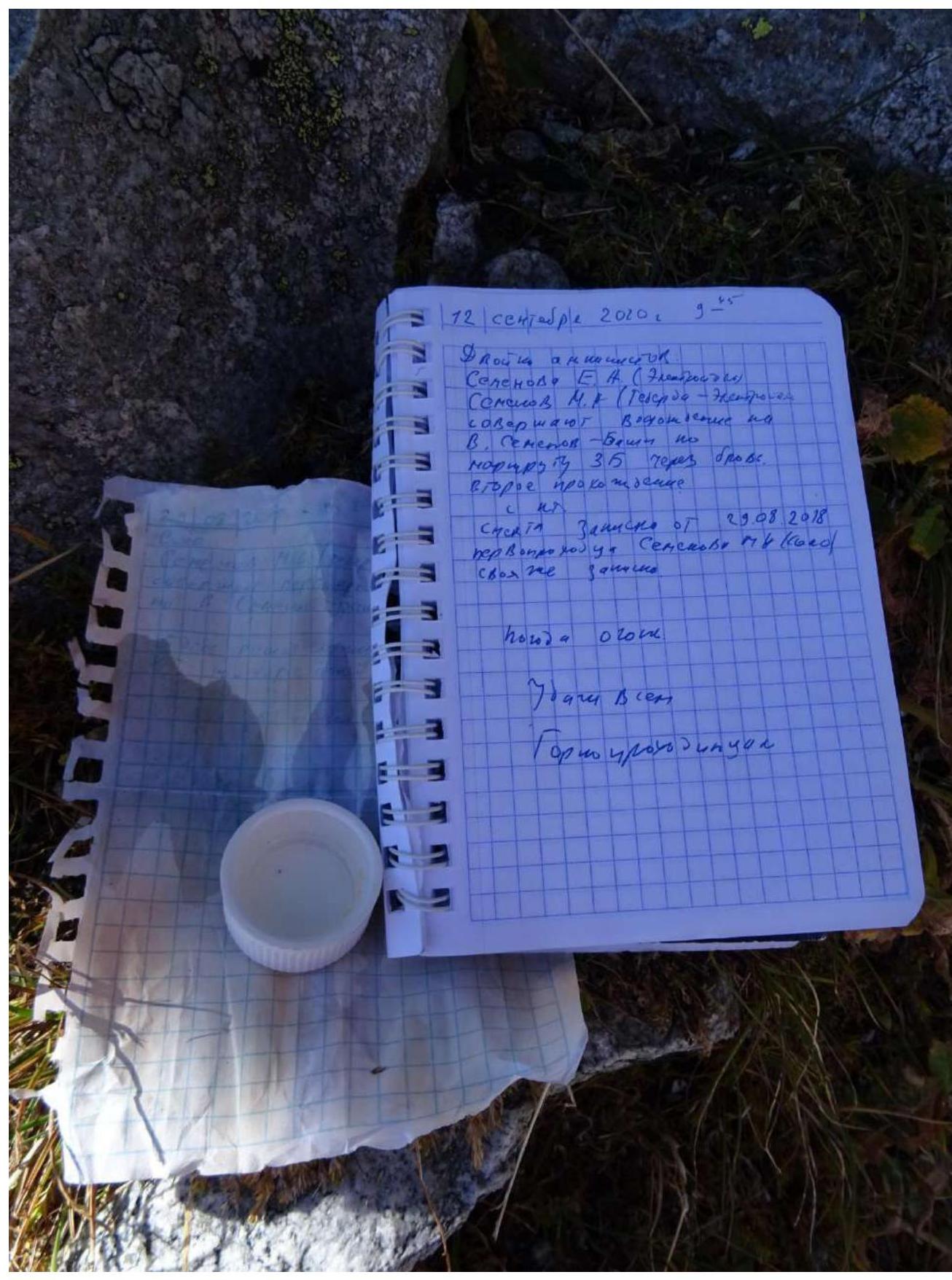
- Team's climbing time: 12 h 15 min, 1 day.
- Descent from the summit via the 1B cat. dif. route from the southeast.
- Leader: Semenova Ekaterina Alexandrovna — 3rd sports category, participant Semenov Mikhail Alexandrovich, coach Shipilov V. A.
- Start of the route: 7:00 AM, September 12, 2020. Summit: 7:15 PM, September 12, 2020.
- Alpclub "Gornoye Bezumiye".
- Responsible for the report: Semenov M. A. aravigehc@mail.ru
Description of the ascent area
The Semenov Bashi 3602 m peak is located on a spur of the Main Caucasian Ridge and is framed by the Alibek and Khuty valleys.
Approach description
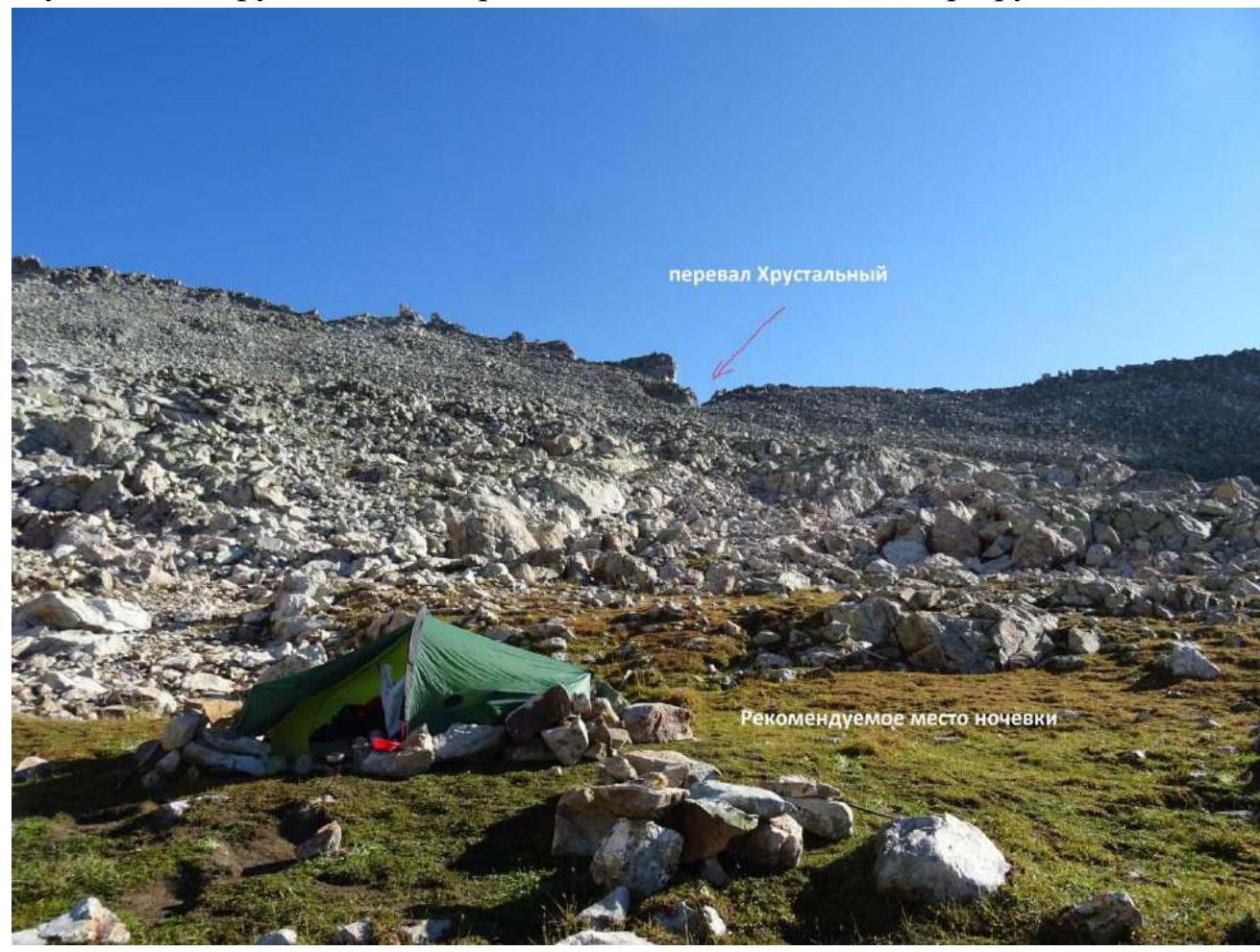
The path to the summit begins from the Dombay plain or the former Alplager "Alibek" along a trail with grassy slopes and scree, leading to the Khrustalny pass. Descent from the pass to the Khrustalny lakes. Near the large lake, there is a bivouac. A second possible approach route is along a trail passing through the Khuty valley to the bivouac near the Big Khrustalny lake. Depending on preparation, 3–8 hours. The recommended overnight stay is on the uppermost platforms under the Khrustalny pass from the eastern couloir side. There is water. It's easier to descend from the Khrustalny pass lightly to the start of the route.

Semenov Bashi 3602 m
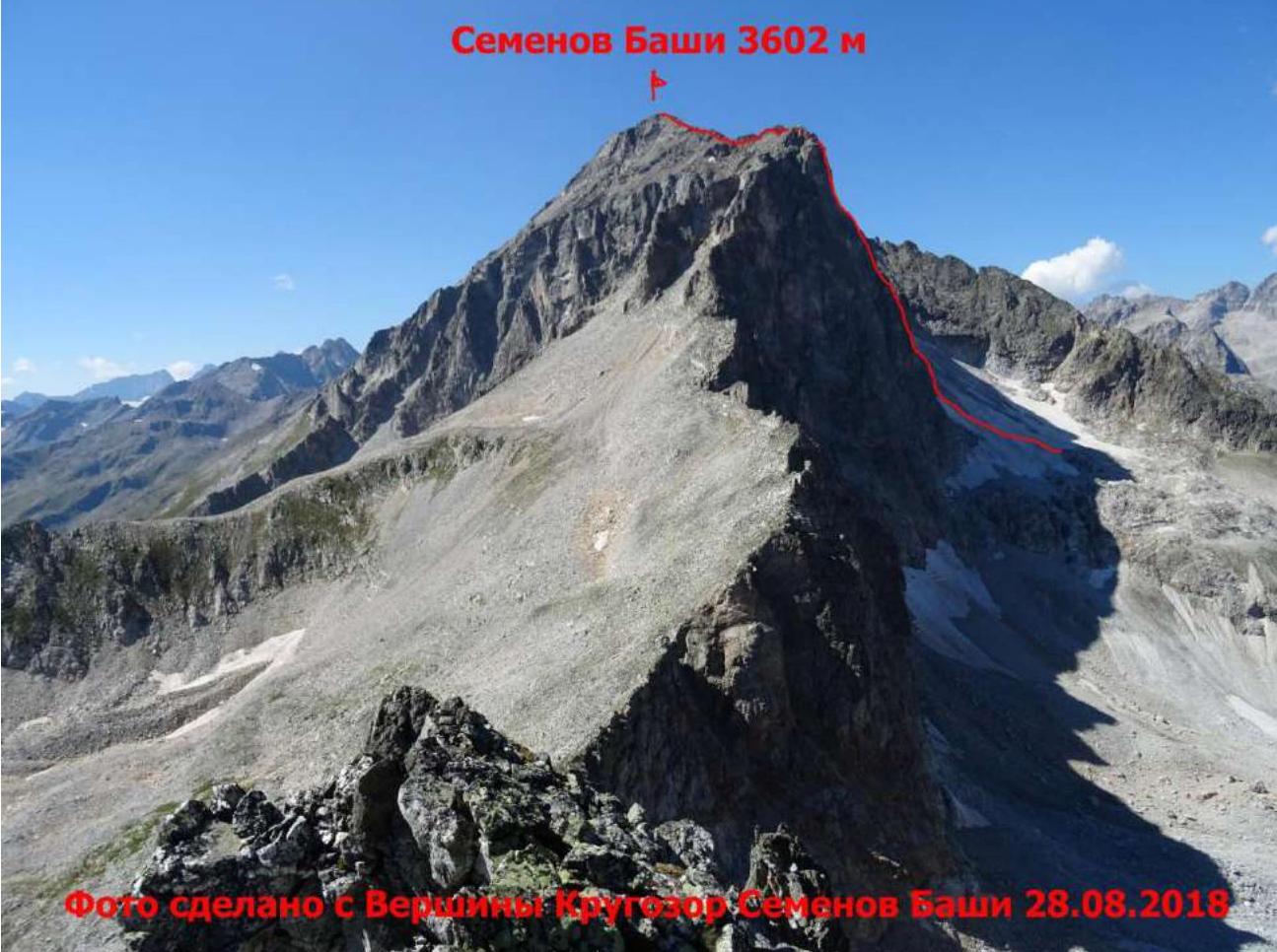

The entire route is well visible from the bivouac near the Big Khrustalny lake (at least the rocky part from the start to the exit onto the 1B route from the southeast). The counterfort can be accessed via two rocky branches.
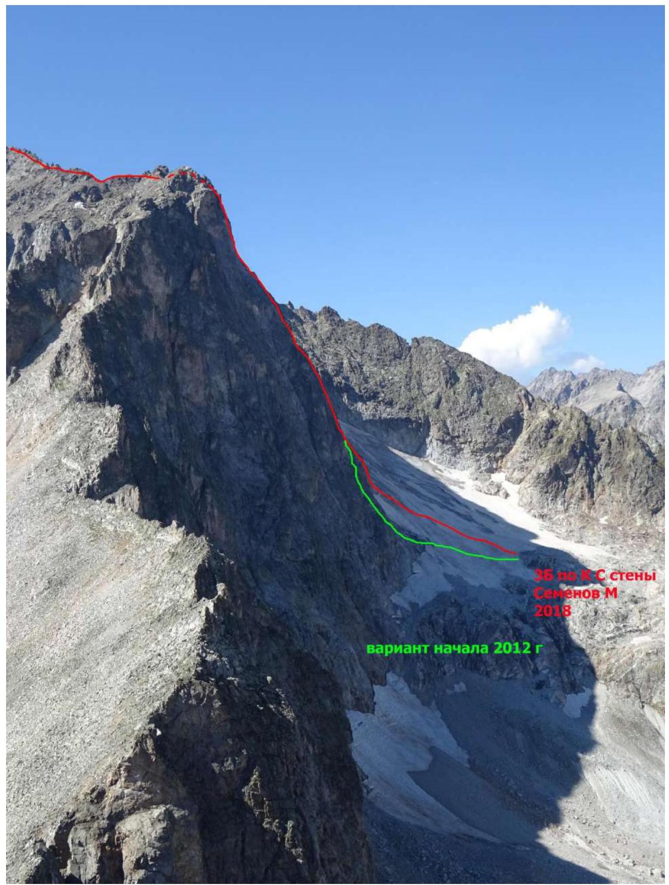
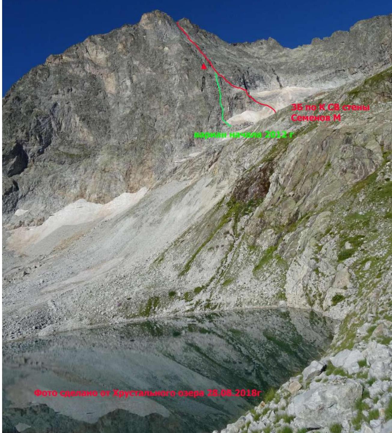
UIAA Route diagram for Semenov Bashi 3B cat. dif.
Technical description of the route to Semenov Bashi summit via the counterfort of the North-Eastern wall
The ascent from the bivouac near the Big Khrustalny lake occurs along relatively simple slopes and scree towards the glacier under the counterfort.
R0–R1 — Simultaneously along the simple glacier towards the start of the counterfort. Attention! There is a risk of silently falling stones thawing from the glacier. Exit onto a wide rocky ledge and traverse left for about 50 m. Convenient station. 200 m, 40°, 1.
R1–R2 — Zigzag up the terrain towards the "Brov'" overhang. Convenient station. 60 m, 60–75°, 3.
R2–R3 — The direction remains the same — after 35 m, you reach a wide monolithic ledge under a large overhang — "Brov'". On the right side of the overhang, a piton is hammered with a control cairn. Convenient station. 35 m, 65–75°, 3.
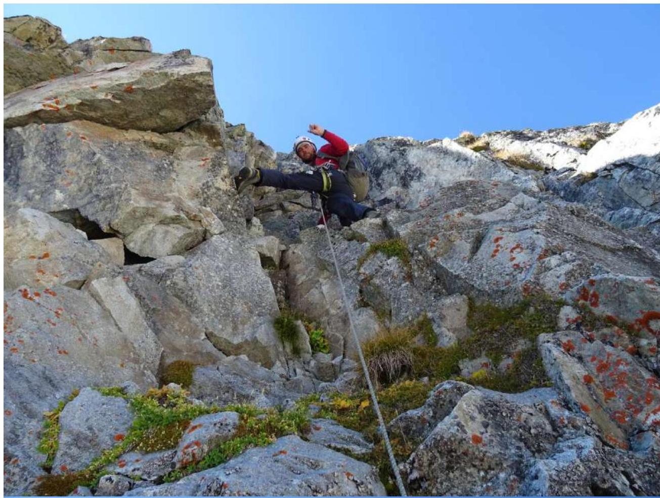
R3–R4 — To the right of the overhang, there is a steep inner corner; the bypass starts along it, exiting onto its left edge. Convenient station. 55 m, 70–85°, 4.
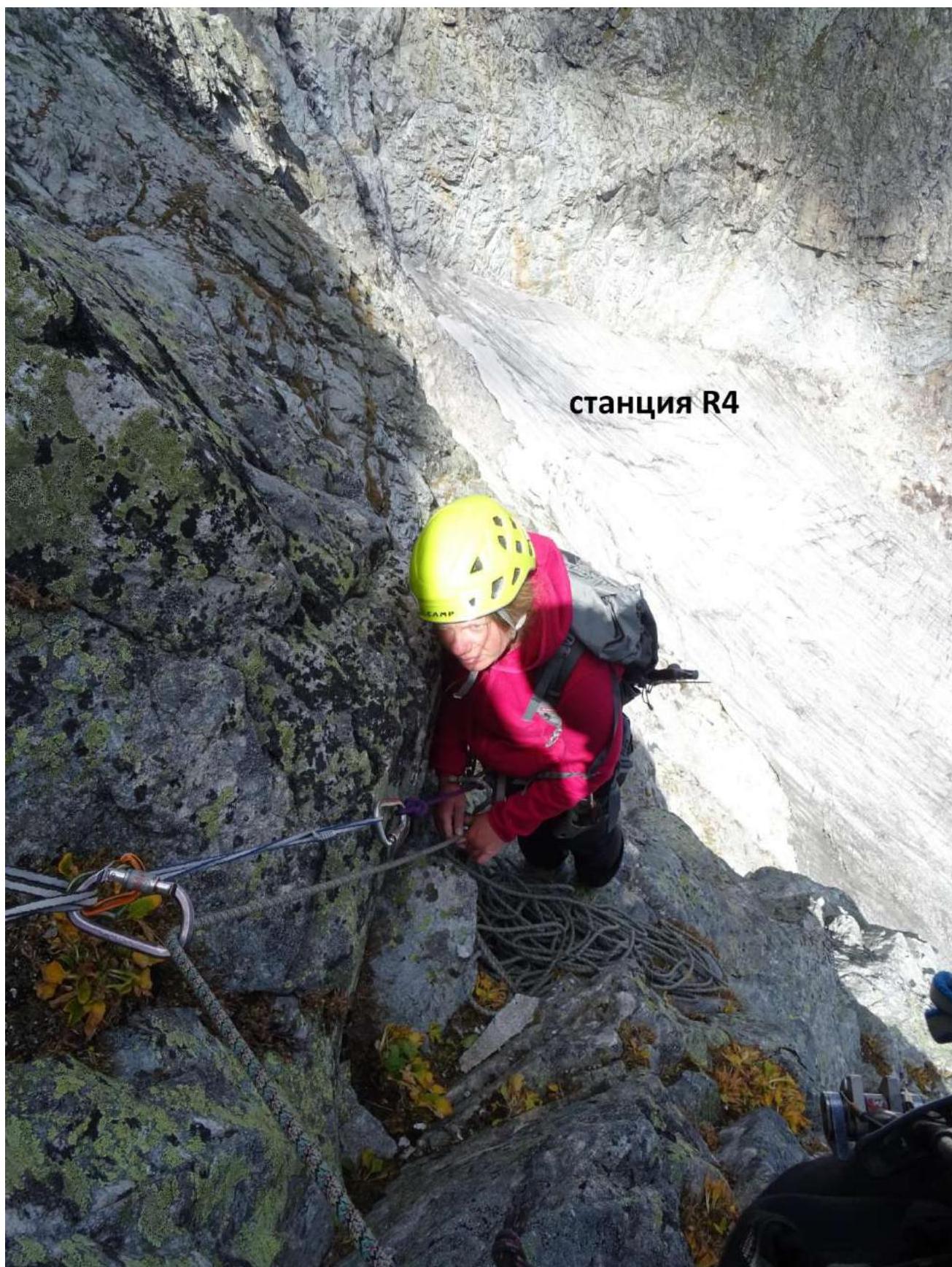
R4–R5 — Further up the left wall of a very wide inner corner directly upwards — exit into a hollow. Convenient station. 55 m, 70–75°, 3–4.
R5–R6 — Move upwards towards the wall until you reach a vaguely defined ledge that goes to the right. We attempted to climb the wall directly, but it was very challenging, with the upper part being 5, possibly 6. We had to hammer a bolt and return to the ledge. From the station to the turn onto the ledge is 35 m. Convenient station. 35 m, 50–60°, 2.
R6–R7 — Traverse to the right along the vaguely defined ledge with a slight ascent to simpler terrain in the inner corner. Convenient station. 60 m, 30–40°, 2.
R7–R8 — Climb directly up the steep inner corner; the climbing is tense, with some crumbling rocks, until you reach a scree ledge. Traverse left for about 8–10 m under a small overhang. Convenient station. 60 m, 85°, 4–5.
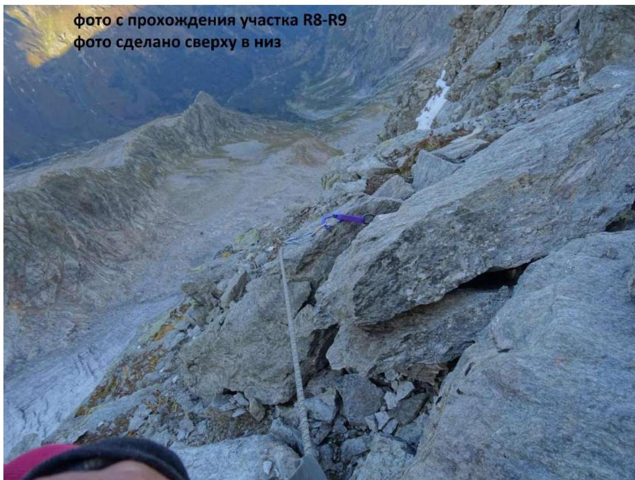
R8–R9 — Two options are possible: either climb through the overhang from the right side or slightly to the left edge and up a monolithic corner with poor holds. Technically challenging climbing for about 5–8 m. Then the terrain becomes significantly simpler, with the direction being right-upwards until you reach the main ridge — the classic 1B route. Here, on a large stone, a bolt is hammered. 5–8 m, 85–90°, 4. 50 m, 60–65°, 2–3.
R9–R10 — From here, the route follows the classic 1B route. From the point where you exit the counterfort onto the ridge to the summit, you need to traverse about 350–400 m.
Descent from the summit via the 1B route.
https://www.risk.ru/blog/215165↗ — publication on Risk.ru about this ascent. Comparing all available routes on this mountain, this line is the most technically challenging. If this line were longer, the route could be confidently classified as 4B. Considering the relatively short length of the wall section and its technical difficulty, we believe the route deserves a classification of 3B.
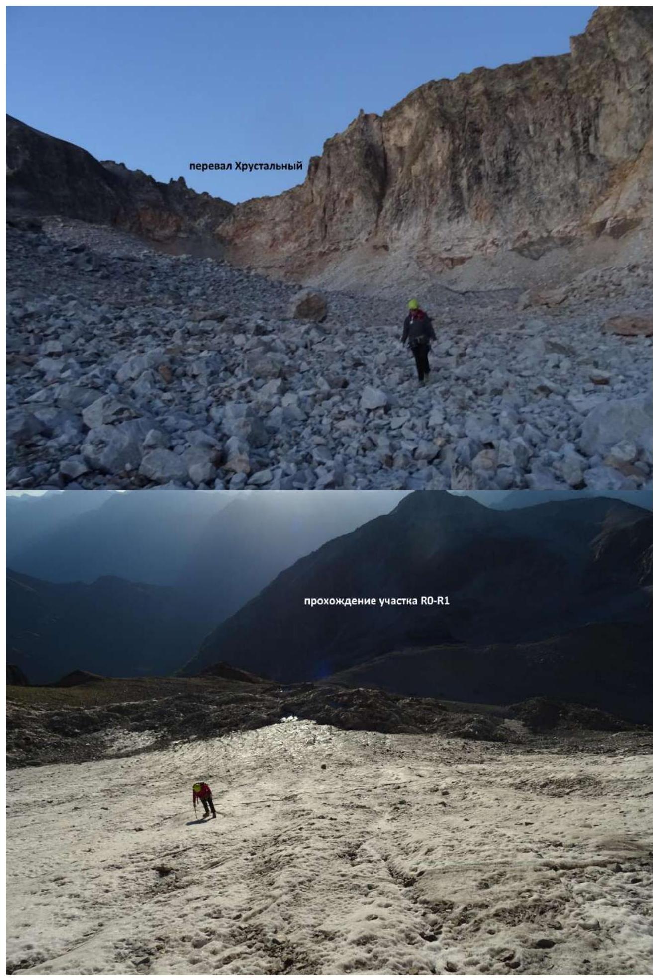 Passage of section R0–R1
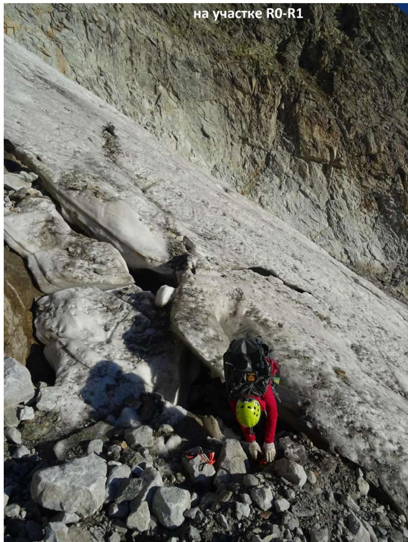 On section R0–R1
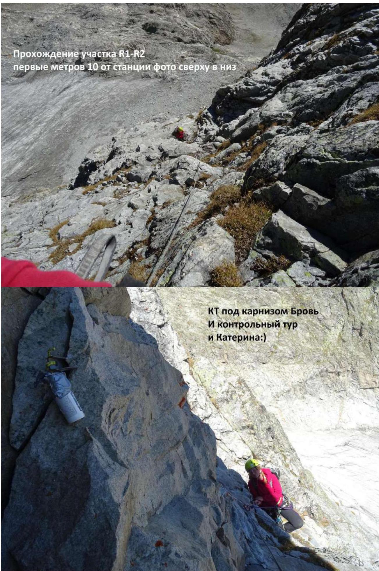 Passage of section R1–R2. First 10 m from the station, photo taken from top to bottom.
 Piton under the "Brov'" overhang and control cairn (and Ekaterina).
 Station R4
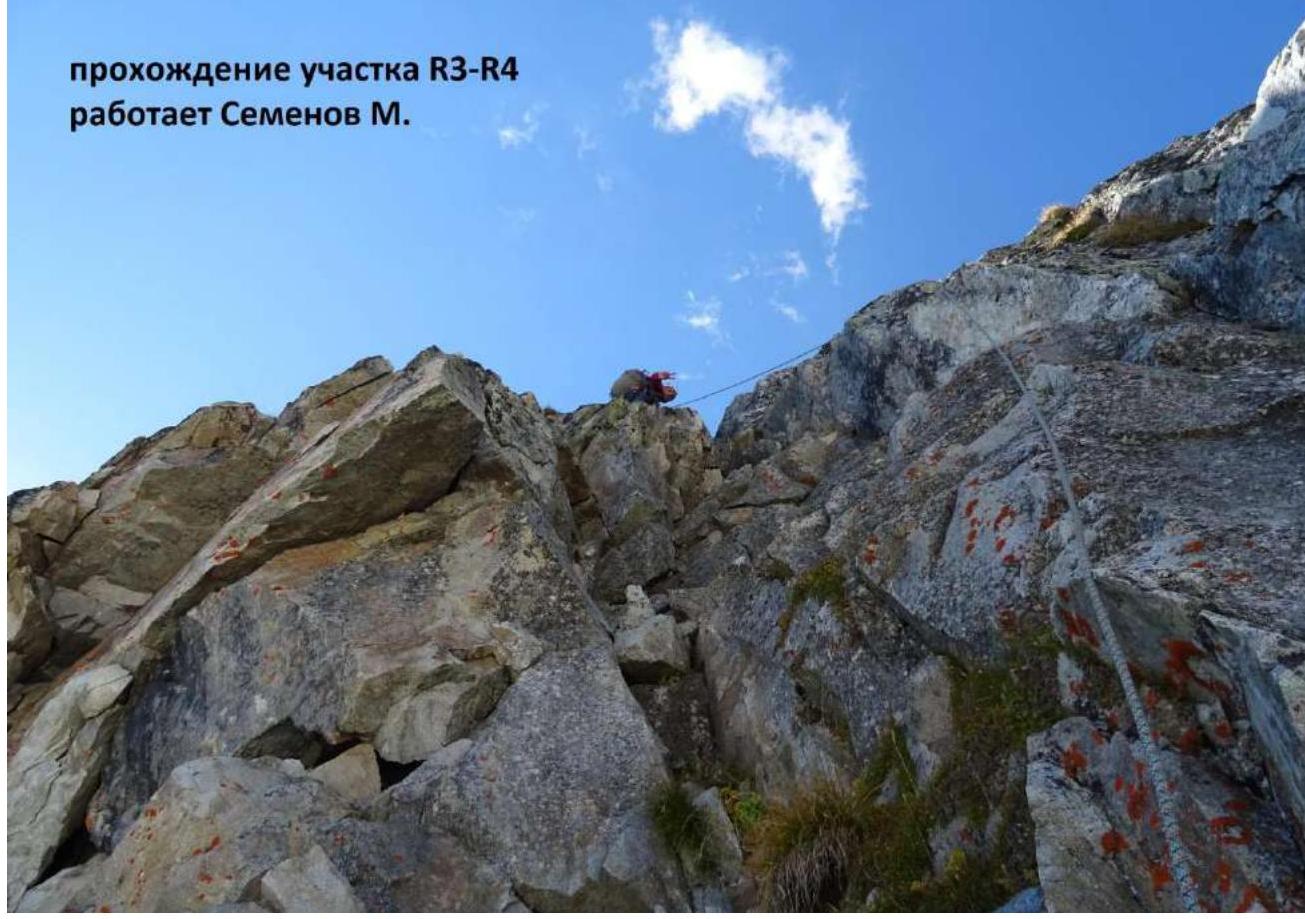 Passage of section R3–R4, Semenov M. is climbing.
 Passage of section R6–R7
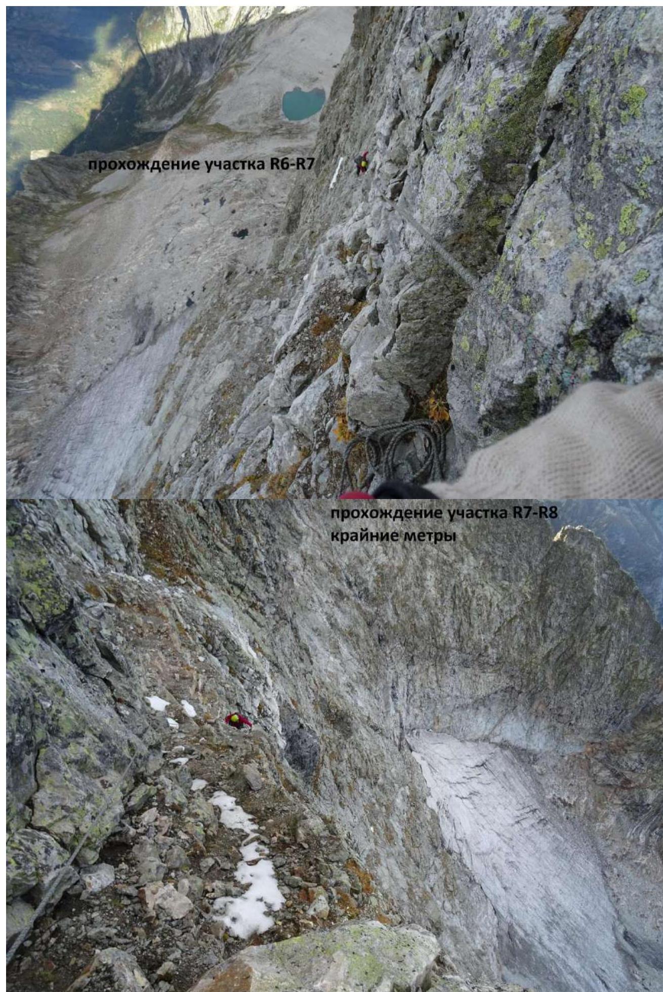 Passage of section R7–R8, final meters
 Station R8. From the station, we climbed directly upwards, slightly to the right, through an overhang.
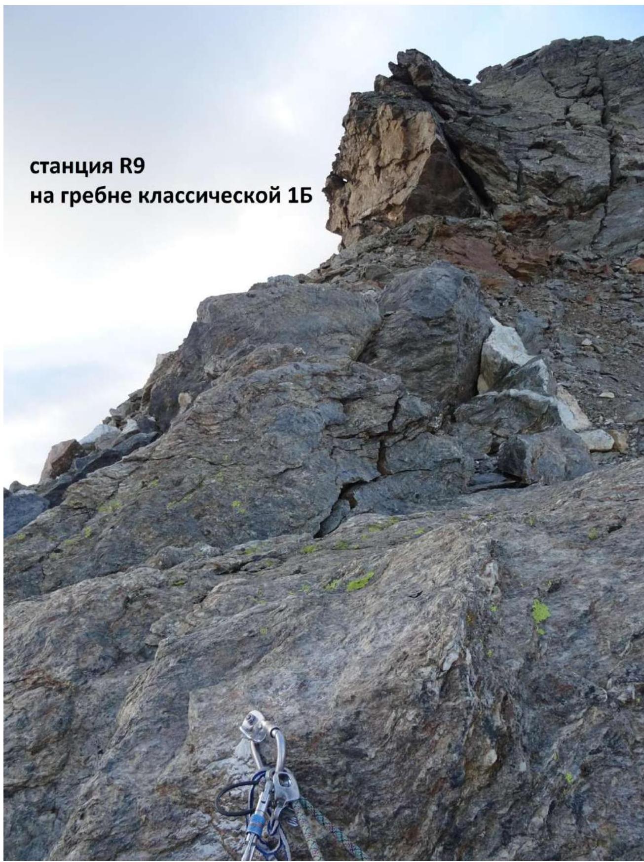 Photo of the passage of section R8–R9. Photo taken from top to bottom.
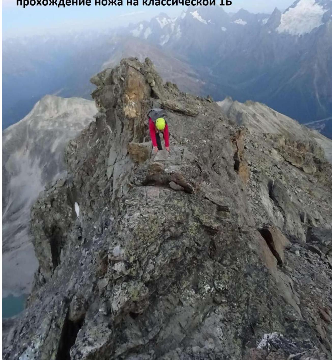 Passage of the "knife" on the classic 1B route
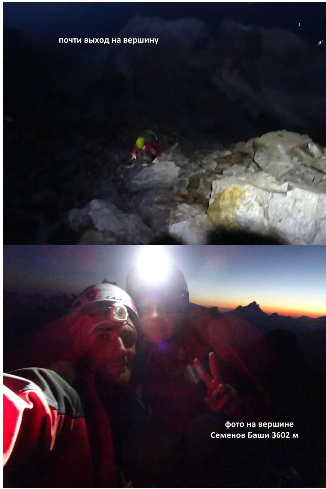 Almost at the summit.
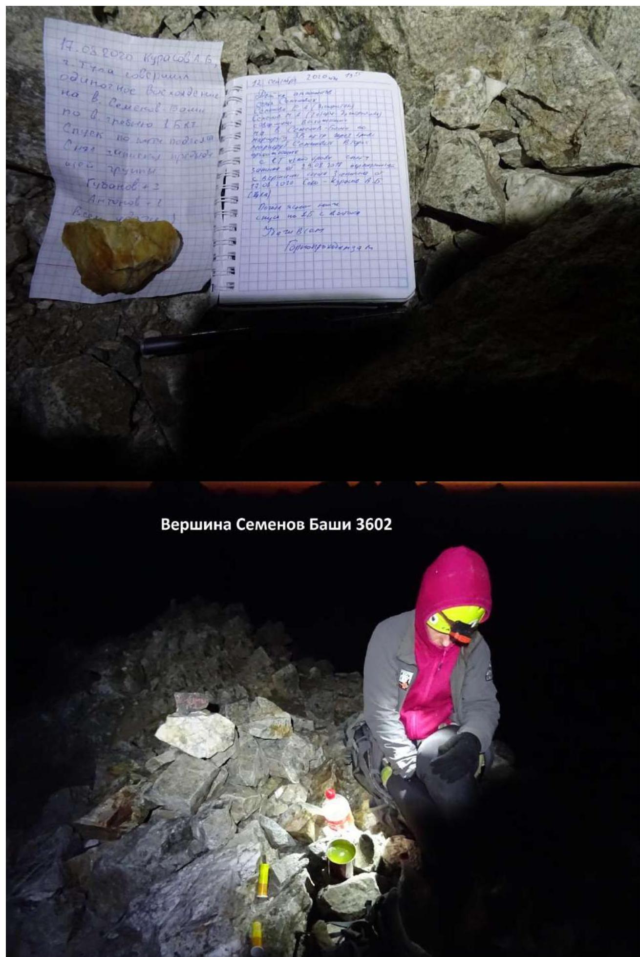 Photo at the summit of Semenov Bashi 3602 m.
Semenov Bashi 3602 m peak Ascent leader: Semenova E. A. Participant: Semenov M. A. Coach: Shipilov V. A.


